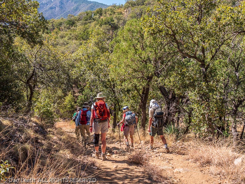
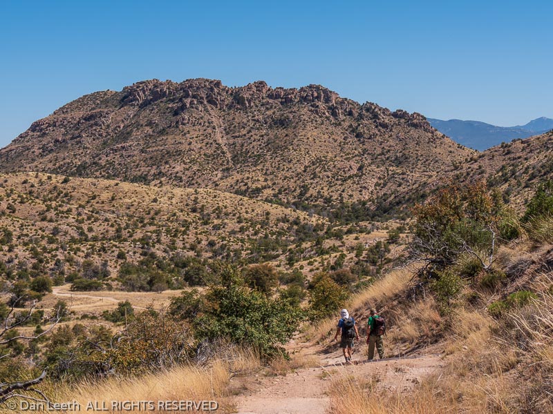
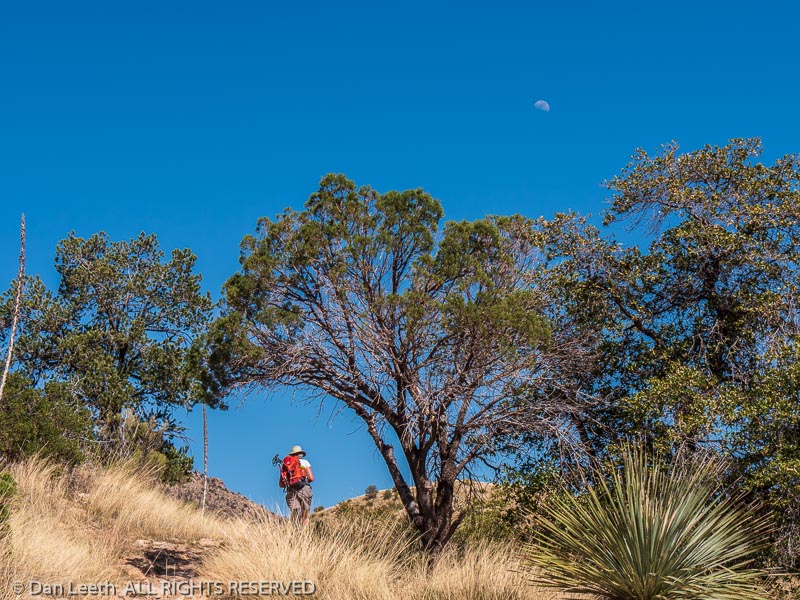
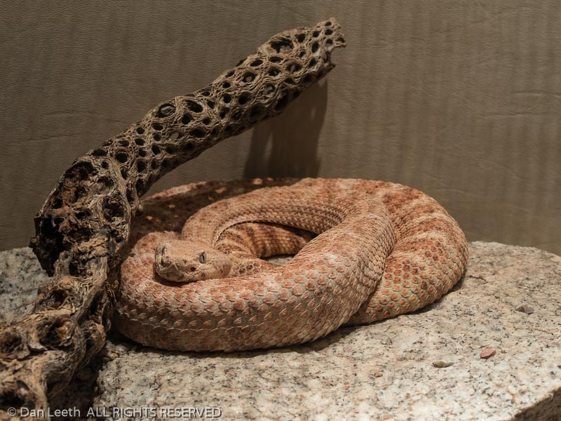
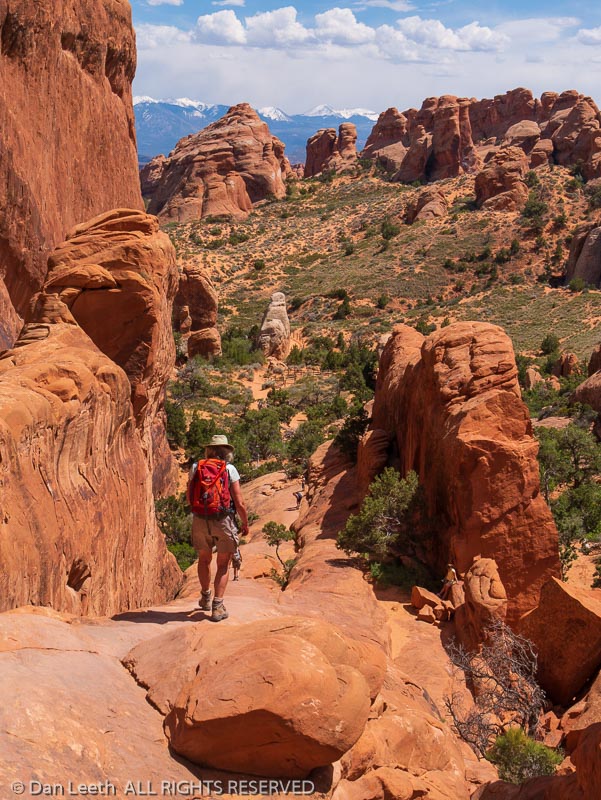
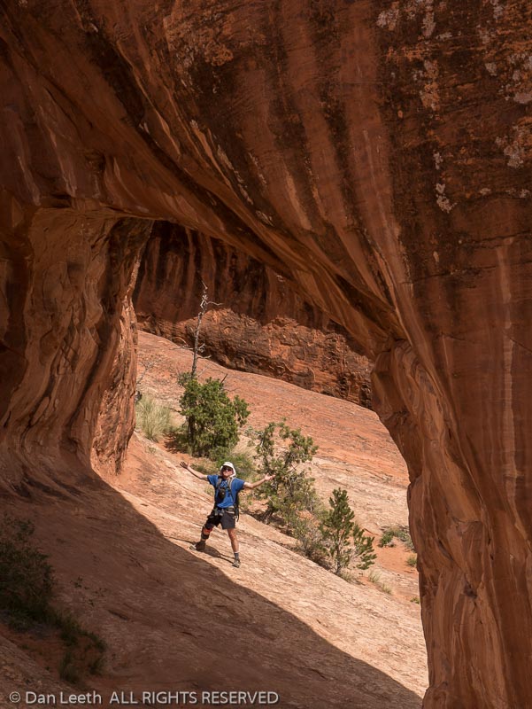
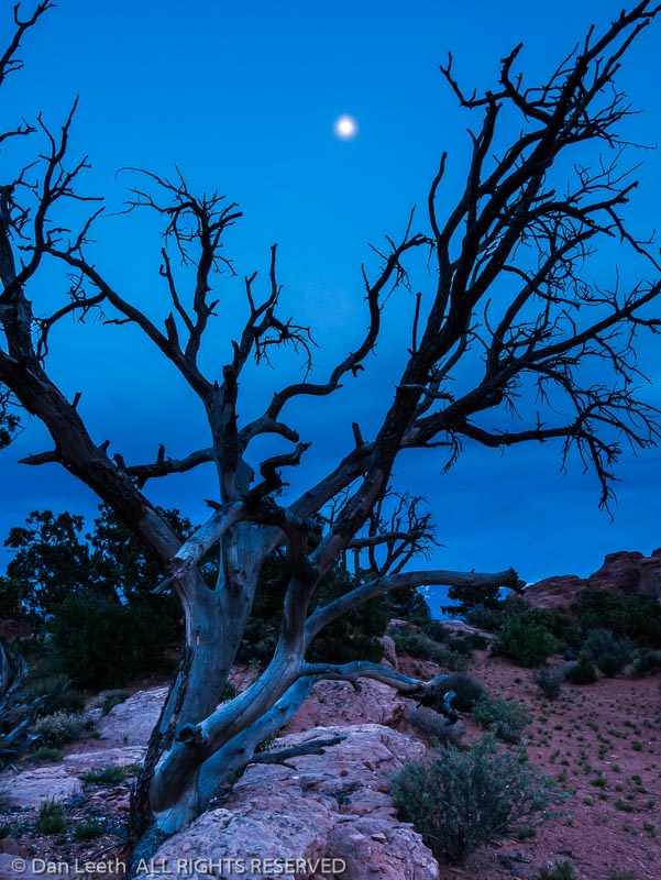
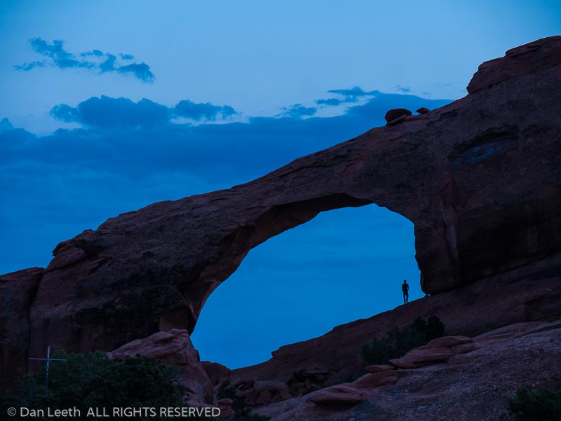
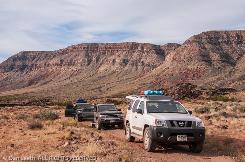
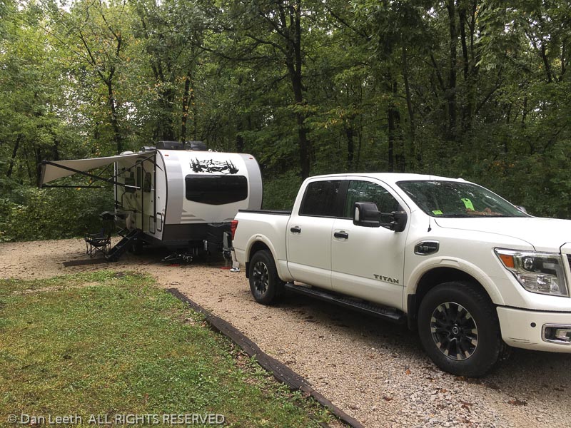
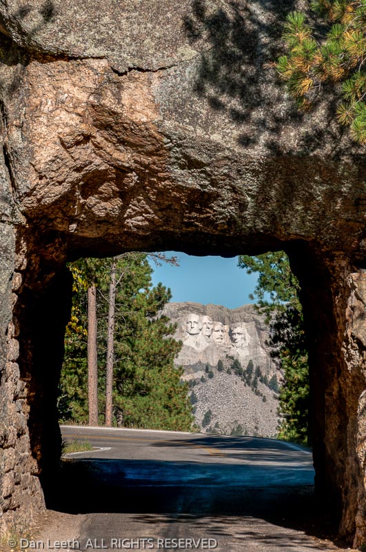
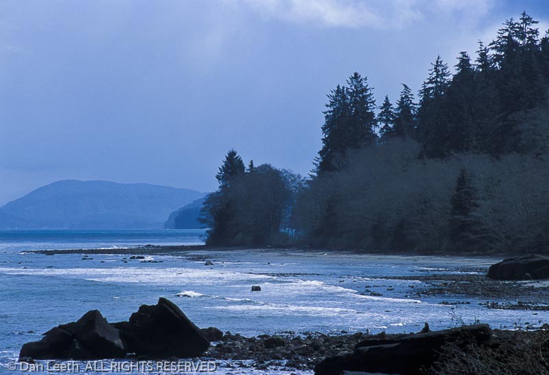
Photos are arranged in the order they appeared in the album, which I assume is roughly chronological order. Enjoy.


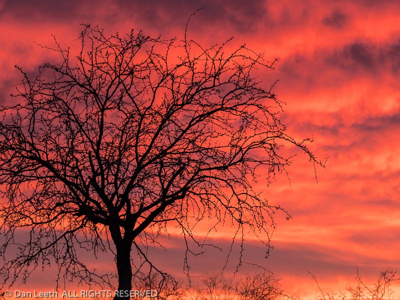
Photos are arranged in the order they appeared in the album, which I assume is roughly chronological order. Enjoy.
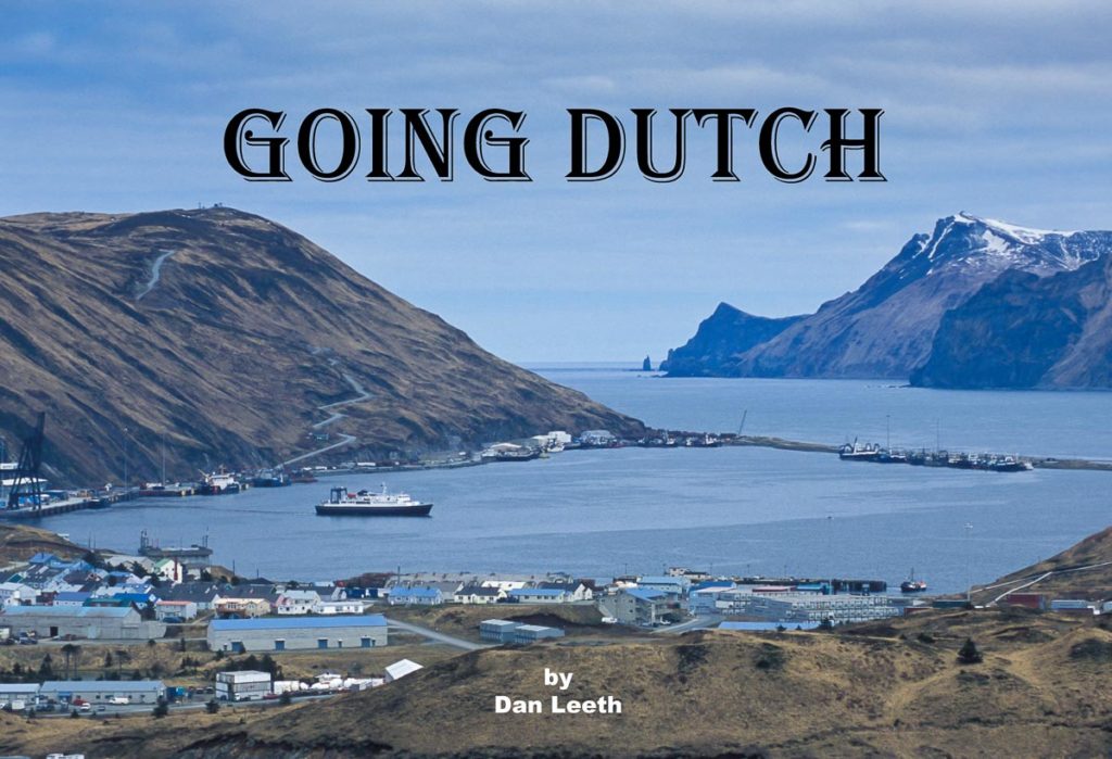
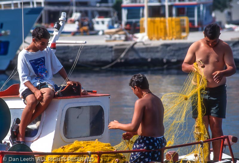
The Island may be Named Unalaska, but this Home of Discovery’s “Deadliest Catch” Offers a Real Slice of Genuine Alaska
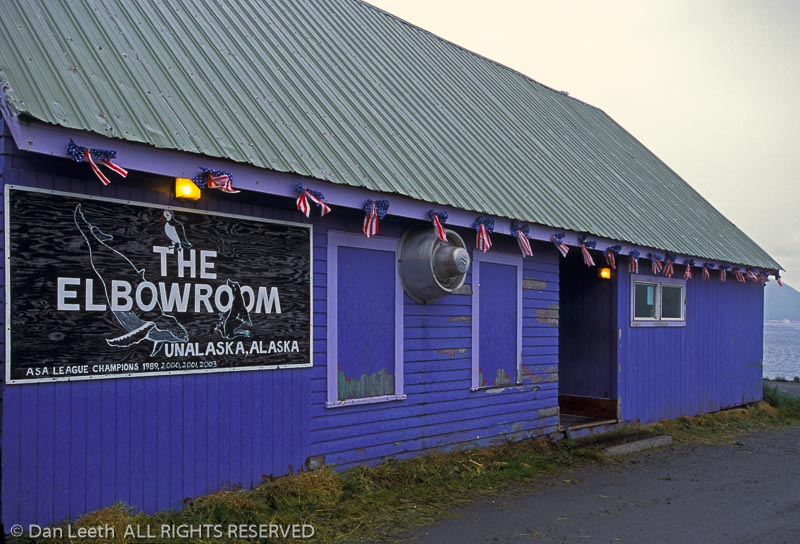
Local lore claims that in the 1970s, Playboy declared the Elbow Room on Alaska’s Unalaska Island to be one of the roughest, most notorious bars in America.
Flush with cash, Bering Sea fishermen arrived looking for alcohol and trouble. They guzzled drinks six at a time and got into more fist fights than NHL players in a hockey game. When they weren’t punching bellies, patrons slid on them.
“They would pour pitchers of beer on the floor. Everybody would strip off their shirts and slide across, seeing who could glide the farthest,” reports Rick Kniaziowski. “The town’s matured a lot since then.”
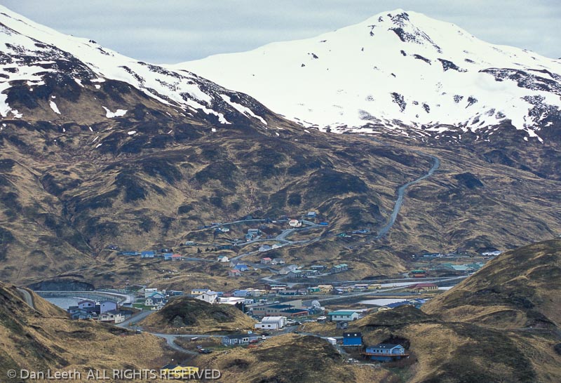
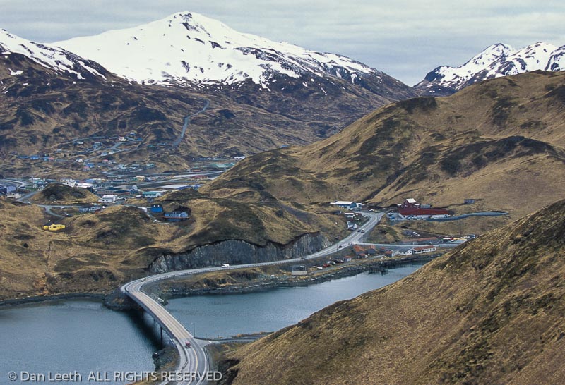
It certainly has. Known to airlines and Deadliest Catch viewers as Dutch Harbor, Unalaska is the most populated port in the Aleutian Islands. Bigger than Maui and Molokai combined, the 4,000-inhabitant isle offers business-class lodging and restaurants, an anthropological museum, nine city parks, three national historic landmarks, a national wildlife refuge and a national historic area.
Today, it sports more churches than bars, its schools rank among the state’s best, and the notorious Elbow Room, now closed, serves booze and blows no more. Located closer to Russia than Juneau, Unalaska’s remote allure hooks us off-the-beaten-track travelers.
“We’re kind of like the UnCola,” explains Mayor Shirley Marquardt. “We don’t have trees, bears, snow, moose and things like that. What we’ve got is a real working Alaskan town that’s kind of on the fringes in the middle of the Bering Sea.”
The island’s un-name comes from the native “Ounalashka” meaning “near the peninsula,” and the harbor’s Dutch moniker reflects a time when a ship from the Netherlands anchored there. While “Dutch Harbor” remains commonly used, the official name for both the island and its town is “Unalaska.”
“Calling us Dutch Harbor is kind of like calling Seattle Elliott Bay,” complains Rick. “It’s only the name of the body of water.”
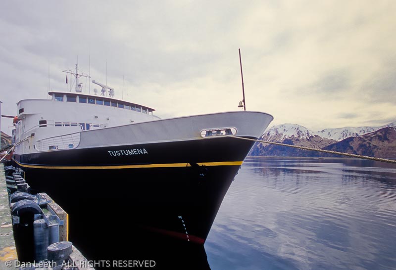
Getting here takes a bit of effort. A few cruise ships call, and Alaska Marine Highway ferries serve the island twice monthly from April through September. For most of us, however, it’s a three-hour, turboprop flight from Anchorage that gets us here.
Landing in Unalaska is like dropping onto an aircraft carrier. Water borders the runway on three sides, and a sawed-off hill rims the fourth. A pilot error here results in either a splash or splat. The Elbow Room may be closed, but the airport bar, I discover, is going strong.
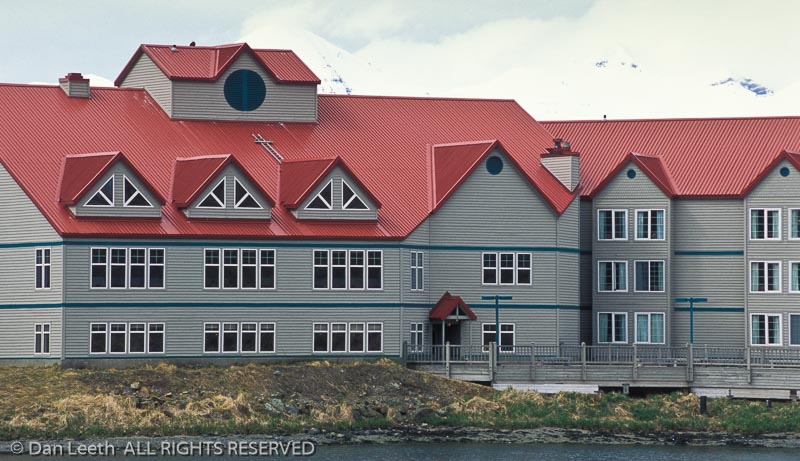
I stay at the Grand Aleutian, a 112-room, three-story hotel. Its restaurant, I’m assured, offers the best (and only) Sunday brunch in town, and its gift shop carries crafts from Unalaska’s sister city of Petropavlovsk. I may not be able to see Russia from here, but at least I can buy souvenirs from there.
The town wraps around Iliuliuk Bay with part on Unalaska Island proper and part spilling onto a subsidiary isle. Connecting the two halves is the officially designated “Bridge to the Other Side.”
Downtown Unalaska has a last outpost of civilization look to it. Most homes seem modest with trailers, prefabs and refurbished World War II cabanas capping the real estate mix. The town sports a public library, community center, aquatic center and a staffed visitor center run by the optimistically named Convention and Visitors Bureau.
“Just how many conventions do you have here at the tail-end of Alaska?” I ask Rick, who served as executive director.
“Well, we hosted a state school board meeting once,” he smiles.
The biggest land-based employer is UniSea, which runs a highly automated pollack processing plant. Fillet from the white fish becomes sandwiches while the rest is ground into surimi that is used in imitation crab and fish sticks.

“There’s a one-in-ten chance that if it’s Alaskan pollack, it came from this plant,” Don Graves tells me on a tour. “McDonalds uses our pollack in their fish sandwiches as does Burger King.”
In addition to the commercial catch, sport fishing lures anglers to Unalaska. A replica of a 459-pound Pacific halibut hangs inside City Hall. Celebrities who have baited hooks here include Jimmy Buffett, who once performed an impromptu concert at the Elbow Room, allegedly without margarita belly slides.
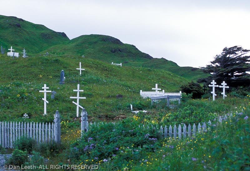
At the end of downtown, a block from that infamous bar, sits the Church of the Holy Ascension. Started in 1825, this Russian Orthodox facility remains one of the oldest cruciform-style churches in the United States. Its icon collection dates back to the 16th century.
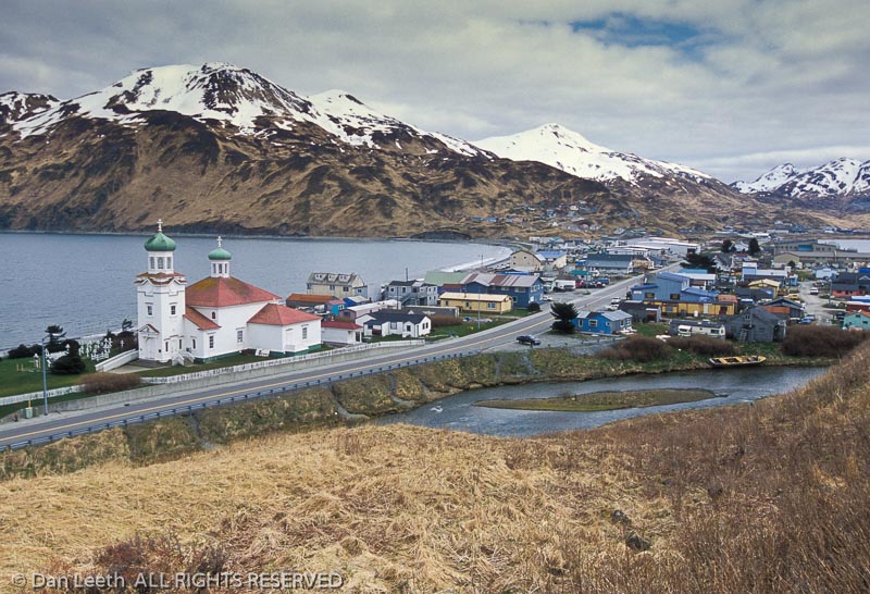
“The icons on the back wall, a set of 12, are called calendar icons,” explains local resident Susan Lynch. “There are only three full sets from this era in the whole world, and we have one of them.”
When it comes to trees, Unalaska stands as bare as Howie Mandel’s noggin. Hoping to make their fur-trading effort more self sufficient, the Russians planted Sitka spruce seedlings here in 1805. Six original trees still stand, becoming one of the few arboreal entries gracing the list of National Historic Landmarks.
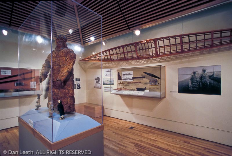
Not far from my hotel sits the Museum of the Aleutians. It presents a collection of finely woven baskets, a 1778 drawing of an Unangan woman done by crewmember of Captain James Cook and a waterproof parka called a kamleika made from sea lion esophagus tissue. There’s also a 1940’s vintage ski, a model of the Coast Guard’s USS Bear and numerous World War II artifacts. One item, a Japanese soldier’s good-luck flag, has been returned to the family of the man whose fortune was battle ended.
“His widow had been told he was killed in the South Pacific,” explains Bobbie Lekanoff, owner of The Extra Mile Tours. “The Japanese kept it a secret that they were fighting in the Aleutians.”
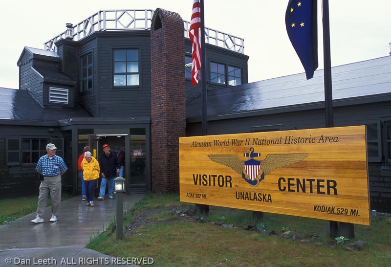
The Visitor Center of the Aleutian World War II National Historic Area displays information about the conflict and provides a mockup of a communications center with mannequins manning equipment. Bobbie reminds me that six months after Pearl Harbor, Japanese aircraft dropped their loads on Dutch Harbor.
“Right in front of us, you can see a dip in the ground that’s more green than everything else,” Bobbie points out. “That is a crater from where one of the bombs hit.”
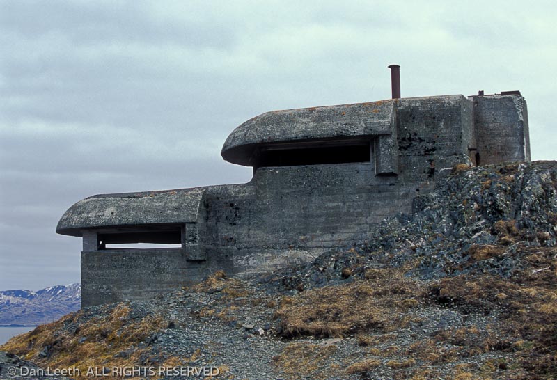
Days after the attack, the Japanese invaded Kiska and Attu Islands further down the Aleutian chain. To stifle possible advances, allied forces stationed nearly 50,000 solders in Unalaska. Abandoned bunkers, pillboxes, ammo depots and gun mounts still surround town.
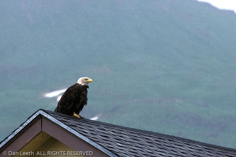
Bobbie’s tour mixes history with nature. By mid-July more than 160 species of flowering plants will carpet the mountains. Until then, bald eagles top the nature enthusiast’s interest list. With 878 spotted at a recent Christmas count, the national symbol can be seen perched everywhere around town. Bobbie monitors over 30 perennial nesting sites. The easiest nest to spot sits atop an unused construction crane in the middle of town.
“The first year they tried to build there, the sticks fell through,” she explains. “The following spring, a couple of local people climbed up and tied fishnet to the bottom. The eagles successfully completed their nest and have come back every year since.”
Another species that attracts birders to Unalaska is the rare whiskered auklet, whose range is limited to the Aleutians. To see them, I board a boat captained by wildlife biologist Tammy Peterson. We sail toward the Chelan Bank.
“The sea bottom comes up abruptly here, so there’s a big upwelling. It’s really nutrient rich, which means the bait fish are here along with whatever feeds on them,” she says. “It’s like a fast-food restaurant in the Bering Sea.”
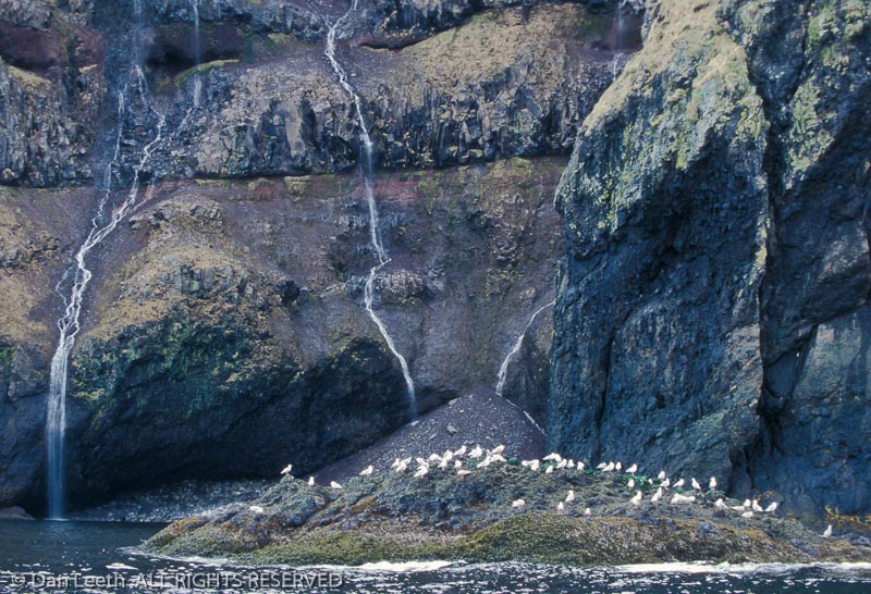
We catch a pod of orcas breaching to the starboard and white-sided dolphins porpoising to the port. A short-tailed albatross glides overhead like a white, U2 spy plane. Tammy points out sooty shearwaters, tufted puffins and various species of gulls. Best of all, we spot numerous whiskered auklets. Our route back takes us past the airport.
“Nine years ago, my brother died,” Tammy reveals. “I got the phone call saying it was time, but I got stuck here for six days because of fog. He died before I could get off the island. That’s the drawback to living out here.”
Fortunately for me, the weather dawns fog-free my departure day. I head for the airport assured that not only will the plane will arrive and depart, but it will even be reasonably on-time. Unlike some fellow passengers, I don’t even feel a need to fortify myself at the bar.

Yachting through the Greek Islands Offers Seas, Scenery and Serenity
Crowds may be fine at football games, Olympic events and yard sales. But when it comes to vacations, some of us crave getaways that truly get us away.
For me, an ideal escape involves a clutch of friends, a teak-decked boat and a sea garnished with picturesque islands. It’s all the better if the isles are Greek, the vessel a chartered yacht and the six chums I share it with promise not to hog the ouzo. Even Aristotle Onassis could not have asked for more.
Fortunately, one does not need Jackie O’s inheritance to rent a crewed yacht. With vessels starting around $5,000 per week, a group of cost-splitting friends can charter a craft for the price of a decent cruise. Granted, the cabins may be more cramped and shuffleboard courts absent, but these amenities pale against the freedom of experiencing the sea unencumbered by fixed itineraries.
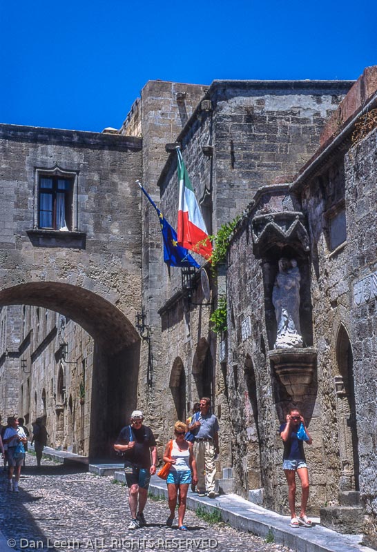
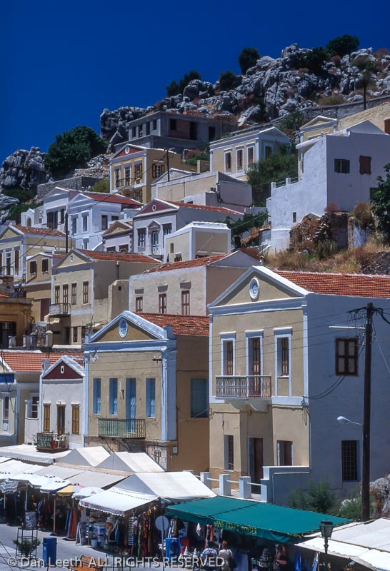
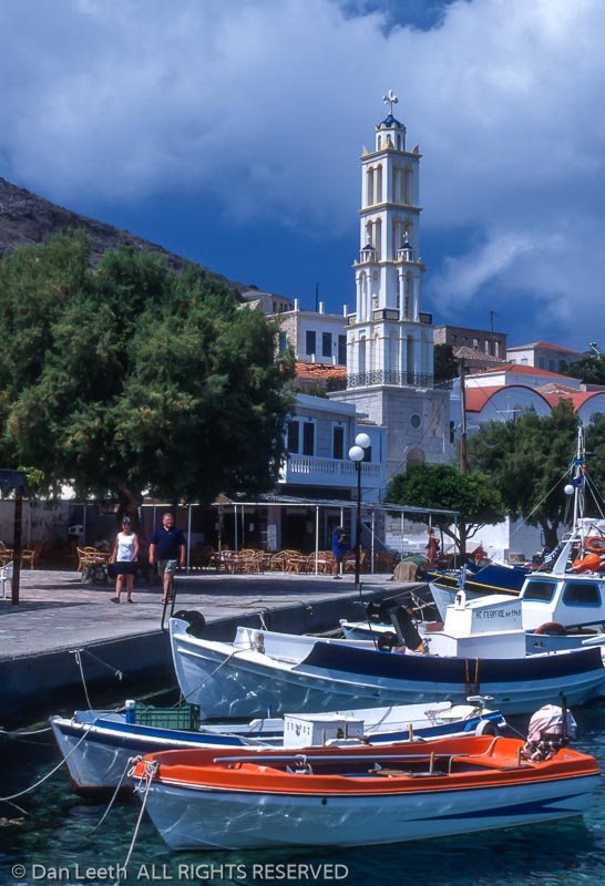
We sail from Rhodes, largest of 12 islands in Greece’s Dodecanese chain located near the coast of Turkey. Its major city, also called Rhodes, rose as a Bronze Age kingdom. It became a Greco-Roman art center, and retreating Crusaders made it a fortified stronghold. The city ultimately fell to T-shirt vendors in the 20th century.
Our vessel awaits outside Rhodes’ Old Town, a city-fortress the Knights of St. John began in the early 1300s. Ponderous walls made from cut rock line cobblestone streets. Arched causeways link stone facades, thick doors fill Gothic portals and turrets tower skyward. I feel humbled by the site’s medieval power.
I also feel crushed by crowds. Waves of tourists chatter in a Berlitz sampler of languages as they follow guides lofting colored pennants. They haggle with merchants hawking wares from sidewalk shops. They queue into columns awaiting entry to the Palace of the Grand Masters. Like a salmon in a spawning run, I become trapped in the onslaught. The boat offers an escape.
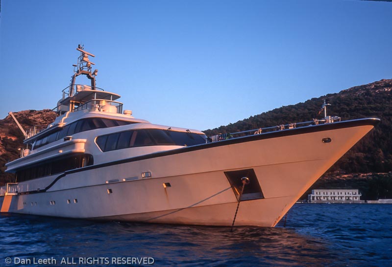
The Carmen Fontana lies moored next to the Sultan of Oman’s yacht. Our more humble craft has five cabins with beds for ten. Its refrigerator holds the beverage supply, a topside deck provides a sunning retreat, and crewmen stand ready to serve meals onboard. The captain fires the engines, and waving good-bye to an unseen Sultan, we motor into the Aegean.
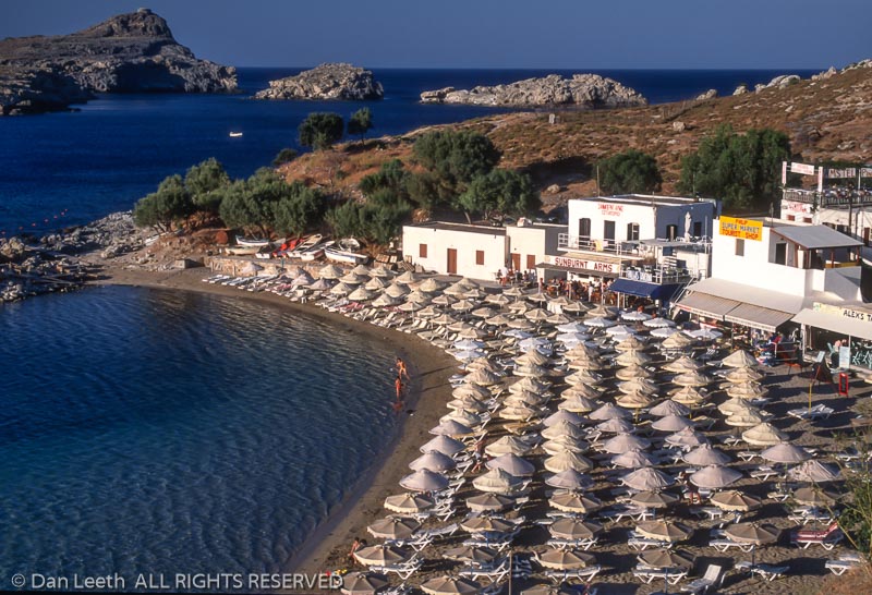
A few hours later, we anchor at Lindos, midway down the island’s eastern shore. Bluffs tower over a community skirted in whitewashed houses. Below lies a crescent of sand covered with umbrellas in such uniform rows, it looks like a military parasol parade. If the orderly Swiss had an ocean, this is what their beaches might look like.
Cars are banned from the hillside village. To reach the cliff-capping acropolis, visitors either walk or ride donkeys. Choosing beast over brawn, I hop into a saddle hard enough to bruise even Zorba’s ample padding.
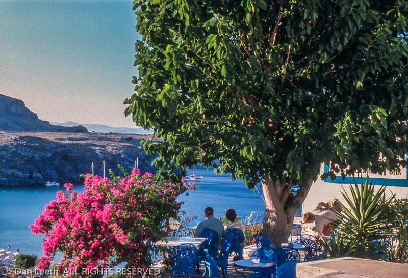
A quiet breeze brushes the summit where Alexander the Great, Helen of Troy and Hercules supposedly once stood. Columns from bygone eras point skyward. Below, narrow streets wind past homes and shops where merchants quietly await business. People sit at outdoor tavernas savoring views with a brew. Carfree and carefree, Lindos offers a serenity absent in the town of Rhodes.
Peals from the town’s bell tells us it’s late, and we need to return to our craft. A three-hour voyage separates us from our next island. The motion of the ocean rocks me to sleep on the journey over.
“Sea travel affects the thyroid differently in each sex,” theorizes my Italian-born friend Roberto Mitrotti. “It makes men more relaxed, which is why they love to sail. Women, on the other hand, get amorous,” he adds, winking at his young American girlfriend. “That’s why they love to sail.”
We dock in Symi, the main village on the island of the same name. Twelve feet from our stern, workmen sit at a taverna drinking beer. If we were any closer, the waiters could offer table service. We dine on the deck, much to the delight of staring locals.
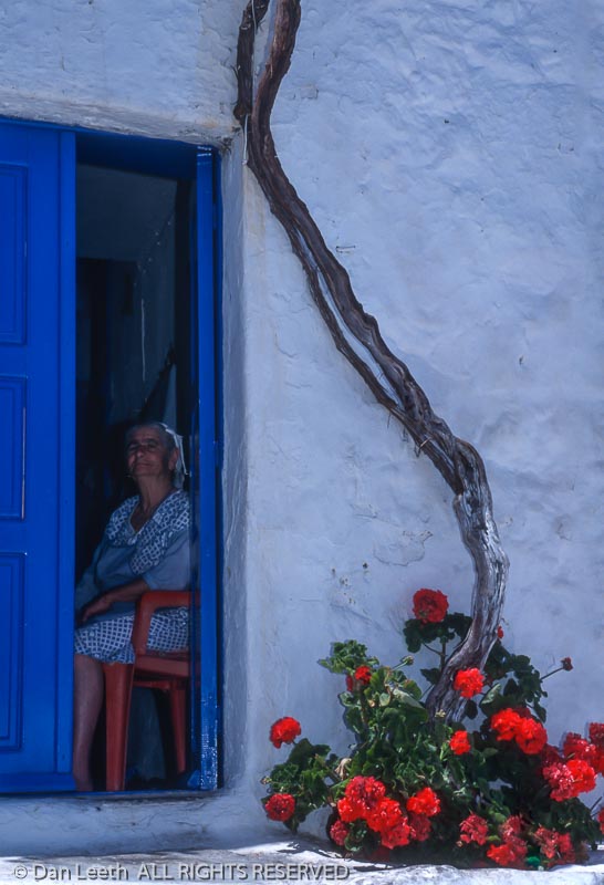
In the morning I go for a walk. Although popular, Symi seems less touristy than Lindos. Two-story pastel homes, once the residences of sponge merchants, round its waterfront. Behind, desert mountains rise toward unblemished skies. Roosters crow, chickens peck and children play while mothers watch. Men ride motorcycles and women scoot by on Vespas. Cars and trucks are few. Tranquility prevails.
Small fishing boats bob in a shallow harbor. Each looks like it was colored with the brightest crayons a child could find. The transparent water shimmers in shades of teal and turquoise. Beyond spreads a sea as blue as unwashed Levi’s. It’s like I’m walking through a virtual tourism brochure.
Our captain, Tasos Dimisetis, joins us for a late lunch. He says he has spent almost 27 years at sea. He was a cargo-ship officer for six and served as a cruise-ship master for another six. Since then, he has captained yachts. When he’s not sailing, he hunts wild boars.
“This guy’s truly a man’s man,” jokes musician Iris Brooks.
After lunch, we sail to Panormitis on the south side of the island where we visit the monastery of Archangel Michael, patron saint of Greek mariners. A pilgrimage to the sprawling enclave is a ritual for Orthodox sailors. Abbot Gabriel shows us the facilities.
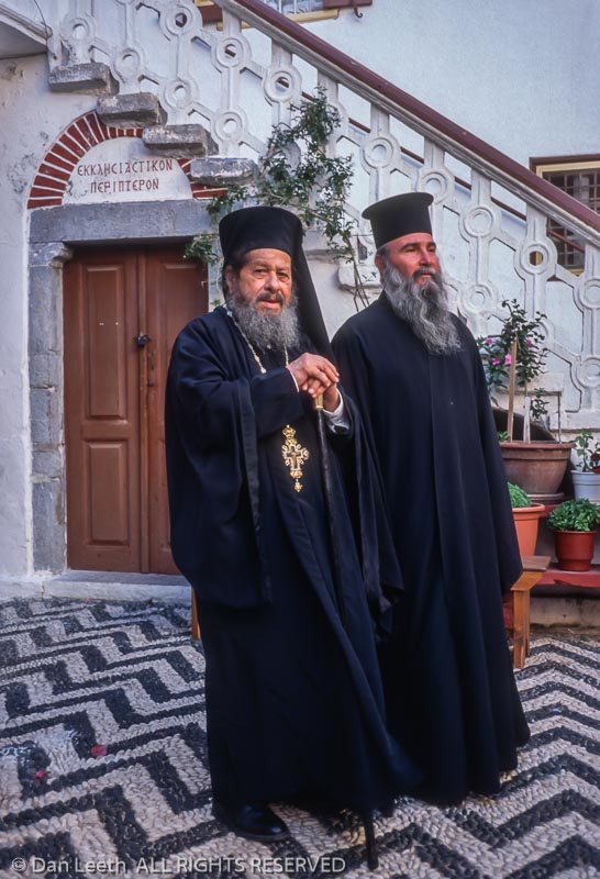
“I have been here 54 years,” the black-robed man says in slow but precise English. “I came after the war.”
He tells us that when the Italians held the Dodecanese during World War II, one of their ships carried both military officers and civilians, including Gabriel. An Allied submarine torpedoed the vessel. Cast to the water, the young man prayed for St. Michael to save him. Six hours later, rescuers arrived. In mortal gratitude, Gabriel dedicated his life to the patron saint of Symi.
A grandmotherly woman serves us cookies and glasses of fig schnapps, a monastery specialty. As we depart, I hear Gregorian chants coming from the chapel. Perhaps it’s the alcohol, but I suddenly feel touched by an archangel.
Yacht life falls into a pleasant routine. We spend the days exploring. Come evening, we nap while the captain sails to new shores. Then it’s time to rise and dine.
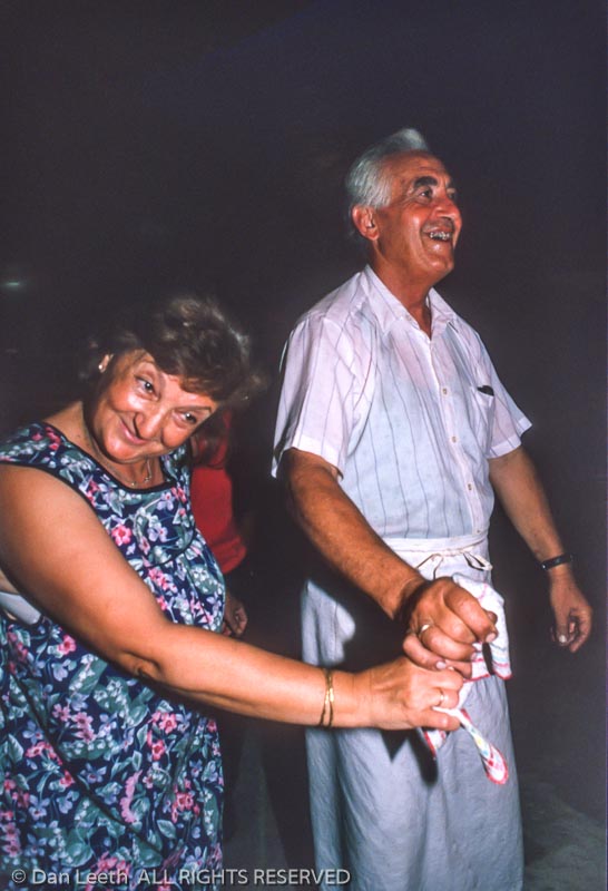
At midnight we arrive at Nisyros, a volcanic isle northwest of Rhodes. After docking in the capital of Mandraki, we follow lights to an open-air taverna where late-dining patrons engage in lively conversations. A waiter approaches.
“Do you want your fish cleaned or uncleaned?” he asks. “You know, with the insides still inside?” Considering the options, I choose pork.
At 1:30 in the morning, dancing starts. The chef and the owner’s wife perform a traditional handkerchief dance, substituting dishcloths for hankies. The festivities continue at the island discotheque.
Rising at the crack of noon, the seven of us stumble out for a van tour of the island. We motor up slopes terraced with rock walls and dotted with oak and olive trees. At the top lies Nikia, a hilltop village perched on the crater rim. Its whitewashed buildings sport royal blue doors, shutters and trim. The incense of cook-stove smoke melds with the potpourri of blossoming flowers. Stairs and walkways wind in a maze of routes. It’s the classic Greek Island cliché of stucco and bougainvillea, only here we enjoy it free of shop-swarming cruise commandos.
“There are only about 40 inhabitants left in this village,” says guide Vera Sakka. “Most Niserians have emigrated to Rhodes, Athens or even the United States and Australia. But I stay. I like to open my eyes with a smile.”
Back onboard, we enjoy the advantage of private yachting and vote to overnight again in Nisyros rather than move on. In the disco, the town’s mayor shows up to try convincing us “rich foreigners” into investing in local tourist development. Bailing on the business talk, I walk back to the boat and sit alone on the deck. The night is dark and dead quiet. It’s an eerie silence seldom found in my urban world.
As we sail away in the morning, I watch Nisyros disappear into a blur of blue sky and bluer water. I’m glad I was able to see the island before multitudes overrun its shores and strangle its allure.
We head to the island of Chalki. Now home to only a handful of residents, it was once prosperous with a population of 4,000. Copper came from its hills and sponges from its waters, but the mines played out and the divers moved to Florida. Then the sea infiltrated the water table, making the once fertile landscape barren. Fresh water now arrives by tanker.
Neoclassical homes line the harbor. In their midst rises the wedding-cake tiers of a church bell-tower. Fishing boats in a rainbow of vivid hues float on water clear as a mountain lake. Their owners work on untangling nets. A quarter-mile away lies the town’s beach where neither umbrellas nor vendors mar the sand.
“My wife and I come here to do nothing,” says Chris Heather, on holiday from England. “It’s a different life. Anything important you must bring with you because there are no shops, no movies, nothing at all.”
Wading the surf, I feel content. The crowded, chaotic world of home has dropped into a distant memory. It’s as if I have been sedated for a week, living a halcyon dream of rest, relaxation and renewal.
Isn’t that what vacations are for?

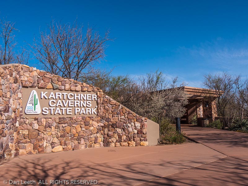
We had planned a camping trip to Arizona, but alas, a certain nasty virus got in the way. While camping might be a good way to practice social distancing, getting there and back would involve a fair amount of social interaction. While our intended campground remains open, there’s no telling when state-wide or national quarantines might drop into place.
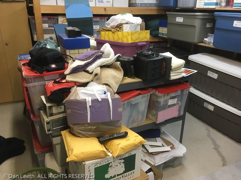
Problem is, by staying home we have no excuse not to finally get around to cleaning 35 years accumulation of crap out of the laundry room.

I’m a planner. When it comes to activities, I’ve always liked to plan ahead.
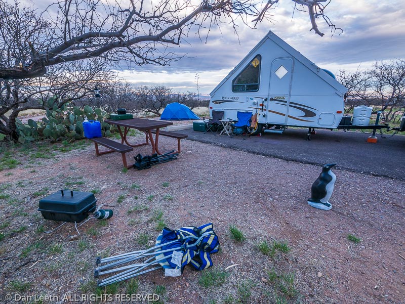
As a hiker/climber/backpacking tent-camper, I’d sit down in the spring and map out every weekend and vacation adventure through the end of autumn and beyond. The need for preplanning got worse when Dianne and I bought a trailer.
In the old days, any place we could park our truck became a potential campsite. Other than an occasional national park stay, we had no need to bunk in formal campgrounds. That’s tougher with the trailer.
These days, we need a nice flat spot to park our motel on wheels, ideally with water spigot nearby. With solar panels and/or a generator, we can go without a power hookup, but a dump station for draining the holding tanks is a handy amenity if we’re staying more than a few days.
We’re not big fans of RV parks where “campers” are parked elbow-to-elbow like cars in a Costco parking lot. We prefer state parks, where sites are typically spaced farther apart and often cloaked in vegetation. For most state parks, ensuring a site requires making a reservation sometimes up to a year in advance.
The problem with planning one’s life that far ahead is that as Forest Gump pointed out, sometimes “stuff happens.” Take the latest pandemic, for example. By the end of 2019, I had our camping for 2020 totally scheduled, with campsites reserved through late September.
We’re now rebooking things. We had a long-planned trip with friends to an Arizona state park in April, timed so that we would be there for their annual wine and food tasting event. We had to cancel one week before departure when Colorado was put on a shelter-in-place lockdown. We rescheduled our reservations for October.
This week, another trip bit the dust. We were planning to meet some friends at a trailer rally in South Dakota in mid-June with stops at a Nebraska state park on the way up and a week-long retreat in the Black Hills on our way back. That trip will now be held next year, virus-permitting. Instead of South Dakota, we found a site still open at a Colorado state park and booked it for the same time period.
A late-May trip to Robb State Park in Grand Junction, Colorado, is still on our calendar at this point, although the scope of the trip has changed. As baseball fans, we originally planned to attend a few games of the Junior College World Series while we were there, but that event has, of course, been cancelled. If the campground reopens, we’ll still go and just do a lot of hiking instead.
Beyond that, we still have campsites reserved for July in Colorado. In mid-August, we have reservations for a six-week swing down the Left Coast with stops at state parks in Oregon and California with a couple of weeks camped in the redwoods before continuing on for our rescheduled Arizona trip.
While we may not be camping in the trailer, I am taking the time to “improve” our motel-on-wheels. In the next few weeks, I’ll be installing an upgraded toilet, reinforcing the bumper, moving the spare tire to below the frame and bolting on a receiver for a bike rack. I’ll probably be replacing the refrigerator thermistor with an adjustable version, installing a pair of solar panel inputs at the rear of the trailer and adding a sliding silverware drawer.
I’m also thinking about spending our covid-incentive on upgrading my factory power center converter/charger with a Progressive Dynamics unit and replacing a pair of anemic, lead-acid batteries with a 200-amp lithium-ion unit. That will allow us to boonie-camp for longer periods without needing to pull out the solar panels or fire up the generator.
Now, if we could just solve the need for a dump station, but unfortunately, Dianne is too excited about using that new, upgraded toilet for that ever to happen.
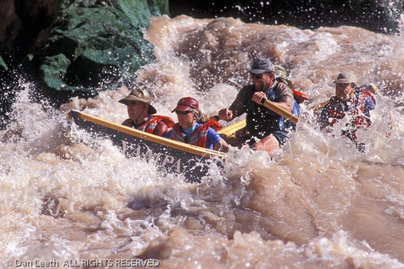
The Most Exciting Way to Experience the Grand Canyon May be in a Wooden Boat
Like a liquid freight train that’s jumped its tracks, the entire flow of the Colorado River careens toward the canyon’s far wall. Beyond, it shakes and churns down a channel choked with submerged boulders. Between those rocks and the hard place froths enough hydrological mayhem to flip the Queen Mary.
Expedition leader Bill Bruchak guides our tiny boat toward the left side of the flow. With a series of hefty pulls, he rows stern-first into the agitated bedlam. Engulfed in turbulence, Bruchak yanks an oar, and we pirouette to go with the current.
Ahead stands a wave taller than a suburban tract home. As we graze its side, water arcs down, filling the foot wells 15 inches deep. A series of rolling tail waves follow. Like the mechanical bull at Gilley’s, the boat bucks through each swell with all onboard screaming “HEE-HAW!”
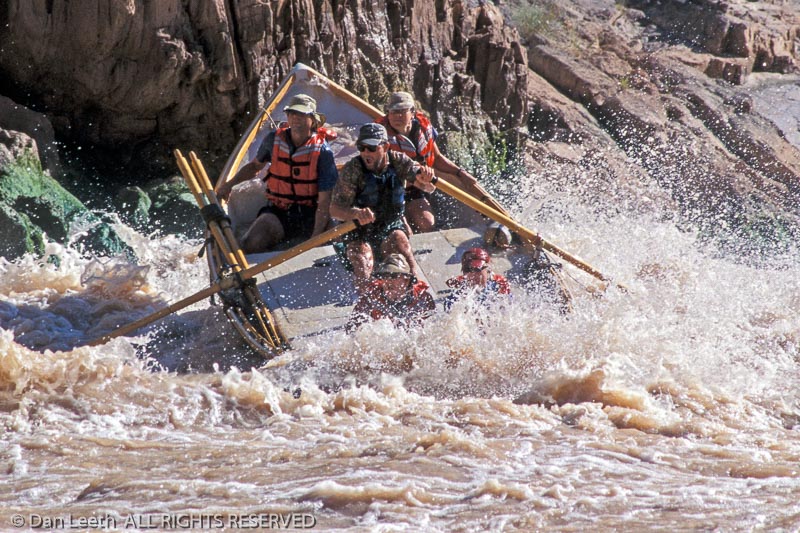
We finally reach the eddy at cataract’s end, and I’m beaming. House Rock Rapid has just given me an exhilarating taste of how dories cruise through white water.
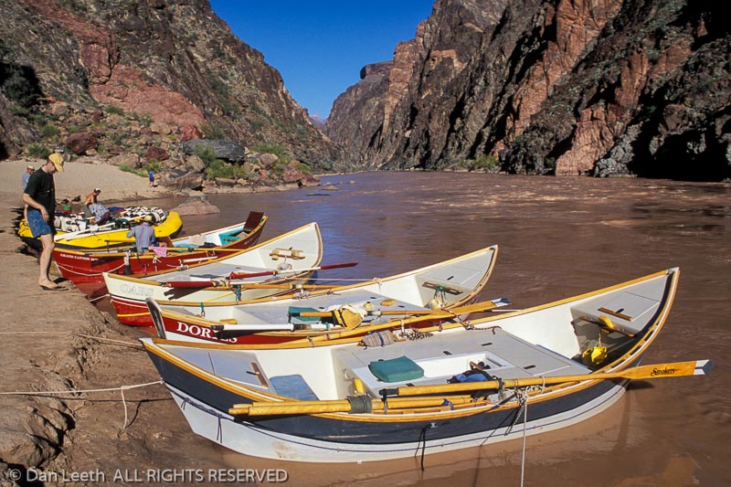
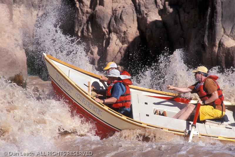
The sports cars of commercial river running, dories are made from wood, foam and fiberglass. They stand about 18 feet long, 56 inches wide and comfortably hold four passengers and an oarsman. A flat bottom and upturned ends make them easy to steer on the river, and because they have rigid hulls, they don’t flex with the waves as rubber rafts will. Instead, a sharp prow splits the water in a way that makes even riffles exciting. Unlike inflatables, however, these rigid-walled craft can crack on rocks, so dory drivers must carefully plot routes through rapids.
“They’re a royal pain sometimes, but they’re worth it because of the ride you get,” says guide Shawn Browning.
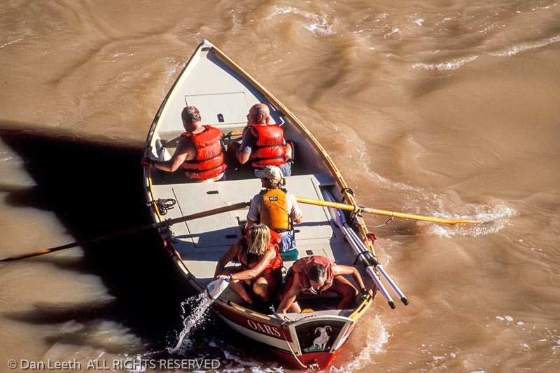
On this Grand Canyon Dories journey through the length of the canyon, we have four boats for 16 clients, rowed by a three-man, one-woman crew of seasoned guides. The bulk of our gear travels onboard a pair of oar-powered baggage rafts.
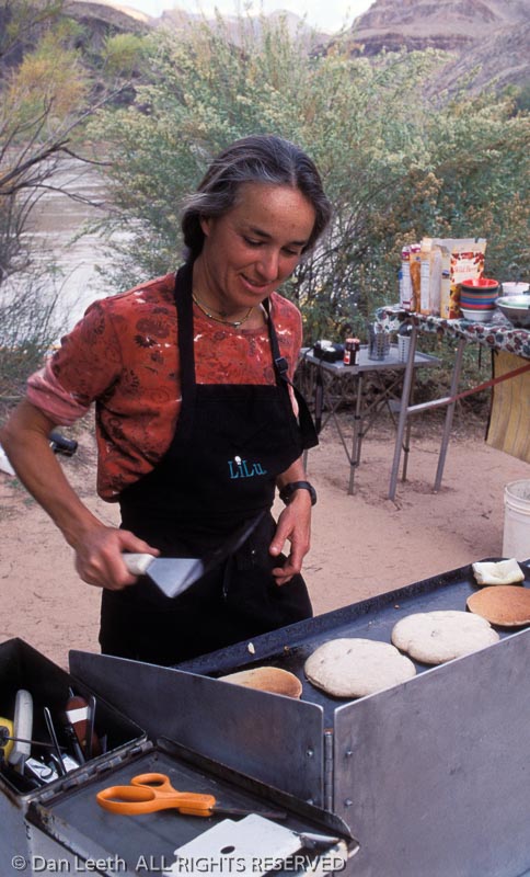
Our first camp lies on a riverside beach two miles below the rapid. In a drill that’s repeated for 17 nights, everyone first unloads gear and waterproof “dry bags” from the rafts. While we seek sleeping sites, the cooking team begins preparing a fresh-food dinner in a portable kitchen, complete with propane stove and lantern. The boatmen assemble water-purification and hand-washing stations, then find a secluded yet scenic spot for the portable potty. Nicknamed “The Unit,” this toilet-seat-on-an-ammo-can offers a throne with a view.
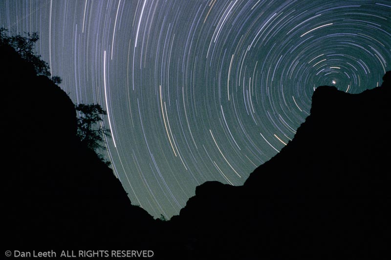
We spend evenings circled around a campfire. The Milky Way shimmers overhead, its luminescence painting the gaps between inky canyon walls. Civilization fades far away.
Most mornings, I awaken to the descending notes of a canyon wren. After coffee and a hot breakfast, we load boats and head downstream. Calm current and raging white water await.
Rapids occur near the mouths of side canyons where flashfloods have washed rocks and rolled boulders into the river. We porpoise through most like dolphins on pep pills. If the boat hits waves straight on, the prow shoots high into the air with nothing but blue above the bow.
Grand Canyon cataracts are rated on a 10-point technical scale, with “one” being a dancing riffle and “10” a slobbering ogre ready to devour anything floating through. I soon develop my own “fun-factor” rating system based on how many inches of water occupy the foot well at rapid’s end.
Although pros operate the oars, dory passengers play a part in running rapids. We are responsible for “high siding,” a weight-shifting maneuver that helps keep the boats from tipping.
“If a big wave’s coming right at the side of the boat, you want to lean into it,” says guide Elena Kirschner. “That means you’re going to get wet and cold, but it’s a lot less wet and cold than swimming in the river.”
Fortunately, dories seldom flip, and unlike rafts, they are easy to turn right-side up. None of ours tip over, but a private raft trip that launched the same day we did experiences several upsets.
“There’ve been some deaths on the river by drowning and being hit,” says Martin Litton, the man who introduced dories to the canyon. “Nearly all of them have occurred in inflatable rafts.”
In 1869, Major John Wesley Powell led the canyon’s first float trip in wooden boats. Built for straight-line speed, his craft proved unwieldy in rapids. Other river runners followed, each generation improving its predecessor’s designs. It took almost a century for dories to reach the canyon.
“I’d seen these McKenzie boats in Oregon made out of plywood,” explains Litton. “We got a builder to craft a couple of hulls, and in 1962 we made the first trip in dories.”
Litton soon began annual river-running vacations, taking along friends, friends of friends and people he’d never seen before. To keep from going broke, he started charging $180 for his 21-day trips. In late 1968, he quit his senior editor job at Sunset magazine.
“I just walked out,” he says. “From then on, I was in the business of running river trips.”
His company, Grand Canyon Dories, became a leader in the burgeoning industry of white-water river running. In the late 1980s, Litton sold the operation to O.A.R.S., which continues to offer a full schedule of trips.
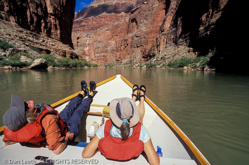
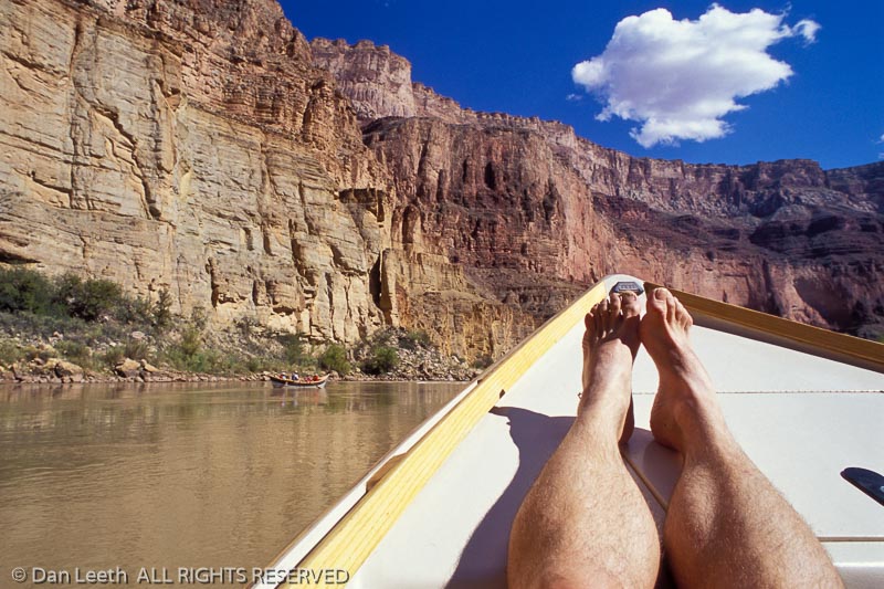
If rapids provide the river’s caffeine, flat stretches are its herbal tea. In the calm between the cataracts, we relax as oars stroke the water in metronome rhythm. Great blue herons stand by the shore watching our passage. Bighorn sheep gaze down from above. Rock walls reach upward, their colors and textures revealing the canyon’s geological history. We float through nature’s gallery, displayed at its artistic best.
“If this was all flat water, I’d like it just as much,” admits baggage-boat oarsman Kurt Brooks.
Although we stop at the canyon’s famous spots, it’s not the guidebook highlights that prove most memorable. It’s the secret places. We climb to overlooks and hike side canyons to waterfall grottos. We see where geologic faults have bent rock as if it was made of taffy. We examine prehistoric petroglyphs, pictographs and Indian ruins, as well as remains left by miners, railroad surveyors and would-be dam builders.
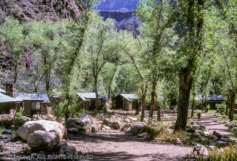
Conventional civilization lies in abeyance. Only on day eight when we reach Phantom Ranch, an inner-canyon lodge, is our wilderness interrupted. There, surrounded by hikers and mule riders, we buy lemonade, T-shirts and postcards. Escaping back into the wild, we camp for the night below Horn Creek Rapid, one of the canyon’s more challenging cataracts. The worst lie ahead.
The next day, we cover what Bruchak claims is “the biggest navigable water for a dory in North America.” In 23 miles we navigate 16 named rapids that include several of the canyon’s gnarliest. I ride with Browning.
After breezing through Salt Creek Rapid, we hit Granite, a boiling pot of froth and turbulence. Browning aims down the tongue, but misses the line by a few inches. Nipping “the crasher,” he spins around. Suddenly, we’re rushing stern-first toward a very hard wall.
“Schist!” I shout, naming the rock strata lying dead ahead.
Browning pulls the oars with every adrenaline-packed ounce of energy he can muster. But the river is stronger.
WHAM! We hit with an impact that would make a demolition derby driver wince. The collision spins us again so we’re now moving forward. Browning catches the current, and we finally jolt out the bottom of the rapid. Opening the stern hatch, I expect to see a Titanic-size hole, but it’s dry. We’re only bruised, not busted.
“Yikes, that was close,” Browning says in what may be the understatement of the day.
Downstream, we ride Hermit’s 35-foot-tall wave train without incident. After an inconsequential run through Boucher, we arrive at Crystal. Once, this was little more than a riffle, but a 1966 flashflood choked the river with debris, forming one of the canyon’s most gut wrenching cataracts.
“At high water, Crystal is a difficult rapid with dire consequences if you blow it,” says Browning. “We’re at medium-low water, so we’re going to do what is called the left run. It’s big.”
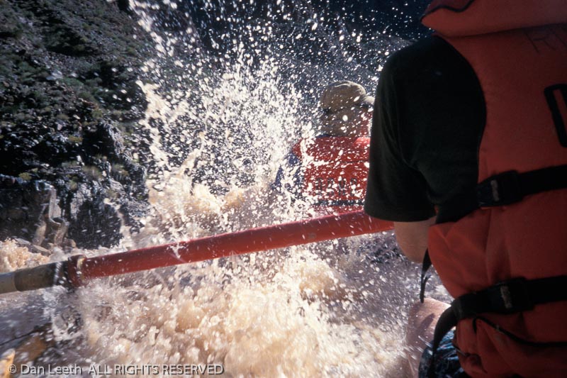
We pull into the current, nipping the edge of a gaping hole. Water crashes down. Like Niagara Falls hitting a teacup, the boat fills from gunwale-to-gunwale rendering it too heavy to maneuver. Boat-shredding boulders loom below.
“BAIL!” Browning cries. “BAIL! BAIL!”
We begin madly flinging water over the sides. Our compatriots say it looks like hoses spraying from a fireboat. We lighten the craft enough to safely negotiate the final white water. At the bottom, we mercifully say our ABCs – Alive Below Crystal.
After lunch, we plow through a succession of cataracts, missing walls, rocks and holes. It’s a repetitive cycle of anticipation and anxiety followed by jubilation and relief. If the dories are sports cars, this is their Le Mans.
I fall asleep, confident that our spunky guides and spritely craft can handle anything the canyon throws at it. That’s good, because the most feared rapid lies three days downstream.
Once, molten magma dammed the Colorado, but the relentless river eroded away the impediment, leaving only a surging drop called Lava Falls in its wake. While not the most technically upsetting rapid, it’s the one that drives more boatmen to hit the Maalox.
“Every time I make that turn and hear the roar, my heart jumps 15 beats faster,” says Bruchak, with whom I ride today.
The cataract looks like a blender churning milkshakes in the river. We slowly approach the lip of the cataclysm like condemned prisoners on a gurney.
“Hang on,” he says. “We’re getting close. Get ready!”
We teeter at the brink, then swoop into the Cuisinart chaos. A ledge to the left has formed a gaping maw in the river. Bruchak pulls the dory to the edge of it, gaining momentum.
“Get ready! Big one!”
We sever a lateral wave and slice down to where two currents rush together to form a bulging V-wave. The bow rises. Water flies. We bounce like an ice cube in a martini shaker.
“Bigger one coming! Hang on! BIGGER ONE.”
We plow through a second, larger V-wave. Torrents crash by the boat’s bow. I grip the gunwales so tightly, I expect to leave indentations in the hardwood. We bound, bounce and bash through the rapid’s gut, finally exiting through the tail waves.
Nine seconds after it began, it’s over. Bruchak pulls into the eddy and everyone breathes a triumphant sigh of relief.
“There’s no place on the river like that,” he exclaims, grinning.
I look at the bottom of the boat. Only four inches of water slosh in the foot well. Maybe Lava Falls isn’t so bad after all.
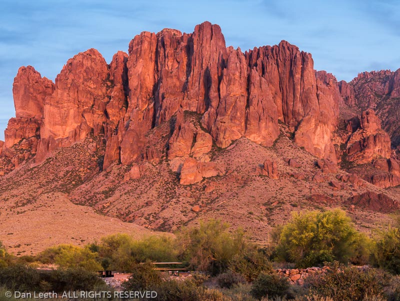
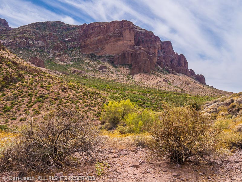
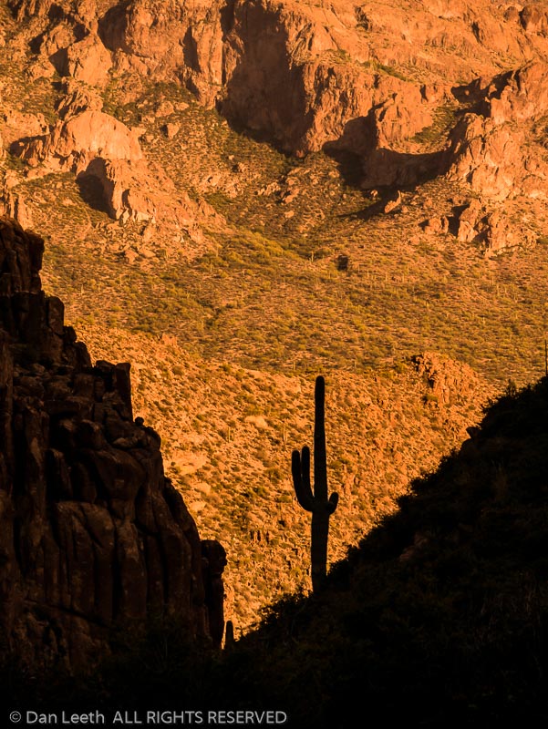
It was my first ever hike. I was nine years old when my father’s friend, Scotty, invited us to join him on a trek into the Superstition Mountains, a rugged jumble of bluffs, buttes, crags, cliffs and canyons rising 35 miles east of Phoenix. Naturally, I wore my Roy Rogers cowboy boots. Six blisters later, I realized why Roy rode and seldom walked. Only Scotty’s tales of treasure kept me going.
As every Arizona kid of my era knew, the Superstitions held the Lost Dutchman Mine, and Scotty was an expert on this missing treasure trove. He led us into an area known as the Massacre Grounds where the story got its start.
According to Scotty, the Peralta family from Mexico opened 18 mines in the Superstitions from which they extracted gold in unbelievable quantities. Their last foray, a procession of 400 men and 200 pack mules, came in 1847. On their return, they were ambushed, their gold was scattered and their mines were soon covered over. Skeletons, rotten saddlebags and $18,000 in loose, gold-veined concentrates found later in the area support the story’s accuracy.
The only thing we discovered on our adventure was an arrowhead and a shallow cave whose campfire-sooted walls stood black as a chalkboard. Somebody spent many nights camped here. I figured it was the Dutchman.
As the story goes, two German prospectors, Jacob Waltz and Jacob Wieser, drifted into a small Mexican village where they rescued a man from a barroom brawl. In gratitude, the saved señor, a Peralta relative, gave the partners a map and ultimately rights to the family’s Arizona diggings. The two Germans headed north, and in a land so rugged that even a lizard could get lost, they found the Peralta site left uncovered. It held, according to Waltz, an 18-inch vein of pure gold.
“World’s richest mine,” he bragged.
Wieser’s good fortune remained short lived. With Waltz allegedly out buying supplies, someone murdered Wieser. All the gold now belonged to the “Dutchman,” whose nickname either came from Deutsch, the German word for German, or his contemporaries bore a worse sense of geography than today’s sixth-graders.
I’ve logged hundreds of trail miles in the Superstitions since that first experience. Today, I’m introducing my wife, Dianne, to the area. As Scotty did for me, I’m sharing with her tales of the Dutchman and the “Dutch hunters” who followed.
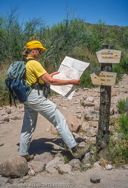
Our springtime hike from the First Water Trailhead begins, appropriately, on a trail named for the Dutchman. The cool morning air carries the fragrance of wildflowers. Mourning doves coo plaintive dirges in the distance.
Although historical records cannot confirm Wieser’s or the mine’s existence, Waltz was a very real person. Born in Germany, he immigrated to the U.S. in 1839. A decade later, he headed west for the California gold rush, obtaining American citizenship in Los Angeles. He later moved to Prescott, Arizona, where he filed mining claims.
In his snow-bearded years, Waltz settled down in Phoenix to raise chickens on a 160-acre plot near the Salt River. The stream flooded in 1891, and Waltz spent two frigid nights in a tree before being rescued. He contracted pneumonia from the incident.
Julia Thomas, a German-speaking ice-cream parlor owner, cared for the ailing Dutchman. After eight months’ convalescence, the 81-year-old Waltz took a turn for the worse. Prior to cashing in, the Dutchman attempted to disclose his mine’s whereabouts, but all he ended up bequeathing were vague directions and a few pounds of gold-laced rock.
Firmly believing she could find his mine, Thomas sold her shop and rode into the Superstitions the following August. Waltz’s deathbed instructions ultimately proved impossible to follow. After repeated searches, Thomas did the next best thing. She sold maps to the mine she couldn’t find.
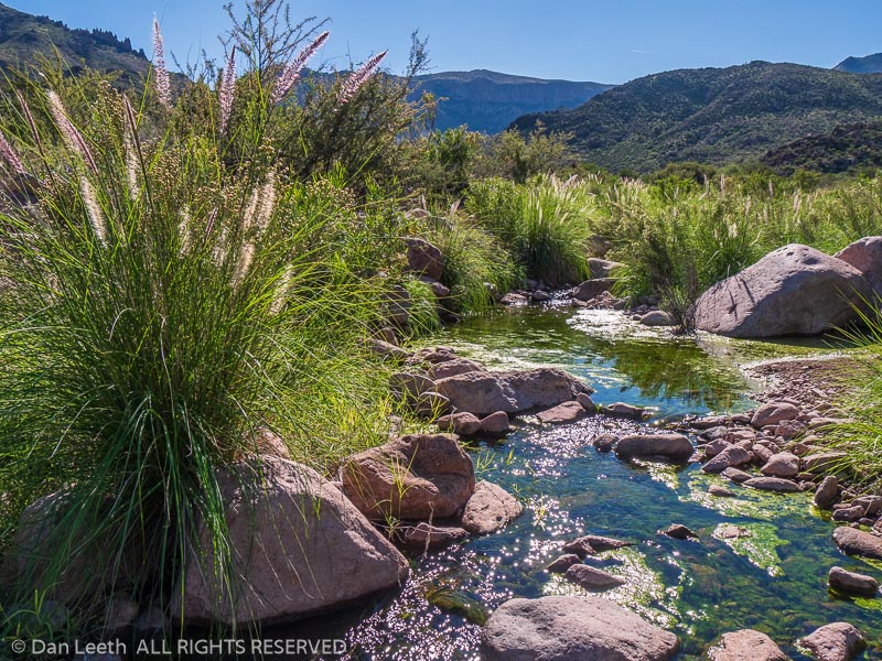
Our trail parallels First Water Creek as it whispers through rock-lined pools. Come summer, the creek will be deathly dry. I know because like Julia Thomas and a slew of other Dutch hunters, I’ve hiked here in the height of heat.
Years ago, a group of us wanted to see what it would be like to explore the wilderness when temperatures topped triple digits. It wasn’t fun. By the time we reached our campsite, we were sizzling like pigs at a luau. We spent the remainder of the day simmering away beneath a cottonwood tree.
Dianne and I cross Parker Pass and head down to Boulder Basin, an open area studded with cactus and laced with wildflowers. A short detour up East Boulder Creek takes us to the site of Aylor’s Caballo Camp.
Arriving from Colorado, Chuck and Peg Aylor moved into the Superstitions in 1939 hoping to find the Dutchman’s lost diggings. They remained here until the Forest Service evicted them in the 1960s and dismantled their camp. Although the Aylors found nothing of value, they at least left alive. Many were not so lucky. One of the most famous of the dearly departed was Adolph Ruth.
A retired bureaucrat from Washington, D.C., Adolph Ruth came in 1931 with an old map his son had obtained from a Mexican diplomat. He arrived in mid-June and immediately hired a couple of cowboys to pack him into the Superstitions. A week later, a rancher found his camp empty. Ruth was nowhere to be seen.
A 45-day search ensued with no results. Six months later, members of an archeology expedition found a skull several canyons away, which authorities confirmed was Ruth’s. Bullet holes punctured both sides of the cranium.
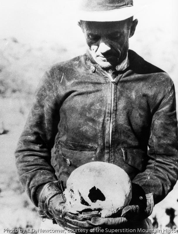
The rest of his skeleton and personal effects turned up a half-mile away. In one pocket was a sheet of paper on which Ruth had written “Veni, Vidi, Vici” (I came, I saw, I conquered). His map was missing.
Dianne and I continue our hike over Bull Pass and down into Needle Canyon. A buzzard circles overhead, perhaps hoping that we, too, are doomed Dutch hunters. We aim to disappoint.
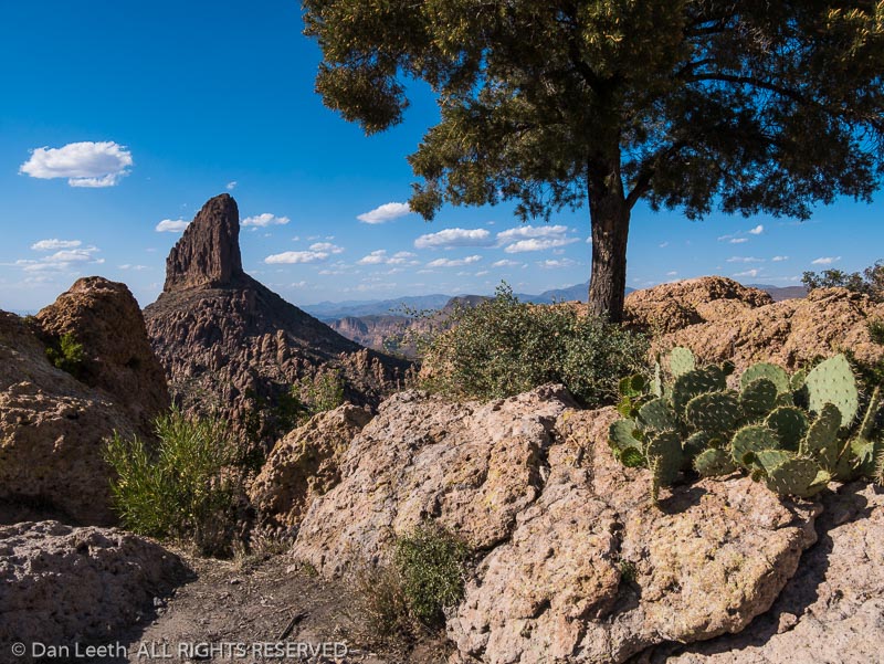
Weavers Needle, icon of the Superstitions, towers to the south. In the shadow of this thousand-foot-high volcanic monolith, two rival groups battled in the 1950s over lost gold, but not from a mine. They sought a treasure allegedly stashed by priests.
After King Carlos III evicted the Jesuits from New Spain in 1767, a missionary-led pack train supposedly entered the Superstitions with 240 heavily burdened mules. When the convoy reemerged, the animals bore no loads. The toted treasure, the opposing factions figured, must be hidden in these hills.
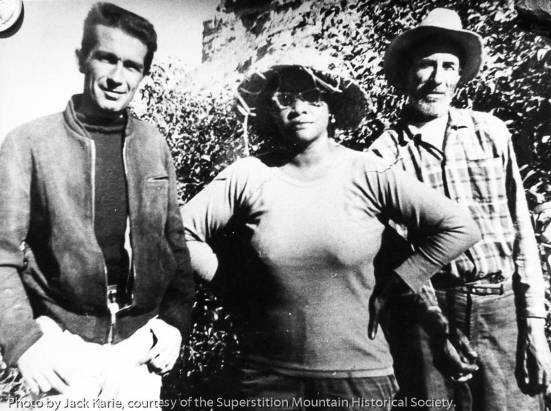
One heavily armed band was led by Celeste Jones, a black woman who claimed to have studied music at Juilliard and sung with the Metropolitan Opera. She traipsed about the mountains in sneakers, Bermuda shorts, sunglasses and a wide-brimmed hat. Jones believed gold lay hidden in Weavers Needle, guarded by a band of people visible only to her. To win their favor, she serenaded them.
Ed Piper, a lanky white prospector, led the opposing armed camp. He generally donned khaki trousers and, like Jones, always sported a sidearm. He was an accomplished farmer and planted fruit trees in the desert near the base of Weavers Needle. Both groups shared the area’s sole water source.
Animosity peaked when Piper killed one of Jones’ men. He was questioned, but for lack of witnesses, the court ruled self-defense. Diagnosed with stomach cancer, Piper left in 1962 and died two months later. Jones stayed another year before departing the Superstitions for good.
We follow Boulder Canyon downstream to the Second Water Trail, our return route to the trailhead. Afternoon light glints off cholla and saguaro needles. Butterflies flutter among purple-flowered thistles, globe mallows add dollops of orange and century plants stalk upward in their single reproductive shot before death.
“Does the mine really exist?” Dianne asks.
Scant documentary evidence exists to support the existence of Dutchman’s diggings. No claim was ever filed, and tax records show Waltz claimed only around $200 in personal property. But folks occasionally lie to assessors, and locals saw Waltz brandishing gold from somewhere.
“I believe there is a Lost Dutchman Mine,” Mike Smith, who formerly managed a local prospecting supply store, once told me. “There are enough facts to conclude something is out there.”
Critics speculate that Waltz may have stolen ore from the Vulture Mine northwest of Phoenix. Others contend the Dutchman’s nuggets came from a mine in Goldfield, four miles north of Apache Junction.
“That was a possibility,” Smith countered, “but Dr. Tom Glover did electron dispersal analysis of ores from Goldfield and the Vulture. None matched the Dutchman’s.”
Longtime Dutch hunter Ron Feldman, owner of Apache Junction’s OK Corral stables, suggested to me that the Dutchman’s mine may already have been totally gutted in the ’20s.
“Think about it,” he argues. “If you found the mine and staked a claim, foes would come right to you. Your best bet would be to keep your mouth shut.”
History may never reveal the truth of the Dutchman’s gold, which is fine by me. The lingering mystery offers a inexhaustible excuse to poke around this inspiring El Dorado. After all, as Scotty pointed out on my first hike years ago, “If failure foiled dreamers, no one would drop a second quarter in a slot machine.”
After 26 years of full-time, freelance travel writing, I’ve decided it’s time to finally hit the brakes. Instead of researching stories, I’m going to visit places just for the sheer joy of being there. No more interviews to schedule. No more copious notes to take. No more casting for storylines.
Continue reading Test