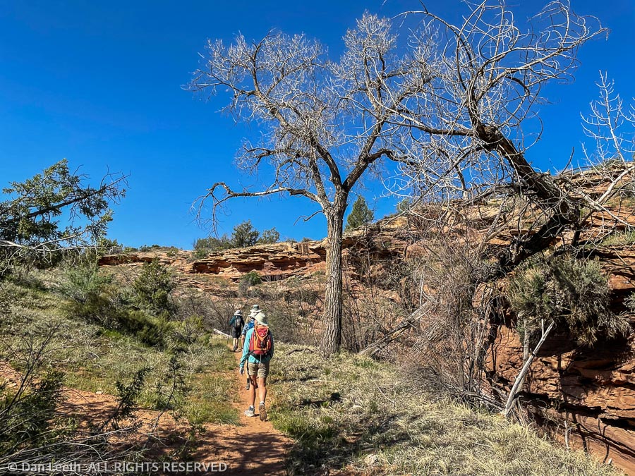
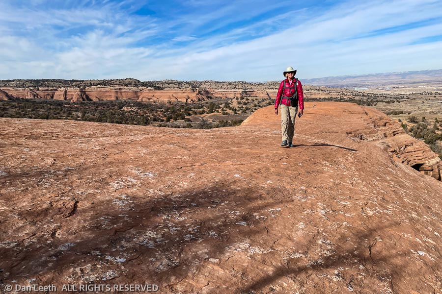
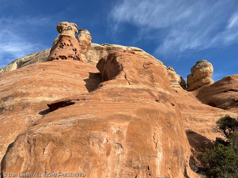
Today, Dianne and I joined six others on a Colorado Mountain Club loop hike up Flume Canyon in the McInnis National Conservation Area. The outing was led by one of our soon-to-be neighbors from the village.
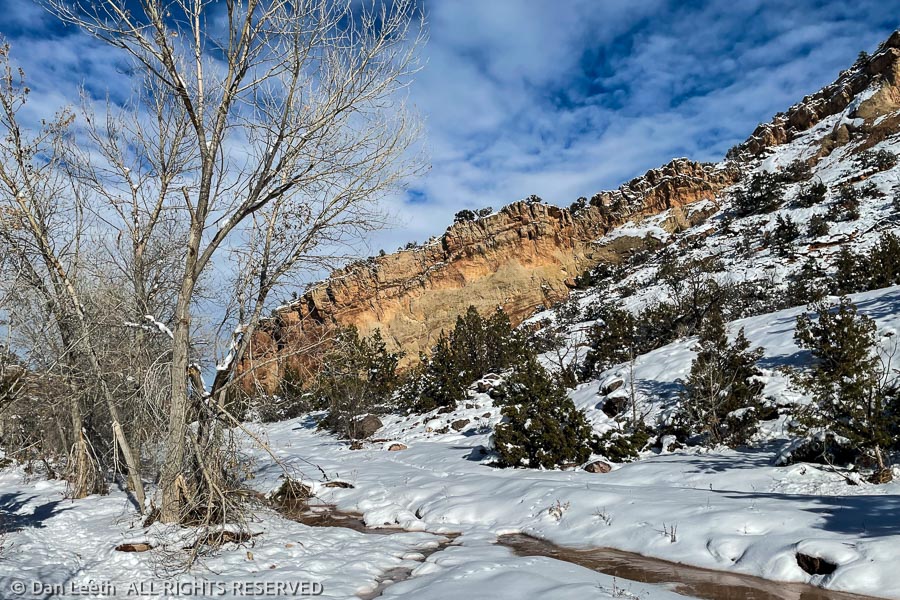
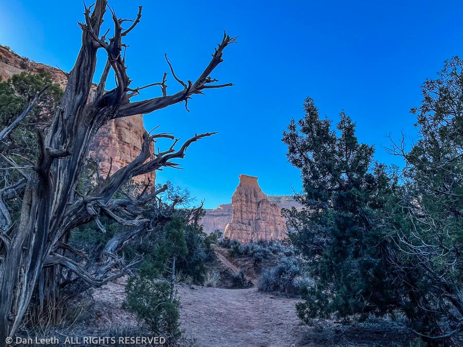
Our route up was by the Inner Flume Trail, which follows the creek along the base of Flume Canyon. Dianne and I tried this route a few years ago, but we had to turn around when we found the trail blocked by a growth of poison ivy. The ivy hasn’t sprouted leaves yet this year, so we had no issues this time.
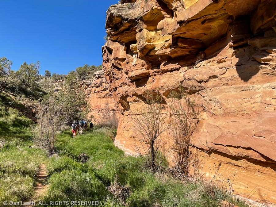
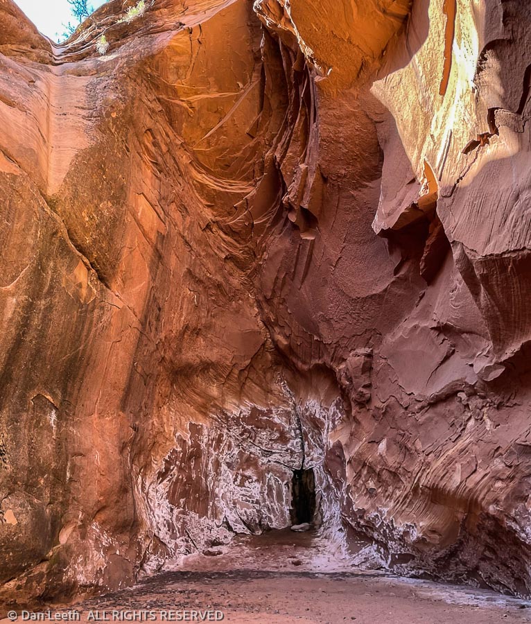
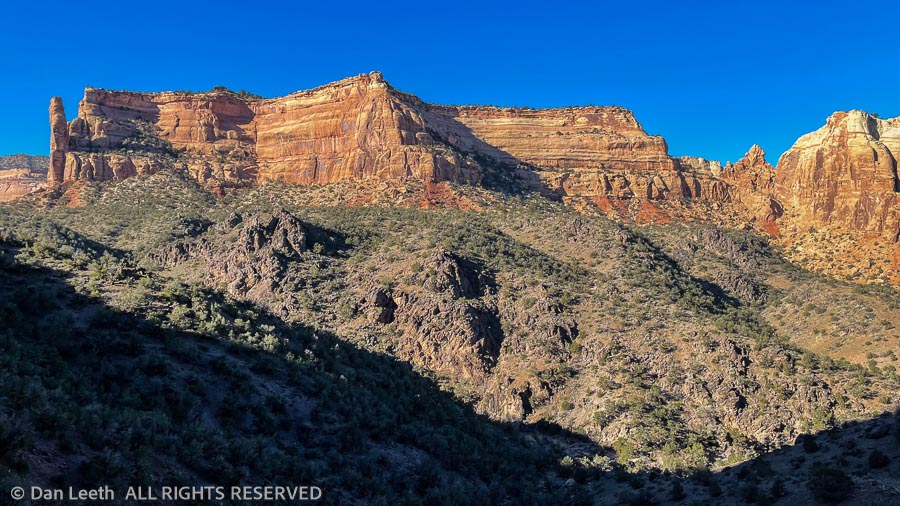
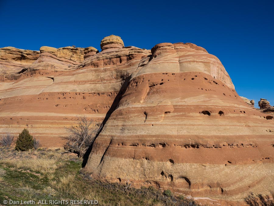
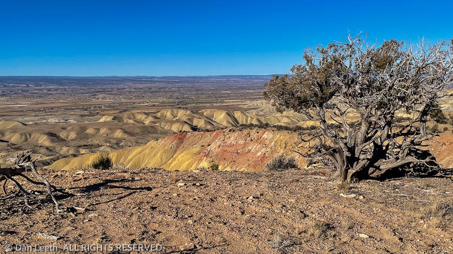
It’s quite pretty down in the bottom of Flume Canyon. At least I think it was pretty. I like to hike slowly and absorb the environment. Our CMC leader had us sprinting right along, so views and photos were limited. Dianne and I may head back down there next week with the big camera gear and just wallow in the scenery.
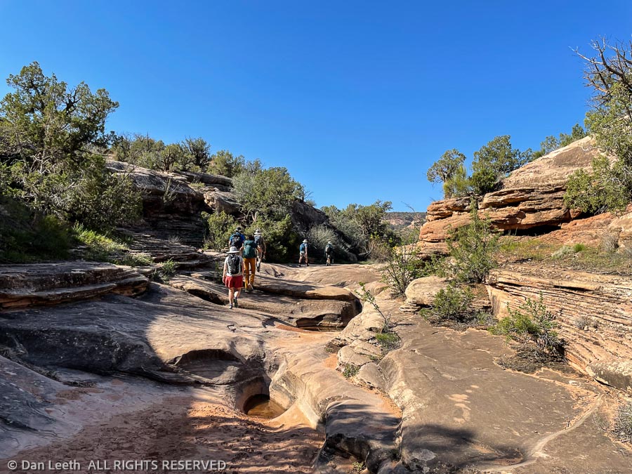
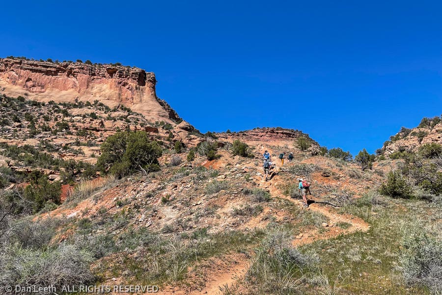
The trail up the inner canyon came to an abrupt end at the base of a huge pouroff. After an in-and-out water stop, we dropped back down the canyon a short distance and followed a trail up onto the rim.
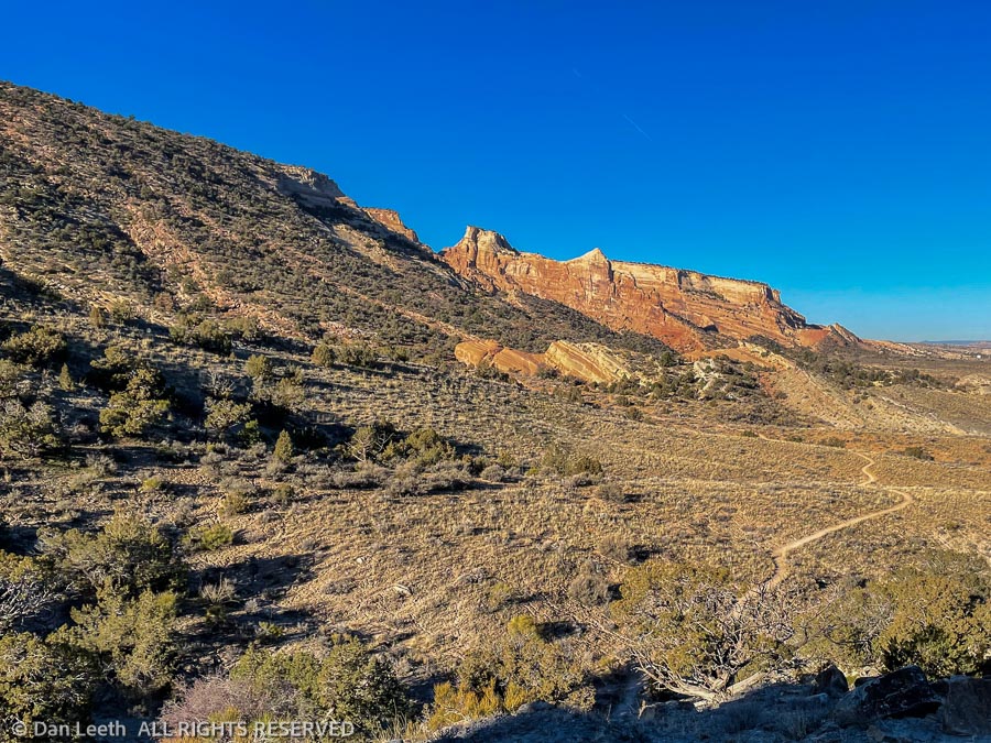
From there, it was up and down over hill and dale as we followed the trail above the rim of Flume Canyon and back to the trailhead. The Garmin said I’d covered 5.77 miles and burned 798 calories on the three-hour hike.
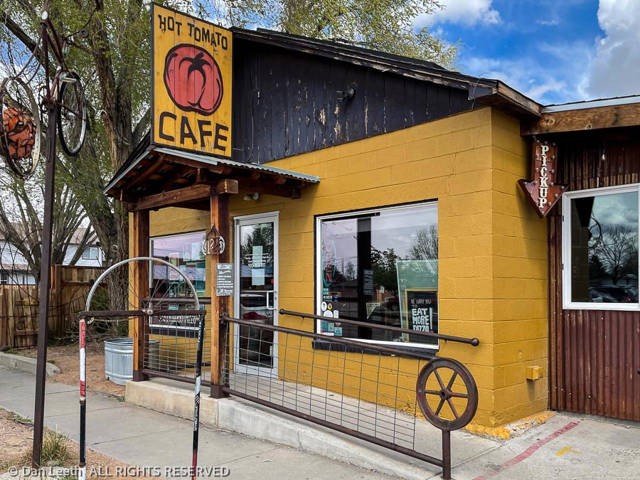
To make sure we got those calories replaced ASAP, we all headed into town for pizza and beer at Hot Tomato.
Back when we hiked out of Reno, everyone stopped at some predetermined restaurant for food and brews before heading home. When we hiked with the CMC out of Denver, nobody ever wanted to stop after a hike or climb. I don’t know if it’s because Front Rangers are more stuffy or maybe they just wanted to get an early start battling the Gridlock City traffic. I hope the après-hike dining practice continues on future outings out here.
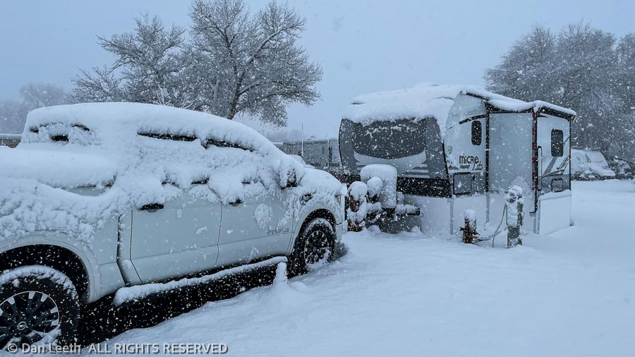
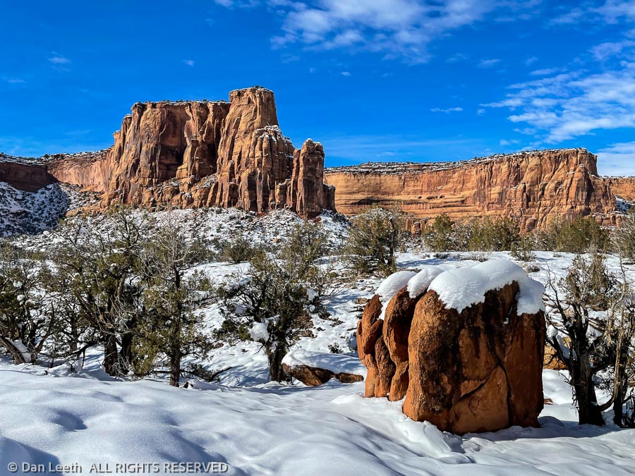
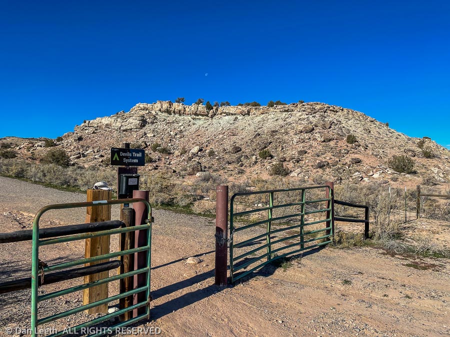
When we signed up for a Colorado Masochists Club hike up Devil’s Canyon, temperatures were above freezing and the ground was dry. That changed.
The Fruita area, which some have referred to as the Icebox of the Grand Valley, got well over eight inches of snow followed by a week of subzero temperatures.
No worries, we thought. It will warm up and melt before our hike.
It didn’t.
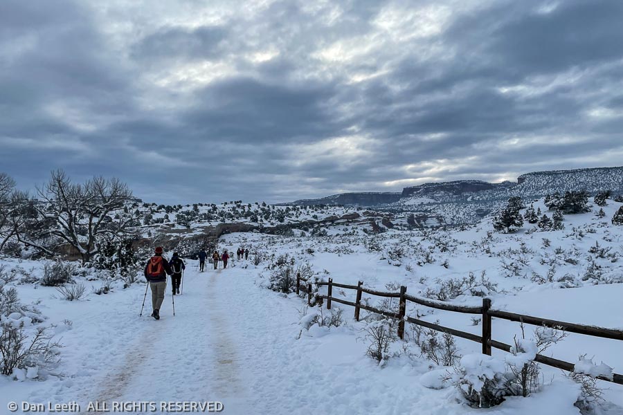
The leader was not going to let a little of that angelic white stuff keep us from experiencing the Devil’s very own canyon, so the trip was a go. We packed our hiking stuff, and in 14-degree temperatures under overcast skies, we made the 2.4-mile drive to the trailhead where we met the other seven members of our upcoming hike.
We put traction cleats on our boots, and after the usual introductions, we headed up the main trail, which was well packed by the footprints of numerous other hikers. At the appropriate junction, we broke off on the D3 trail that would take us up Devil’s. It, too, had been previously hiked and was easy to follow.
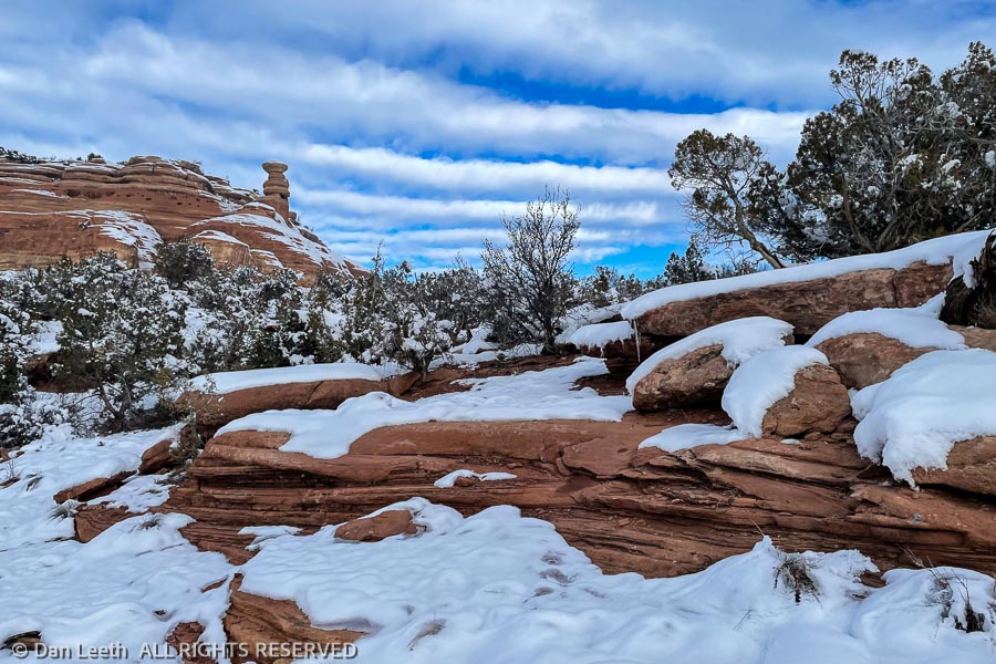
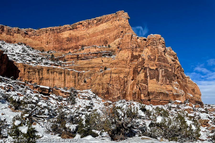
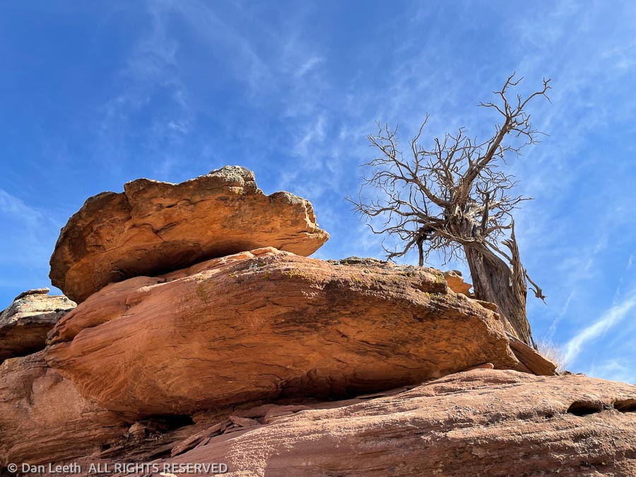
“Red hair and black leather, my favorite color scheme,” Richard Thompson sings in his tale about a 1952 Vincent Black Lightning motorcycle. We’ll, I’m kind of partial to red rock and white snow being my favorite color scheme.
When the sky cleared, the sun came out and the cliffs lit up. It was absolutely beautiful. It’s a good thing I only had my iPhone to record the scene. If I had a real camera with me, I’d still be up there snapping images. If it snows again, I’ll come back armed with the good stuff.
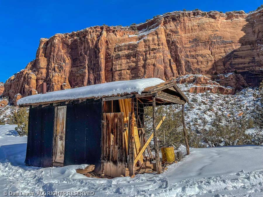
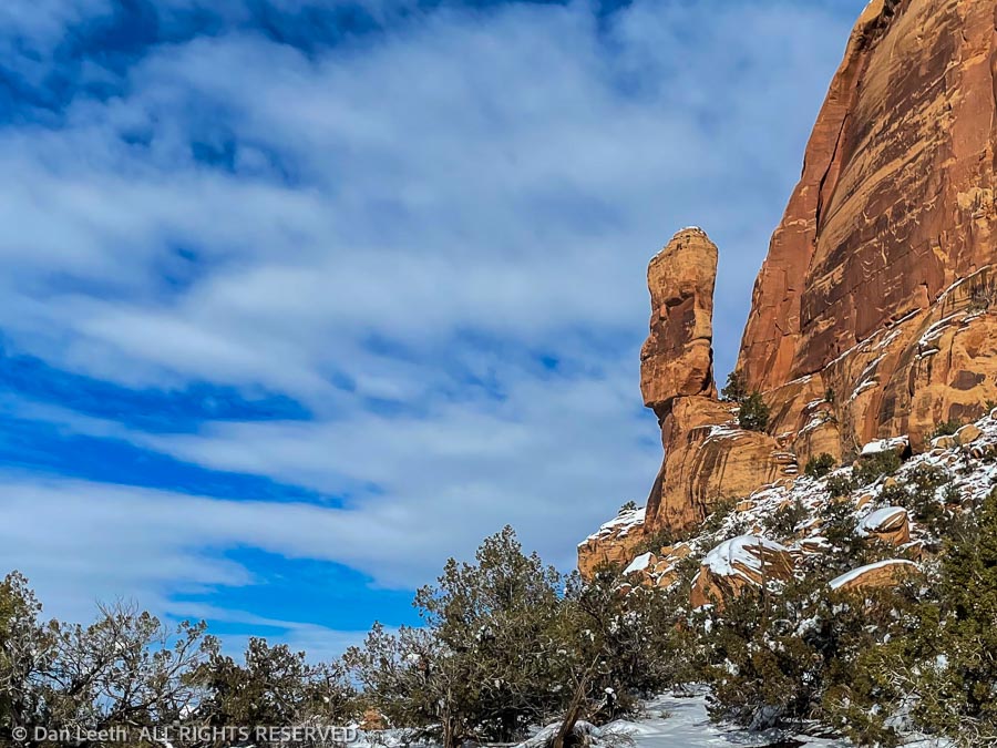
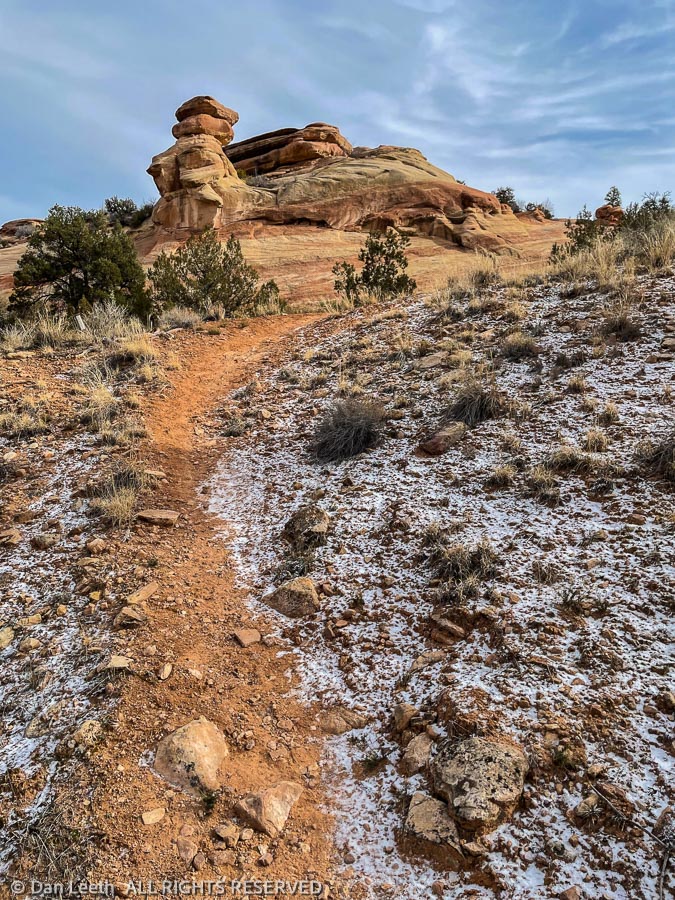
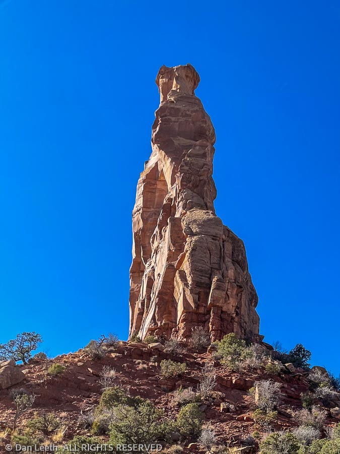
We trudged up the trail to an old cowboy line shack at the end of the loop. After lunch on the rocks, we headed back down the canyon past a hoodoo pillar that looks very much like an Easter Island moai.
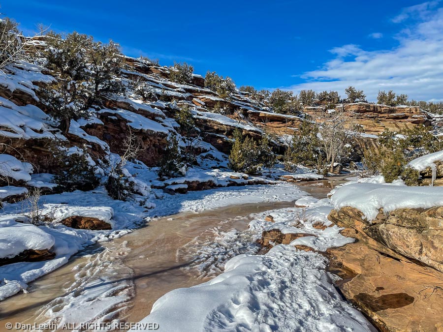
The trip ended with a slog down through the canyon with numerous crossings of the half-frozen stream.
While the hike was only a bit over seven miles, walking on snow takes a bit more energy. We were pleasantly fatigued. Dianne and I sat on our folding chairs and took off our traction cleats. Finally, exerting maximum willpower, we eventually got back into the car for the long (2.4 miles) drive back home. Back in the trailer, I stripped to jammies, poured some wine and treated myself to a healthy dose of Morphine.
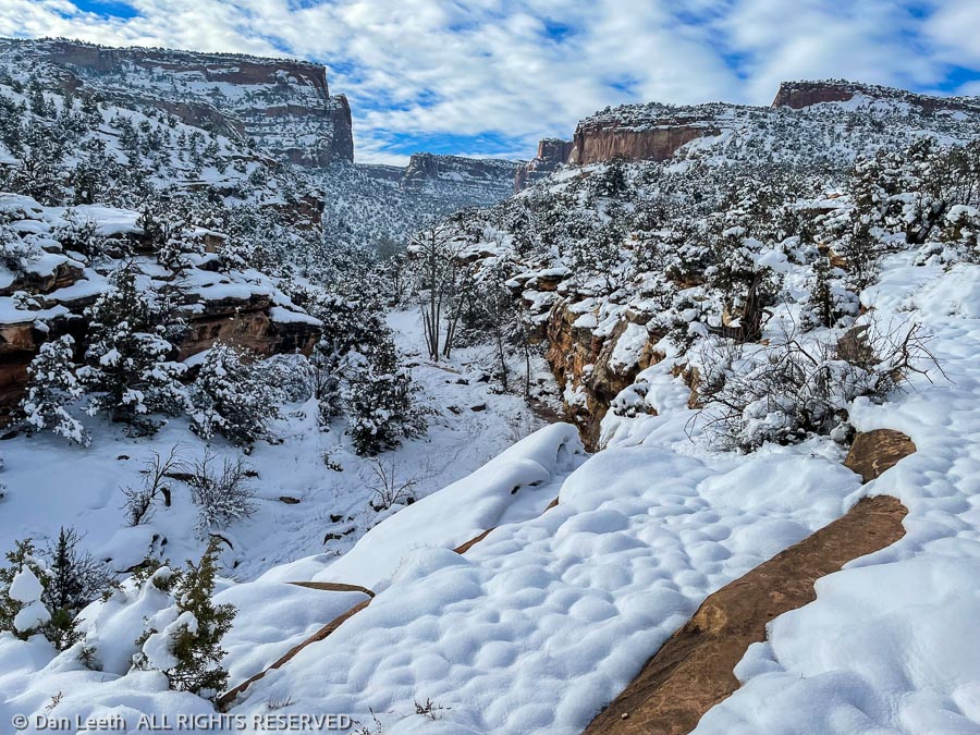
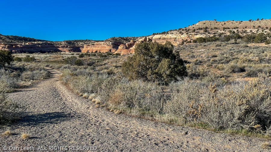
It was sunny and a balmy 28 degrees outside, perfect conditions for a winter hike in Colorado’s canyon country. Our goal today was to explore the Kodel’s Canyon section of trails in the McInnis Canyons National Conservation Area. We started from the Devil’s Canyon parking lot.
The B.L.M. designates trails out here with letters and numbers, with the letter identifying the area. We followed Devils Canyon’s D1 trail to its intersection with Kodel’s Canyon trail K1. The K1 was easy to follow as it wound its way up shallow canyons and over soft ridges.
As I’ve probably mentioned before, there are a plethora of unofficial, “social trails” out here that look just as well trodden as the official pathways. The BLM hasn’t done a very good job at marking and signing trails, so knowing just where to go sometimes can be a challenge.
Not long after turning onto the K1, we came to fork in the trail. Both options were equally well covered with footprints. One side dropped down into a small, cliff-hemmed wash. The other led across the flats toward more distant cliffs. We went that way.
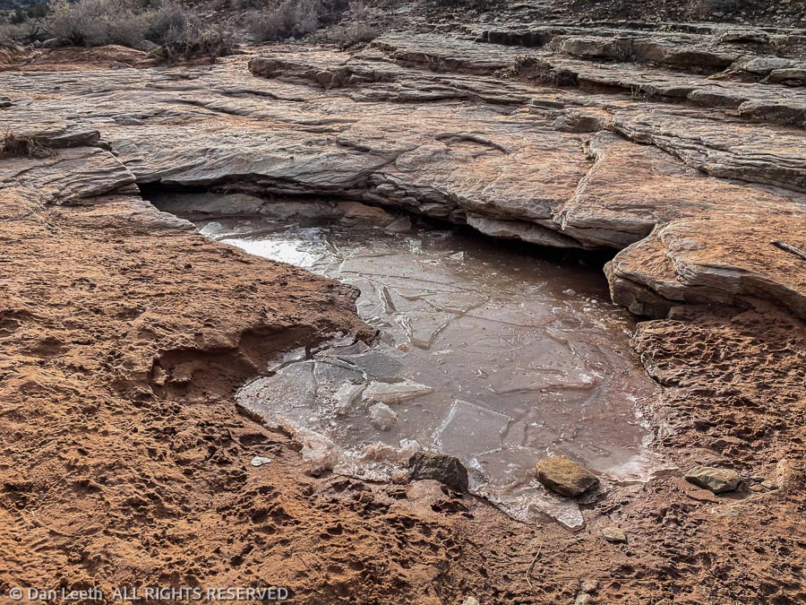
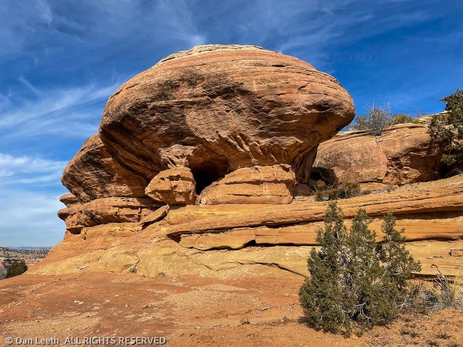
The path led us onto long rib of sandstone, dotted with rain-catching water pockets. A toadstool hoodoo stood at one end. While the route provided a delightful diversion, this was obviously not our trail. We hiked back and took the other fork.
We continued along that trail to another unmarked fork where we met a man hiking with his dog. There are a lot of official side trails that intersect with the K1 trail, and we figured he was on one of those. We continued onward.
The trail upward from here showed signs of recent trail maintenance with new freshwater diversion channels added. At the top of a small ridge, this nicely improved trail seemingly stopped. We could find no sign of a pathway beyond. With Highway 340 visible below, we knew we wouldn’t get lost, so we started bushwhacking our way down, figuring we’d cross the trail somewhere below. We didn’t.
I’m a map guy. I prefer to use 7½-minute topo maps, not a GPS in the field. Lacking a 7½-minute topo, I decided to make an exception and use 21st century electronics to see just where we were. I clicked the CoTrex app on my phone and discovered we were nowhere near where we were supposed to be. Wrong Way Corrigan could not have gotten us more off route.
We pointed ourselves in the right direction, crossed a barbed wire fence and continued cross-country to where we wanted to be. There we caught the series of trails that would lead us uneventfully back to Devil’s Canyon and our parked car.
We now have a goal for our next McInnis outing. Next time, we’re going to start at the opposite end of the trail and hike the K1 back toward Devil’s Canyon. I want to see where we went wrong.
Today, Dianne and I repeated one of our favorite loop hikes in Colorado National Monument. Accompanying us were a fellow Colorado Mountain Club member, whom I met on the Sunset Rocks hike, and his girlfriend. She’s a nurse and my wife was a nurse. As we proceeded up the trail, the women got to talk for miles about injections, bedpans and other nursing topics.
The hike begins at a trailhead near the base of the Colorado National Monument cliffs. From there, one trail goes up Monument Canyon, passing the towering rock formation known as Independence Monument before continuing onward to Rim Rock Drive.
Another trail goes up Wedding Canyon to Independence Monument where it connects with the Monument Canyon Trail. The loop up one canyon to Independence Monument and back down the other is about five miles long with around 1,000 vertical feet to ascend. It would be a nice, relaxing day of hiking.
Last time we hiked the loop, we started up Monument and returned via Wedding Canyon. This time, we did Wedding first. The first part of the hike requires traversing the flats close to the park boundary.
The morning was cool and the skies clear. Unblemished sunlight spotlighted the ruddy cliff faces across the canyon. I love this country.
The Park Service considers Wedding Canyon to be a “route,” not an official trail. There were places that required ascending and descending steep, baren ground. Needless to say, we all did quite well.
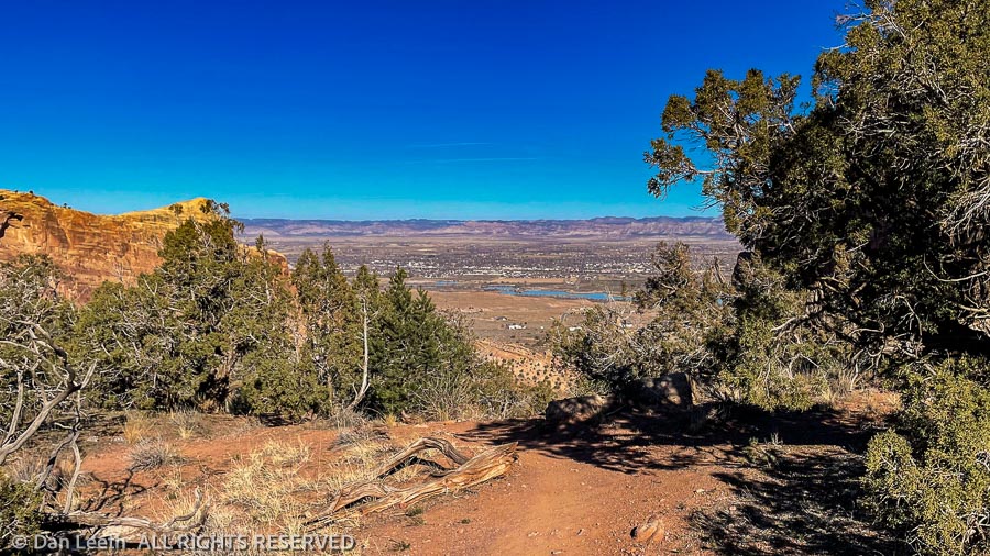
After a brief snack stop near Independence Monument, we started back down the Monument Canyon Trail. An official National Park Service trail, it is much wider and has rock slabs serving as stairsteps in the steeper places. Ahead, we looked down the canyon at the city with the Book Cliffs and Grand Mesa towering behind.
Bighorn sheep are common in this canyon, and at one point I spotted a flock of female bighorns dining on the flats below. For the benefit of our nurses, I pointed them out by announcing, “I see ewes.”
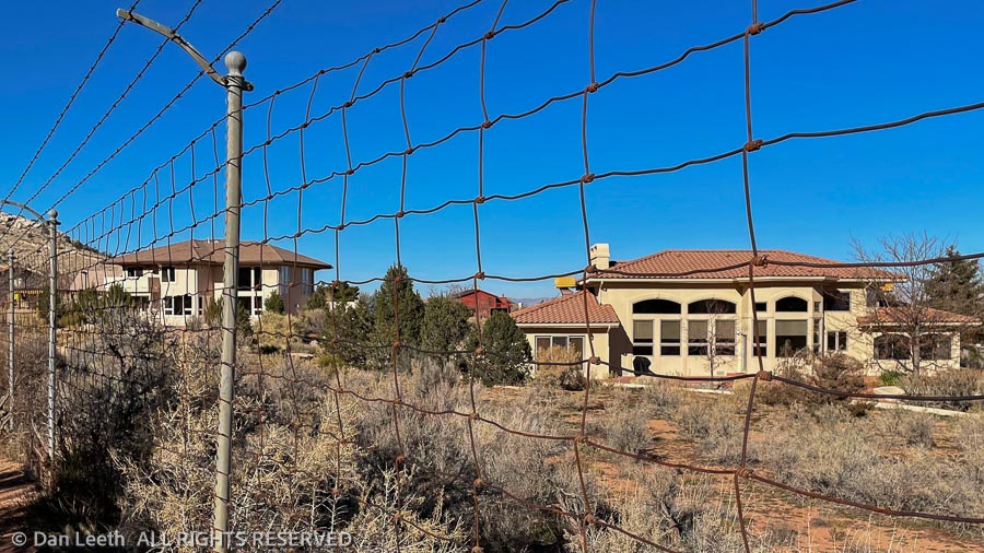
Down at the bottom, the trail parallels the park boundary for a half-mile or so, with a wire fence blocking us from the backyards of a few high-end homes. While the views from their patios would be stunning, I’d hate to have to put up with riffraff like us constantly hiking by.
Back at the car, we said goodbye to our hiking companions and drove back home to our trailer where the beer awaited.
We pulled into the Devils Canyon parking lot for our hike. I hate door dings, so I try to park at the far end of parking lots and stay more than an open-door’s width away from other cars. I backed the truck in a good five feet away from a Toyota Prius parked there.
I thought the car was empty, but as it turns out, there was a man sitting in it. As we got out, he rolled down his window, angrily told us we’d parked too close to him. He then insulted us, accusing us of being Democrats.
In the past, I’ve been accused of being born out of wedlock, being the male offspring of a female dog and of having an incestuous relationship with my mother. To this guy, maybe being a Democrat is worse than any of those. Sorry, fella, but we don’t qualify.
Rather than risk possible retaliatory vandalism, we drove on and parked at the Fruita Paleontological Area parking lot, where we avoided parking near any car bearing a Trump or Lauren Boebert bumper sticker.
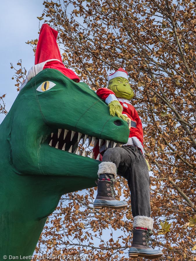
Fruita is famed for its dinosaur discoveries. They began in the early 1900s when a paleontologist from Chicago’s Field Museum dug into a nearby hillside and unearthed nearly 2/3 of the fossilized remains of a Brontosaurus. Today the famed Dinosaur Journey Museum lies across the street from our RV park in Fruita, and to celebrate Christmas, the Grinch rides high in the jaws of Fruita’s giant dinosaur replica.
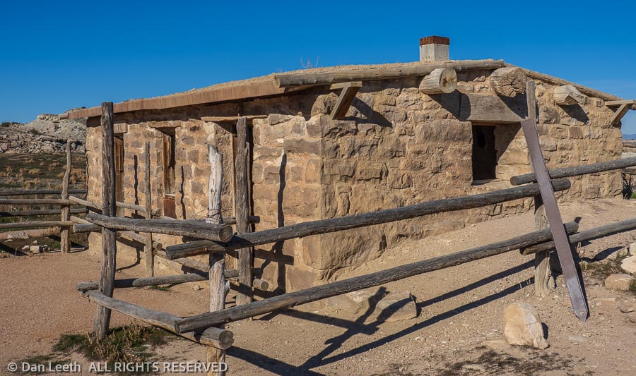
From our Paleontological Area trailhead, a one-mile, education loop trail lies dotted with interpretative signs providing more information than I want to know about these ancient lizards. An alternative trail from there leads to the Skinner Cabin and beyond. We opted for the cabin route.
The Skinner Cabin was apparently built around 1905-10 by a stonemason named John Skinner who owned a ranch on the other side of the river. In the 1940-50’s, it was occupied by John Condon, a man who made part of his living by digging up and selling dinosaur bones. The cabin was abandoned in 1953 and had pretty much fallen into total disrepair by 2016 when volunteers began restoring it to its original configuration. A wooden rail fence now encourages people to stay out, and other than a bit of interior graffiti, it seems to be working.
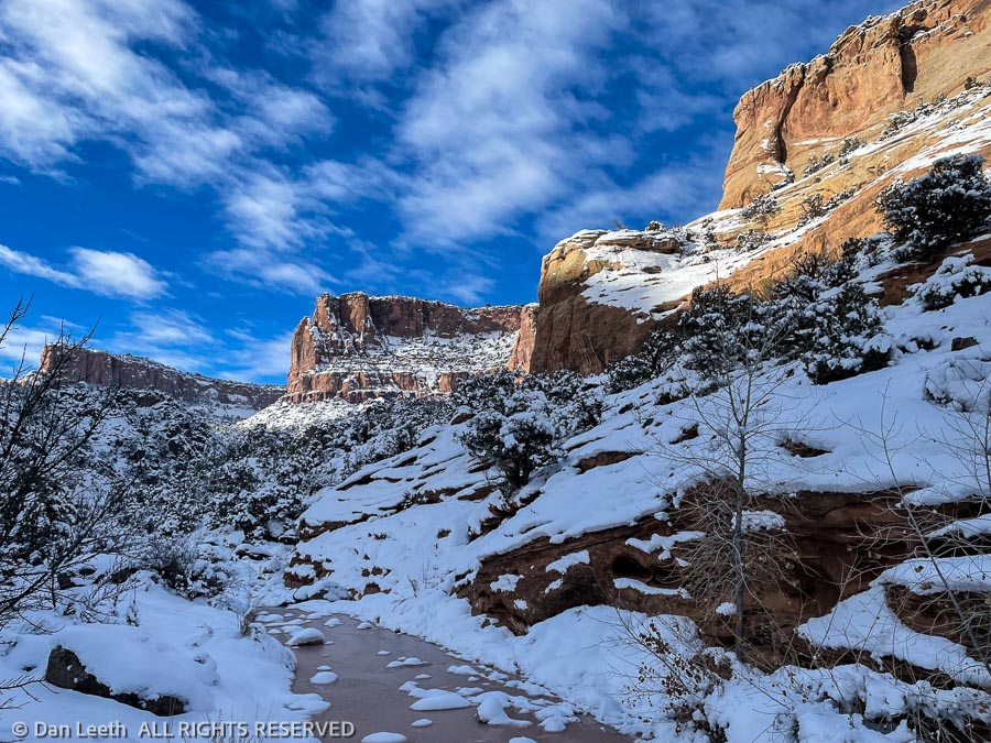
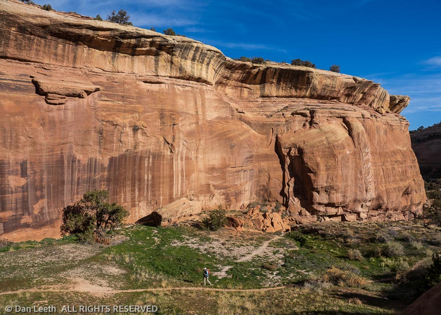
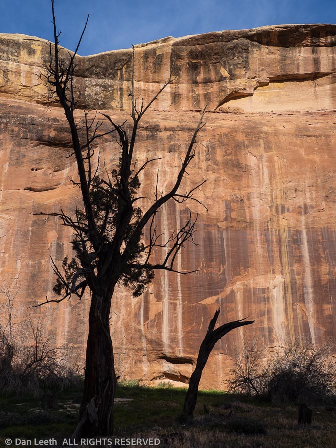
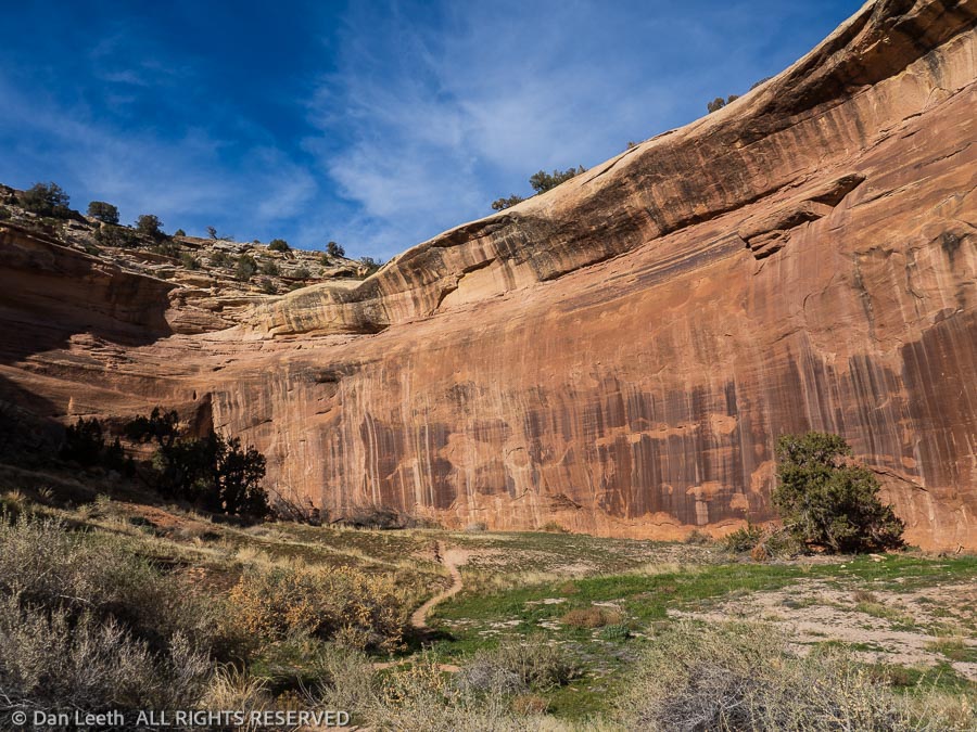
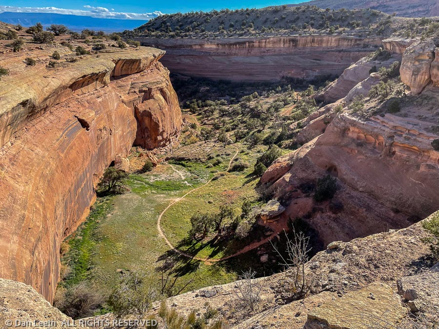
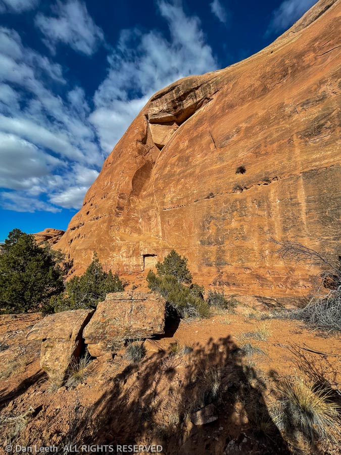
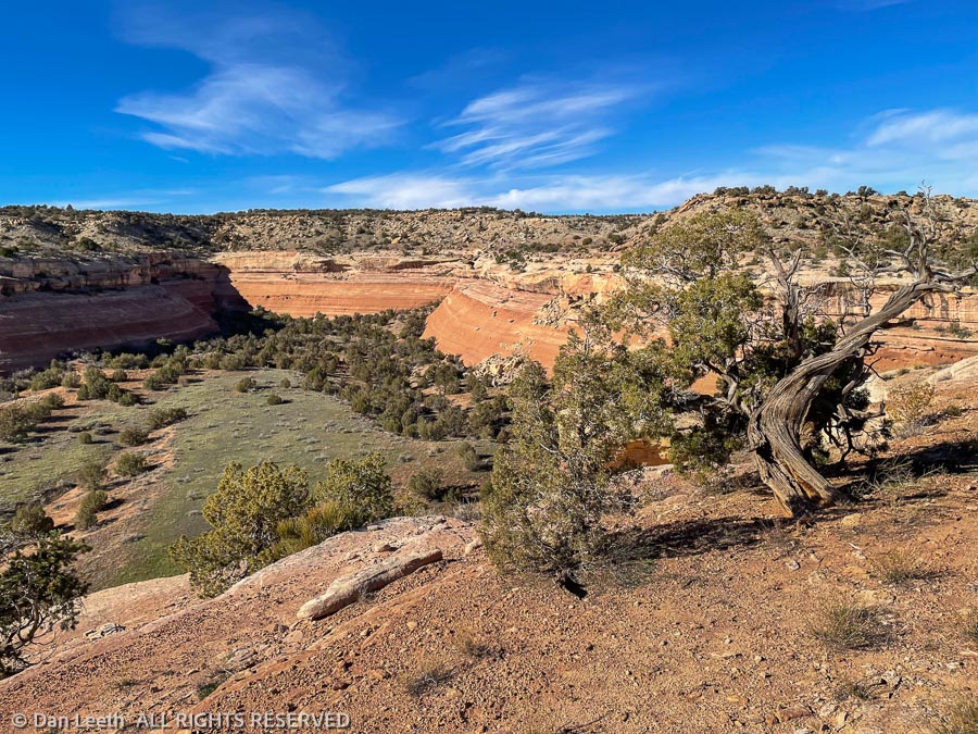
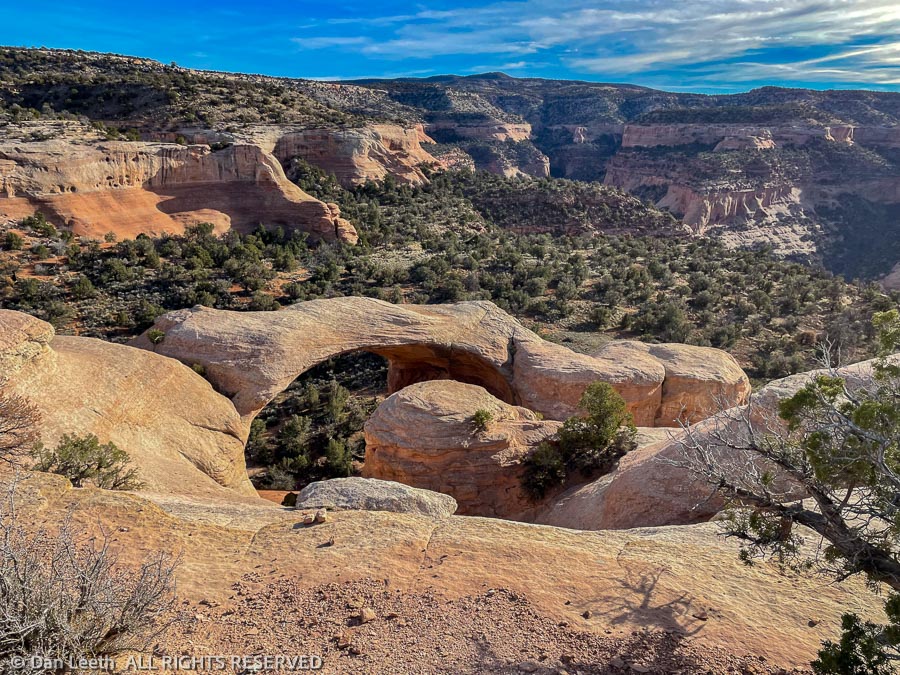
From Skinner Cabin, we continued down the trail to the Devils-Flume Connector Trail, which we had hiked on Wednesday. I wanted to continue on and explore the bottom of the box canyon we had admired then from above. Map in hand, we somehow took all the right trail junctions to reach the D4 Loop Trail that would take us into that canyon.
From the first time I read the Sierra Club coffee table book “Slickrock,” I’ve been enamored with the sandstone-walled canyons. Hiking this short canyon was a treat. Even at high noon, the low, pre-solstice sun made the sandstone cliffs blush. Streaks of desert vanish draped those towering walls, and the trunks of living and dead junipers offered inspiring silhouettes against the vivid, stony backdrop.
Reaching canyon’s end, we looked up. Using just the friction of our boots on the slickrock (which actually has the texture of sandpaper) we figured we might make it maybe halfway to the top of the canyon-ending pouroff. Beyond that, it looked impossibly challenging with the emphasis on “impossible.” Lacking Spider-Man’s agility, we turned around and headed back.
Returning toward the Skinner Cabin and our nonpolitically parked truck, we found the remains of some cement water headers and a few six-inch, PVC pipes poking from the ground. In the 1990s, the area around Devils Canyon was privately owned and slated to become an upper-end housing subdivision complete with a golf course. Thankfully, the BLM bought up the land before those plans became irreversibly implemented.
“Those must be the golf course sand traps,” my wife joked as we passed patches of white sand garnishing the nearby desert floor.
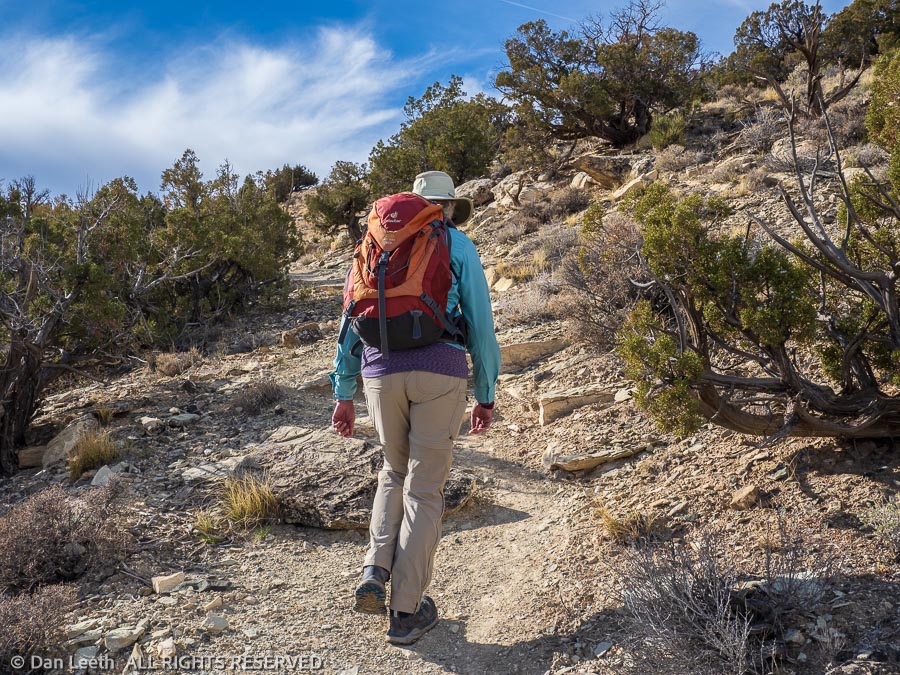
There are two major trailheads into the McInnis Canyons National Conservation Area off Kingsview Road – Devils Canyon and Pollock Bench. Today’s hike was a loop trip from one to the other and back again.
The BLM brochure Dianne picked up showed the route and said it was 6.4 miles in length, perfect for a sunny but cool, midday Wednesday hike. We threw our packs into the Mazda and made the ten-minute drive to the Devils Canyon trailhead.
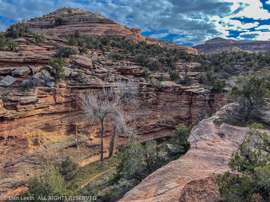
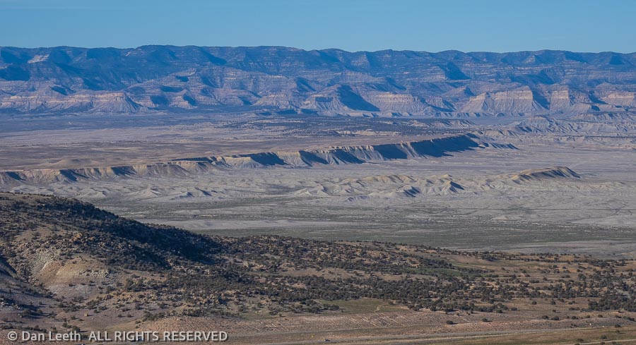
This area is crisscrossed with trails and to help hikers out, the BLM provides pads of free maps. Trails are designated with letters representing the trailhead area and then numbered. We set out on the D1 trail before cutting over to the D5. We would follow that until it merged again with the D1 trail a few miles beyond. From there we would follow F1 (named for Flume Canyon) toward the Pollock Bench trailhead where a connector trail would lead us back to the Devils Canyon trailhead.
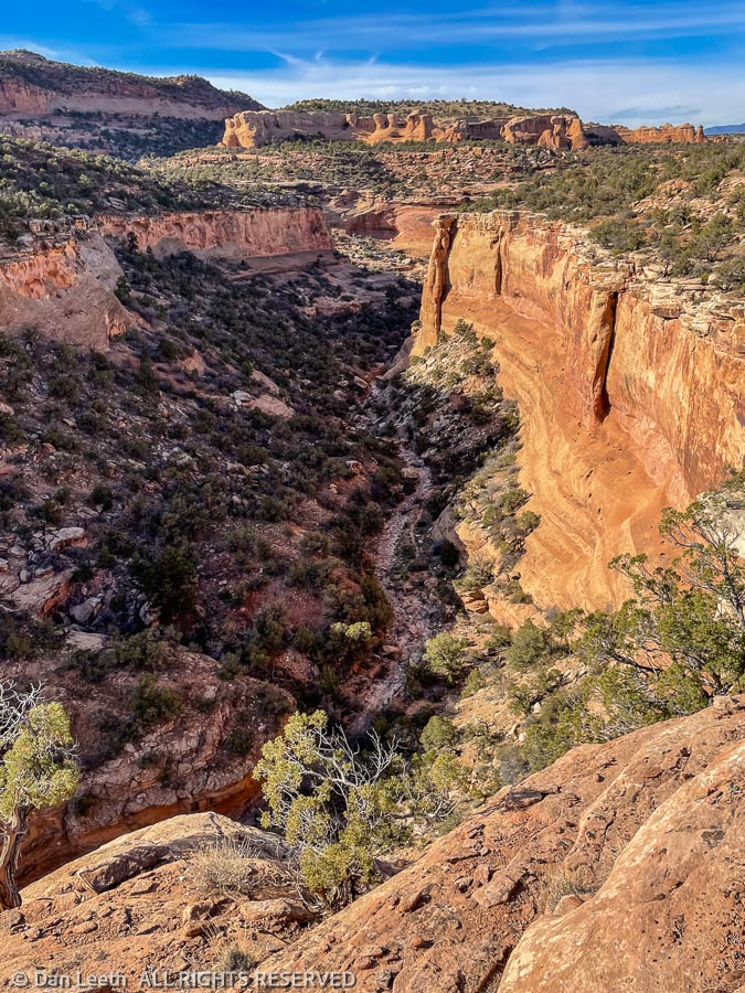
Our trail wandered up benches and over piñon and juniper terrain before looping around the rim of a sandstone-hemmed box canyon. Far below, a trail led up the canyon floor to its sheer-walled end. I promised myself that we’ll explore that trail one of these days soon.
While the BLM is good about providing trail maps, they aren’t too good about marking trails on the ground. We came to several undesignated trail junctions. While Yogi Berra may suggest “if you come to a fork in the trail, take it,” that wasn’t going to work for folks like us who need to follow specific routes to reach our destination.
At such unmarked junctions, we always tried to follow the most logical, well-worn paths and used a lot of dead reckoning. With only a few blunders, we ended up on the correct combination of trails that would take us to the F1 trail, which would follow the rim of Flume Canyon toward the Pollock Bench trailhead.
Our biggest trail-finding error came near the Pollock Bench trailhead. A quarter mile or so before the parking area, we were supposed to find the Devil’s-Flume Connector trail. It was nowhere to be seen. Dianne suggested just hiking the road back to our car. I preferred first trying a bit of backtracking.
We soon found the connector trail, which it turned out was nicely signed. We would have spotted it if we had stayed on the main trail and not got sidetracked down somebody’s shortcut.
We followed the connector up a shallow canyon until we got to reached a barbed wire fence strung across the wash. We could have crawled under the wires if we had wanted to, but logic suggested the BLM wouldn’t offer a formal trail that required such a maneuver. After a few false starts, we discovered a that our trail crossed over a little rise to where the fence ended. After rounding the wires, it was pretty much easy going from there.
Back at the car, we checked our Garmin GPS watches. We had covered 8.62 miles on our 6.4-mile hike.
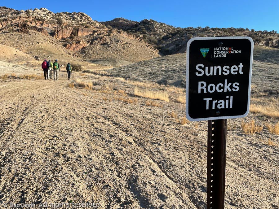
Today, I went on another Colorado Mountain Club hike, this time traveling solo while Dianne attended church. For once I had to carry my own lunch.
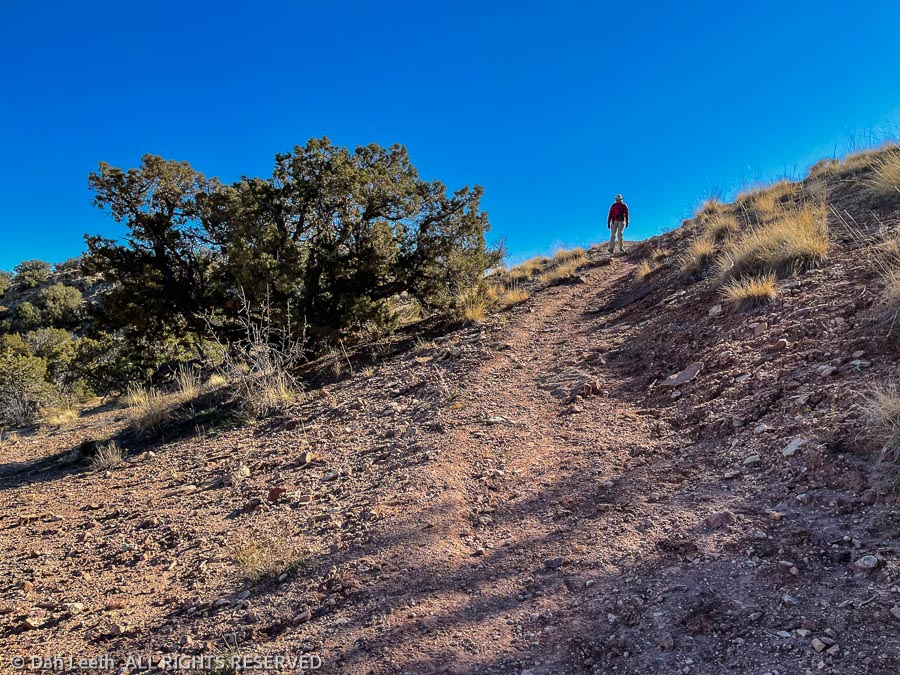
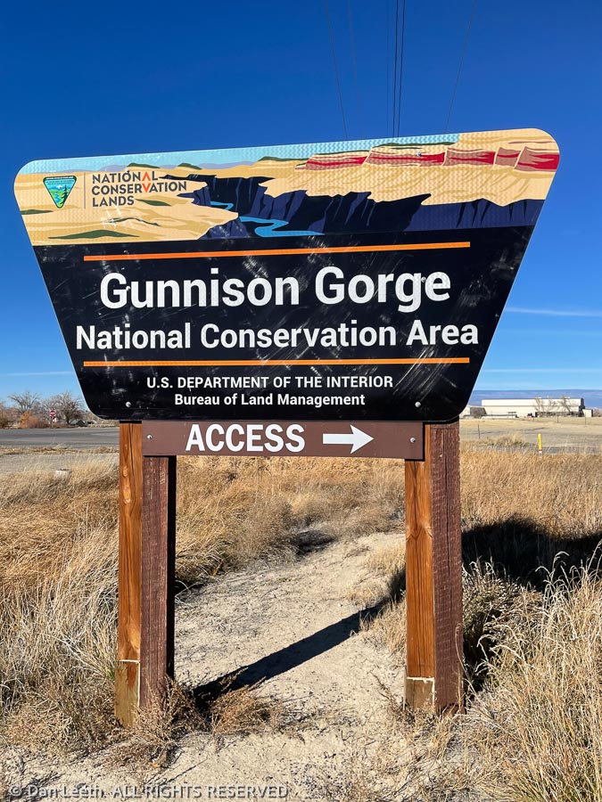
The hike was on the Sunset Rocks Trail in the Gunnison National Conservation Area east of Olathe. That’s about an hour’s drive south of the Grand Valley. From our old house in Aurora, an hour’s drive would only take me to the other side of the metro area. Here, I reach trailheads.
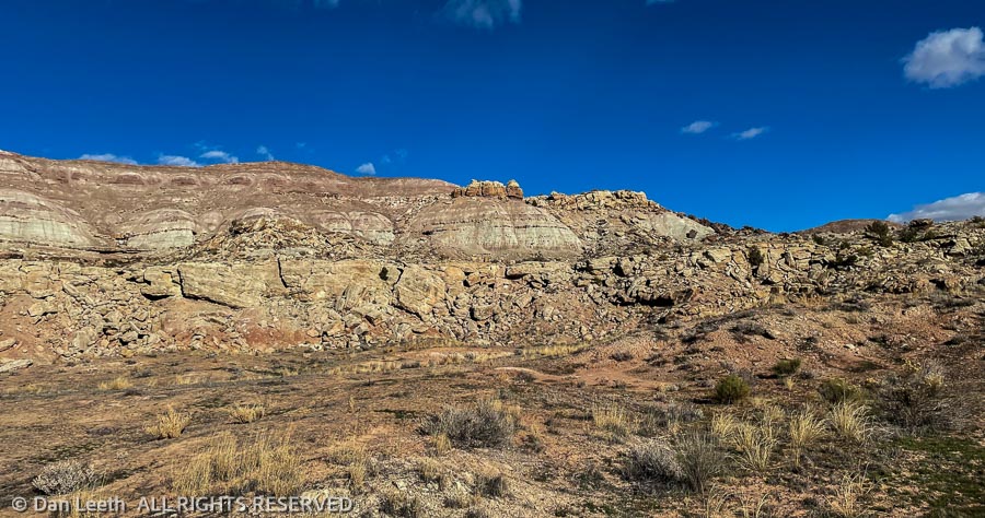
Three out of four fellow hikers hailed from Montrose, and they met at 8:00 a.m. That meant I had to get up long before sunup and leave Fruita at 6:30 to meet them at the turnoff in Olathe a bit after 8:00. I’m desperately allergic to mornings, making this the most painful part of the endeavor. Driving in, we passed some colorful hills on the way to the trailhead.
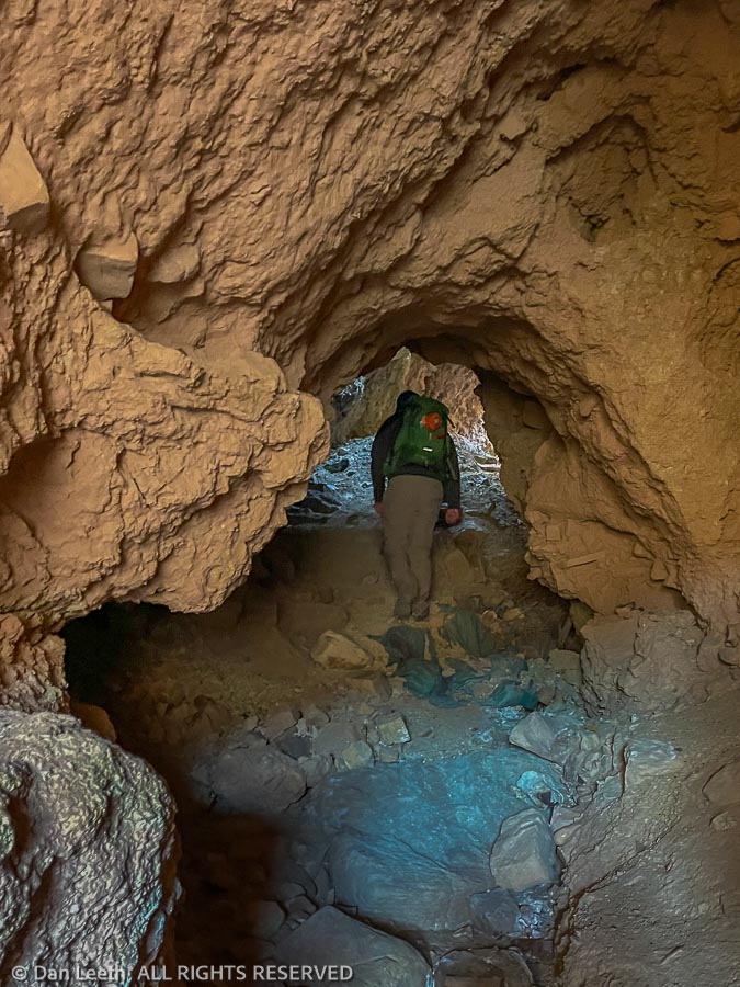
The first part of the hike took us to a cave/tunnel through the rock. I always though to be a good cave, it had to have stalagmites and stalactites or at least a hibernating bear. This one had none of the above.
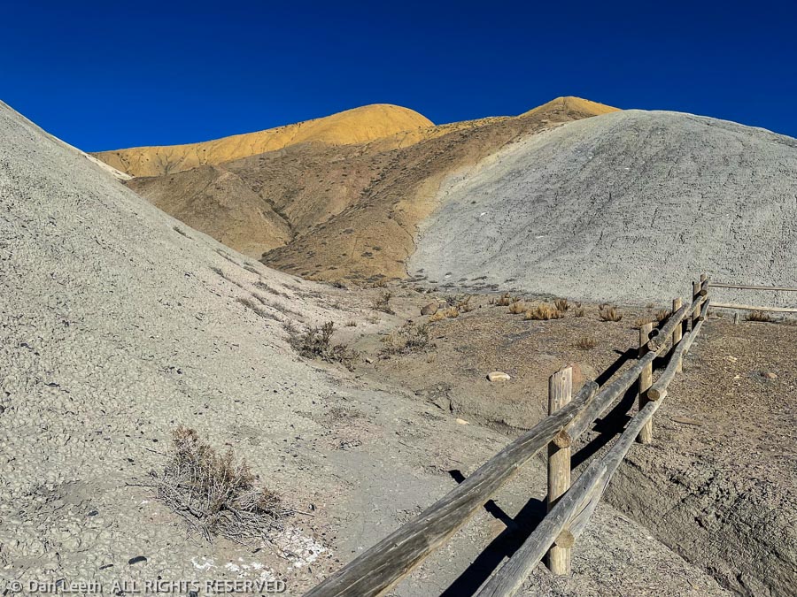
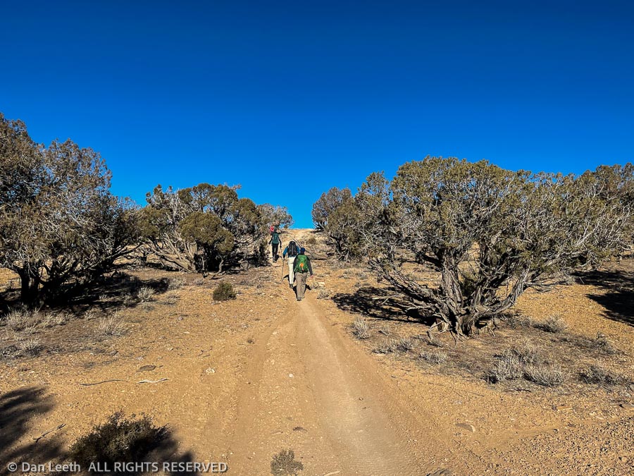
From there, the hike was largely across rocky, nondescript terrain sparsely covered with piñon and juniper. The trail was largely up and down, which offered the feeling of getting a good workout.
Part of the route was open to ATVs and the rest open to dirt bikes. It’s been said that ATVs/dirt bikes are Japan’s revenge for Hiroshima, and I believe it. We encountered tracks, but fortunately encountered none of the above. They must have all been in church.
Besides the lack of motorized madness, the beauty of the hike were the views. To the south stretched a wall of the San Juan’s jagged peaks rising above a layer of clouds. Below to the west lay the farmlands around Olathe and Delta with the Uncompahgre Plateau offering a dark barrier beyond. To the north and east rose the hills we would next have to ascend and descend.
We stopped for brunch at our arbitrary turnaround point, about three miles from the trailhead. From there, it was turn around and hike back to the cars. Civilization and beer lay beyond.
Exploring this area may prove to be more fun than I thought.
The map of the McInnis Canyons National Conservation Area shows a plethora of trails cross-crossing and looping through the canyon country south of the Colorado River off Kingsview Road.
Those are just the designated trails. In addition lie many undesignated, “social trails” that wind through the area. As we soon found out, some of these are as well trodden as the official pathways and equally interesting.
Our goal today was to do the 10-mile round-trip hike from the Pollock Bench Trailhead to the point where the Rattlesnake Arches Trail from the top meets the Rattlesnake Arches trail from the bottom. We grabbed the BLM supplied map at the trailhead and set off up the Pollock Bench Trail to its junction with the Rattlesnake Arches Trail. The path, an old, abandoned Jeep road, was extremely well defined.
The lower stretch of the Rattlesnake Arches Trail wanders across the flats and into and out of a small side canyon or two. It was well used, and except for where it crossed baren slickrock, proved easy to follow.
We reached the lip of Pollock Canyon, a wide, deep gouge in through the sandstone landscape. A hiker with two leashed bulldogs we had met earlier on the trail said he had turned around because he didn’t think the dogs could get down a series of ledges. Perhaps this is where those ledges lay.
I assumed it was, although there were neither trail signs nor cairns marking a route down. I started zigzagging down trying to follow footprints left in the few spaces of loose dirt. I was a few dozen yards below when Dianne shouted out that she had found the trail up on the rim. Since my route looked somewhat precarious, I was more than happy to get back on a well-defined trail.
We followed the footprints of dozens of hikers as we hiked the trail along the rim. Stunning cliffs that appear to be hundreds of feet high lined the deep canyon. We would lose the pathway in rocky spots, but always rediscovered it just beyond. The farther we progressed, the fainter the trail became. It became obvious we were following a social trail, not the official route to the arches.
Our GPS watches said we had traveled four miles from the trailhead. It was decision time. On the map, it looked like we could continue onward and hit the Pollock Bench Trail, which would lead us back to our truck, or we could turn around and follow the known path back. Common sense dictated the latter option.
We turned around and headed back. Looking down from the spot where I had started to descend from the rim, we saw a BLM sign down at the bottom of canyon floor. I pulled out my binoculars and read what it said. It pointed toward Rattlesnake Arches. I had been on the right route before we discovered the social trail.
We continued back to the truck, walking past sandstone cliffs, buttes and hoodoos bathed in the golden light of the late-day sun. Across the Grand Valley, the Book Cliffs looked stunning with inky shadows accentuating its cliffside skirts. Wispy clouds offered the first hint of a soon-to-be colorful sunset. Yes, it was just another typical afternoon in canyon country.
Today’s hike was a delightful failure. We didn’t succeed in our effort to follow the Rattlesnake Arches Trail to its junction at the top. Instead, we accidently ventured into the Great Unknown, following a scenic, undesignated trail that offered delightfully lofty views.
We now have a goal for a future hike. We’ll have to follow this undesignated trail and see where it goes.
One of the first things we did when we first moved to Colorado back in 1983 was to join the Colorado Mountain Club (CMC). It proved to be an excellent way to discover places to hike/climb and make new friends. During my travel writing years, we found we weren’t using the club services and dropped out.
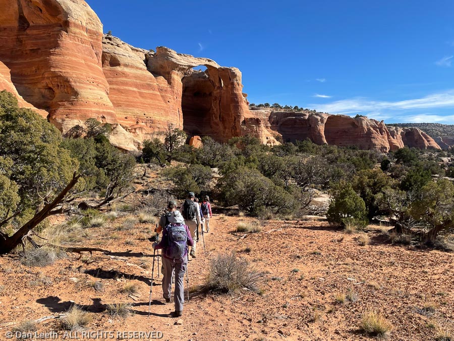
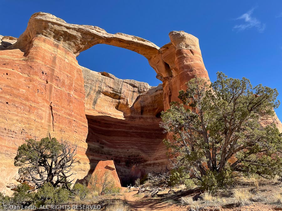
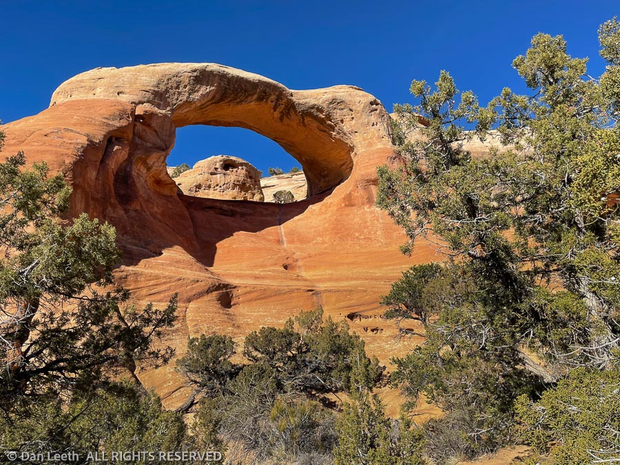
Now, having moved to a new area and looking to discover places to hike/climb and make new friends, we rejoined and signed up for the first available hike. It was a hike to Rattlesnake Arches, the largest concentration of natural sandstone arches this side of Utah. We’ve been there at least twice in the past and were looking forward to another visit.
There are two ways to get to the arches, which are located in the McInnis Canyons National Conservation Area. The long route is to go from the bottom up, which involves driving a few miles on a graded road to the Pollock Bench Trailhead and hiking 7¼+ miles up to the arches and 7¼+ miles back.
The short option is to do the 5¼-mile walk down from the top. Unfortunately, that involves driving about ten or so miles of high-clearance dirt roads, the last few miles of which are 4×4-worthy. That’s the route we’d be going on our CMC hike.
The nine hikers on the trip pile into three 4×4 vehicles, which include a Toyota FJ Cruiser, a Nissan Frontier 4×4 crew cab pickup and our full-size Nissan Titan Pro-4X crew cab pickup. The FJ Cruiser heads down the dicey parts of the road with no problem. The Frontier truck with its shorter wheelbase and limited overhang seems to have no issues.
I drive last, nursing our long-wheelbase, long-overhang monster down the trail. Nissan may like to market this “Pro-4X rig as off-road worthy, but a Jeep it is not. I sure miss my Xterra, which would have been as good as the FJ Cruiser on this route. We do finally make it to the trailhead with no undercarriage scrapes and most of the body paint still intact.
The hike is rather straightforward. It begins with a switchbacking plunge down a few hundred vertical feet, then follows a wide bench a couple of miles to the arches. After lunch at Cedar Tree Arch, trail’s end, we hike back. The morning’s plunge down is now a grunt up.
Near the top, there’s another, relatively flat trail that leads to an overview of Cedar Tree Arch from above. Most of us opt to extend the hike and head that way.
Back at the trailhead, we pile back into our vehicles and begin driving up the 4×4 portion of the 4×4 road. Going up the dicey loose rock is even more “fun” than descending it, but again, we make it to the top with no scrapes or dents.
The route back to civilization takes us right past the Glade Park Store, a classic little market seemingly in the middle of nowhere. To reward ourselves for a successful drive out, we stop in for a bit sustenance. I am careful to keep the open bottle out of sight as we drive back through Colorado National Monument and on to home.
Over our first eight days in Fruita, our only “hikes” were walks down a few paved bike trails and through neighborhoods. Our first real hike in the woods came on day nine.
Considering all of the close-in destinations available, we chose to do one that involved a “long,” 17-mile drive down the interstate to the Rabbit Valley area of the McInnis Canyons National Conservation Area. Although it’s largely a 4×4 playground for the ATV and dirt-bike crowd, there are some hikers-only trails out there for folks like us.
Our destination was the hikers’ trail up Rabbit’s Ear Mesa. I’m not sure how the mesa earned its name. This squatty plateau does not look the least like anything I’ve see poking from bunny’s noggin.
The trail climbs up for about a mile, then splits to offer a nice loop hike along the perimeter of the mesa top. The BLM sign says the trail is 4.8 miles long. The BLM website says the loop is 5.6 miles long. The map on the Colorado Trail Explorer (Cotrex) website indicates a 5.9-mile length. We set our Garmin GPS watches and head off to determine the true length.
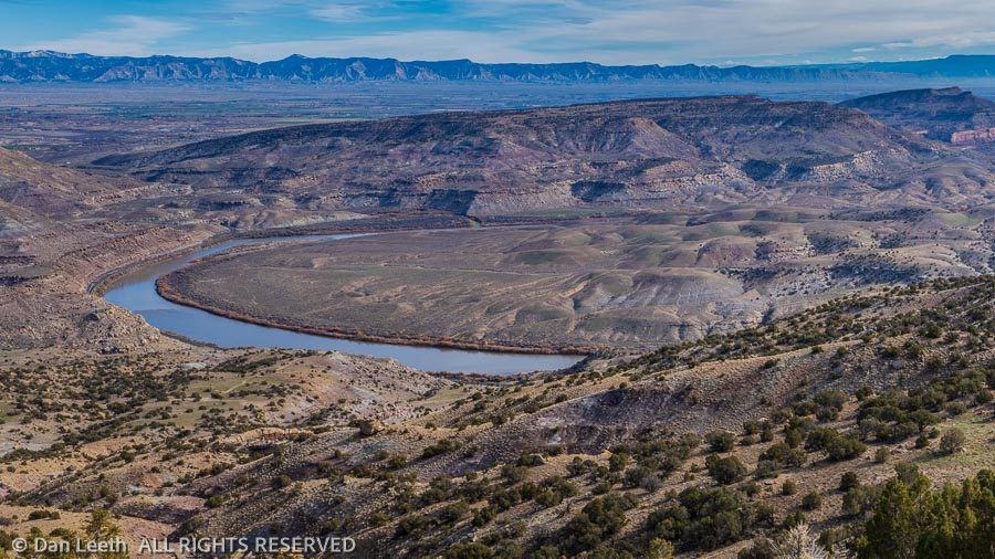
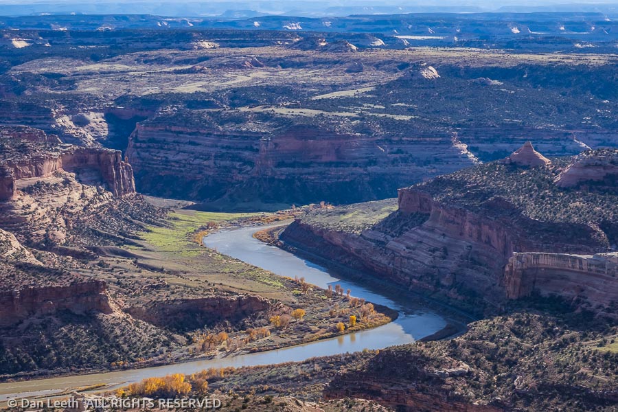
It’s a 700-foot vertical grunt up to get to the mesa top. From there we are treated to a relatively flat trail with splendid views of the Colorado River meandering far below. Cottonwood and tamarisk leaves offer autumnal splashes of streamside gold along the river. We spot rafters and kayakers slowly paddling down the lazy current.
Off through the haze to the west rise the La Sal Mountains near Moab, their slopes glistening with snow. Rounding the mesa top and heading down, we gaze across the valley to the Book Cliffs stretching off into Utah. There’s just so much interesting canyon country to explore out here. I think we’re going to like this place.
Back at the truck, we check our watches. According to Garmin GPS, we hiked 6.33 miles.