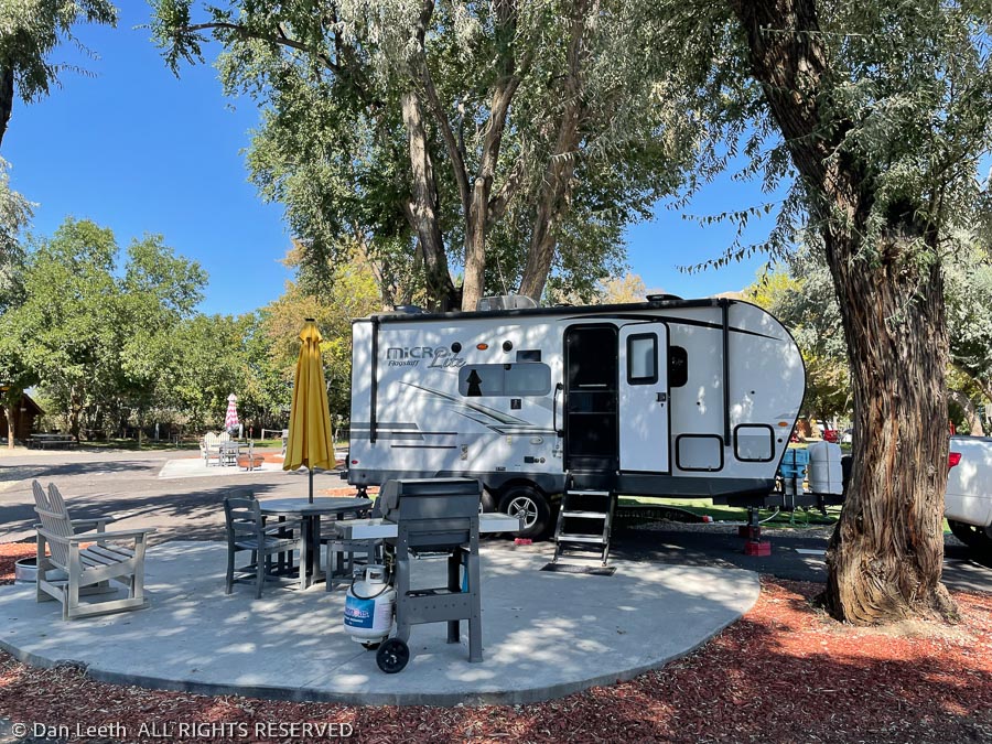
We’re off on a 42-night tour of the Left Coast. Our first night’s stay was at the KOA near Brigham City, Utah where we reserved a basic site. Temperatures were nearing triple digits and the site we were given was a gravel pad with nary a lick of shade to be found. The young man directing us to the site looked at Adelle, our plastic Adélie penguin, and asked if we’d be interested in upgrading to a patio site with shade.
“How much more?” I asked. He said it would be a whopping $4 additional.
“We’ll take it!” my lovely heat-hating wife responded. I warned her that the additional charge was coming out of her allowance.
It turned out to be one of the nicest KOAs we’ve ever stayed in. Next time we’ll reserve a patio site to begin with.
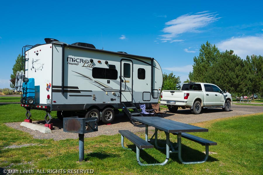
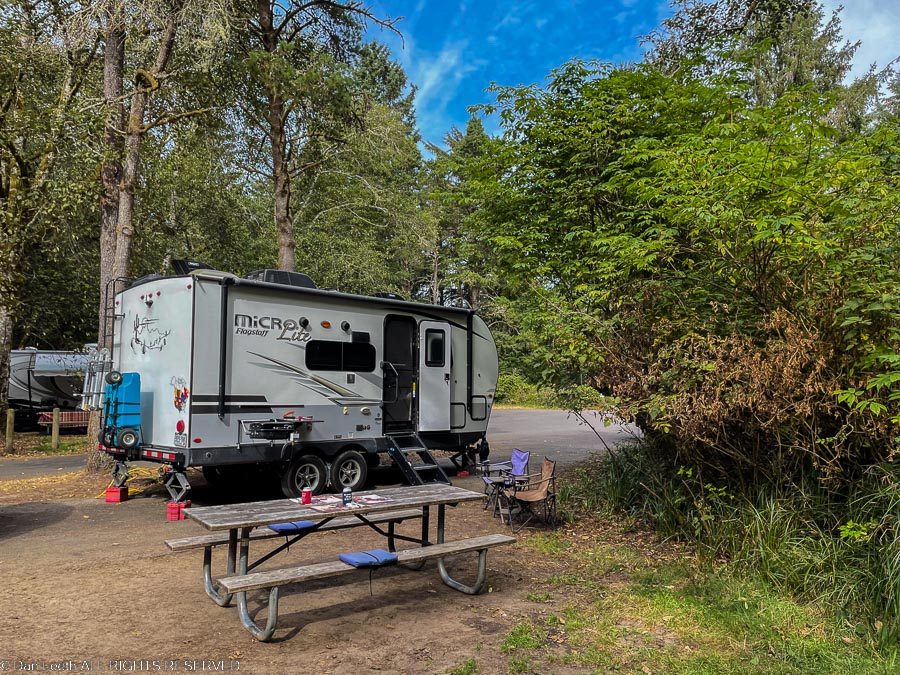
The next day, we headed north to Lake Walcott State Park near Rupert, Idaho. We have a back-in site here bordered by well-watered grass. The sprinklers were watering the site as we arrived, making setting up initially a damp endeavor.
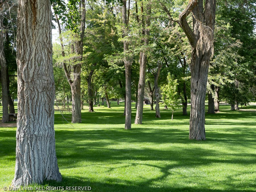
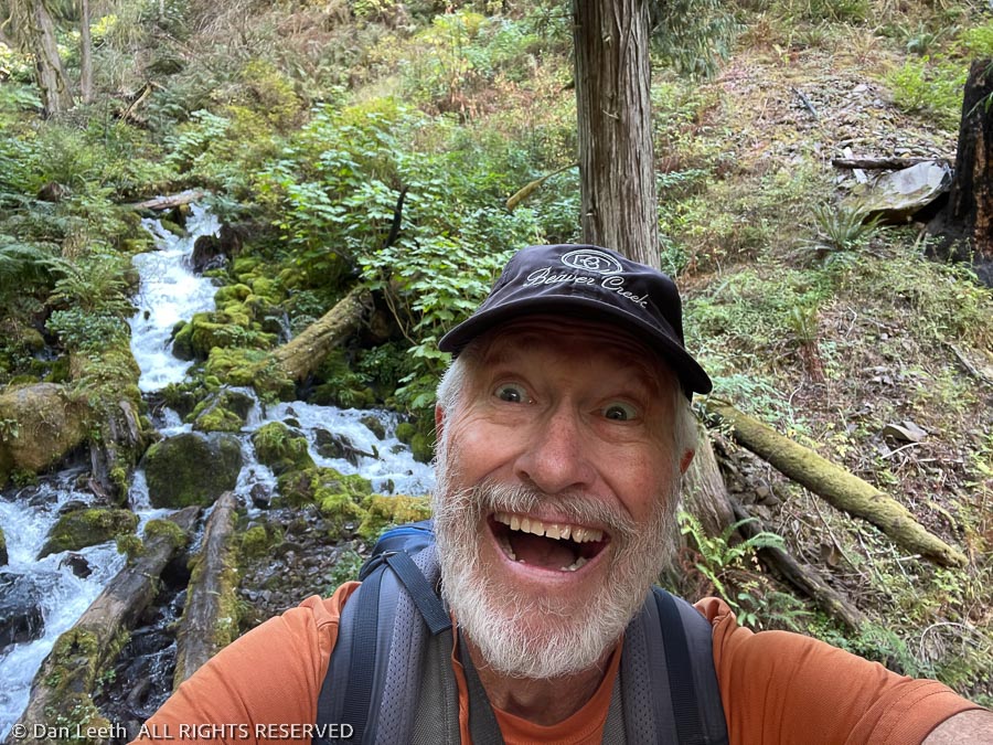
After getting everything set up, we did a three-mile walk around the park. What a beautiful place with damn few people staying here.
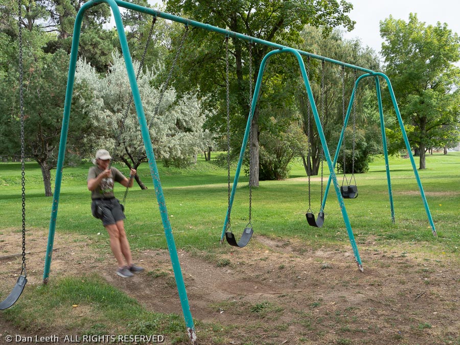
Ah, the joys of camping after Labor Day when the kids are in school and not playing on the playground leaving room for adults wanting to relive childhood!
Tomorrow, if I can tear Dianne away from the playground, we’ll tackle a long hike around the north side of the reservoir. It’s time to get some exercise.
After two days of driving from the vineyards of Colorado’s Grand Valley to the French fry farms of Idaho, Dianne and I both thought it was time to lace up the hiking boots, pack the 10 essentials and set off on a long, scenic trail.
We didn’t do that.
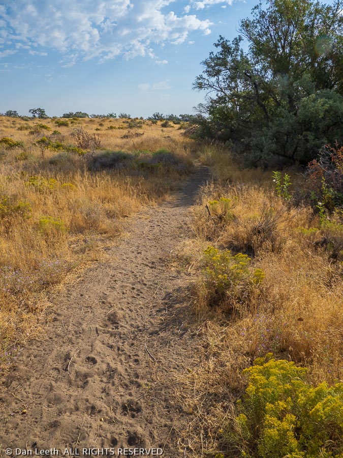
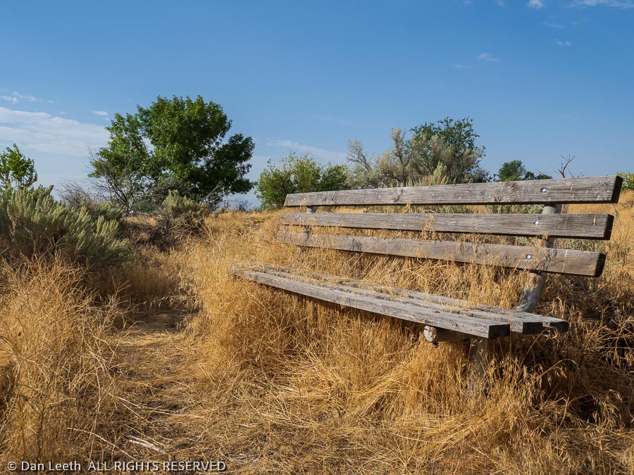
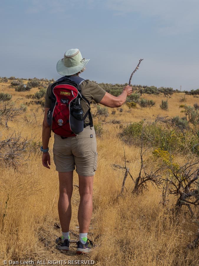
Instead, we laced up our tennie-runners, loaded nothing more than cameras plus water in our packs and set off on the Lakeview Trail, which borders Lake Walcott for a mile or so. It might be considered scenic to those who love tall golden grasses with an occasional view of coves in the reservoir. At least we had nice park benches to rest on.
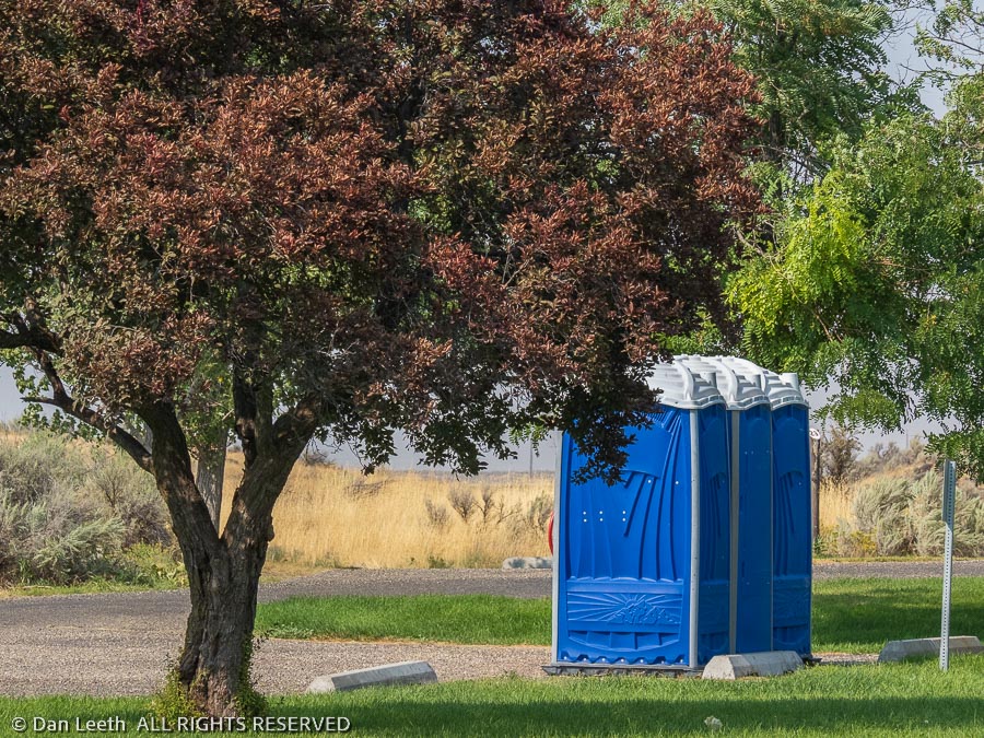
Flush toilet restrooms at the park are not working because of some sewer pump issue. Instead, the park has scattered a number of porta potties around. It appears they were last emptied during the Obama administration. At least by providing housing for numerous spiders, the quantity of flying insects inside the porta potties was minimal.
Spiders of the cob species were a problem on the trail where they built their webs across the walking path. We were constantly pulling cobwebs off our arms as we headed up the trail. Dianne finally picked up a stick and waiving it like a maestro’s baton at a symphony, she beat down the cobwebs along the trail.
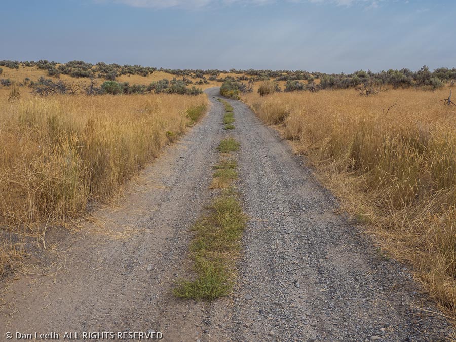
A mile down the trail, we reached an old gravel two-track road, which we followed until nearly the crack of noon.
Then it was back to camp where we were greeted by sprinklers, which were once again watering our campsite. My Garmin says we hiked just under nine miles, with me burning over a thousand calories. That can only mean one thing.
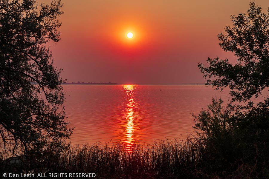
We awoke Friday morning to a brilliant, Ferrari-red sun reflecting across the waters of Lake Walcott. We were engulfed in forest fire smoke, supposedly from a blaze 20 miles upwind. That apparently was not the only wildfire in the area. We had smoke obscuring the views on our drive all the way to Boise.
We planned a stopover in the Idaho capital so we could visit one of Dianne’s favorite nieces. When we stayed in the area before, we booked a site at an upscale RV “Resort” in neighboring Caldwell. Since we are now platinum-level, elite, first-class, gold-encrusted members of KOA, we elected to stay at the Boise-Meridian KOA where we get a 10% discount. It’s a nice enough RV park for those who don’t mind being packed in like sardines camping in can. Our neighbor’s picnic table was maybe two feet from our sewer hose and ours about two feet from the next guy’s.
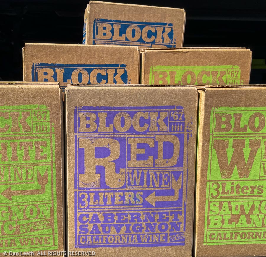
Since niece Laura had to work until 6:00 p.m. in the evening, we had time to do a bit of shopping for treasures we can’t get back home. That meant a trip to Trader Joe’s so we could pick up Dianne’s favorite boxed wine. Apparently, there are two TJs in the Boise area, but our truck navigation only knew of one. We endured a traffic-clogged drive downtown where we had to squeeze our 19-foot-long Titan into a Miata-size spot in TJ’s parking lot.
Back at the sardine camp, we had a nice evening visit with Laura and her offspring. This morning, we drained our trailer sewer tanks, filled up the fresh-water tank and hit the smoke-blanketed freeway for a drive across eastern Oregon. Our next campsite would be just across the Columbia River in Washington state.
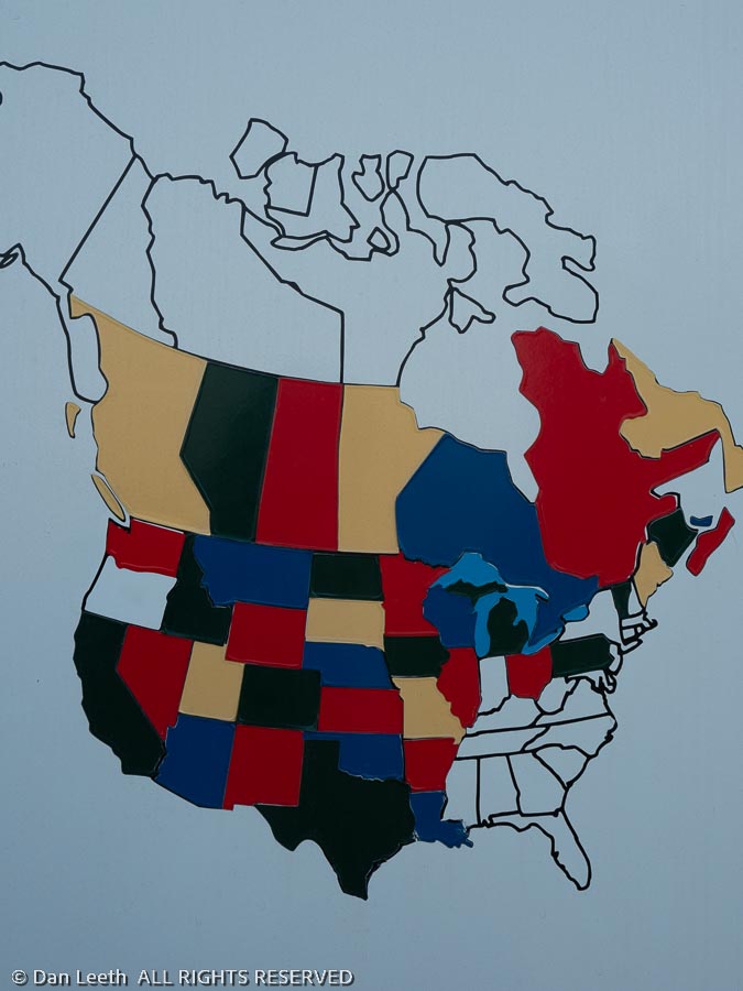
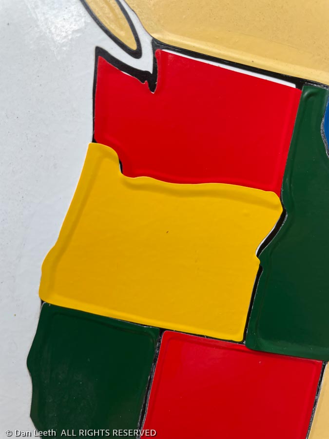
We have a map on the back of the trailer showing states in which we’ve camped with either this trailer or its predecessor. While we’ve truck or tent camped in Washington and Oregon many times before, we’ve never dragged a trailer up there until now. The Washington decal went on minutes after arrival.
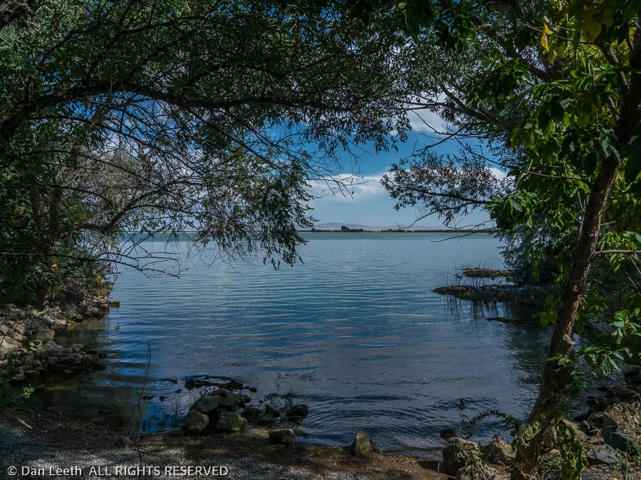
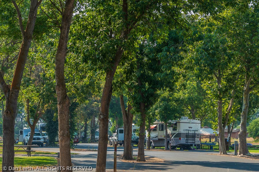
We’re staying in a beautifully kept, Corps of Engineers campground along the Columbia River. We have electric and sewer here, but currently there’s a boil notice for the water. That’s why we brought our own.
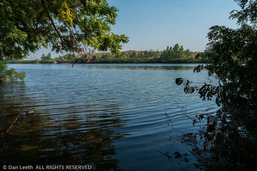
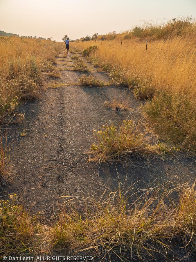
Unfortunately, there’s a wall of veggies blocking views of the Columbia River from the campground. We put on our tennie-runners and set out to see if we could find a break in the greenery that would allow a glimpse of the stream.
We only found a few passages to fishing spots along the edge of the campground. Views were choked.
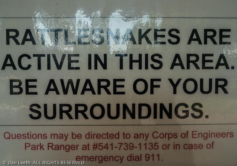
Hoping for more, we continued down an old roadway that cut through the snake-infested brush. We found nary a single buzz worm along the way.
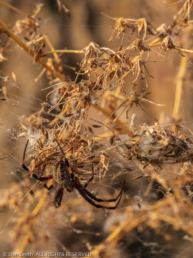
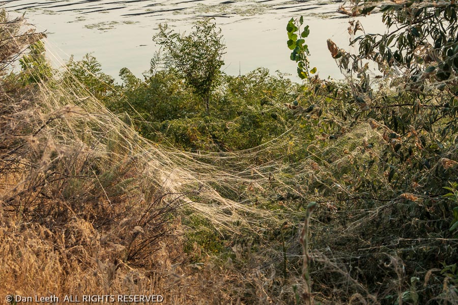
We did, however, find spiders.
When the webs got too thick, we cut over to the paved roadway that led to a parking area used by anglers.
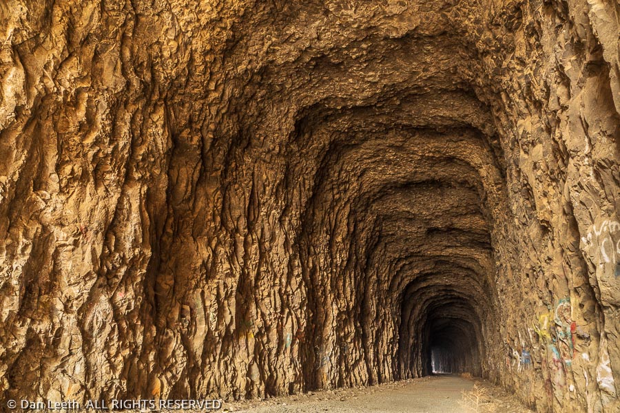
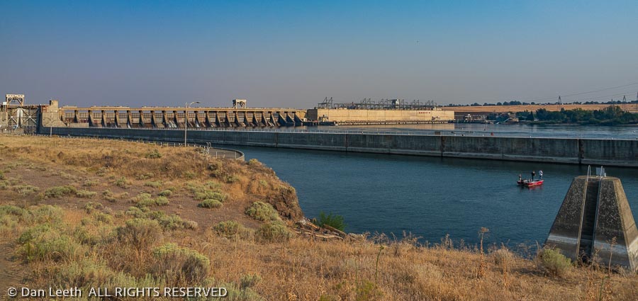
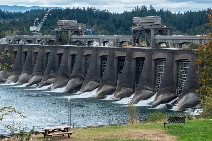
A pair of fishermen there told us that if we continued through a culvert under the freeway, we’d soon reach a tunnel. On the other side of the tunnel, we’d have a great view of the McNary Dam on the Columbia River.
We followed their suggestion and were treated to a view of the nearly 1½-mile long structure spanning the river. The trail continued and so did we, stopping only when we reached a NO TRESSPASSING, GOVERNMENT PROPERTY sign.
We checked our GPS watches when we got back to the trailer. What was going to be a little stroll along the edge of the campground turned out to be a five-mile walk.
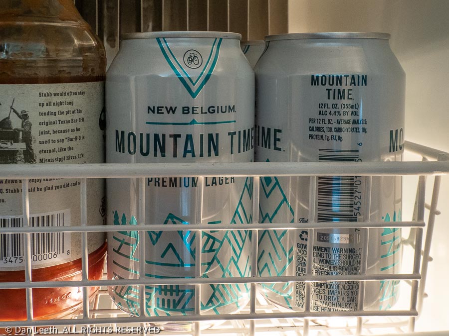
Of course, I celebrated with yet another brew from the fridge.
Monday morning, and it was back to work. We had a 160-mile drive to our next campground, this one in the heart of the Columbia River Gorge National Scenic Area. From Plymouth Park, we had two choices on how to get there. We could stay in Washington state and take a relaxing drive along a two-lane highway hugging the north side of the river. Or we could take I-84 through Oregon on the south side of the stream. We chose the freeway.
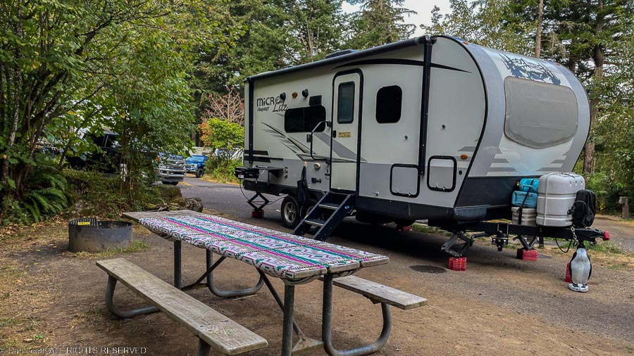
We booked five nights at Ainsworth State Park, a wooded park just off Historic Highway 30. The sites are a bit closer together than we find at most state parks, and the freeway and a pair of Union Pacific tracks lie nearby treating us to nonstop background noise. But other than that, the location is great, and we got to put our final western state sticker on the trailer.
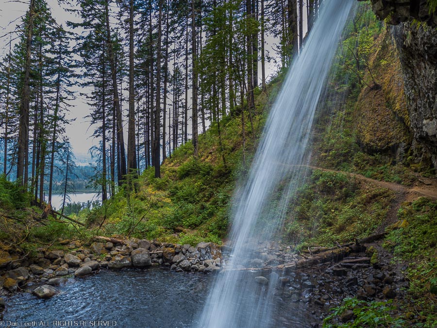
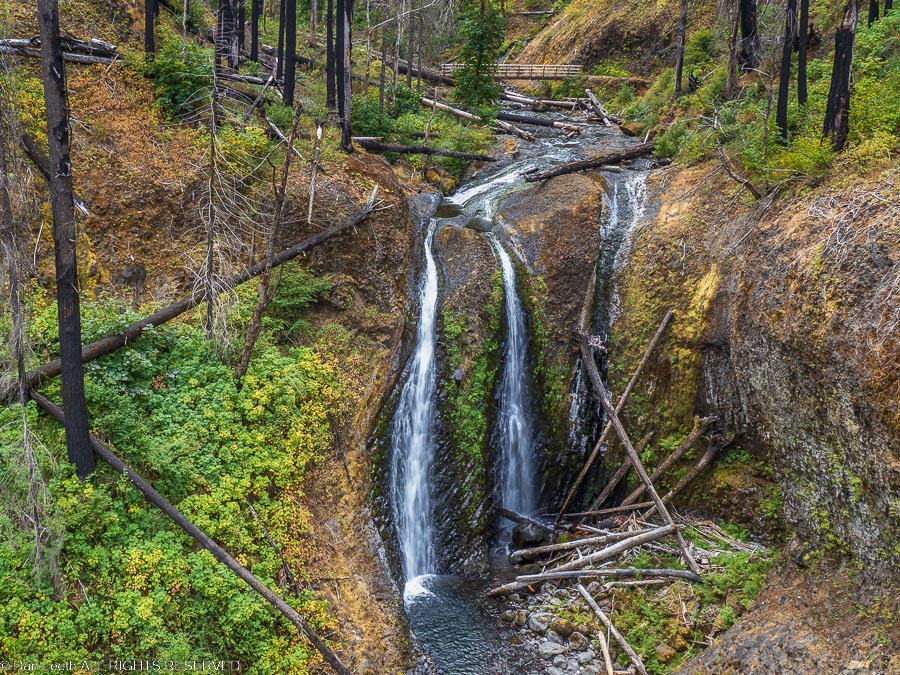
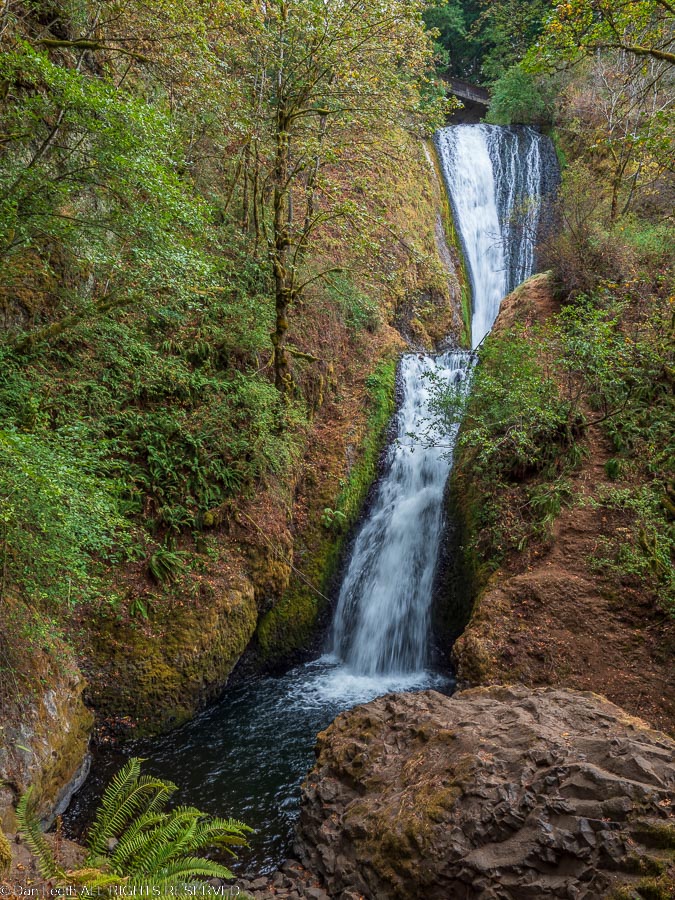
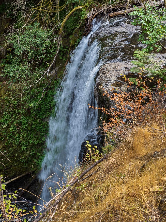
On Tuesday morning, we laced up our boots and set off on a seven-mile hike from the campground that took us to Ponytail Falls.
Continuing on the trail behind the falls, we headed for Oneconta Falls and then on to Triple Falls (only two of the falls showed up for work that day).
Our return took us past Horsetail Falls near the highway with only a short hike along the narrow roadway back to camp.
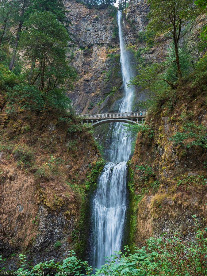
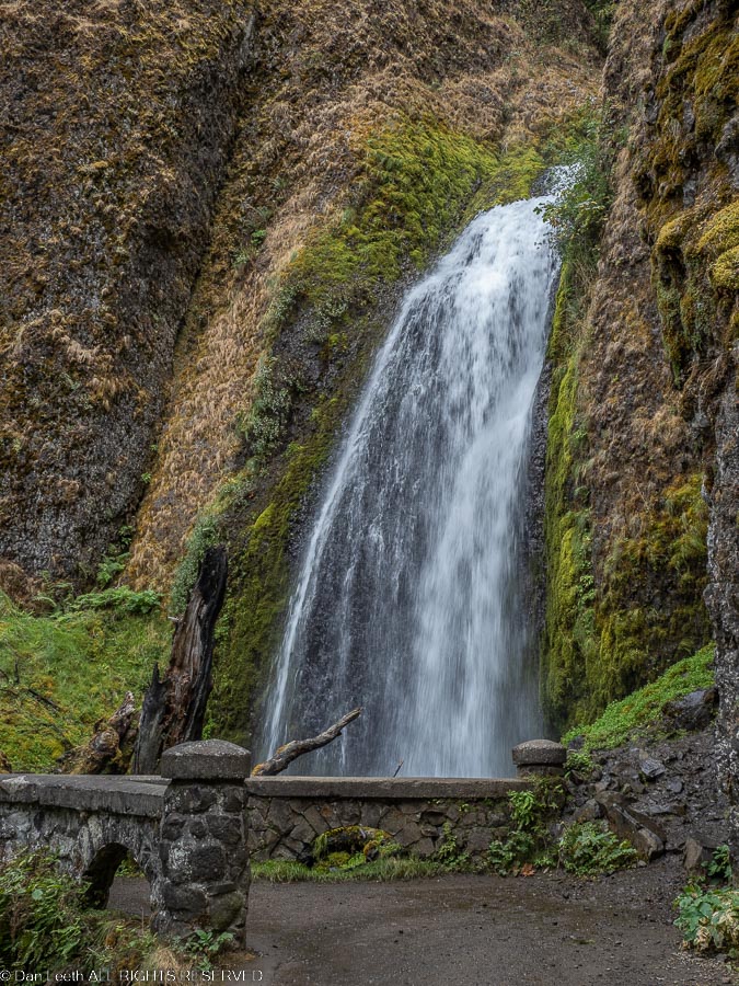
Wednesday morning, we stopped by the icon of the Columbia River Gorge – Multnomah Falls.
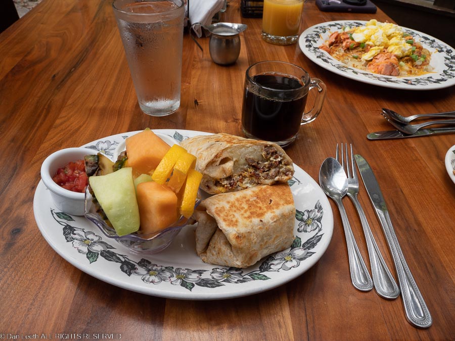
Signs claim it’s the second highest year-round waterfall in the country, but Google thinks otherwise. The ranger at the information center was noncommittal. A historic lodge sits along the highway, and we booked a reservation there for breakfast.
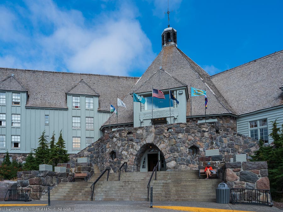
Having hiked the day before, this was to be an exploration day. Our goal was to drive up to historic Timberline Lodge, which is located on the flanks of Mount Hood. It was built during the depression by W.P.A. workers and the craftsmanship shows.
The first time I was here was decades ago when my step dog, her owner and I hiked the Timberline Trail, which encircles Mount Hood. The last time I was there was when I and two buddies drove up to climb the peak. We abandoned the climb when we saw an avalanche sweep another climbing party off the route. They survived and we headed for a southern Oregon hot spring.
We continued down the highway towards Portland, cutting over to the beginning of Historic Highway 30 in Troutdale.
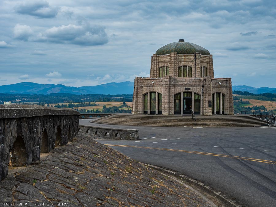
After stopping at the Vista House for views of the Columbia River, we ended the day with a stop at Latourrll Falls and a one-mile stroll down to Bridal Veil Falls.
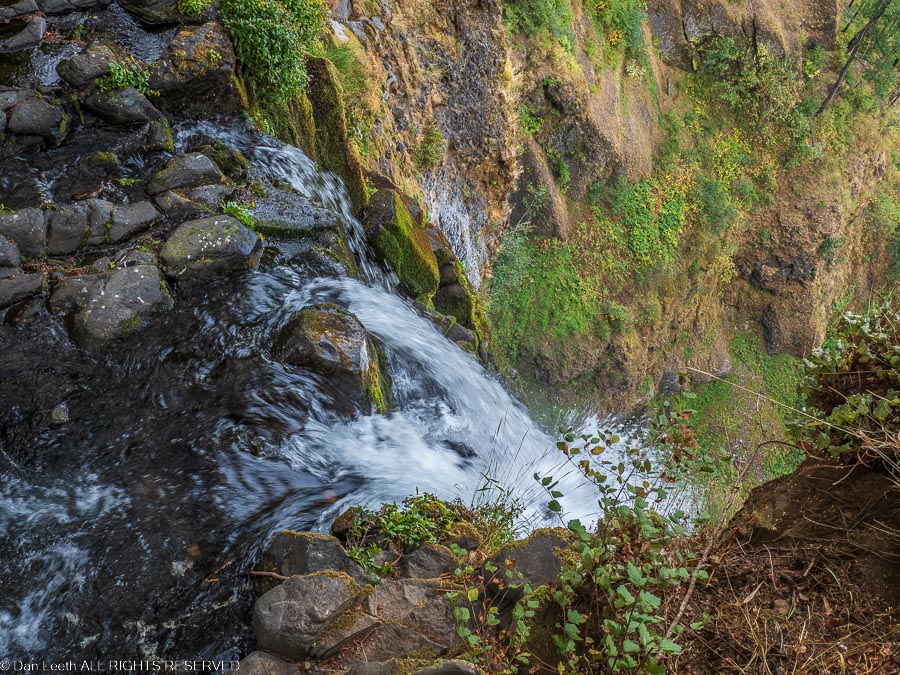
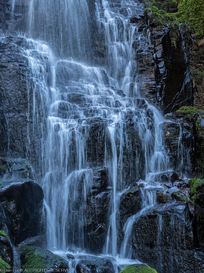
Thursday was another hiking day. This time, we would start from the Multnomah parking lot and take the trail past the lower falls, across the Benson Bridge and up to where the creek begins its vertical plunge. A real butt-puckering view according to one fellow hiker.
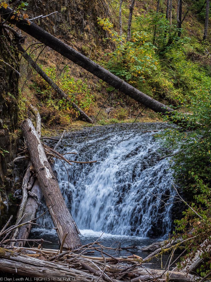
From there, we continued up Multnomah Creek, past tiny Dutchman Falls…
…and on to Wiesendanger…
…and Ecola Falls.
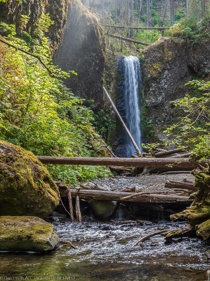
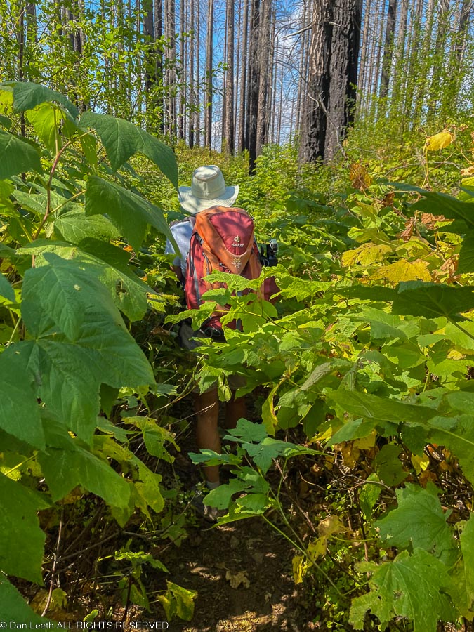
We traversed the hillside to Wahkeena Creek, taking a detour on a trail to where the map promised a viewpoint. The view was nice, but the trail was a bit overgrown. A tick check was mandatory when we reached our target.
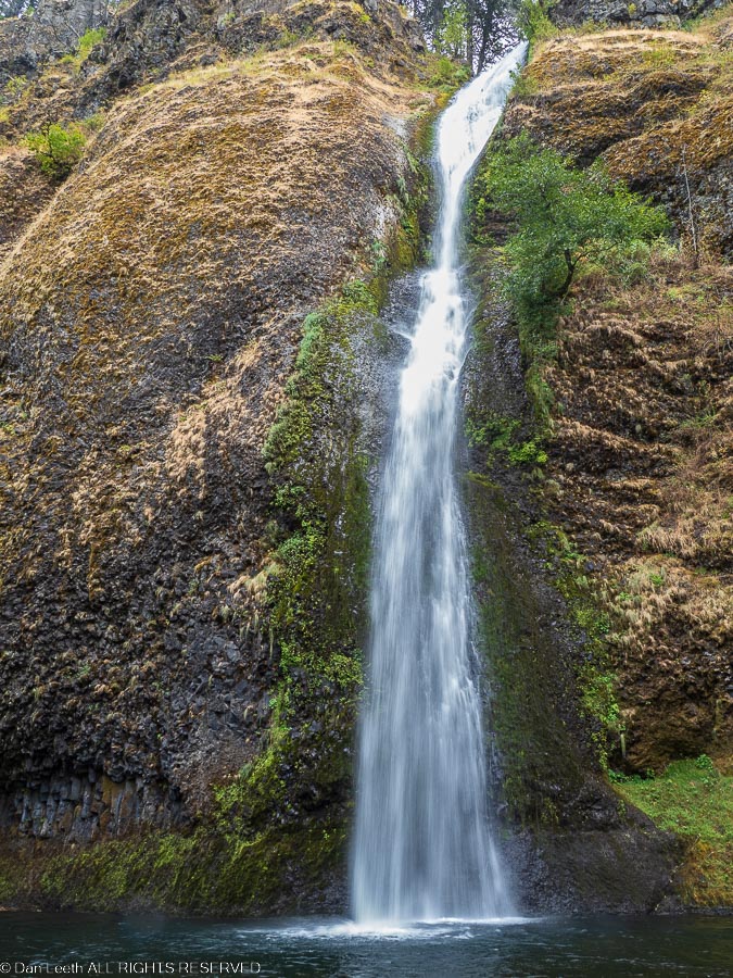
Back on the main trail, we descended the tumbling waters of Wahkeena Creek past beautiful Fairy Falls.
Near trail’s end, we passed the creek’s namesake falls, which lie a short walk from Historic Highway 30.
A half-mile trail took us back to our parked car at Multnomah. A wifely-cooked steak dinner and glasses of tasty wine from a freshly opened box of Australian Shiraz followed.
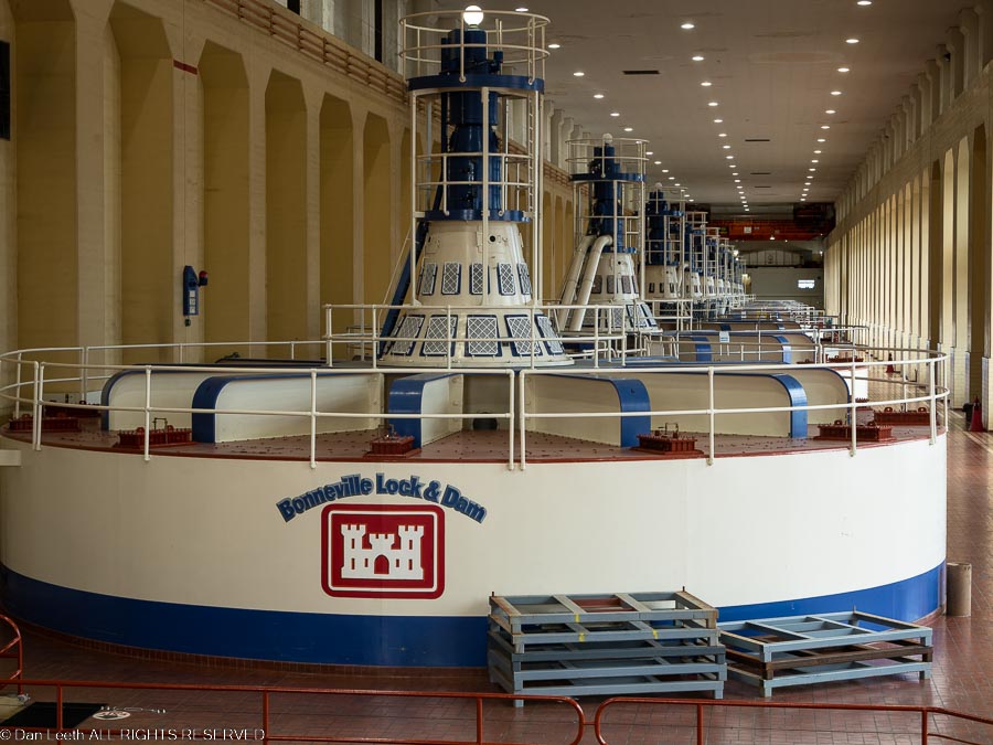
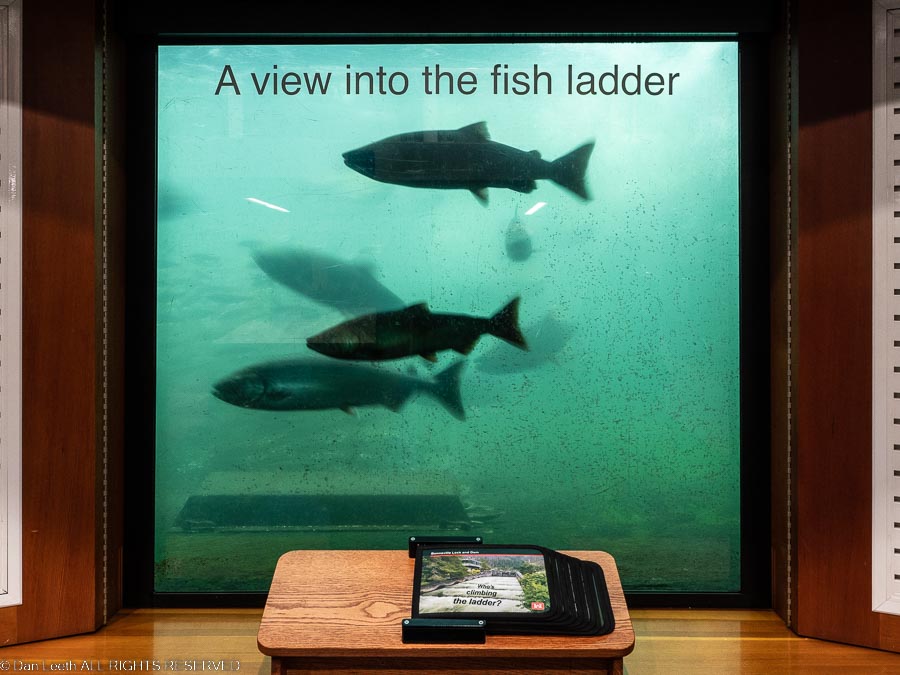
After taking the morning off, we fired up Tighty and headed upstream a few miles to the historic Bonneville Lock and Dam where we stopped at the visitor center on the Oregon side. We looked over the powerplant and gazed at fish swimming up the fish ladders.
Then it was across the river on The Bridge of the Gods to the Washington state side where we once again looked into the powerplant and gazed at Friday dinner swimming up the fish ladders.
It was then back across the Bridge of the Gods to the Oregon side of the river. Instead of swimmy things for dinner, we had burgers at a brew pub, one of at least three in the town of Cascade Locks. The town sits on the Pacific Crest Trail, and if I were hiking from Mexico to Canada, I’d sure take advantage and stop for a cold brew or two before hiking on.
It’s a battle I endure every morning while camping. Sometime around dusk, my bladder starts screaming, “Empty me, NOW!” It’s barely 6:45 in the morning, and I long to remain under the comfort of my covers for at least another hour. But the bladder says otherwise.
So, I try to slip out of bed very quietly and make my way to the trailer commode, ten feet away. Finishing the task at hand, I turn back toward the bed. Sure enough, my lovely wife has taken the opportunity to not only get herself out of bed, but she’s managed in the 45 seconds I spent peeing to have the bed totally made. There’s no returning for me to sweet sheets and slumber.
Bleary-eyed, I put on my clothes, fired up the teakettle for coffee and pondered one of my life’s major decisions. We had two choices on how to get to our next campground. We could shoot up the interstate into Washington, cross the Columbia River on the Lewis & Clark Bridge out of Longview and take an easy drive to our campsite in Fort Stevens State Park in Oregon. The other option was to fight congested traffic of Portland on a route that required us to negotiate three different highways. I chose the latter.
Surviving Portland with the help of the nagging voice of our onboard navigation system, we made our way to Seaside Oregon, then headed up to Fort Stevens State Park located on a spit of land between the Columbia River and the Pacific Ocean.
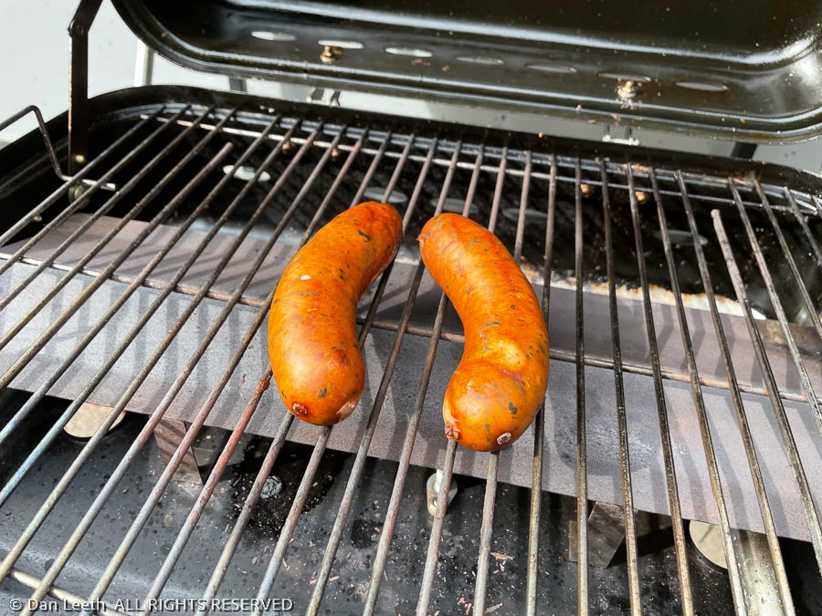
After setting up camp and devouring some savory, Dianne-grilled brats, and Dan-opened brews, we spent the rest of a wonderful afternoon doing our laundry at the nearby KOA.
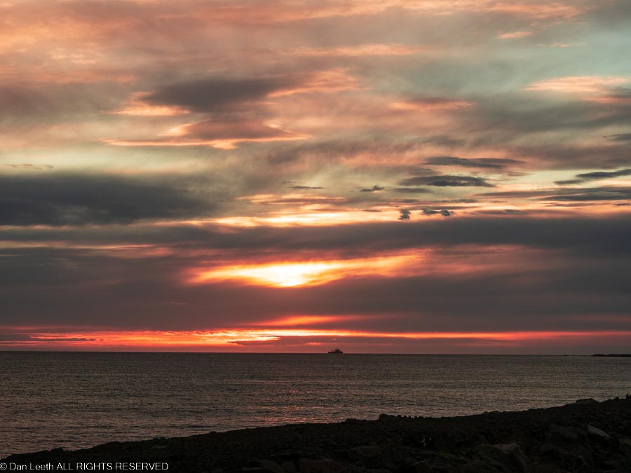
Then it’s back to the park and off to the end of the Clatsup Spit where under the light of the setting sun, we saw ships heading for the inland waterway. It was a nice way to start eight nights of camping along the Oregon coast.
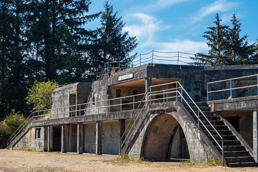
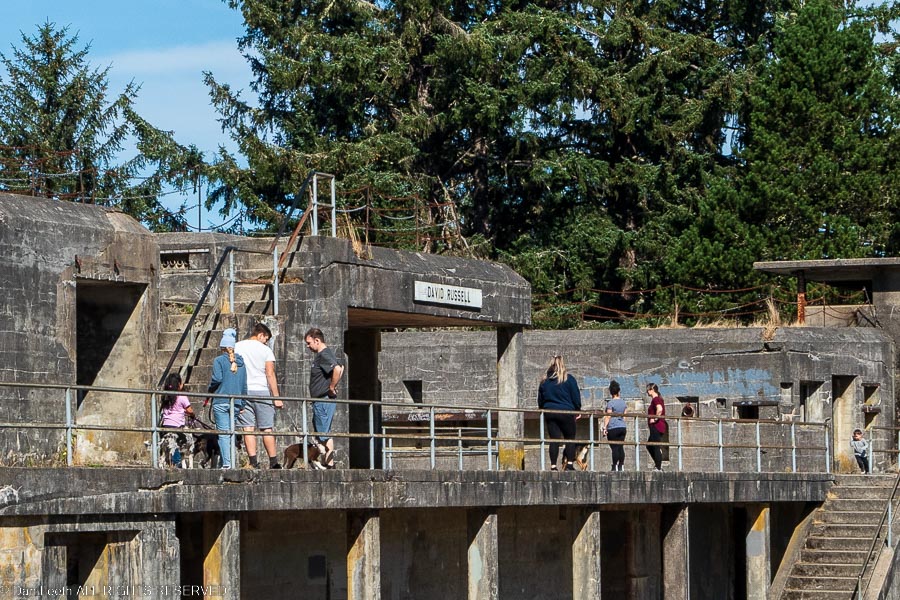
Today, we set off on foot to see the “fort” part of Fort Stevens. For around a century, from the Civil War through World War II, the U.S. Army used armament placed here to protect the Columbia River waterway from being invaded by foreign vessels. Today, foreign invaders come in rented, Cruise America motorhomes and are welcomed. Even our campground host hails from foreign soil (British Columbia).
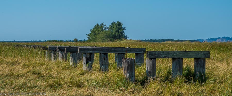
Trails through the park are paved and open to bikers and hikers. We walked through the woods, explored gun emplacements and bunkers and took a 45-minute motor tour in an old army truck through the main fort area. Highlight was walking out to a line of railroad trestle posts that once carried trains across the bay.
It was Sunday and it seems that every Oregon family armed with one or more screaming preschoolers decided to invade the fort.
We tried our best to repel the onslaught, but alas, we finally had to surrender and retreat to our campsite.
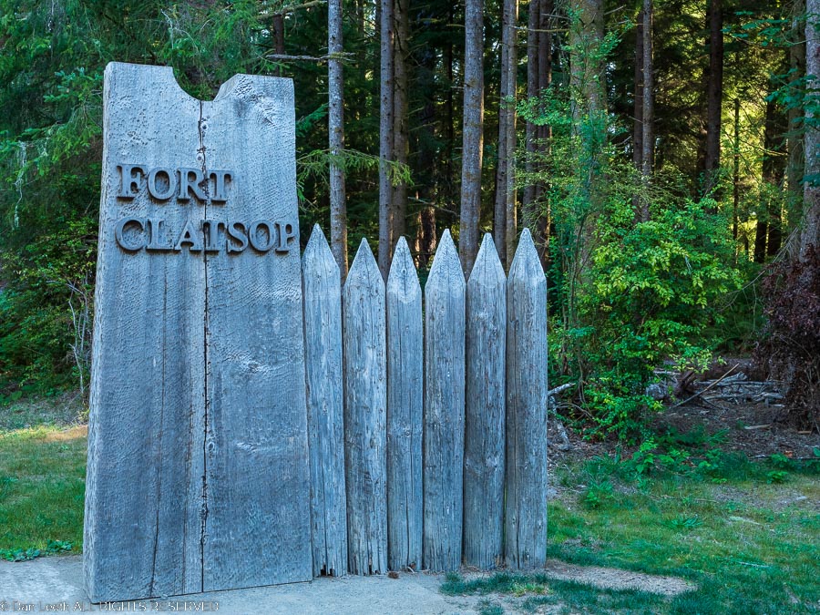
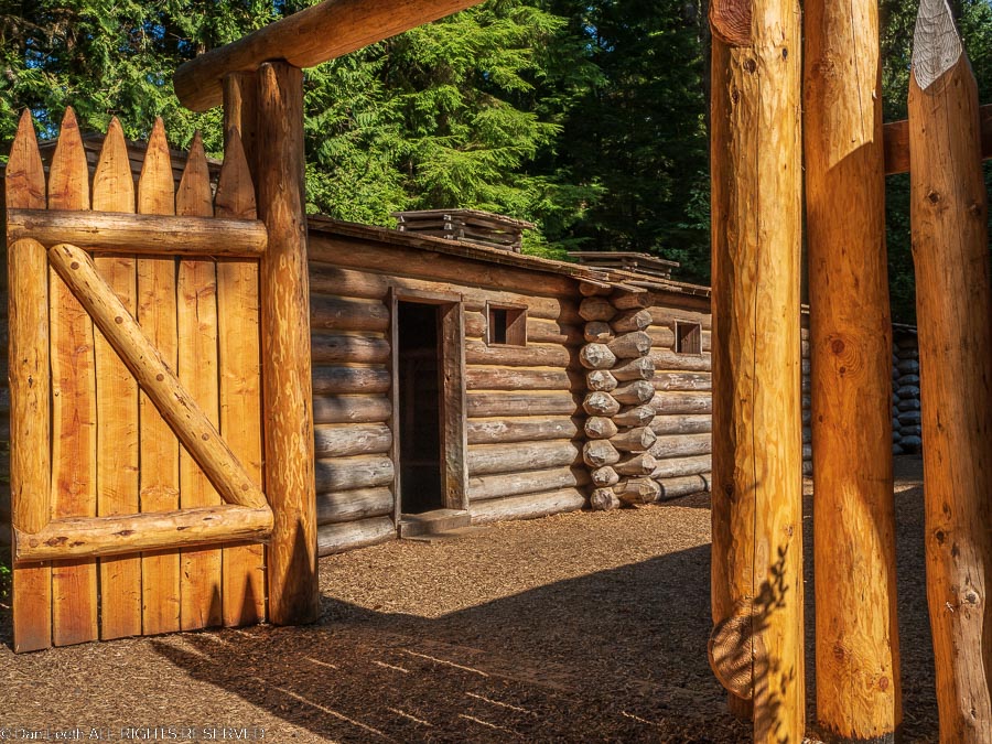
Today, we went back in history to the early 1800s when Meriwether Lewis and Bill Clark first camped in the area. A few miles from Fort Stevens, the National Park Service manages a Historic Memorial site that has a replica of Lewis & Clark’s winter quarters at Fort Clatsop. Life is so much easier today.
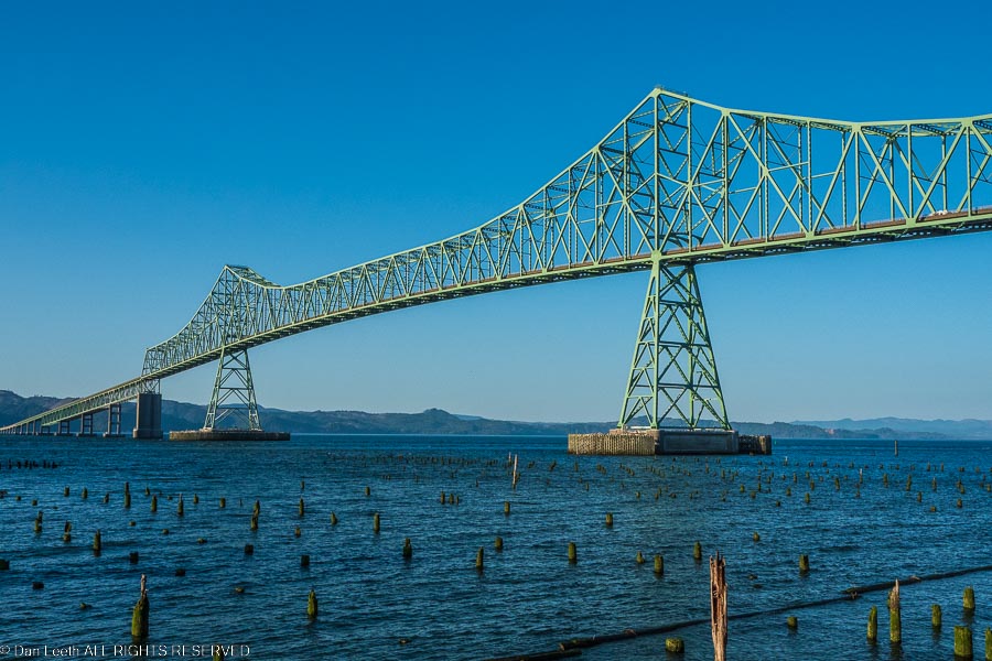
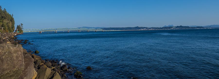
From there, we drove to the riverside town of Astoria and crossed on the bridge to the Washington side of the Columbia River. Now I can climb tall, vertical cliffs and think nothing of it. But I’m not a big fan of long, high bridges over deep water, especially when the bridge is in earthquake and tsunami country.
This narrow, two-lane bridge stretches four miles in length as it crosses the West’s largest river near its mouth. The first part of the arcing span is high enough to let ocean-going freighters (and probably the average aircraft carrier) pass under. Just crossing it was a white-knuckle experience for me. To make matters worse, they were doing construction on the height of the span. We had to stop behind a flagman atop the highest, steepest part of the span for what seemed like 2½ lifetimes, waiting for our turn to pass. Fortunately, there were no earthquakes or tsunamis.
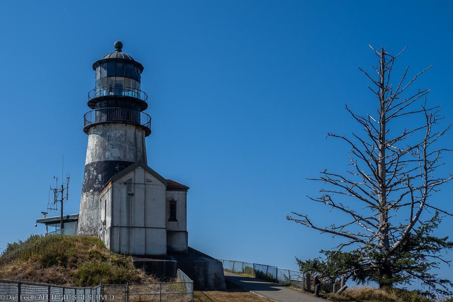
Safely on solid ground again, we drove up the Washington coast to Cape Disappointment State Park. We toured the park’s Lewis & Clark Interpretive Center, walked to both of the Cape’s two lighthouses, checked out the park campground and had brews along the harbor in nearby Ilwaco, Washington.
Then it was back to the bridge. The construction crew was done for the day and there were no holdups this time across.
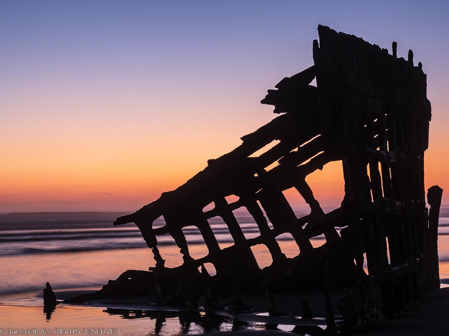
Back at Fort Stevens, we drove down to the beach and watched the sunset light enflame the sky behind the remains of a ship that washed ashore over a century ago. Then it was back to camp where we sat outside with glasses of wine and looked up at the stars.
Our time up at Fort Stevens, we slid the slide-out in, hitched trailer to truck and headed south down the Oregon coast. We had only 169 miles to cover and all day to do it, so there was no rush. That allowed us lots of time to stop at numerous roadside viewpoints.
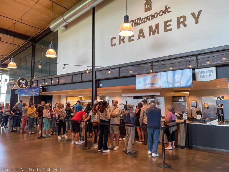
One of the stops Dianne wanted to make was the Tillamook Cheese factory, which not surprisingly is located in the town of Tillamook. She envisioned stopping in, buying some cheese and bread (and wine?), and then having a European-style roadside picnic on the way out of town.
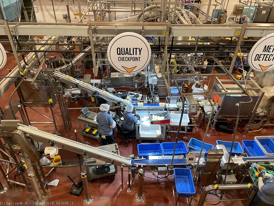
The Tillamook Creamery is huge and boasts a parking lot big enough to host a Denver-size traffic jam. It was packed. Even though they offer a long row of spots for RVs, we had to park across the street in an overflow lot. The place was packed inside with long lines of people waiting for ice cream and food. Their prices for cheese were higher than what we pay for the same thing at the local market. They didn’t sell bread and their white wine was warm. We did a quick, self-guided, overhead tour of the factory and fled the building.
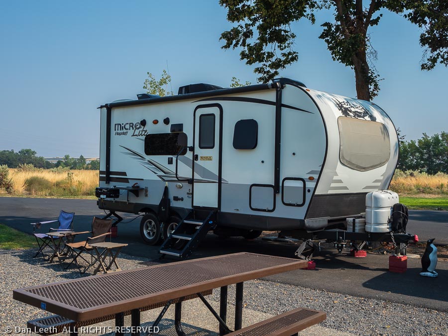
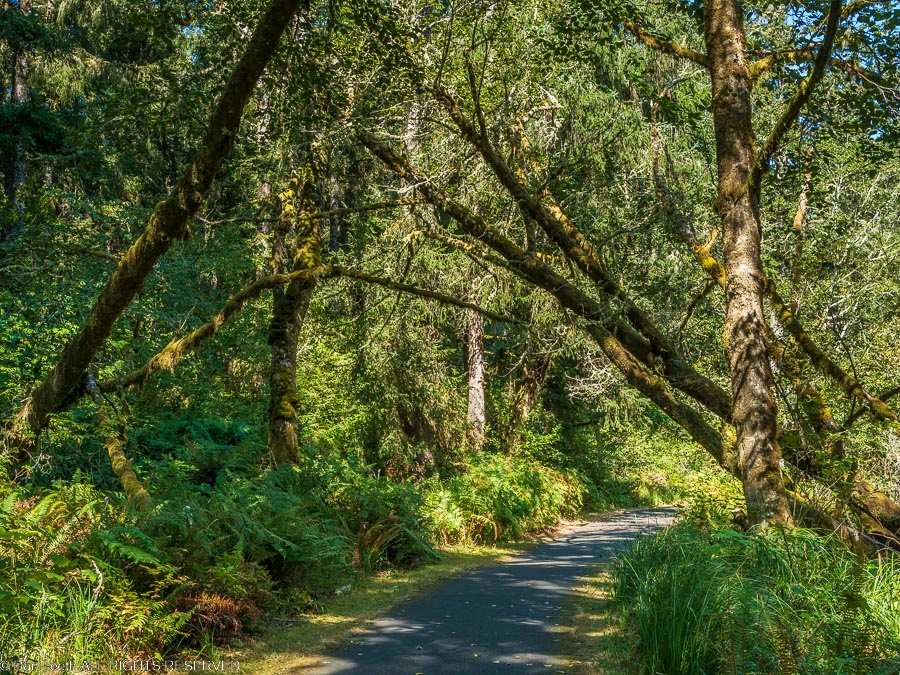
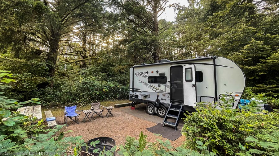
For the next five nights, we will be at the Carl G. Washburne State Park, which is located a half-mile walk from the beach (or so the sign promises). It’s our first back-in site, and with Dianne’s excellent direction, I got the trailer wheels right where she wanted them, and I didn’t hit a single tree.
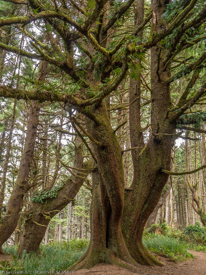
After all this time bunking down in sites surrounded by lush growth, it’s going to feel strange to go back to camping in the desert.
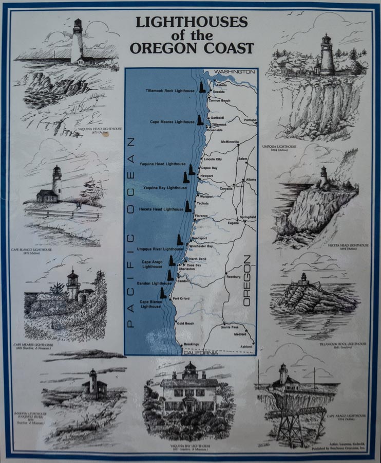
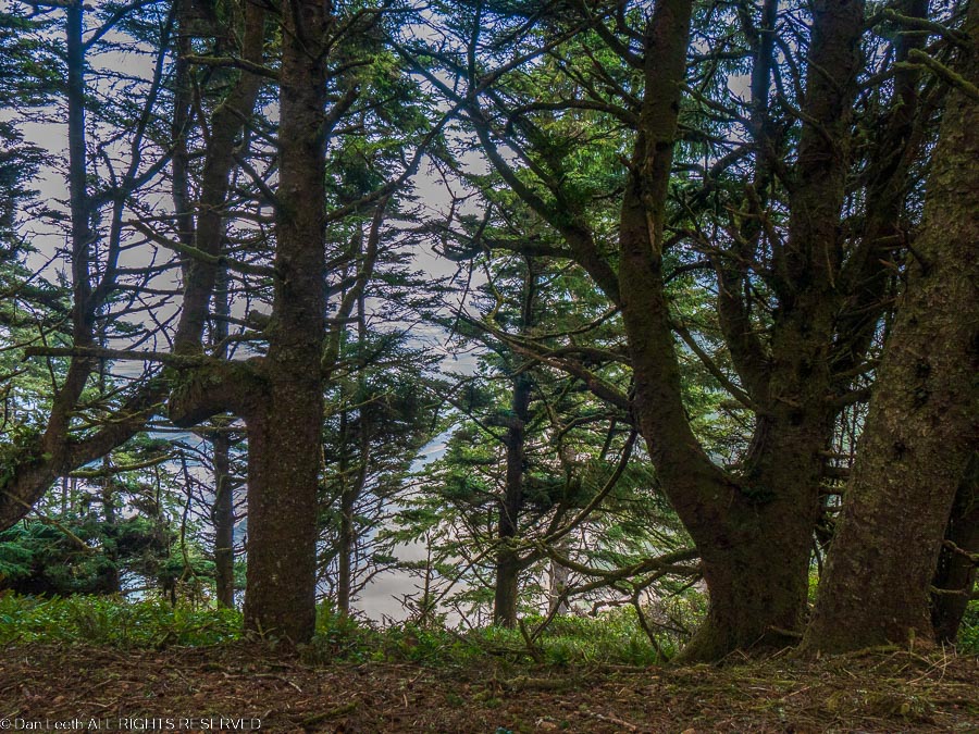
From our campsite, a three-mile trail leads to the Heceta Head Lighthouse. After a bacon and eggs breakfast, we packed our packs, laced up our boots and set off down the trail at nearly the crack of noon. The problem with hiking in this part of Oregon is that there are so many trees, you can’t see anything. In the deserts where I grew up, the views extended nearly forever. Here, the view is to the next tree.
Even the cliffside viewpoints have trees in the way.
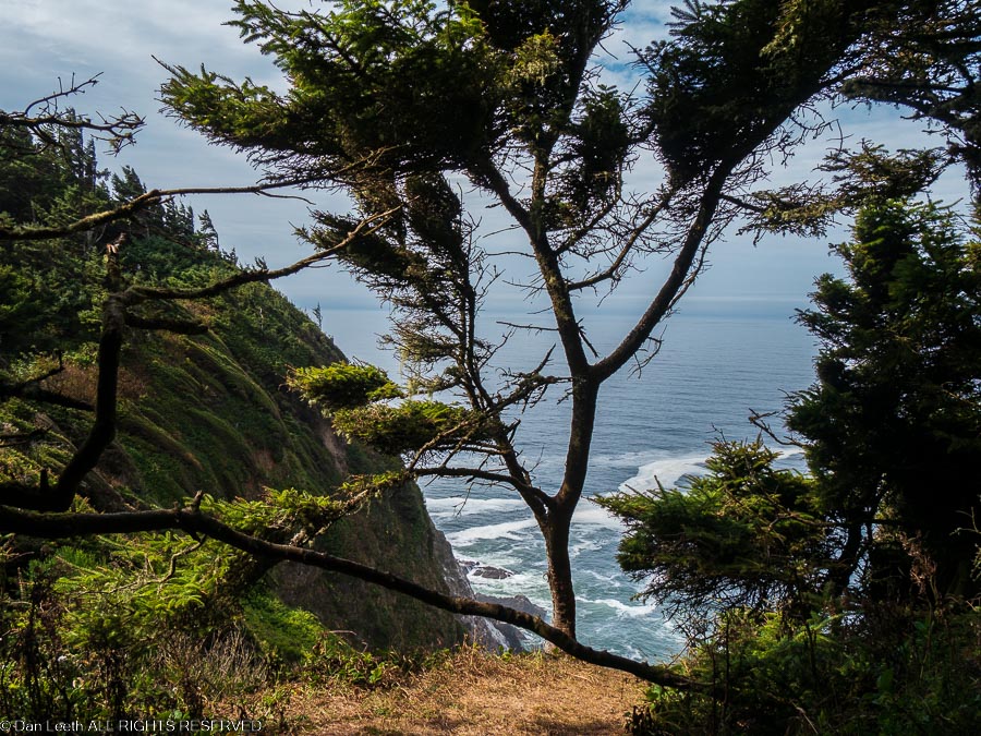
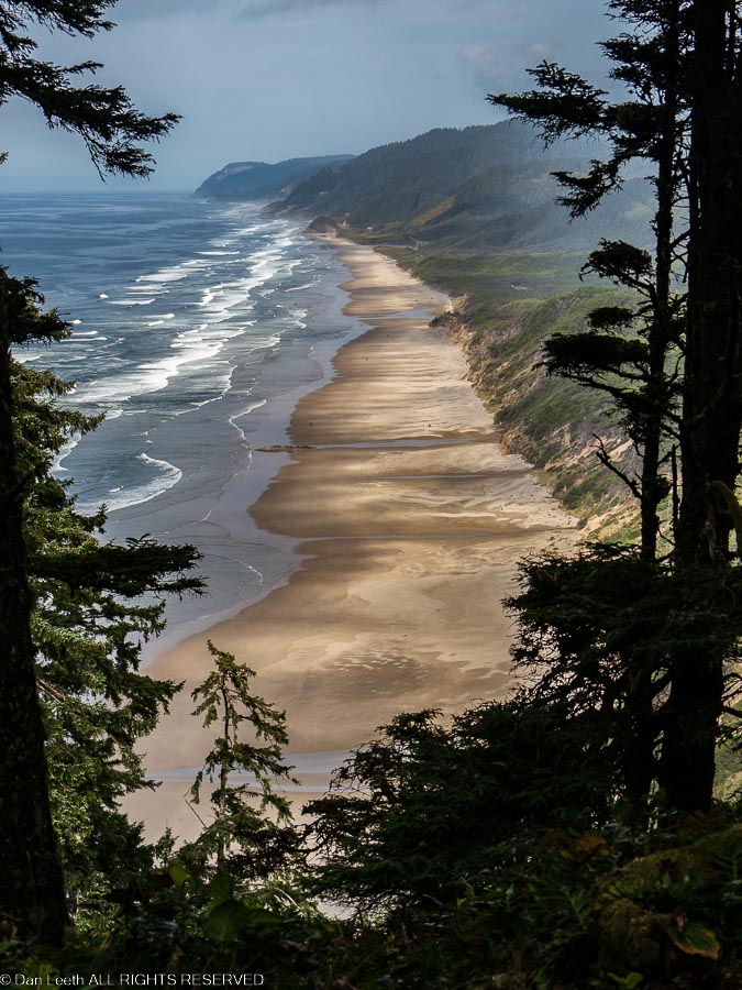
Finally, after covering nearly 2½ miles of serious up and down hiking we got to a break in the vegetation allowing us to gaze down on the sandy beach with waves breaking for shore.
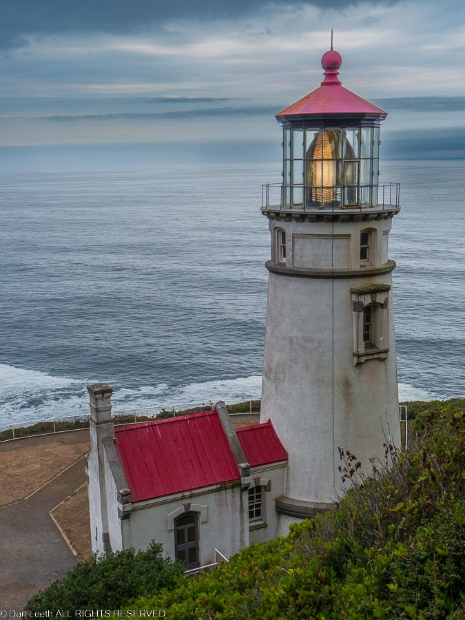
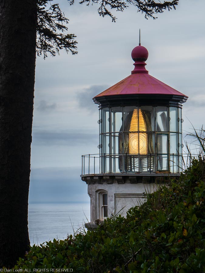
A half mile farther down the trail we reached the lighthouse perched on a cliff with plenty of views of ocean, beach and haystack outcroppings covered in bird guano. Unlike most lighthouses we’ve visited, this one had the light operating. No doubt, Tom Bodett left it on for us.
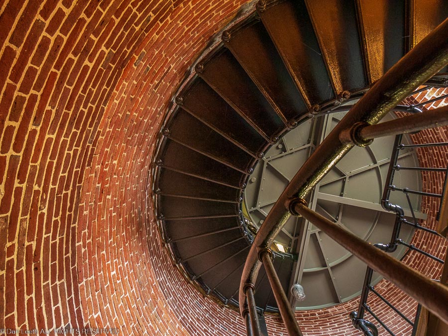
Volunteer docents were in attendance, which meant the door to the lighthouse was open and we could peer in at the circular staircase winding up to the lamp. Unfortunately, we were not allowed to do anything but peer upward. The stairs were closed.
We chatted with a few folks and the site, then with one final look at the structure, started back to camp.
Still no views, but at least some of the trees were kinda cute.