
Exploring this area may prove to be more fun than I thought.
The map of the McInnis Canyons National Conservation Area shows a plethora of trails cross-crossing and looping through the canyon country south of the Colorado River off Kingsview Road.
Those are just the designated trails. In addition lie many undesignated, “social trails” that wind through the area. As we soon found out, some of these are as well trodden as the official pathways and equally interesting.
Our goal today was to do the 10-mile round-trip hike from the Pollock Bench Trailhead to the point where the Rattlesnake Arches Trail from the top meets the Rattlesnake Arches trail from the bottom. We grabbed the BLM supplied map at the trailhead and set off up the Pollock Bench Trail to its junction with the Rattlesnake Arches Trail. The path, an old, abandoned Jeep road, was extremely well defined.
The lower stretch of the Rattlesnake Arches Trail wanders across the flats and into and out of a small side canyon or two. It was well used, and except for where it crossed baren slickrock, proved easy to follow.
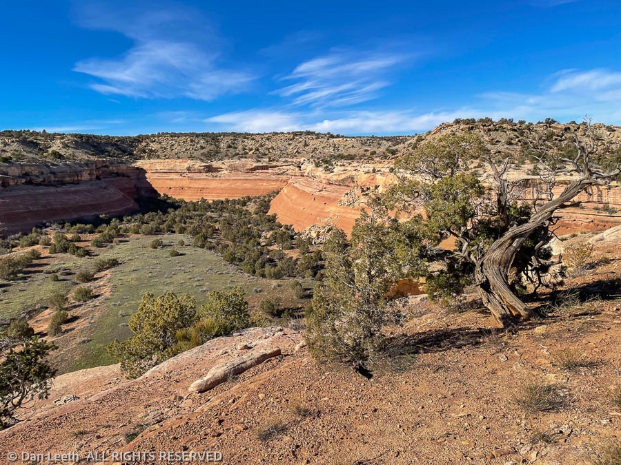
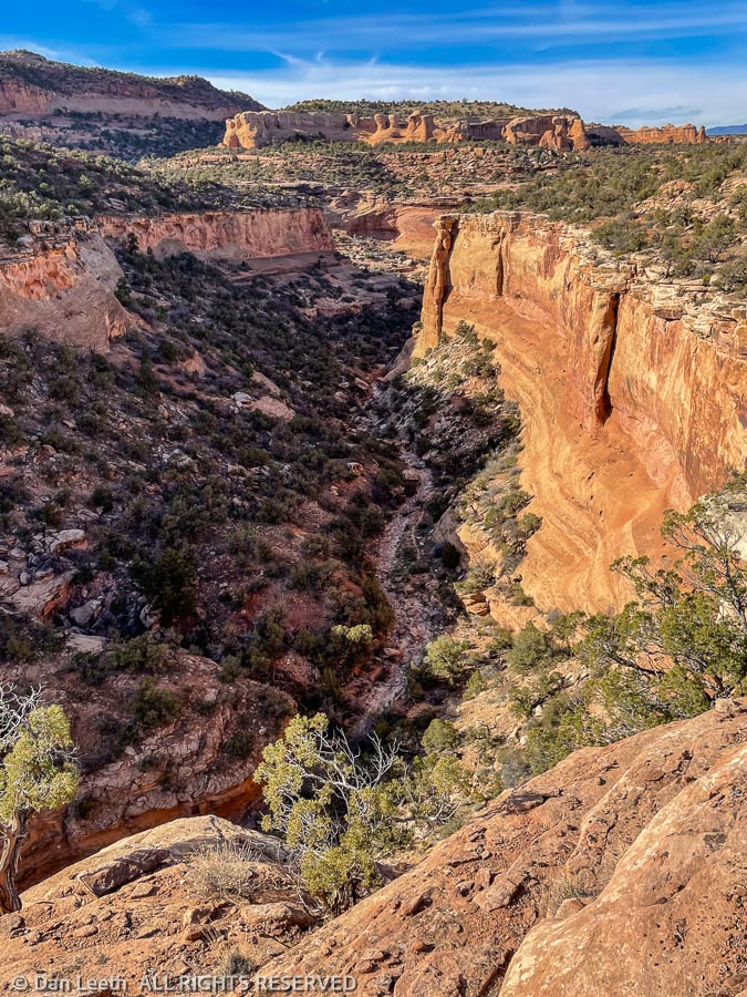
We reached the lip of Pollock Canyon, a wide, deep gouge in through the sandstone landscape. A hiker with two leashed bulldogs we had met earlier on the trail said he had turned around because he didn’t think the dogs could get down a series of ledges. Perhaps this is where those ledges lay.
I assumed it was, although there were neither trail signs nor cairns marking a route down. I started zigzagging down trying to follow footprints left in the few spaces of loose dirt. I was a few dozen yards below when Dianne shouted out that she had found the trail up on the rim. Since my route looked somewhat precarious, I was more than happy to get back on a well-defined trail.
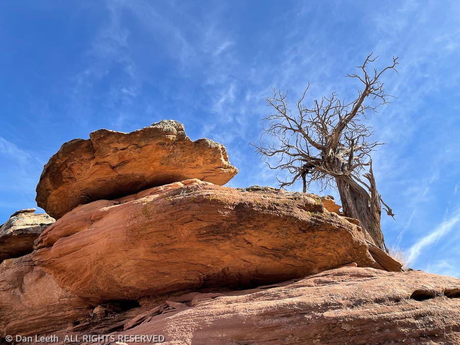
We followed the footprints of dozens of hikers as we hiked the trail along the rim. Stunning cliffs that appear to be hundreds of feet high lined the deep canyon. We would lose the pathway in rocky spots, but always rediscovered it just beyond. The farther we progressed, the fainter the trail became. It became obvious we were following a social trail, not the official route to the arches.
Our GPS watches said we had traveled four miles from the trailhead. It was decision time. On the map, it looked like we could continue onward and hit the Pollock Bench Trail, which would lead us back to our truck, or we could turn around and follow the known path back. Common sense dictated the latter option.
We turned around and headed back. Looking down from the spot where I had started to descend from the rim, we saw a BLM sign down at the bottom of canyon floor. I pulled out my binoculars and read what it said. It pointed toward Rattlesnake Arches. I had been on the right route before we discovered the social trail.
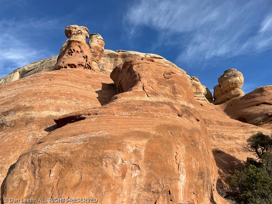
We continued back to the truck, walking past sandstone cliffs, buttes and hoodoos bathed in the golden light of the late-day sun. Across the Grand Valley, the Book Cliffs looked stunning with inky shadows accentuating its cliffside skirts. Wispy clouds offered the first hint of a soon-to-be colorful sunset. Yes, it was just another typical afternoon in canyon country.
Today’s hike was a delightful failure. We didn’t succeed in our effort to follow the Rattlesnake Arches Trail to its junction at the top. Instead, we accidently ventured into the Great Unknown, following a scenic, undesignated trail that offered delightfully lofty views.
We now have a goal for a future hike. We’ll have to follow this undesignated trail and see where it goes.