Spring is in the air. It’s mid-April, and the flowers are beginning to bloom. Denver temperatures are supposed to be in the 60s with sub-freezing lows long gone for the season. It should be perfectly safe to turn on the plant watering sprinkler/drip-system and hit the road.
Oops. This is Denver.
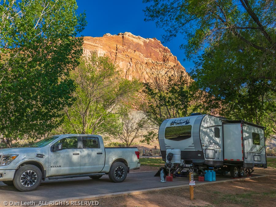
We’ve planned a 36-night camping trip to the canyon country of western Colorado and eastern Utah. We have friends joining us for the first part of the trip. Camping reservations have been made and paid for. The trailer’s been dewinterized and we’re packed. After enduring a long, Covid winter without leaving the city, we’re eager to be gone.
Last year, it was that Mexican beer virus that upset our well-crafted camping plans. This spring, it’s the weather gods who are throwing us a curve.
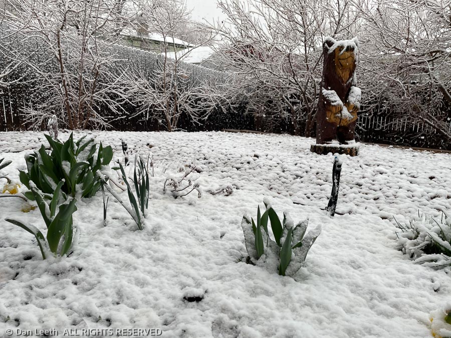
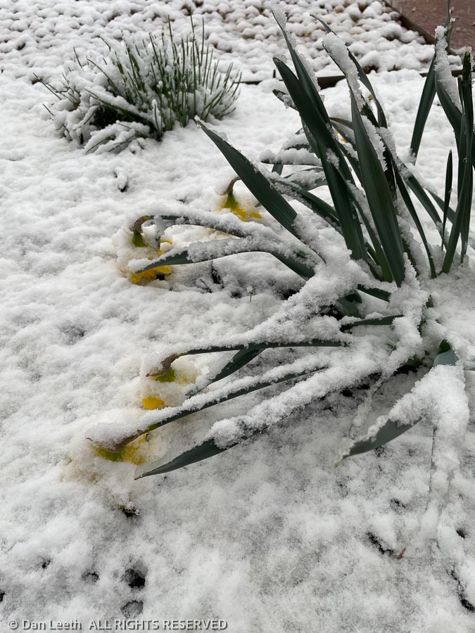
Prognosticators are predicting high temperatures barely above freezing with 17-degree lows for the first few days we’ll be gone. Plants will freeze unless covered, my wife insists, and with temperatures that low, we don’t dare activate the sprinklers.
There’s only one thing we can do. Panic.
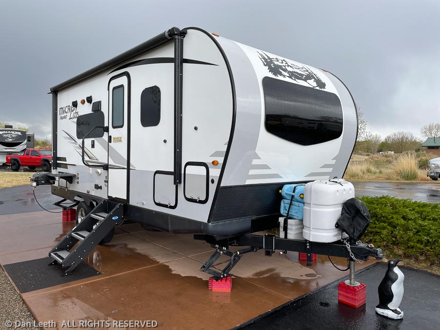
Putting our heads together, my wife has come up with a plan. I will pull the trailer solo over the mountains on the one good weather day predicted. Dianne will stay home and keep the plants covered and happy.
When the weather finally clears, I will drive 250 miles back to Denver, pick her up and return those same 250 miles back to camp.
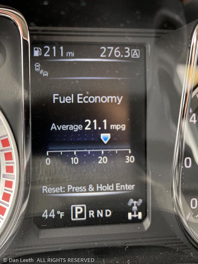
There is a bright side to this whole plan. When I pull the trailer, Tighty (our Nissan Titan pickup) gulps gas faster than an alcoholic guzzling the spiked punch at a wedding reception. I can reach 10 miles per gallon only when going downhill with a tailwind. Otherwise, it’s in the eights or nines.
Driving back empty, I’m looking forward to seeing what the fuel economy gauge looks like when displaying double digits.
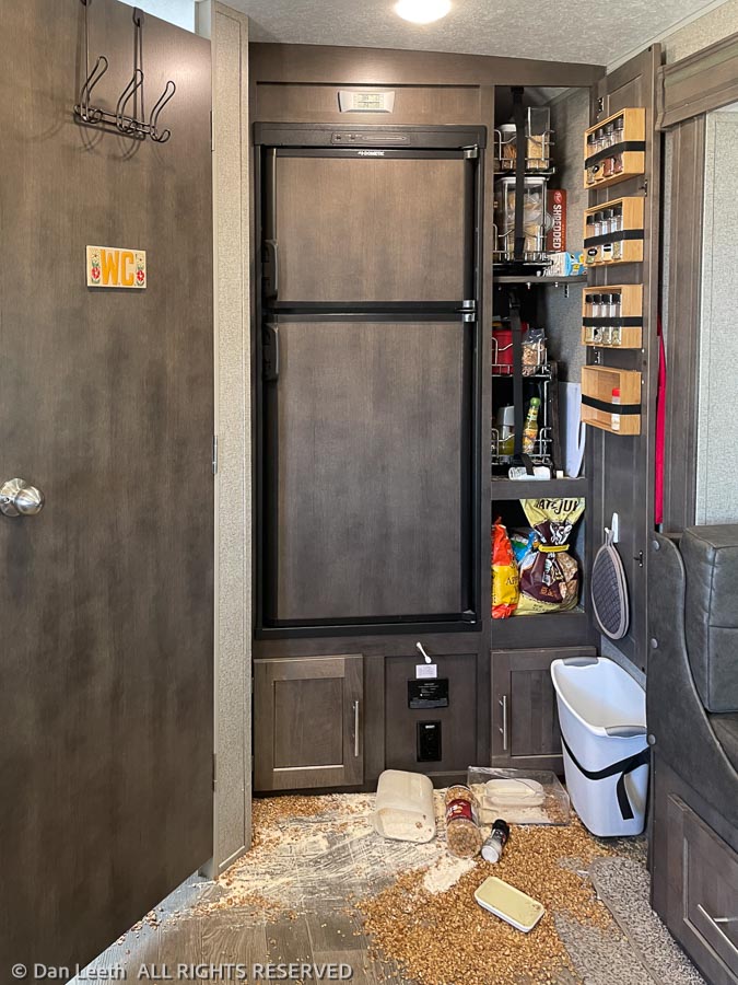
“What happened?” my wife, Dianne, asked when she saw the photo. “Did you pull the trailer down a four-wheel-drive road?”
No, it was far worse than that. I was on Interstate 70.
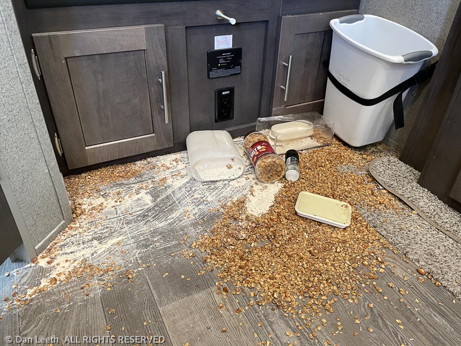
The potholes, cracks, frost heaves, bumps and sudden plunges in the pavement on Colorado’s main route across the Rockies agitated the contents of the trailer like a martini in a bartender’s cocktail shaker. When I opened the door, I was greeted with the remains of an Animal House food fight.
I don’t know if the food loading crew (Dianne) didn’t get the pantry door firmly latched or if it was just the weight of the innards pushing outward, but the door had flown open, and stuff came out.
All of Dianne’s homemade granola lay in a mound on the floor along with enough pancake mix to feed a Boy Scout troop for a month. Like the aftermath of a wedding party, rice lay scattered everywhere.
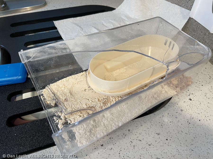
It took an hour to clean up the mess. Fortunately, the only thing broken was the plastic granola cannister.
No damage was done to the trailer. We can replace the lost ingredients at the store, and Dianne promises to make up more granola before she rejoins me on Thursday. In the meantime, I’ll head to the hardware store and buy a safety latch for the pantry door.
Unfortunately, until that granola arrives, I’ll have to refrain from playing my John Denver CD for breakfast.
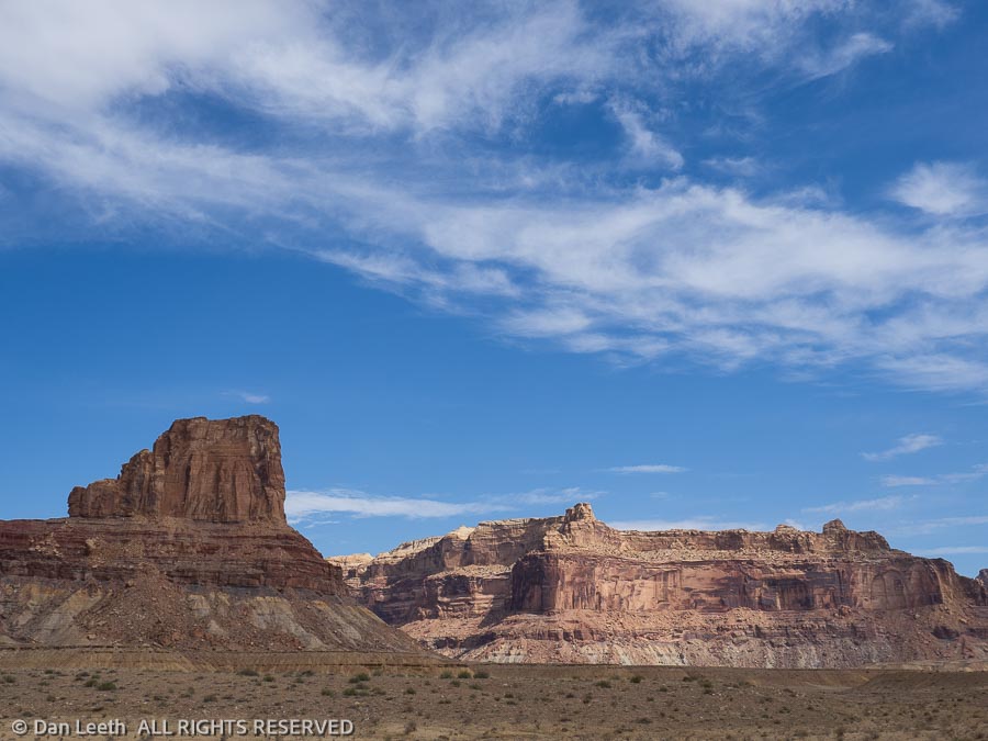
Of course, it’s raining on our last full day in the canyon country around Grand Junction. The weather on this trip has been less than ideal.
We had planned to leave home a Saturday ago, but nixed that plan when a storm hit the Rockies. Pulling the trailer over/through a pair of 10,000-foot passes on snow-plastered roads just didn’t sound like an intelligent thing to do.
Then there was the home issue. Our budding plants needed to be covered to protect them from sub-freezing temperatures, and the sprinklers couldn’t be safely activated in such cold conditions. So, Dianne offered to stay home and protect the plants and plumbing while I took the trailer across the Rockies on Sunday.
One pair of friends also arrived on Sunday. Monday morning was dead calm, and they put up the awning on their Airstream trailer. We then walked into town to get a latch for our trailer’s pantry door. While we were there, we hit a neighborhood brew pub for burgers and brews. By the time we returned the wind was howling. Fortunately, it only took a few hours to unbend the bars and retract the remains of his awning. A replacement will be on order when he returns home.
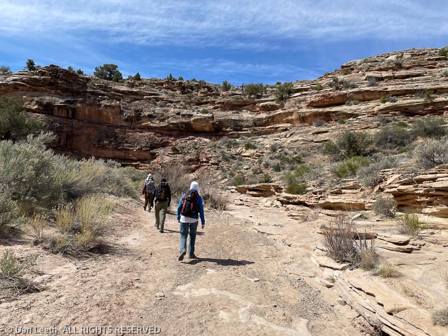
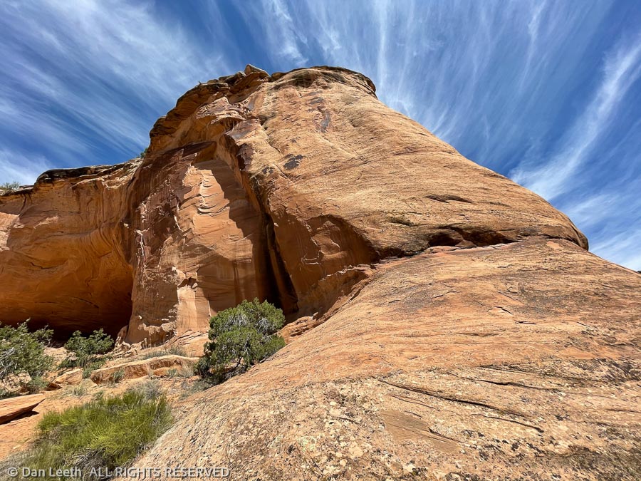
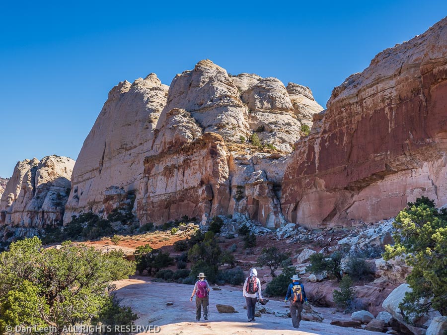
Another pair of friends arrived on Monday. Hiking began on Tuesday with a short trek down a canyon in the McInnis Canyons National Conservation Area. We hiked another set of trails in the McInnis Canyons on Wednesday.
It was time to eat something besides microwave popcorn and wine for dinners, so on Thursday, I drove back to the Denver area to fetch my cooking staff. It’s a bit over 250 miles from our campsite in Fruita to home and another 250 back. Indy car racers go 500 miles and think nothing of it. My friends, however, were absolutely impressed that any human being could possibly drive that far in one whole day. I was impressed that without the trailer in tow, I actually got better than 20 mph in the truck.
Over the next four days, we did more hikes, both in the McInnis Canyons area and in Colorado National Monument. The skies remained dry, but we frequently had to deal with bothersome winds. The joy of being surrounded by sandstone cliffs and canyons made up for the fear of being blown to Oz.
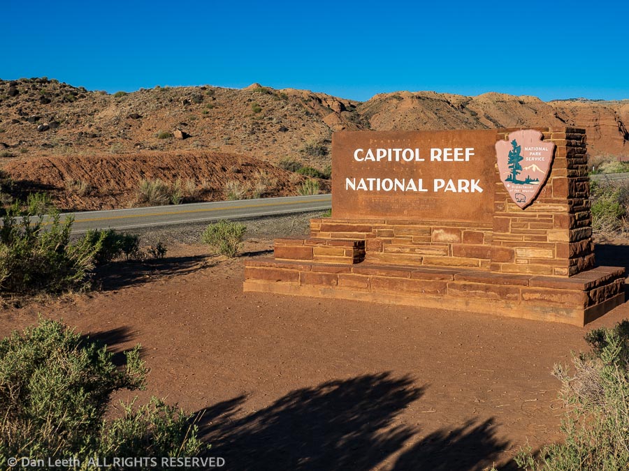
Tomorrow we hook up the trailer and head for Capitol Reef National Park in Utah. Hopefully, the winds calm on the way there. There is one certainty in our future. We won’t be seeing 20+ mpg again in the truck.
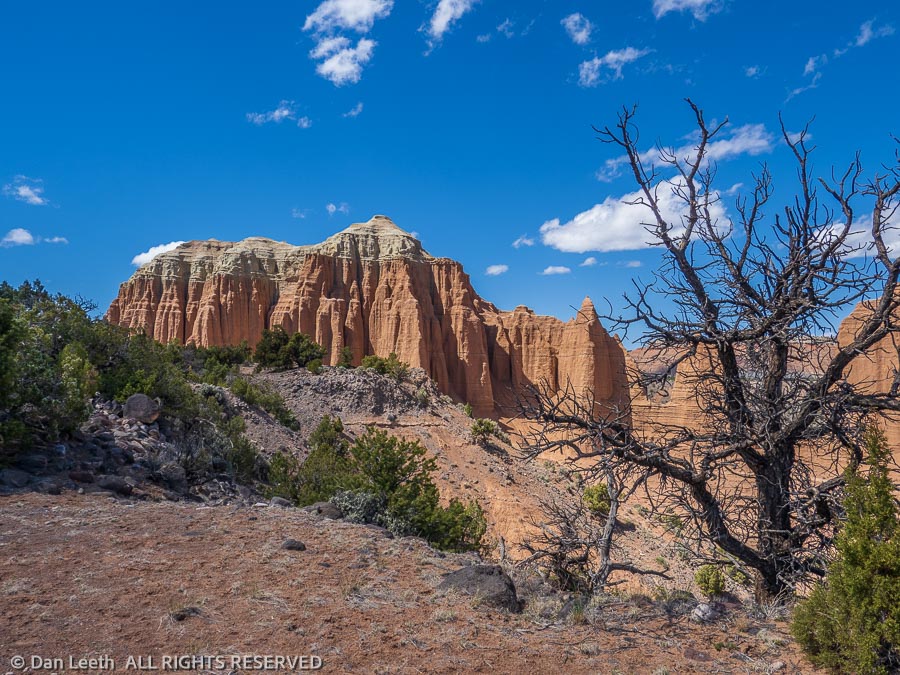
Capitol Reef National Park is a bit of a rarity. It’s a popular park that still allows one to camp for 14 consecutive days. That’s exactly what we did.
Getting a camping reservation, however, was a bit of a challenge. When sites became available exactly six months ahead of our chosen date, our first-choice site was not available. Instead, we got an end site directly across from the dump station.
A large open lawn giving us plenty of sun for the solar panels and a direct line of sight to the dump station provided hours of people-watching entertainment. Yes, there are a lot of newbies out there who don’t yet know what they’re doing.
Our friends who joined us at Robb State Park in Fruita, Colorado, joined us for various lengths of time at Capitol Reef. That meant lots of hiking.
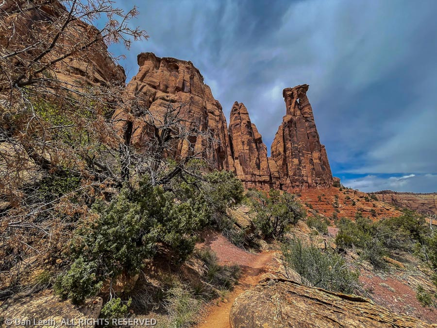
The first day, we did a 10-mile hike to the Navajo Knobs. The trail shares a trailhead with the route to Hickman Natural Bridge, one of the most popular hikes in the park. Much against the wishes of one member of our group, we made a 7:30 a.m. departure. We arrived to discover the trailhead parking lot was already a quarter filled. It would be overflowing in an hour.
We avoided any parking problem on our second day by hiking the Cohab Trail which starts directly across from the campground. Four of us just did an out-and-back hike to where the trail ends at the highway into the park. The other four broke off onto the Frying Pan Trail and continued to Cassidy Arch and down into Grand Wash. Providing Uber-service, I drove around to their take-out point that afternoon and gave them a ride back to camp. They didn’t tip.
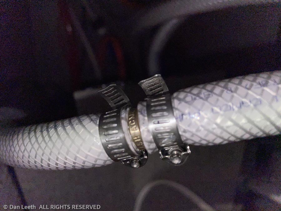
Our third day was spent doing plumbing repairs. A pipe from the water pump began leaking, so Dianne and I drove 28 miles to the nearest hardware store in Loa for parts. Back at the trailer, I loosened my pants to show lots of plumber’s butt and repaired the problem. That night we celebrated one member of our group’s birthday at the Broken Spur Restaurant in Torrey.
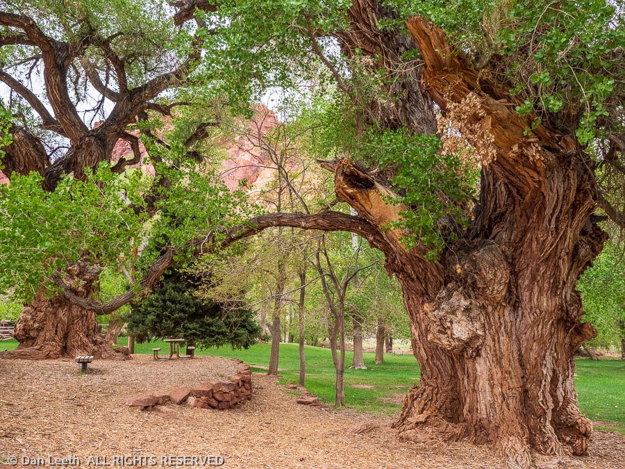
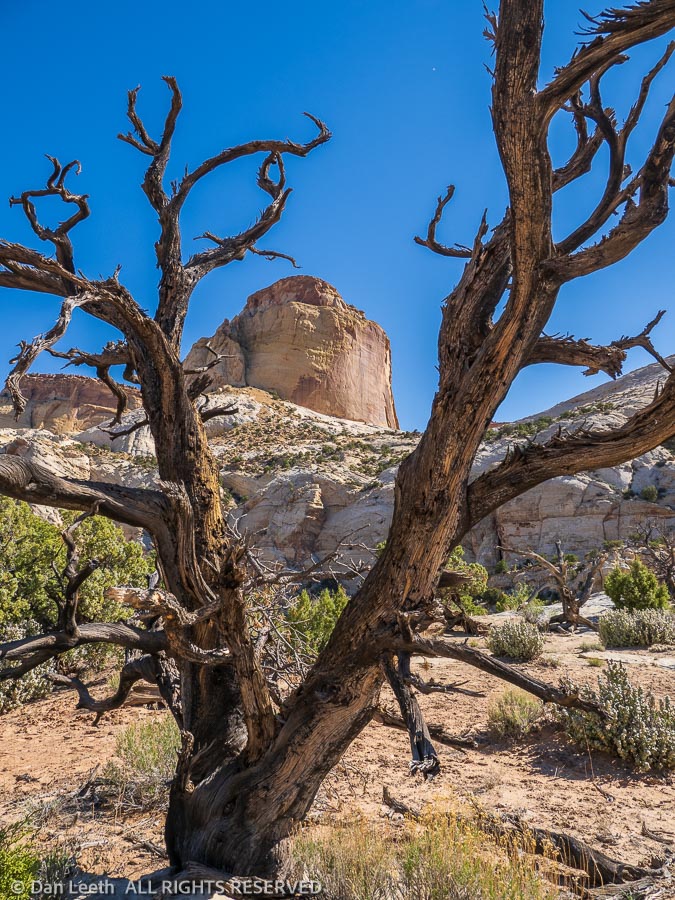
Lousy weather made the next day a rest day with only a three-mile walk to the park’s visitor center. An information volunteer there gave us details about one of our proposed hikes, Sulphur Creek. With an unavoidable plunge pool on the route that required swimming across, we struck that hike off the list. Back at camp, we walked over to photograph some giant Fremont cottonwood trunks in the soft, overcast light. No image can capture the magnificence of these historic trees.
The next hike was on an abandoned trail behind a formation known as the Castle. Requiring a lot of trail finding over fallen rock, it was easy to see why the park chose to cease maintaining the route. We only saw four other people on the trail, the fewest we had yet encountered.
I’ve been to Capitol Reef perhaps a dozen times or more over the years. This was the most crowded I’ve ever seen. Dianne met a guy in line for pies at the Gifford House who worked for the Forest Service. He told her that nationwide, there are 7½ million new campers out this year. Many of them, no doubt, were at the park.
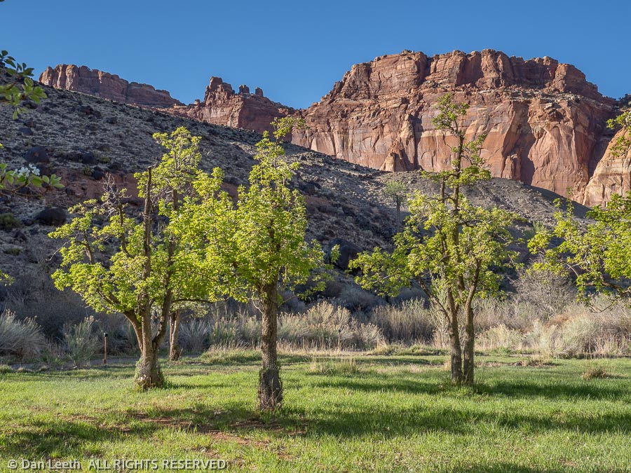
Capitol Reef National Park has three distinct sections. The main one, the one that those 7½ million new campers are heading for, is the historic Fruita section. This is where the historic buildings, orchards, main campground and scenic drives are located.
To the north lies the Cathedral Valley section, which one member of our group wanted to see, and another was willing to visit as long as he didn’t have to drive his own truck there. They all piled into one vehicle with Dianne and me following in ours.
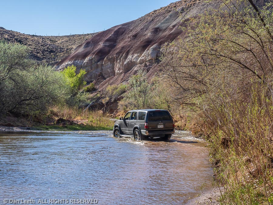
The Cathedral Valley road is graded gravel, rough in spots and highly washboarded otherwise. The loop route begins by fording the Fremont River, which was about hub-deep on our vehicles. This is not a route for grandma’s Buick.
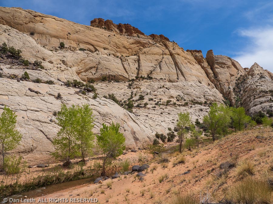
We did the loop route with several short hikes to viewpoints along the way. When we got back to camp, we discovered that the tonneau cover on our pickup bed had slid off to one side. The next morning, I got to take everything out of the bed and make repairs. We followed that with a short hike up the Fremont River Trail in the afternoon.
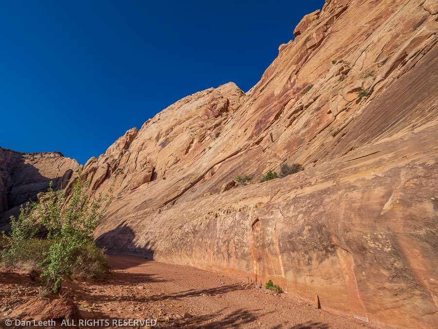
Our last hike with friends was to the base of the Golden Throne formation followed by a walk down Capitol Gorge to the park boundary. Along the way, we passed the Pioneer Register, a sandstone wall covered with historic Mormon graffiti, and a side canyon filled with the potholes that earned the geologic uplift it’s Waterpocket Fold moniker.
With our friends heading for home, Dianne and I did what we had been longing to do. We took a day off and did nothing. And we did it well.
There are three immensely popular hikes in Capitol Reef – Hickman Bridge (which we did on our last visit), Capitol Gorge to the graffiti wall and Grand Wash.
To make sure we got our full dose of humanity, the next day we hiked Grand Wash. We did it from the bottom up, beginning where it ends at the state highway. With an early start, we largely had the canyon to ourselves. That ended as we approached the upper end.
Now, don’t get me wrong. I like people. I’ve hung around them all my life. I even married one. I should be glad to see hundreds and hundreds of people enjoying our national park gems. Hopefully, they will be inspired enough to support the efforts being made to protect more of our public lands.
But there are times when Dianne and I just want to get out and enjoy the landscape on our own. We want to listen to wind rustling tree leaves, not country-western tunes from a hiker’s boombox. We had that opportunity with a hike down Pleasant Creek.
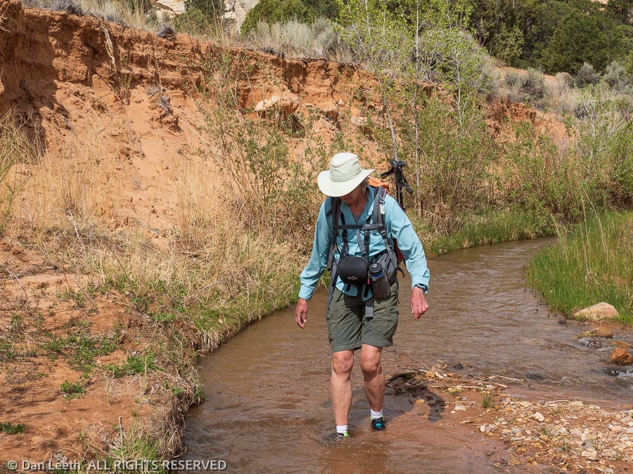
There’s no trail down Pleasant Creek. There are simply hikers’ routes through a wide canyon with a permanent stream. Cliffs by water’s edge make crossing the creek a necessity. Later in the season, it may be possible to rock-hop across in places. With the spring runoff still coming down, we had to wade through ankle-deep water 21 times each way. We hiked in tennies for just that purpose.
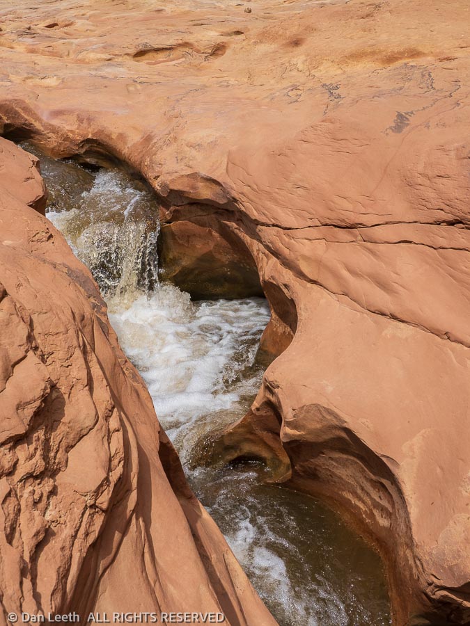
Covering 9¼ miles, out and back from the trailhead to the park boundary, we saw absolutely no one. In one place we passed a chute where the creek formed a Jacuzzi tub in the sandstone. If it had been a warmer day, it would have made a great skinny-dipping hole.
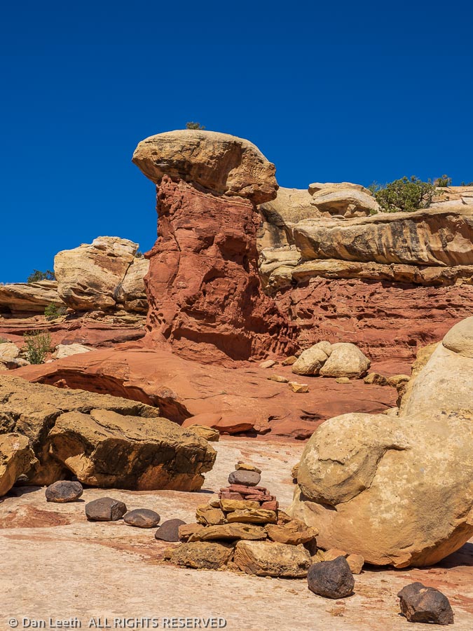
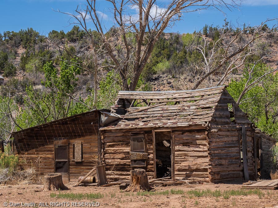
After a day spent grocery shopping in Loa and doing laundry in Torrey, we spent our final Capitol Reef day driving the Notom-Bullfrog road into the third portion of the park – the Waterpocket Fold section. We explored a few side roads where we photographed cliffs, hoodoos and abandoned cabins. We turned around at the park’s Cedar Mesa primitive campground.
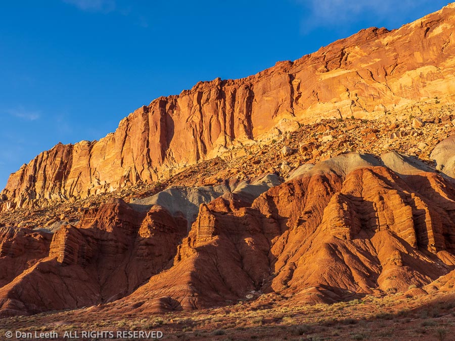
That evening, we drove down the park’s Scenic Drive, passing cliffs glowing in the light of the setting sun. Other than a few cars exiting the drive, we saw no one. It provided a glorious end to a two-week stay in my favorite Utah national park.
There aren’t many places in southern Utah canyon country I haven’t visited. I found one today.
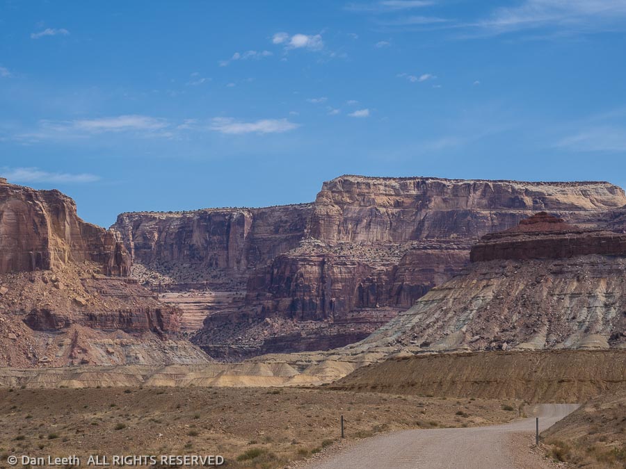
Years ago, I picked up a free booklet touting sights to see along the San Rafael Swell, a sandstone anticline west of Green River. We’ve cut across the Swell countless times on Interstate 70, stopping at numerous viewpoints to admire the terrain and the pit toilets. We were always on our way to somewhere else, so we never had time to get off the highway and explore what’s out there.
After leaving Capitol Reef, we had planned a three-night stop at Goblin Valley State Park. When no sites were available at Goblin, we booked a site at Green River State Park. We finally had an opportunity to visit the Swell.
Our chosen route was up a series of gravel roads that began at I-70’s exit 131. In the finest Utah tradition, the road surface was seriously washboarded. Fortunately, none of our tooth fillings fell out as we vibrated up the roadway.
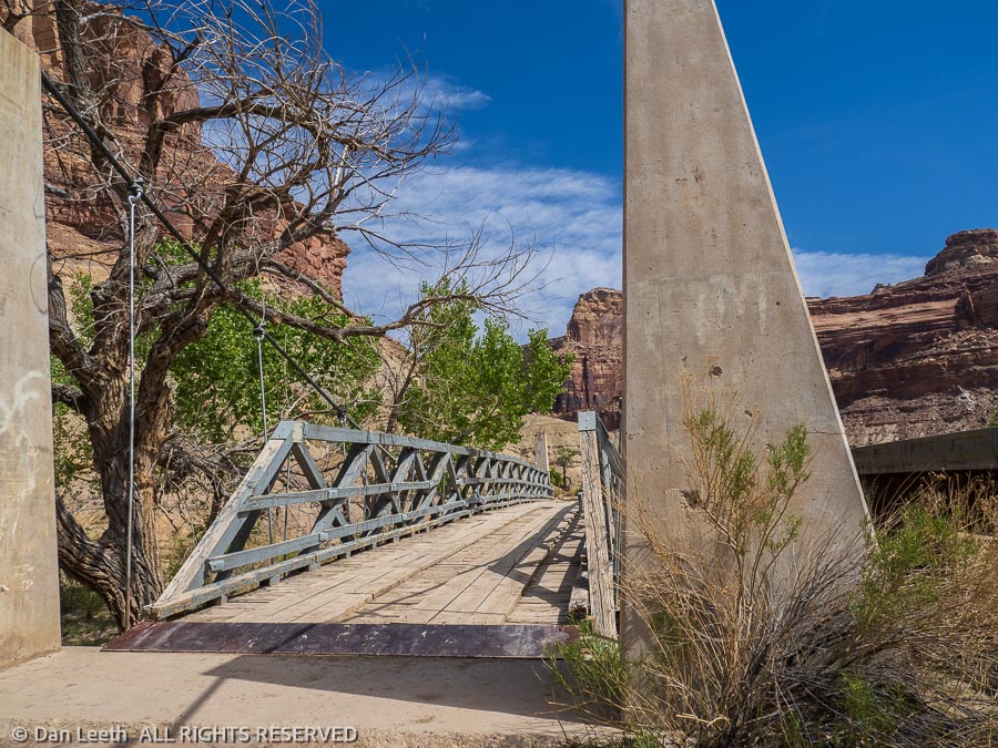
After numerous stops to ogle the scenery and water the plants, we reached the old “Swinging Bridge” across the San Rafael River. It may be a cable bridge, but it didn’t really swing. It’s closed to motor traffic now, but maybe it did back in the day.
We would have enjoyed the bridge more, but the area soon became overrun by an infestation of third graders on a school field trip, each trying to out-shout his or her schoolmate. Adding to the din were a gaggle of teachers futilely shouting “don’t do that” commands to the kids.
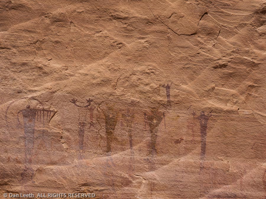
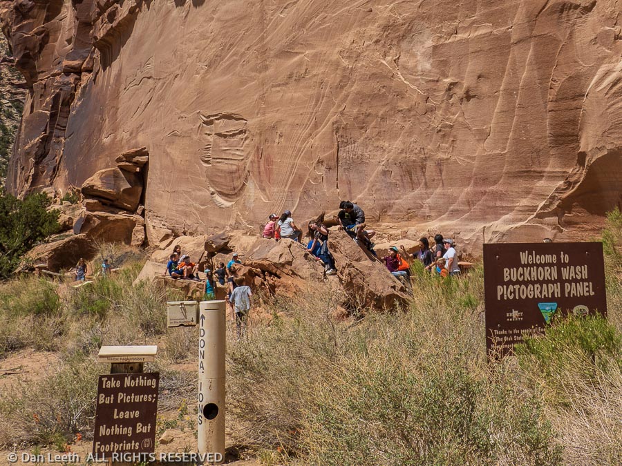
With the false assurance that they would be there most of the day, we took off to our next objective – the Buckhorn Pictograph panels. Here, members of the Barrier Canyon culture painted figures on the sandstone that have endured for perhaps a thousand years or more. I only wish Sherwin-Williams paint lasted that long.
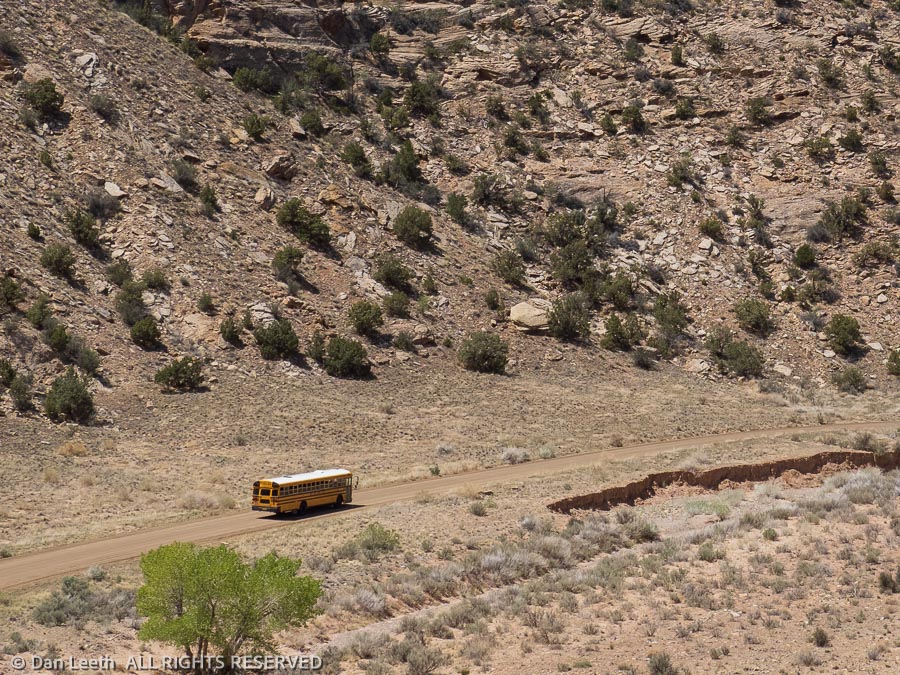
As we examined the artwork, the unthinkable happened. We saw a large, yellow bus approaching. The school kids had arrived and were soon swarming over the site. With the promise from the bus driver that their next stop would be nowhere near ours, we evacuated the area and fled up the road.
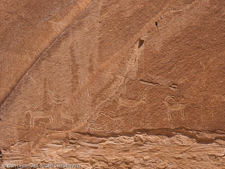
A small, BLM (Bureau of Land Management, not Black Lives Matter) sign beside the road alerted us to another rock art site – this one largely consisting of petroglyph figures pecked into the rock.
As we examined the site, I saw the bus pass us on the road below. Thankfully, they didn’t stop.
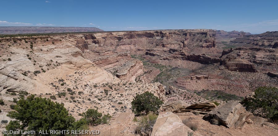
Our next stop was the Wedge Overlook. Here, the San Rafael River cuts through the uplift forming a deep canyon that local folks like to call the Little Grand Canyon. We ate our lunch atop the canyon rim, wishing we had something better than midday light to photograph the grandeur spread below.
Reaching Utah Highway 10, we made drive-through examinations of Huntington and Millsite State Park campgrounds. We then turned toward our final planned stop – the Rochester Creek petroglyph panel.
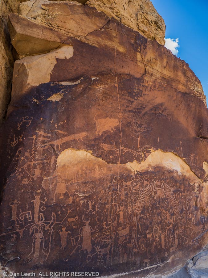
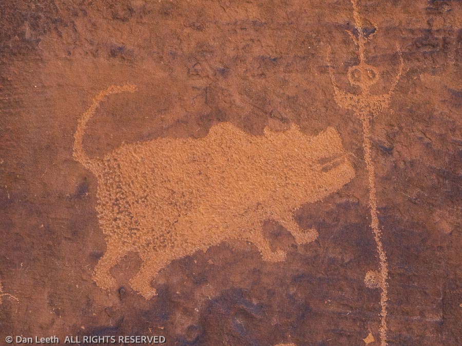
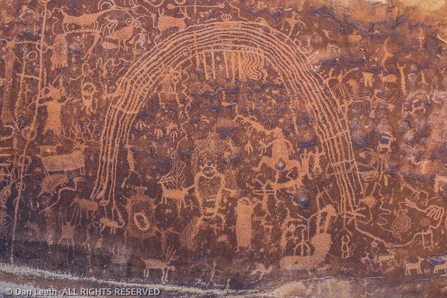
Over the years, I’ve seen hundreds of petroglyph sites where prehistoric peoples have pecked figures into the rock. I have never seen anything like this.
There were the usual drawings of hunters after bighorn prey. There were depictions of identifiable animals and some that could have come straight from a horror film. There were the commonly seen figures that X-File folks might say depict extraterrestrial visitors from another world. Arcing over many of the pecked drawings were a set of curving lines that could have easily represented a rainbow.
With the exception of what looked like a couple of bullet holes along with the names and initials of a few vandals from decades ago, the site was largely unmolested.
We returned to the interstate to make the 70-mile drive back to Green River. From here to “home” it was all familiar territory. Stopping at Ray’s Tavern in downtown Green River, we ended the day with burgers and brews. No third graders in here.
Next stop was a five-night stay in Canyonlands National Park. Like the porridge Goldilocks sampled in the three bears’ den, Canyonlands is divided into a trio of distinctly different districts.
There’s Island in the Sky, which lies across the street from Arches. With its proximity to Moab, that’s where most visitors go. It’s a beautiful place to visit if you like lofty canyon views that extend forever.
Then there’s the Maze, which requires a serious 4×4 vehicle or a river raft to get in. We bent a tie rod on our old truck when we visited the area a few decades ago. Needless to say, few make it to the Maze.
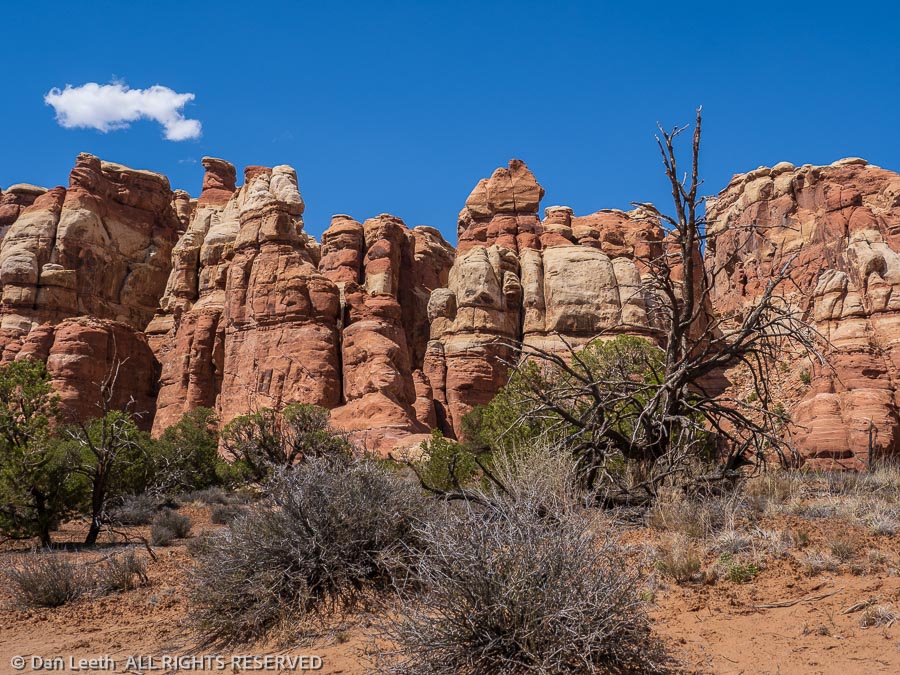
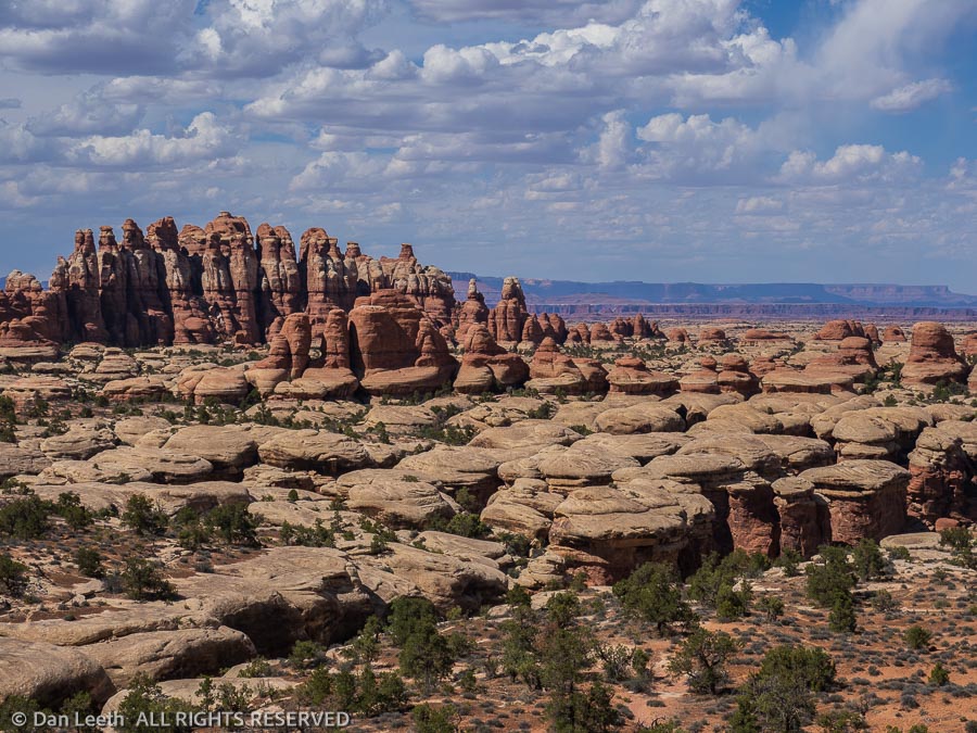
For our Goldilocks “just right” tastes, the Needles District was the perfect destination. Offering little more than rocks and ravines, it is largely visited by folks like us who want to lace up hiking boots and explore slickrock country.
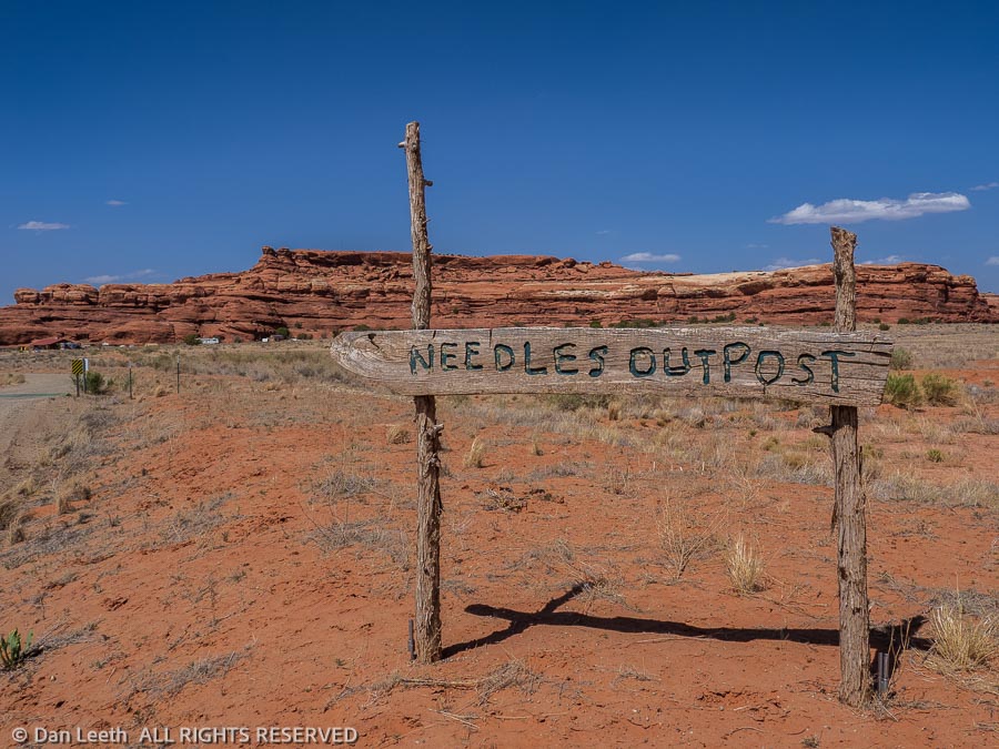
We tried to get reservations in the park’s small campground, but all of the reservable sites were taken for the dates we needed. So, we did the next best thing. We reserved a site in the Needles Outpost, which lies just outside the park boundary.
Privately owned, the Needles Outpost is a commercial campground without most of the usual, RV park amenities. There are no electrical, water or sewer hookups. There’s no dump station, no wi-fi and no cable TV. Roads may have some gravel, but the sites are just good ol’ Utah sandstone-country red dirt. There is a flush-toilet restroom with showers ($3 for five minutes) and a small convenience store selling water, ice and if you’re lucky, fresh-squeezed lemonade.
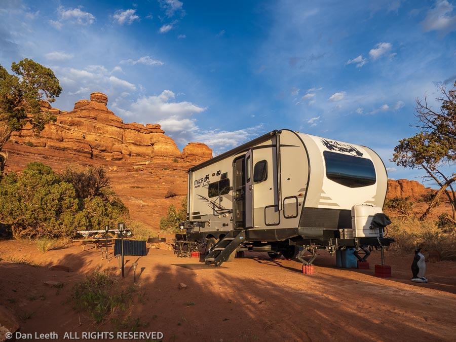
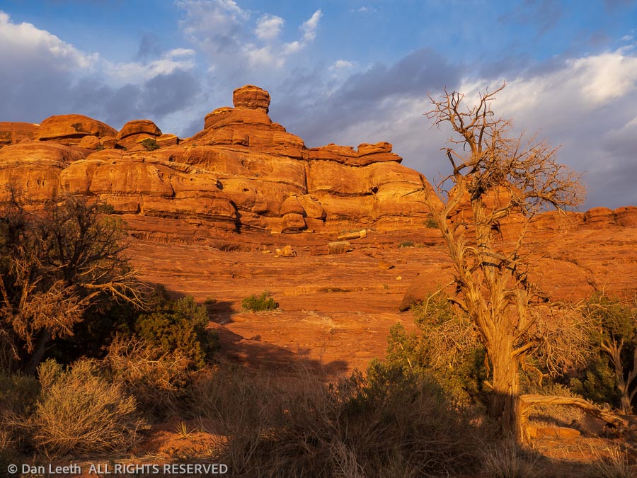
What the campground lacks in amenities, it more than makes up for in beauty. We camped beside juniper trees and towering sandstone walls. Instead of watching the sunset in the western sky, we looked to the east and watched as the last crimson rays of day ignited the rock into glowing shades of flaming orange.
Unfortunately, the site is open to the west and when the wind blows, everything in camp gets caked with that good ol’ Utah sandstone-country red dirt. Dianne had to work overtime trying to keep the inside of the trailer clean and keep the flying grit out of meals cooked outside on the grill. I think I’ll keep her around for another 40 years.
Other than buying $30 t-shirts at the Visitor Center, there’s not much to do at the Needles but hike. The park brochure lists four “short” hikes and eight “strenuous” hikes.
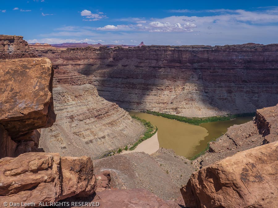
We, of course, did the shorties on our “days off.” It was a pair of the strenuous hikes that filled our dance card. The first was a 10-mile hike (11 for us) to the Confluence Overlook where the Green River meets the Grand to form the mighty, canyon-cutting Colorado.
Yes, I know it’s really the Green meeting the Colorado. The Grand River lost its given name when the Colorado legislature, in a fit of self-righteous vanity, petitioned to have the stream that flows through Grand Lake and Grand Junction renamed the Colorado.
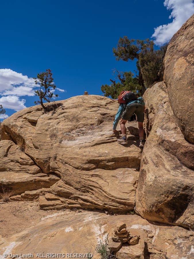
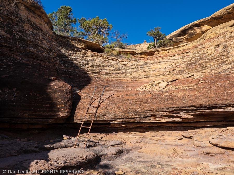
In mountaineering terminology, the hike to the Confluence was “interesting.” It wasn’t so much a trail but rather a somewhat arduous route. We followed cairns, picking our way down the walls of one steep canyon and up the other side, depending on the friction of our boot soles to hold us on to steep slabs of sandstone. In one place where there was no other option, the Park Service bolted in a steel ladder.
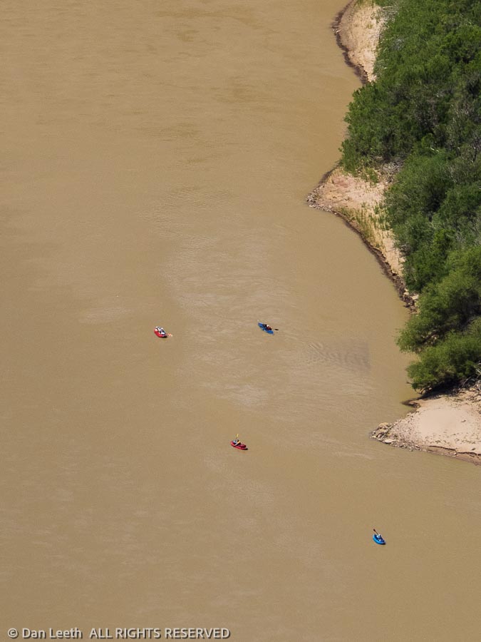
We crossed another canyon followed by two more shallow valleys before reaching our objective. There, a thousand feet below us, the Green River met the Grand (Colorado).
A century and a half ago, John Wesley Powell and his men floated through. Today, we saw four tiny kayaks paddling downstream.
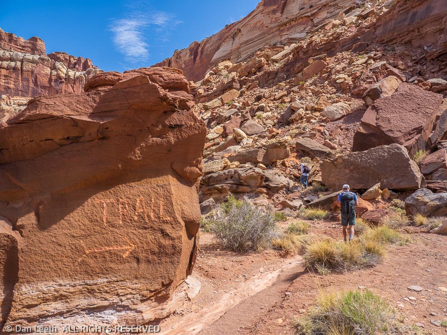
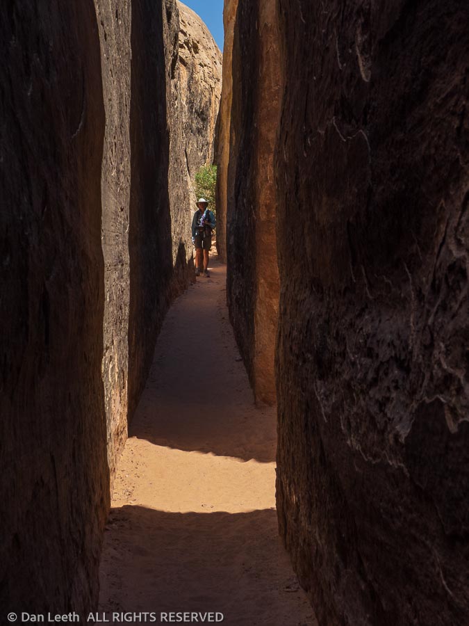
Our second strenuous hike was to a place known as the Joint. This is a quarter-mile-long, two-foot-wide slot between two massive sandstone slabs.
Getting there took us through 11 miles (12½ miles for us) of beautiful sandstone canyons in the needles section of the Needles District. While slightly easier than the Confluence trail, the terrain still required a lot of cairn following and friction climbing. The beauty made it all worthwhile.