Last time we visited Petrified Forest National Park, one of the rangers asked if we wanted to hike trailless routes in the backcountry. We answered to the affirmative and she let us borrow a Xerox-copied booklet of off-the-beaten-path hikes. We chose the First Forest hike and had a delightful time getting away from the hoards. We planned on doing more of these back-of-beyond hikes on this visit.
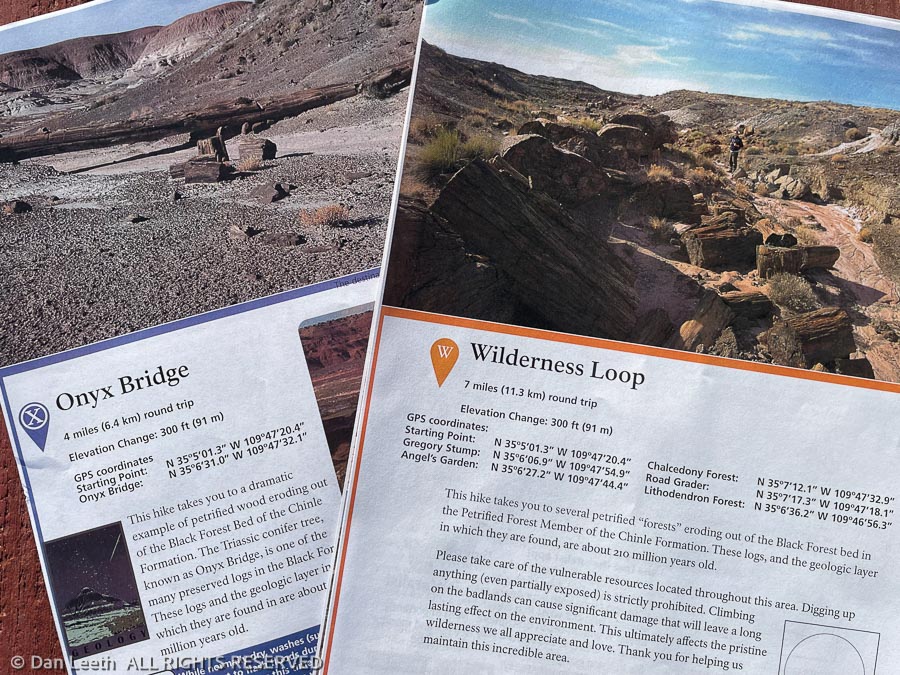
Checking in at the Visitor Center, we discovered that since Covid, they no longer hand out the booklets. Instead, pages covering individual hikes were available from the information desk rangers. I wanted to do a hike in the Painted Desert portion of the park, so we got packets covering the seven-mile Wilderness Loop hike and the four-mile Onyx Bridge hike.
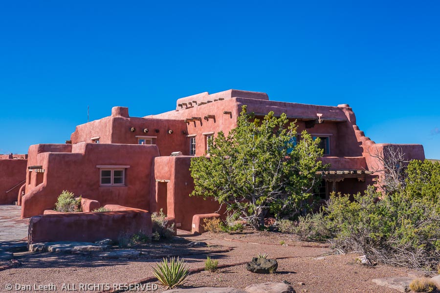
The original plan was to do the Wilderness Loop hike, but with the wind kicking up, we opted to do the shorter Onyx Bridge hike. We drove out to the trailhead at the old Painted Desert Inn and set off down the trail at the crack of 10:30 a.m. in the morning.
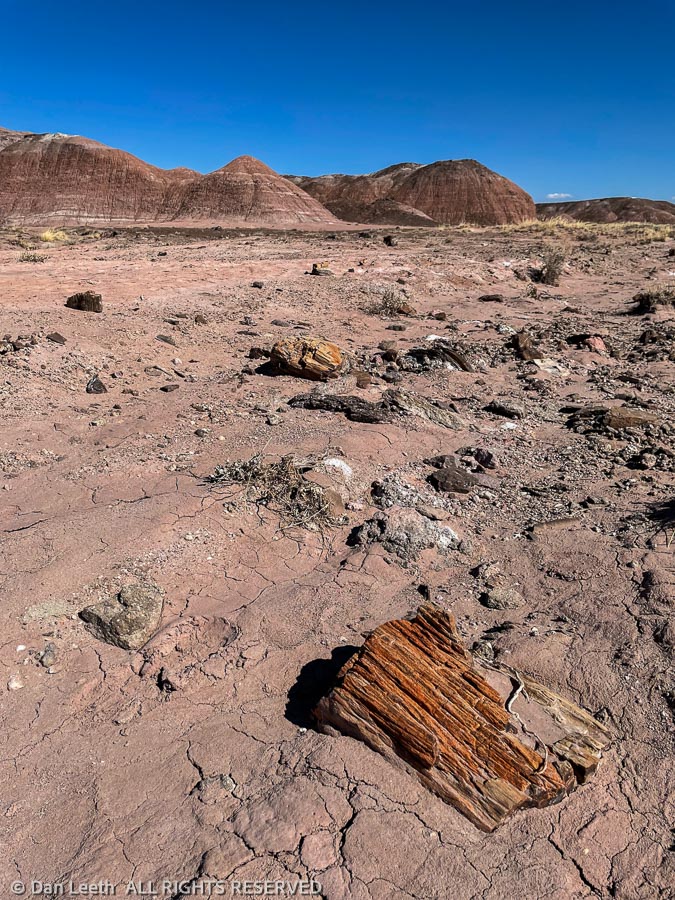
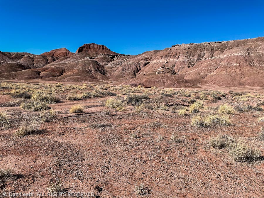
The route drops 300 feet off the rim, passes by some old bridge abutments built in the 1920s, then cuts across the desert flats toward a distant butte. There’s no trail, only the occasional footprints to follow. We had the place virtually to ourselves. The only other hikers we saw on our way in were an elderly man in a yellow shirt way out ahead of us and a pair of backpackers who passed us on their way back up to the trailhead. The descriptions in the handouts were vague enough to keep us on our toes, and although we went a bit farther than the indicated distance, we had no trouble finding our objective.
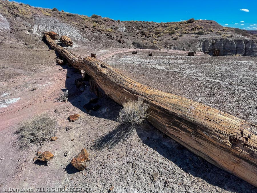
Onyx Bridge is a twenty-foot long petrified tree trunk lying across a dry wash bed. A large assortment of petrified logs lay nearby. We found a semi-sheltered spot out of the wind to eat our lunch. From here, it was a two-mile slog back straight into an ever-increasing wind. It was miserable.
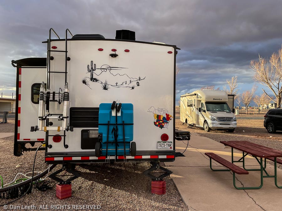
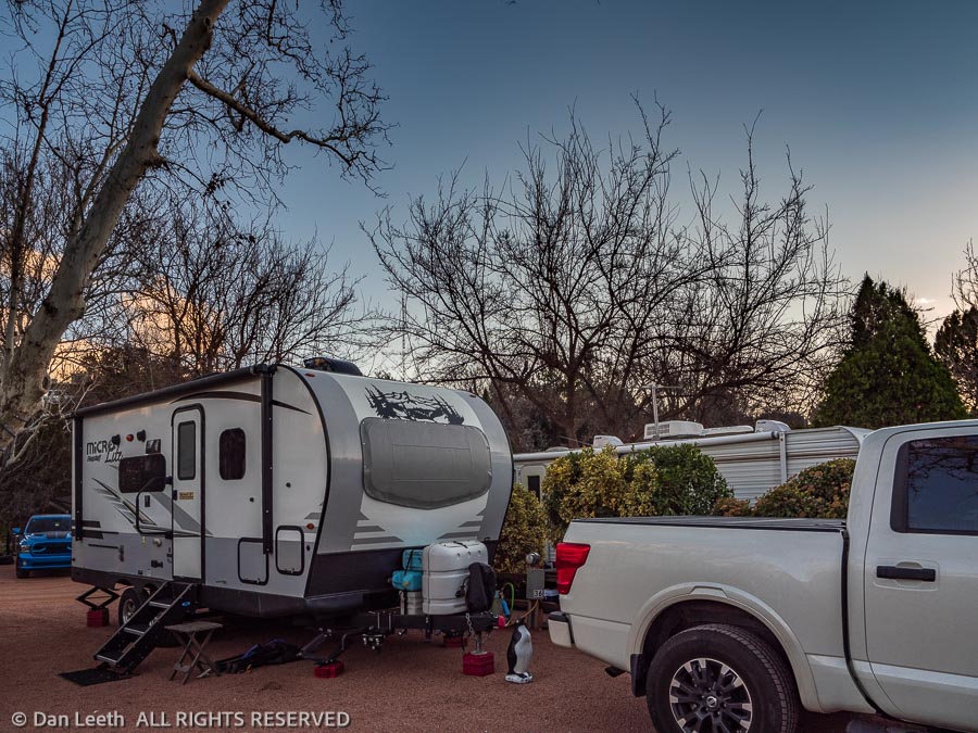
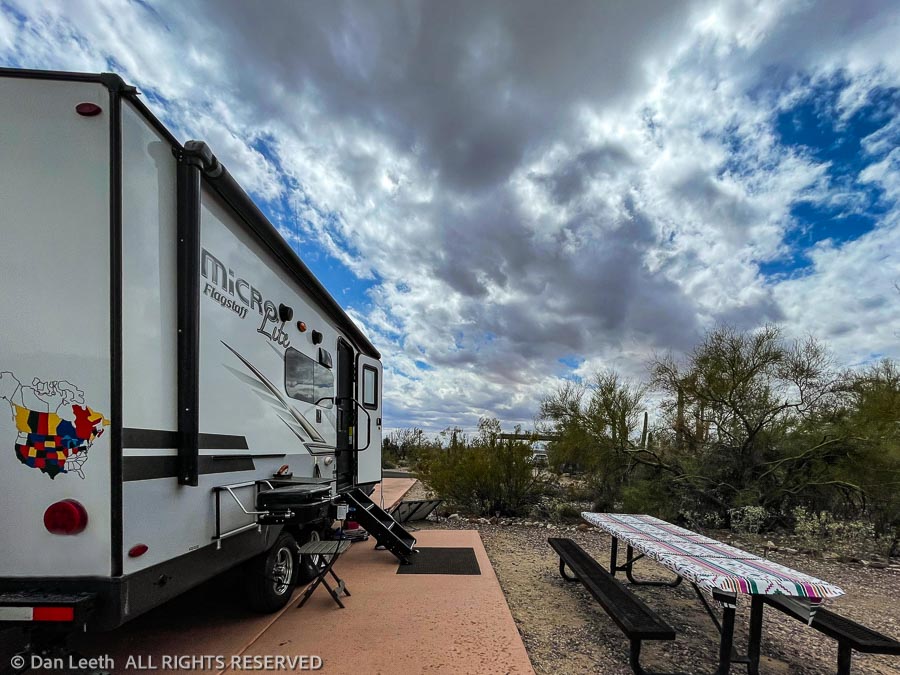
Back at our RV site in Holbrook, we had a decision to make. The wind howled with gusts of 45 miles per hour. The slideout topper (a short awning over the top of the slideout) on a neighbor’s trailer had ripped apart. Our slideout topper was whipping back and forth, threatening to become airborne. Figuring a night in a motel was cheaper than replacing the slideout awning, we considered pulling the slideout in and spending the night at the nearest Super 8.
Fortunately, with evening approaching the wind began to die down and we nixed the motel idea. With similar winds predicted for the following day, we decided to try finding an alternative place to camp. With a little effort, we landed a spot at the Zane Grey RV Village down in Camp Verde, a small, central Arizona town in the Verde Valley not far from Sedona. We would catch some rain, the RV park attendant said, but winds weren’t bad down there. Setting the alarm for an early departure, we hoped to get out of town before the winds kicked up again.
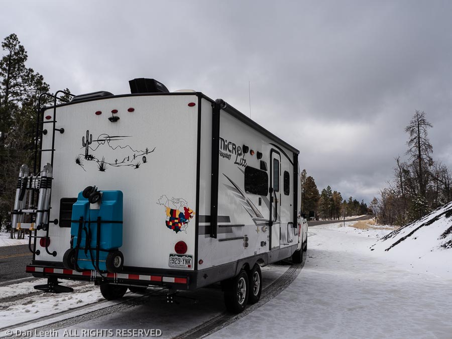
Holbrook sits in a high, flat, treeless plain at 5,082 feet above sea level. Camp Verde, our escape destination, sits in a semi-forested valley 3,147 feet above sea level. Between the two lies the Arizona high country where desert dwellers like my grandmother head to escape the summer heat. Here, we experienced wet roads and fresh snow. I wondered what passing motorists thought when they saw two adults with Colorado license plates standing beside the highway shooting pictures of snow.
Leaving our RV park site in Holbrook at 8:00 a.m. was both good and bad. On the positive side, we did manage to escape the gusting winds scheduled to hit later in the day. On the negative side, we arrived in Camp Verde two hours before we could check into our campsite at the Zane Grey RV Village. The attendant was adamant that because of low-hanging tree branches, nobody was allowed to park their rigs without a staff member directing them, and that doesn’t happen until after 1:00.
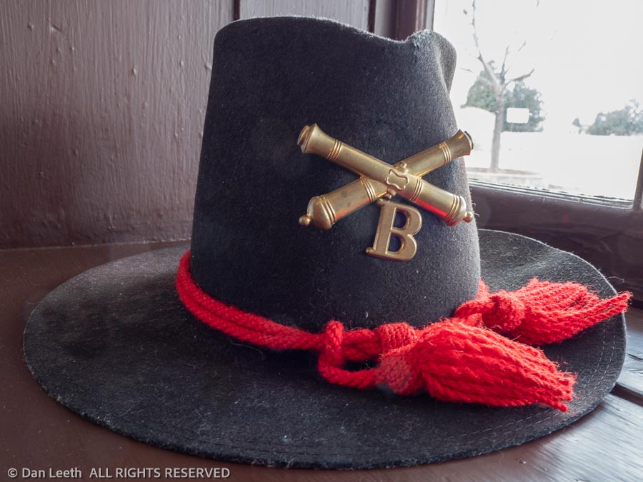
With time to kill, we went into town intending to do one of two things. We would either have a two-hour lunch somewhere or we would go tour Fort Verde State Historical Park. The park won out.
The historical park preserves the remains of Fort Verde, a military post built back in Arizona’s territorial days. Several of the original buildings still survive, and the park features a small museum with artifacts and displays covering the days when soldiers fought Indians. On this cool, wet, early season day, we had the place virtually to ourselves.
Departing the park, the lunch option hit. Using Google, Dianne found the only Mexican restaurant in town, where we sat down and enjoyed chips, salsa, margaritas and burritos. Then it was off to the RV park where with the help of the parking attendant, we cleared by mere inches the leaning trunk of the Arizona sycamore tree guarding our site.
I’m not a lover of RV parks, but this is one of the better ones I’ve stayed in. Split-rail fences separate the sites and we’ve got vegetation around us offering a small degree of privacy. Our site is relatively level, and with a tree flush against our dinette window, we can’t see our port-side neighbor. Best of all, the wind isn’t blowing.
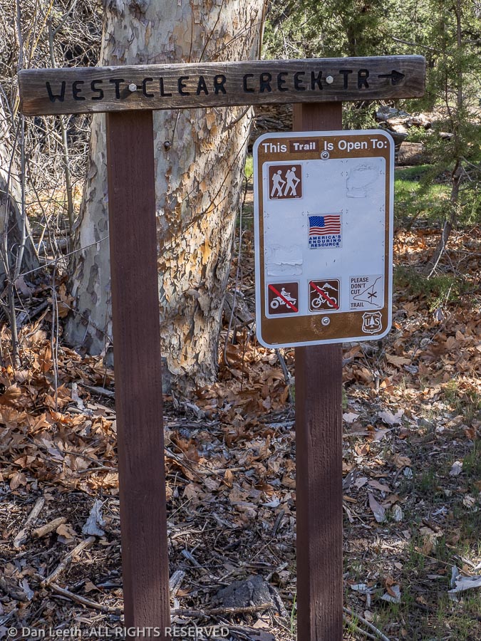
On our one full day here in the Verde Valley, we went on a hike. Our goal was a six-mile hike into a place called Blodgett Basin. Somehow, we missed the trailhead and ended up parked at the trailhead for West Clear Creek. I remember this as being a popular hiking destination from back when I lived in Arizona, so it was a good alternative.
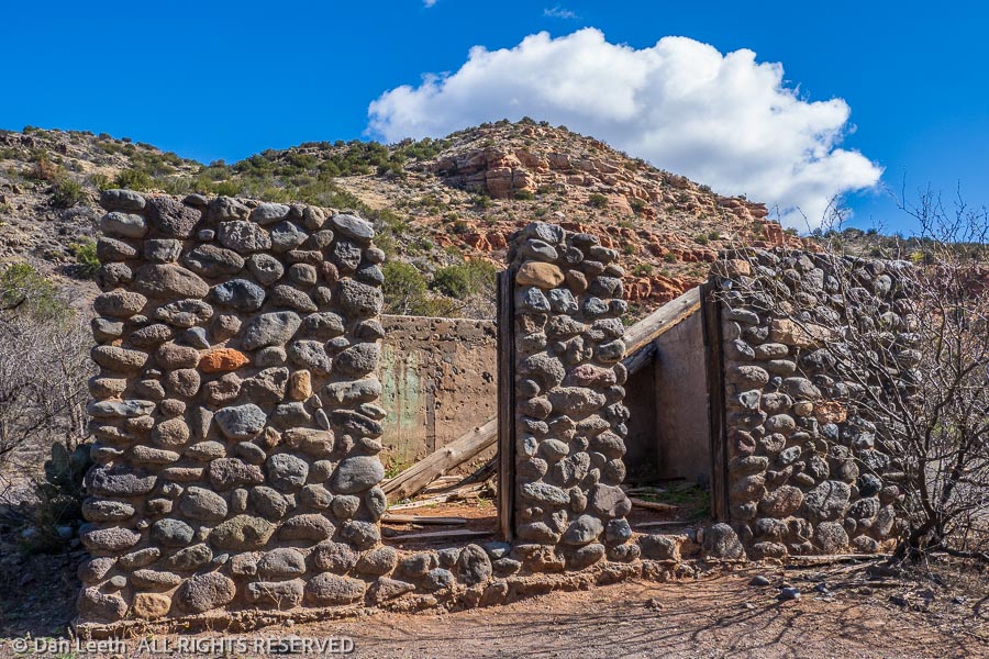
The first part of the hike was across the flats at a wide spot in the lower canyon. A mile from the cars, we passed a stone cabin near the site of the Bull Run Ranch. The cabin had two front doors. In the old days when the Mormons sported more than one wife, their homes would have multiple front doors – one for each wife. Smaller than our trailer, this cabin would have been a bit cozy for a ménage à trois, but at least each wife would have had her own front door.
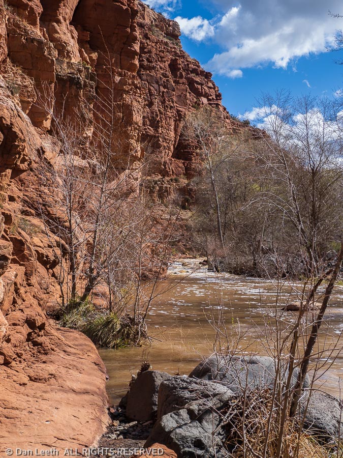
We followed the trail up the canyon. The creek was high with snowmelt runoff. When we got to the trail’s first creek crossing, we turned around. Our planned six-mile hike ended up being a three-mile stroll.
Returning to Camp Verde, we stopped and bought a few groceries. On our way to camp, we stopped at the Rio Claro winery for a tasting. It only cost us a bit over $50 for a five-pour tasting and a bottle of Cabernet Franc.
Back in camp, we enjoyed a lunch of wine (cheap boxed wine, not the good stuff we just bought), cheese and crackers followed by hot showers in the trailer. Tomorrow, we actually go camping for the first time since our trip to Santa Fe. This place is nice, but parking in an RV resort with LED lights wrapping the trees just isn’t “camping.”
After a lazy morning, we hitched up the trailer and headed down the interstate toward Phoenix. Winding our way through endless city traffic, we escaped into McDowell Mountain Regional Park.
We arrived at 12:40 p.m. in the afternoon. Check-in time for campsites is 1:00 p.m. and the gate keeper was adamant that absolutely no one could check into their sites before that exact time. We killed our 20 minutes of wait time at the park’s visitor center where we got a map and suggestions for hikes.
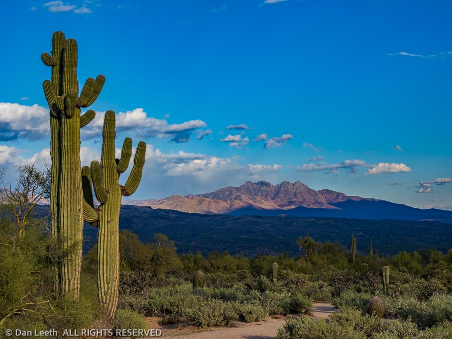
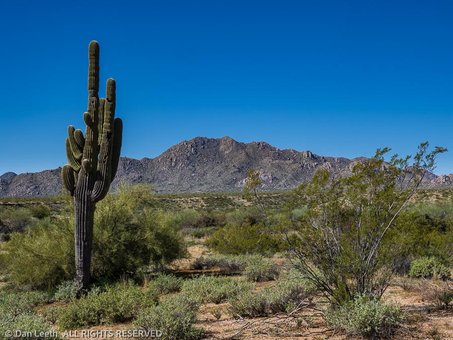
After six nights of bunking in RV parks, it was great to once again be camping with our nearest neighbor dozens of yards away. From our site, we’ve got a great view of Four Peaks, a mountain with a quartet of conical summits across the valley, and Weaver’s Needle, a volcanic monolith in the Superstition Mountains long associated with the Lost Dutchman’s gold mine.
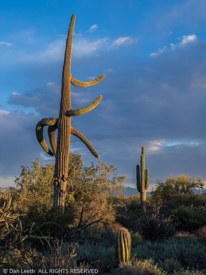
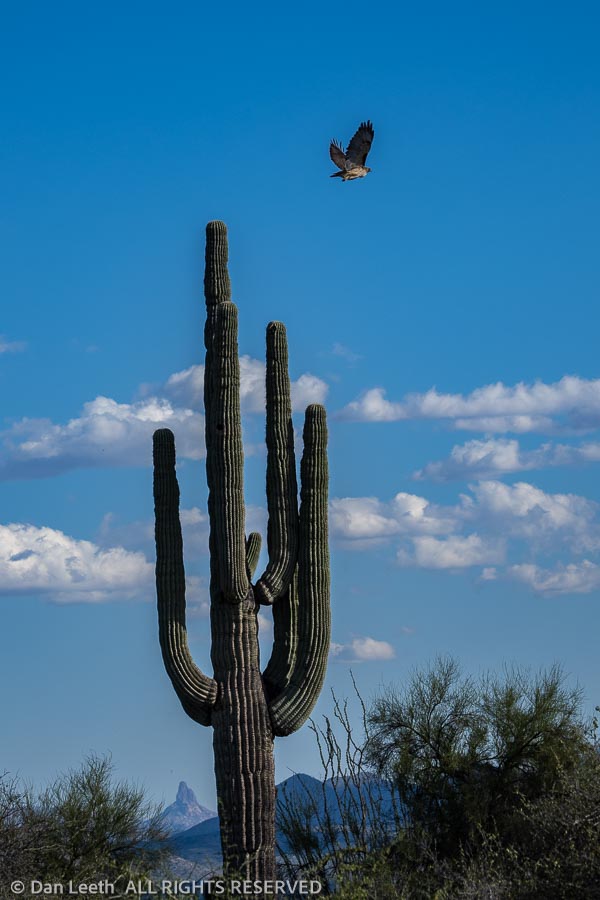
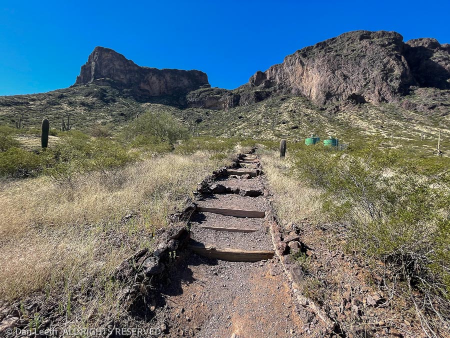
After setting up the trailer and devouring a hot dog downed with beer, we set off on our first hike. This was a three-mile nature walk on the park’s North Trail. We had a brochure explaining what we were seeing at 26 stops along the route. I grew up in the desert and have returned on many trips, so none of this was new to me, but the descriptions in the handout served as a pleasant reminder of the desert’s beauty.
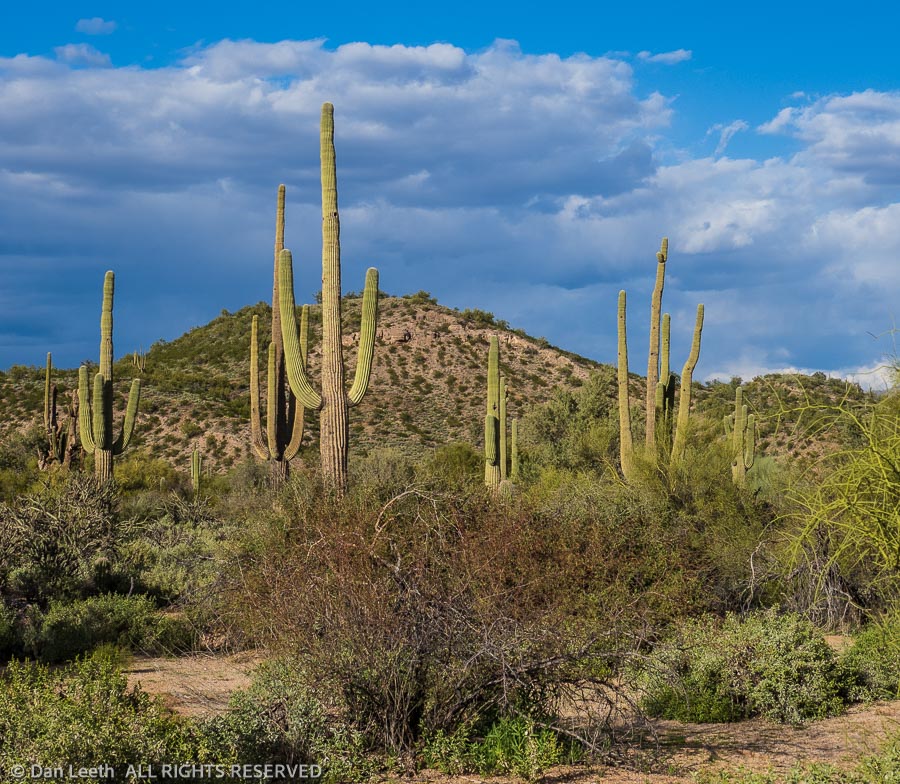
Everyone, I suppose, has their favorite topography. There are three types of landforms that illuminate my soul – rugged mountains, slickrock canyons and the Sonoran Desert.
We’ve got rugged mountains and slickrock canyons near our new home on the Western Slope of Colorado. It felt great now to be camping and hiking in the third of my beloved landforms out here in the Arizona desert.
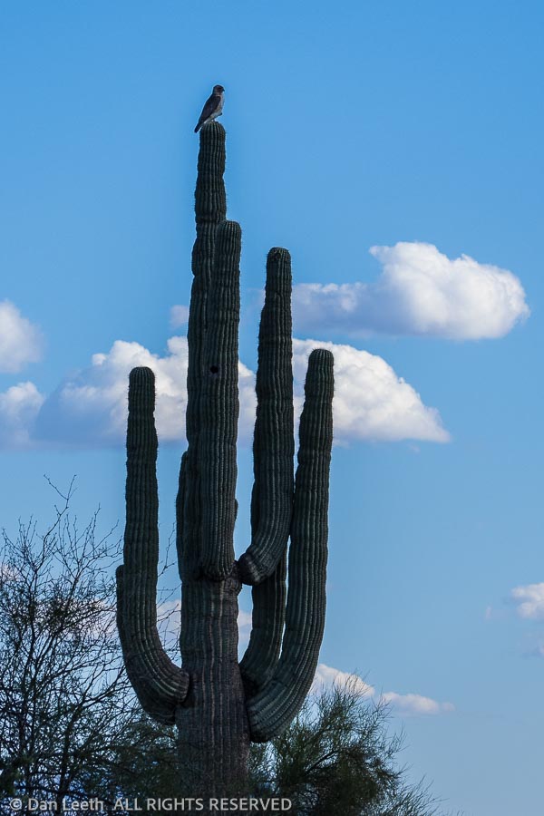
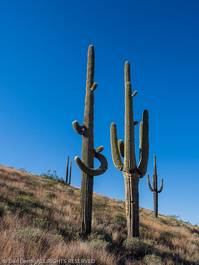
We reserved three nights of camping at McDowell Mountain, and we were determined to make the most of it. Our first afternoon, we hiked the North Nature Trail where we saw a hawk perched atop a saguaro.
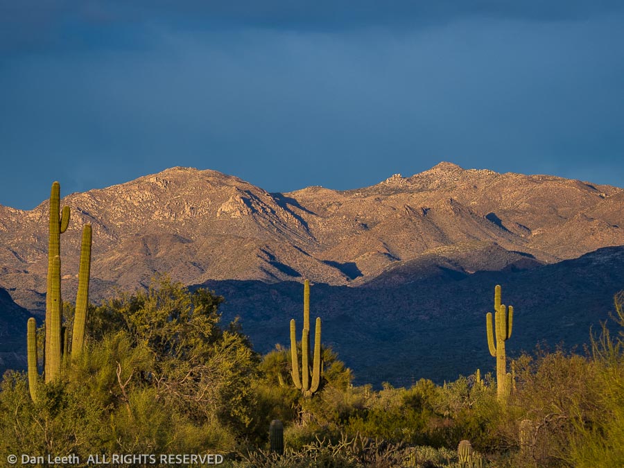
On our second day, we hiked a combination of trails that took us on an 11-mile loop through the northwestern part of the park. The trails remained relatively wide and flat as they meandered through the desert. The scenery was pretty much uniform along the way with the McDowell Mountains ahead, Four Peaks to the east and Weavers Needle to the southeast.
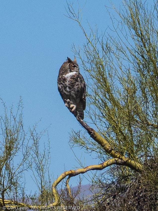
Our top wildlife sighting along the way was a great horned owl perched on a tree branch. That evening, we had a coyote saunter down the ravine behind our campsite. He and his buddies serenaded us that evening with distant yips.
On our third day at McDowell, we hiked what they billed as the “Scenic Trail.” It offered the same scenery as before, but just from a slightly loftier vantage point.
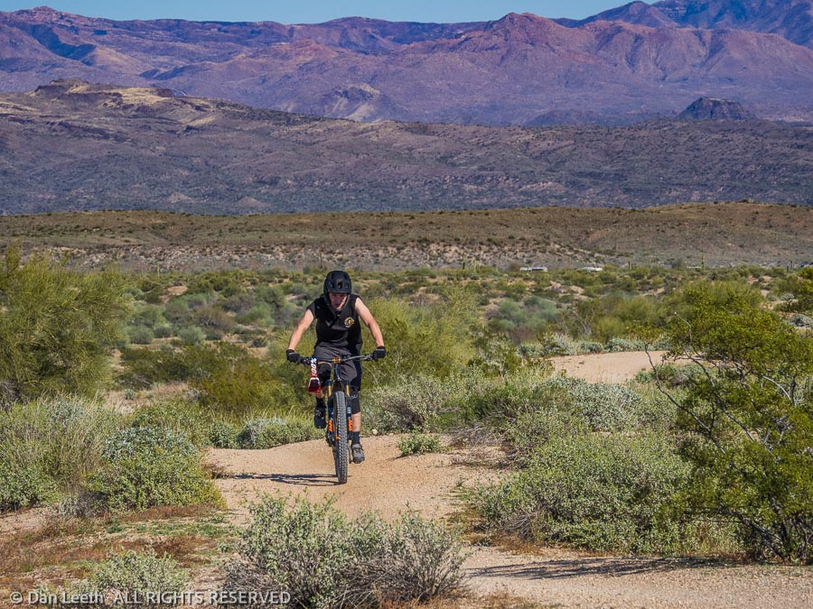
The trails at McDowell Mountain are also open to bicyclists. We must have met at least five mountain bikers (mostly old people) for every one fellow hiker (mostly old people) we came across. Except for a pair of teenage lads (not old people), all were friendly and courteous. An appreciated practice out here is for the lead bicyclist to tell us how many more are following them.
While the bikes weren’t really a problem, they were a bit of an annoyance. In a few weeks, we’re going to appreciate that in the Superstition Wilderness Area behind Lost Dutchman, bikes are banned.
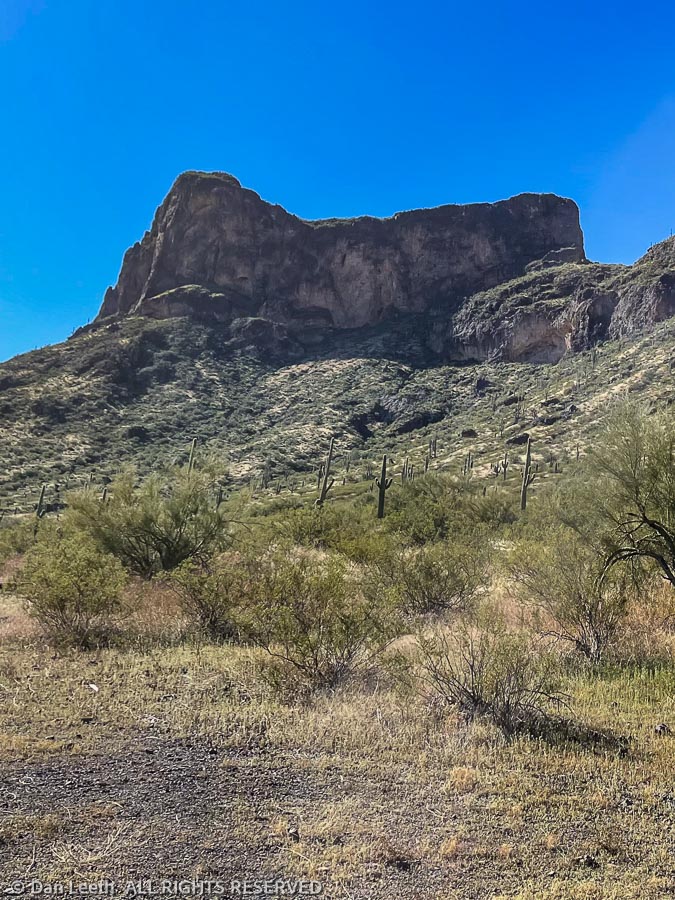
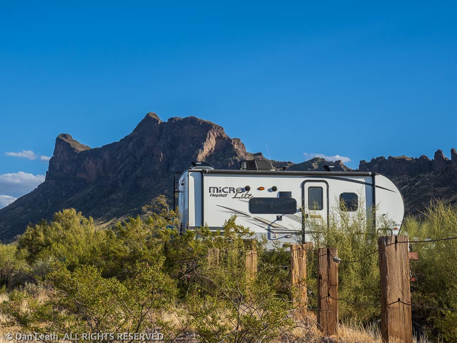
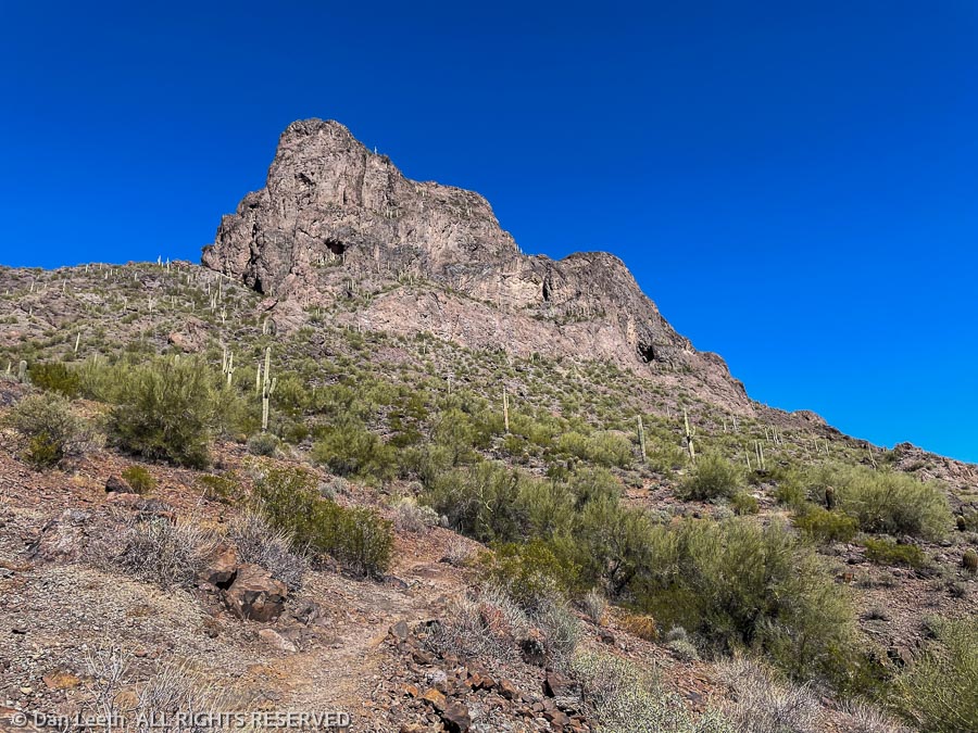
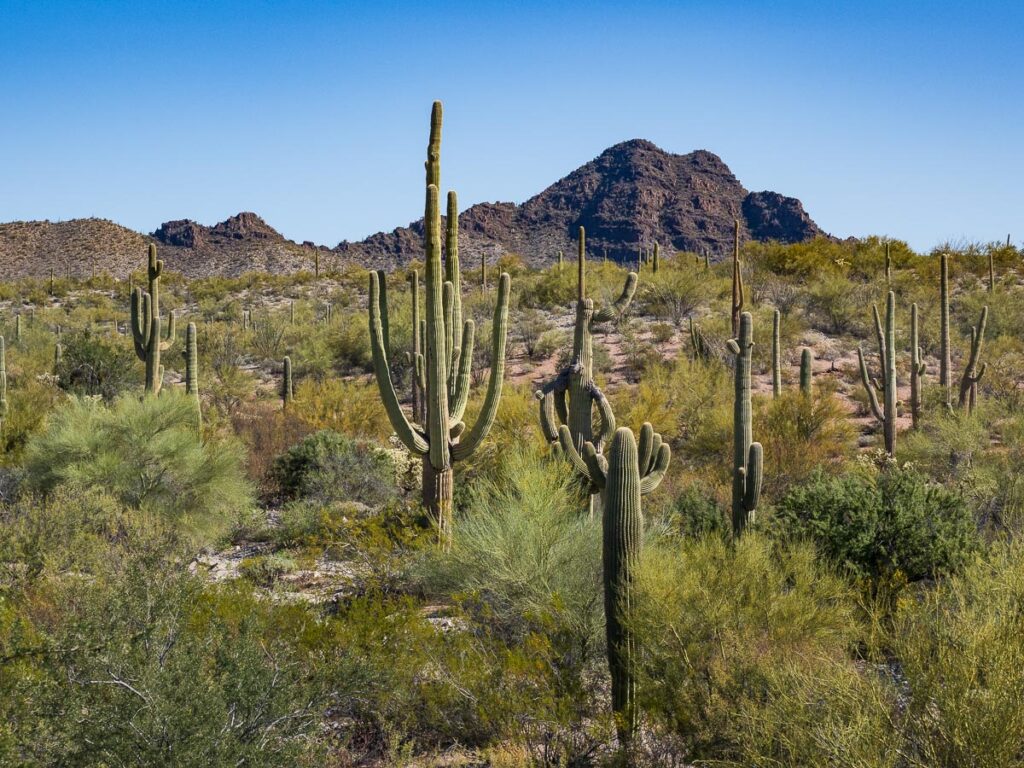
Visit Arizona refers to Picacho Peak as being “the most famous summit in the Sonoran Desert.” This impressive hunk of basaltic and andesite volcanic rock rises nearly 2,000 sheer vertical feet from the desert floor between Phoenix and Tucson. A state park sits at its base where we camped for two nights. On our layover day, we climbed to the top of this seemingly unclimbable peak.
There are two trails leading up the peak. The common route, the Hunter Trail, involves a 1.6-mile grunt up a steep trail that begins near the visitor center. The other route up is the three-mile Sunset Trail, which leaves from a picnic area not far from the campground. We decided to make a loop of it. We would walk 1½ miles from our campsite to the Hunter Trail, scale the peak and return to camp on the Sunset Trail.
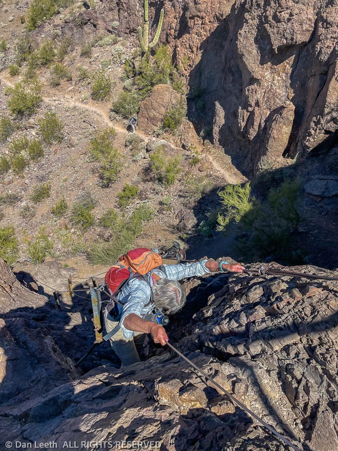
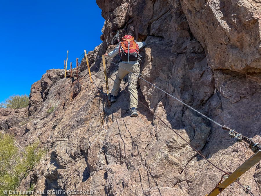
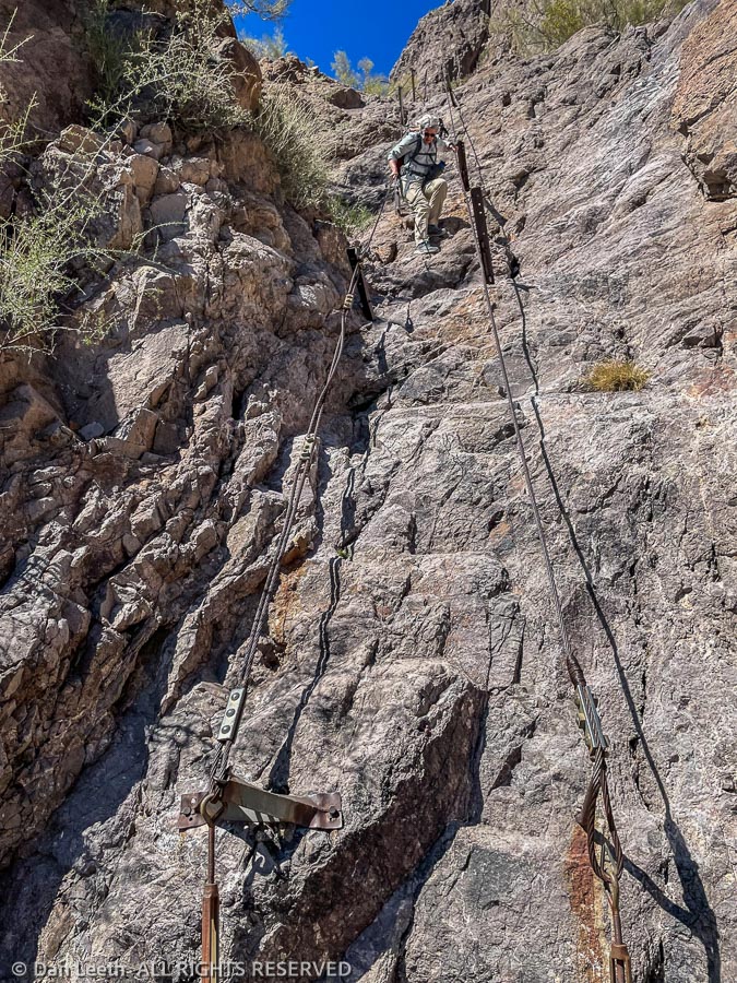
The first part of the Hunter Trail was like climbing a rocky stairwell to the top floor of a 100-story skyscraper. That only got us to the saddle, with the summit another 414 vertical feet above. Unfortunately, towering cliffs prevent an easy stroll to the top. From here, the going gets interesting.
Instead of going up, the route descends a steep, cliff-hugging rock bench. Steel cables attached to the stone provide handholds. Hopefully, they weren’t installed by Larry the Cable Guy.
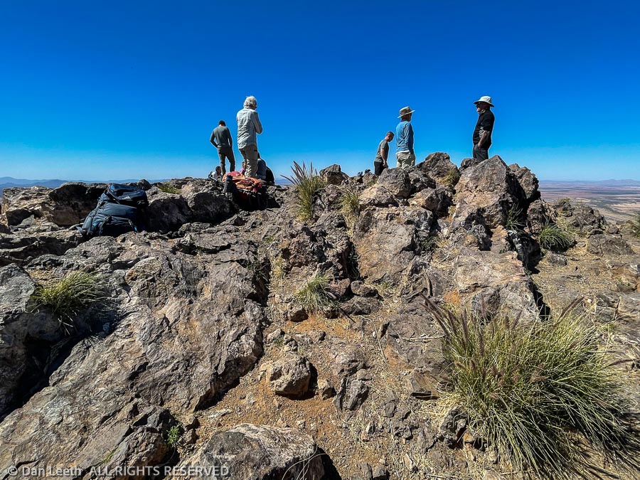
We lost about a fifth of our hard-earned altitude as we dropped down and wrapped around the cliffs on the backside of the peak. Cables are ever present as we scaled near vertical slabs of rock in places. In one spot, we crossed the void on a 2×10 board anchored to the wall. We finally completed our last cliff-hanging catwalk and scrambled to the summit, which we shared with over a half-dozen fellow hikers.
Back in my prime, I like to think I could have done this class-4 climb without the cables. But that was 25 years and 25 pounds ago. Now, on the cusp of geezerhood, there’s no need to be macho. I was happy to have the cables.
After downing a bag of gommp (good old M&Ms and peanuts) and some aged beef jerky, we started down the peak using a whole new set of muscles. A half mile from the summit, we reached the Sunset Trail junction and followed it down with more vertical, cabled sections to descend. We finally hit the relatively flat valley floor and began the final two-mile, scenic slog back to camp.
Back at the trailer, we indulged in the three joys of hiking. We stripped off our boots. We downed cold brews and we took long hot sailor showers (well, not really long, but definitely hot and wet). Never has not hiking ever felt so good.
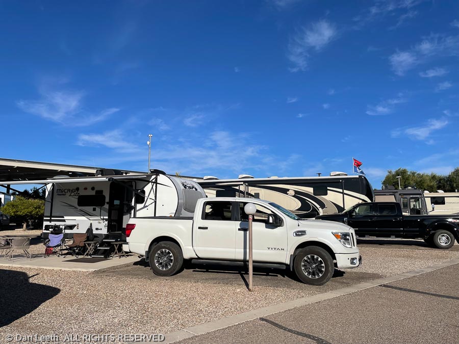
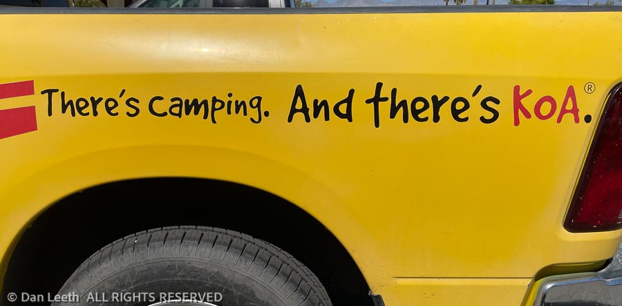
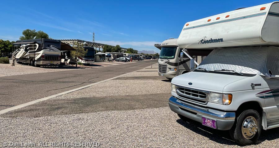
We left Picacho Peak and headed for Tucson where we will spend the next four nights, shopping, doing laundry and visiting friends. We’re staying at the Lazy Days KOA on the south side of town. It’s a large and beautiful park (for an RV park), primarily filled big rigs, some of which have neither Texas nor California plates. It’s clean, the staff is friendly, and they have a barbecue restaurant on the property.
I’ll sure be glad when we can leave here and go camping again.
Don’t get me wrong. The Tucson/Lazy Days KOA is a beautiful RV resort. There are 400 individual sites, two large pools with spas (local dialect for “hot tub”), an on-premise barbecue bar/restaurant with pretty good ribs (lunch today) and the park offers lots of planned activities. This is one of the few RV resorts we’ve been in that deserves the “resort” designation.
But it’s not camping.
For us, two weeks of camping begins tomorrow. We’re heading to Organ Pipe Cactus National Monument, which sits pretty much in the middle of nowhere.
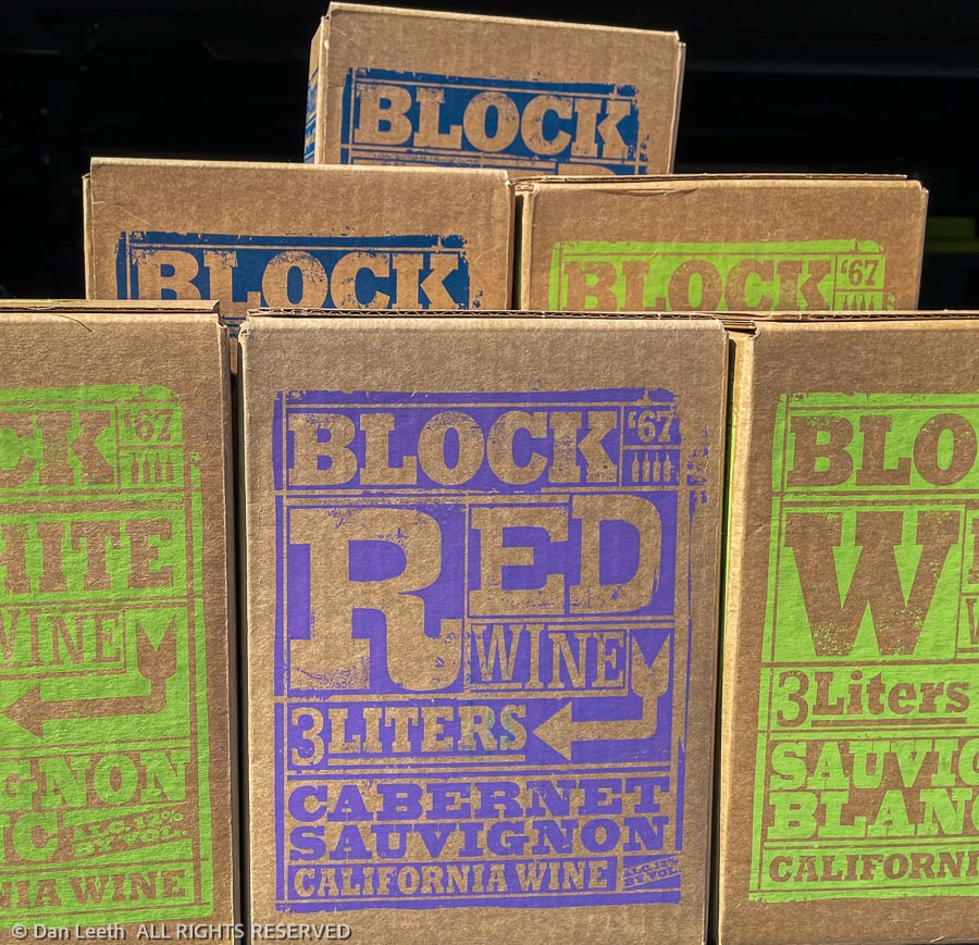
With that in mind, we spent today stocking up on fruit drinks…
…and grain beverages.
[Note: This is not Colorado, and the beverage options at the local Kroger market were largely limited. The best local craft beers we could find supported local professional sports teams. With the cans sandwiched in koozies, we won’t have to look at the team logos.]
Our previous two days here in my old hometown were spent visiting friends. On Sunday, we went to see our old neighbors from Aurora who fled to Arizona a couple of years ago. They had a house built for them, so we spent time comparing how much fun it is to have a freshly constructed home customized to our own specifications.
On Monday, we visited an old nursing friend of Dianne’s from years ago when they both worked in the Burn Unit at the University of Colorado Hospital in Denver. Semi-retired, she and her husband now spend their winters at a retirement resort in Tucson.
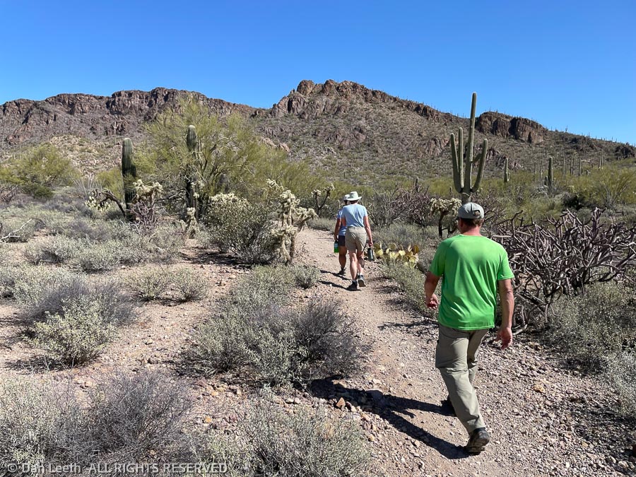
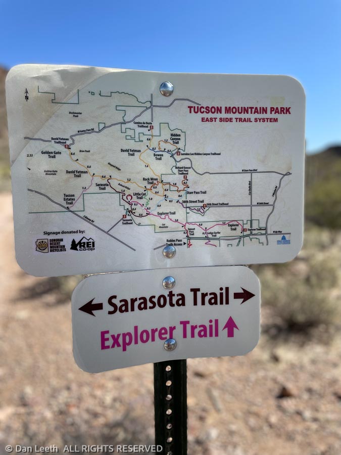
We thought we were close to hiking at our new place in Fruita, but here, we did a four-mile hike through the Tucson Mountains, leaving directly from their front door. No driving necessary to reach a trailhead.
At one time in my life, I thought it would be nice to move back to Tucson. Not anymore. Like an out-of-control case of cancer, city sprawl has metastasized across the landscape. Arterial motorways remain clogged with traffic, making it a challenge to pass through the heart of the city. (Many Tucson motorists apparently learned to drive by watching NASCAR where cars crash a lot.) When I lived here, the local population was around 274,000. It’s now 993,000 and growing.
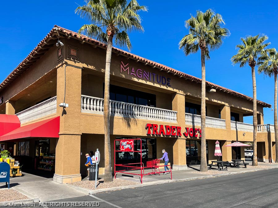
On the plus side, Tucson does offer no fewer than three Trader Joe’s, all of which sell wine.
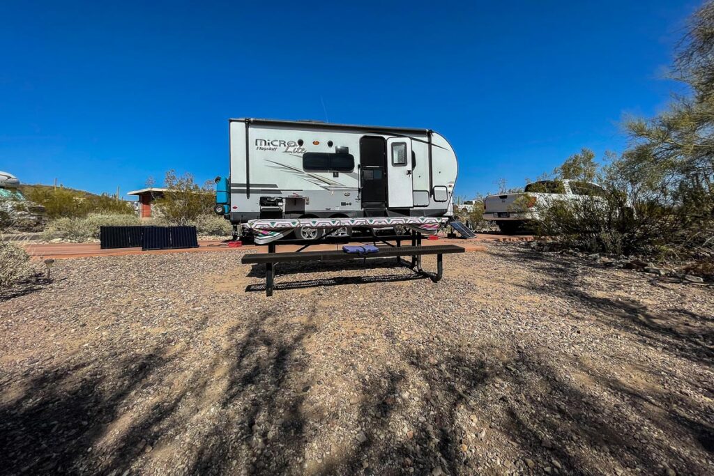
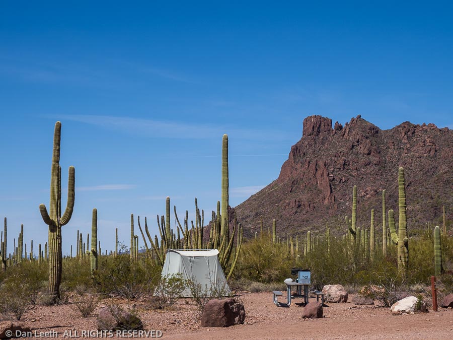
We have no hookups here in Organ Pipe Cactus National Monument. Our freshwater comes from an onboard tank filled from a spigot at the dump station. We’ll cart our used water back there in Bob, our 25-gallon honey wagon. We have only the sun to recharge our battery. Generators are not allowed in our section of the campground. The flush-toilet bathhouse is over 50 yards away, with the nearest solar-heated showers more than 100 yards away in the opposite direction. This is definitely not a KOA.
After pulling in and getting set up yesterday, we took a four-mile hike down to the Visitor Center for information and yes, for souvenirs. Back in camp, Consuela (Dianne’s undocumented, live-in pseudo-assistant) fixed barbecued chicken, which we downed with some of the finest (and only) boxed Spanish wine we brought from Colorado. Our Trader Joe’s wine waits in the Whitey’s wine cellar.
For the first time in months, we lingered outside after dinner, gazing at stars (not many because of the nearly full moon) and discussed our future. We decided that on the first day of the rest of our lives, we would throw caution to the wind and take a hike to two abandoned mine sites.
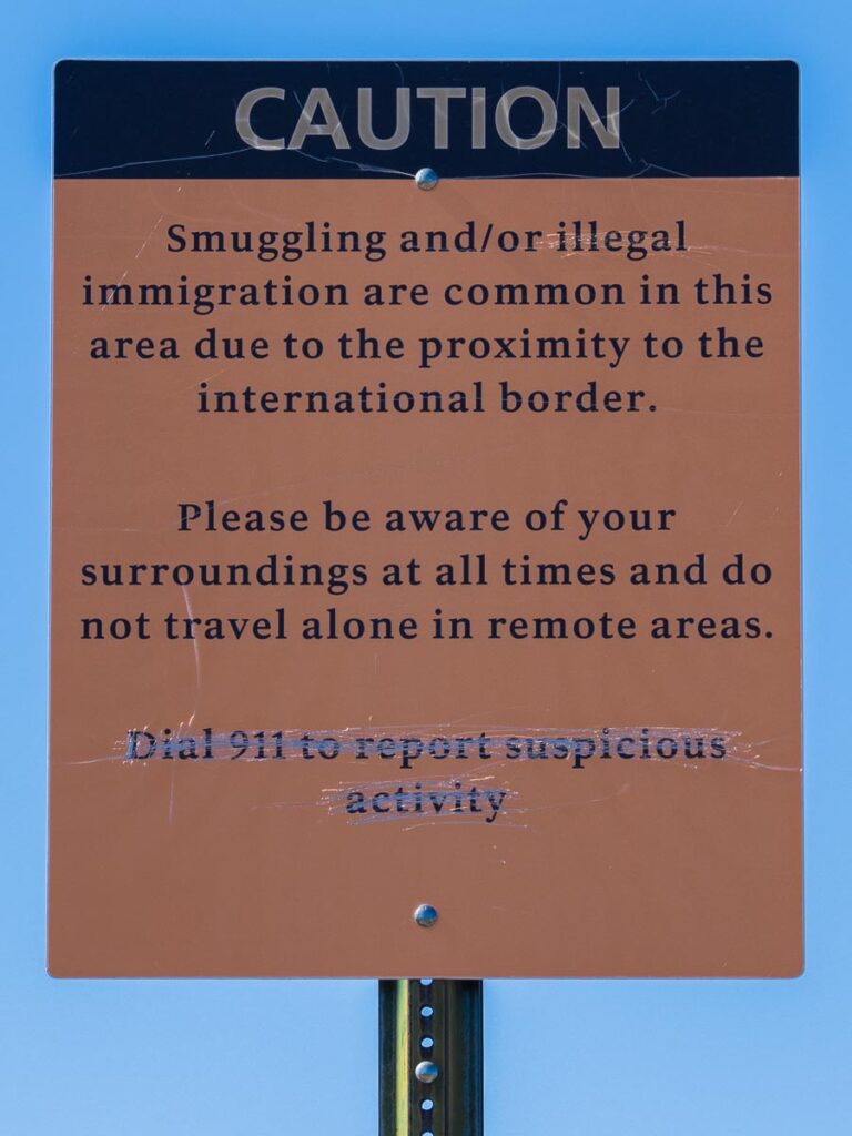
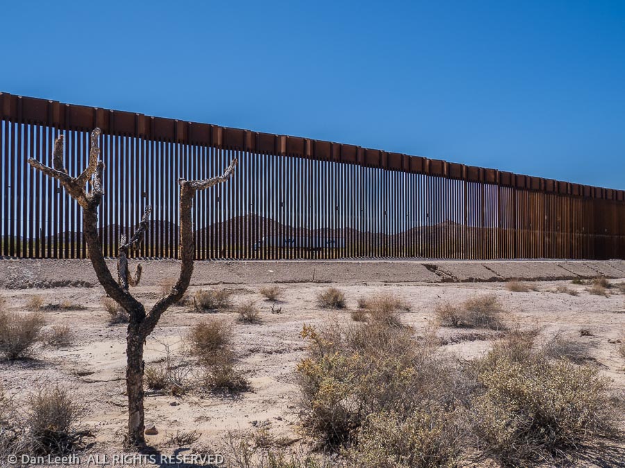
One would think that with The Donald’s magnificent new wall in place, we would no longer meet smugglers or immigrants on this side of the fence.
“Are there many holes in the wall?” I asked the ranger at the information booth.
“Plenty!” she responded.
Immigrants, she told us, can frequently be seen on South Puerto Blanco Drive, sitting by the roadside waiting to be picked up by border patrol. The smugglers, of course, try to avoid detection and will avoid all tourist-traveled areas.
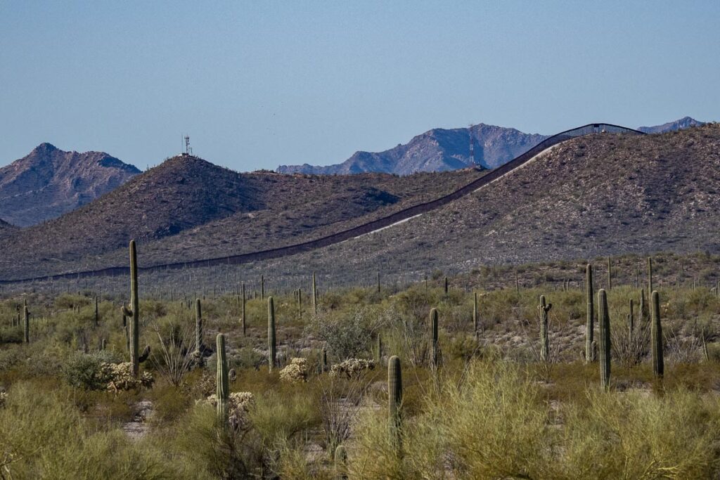
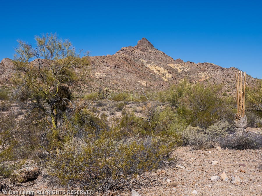
Our trail to the two historic mines started near the campground. Less than a mile from the trailhead, we got our first good look at the wall, about 5-7 miles to the south. From this distance, it looked like someone took a large Sharpie and drew a long, straight black line across the distant horizon with a white strip (the border patrol road) inscribed in front of it.
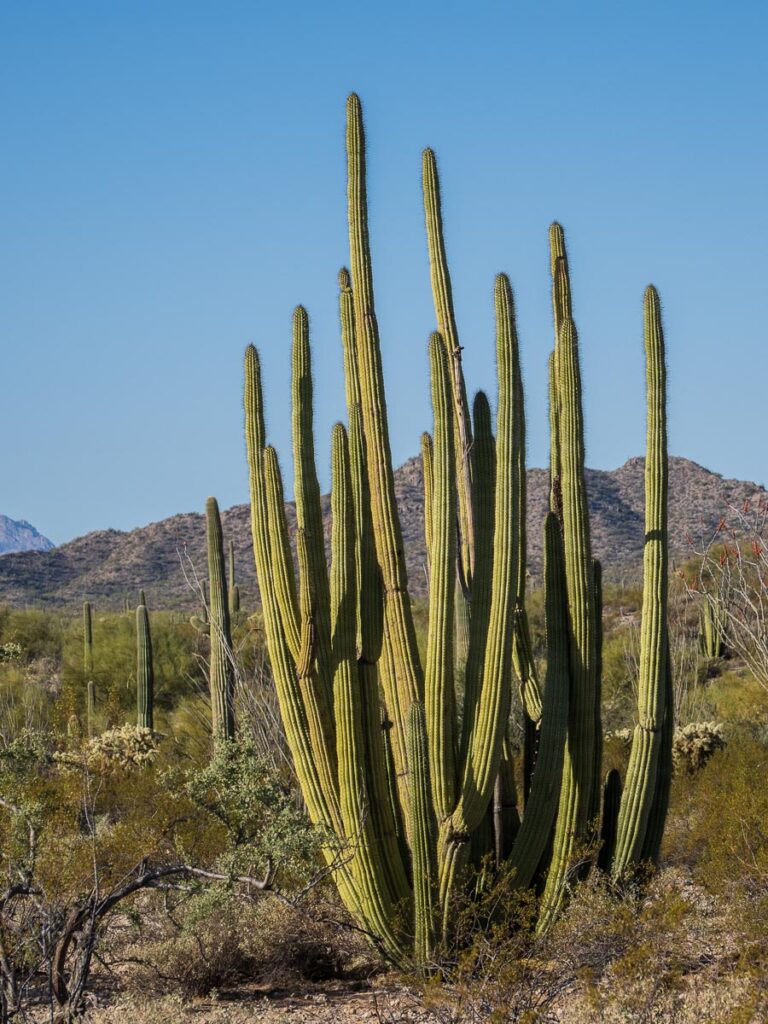
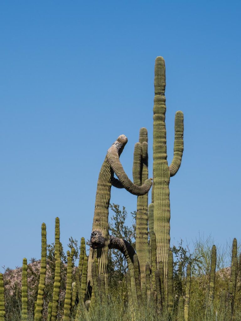
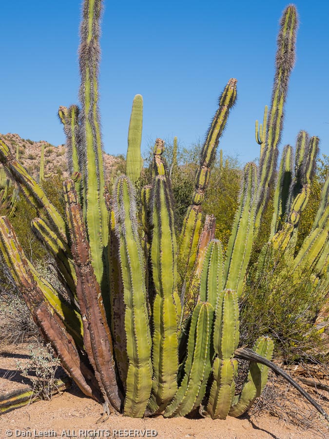
Our hike took us across the desert floor garnished with saguaro, organ pipe and several varieties of cholla cactus. Intermixed with the cactus were palo verde and mesquite trees along with ocotillo plants displaying buds ready to bloom.
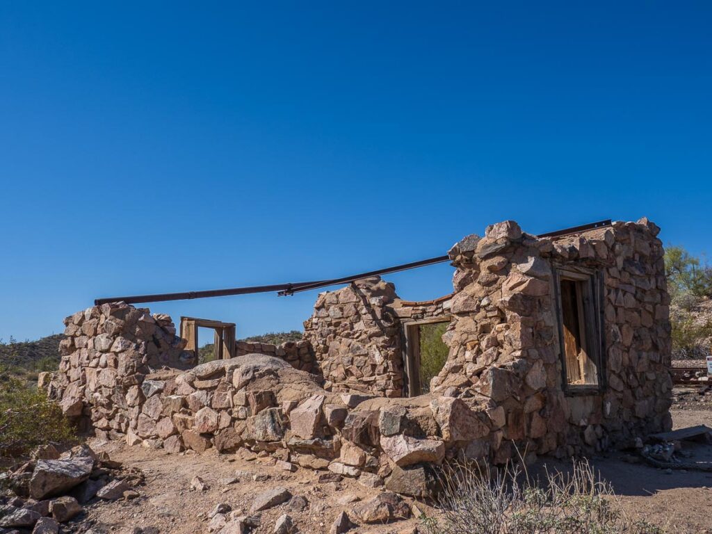
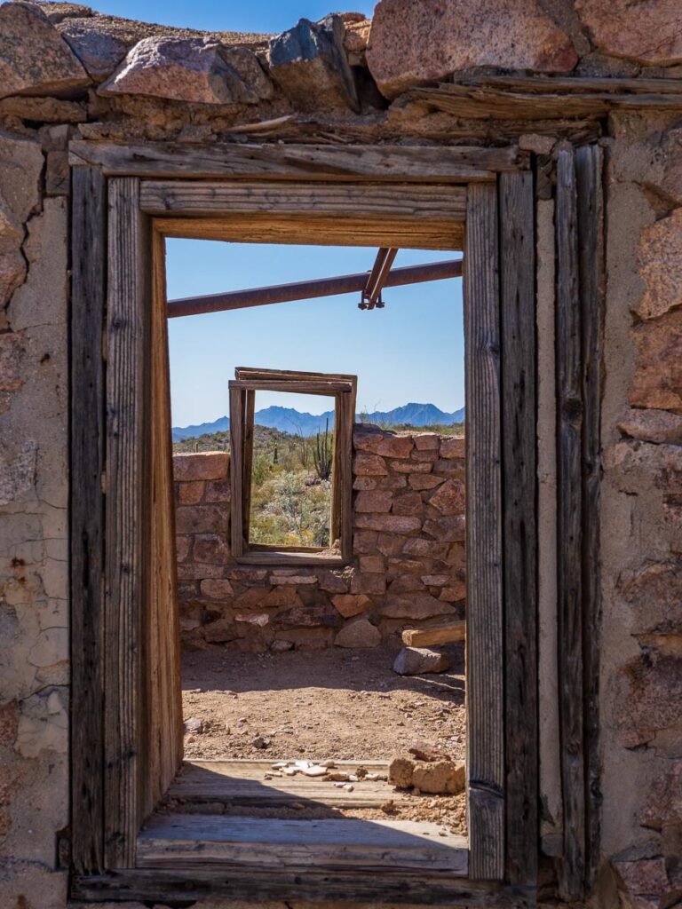
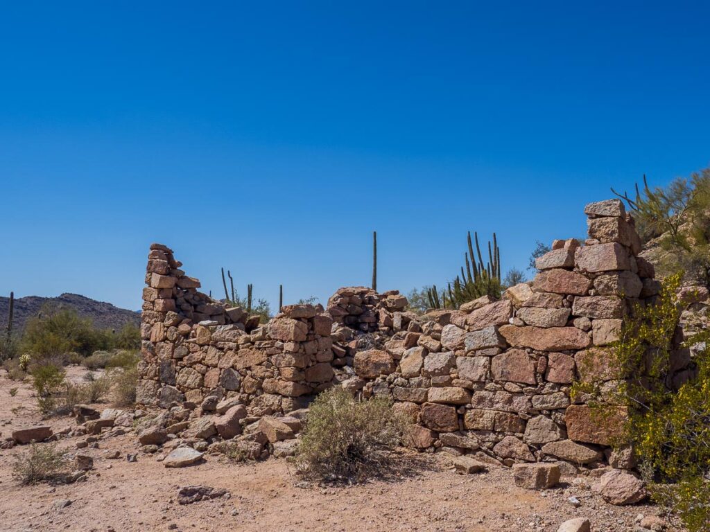
The first mine, the Victoria, lies about two miles from the trailhead. Rangers covered the mine shafts to keep people out while leaving them open for the bats, which like to hang out inside.
The only remaining structure was (according to the guidebook) the mine’s store. It apparently was closed for the season, or we might have bought some more souvenirs.
We shared the Victoria mine site with more than a dozen fellow hikers. We met only four other people continuing the additional two miles to the Lost Cabin Mine.
Here, too, we found the remains of one old stone building. The guidebook did not reveal its intended purpose, and we didn’t really care. It was time to turn around.
Back at camp, we shared our one chilled beer (a refrigerator-filling error that will never be repeated), stretched our sore muscles and then got to work uploading photos to our computers.
No life of leisure for us. After all, this is camping.
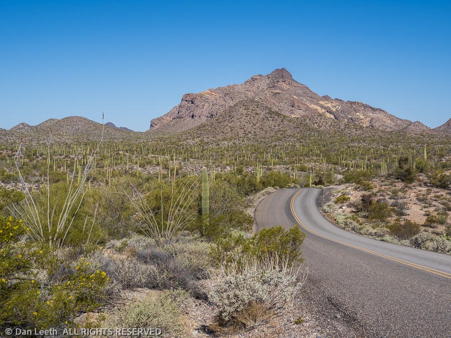
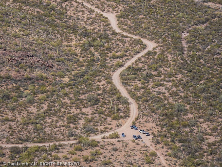
Organ Pipe Cactus National Monument offers a pair of long loop drives for guests to explore. Both feature mostly graded gravel roads with one-way sections. Neither is crowded. The longest is the 41-mile-long Puerto Blanco Loop, which has an extended “high clearance” section. Of course, we drove that road first.
Done in an anticlockwise direction, the first part of the drive features two-way traffic (we met no one) up to the Pinkley Peak picnic area, which is named for some person, not the color of the rock. From there, it’s one way as it winds onward through the desert.
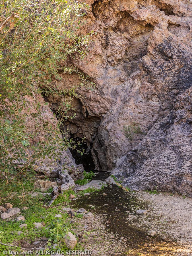
We stopped at the trailhead for Dripping Springs and walked the one-mile trail to the springs, which lie in a cave. The place was rife with bees, which according to a ranger at the visitor center are probably Africanized killer bees. We didn’t stay long.
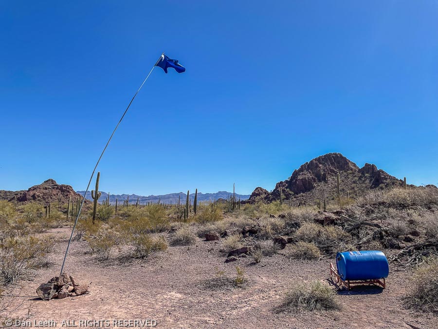
At a few spots along the road, we saw blue flags flying atop tall staffs. They marked caches of water held in blue barrels, which were placed in the area by a group called Humane Borders. Obviously, the Park Service is content with their existence.
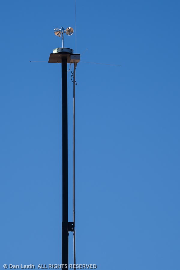
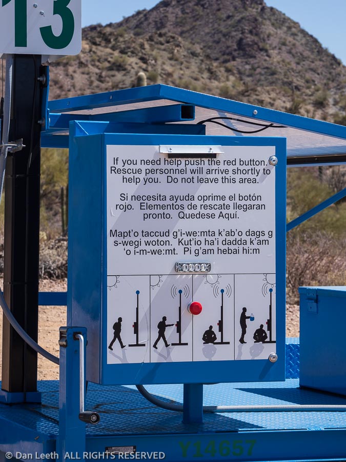
Elsewhere along the road we saw light reflecting off rotating mirrors. They marked emergency call boxes.
Instructions for their use have been posted in English, Spanish, native and sign languages. With no cell coverage along much of the road, these boxes could be lifesavers for us gringos as well as undocumented immigrants.
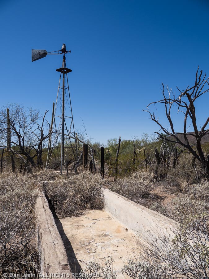
We stopped at Bonita Well, which offered pit toilets and a picnic table. The well has long since run dry, perhaps because someone stole the rotor blades off the windmill. It’s hard to imagine someone choosing to live out here in the middle of nowhere, but I suppose one could have said the same thing about the first inhabitants of Phoenix or Tucson. Maybe the current inhabitants, too.
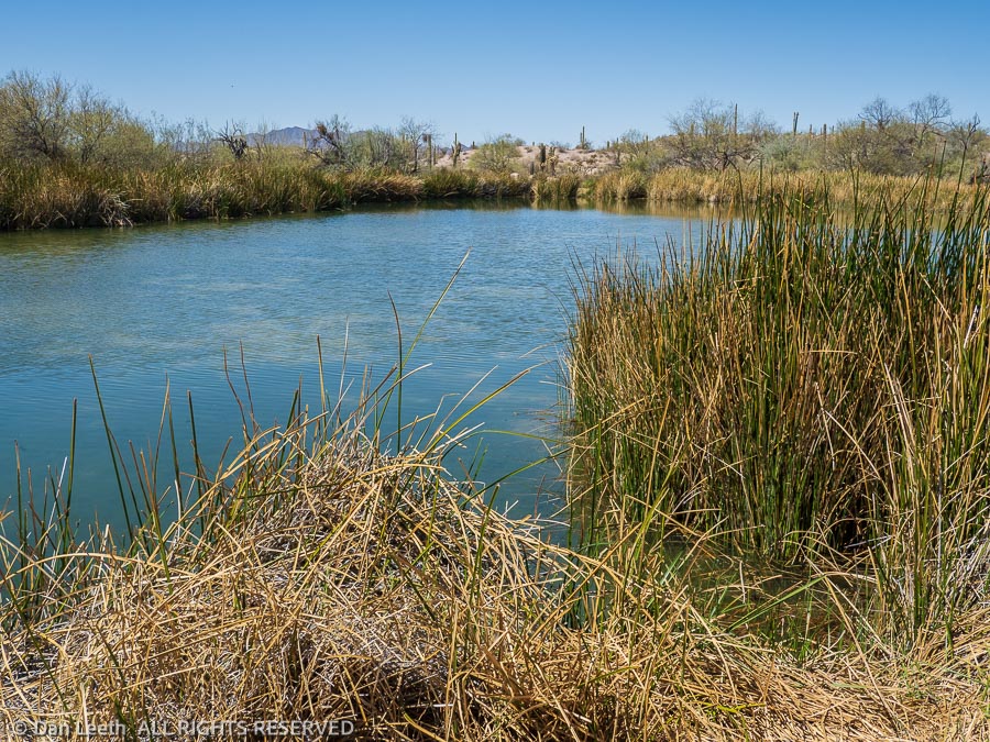
Just north of the border, we stopped at Quitobaquito Spring, a pond of water in the middle of the desert. Last time I was here (probably 1974) my step dog decided the ducks swimming in the water needed a little herding. She jumped in and swam after a flock of fowl, giving out an occasional bark. The ducks waited until the dog was just a few dog lengths behind, then they would flap wings and flutter out ahead, laughing all the way.
[Yes, dogs should be on a leash and never allowed to herd the local wildlife. But we were young and rebellious back then, protesting the war, segregation and leash laws.]
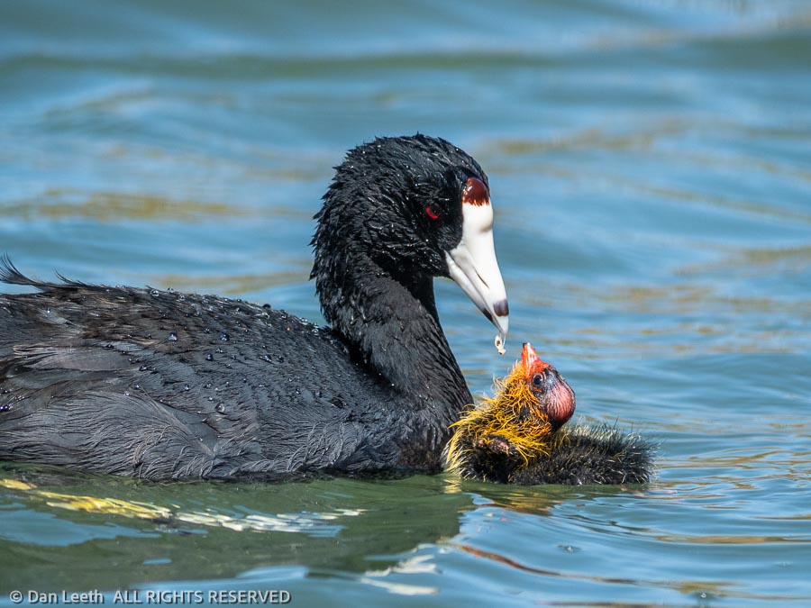
On this visit, we found a pair of black bodied American coots and their colorful offspring swimming in the pond. We watched the adults dive down, pull up a hunk of some tasty plant and feed it to the colorful little quackers who diligently followed their parents around.
Now following the border, we drove for miles along The Donald’s wall. Regardless of one’s political stance, this might be a place where this tall picket fence might be needed.
Mexico Highway 2 runs a few dozen yards away on the southern side of the border. Without the fence, drug runners could simply stop along the highway, walk their product over to a tourist-looking accomplice on the American side and be gone. Now they’ll have to catapult it over the fence. Make ‘em work for it has always been my motto.
Driving back to camp, we took a detour up to Senita Basin so we could see what a senita cactus looks like. Although similar to an organ pipe, the senita has fewer vertical ribs and is covered with needles that look like an old geezer’s beard. I remember seeing and photographing these growing along the Mexican coast in San Carlos.
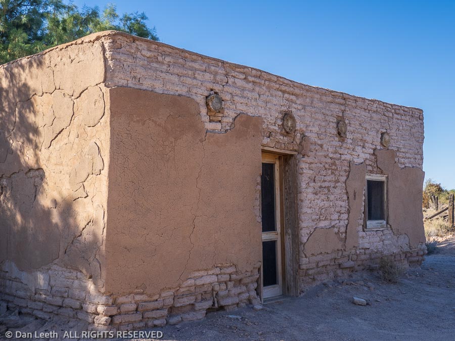
A final detour before heading back to camp was to Gachado Line Camp on the Camino de Dos Republicas.
Here stands an old adobe dwelling with its roof and much of its stucco still in place. On the way in, we passed a pair of Border Patrol trucks. The agents driving apparently knew we weren’t smuggling in dope or immigrants.
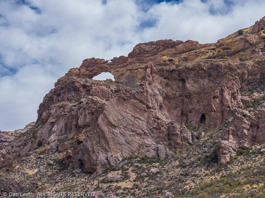
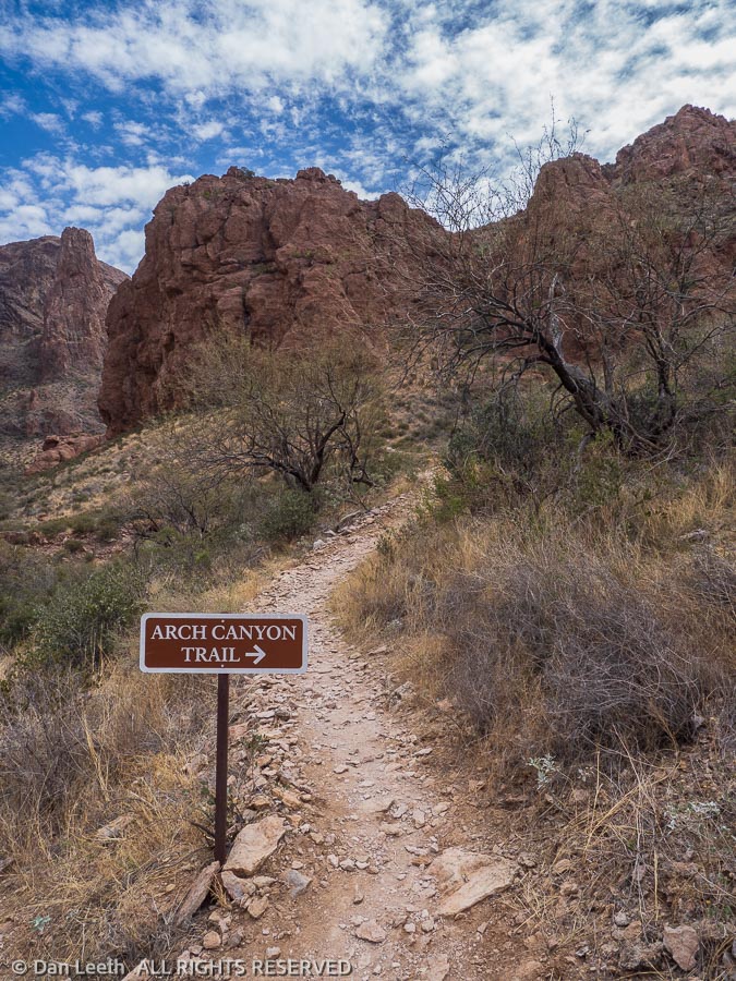
Yesterday, we drove the 21-mile Ajo Mountain Loop. The plan was to do a series of shorter hikes along the one-way section of the loop. Our first was Arch Canyon.
On the way, we listened to a point-by-point narrative describing the things we were seeing along the way. At Arch Canyon, the ranger in the app said it was a two-mile roundtrip hike up the canyon. For a hike that short, we didn’t even bother to take packs or water.
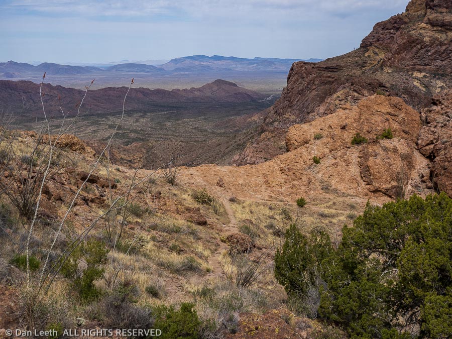
At the 0.6-mile point, a sign pointed us up a steep side canyon. We made the turn and started upward. The trail got steeper and rockier as we went up. Since we hadn’t yet reached the one-mile point, I figured this must still be the main tourist trail.
The one-mile point came farther up the trail, but since it looked like we were near the top, we continued onward. At a ridgetop saddle, I stopped and looked down on the parking lot where Tighty was parked. She now had nearly a half-dozen neighbors.
The trail looked as if it continued down to a steep drainage below. Maybe this was an alternative route down? I took a quick peek but decided not to pursue it. It turns out that trail continued around and into the arch.
We had another hike planned for another spot down the road, but Dianne said she’d had enough for the day.
“Let’s just go back to the trailer and down a few beers and maybe a box or two of Girl Scout cookies,” she suggested. At least that’s what it sounded like to me.
Not wanting to insult my body by ingesting a massive overdose of sugar and alcohol, I decided we needed to do another hike. This one would be up Alamo Canyon in the northeastern part of the park. A few miles drive down a graded gravel road led to the Alamo Canyon Campground, a four-site, tents or pickup camper only primitive campground at road’s end.
“It’s really quiet out here at night,” an elderly tent camper from Pennsylvania told us.
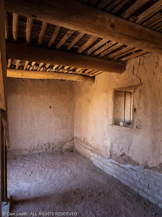
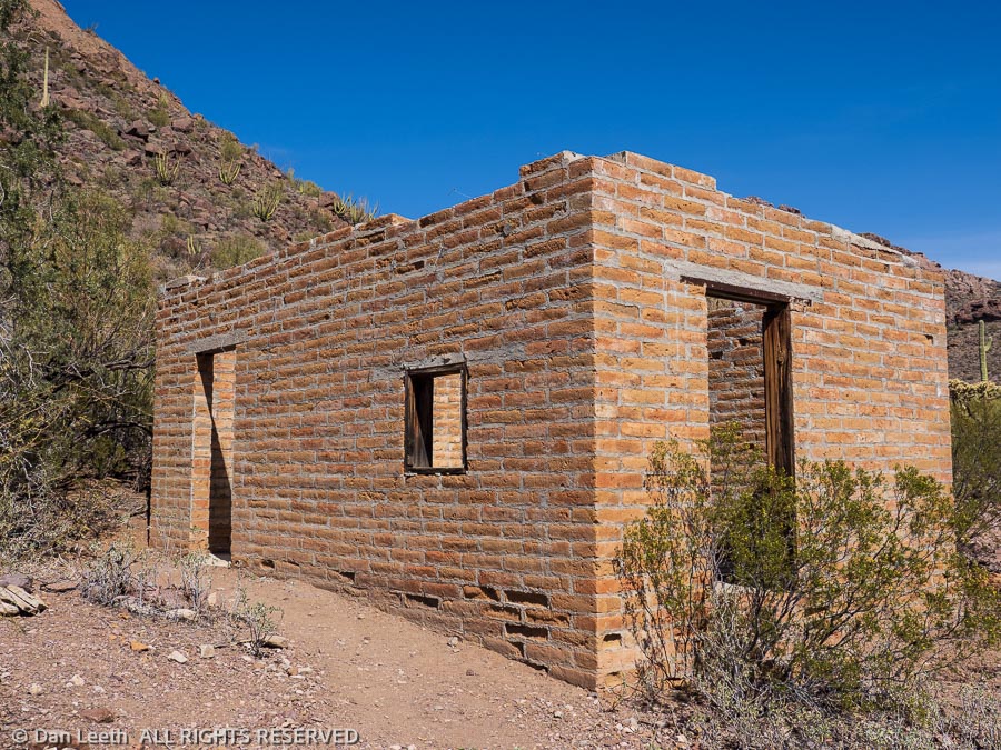
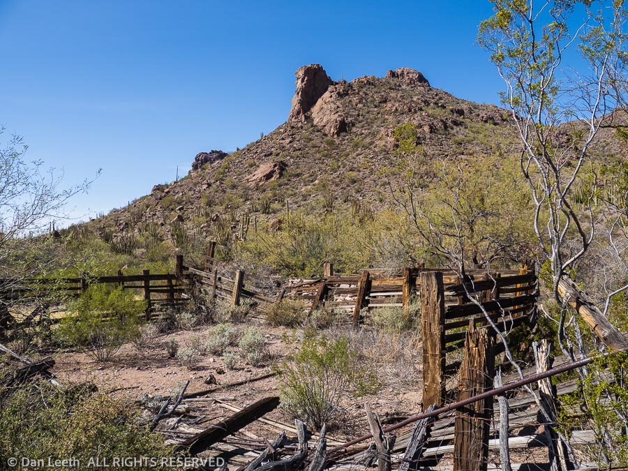
From the campground, a one-mile trail leads to an old ranch where a brick home/cabin still stands with an old corral a quarter mile beyond. It made a lovely final hike.
Back at camp, I made sure we had only one beer each with nary a single Girl Scout cookie to be seen.
Today, Sunday, is our rest day. Dianne watched a video of her church service while I slaved away in the kitchen washing dishes. When the rain stops, we’ll unleash Bob and the two Jerrys from the trailer so we can refill the trailer’s freshwater tanks and drain the gray and black.
Oops. After 47 seconds of torrential drips, the rain storm just stopped. Time to get to work.