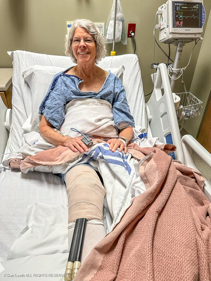
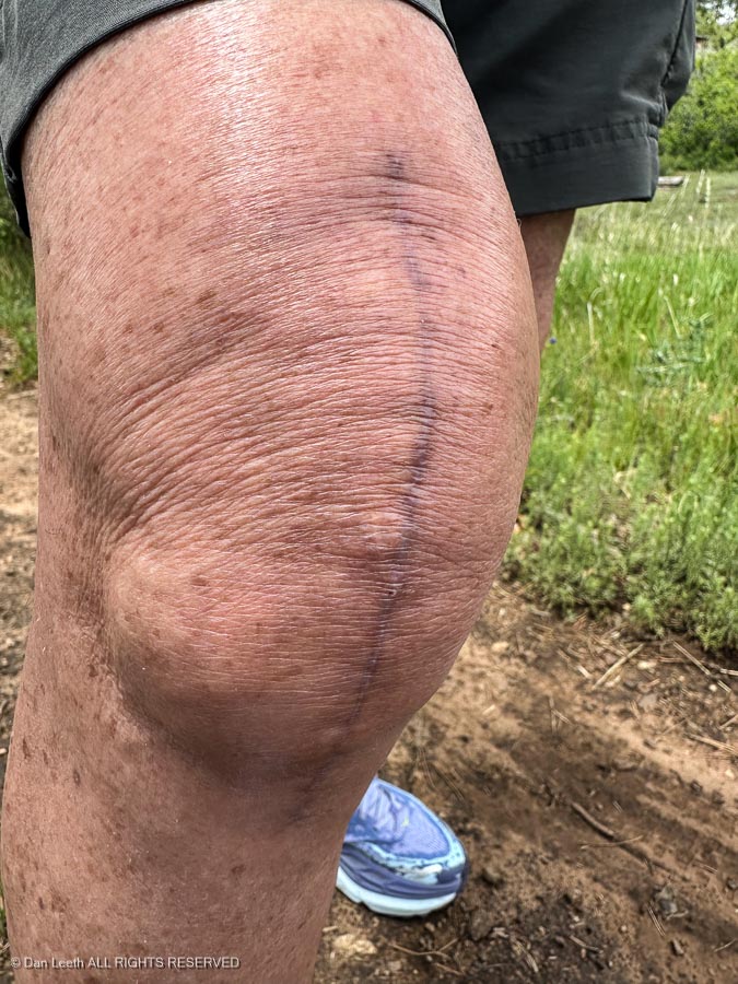
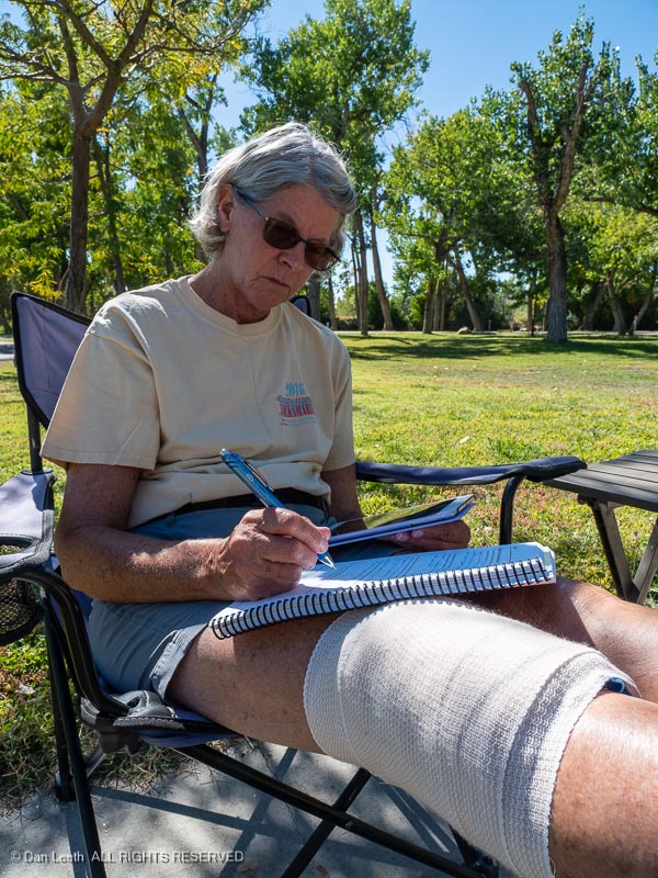
We had our camping trip to Mancos and beyond (plus others) planned six months in advance. Then in early-April, Dianne’s doctor suggested that it was time for her to swap her now painful OEM knee for a bionic replacement. The surgery was done on April 30, a mere 53 days ago.
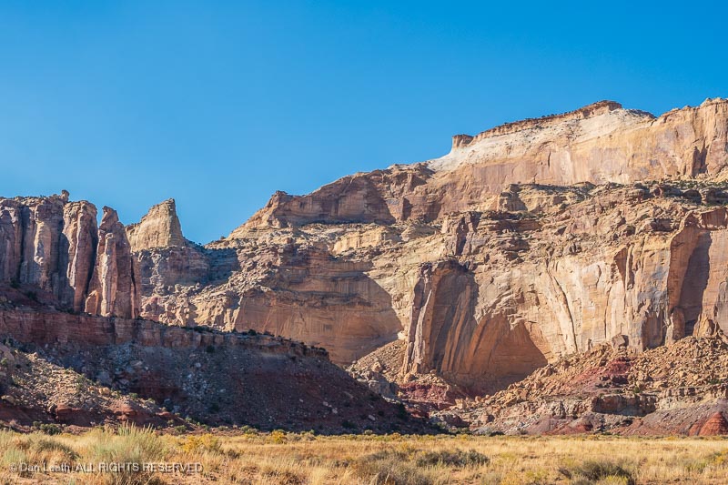
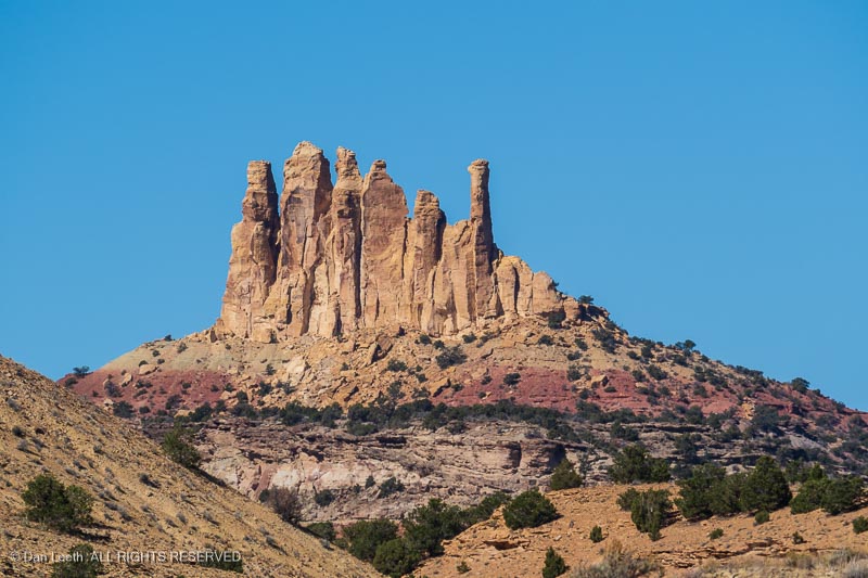
Because of the surgery, we had to cancel a trip to Capitol Reef…
…and Bryce Canyon National Parks that we had planned for April-May.
This June-July trip, she insisted, would not be cancelled even if she wasn’t totally back to normal. It would be knee recovery on the go.
We wouldn’t be doing the longer hikes we had planned, but Dianne figured she’d be able to do some shorter hikes while her knee scooted toward recovery. Even though we couldn’t do as we first had planned, we were happy to get out with our trailer and drink ample quantities of box wine out here in the wild. So here we are, tucked into our little spot in the ponderosa pines, enjoying cool, semi=sunny days and nights with ground-drenching rain.
(It turns out that the leak we thought we had the first night from the overhead vent was the result of it not being totally closed. The only remaining problems are a propane tank gauge sending unit is not working and a blown fuse on the 12-volt plug I use for my coffee warmer.)
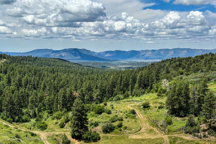
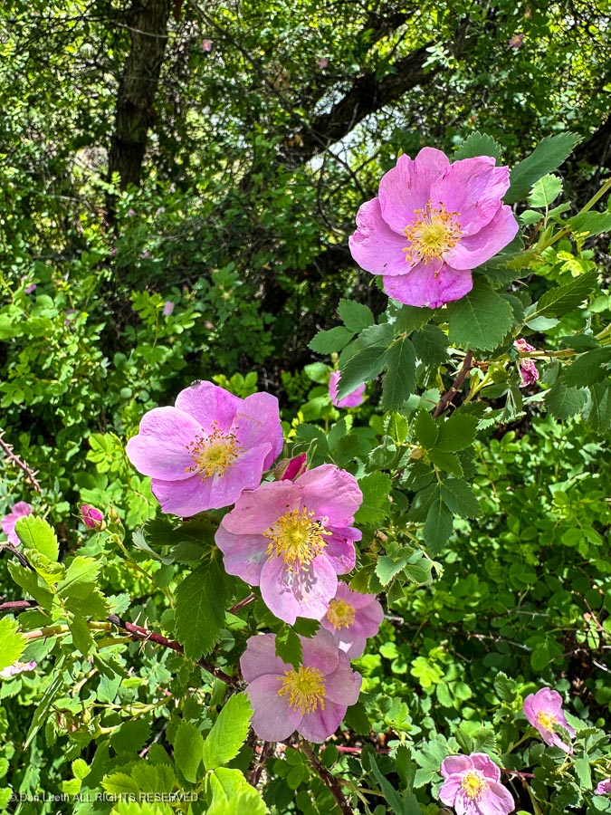
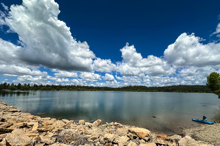
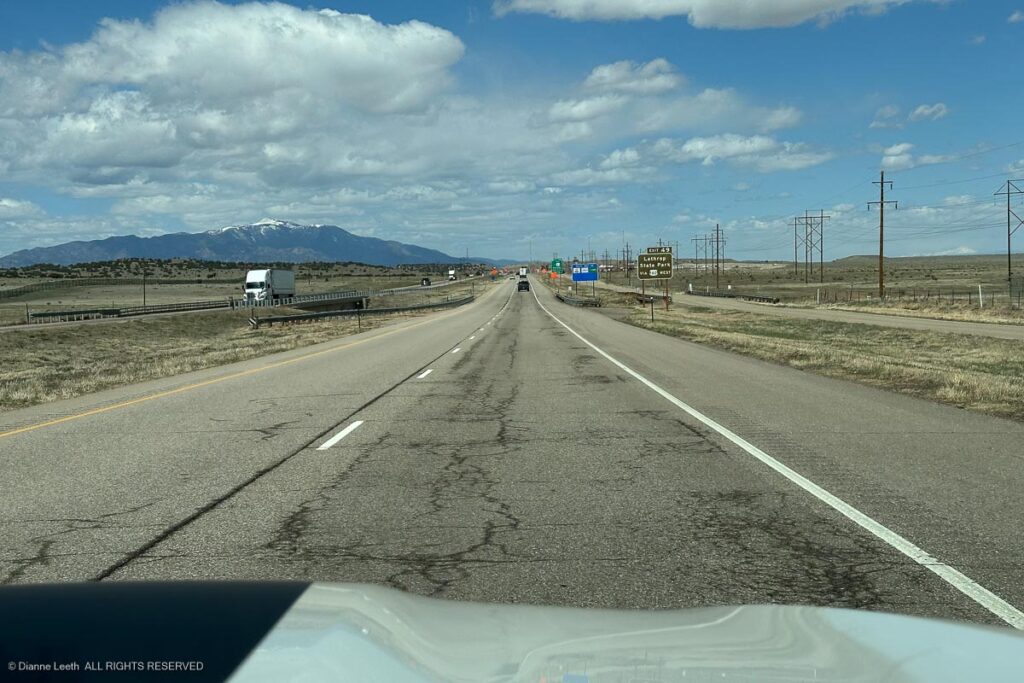
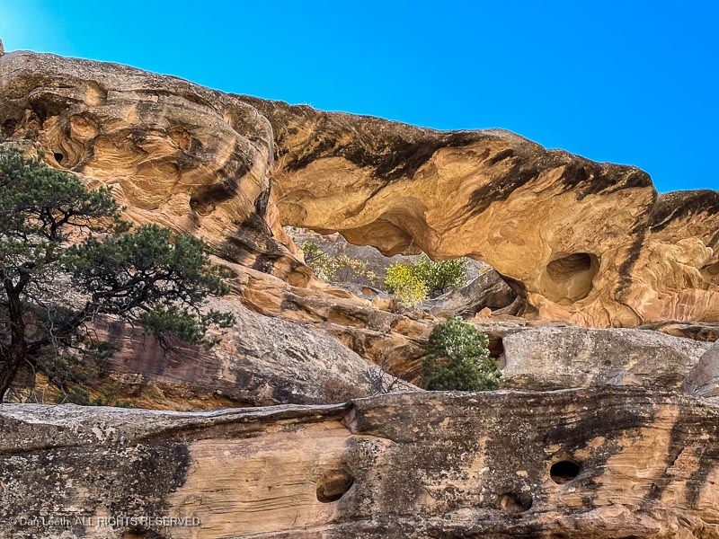
Today, we went for an easy, 3½ mile walk across the dam and up the road to the Chicken Creek hiking trail, which we found to be too muddy to follow for more than a quarter mile.
Dianne’s knee did well,
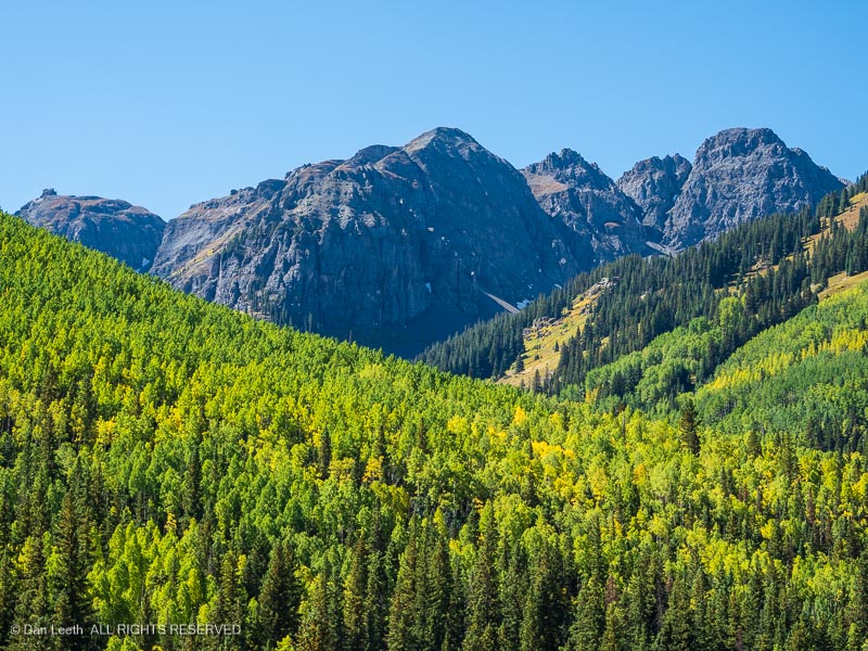
and along the way we enjoyed views of distant peaks,
wild roses in bloom,
and, of course, the shimmering blue waters of Jackson Gulch Reservoir.
Sometimes trips (like this one) don’t go off exactly as planned. No major disasters (so far) but we have experienced a series of inconveniences.
Getting ready for the trip, we had issues with the refrigerator not wanting to refrigerate and low point drain caps that leaked. We had water overflow from the gray water tank and driving to our first campground, we found a rubber trim-seal peeling off the side of the trailer.
When we got to Mancos State Park where we would stay for five nights, we discovered that we didn’t have our campsite reservation form. I checked online to verify our campsite number and found only a record of our original campsite cancellation notice.
The park office was closed, so we faced a dilemma. We could go set up in the site we thought we had, even though there was no online record of me ever reserving that site. If someone else had reserved the site and came in later, we would have to pack up and move.
The other option was to bunk down in a nearby RV park and sort it out with the state park staff in the morning. We took that option and grabbed a beautiful site at the Views RV Park up the road near Dolores.
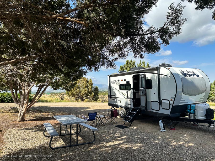
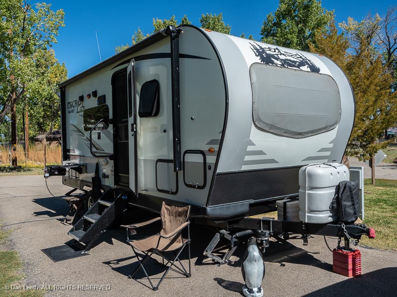
Trailer in campsite 43, The Views RV Park, Dolores, Colorado.
The next morning, we called Mancos State Park and discovered that we did have a site reserved there. It didn’t show up online because we made the reservation in Dianne’s name. We closed up the trailer and headed back to Mancos.
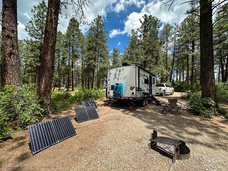
We will now have four nights at Mancos instead of five, but the site is beautiful. The trailer had a full tank of water (no leaks), the fridge read 34 degrees (nice cold beer) and the solar panels had the battery fully charged. We were totally happy campers for about two hours.
Trailer with solar panels in campsite 11, Mancos State Park, Colorado.
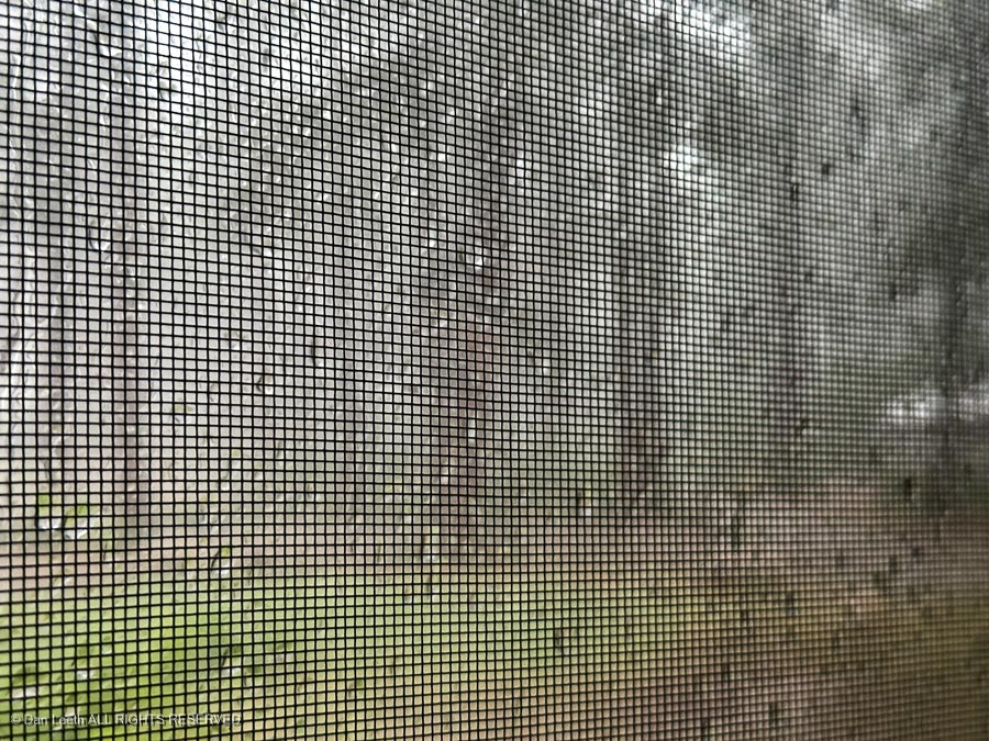
Then the afternoon thunderstorm began. After an hour of pounding rain, we discovered that our front, overhead fan vent is now leaking (even though it’s tightly closed). It looks like tomorrow’s project will be to get up on the roof and do some resealing.
Screen.
I’m now sitting in the trailer, listening to the rain pounding on the roof and reminding myself that yes, camping is what I do for fun.
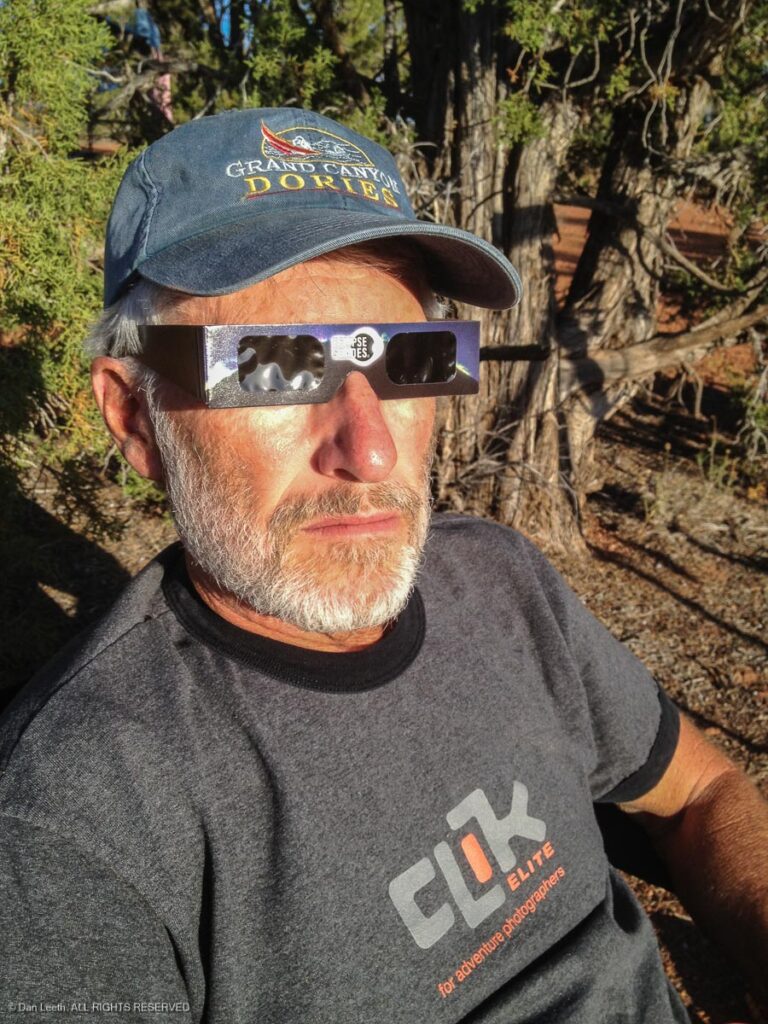
Who in their right mind would drive 2,667 miles over nine days to see a spectacle that at best would last for less than 4½ minutes?
I grew up being something of a space junkie. My favorite adventures on Walt Disney’s TV series were those dealing with space travel, I’ve watched 2001 a Space Odyssey more than a half-dozen times and I can still spout out the names of the original seven Mercury astronauts.
The first time I saw a photo of a total solar eclipse, I knew I had to see one in person. Unfortunately, they never seemed to happen anywhere close enough to visit. Over the years, I’ve seen plenty of partial eclipses, and in 2012, I caught an annular, ring-of-fire eclipse over Utah canyon country.
I would have had an opportunity to see a full eclipse across Wyoming in 2017, but we were up in the Great White North camping across Canada. When I heard that there would be a total eclipse crossing Texas and beyond in 2024, I began making plans.
Texans, being savvy entrepreneurs, made sure that lodging costs in the path of totality were as lofty as the moon itself. One Super 8 motel had rooms going for more than $900 a night. We ended up saving $800+ a night by booking a Days Inn motel in San Angelo, Texas, which lies 150+ miles from the path of totality.
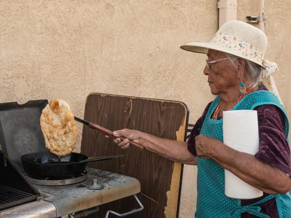
Day one of our eclipse trip involved motoring south from western Colorado to Farmington, New Mexico. Last time we were in Farmington, Dianne and I were on a press trip (I love traveling on O.P.M.). One of the things we got to do was watch a pair of local Indian ladies make frybread for Navajo Tacos.
On this trip, we ate far inferior fare at a local Mexican chain restaurant.
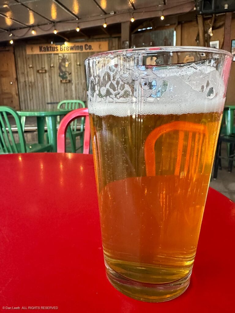
From Farmington, we drove to Albuquerque by way of Bernalillo where we stopped for brews at our favorite New Mexican brew pub. It’s a favorite because it’s located next to a KOA campground we used to frequently visit.
From there, it was down to Albuquerque where we found that the motel we had reserved was under new ownership. Worst lodging on the trip.
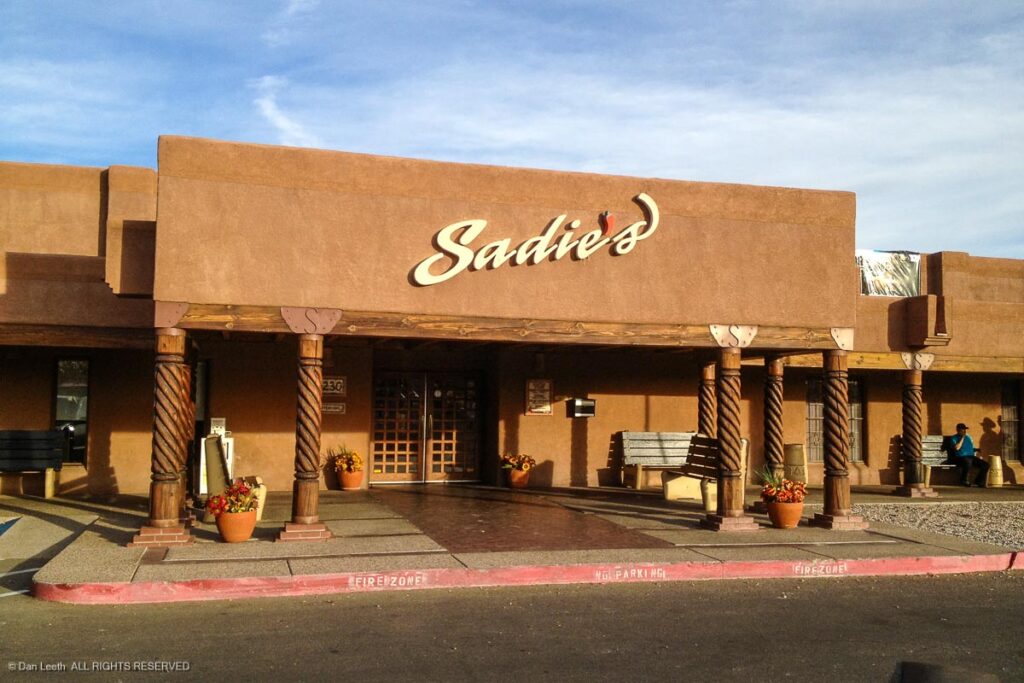
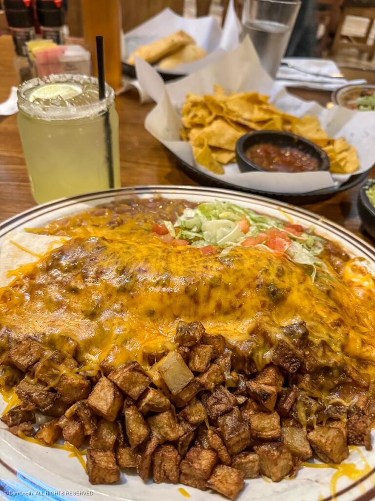
The best thing about Albuquerque is that it’s home to Sadie’s of New Mexico, which some think offers the best Mexican food in America. Where else does one get fried potatoes with a green chili burrito? Spicy good!
Their margaritas are pretty good, too!
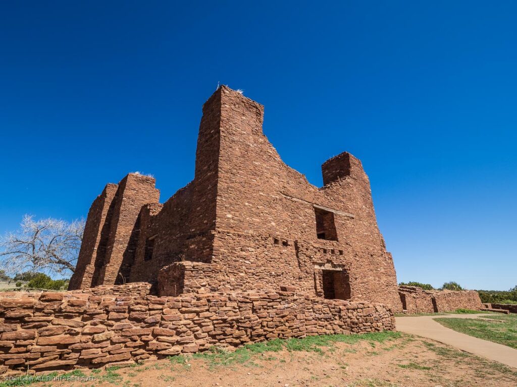
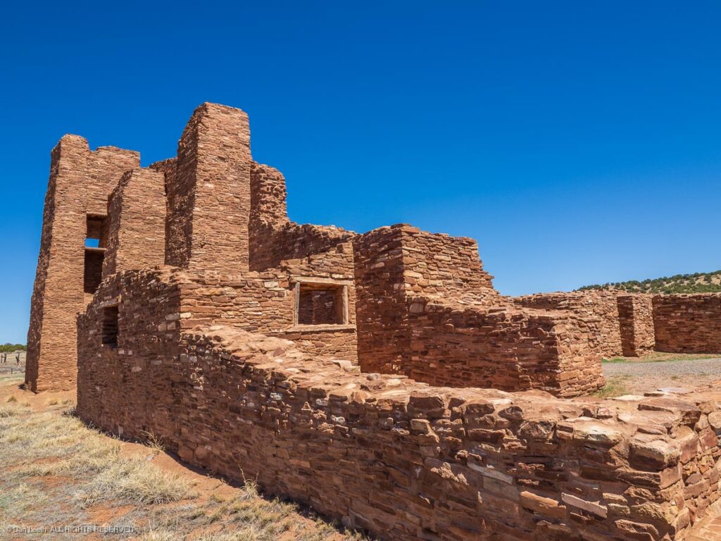
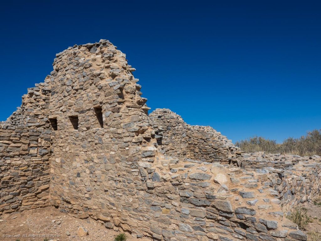
Day Three took us South from Albuquerque to Alamogordo. I planned a backroad route that would take us past the three units of Salinas Pueblo Missions National Monument. The ruins date back to the 1600s when Spanish priests built towering missions in Native American pueblo communities.
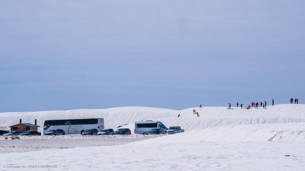
Back in the ’60s when I was living in Tucson with my starter wife, we often drove to Alamogordo to visit White Sands National Monument (now a national park). Back then, visitors were few and I envisioned the wife and I disappearing behind a few dunes and lying naked atop the gypsum sands.
Can’t do that now. Instead of preserving unimpaired the natural and cultural resources and values of the park for the enjoyment, education, and inspiration of this and future generations, White Sands has become the national playpen for the sandbox crowd.
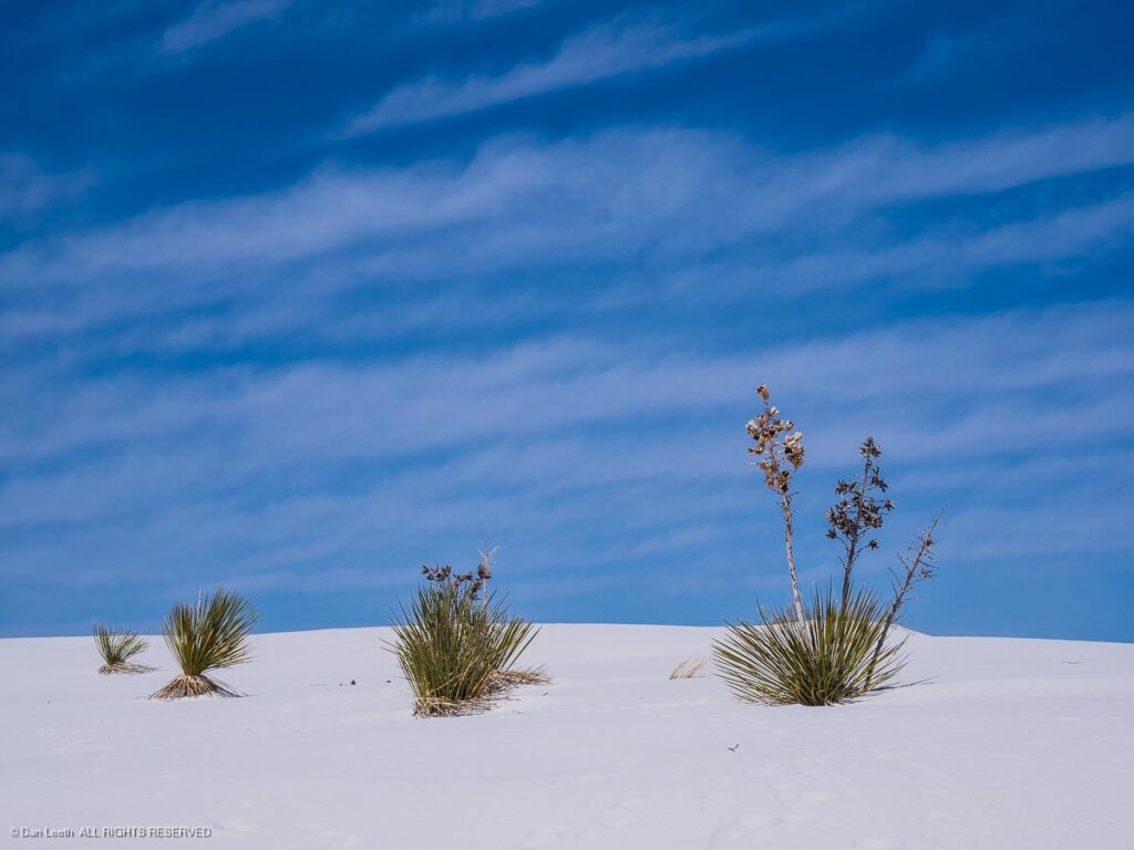
My latest wife and I did find a place where we could get out and wander the dunes (fully clothed) away from the hoards, so our visit was not a total waste.
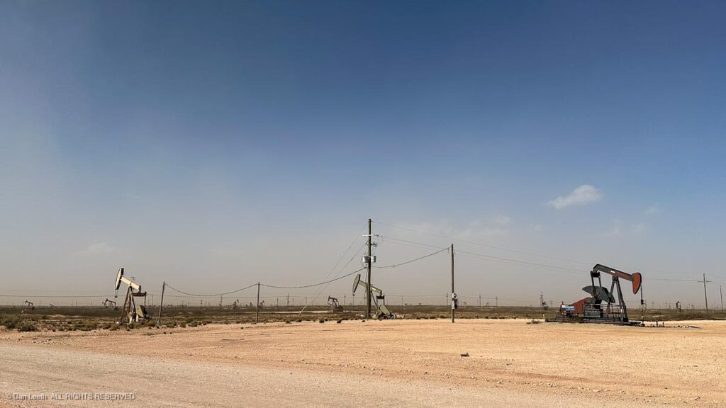
From Alamogordo, we headed east toward Texas. Our route took us through eastern New Mexico where oil wells poked up like zits on an acne-prone teenager’s face. The only nice thing was we had a 30-40 mph tailwind scooting us along, with the Subaru’s gas mileage gauge reading 35+ mph, so we didn’t have to use as much of the locally pumped product.
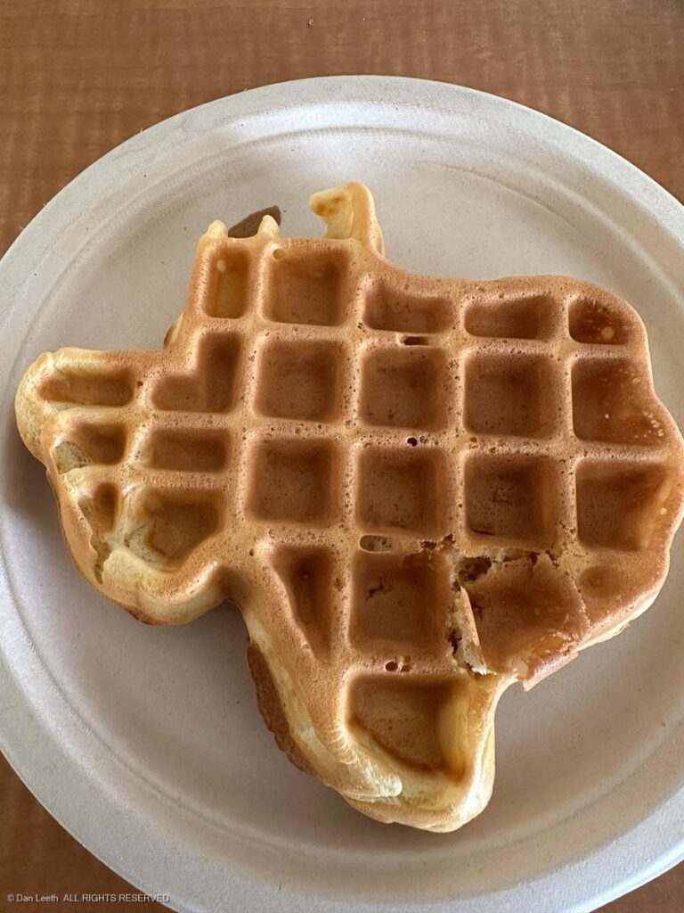
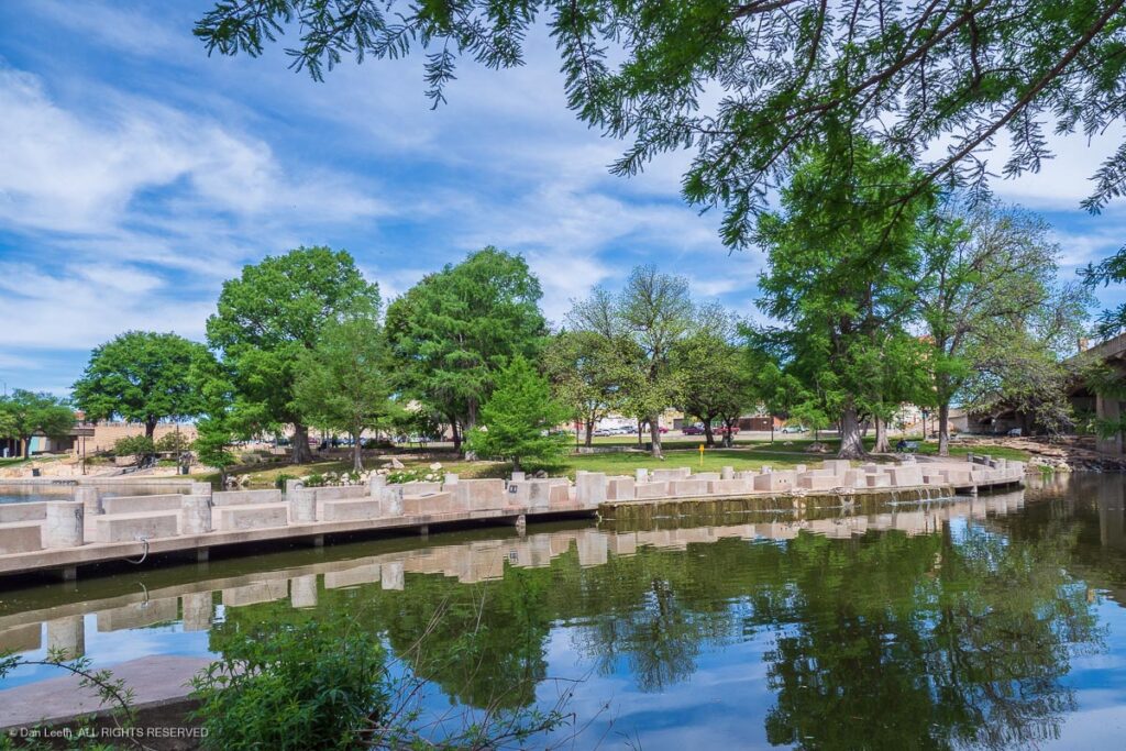
I’ve heard that some Colorado residents do not like Texans, but we really enjoyed our stay in San Angelo, in spite of the motel’s state-shaped waffles. Arriving early, we had a full day to explore the city’s River Walk trail…
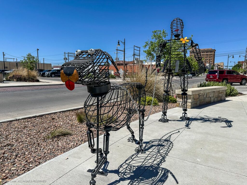
…ogle the town’s sidewalk artworks…
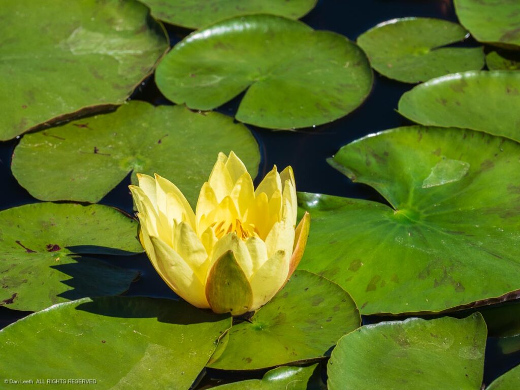
…and admire blossoms at the city’s International Waterlily Collection…
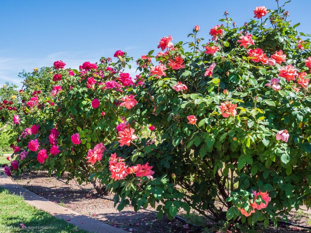
…and the nearby Municipal Rose Garden.
As it turned out, it was a good thing we were miles away from the path of totality. A front had moved into West Texas and skies above most of the area were scheduled to be totally overcast. I scanned AccuWeather forecasts for cities along the path of totality, hoping to find a town with less cloud cover.
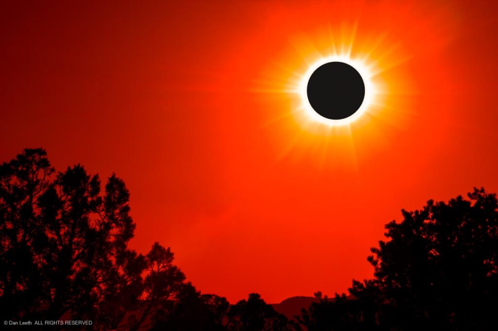
The best option appeared to be Gatesville, a city of 16,000 located about 40 miles southwest of Waco. It lay dead center on the path of totality, and the forecast said it would be only “partly cloudy.”
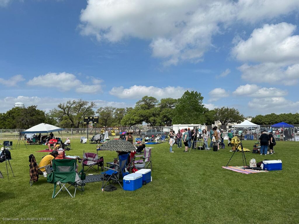
Arriving in town, we were directed to several possible sites for watching the eclipse. We chose the local ball fields option where we would have parking, restrooms, food trucks and, of course, a neighbor playing Pink Floyd’s Dark Side of the Moon on a nearby car stereo. It cost $20 to park, but the money was going to the local library, which promised it wouldn’t be used to buy banned books.
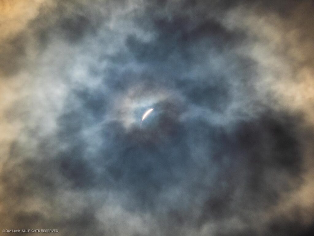
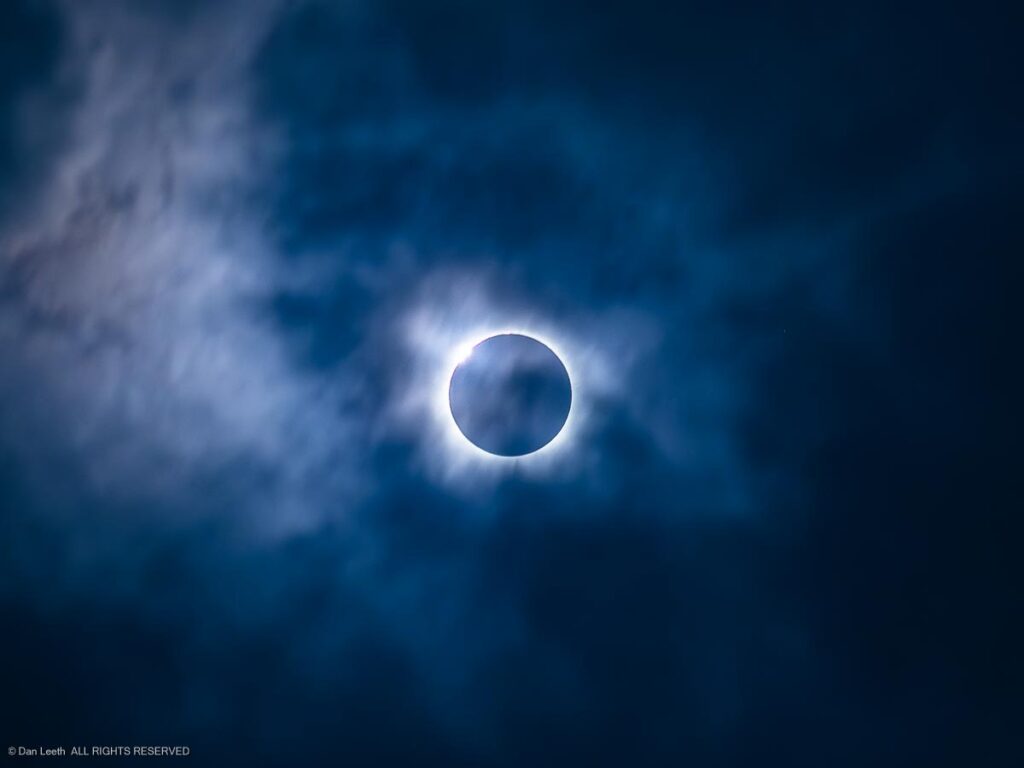
Through the morning hours before the eclipse, the clouds behaved and stayed away from Old Sol. But, as Murphy’s Law dictates, the clouds thickened as the last sliver of sun was being eaten away by the moon.
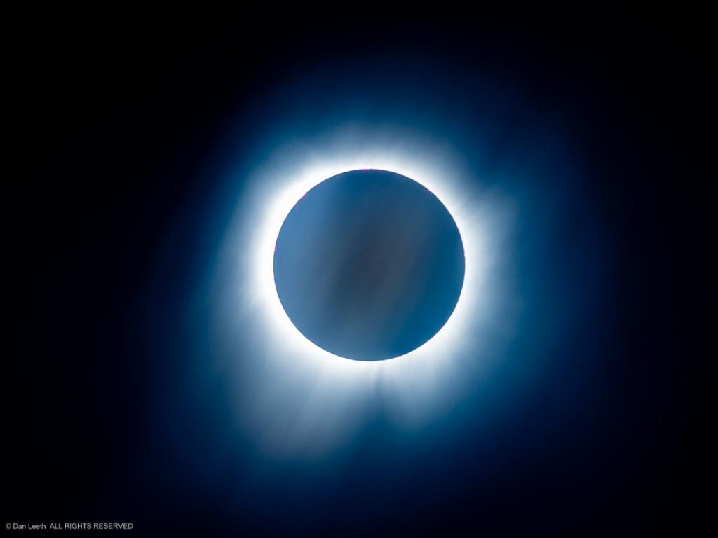
Fortunately, things were changing quickly, and during the four minutes of totality we enjoyed full-on views of the darkened sun. The thin, misty clouds actually seemed to enhance the solar corona.
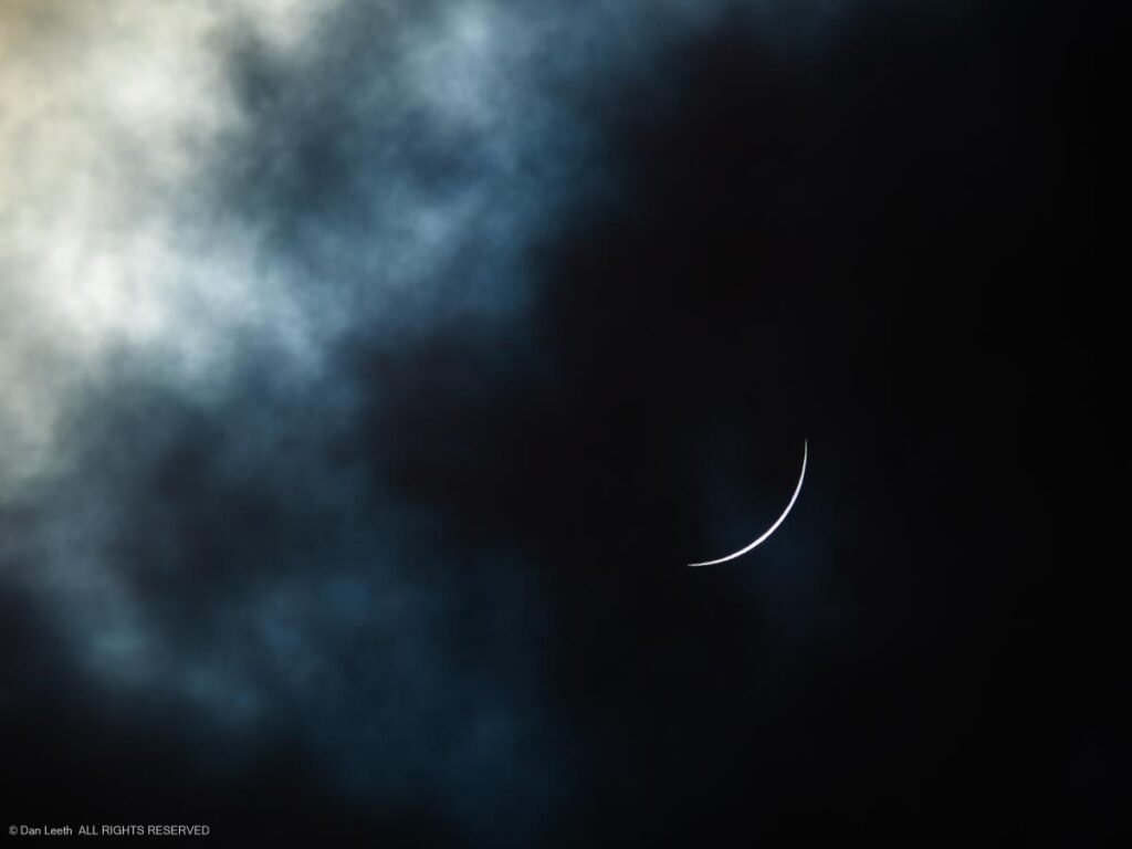
All too soon, our four minutes of totality was over and a crescent sun began to reappear.
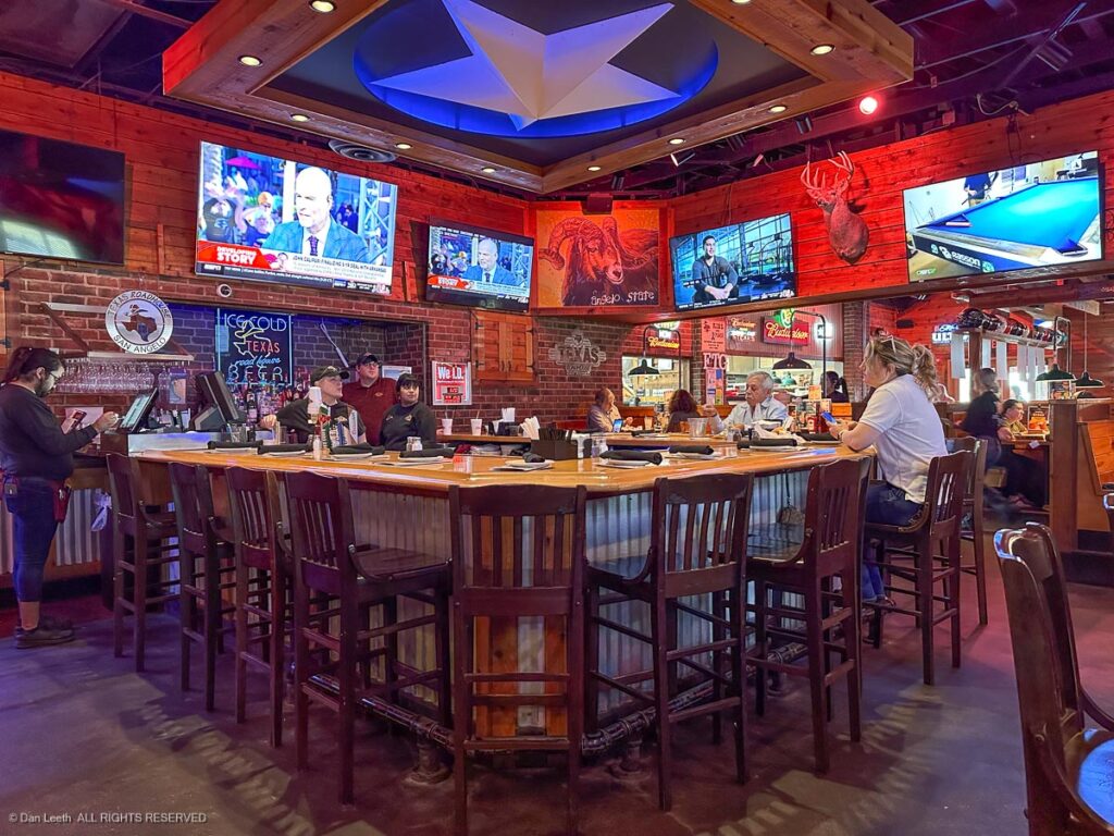
The show was over. We packed up our toys and drove back to San Angelo. There, we celebrated our Texas eclipse trip with dinner at the most Texan place around – the Texas Roadhouse (a restaurant chain started in Indiana by a former Colorado resident). The steaks and ribs were great and best of all, we got a 10% discount, courtesy of a coupon from the motel.
The next morning, we set off for home with an overnight stop along the way at Dalhart, a small city in the corner of the Texas Panhandle. The land out here, in the words of James McMurtry, is “flatter than a tabletop,” and we made good time in spite of the wind and rain. Even paved farm roads carried a 75 mph speed limit.
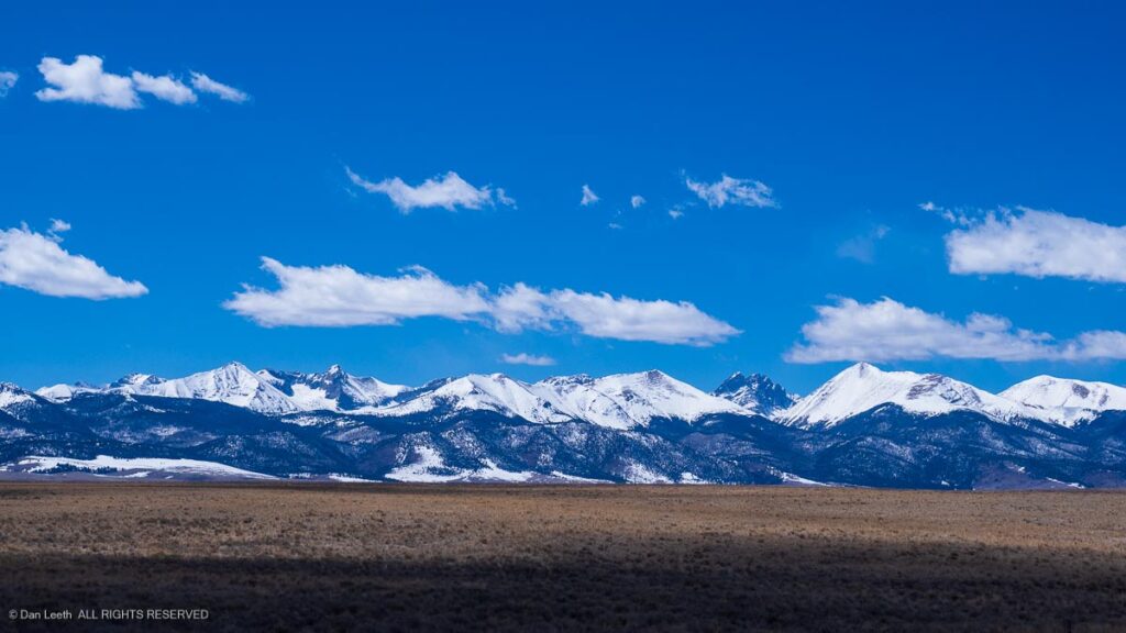
But as anyone crossing Kansas can tell you, flat is boring. I was so glad when we finally entered Colorado and were treated to views of a mountainous wall of white.
After nine days and 2,667 miles on the highway, it was good to be back home again. Rather than schussing straight down the well-paved highways in Texas, we now get to do the four-wheel slalom, dodging potholes and pavement cracks on our beautiful Colorado highways.
Every year, I get an email invitation from Xanterra to book off-season lodging at one of their national park lodges at a discounted rate. In years past, we’ve headed off to Zion for our national park winter getaways. This year, we chose the Grand Canyon, where we would celebrate the anniversary of my 40th birthday.
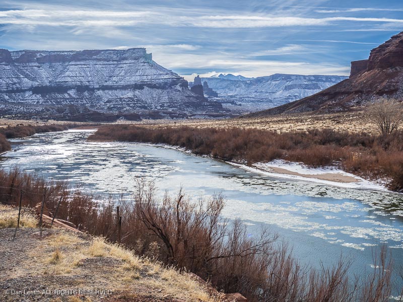
The route down took us south along what was formerly the Grand River to Moab. The cliffs were dusted with snow and ice floated in the stream. It’s so much nicer driving the Subaru instead of the truck pulling the trailer.
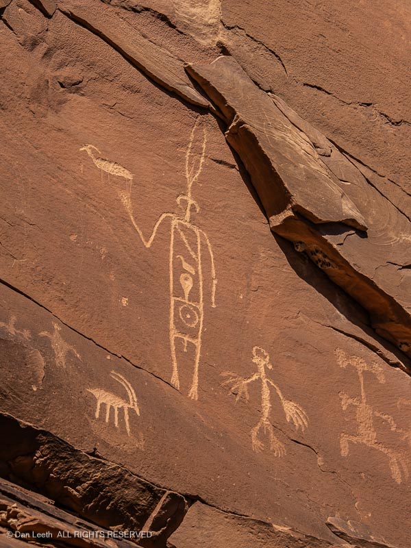
Having booked months in advance and not knowing what the weather might bring, we chose to break up our trip south with an overnight’s stay in Bluff, Utah. Arriving early, we drove to the nearby Sand Island BLM campground to photograph an extensive array of Indian petroglyphs.
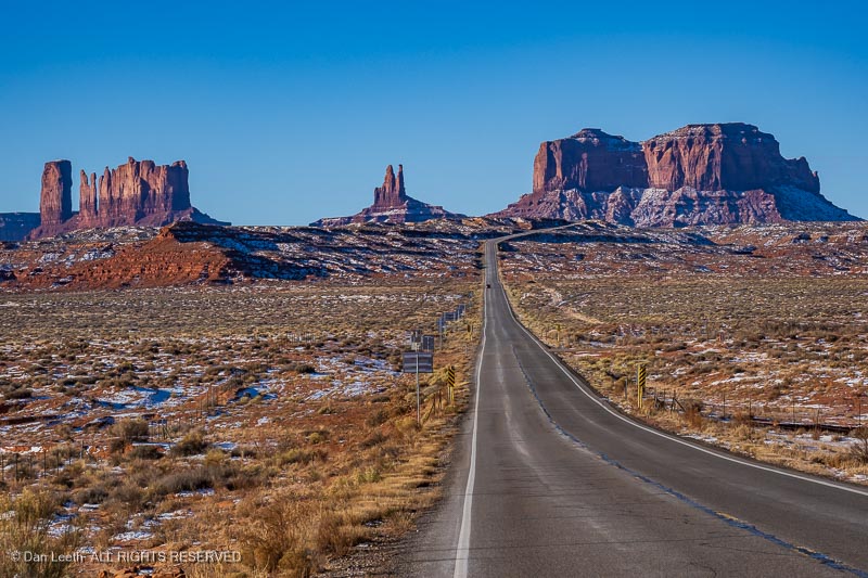
From Bluff, we had a choice of routes to the Canyon. We chose the scenic, Monument Valley alternative. The nice thing about winter travel here is that there was very little traffic.
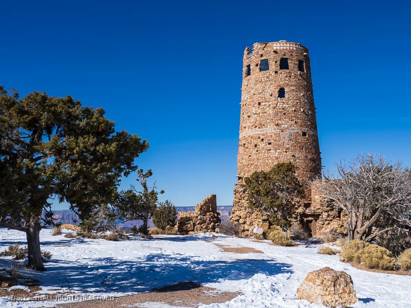
After a bathroom break and a lunch of Navajo tacos at the Cameron Trading Post, we headed into the Canyon, with a long stop at the Desert View Watchtower.
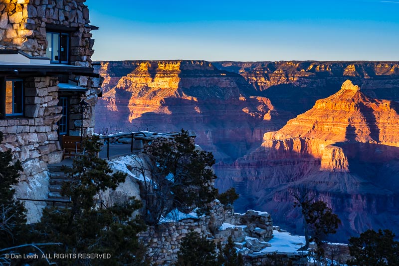
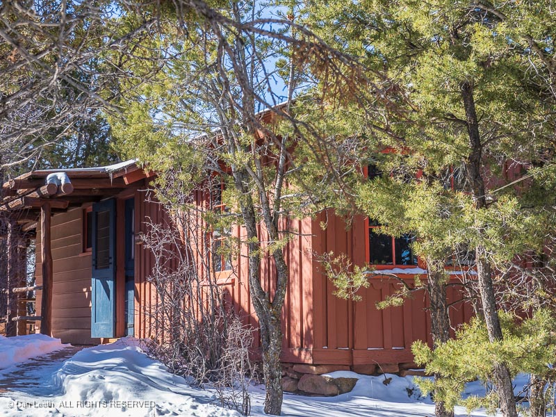
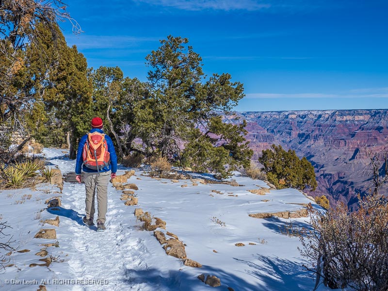
A few stops later, we arrived at Grand Canyon Village and followed the signs to the Bright Angel Lodge where our cabin for three nights was located. The place was small but cozy with the rim a short stroll away.
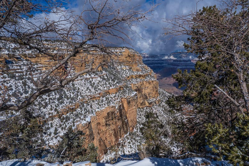
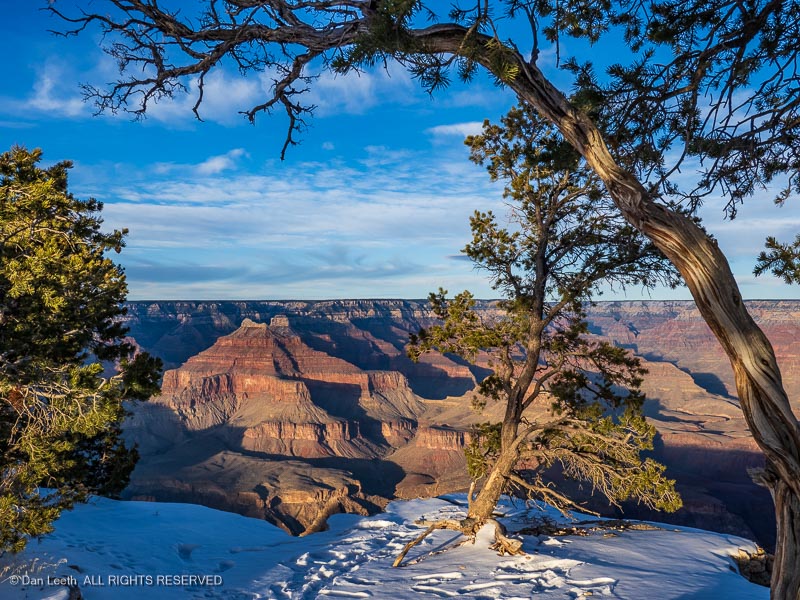
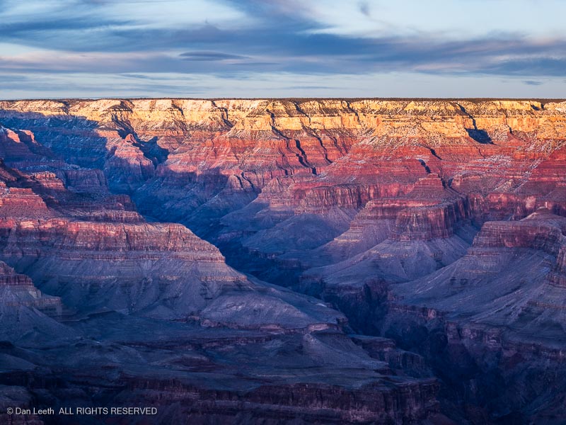
It snowed that night, leaving the canyon walls coated with winter white. We wandered around shooting photos. That night, we dined in the El Tovar.
The Bright Angel Trail to the bottom was closed a ½ mile below the rim, so Dianne and I couldn’t do our usual 50-mile, Rim-to-Rim-to-Rim day hike. Instead, we settled for a stroll down the snow-packed Rim Trail along the canyon rim.
While the trail was covered, most of the snow had melted from the canyon cliffs.
Arizona’s Big Ditch has always been a special place to us. Between us, Dianne and I have hiked all of the park’s maintained trails, most of its unmaintained ones, and we’ve floated its length on two occasions, once in dories. It’s always good to be back.
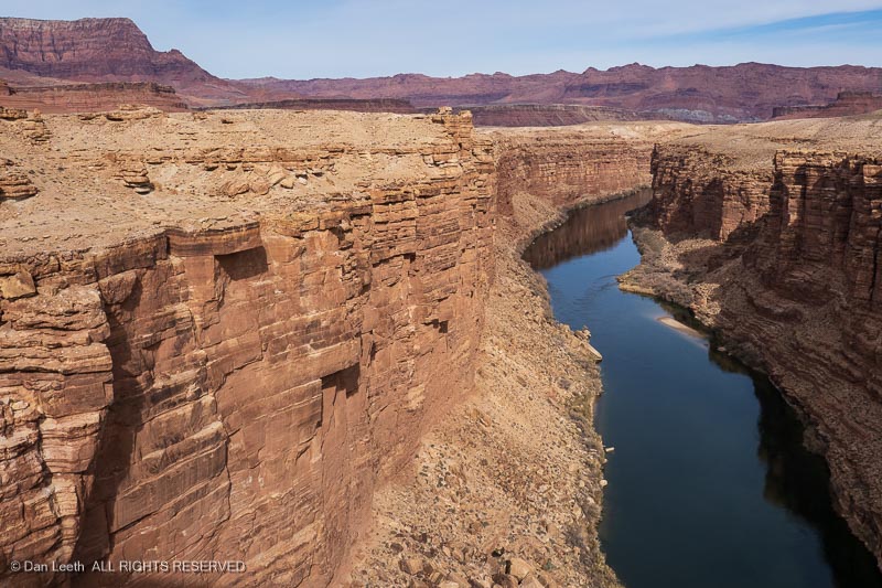
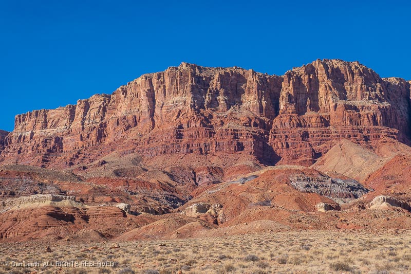
Since we were going to be in the neighborhood anyway, we had also booked a three-night stay Ruby’s Inn, a Best Western resort just outside Bryce Canyon National Park. We had a pair of options for routes there from the Grand Canyon. We chose the Vermilion Cliff route, which crosses Marble Canyon on the Navajo Bridge.
There’s a visitor center/gift shop there along with some restrooms. Fortunately, the flush toilets come with complete instructions.
We followed the towering Vermilion Cliffs for 40+ miles to Jacob Lake, then turned north toward Utah. I remember how inspired I was the first time I saw this magnificent escarpment when I was just a kid. I’m still inspired.
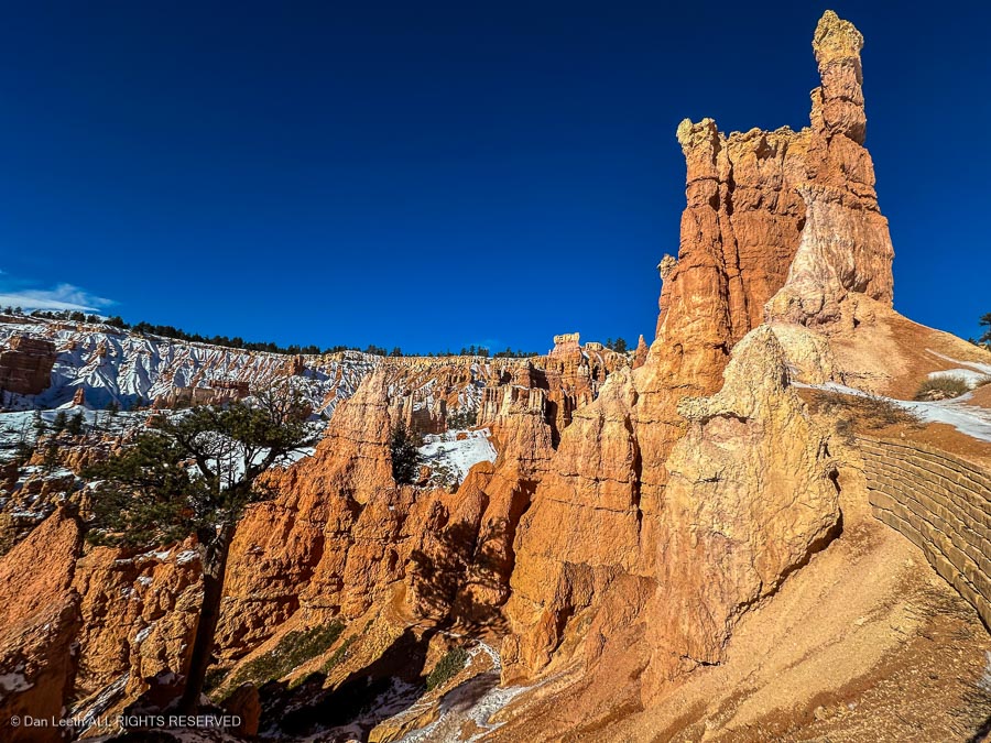
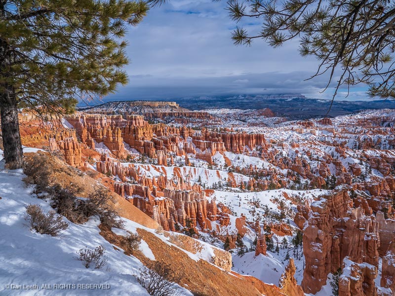
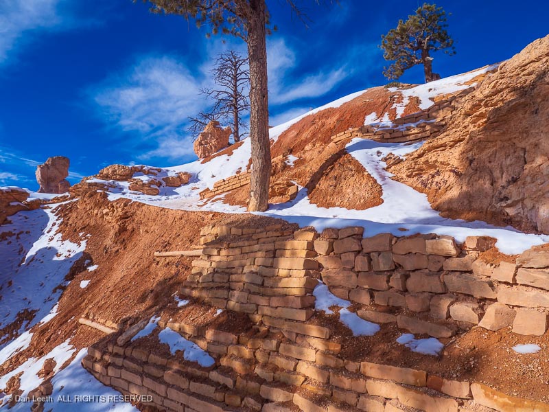
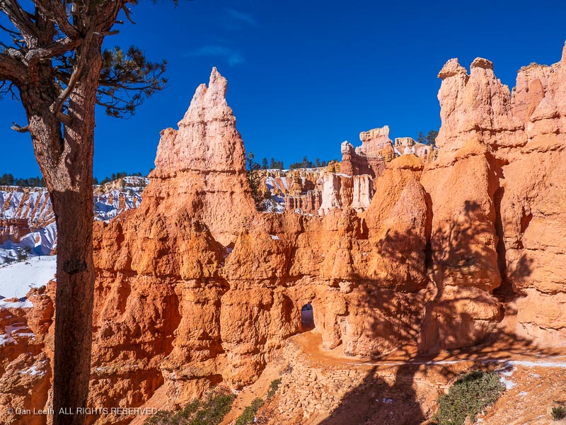
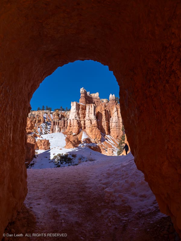
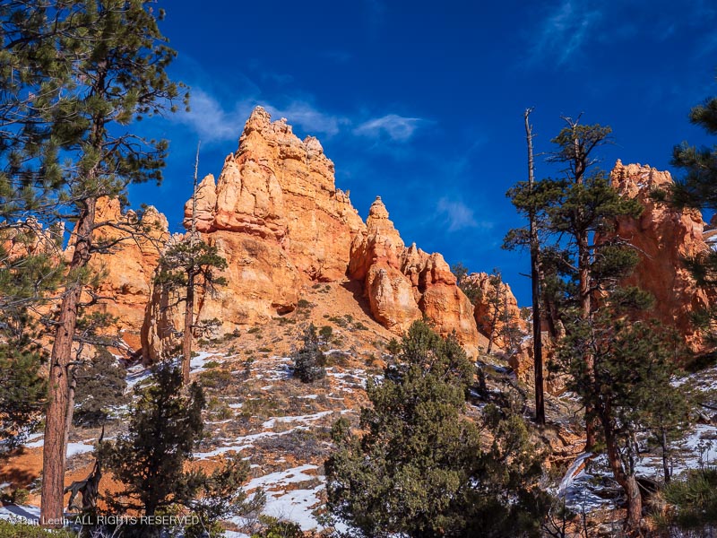
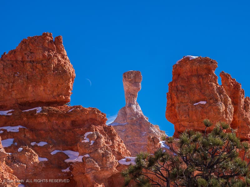
Arriving at Bryce, we checked into our room. The next day, we headed into the park for some rim-top views of snow on the hoodoos.
One of the rangers suggested a hike we might like. The next morning, we parked at the trailhead, strapped traction spikes to our shoes and headed down the snow-packed, Queen’s Garden Trail.
The going was slow, not because of trail conditions but because of the beauty that surrounded us. I shot well over 300 photos and Dianne came close to that number.
In April/May, we are scheduled to go on a short, Colorado Mountain Club trailer-camping outing to Capitol Reef National Park. After Cap Reef, we had reservations to camp in a Utah State Park near the San Rafael Swell.
That state park reservation got cancelled when we got home. Instead, we booked an RV site near Bryce and plan to spend two weeks exploring Bryce Canyon and the Grand Staircase-Escalante National Monument after Cap Reef.
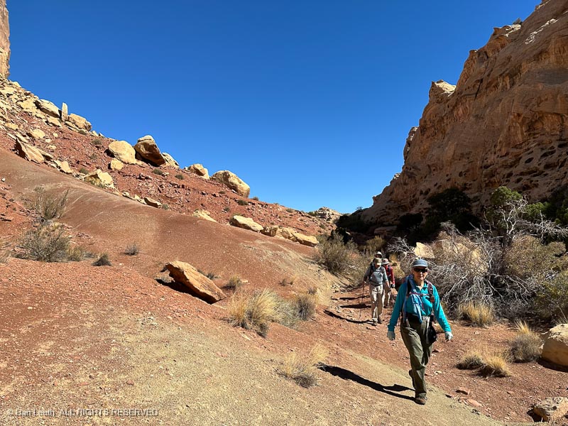
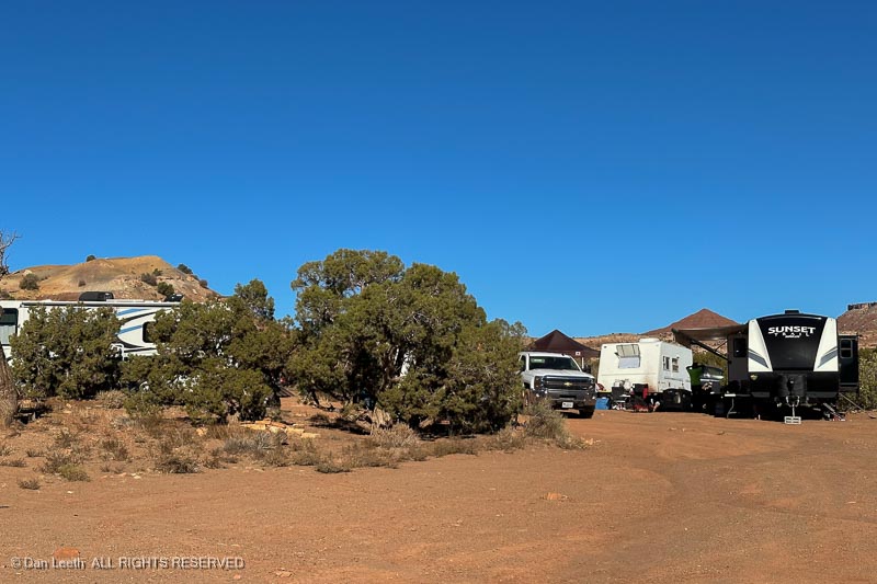
On Thursday, we hooked up the trailer and headed off to Green River State Park, a 90-minute drive from home. We had five nights reserved at our favorite campsite with water and electric hookups. Our objective was to hike a couple of canyons on a Colorado Mountain Club (CMC) trip, then spend a couple of days exploring on our own.
Our original plan was to continue from Green River to Joshua Tree National Park and then on to Death Valley for a couple of weeks. Damage caused by Hurricane Hillary nixed those plans. Instead of a month on the road, we would have just five nights away, which was fine.
Dianne was having knee issues and could barely walk, so there wouldn’t be much hiking for her to do anyway. At Green River she could stay at camp and enjoy the day without needing to supervise her husband.
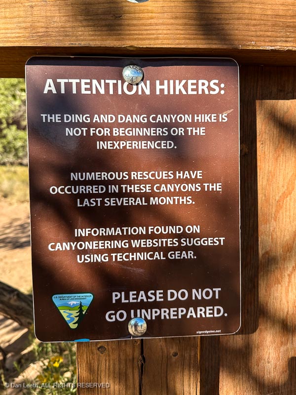
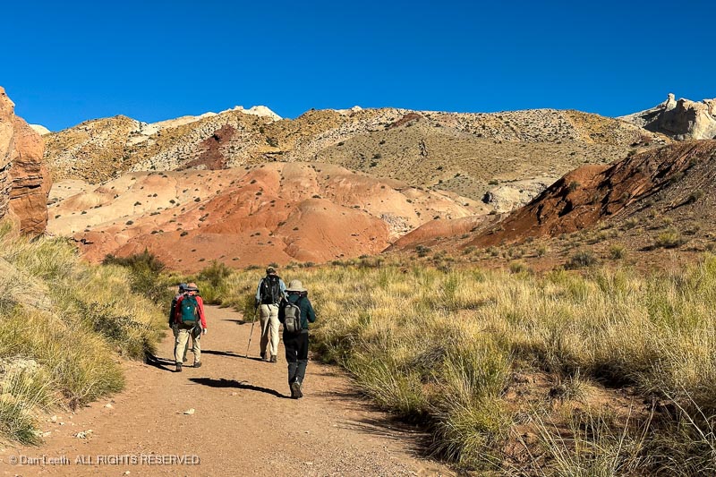
Friday morning, five of us from the CMC set off to hike Ding and Dang Canyons in the San Rafael Swell for a day of Type II Fun – difficult at the time but feels rewarding afterward. The BLM made sure we knew what we were getting ourselves into.
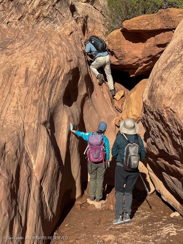
Our adventure began with a short, mile-long hike up a dry wash to the junction of the two neighboring defiles. We took the right fork to begin our walk up Ding Canyon.
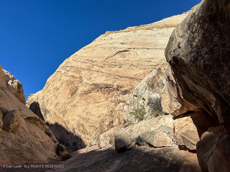
Walls rose and we were soon passing through a narrow slot in the cliffs with the occasional obstacle to overcome. Let the fun begin.
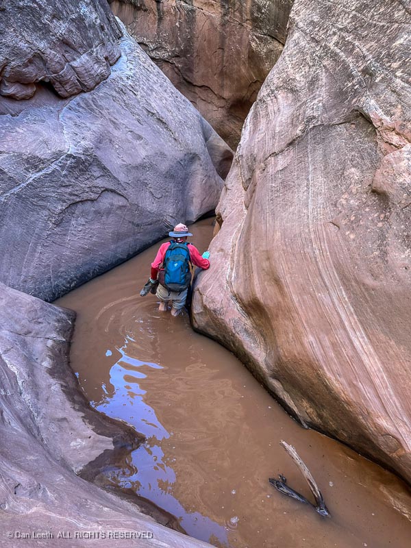
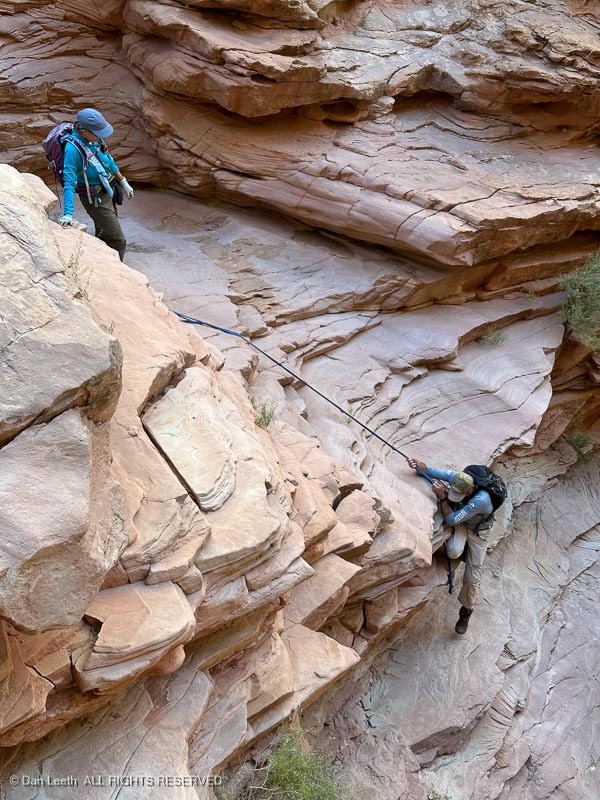
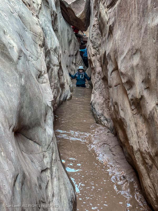
It didn’t take long for us to find our first water hazard – a 50-foot-long, calf-deep strip of cold, muddy water.
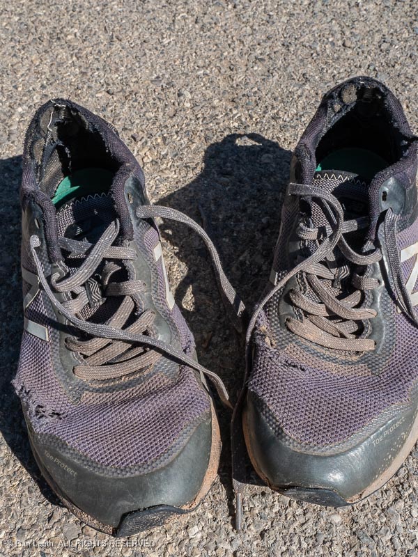
Off came the hiking boots and on went the wet walking wear. For me, it was an old pair of tennie-runners, which I wore sans socks.
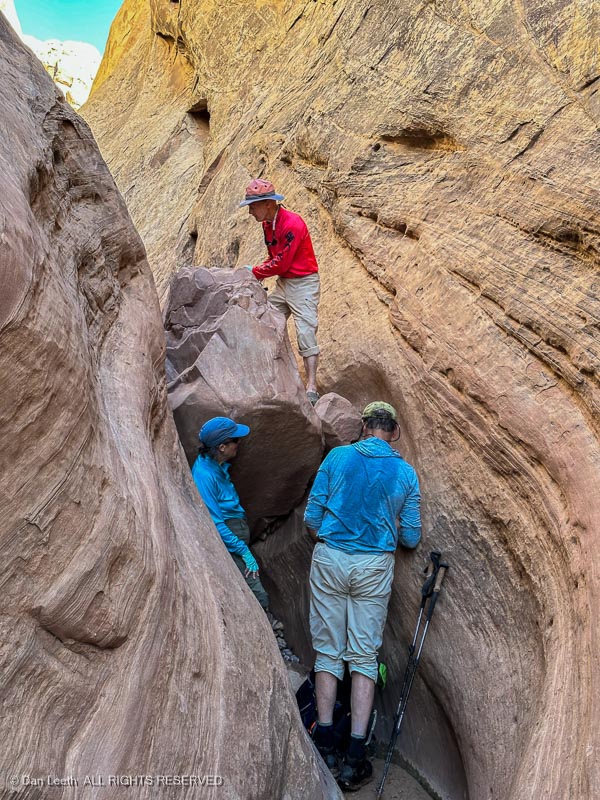
The route got more interesting as we progressed upward with boulder chockstones blocking the canyon…
…and more water hazards to negotiate.
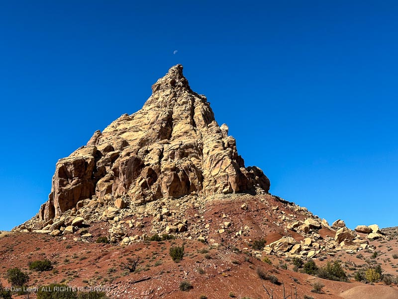
About three miles from the start, the canyon opened, and we exited into a broad valley. There we got our first sighting of Ding Dang Dome, which we all agreed looked nothing like a “dome.” Whoever named it obviously opted for alliteration over accuracy.
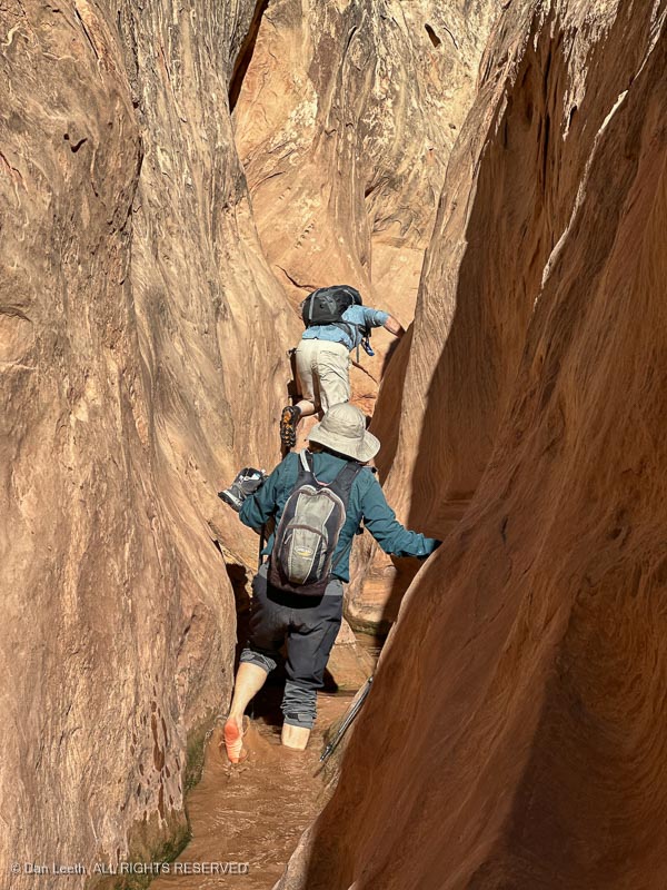
From Ding Dang Dome, we turned down a shallow wash and soon entered Dang Canyon, the more technical of the two abysses.
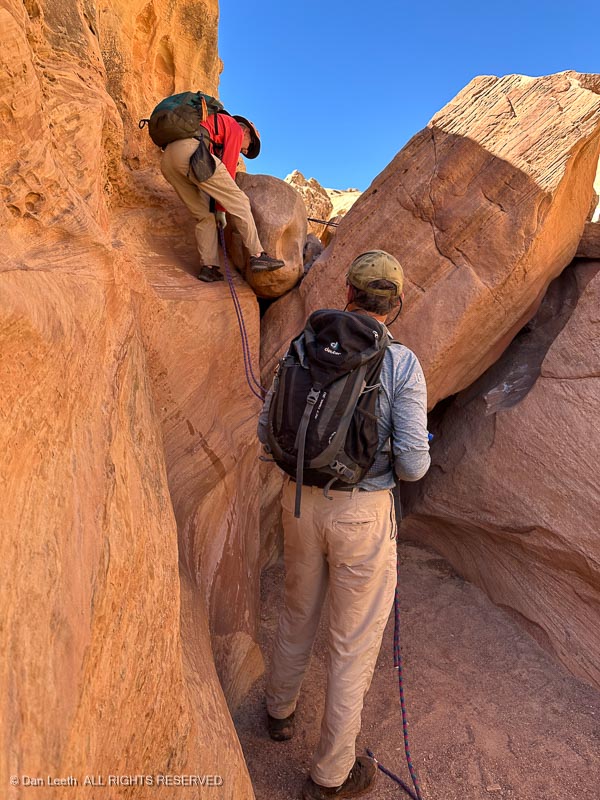
In numerous spots, we had to use ropes to descend one drop…
…after another.
There were deeper pools of cold, muddy water that, depending on one’s height, was crotch to waist deep.
Finally, the canyon opened, sunlight bounced off the rocks and I could finally get out of my tennies and put my hiking boots (and socks) back on.
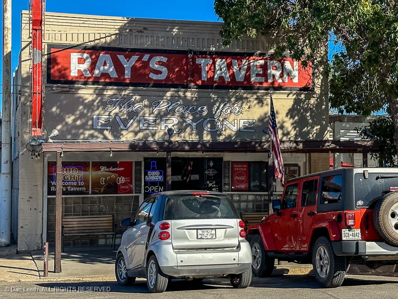
That night, we headed to Ray’s Tavern for burgers and beer.
After a day like this, that glass of Wasatch Amber tasted swell.
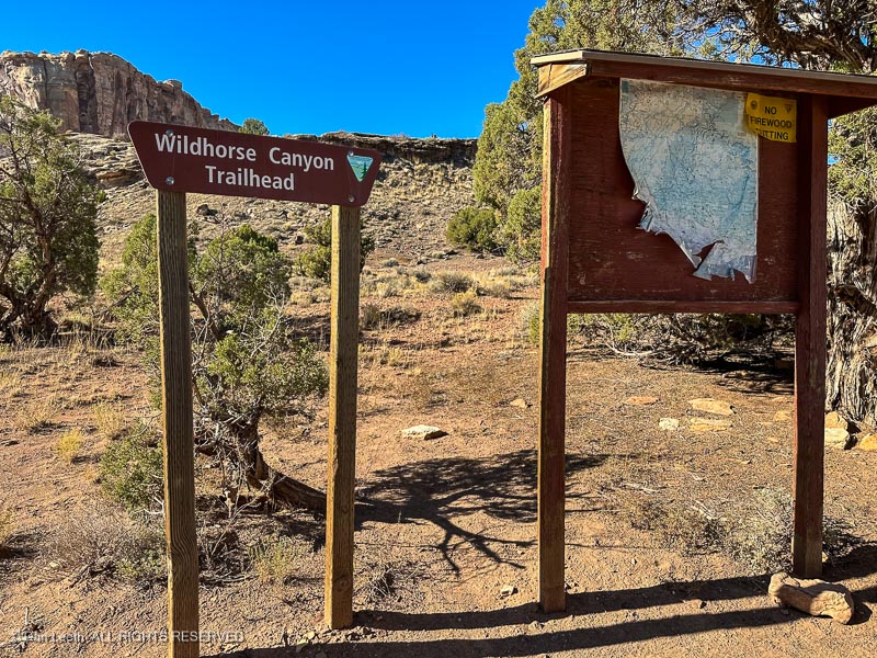
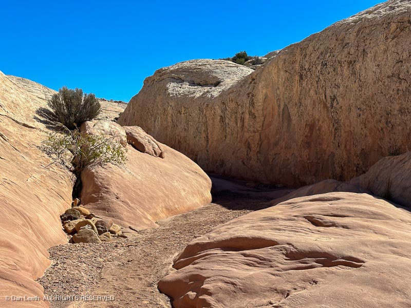
Not to be confused with Little Wildhorse, which we hiked last spring, just plain old Wildhorse is a broad canyon with only a small section of narrows. It’s easy walking with no chockstones to climb nor descend and nary a drop of water to wade. It was a perfect follow up to Ding and Dang. This will be Type I fun.
A dozen of us started down the canyon from the trailhead, which also served as a campground for friendly ATV and dirt bikers. It was easy going with a dash of fall color to admire.
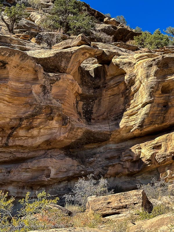
We passed the first…
…and second of the two arches/bridges and stopped for photographs.
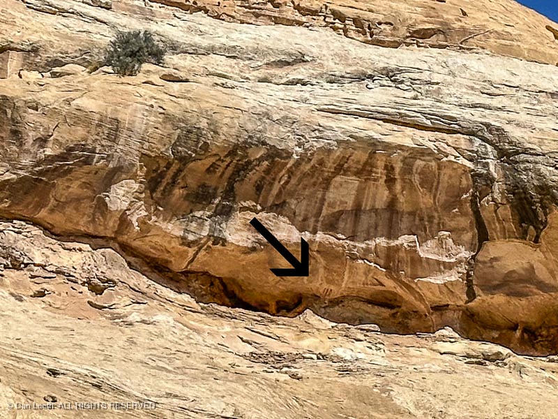
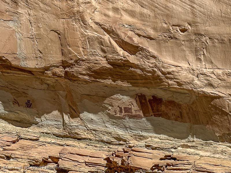
A bit farther down the canyon, one of our eagle-eyed fellow hikers spotted some Fremont Indian pictographs high on the cliffs.
After passing through a shallow set of narrows, we stopped for lunch beneath a cottonwood tree, then retraced our steps, four miles back to our vehicles.
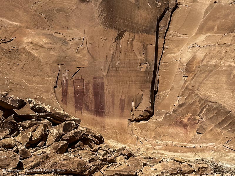
On the way back to Green River, Paul, our driver first stopped so we could check out the Temple Mountain Wash pictographs…
…and then took us on a short a detour off the interstate to see the Black Dragon pictographs.
Our Colorado Mountain Club friends departed on Sunday, but we had booked a pair of additional nights at Green River State Park, so we got to stay and enjoy two extra days of beautiful Utah weather without a fixed agenda.
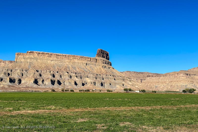
Our first day was spent just enjoying the town. We drove out to where Dianne’s ancestors once owned a ranch at the base of Gunnison Butte.
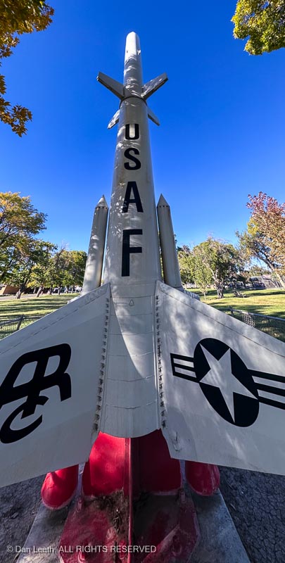
Back in town, we learned about the Green River Lunch Site where Athena missiles like this were fired toward New Mexico.
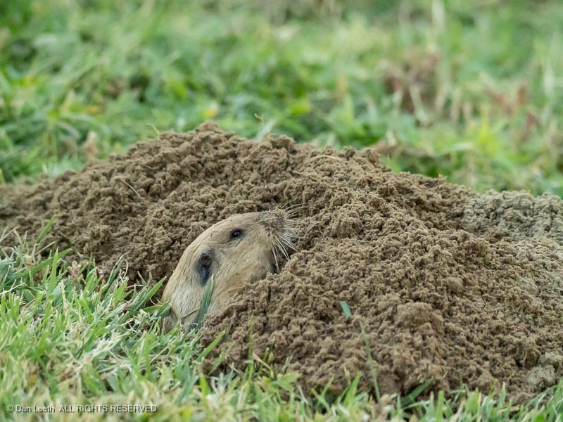
At camp, we watched this little guy excavating a tunnel beneath the campground lawn.
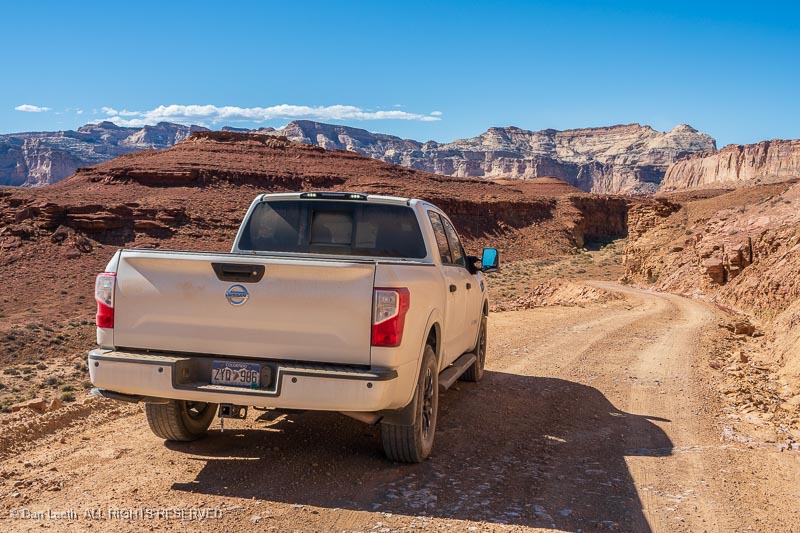
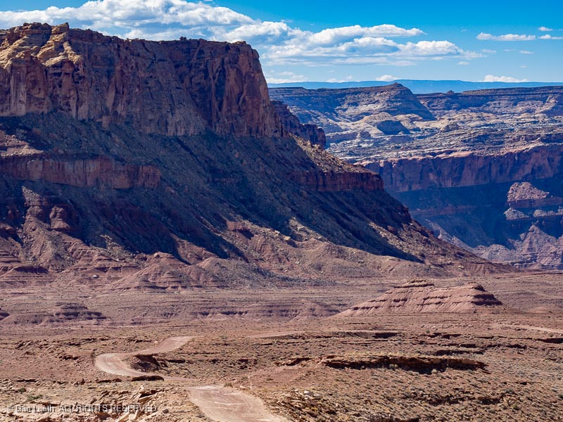
On Monday, we topped up the truck’s tank and went for a drive out on backcountry roads, on which we had originally planned to take the Subaru.
Normally I’d be willing to disclose our route, but we encountered fewer than a half-dozen other vehicles out in this vast, empty landscape. We want to keep it that way.
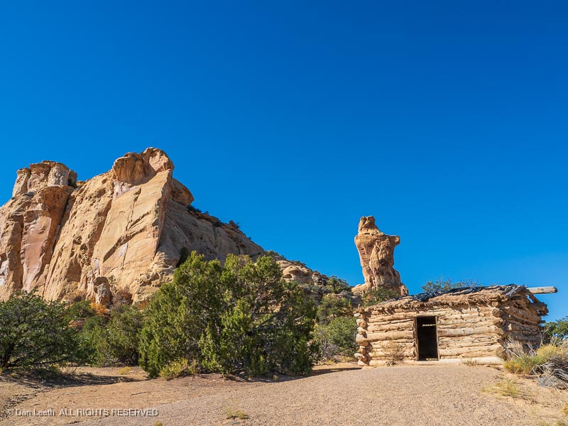
Of course, those of you familiar with the area may recognize this cabin, which we drove near the start of our adventure.
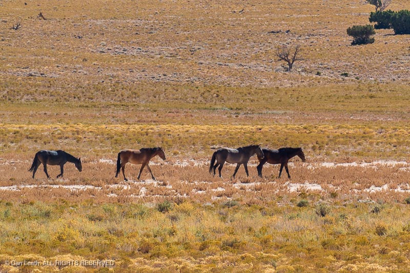
The first part of our journey took us across some open, grassy lands, home to herds of wild horses.
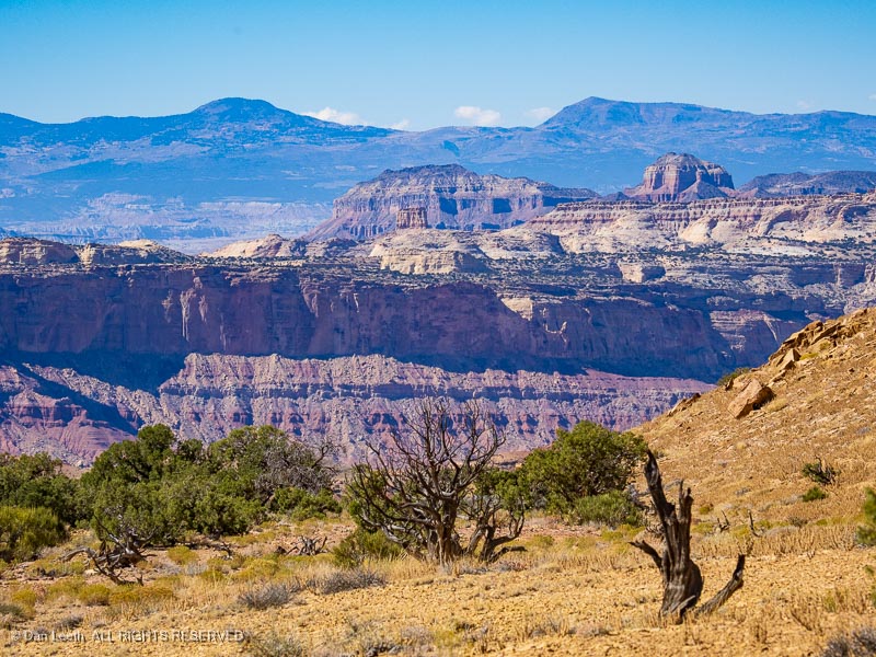
The scenery changed a few miles later.
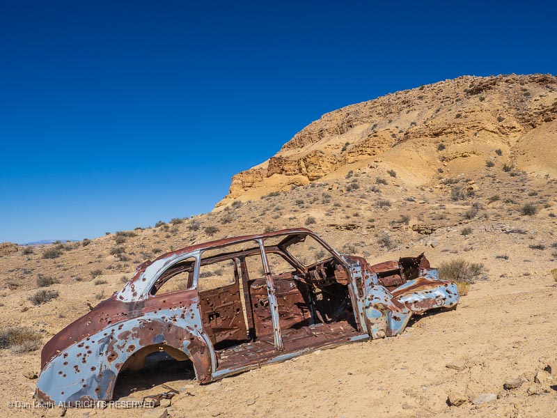
We passed several previously owned vehicles, this one perforated with more bullet holes than Bonnie & Clyde’s ’34 Ford.
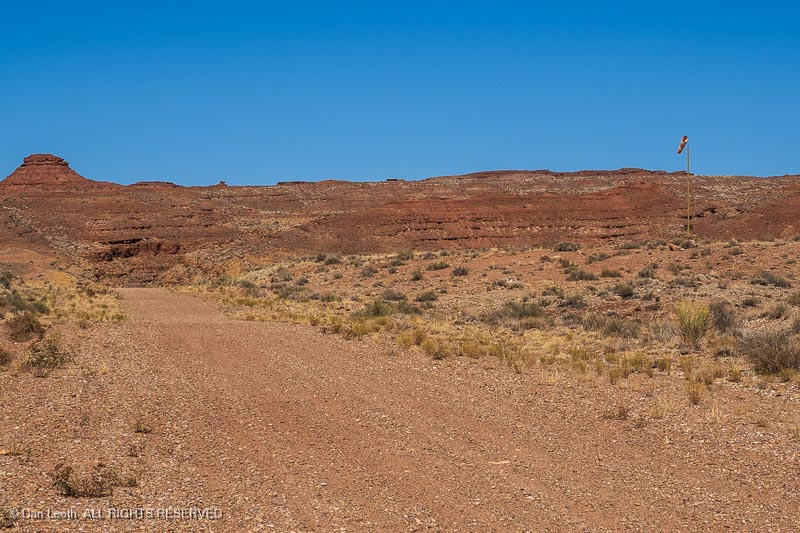
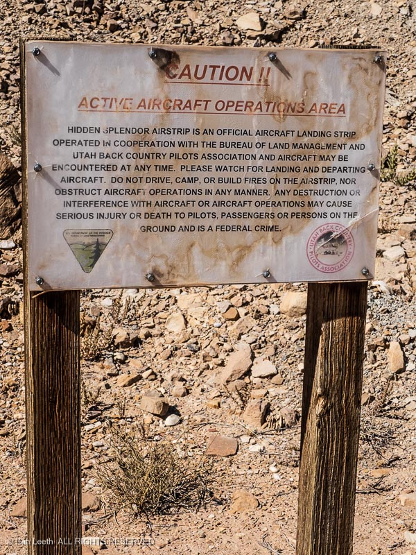
This is not a road. Notice the windsock? This is actually an airfield runway near an old uranium mine site.
It’s still in use today, we’ve been told. Instead of the TSA, I suspect flights into here are more likely to be greeted by the DEA.
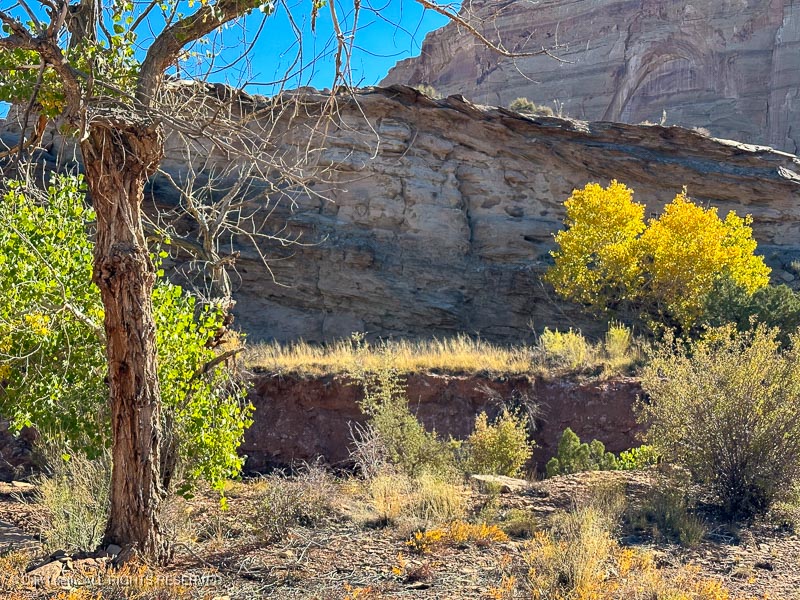
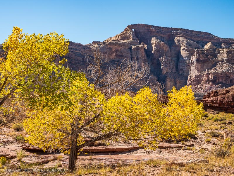
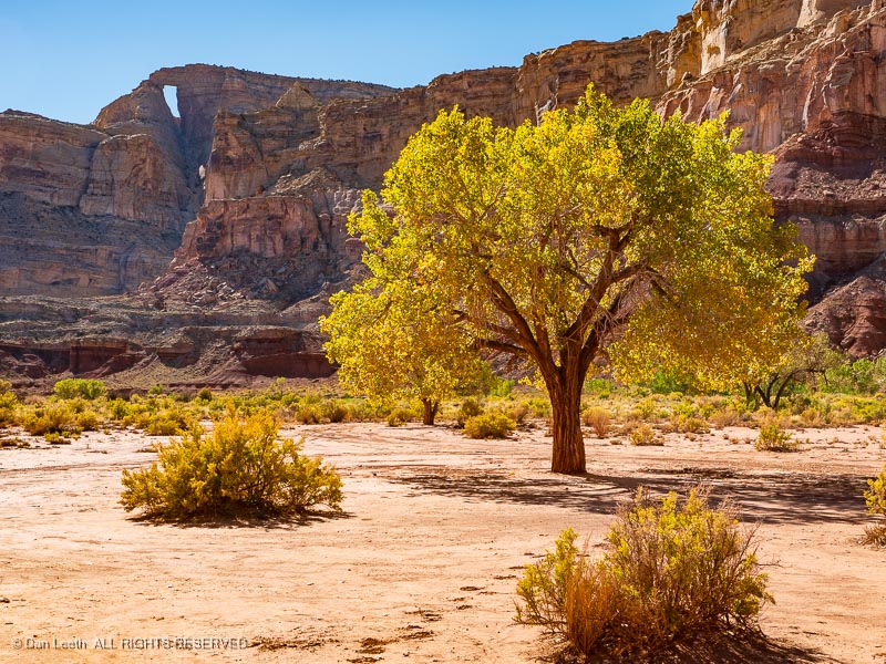
Backtracking, we came to a fork in the road and took it. We soon encountered a golden touch of autumn color…
…with a lofty, natural arch for a backdrop.
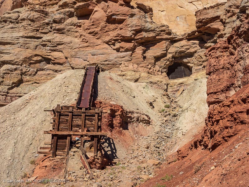
We passed the rusty remains of an old uranium mine…
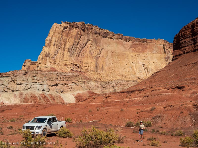
…and plenty of towering natural splendor to admire and photograph.
With Dianne unable to hike, our backcountry drive proved to be a swell way to spend our last full day in the San Rafael Swell.
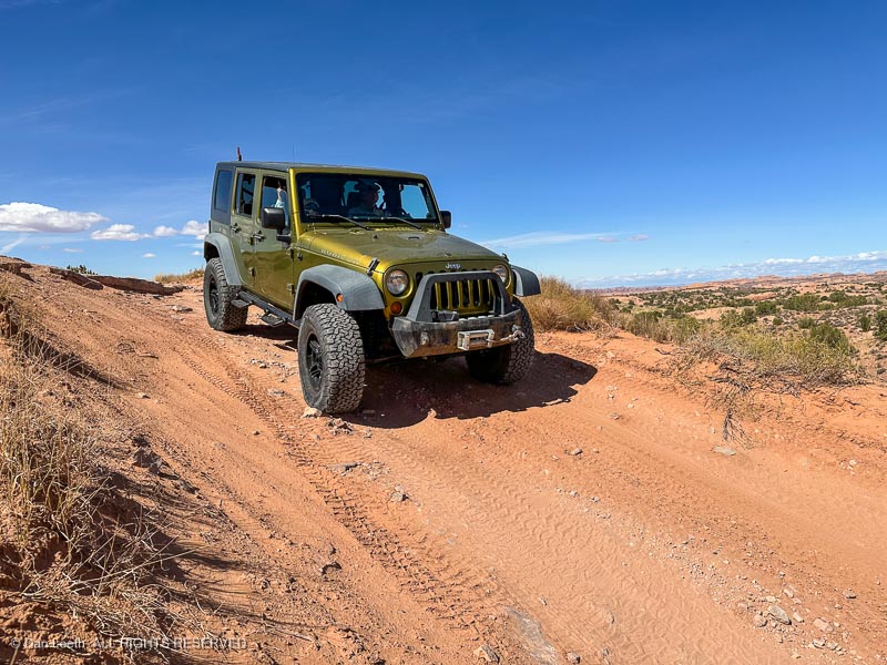
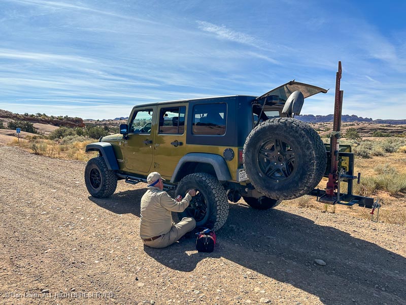
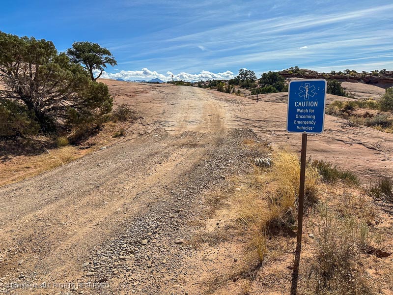
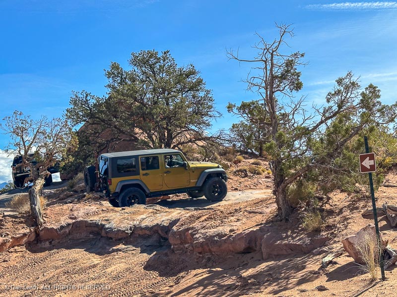
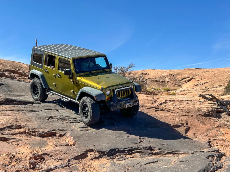
Our new Subaru Outback (SOB) will go a lot of places, but there are some trails where it pays to have friends like Bob and Becky who own a Jeep. One such pathway is the Fins and Things Trail in the Sand Flats Recreation Area east of Moab.
At the start of the trail, Bob took the precaution of airing down his tires to increase traction.
While he’s doing that, I looked at the road and thought that the SOB would have no troubleFins and Things, at least on the starting terrain…
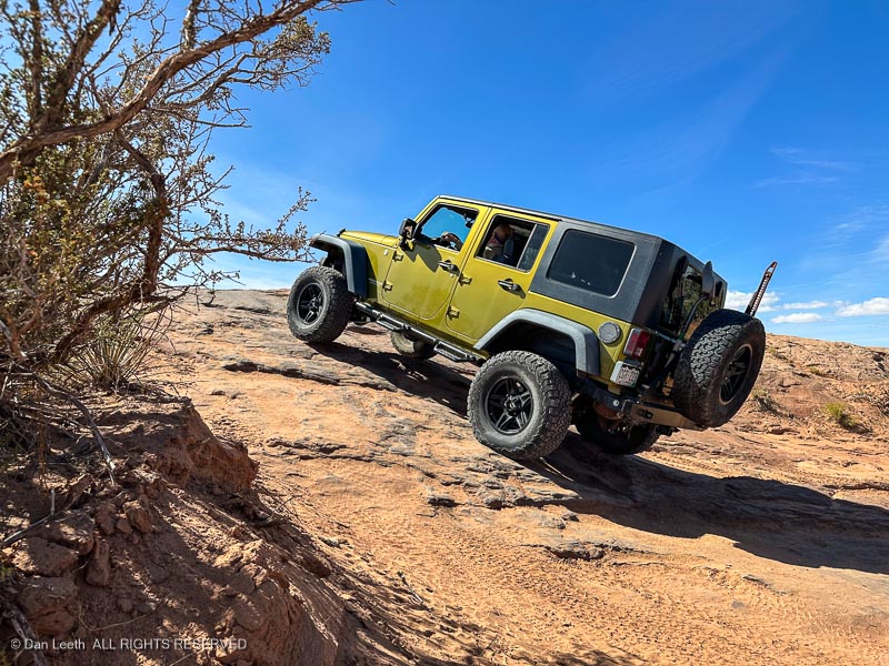
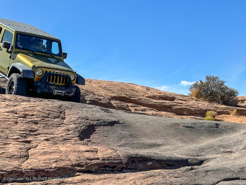
…but on this trail, things have a way of quickly going from good to interesting.
Notice the skid marks on this drop.
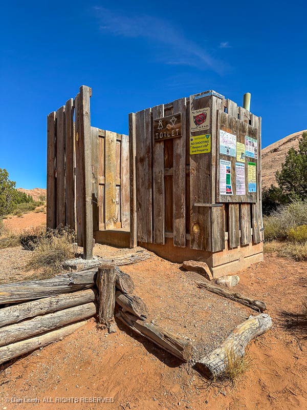
Best of all, it wasn’t all bushes out here. The ladies actually had some nice facilities to use out in the wild (I still preferred the bushes).
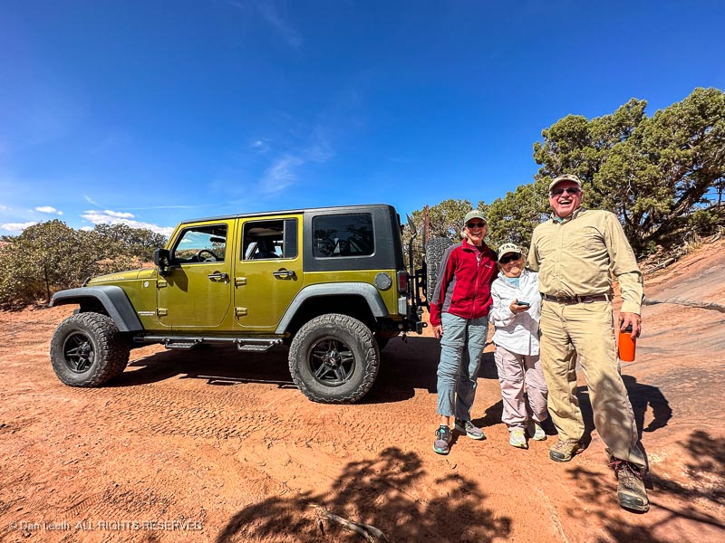
After the obligatory group photo…
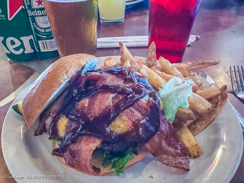
…we headed into Moab for burgers and brews (yes, Utah now offers real beer in restaurants).
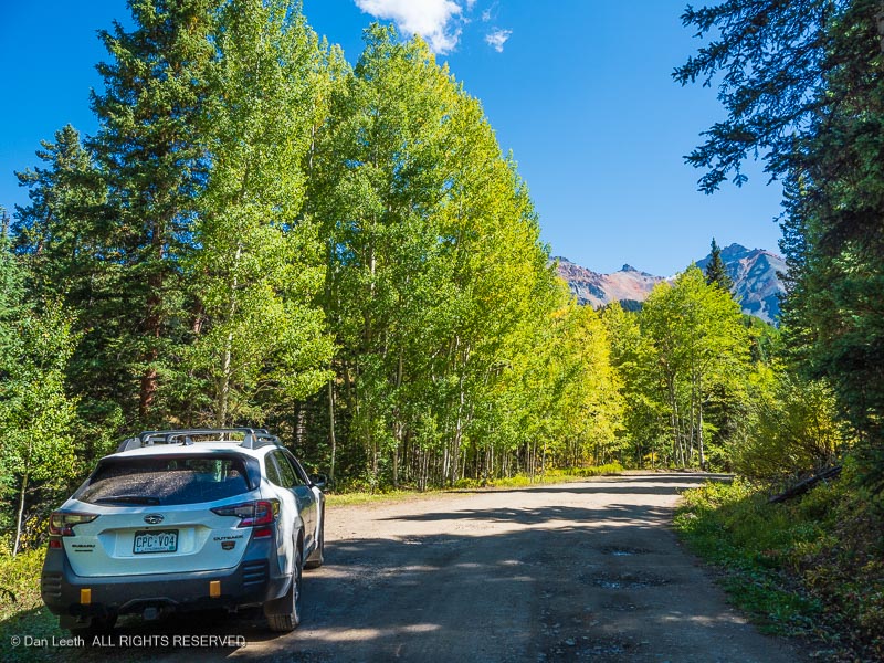
On Monday, we set off on a little two-day drive down some old familiar territory in search of a little fall color. (Leaf changing seems to be delayed this year.)
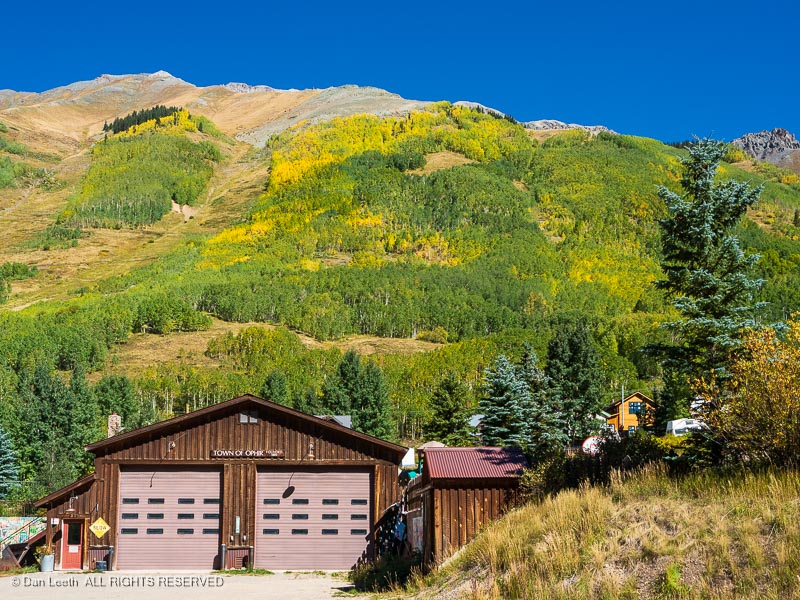
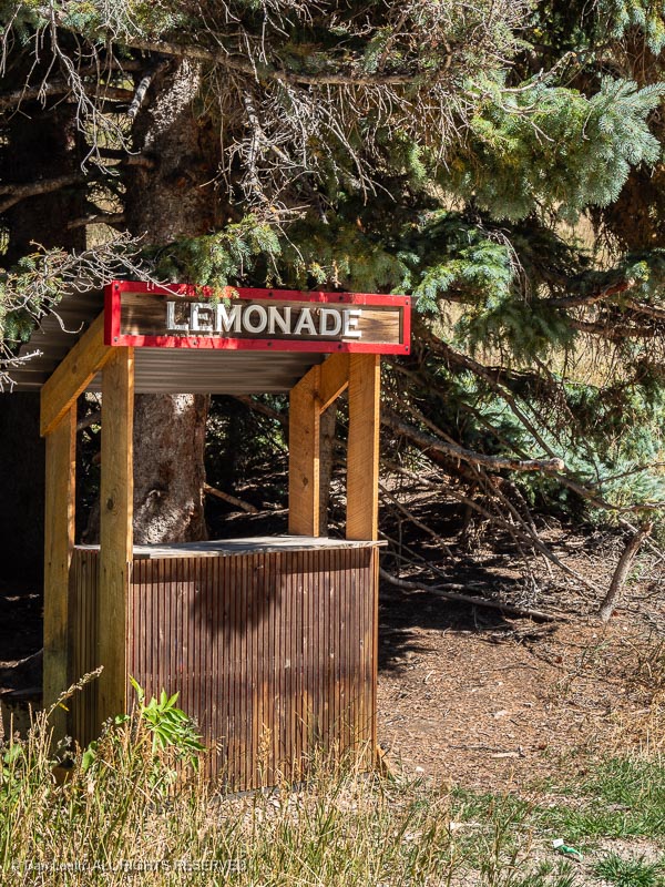
On the way, we took a short detour into the old mining town of Ophir. I had hoped to stop for a Lemonade, but it seems the kids’ upscale shop was apparently closed for the season.
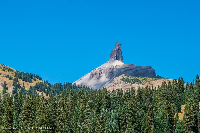
Our route took us down the San Juan Skyway to Lizard Head Pass (named for a spire that doesn’t look like the head of any lizard I’ve ever seen).
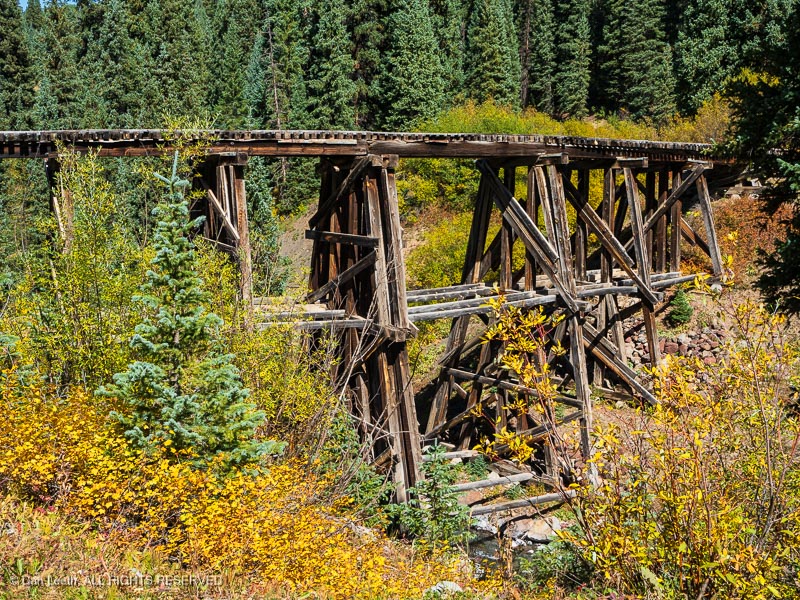
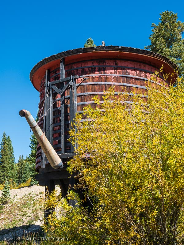
From there, we took detoured down part of the Galloping Goose Trail.
The graded roadway follows the route of the Rio Grande Southern Railroad, once the tracks of the Galloping Geese . Along the way, we passed an abandoned trestle…
…and an historic water tank from the bygone railroad days.
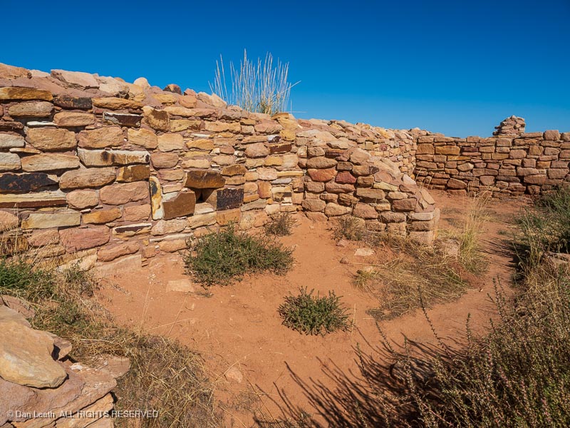
We camped for the night in the Super 8 in Cortez. Tuesday morning, we headed for home on a route through Colorado’s canyon country. Our first stop was a return visit to the Lowery Pueblo ruins in Canyons of the Ancients National Monument, a site I’ve enjoyed several times before.
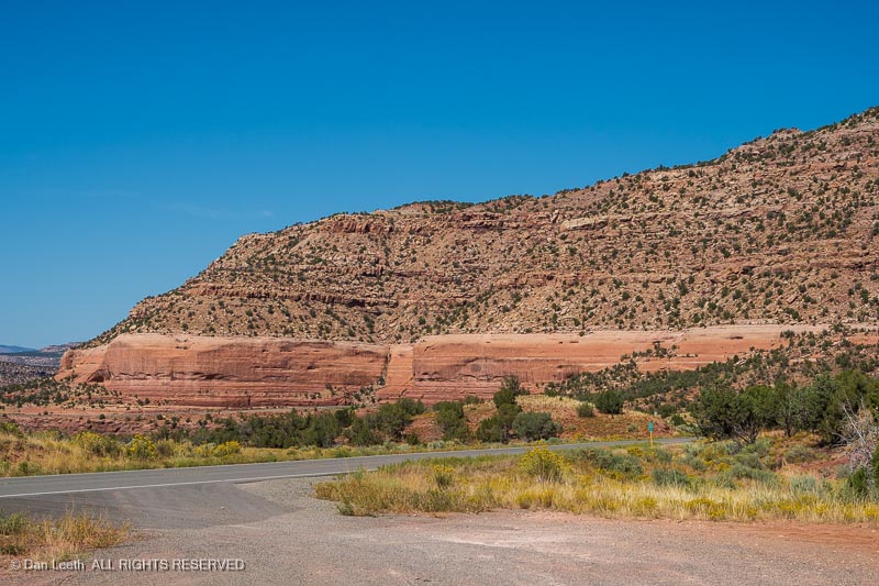
From there, we drove through the self-proclaimed Pinto Bean Capital of the World and soon turned onto a highway that would follow the Dolores River northward.
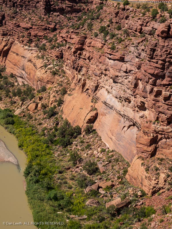
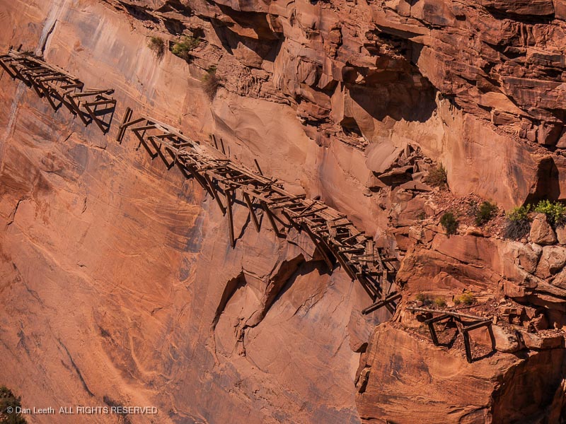
Along the way, we stopped to look down on the remains of the famous hanging flume…
…a wooden water trough clinging to the cliffs, 150+ feet above the canyon floor.
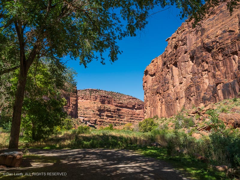
We continued on toward Gateway, motoring through a wide canyon with ruddy cliffs towering skyward on both sides of the highway. (Yes, friends, this is a pretty part of Colorado.)
Entering the Grand Valley, we made a detour to Dos Hombres (our favorite Mexican restaurant) in Clifton for burritos (excellent) and margaritas (not excellent). Then on toward home.