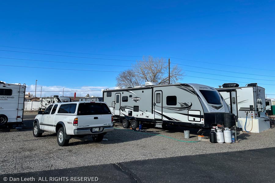
The neighborhood is getting a bit crowded. We’ve gone all winter without anybody even close to us at the RV Resort where we’re staying. A few days ago, another trailer took the spot two sites over.
Today, we got a next-door neighbor, who’s parked about three feet away. The view out our dining room window now faces straight into one of their windows. Dianne’s unhappy that she can’t see what’s happening around us.
Parking lot-style sites is why we’re not fond of RV parks. Fortunately, we’ll be leaving here and heading south on March 1st. After bunking down in RV parks for 165 nights, we’re finally going to go “camping.”
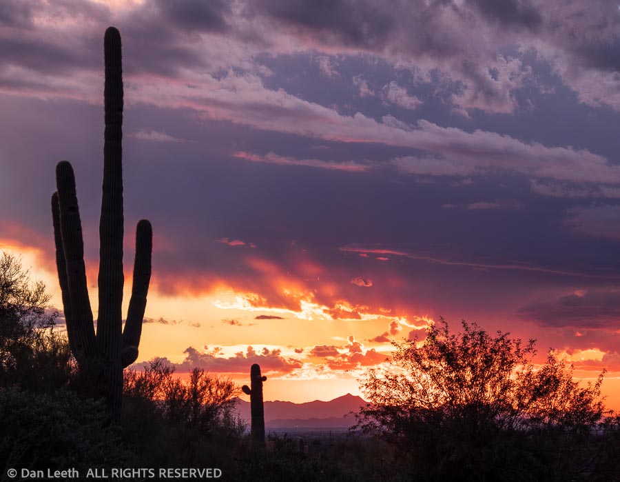
Our destination for this camping escape is my old home state of Arizona.
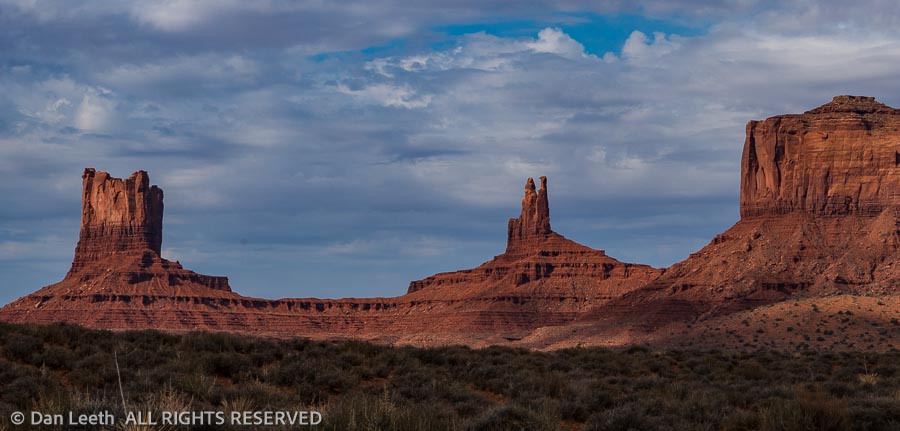
We’ll start at Monument Valley and work our way down to Organ Pipe Cactus National Monument on the Mexican border with stops at Petrified Forest, McDowell Mountain, Picacho Peak and Tucson along the way.
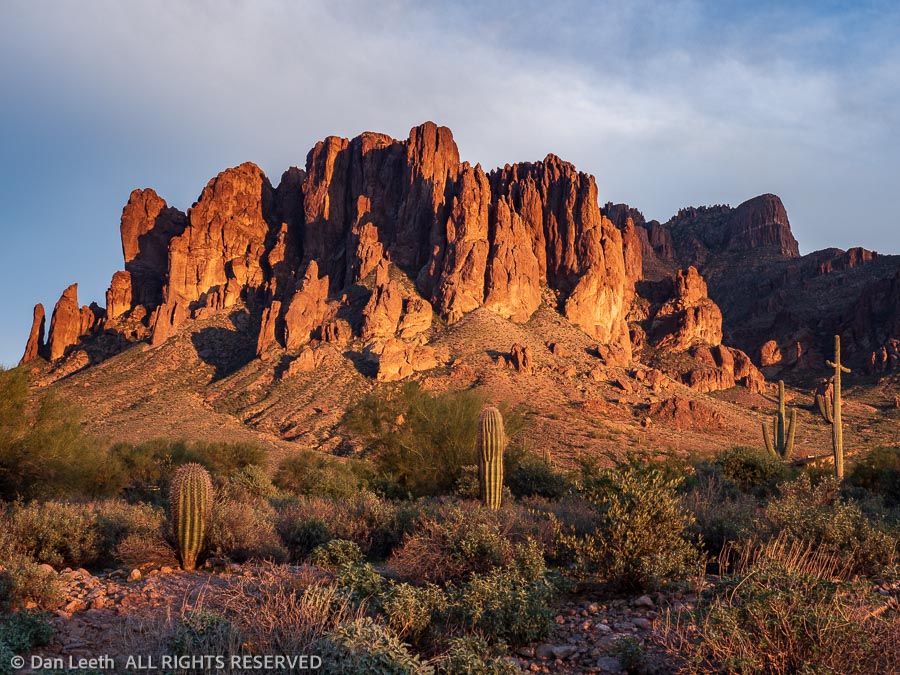
We will then end our 45-day Arizona vacation with two weeks of camping with friends at Lost Dutchman State Park east of Phoenix.
Look for a blow-by-blow account of our trip under “trips” elsewhere on this site.
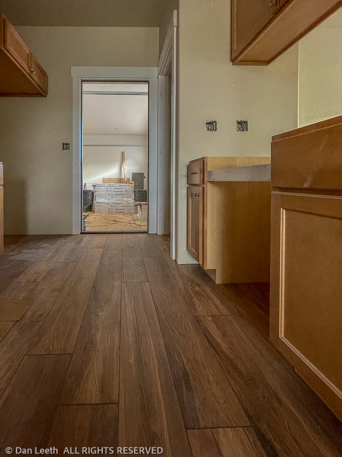
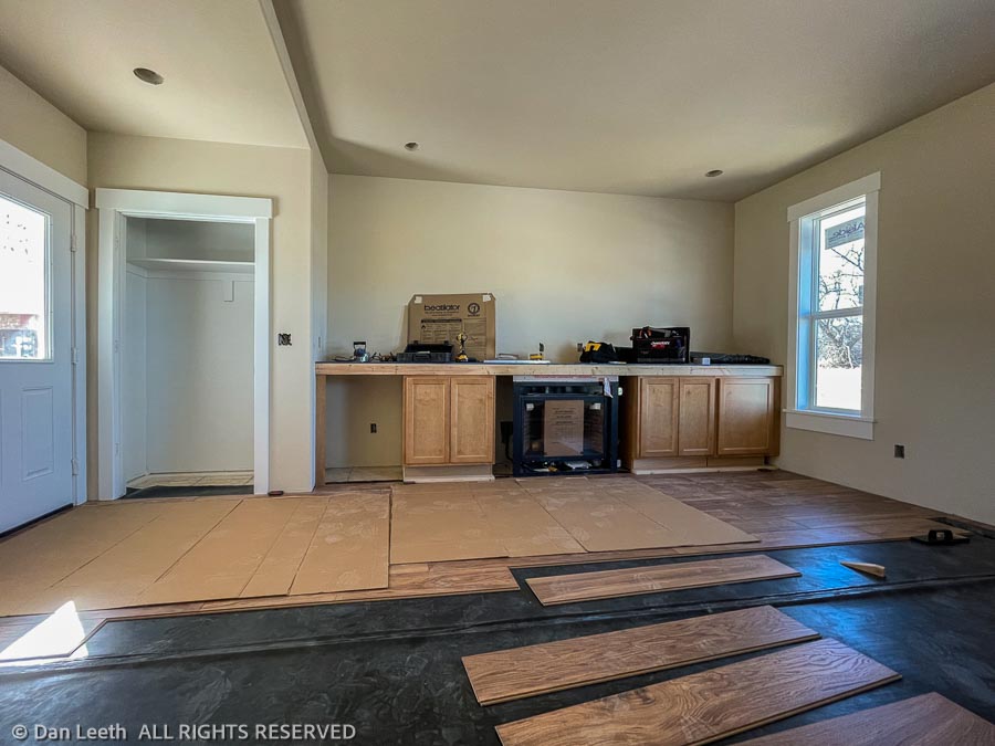
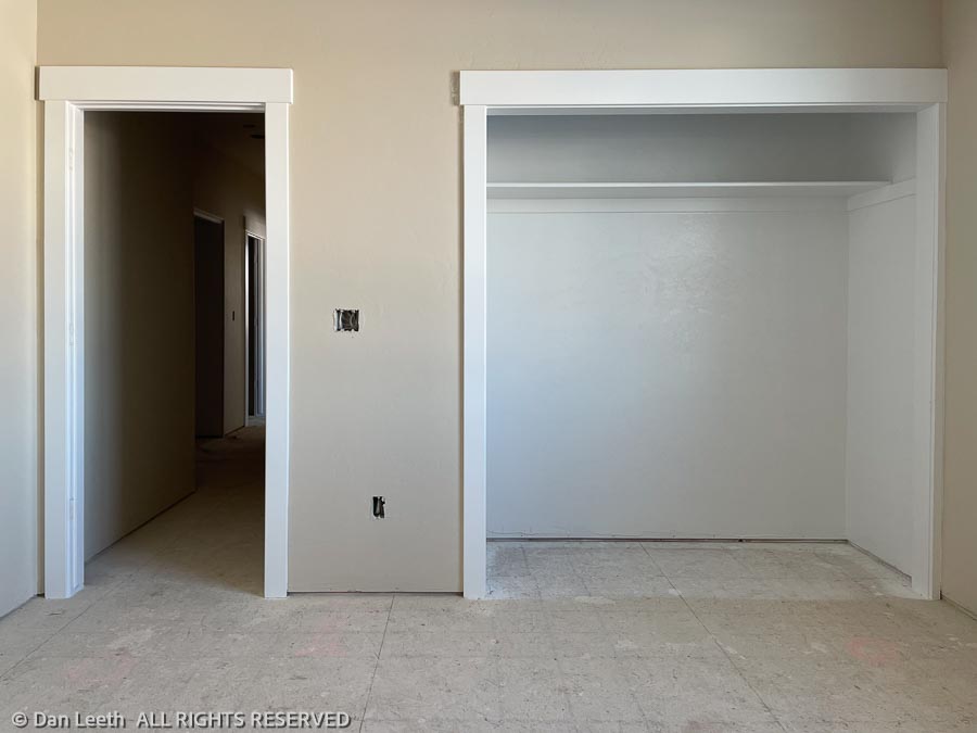
Jeff has the living room and kitchen floors pretty much completed. We’re liking the play of colors between the flooring and cabinets.
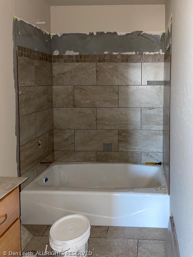
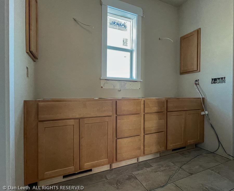
Bathroom and shower tiles are slowly coming along. This is the guest bath. The master bath was delayed a bit while Jeff waited for the shower seat platform piece to be delivered.
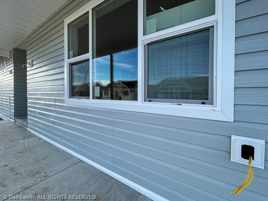
Outside, crews are putting up the siding, beginning with our neighbor’s front porch. Color appears to be gray with a slight bluish tint. It looks more blue in the photo because this was shot in the shade.
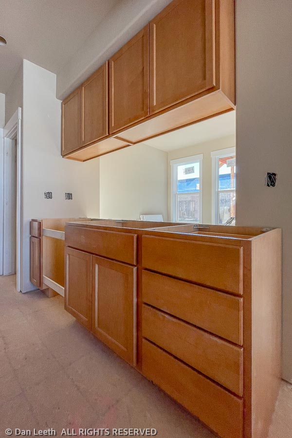
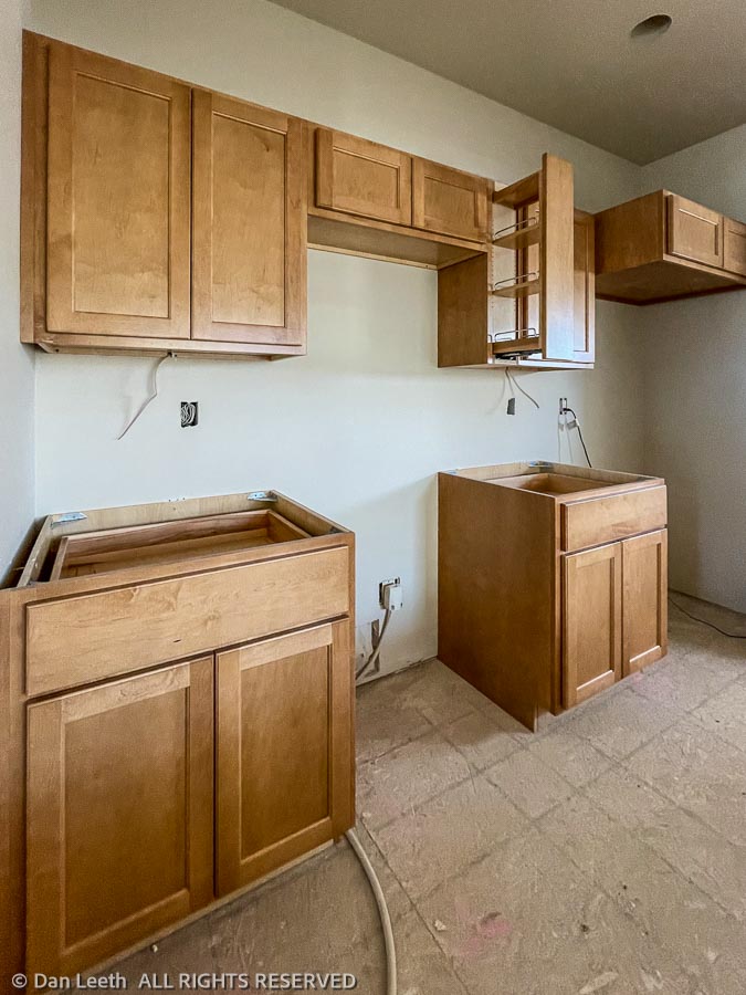
The cabinets are in now, which means Jeff, the floor guy, can get to work on the laminate flooring. He hopes to have it done by the end of the week. Cardboard from the cabinet boxes have been laid down to protect the fresh flooring.
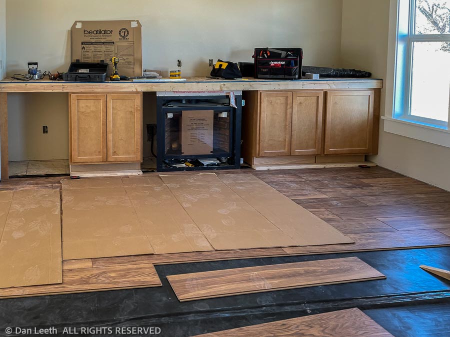
This is the entertainment center in the living room. A 46-bottle wine cooler goes in the cavity to the left. CD storage drawers fill the cabinets on either side of the gas log fireplace. The cabinet on the right will hold the stereo gear. Bookcases will sit atop what is now Jeff’s tool bench.
Our TV will sit or hang between the bookcases above the fireplace. A brand new leather recliner will sit in the middle of the room, centered on the fireplace. Wine glasses, filled with a locally vinted beverage freed from the 46-bottle wine cooler, will occupy our hands.
We love our trailer, but we are so looking forward to moving into a real house.
The cabinets came in Thursday and on Friday, Dave, the installer, was busy screwing them into place. The wood is maple. We chose to go with a lighter stain that wouldn’t dampen the airiness of the rooms. We’re pleased with the color.
All the drawers and cabinet doors are soft close. Dianne has a slide-out spice rack/cabinet built in. It’s cute, but it doesn’t look too practical for spices. I suspect she’ll fill it with her herbal teas (and if I’m lucky, my coffee). The spices will probably end up on a rack in the pantry.
Jeff, flooring guy was also busy. He had to get the bathroom tile down before Dave could install the cabinets. We’ve now got the floor tile laid in the bathrooms and the washer/dryer closet. I’m eager to see what the grout Dianne so painstakingly picked out will look like when he finishes the job.
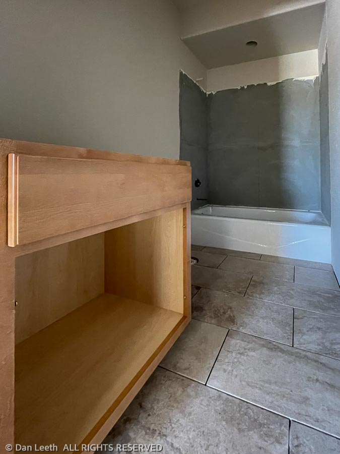
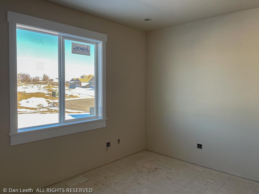
With the floors done, Jeff’s now starting to tile the tub enclosures. The laminate hardwood flooring throughout the rest of the house comes next. Countertops apparently won’t arrive until next month.
We’ve ordered new dishes for the kitchen and have a new loveseat recliner reserved for the living room. We meet with a blind salesman tomorrow to give us a bid for our 11 windows. I hope he brings his seeing-eye dog.
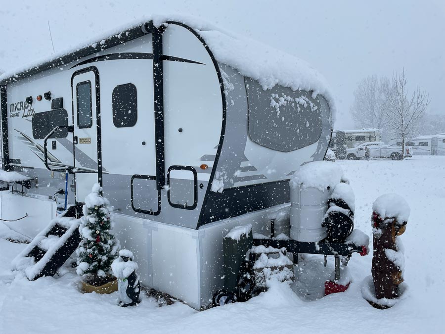
While our new home is being built here in Colorado, we’re staying in our trailer at a nearby RV park for the winter.
I’m not an expert, but here are a few things we’ve done to survive temperatures that are consistently in the teens or lower at night (Fahrenheit) and seldom reach the 40s in the daytime.
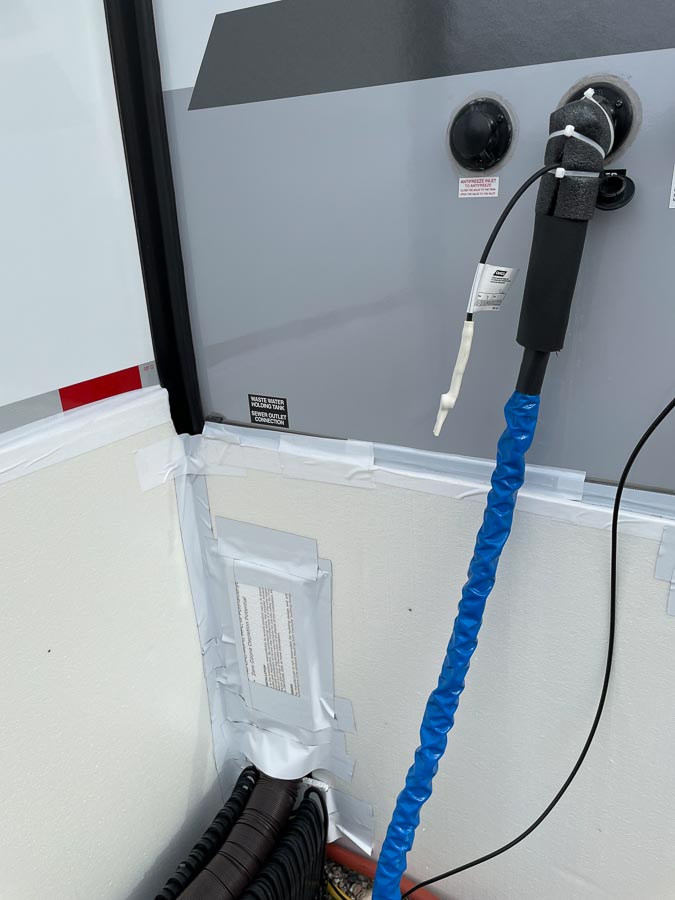
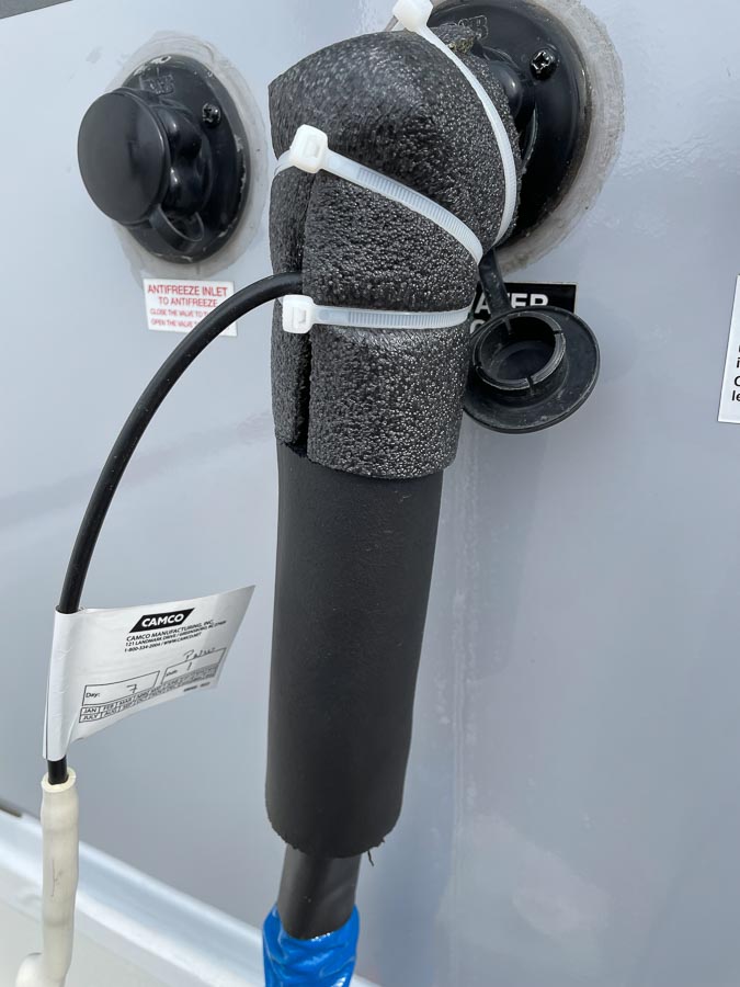
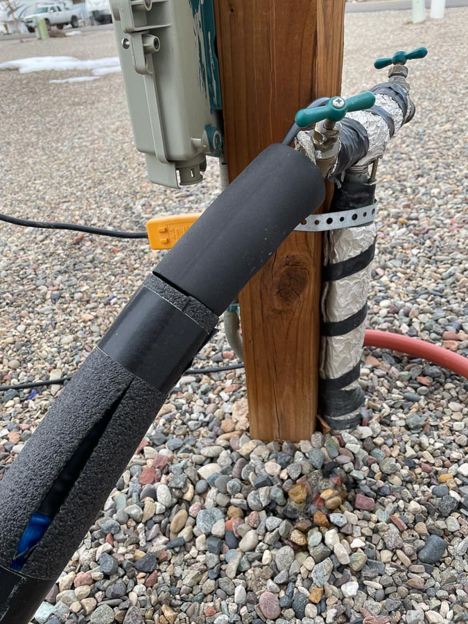
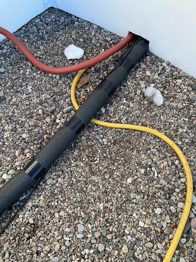
The first thing we did was buy a heated water hose. This one, made by Camco, has a temperature sensor and has not failed us yet.
To insulate the connection into the trailer, I attached a 90-degree brass fitting onto the trailer input and covered it with a foam pipe insulating elbow, which I bought for a few dollars at Lowe’s.
At the other end, I wrapped one-inch, pipe insulation from Lowe’s around the hose to help retain some of the heat and provide a bit more protection where it lies on the ground.
The pipe insulation doesn’t bend easily, so I only put it on the top 2/3 of the hose length.
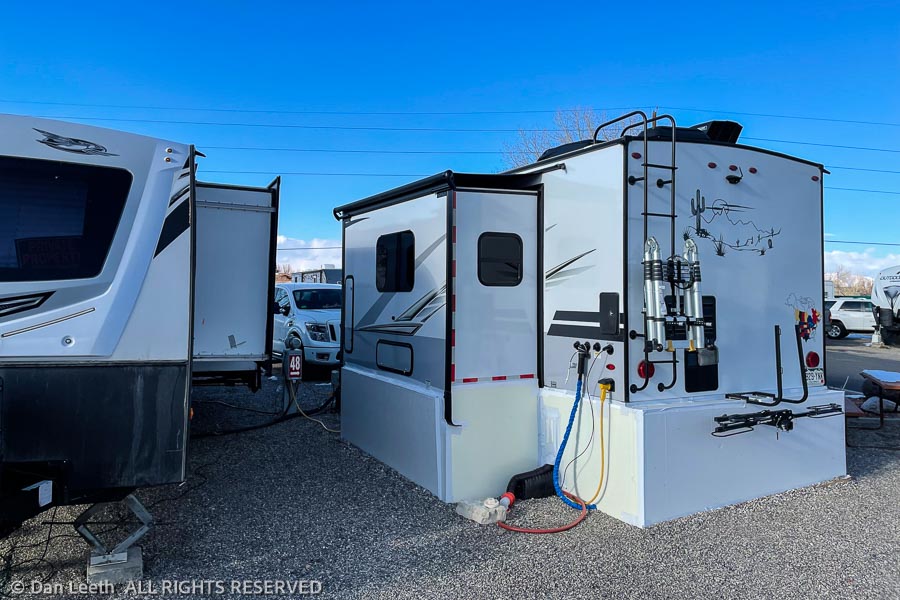
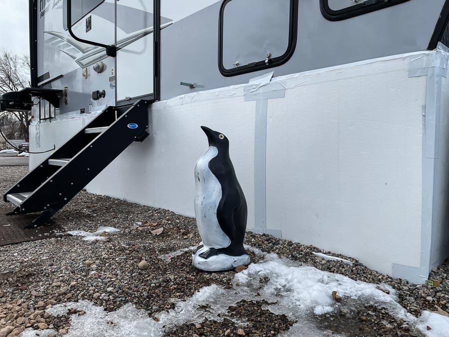
The second thing we did was put Styrofoam insulating panels around the trailer undercarriage. We went with ½-inch panels to begin with, but had to add a second layer of one-inch panels in places. The thinner panels did not hold up to high winds. They’re held together and to the trailer with white, three-inch Gorilla tape.
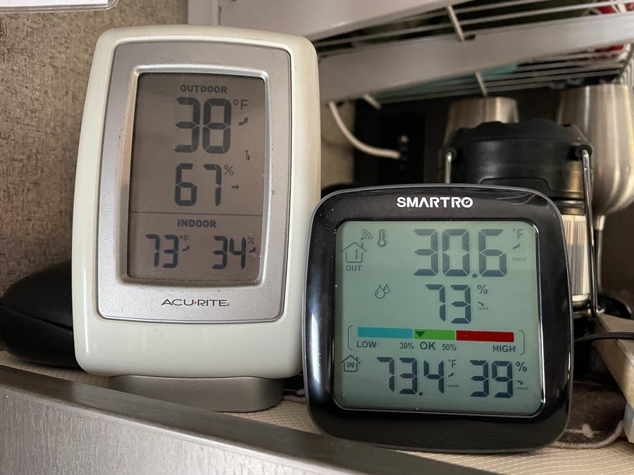
Temperatures in the insulated “crawl space” under the trailer (left thermometer) have been consistently eight to 10 degrees warmer than the outside temperature (right thermometer), seldom dropping below freezing. That means less heat loss through the floor and warmer temperatures on bare feet at night.
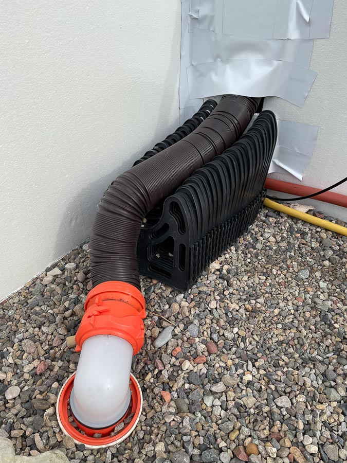
I noticed that others in the RV park who put up undercarriage panels did not leave a place to access the slice valves for their gray and black water tanks. Even though the experts say not to do so, my neighbors just left the valves open. We did the same. Our sewer hose is extremely short and has a steady drop. Whenever we flush or drain water, it goes straight to the sewer. It’s worked perfectly for us, with no icing up and no poopsicles yet, but this is Colorado, not Minnesota.
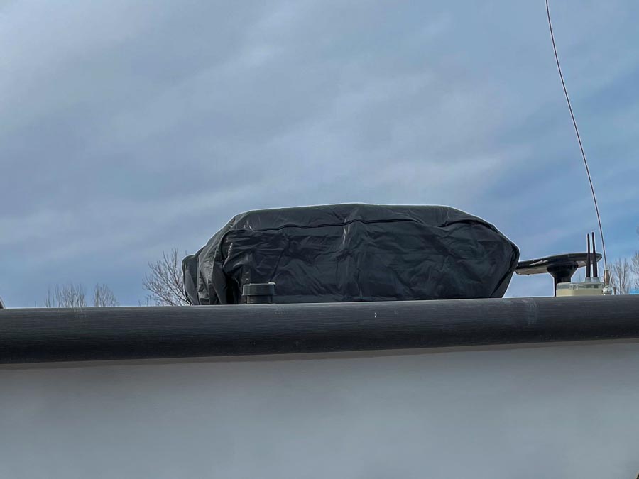
To keep warm air from escaping up through the air conditioner, a neighbor insisted we should put a cover on the AC unit. I’m not sure it helps, but it doesn’t hurt and didn’t cost much.
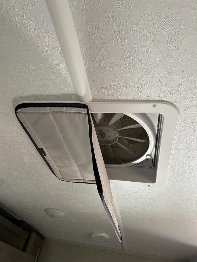
Inside, we put these covers over the Maxx-air fan openings. They’re held on with magnets taped to the inside of the vent frame. They can be loosened or removed if need be to reduce condensation. At $40 each, they’re pricey but they seem to work.
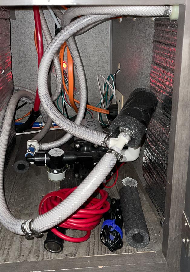
To keep the water pipes, which run near the outside walls, from freezing, we keep the pantry, water pump and water heater doors open. (We removed the panel the factory has inside those bottom compartments a long time ago.)
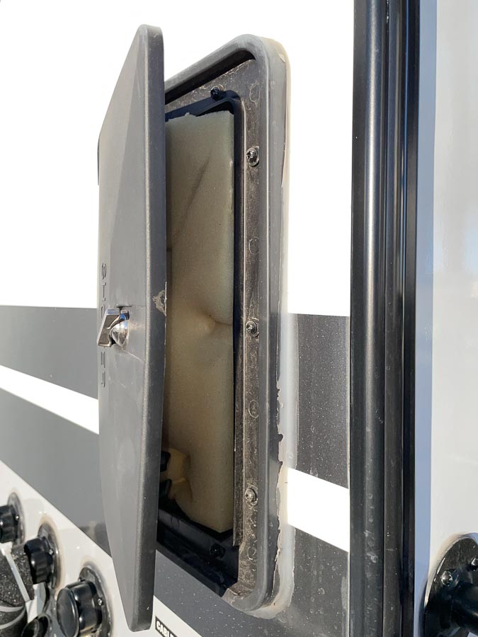
To protect the outdoor shower nozzle from freezing, I placed a piece of thick foam between the door and the plumbing. It’s not elegant, but it’s worked. Best of all, if I want to bathe outdoors in frigid weather, I can simply remove the foam pad and turn on the shower.
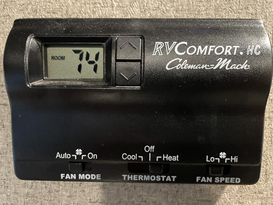
To heat the place, we have the factory furnace, which has been burning up about a gallon of propane every day. Fortunately, our RV park offers discounts on propane refills with free pickup and delivery to our trailer.
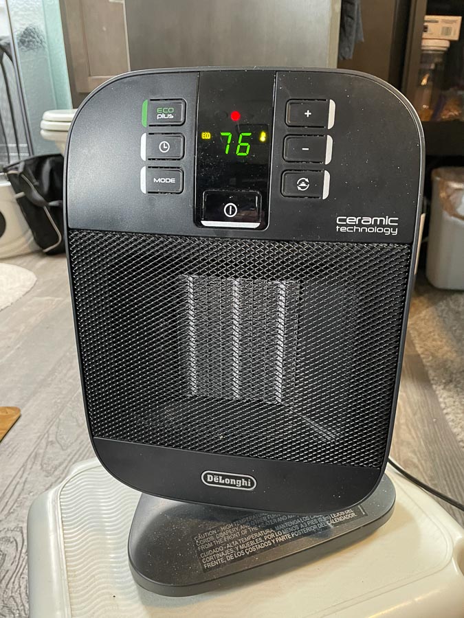
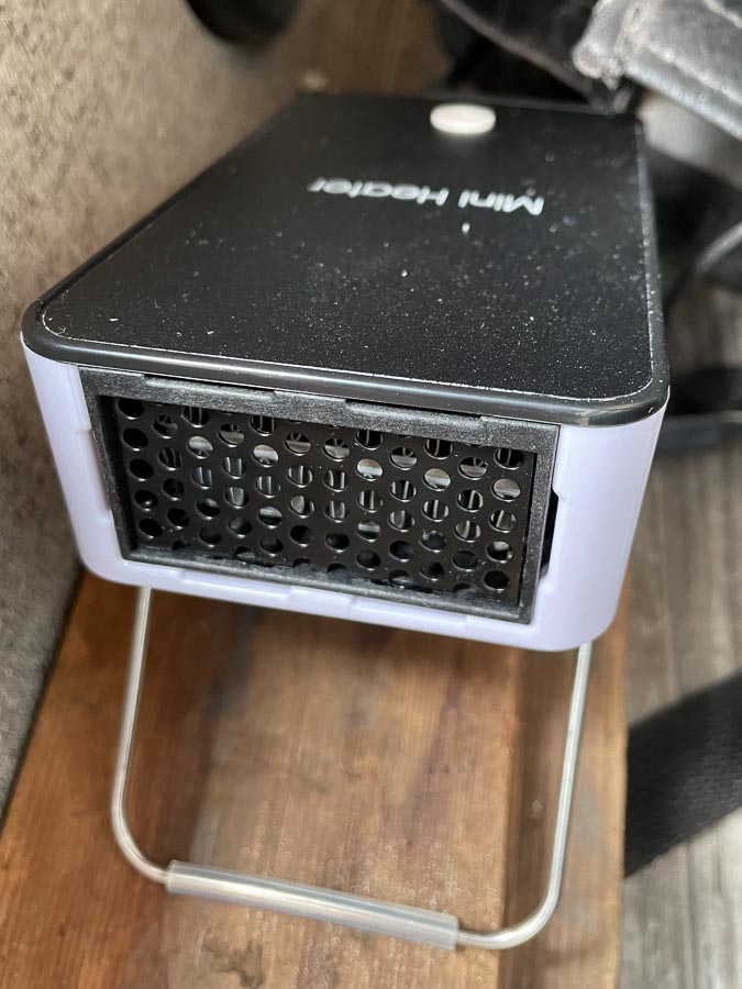
Adding to the furnace heat, we use a small space heater. It can be moved around, allowing us to put the heat wherever we want it. Those of us on monthly space rentals pay for electricity, so space heater heat doesn’t come free, but it sure is handy.
Another problem we’ve had to deal with is condensation. While the trailer can be 70+ degrees inside, the walls hover around 50 degrees or lower. Damp walls from condensation could be found in closed areas such as the inside of closed cabinets. We now keep all cabinet doors ajar during the daytime and wide open a at night.
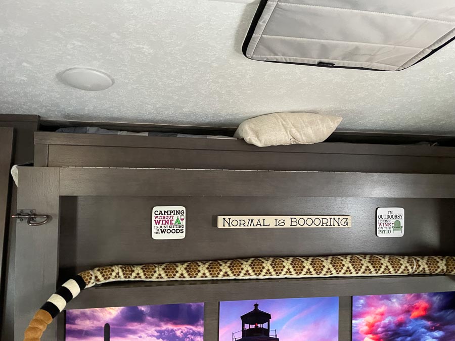
Since the area behind the Murphy bed is closed, we now prop the frame open just a bit at the top, which seems to help. The pillow jammed in there is to keep it all in place. Yes, we could just leave the bed down all day, but we like having the couch to sit on.
I found condensation building up in one of the storage compartments. To help keep it at bay, I added a small, 110-watt heater that runs 24/7 in the starboard storage area. It also helps to keep the wine from freezing.
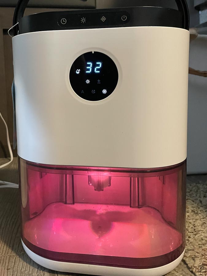
And finally, to help mitigate condensation, we’ve added a small dehumidifier. We’ve also changed a few of our moisture-adding activities. Instead of showering in the trailer, we now use the RV park’s facilities and I try to refrain from doing dishes until my wife, the chef, threatens me with bodily harm if I don’t wash up her favorite spatula.
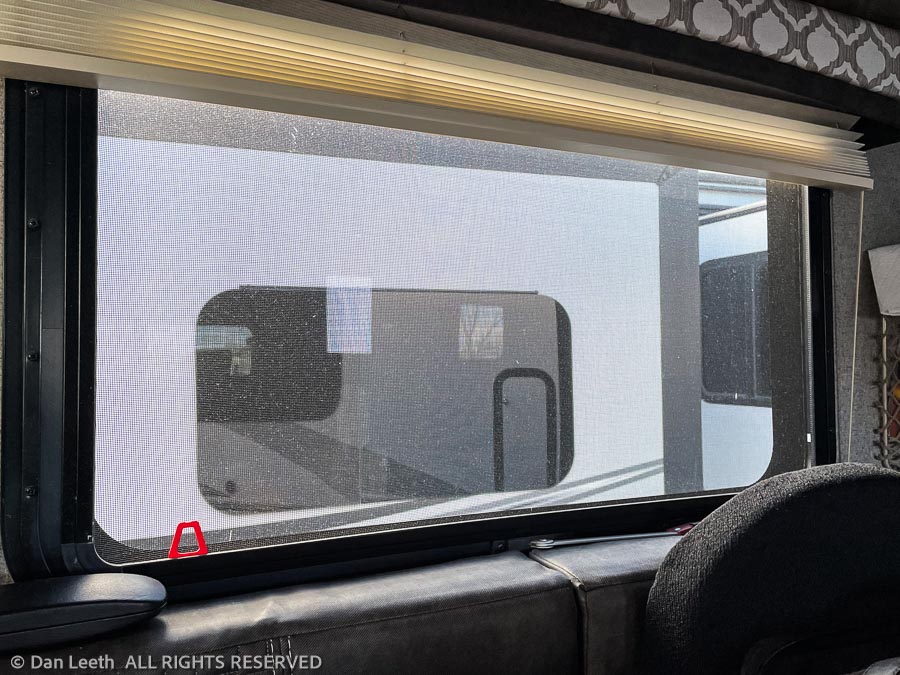
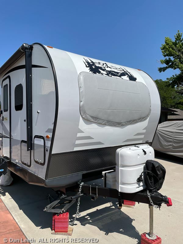
One final piece of equipment that has helped us survive the winter is the padded cover we placed over our front window last summer. We installed it to protect the glass from rock chips and breakage on the road. I thought about removing it while we remain stationary in the RV park, but my wife suggested we keep it on for its insulation value. To reward her thoughtfulness, I’m going to wash up both of her spatulas.
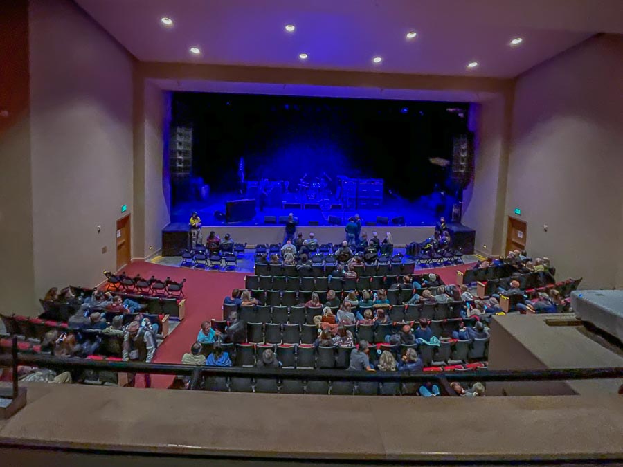
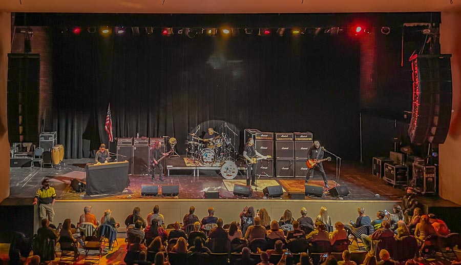
Rail fans that we are, last night we drove into the city to catch a Grand Funk Railroad concert at the Historic Avalon Theatre, which is located on Main Street in downtown Grand Junction.
The theater, built of bricks in the Romanesque Revival style, originally opened in 1923. Over its early years, it hosted speakers and performers including John Phillip Sousa, Carl Sandburg, Ethel Barrymore, William Jennings Bryan and more. In the late 1940s, it was renamed “The Cooper” and remodeled into a movie theater. It continued showing films into the late 1980s. The theater was then abandoned and fell into disrepair.
A money-raising effort began in the ‘90s to restore the theater to its former glory. Done in steps, the Avalon has become a modern, 1,096-seat performing arts venue with state-of-the-art acoustics and accoutrements. As a travel journalist, I was given a private, backstage tour of the facility shortly before the theater reopened in 2014.
Performances at the Avalon range from orchestral symphonies to bubblegum pop concerts, with a healthy dose of geezer rock thrown in for old folks like us. Grand Funk, who had maybe two or three memorable hits in the ‘70s, was one of those AARP-aged groups. They put on an excellent performance with literally non-stop rock for a good 90 minutes.
We bought tickets near the front of the lower mezzanine. They were cheaper, offered a good view of the stage and were far enough away from the speakers that we could leave with our eardrums still intact.
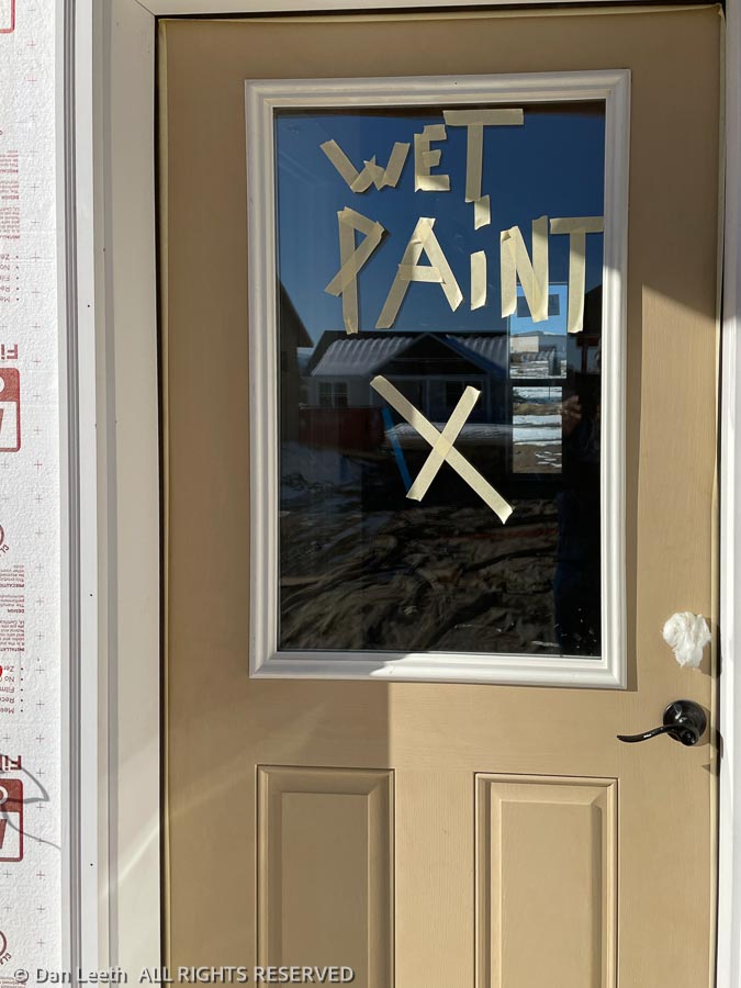
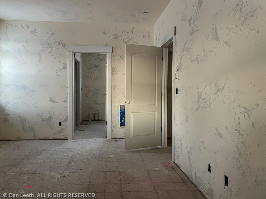
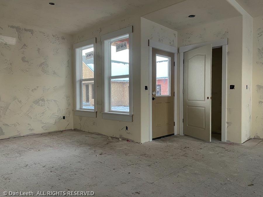
A quick peek in the windows today shows that the drywall has been taped and the texturing has begun. Front, back and interior doors are in place. The patio door was locked and getting around to the front door (we know where they hide the keys) required walking through a stretch of gooey mud, which my lovely wife refused to let me do.
So for now, we’ll have to settle for just looking in the windows.
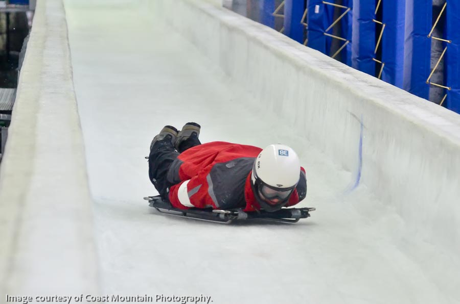
Whoever invented the sport of skeleton must have suffered from loose bones in the brain.
Take a steel-framed sled that’s about a yard long and inches high. Place it on an ice-plastered, concrete bobsled track with banked corners capable of exerting 5-g centrifugal forces. Push off, and like a bowling ball careening down a laundry chute, slide down headfirst at freeway-worthy speeds.
I can’t wait to try it.
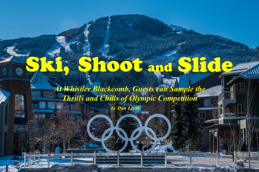
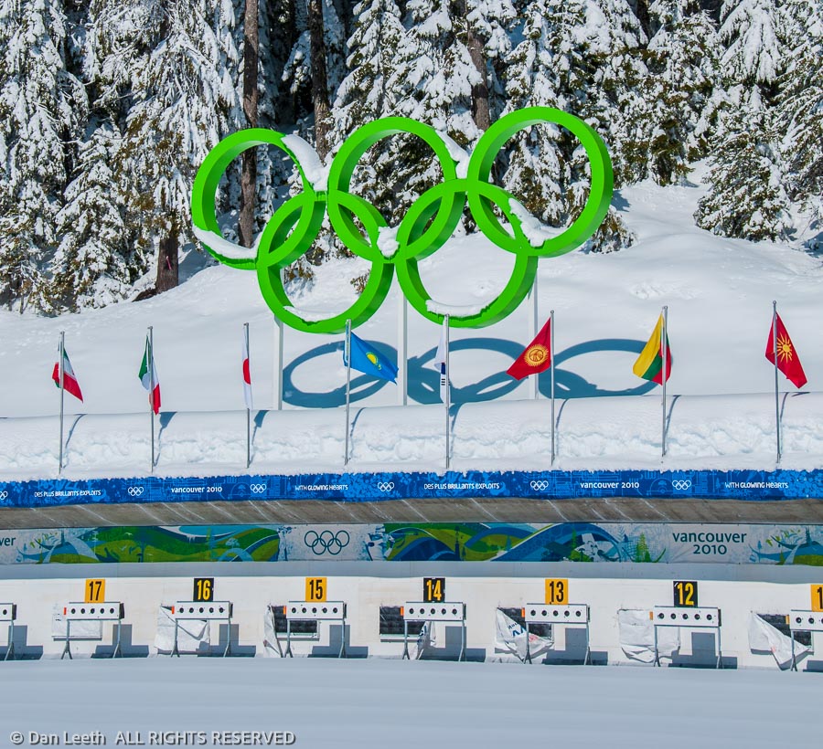
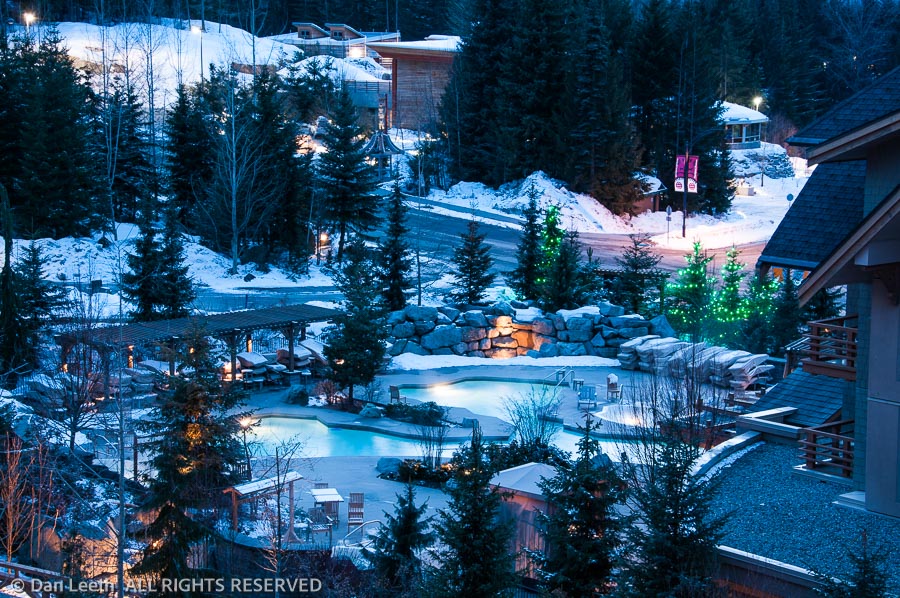
Along with bobsled and biathlon, sampling skeleton is one of the Olympic Legacy Package options offered through the Four Seasons Hotel at British Columbia’s Whistler Blackcomb ski resort.
Home to the 2010 Olympic alpine, Nordic and sliding events, Whistler remains one of North America’s largest single ski area with terrain ranging from groomers to glaciers. It boasts a mile of vertical relief, one of the greatest drops on the continent. I spend my arrival day sliding the slopes like gold-medalist Bode Miller, but at a quarter the speed and a fraction the form.
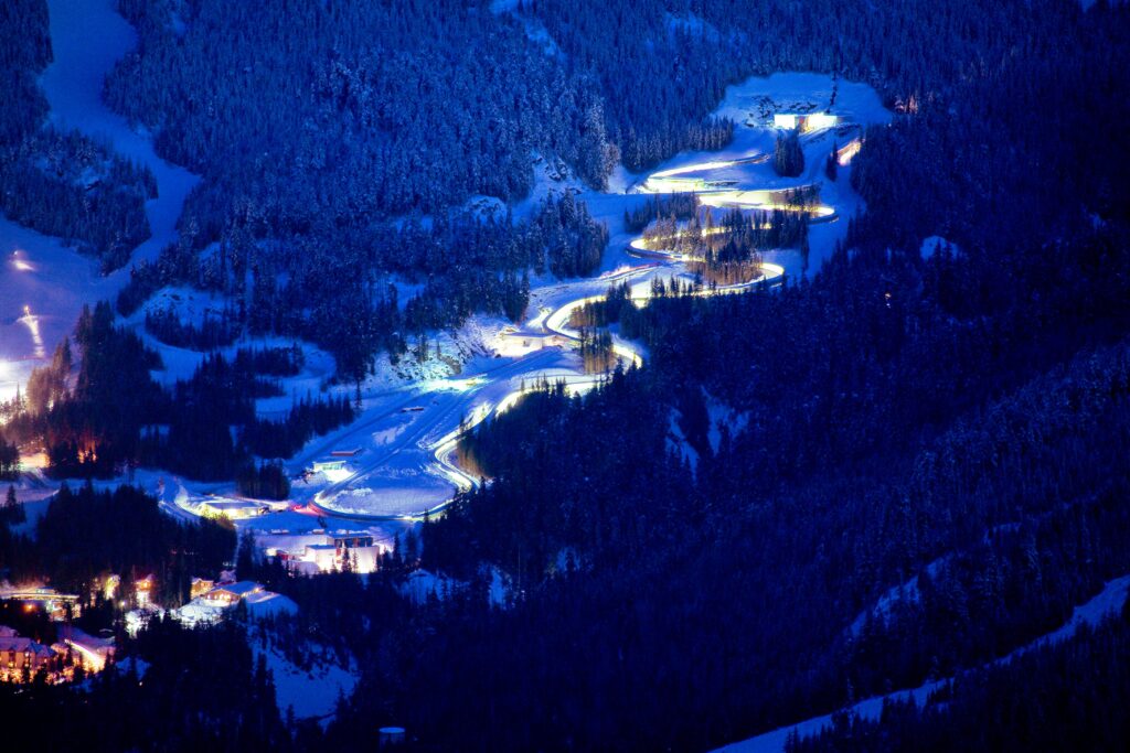
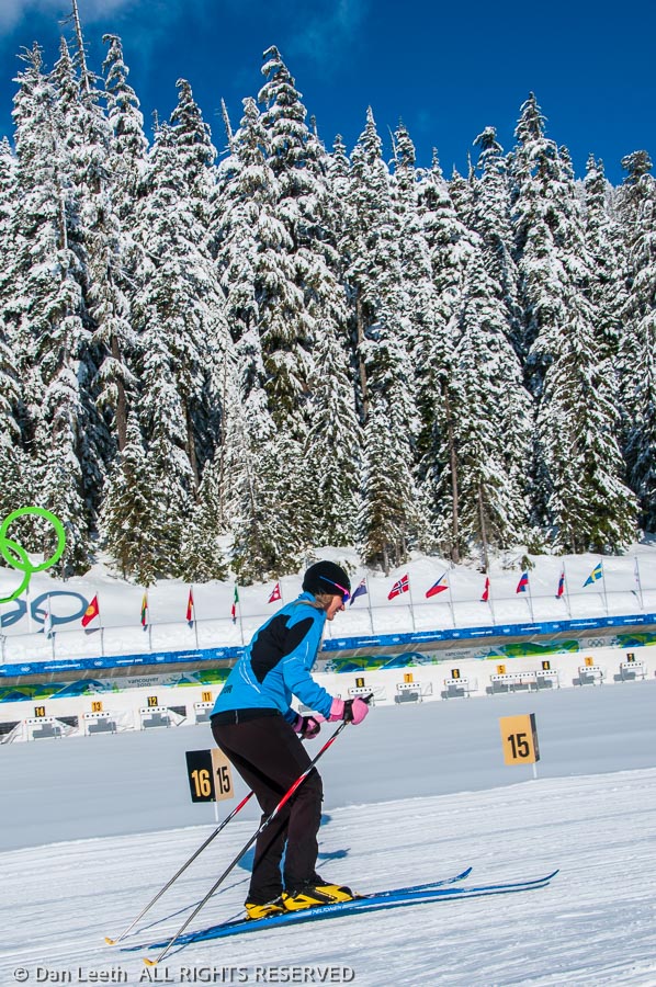
My first Olympic Legacy event is the Discover Biathlon Experience held at Whistler Olympic Park in Callaghan Valley, a 20-minute drive from the village.
In men’s Olympic competition, instructor Jessica Blenkam explains, cross-country skiers race a four-kilometer course which ends at the shooting range. With hearts pumping at a rate that would send Richard Simmons to the ER, the athletes fire five shots at tiny targets. For every miss, they do a 150-meter penalty lap. They then ski another four-kilometer loop and fire again. In all, they do five loops and four firing sessions – two standing and two prone.
“First, we’re going to do a little bit of a skate ski lesson,” Jessica outlines. “Then we’re going to do some marksmanship.”
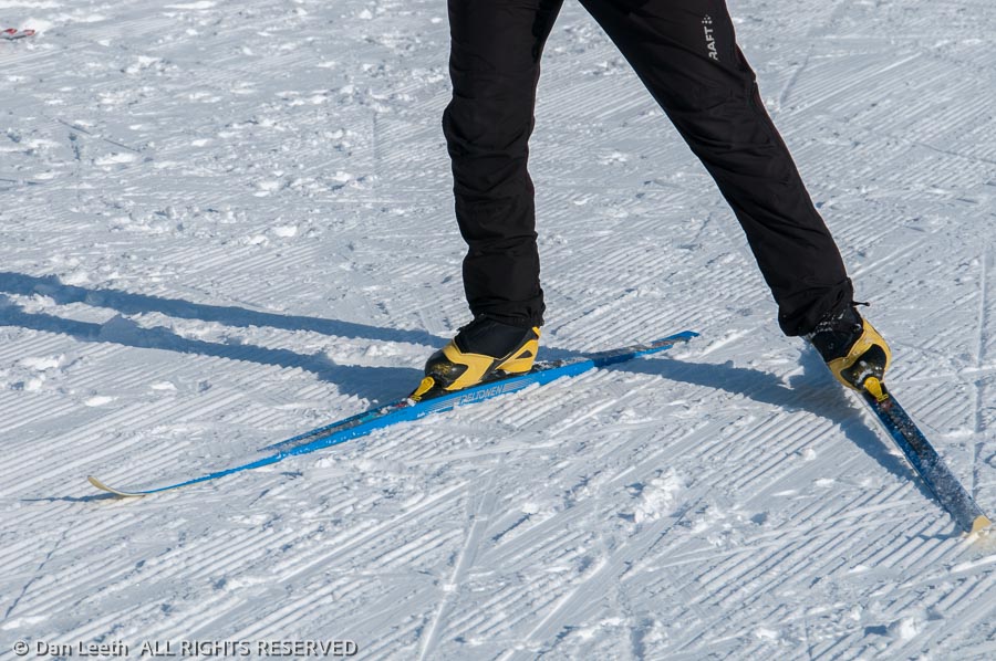
While I downhill and have a long history of classic, kick-and-glide cross country skiing, I’ve never skate skied. Jessica shows me how to balance, how to push off, how to pole and how to turn. She does her best to provide positive reinforcement.
“You’re really good at getting up after falling!” she exclaims. “And wow, you still have both your skis on. Good job!”
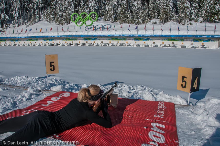
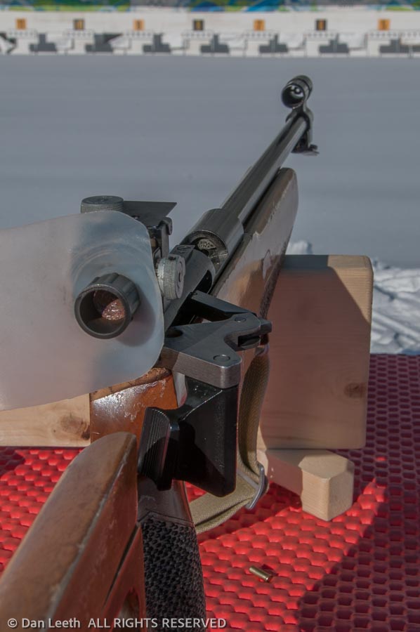
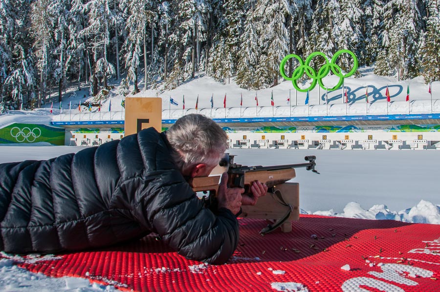
After an hour spent trying to master skate skiing, it’s time to shoot. At the 30-lane firing range, a mat and rifle await me at station five.
“Those targets are 50 meters away,” Jessica points out. “The standing targets are the size of a grapefruit, and the prone are the size of a plum.”
The rifle is a Russian-made .22 caliber specially built for biathlon with bullets enclosed in five-shot clips. Jessica assures me that it’s very similar to what the athletes use, although theirs would probably have a carbon-fiber stock specially fitted to their bodies and cost thousands of rubles more.
“This is similar to a bolt action, but it’s called a Fortner action,” she explains. “It’s designed to fire accurately and perform well in cold, wet conditions. We’ve zeroed the rifles in so they’re dead accurate.”
Lying on my belly, I center the first circle in the sights. Gently, I squeeze the trigger. The shot echoes, but the target remains black.
I missed.
I fire again. And again. By the time the clip is exhausted, only two targets have turned white. Over the course of the next hour, my best result is four out of five, and I don’t have to ski before firing. Maybe biathlon will not be my podium event.
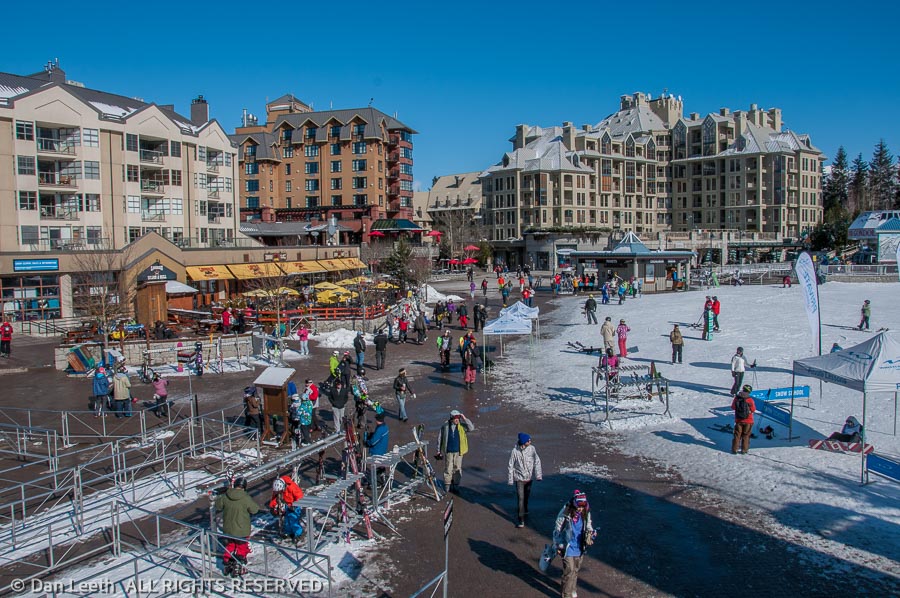
Back in town, I wander the pedestrian-friendly village, which feels like a huge outdoor shopping mall. Overall, Whistler boasts 9,500 permanent residents and 11,500 second home owners. There are at least 24 hotels and enough timeshares and condos to house more than 30,000 visitors at one time. The area boasts 200+ retail shops, 90+ restaurants and cafes, 30+ bars and lounges and 20+ spas. All fit together in architectural harmony, each painted in its own shade of brown.
“There’s a very specific look and feel that you have to have when you’re opening a business in the resort,” admits tourism official Kerry Duff.
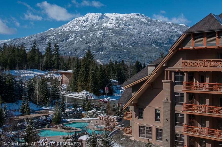
Built in 2004, the Four Seasons is one of Whistler’s newer hotels. It bills itself as a 273-room, rustic modern retreat, and along with the Ritz-Carlton in Toronto, remains one of only two AAA Five-Diamond hotels in all of Canada. Located in Upper Village on the Blackcomb side, it’s not ski-in/ski-out, but they do offer free shuttle service to a slope-hugging ski valet center.
That evening, I hit the Four Seasons Spa and splurge on a heat-therapy treatment originally created for the Olympics. Now called the “Spirit of Whistler,” it began as “On the Podium.”
“When the treatment was created, the spirit at the time was the Olympics,” explains spa director Filipa Batalha.
It’s too bad they changed the name. It might have been the closest I’ll ever get to an Olympic podium.
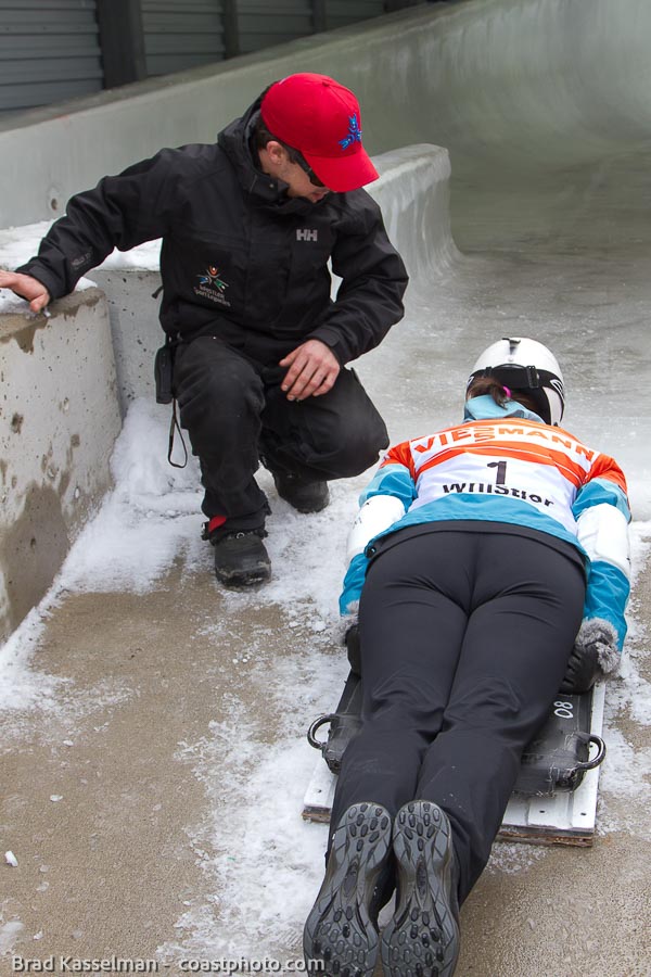
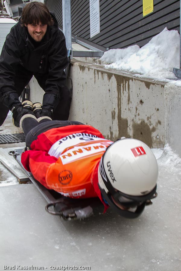
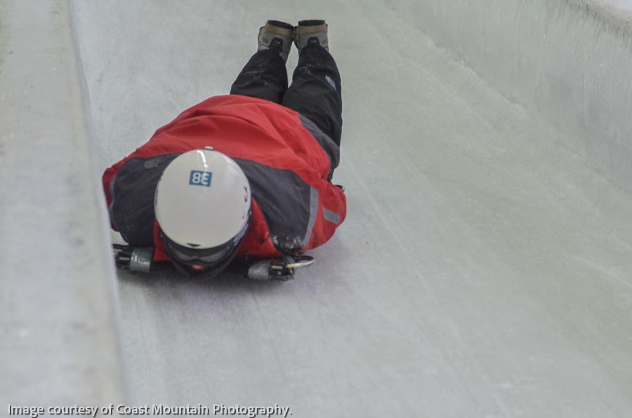
The next day, I head over to the Whistler Sliding Center, site of the Olympic bobsled, luge and skeleton track. It’s nearly a mile in length, sports a 499-foot drop with an average grade of 10.5%. Its 16 corners culminate with Thunderbird, a nearly 180-degree hairpin turn where sleds and sliders experience maximum speeds and G-forces.
“You’re all going to be active participants in the sport of skeleton today,” Anna Lynch tells us at orientation. “You’re going to reach speeds up to 100 kilometers per hour and experience G-forces several times your body weight.”
She shows us the sleds, which look nothing like the Flexible Flyers of my youth. There’s a cutout at the top where our heads go. Our torsos cover the middle part. Arms go down the side and hands grip handles beside our butts. Knees rest on a plate near the bottom.
“Be like a sack of potatoes,” Anna advises. “If you lift your knees or shoulders, the runners are going to be free to move side to side. That’s when you’re going to be tapping the walls. You want to keep a nice streamlined body position at all times. No chicken wings.”
Unlike Olympians who dive onto moving sleds from the top, we start stationary and descend only the bottom third of the track. Anna gives us our starting order. I’m number eight.
My time comes all too soon. Lying in wait, I’m more nervous than the groom at a shotgun wedding.
“You ready?” the starter asks.
Sack of potatoes. Only 30 seconds of sheer terror.
“Sure,” I gulp.
He pushes and I begin accelerating down the track faster than a nitro-flaming dragster. Through goggles, all I see is a whirring blur of gray ice. Centrifugal force slams my helmet down causing the chin guard to scrape the surface. Instinctively, I lift. The sled weaves and I begin caroming off the walls. I make promises I’ll never keep.
Finally, I fling through Thunderbird and stop on the uphill outrun. Like a pilot walking away from a crash, I feel lucky to be alive.
My time is 32:61. After all 20 participants finish their first runs, I’m in 18th place. With two others worse than me, I’m as ecstatic as a nerd who’s suddenly not the last kid chosen for the team.
Exercising better control on my second run, I cut more than two seconds off my time and shoot through the speed trap a hair under 60 mph. That gives me 14th place.
Maybe skeleton will not be my podium event, either. There’s still the final Olympic Legacy option of bobsledding left to do.
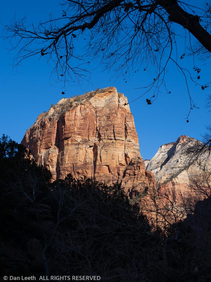
It seems like every year, I get email promotions from Xanterra offering discount prices for winter stays at their Zion Park Lodge property. This year was no exception. “Wanna take a getaway trip to Zion National Park?” I asked my wife of 40 years.
“Does that mean we wouldn’t get to stay huddled up in this cold, damp trailer for a week?” she responded.
“Does that mean I wouldn’t get to cook, clean or go shopping for a week?
“Does that mean that we’d have to look at towering cliffs out our windows instead of the neighbors’ trailers?
“Let me think about it.”
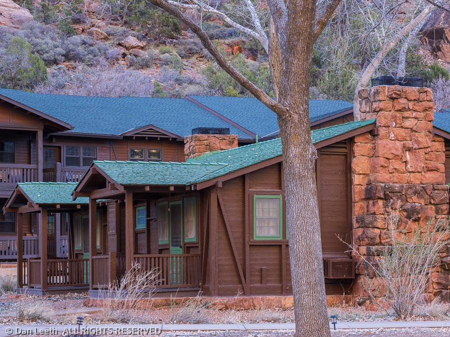
Not wanting her to blow a fuse in her thinking equipment, I went ahead and booked a five-night stay in one of the Zion Park cabins for a Monday-Friday stay in January.
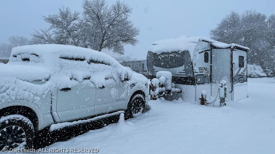
Even though Zion is an easy day’s drive from our new hometown of Fruita, I reserved a night at a Super 8 for the drive down. That would give us time on our departure day to “winterize” the trailer.