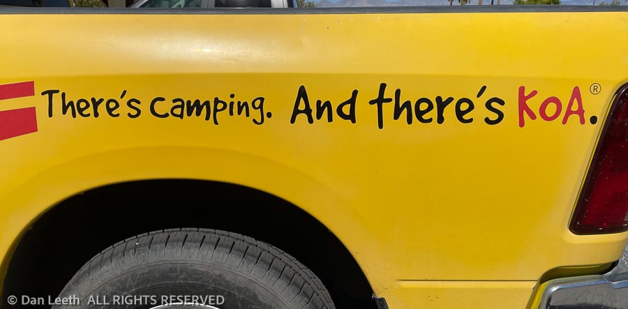
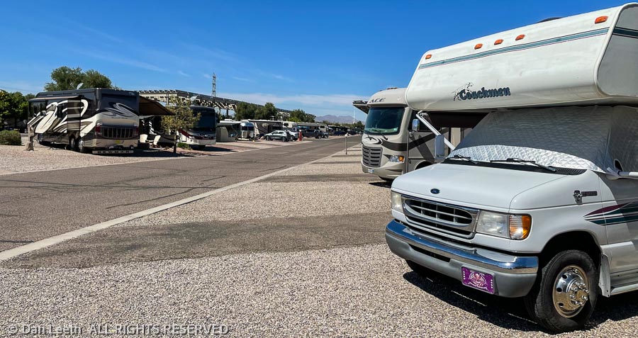
Don’t get me wrong. The Tucson/Lazy Days KOA is a beautiful RV resort. There are 400 individual sites, two large pools with spas (local dialect for “hot tub”), an on-premise barbecue bar/restaurant with pretty good ribs (lunch today) and the park offers lots of planned activities. This is one of the few RV resorts we’ve been in that deserves the “resort” designation.
But it’s not camping.
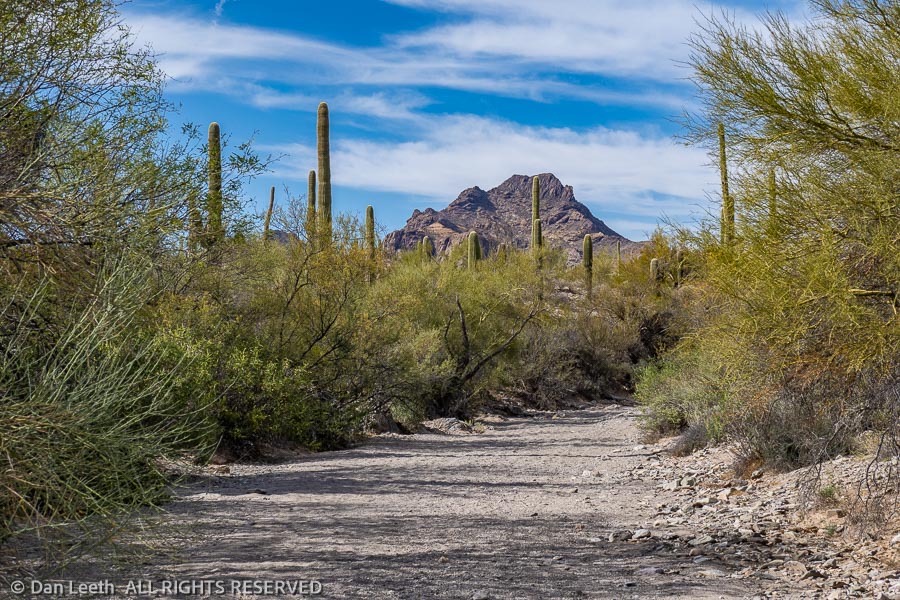
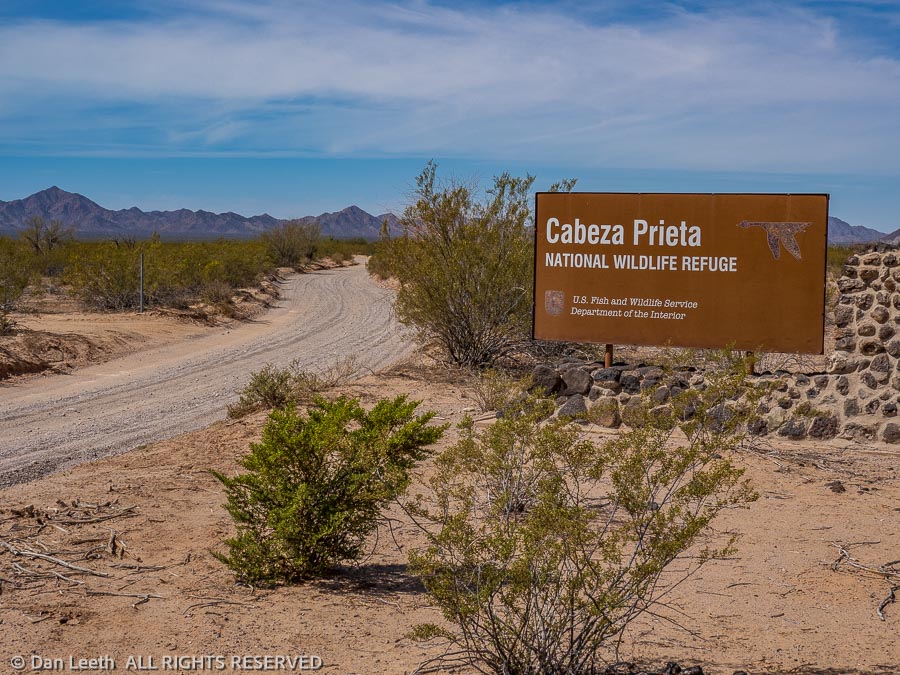
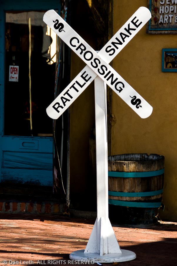
For us, two weeks of camping begins tomorrow. We’re heading to Organ Pipe Cactus National Monument, which sits pretty much in the middle of nowhere.
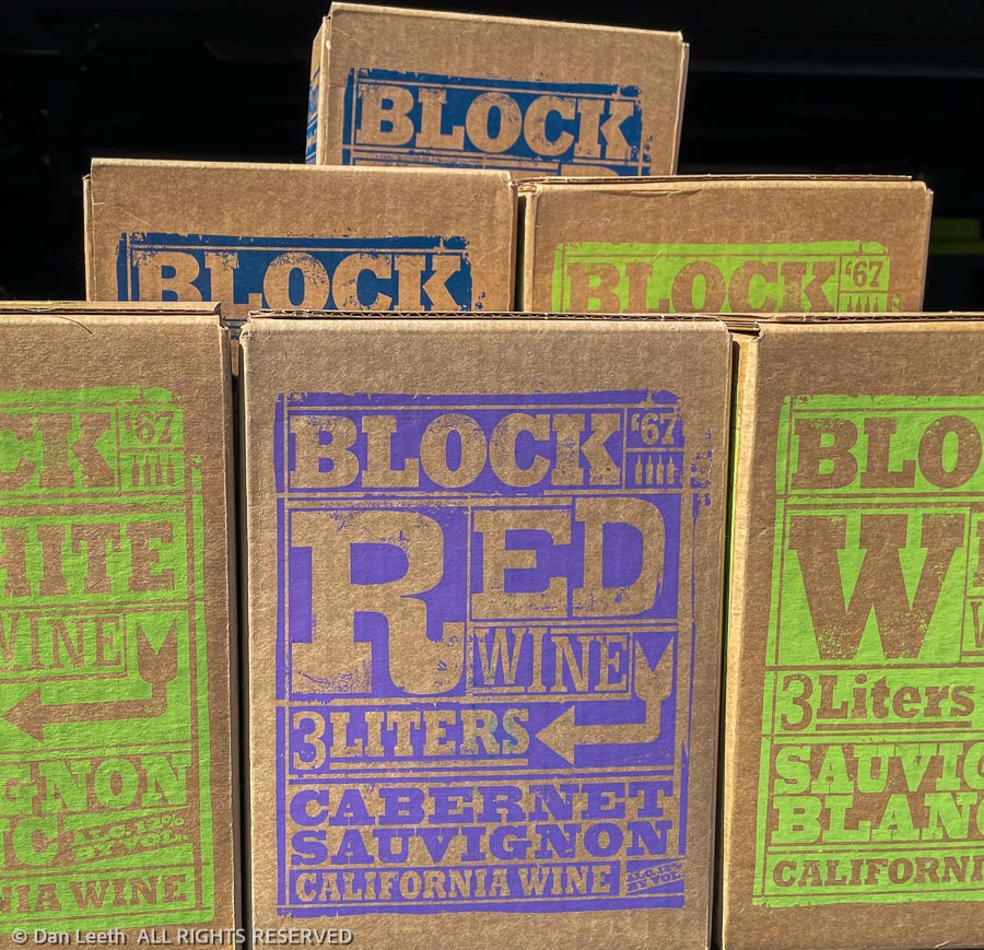
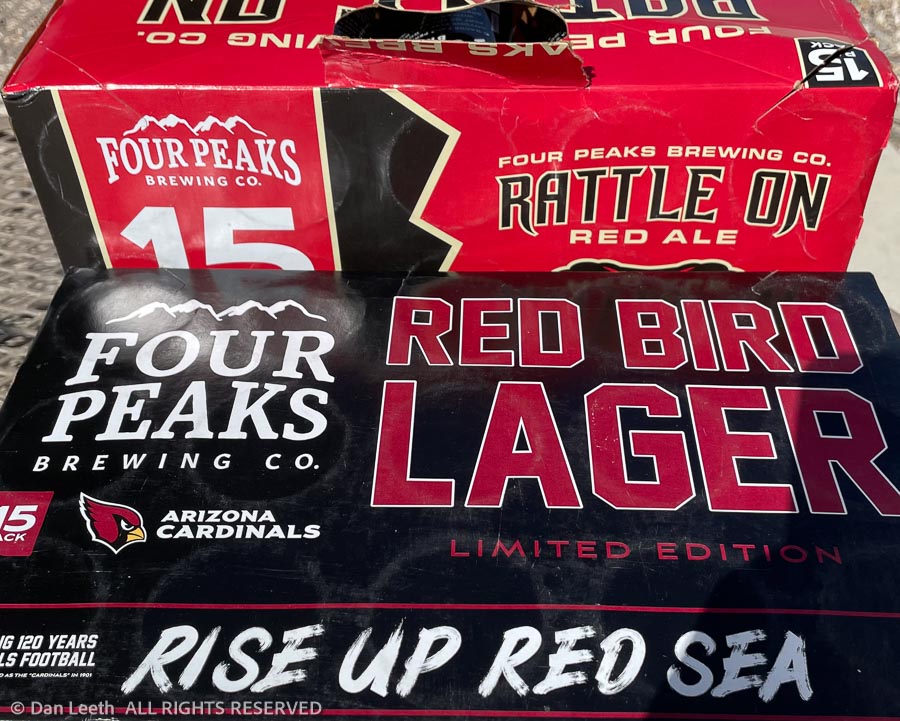
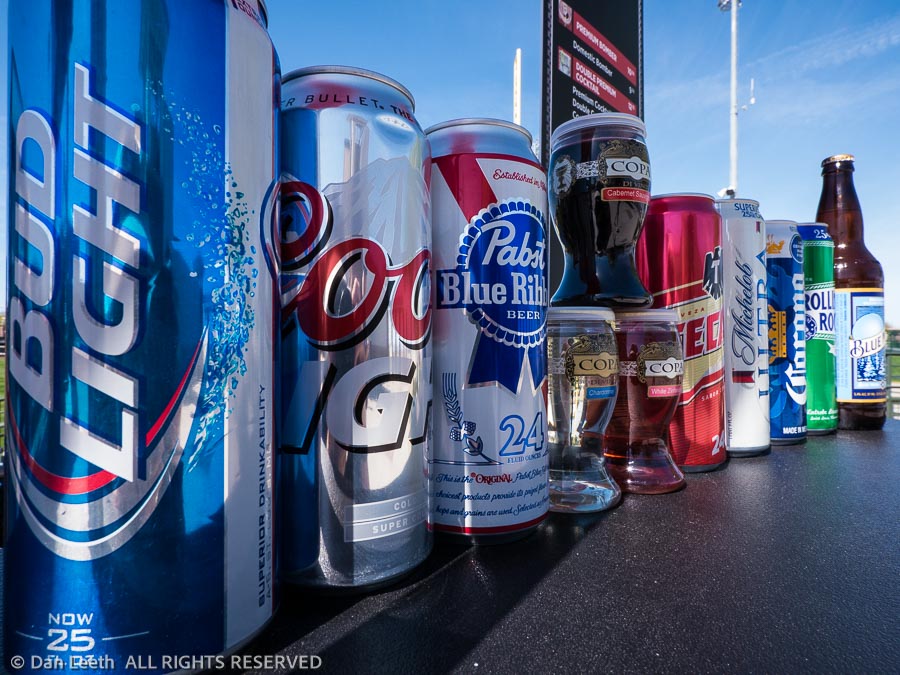
With that in mind, we spent today stocking up on fruit drinks…
…and grain beverages.
[Note: This is not Colorado, and the beverage options at the local Kroger market were largely limited. The best local craft beers we could find supported local professional sports teams. With the cans sandwiched in koozies, we won’t have to look at the team logos.]
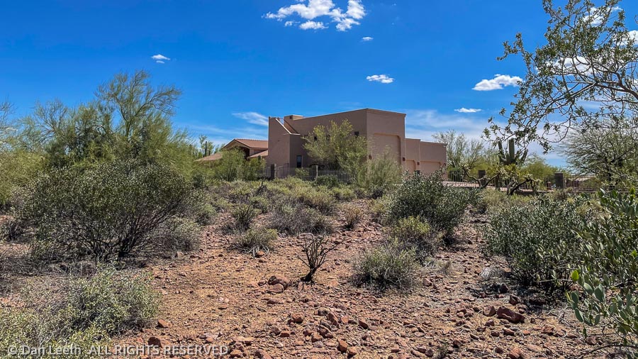
Our previous two days here in my old hometown were spent visiting friends. On Sunday, we went to see our old neighbors from Aurora who fled to Arizona a couple of years ago. They had a house built for them, so we spent time comparing how much fun it is to have a freshly constructed home customized to our own specifications.
On Monday, we visited an old nursing friend of Dianne’s from years ago when they both worked in the Burn Unit at the University of Colorado Hospital in Denver. Semi-retired, she and her husband now spend their winters at a retirement resort in Tucson.
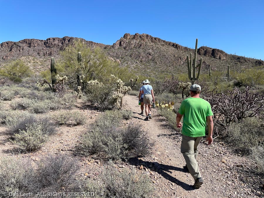
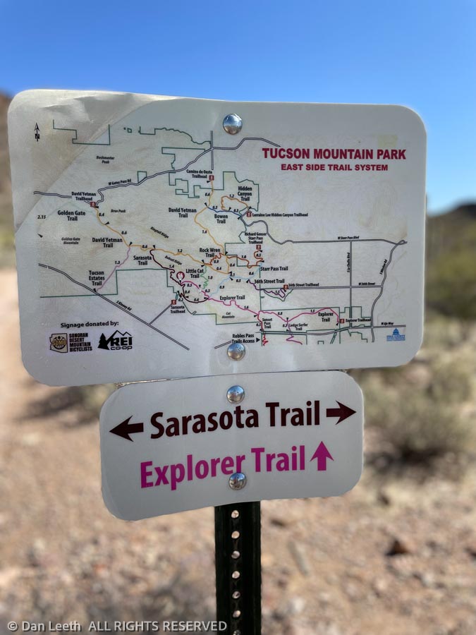
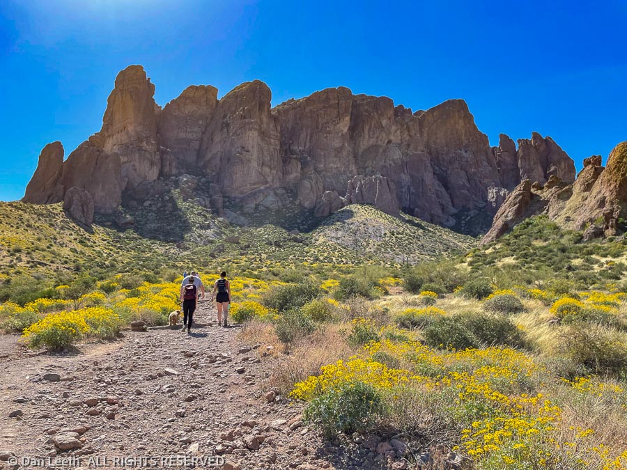
We thought we were close to hiking at our new place in Fruita, but here, we did a four-mile hike through the Tucson Mountains, leaving directly from their front door. No driving necessary to reach a trailhead.
At one time in my life, I thought it would be nice to move back to Tucson. Not anymore. Like an out-of-control case of cancer, city sprawl has metastasized across the landscape. Arterial motorways remain clogged with traffic, making it a challenge to pass through the heart of the city. (Many Tucson motorists apparently learned to drive by watching NASCAR where cars crash a lot.) When I lived here, the local population was around 274,000. It’s now 993,000 and growing.
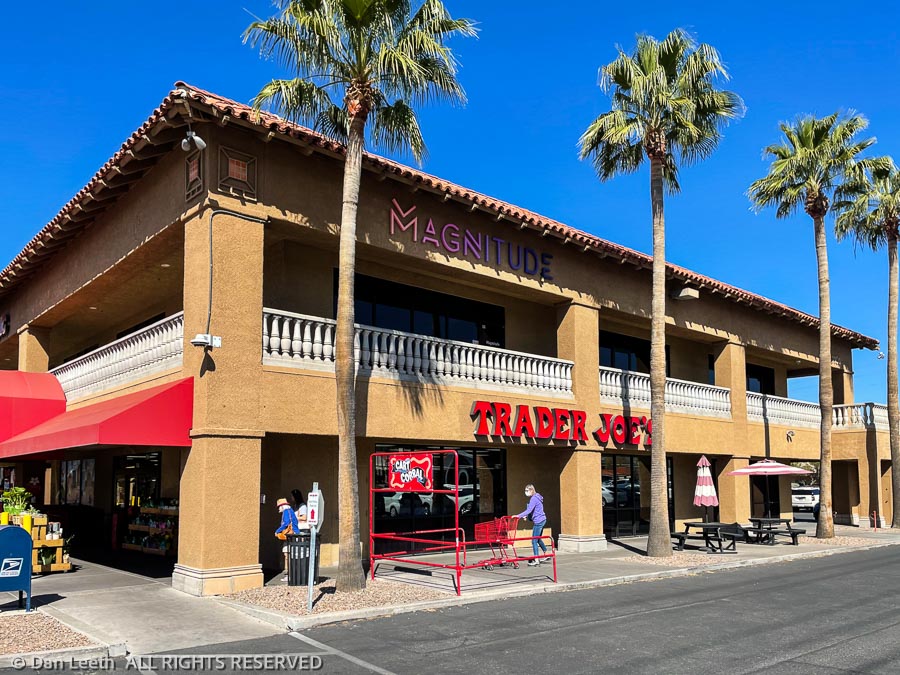
On the plus side, Tucson does offer no fewer than three Trader Joe’s, all of which sell wine.
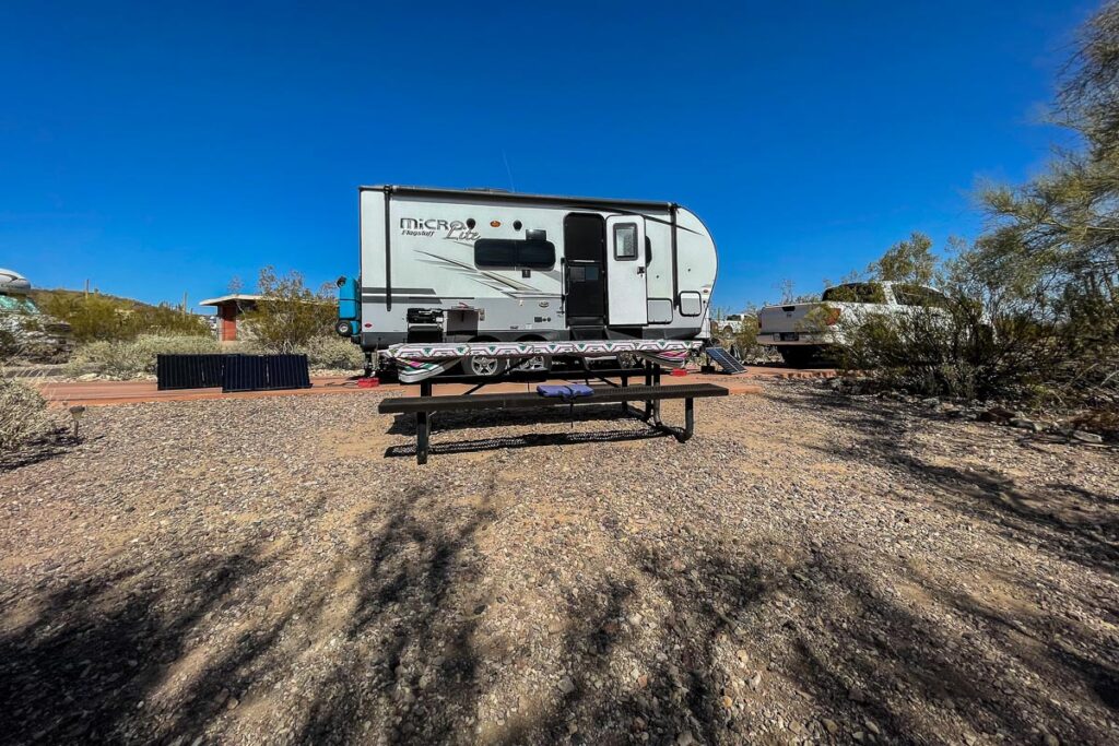
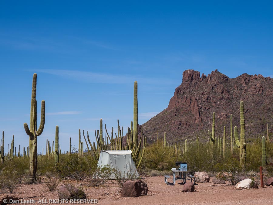
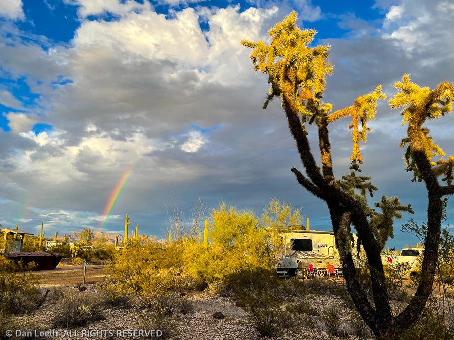
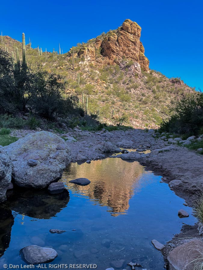
We have no hookups here in Organ Pipe Cactus National Monument. Our freshwater comes from an onboard tank filled from a spigot at the dump station. We’ll cart our used water back there in Bob, our 25-gallon honey wagon. We have only the sun to recharge our battery. Generators are not allowed in our section of the campground. The flush-toilet bathhouse is over 50 yards away, with the nearest solar-heated showers more than 100 yards away in the opposite direction. This is definitely not a KOA.
After pulling in and getting set up yesterday, we took a four-mile hike down to the Visitor Center for information and yes, for souvenirs. Back in camp, Consuela (Dianne’s undocumented, live-in pseudo-assistant) fixed barbecued chicken, which we downed with some of the finest (and only) boxed Spanish wine we brought from Colorado. Our Trader Joe’s wine waits in the Whitey’s wine cellar.
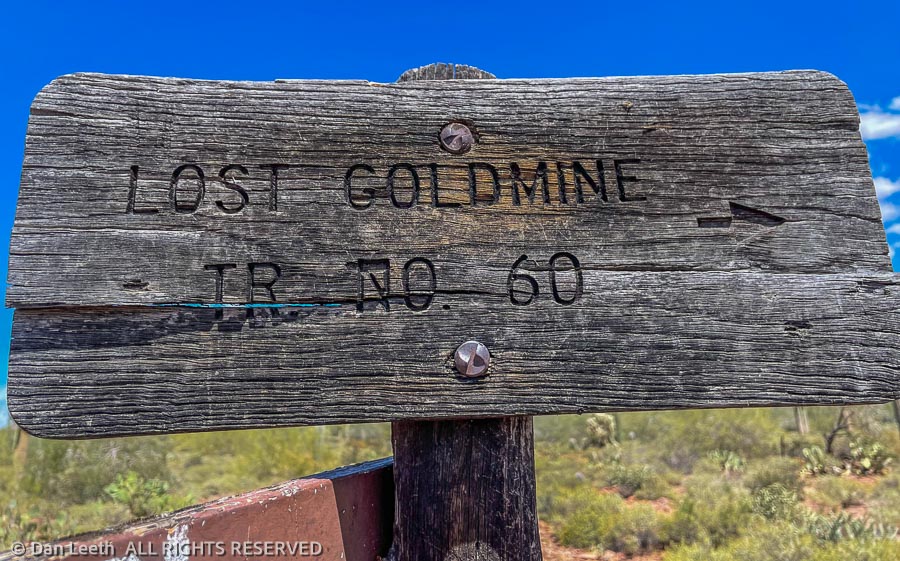
For the first time in months, we lingered outside after dinner, gazing at stars (not many because of the nearly full moon) and discussed our future. We decided that on the first day of the rest of our lives, we would throw caution to the wind and take a hike to two abandoned mine sites.
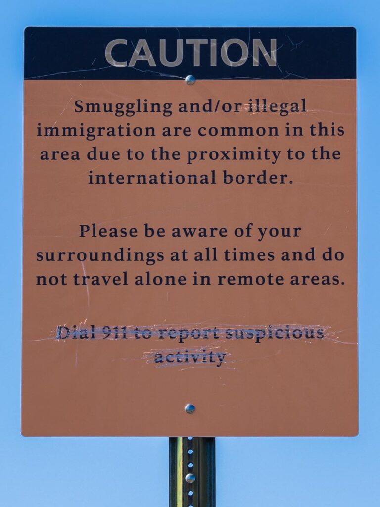
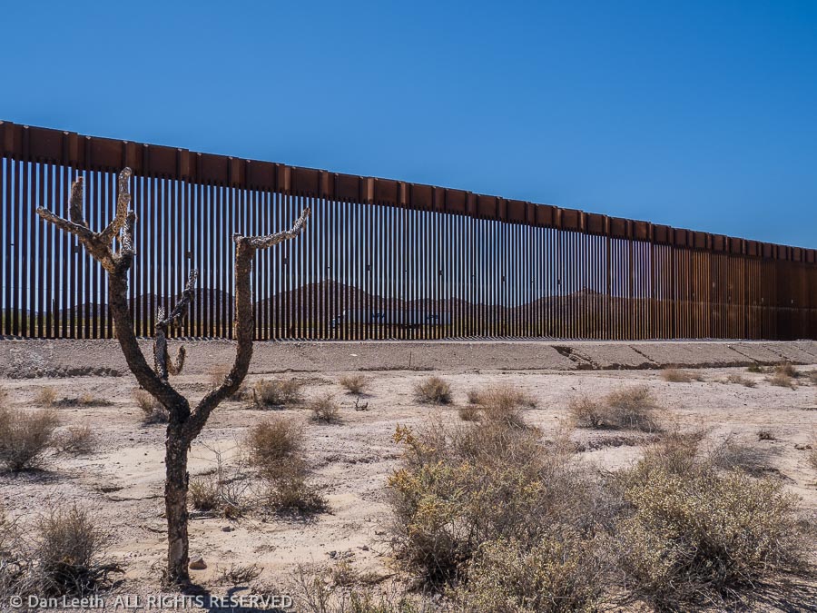
One would think that with The Donald’s magnificent new wall in place, we would no longer meet smugglers or immigrants on this side of the fence.
“Are there many holes in the wall?” I asked the ranger at the information booth.
“Plenty!” she responded.
Immigrants, she told us, can frequently be seen on South Puerto Blanco Drive, sitting by the roadside waiting to be picked up by border patrol. The smugglers, of course, try to avoid detection and will avoid all tourist-traveled areas.
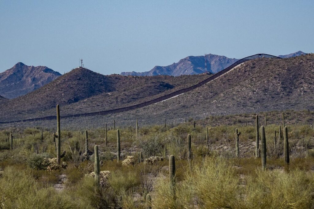
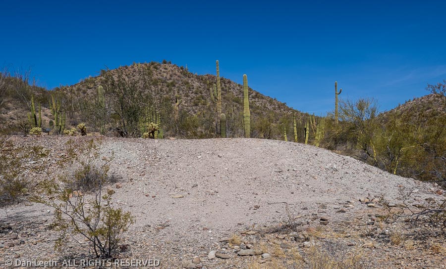
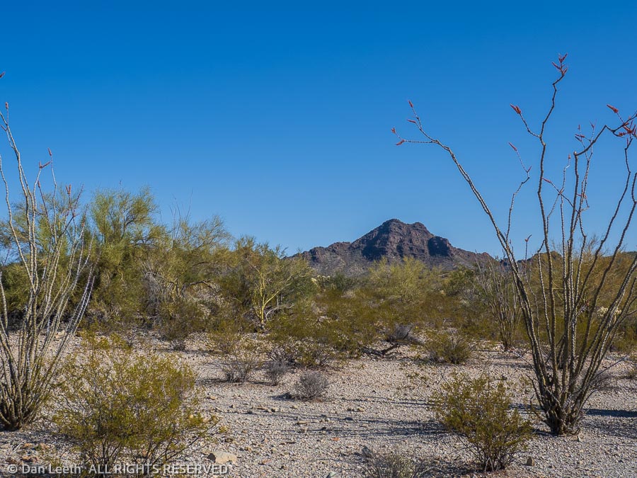
Our trail to the two historic mines started near the campground. Less than a mile from the trailhead, we got our first good look at the wall, about 5-7 miles to the south. From this distance, it looked like someone took a large Sharpie and drew a long, straight black line across the distant horizon with a white strip (the border patrol road) inscribed in front of it.
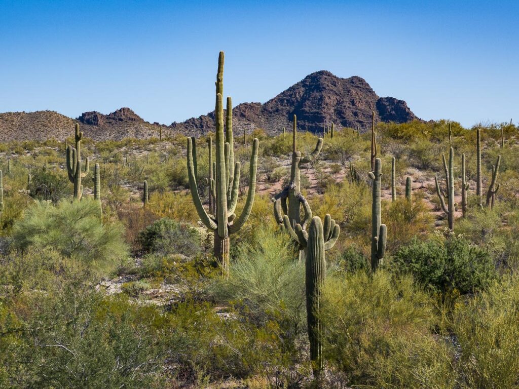
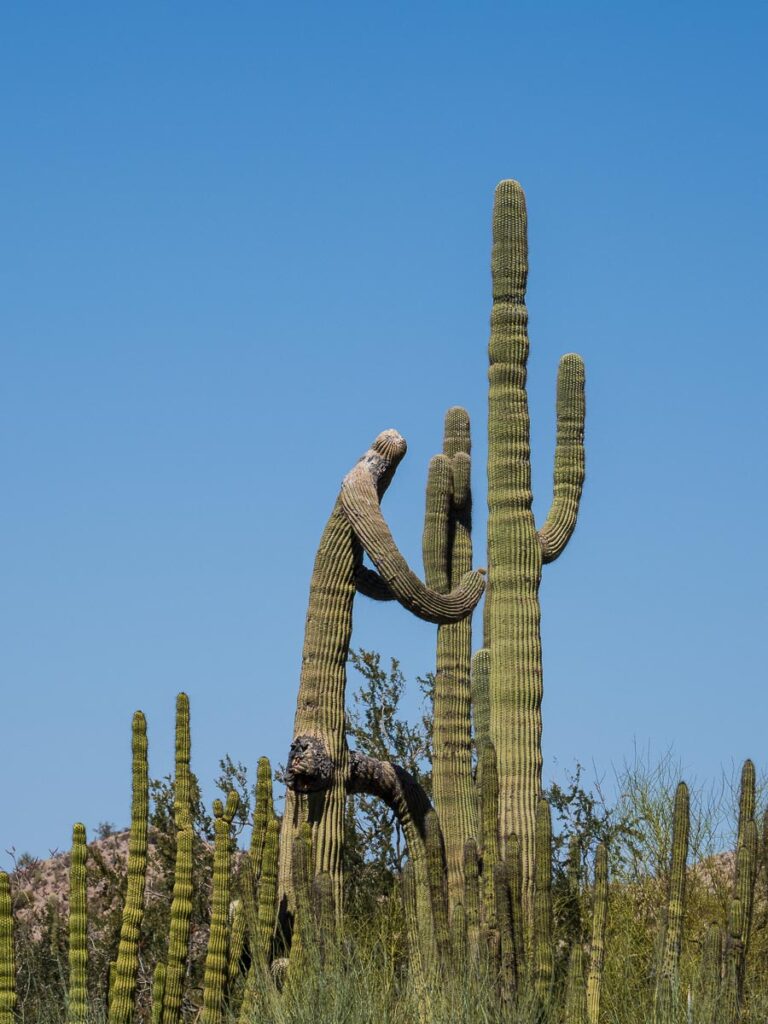
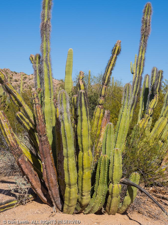
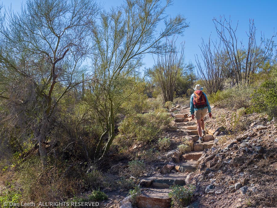
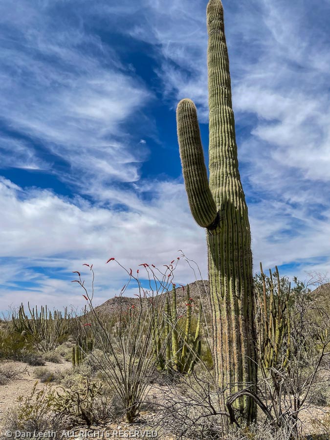
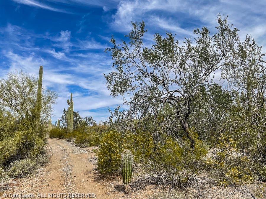
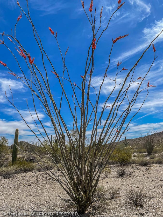
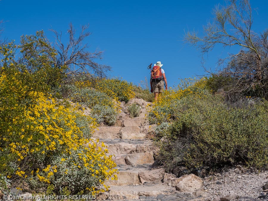
Our hike took us across the desert floor garnished with saguaro, organ pipe and several varieties of cholla cactus. Intermixed with the cactus were palo verde and mesquite trees along with ocotillo plants displaying buds ready to bloom.
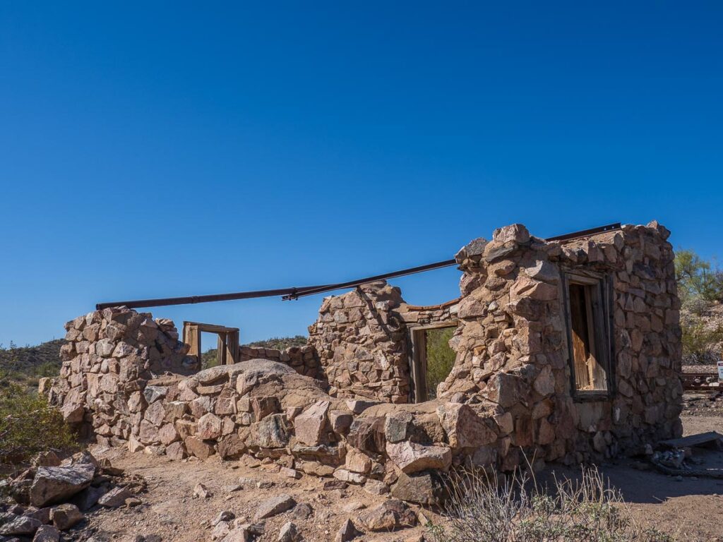
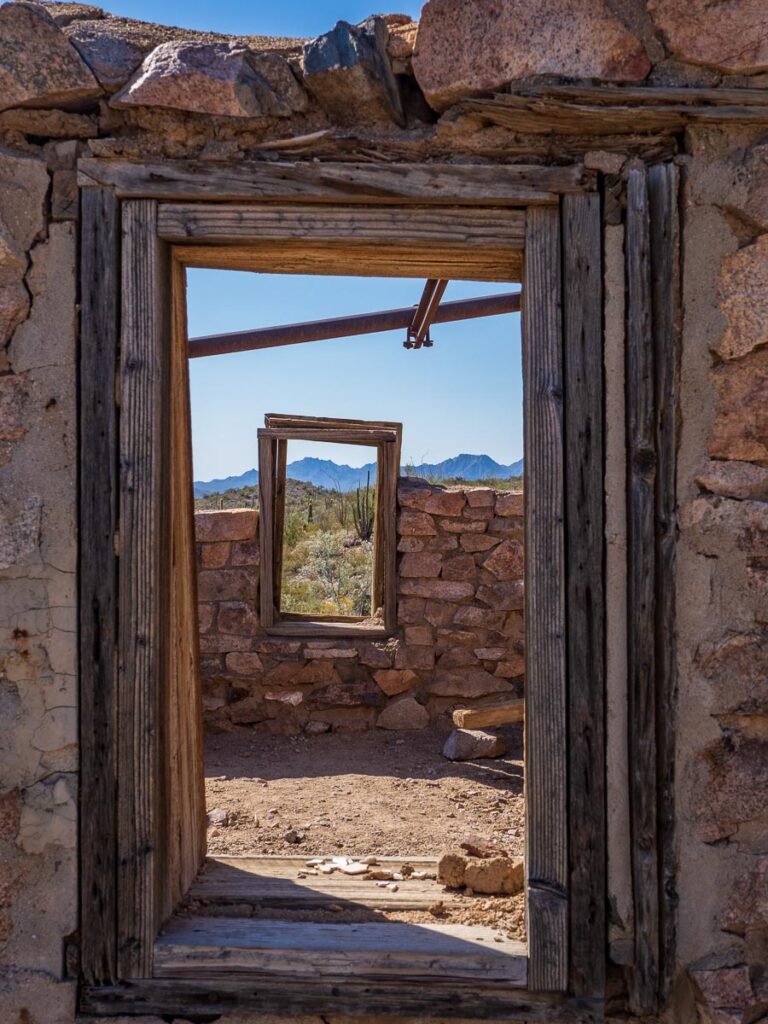
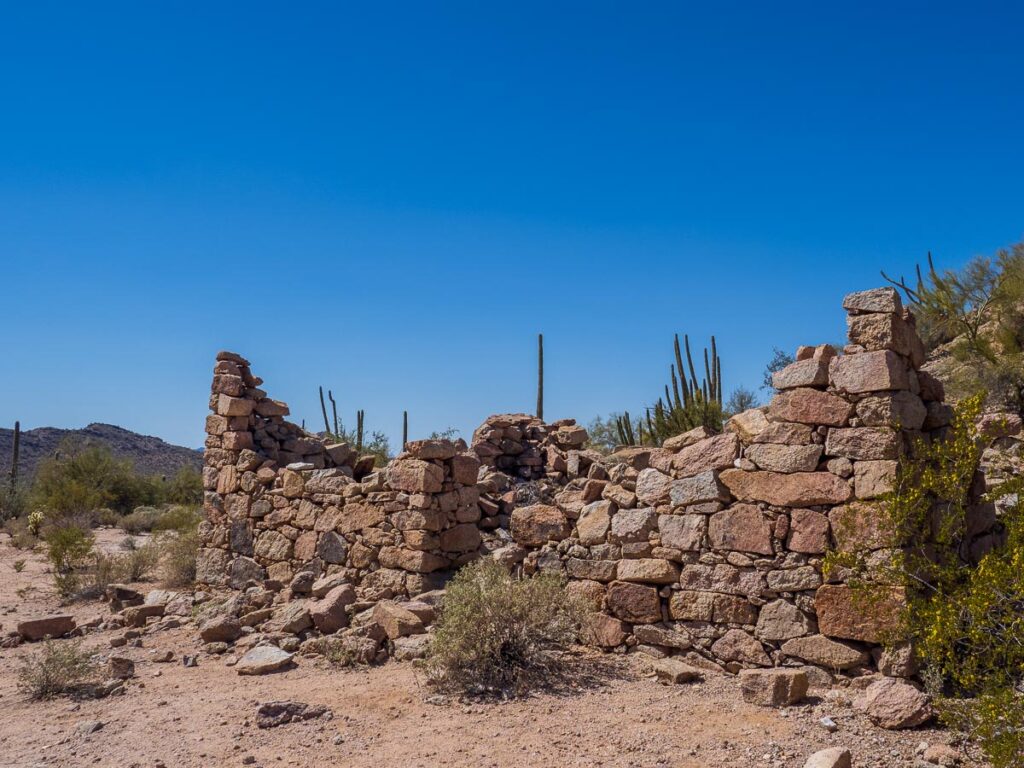
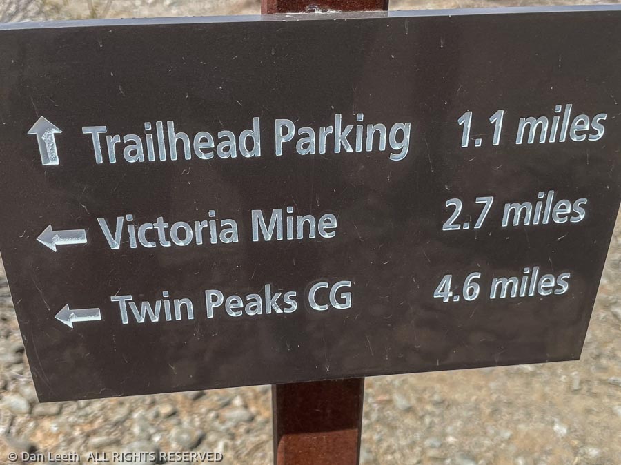
The first mine, the Victoria, lies about two miles from the trailhead. Rangers covered the mine shafts to keep people out while leaving them open for the bats, which like to hang out inside.
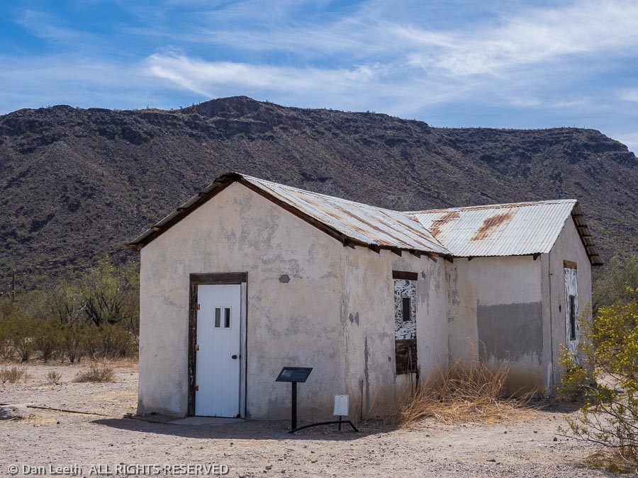
The only remaining structure was (according to the guidebook) the mine’s store. It apparently was closed for the season, or we might have bought some more souvenirs.
We shared the Victoria mine site with more than a dozen fellow hikers. We met only four other people continuing the additional two miles to the Lost Cabin Mine.
Here, too, we found the remains of one old stone building. The guidebook did not reveal its intended purpose, and we didn’t really care. It was time to turn around.
Back at camp, we shared our one chilled beer (a refrigerator-filling error that will never be repeated), stretched our sore muscles and then got to work uploading photos to our computers.
No life of leisure for us. After all, this is camping.
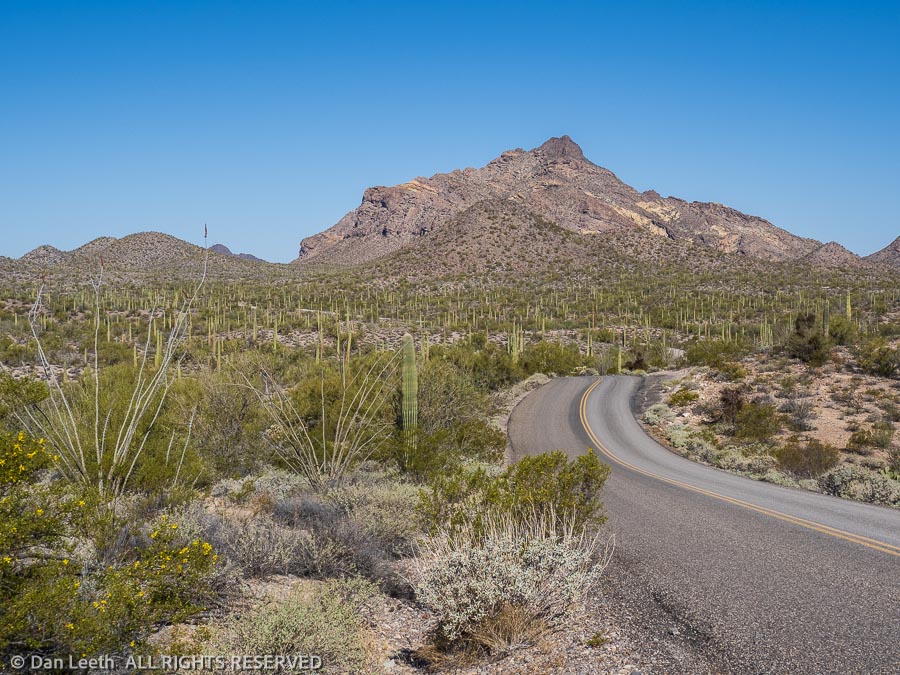
Organ Pipe Cactus National Monument offers a pair of long loop drives for guests to explore. Both feature mostly graded gravel roads with one-way sections. Neither is crowded. The longest is the 41-mile-long Puerto Blanco Loop, which has an extended “high clearance” section. Of course, we drove that road first.
Done in an anticlockwise direction, the first part of the drive features two-way traffic (we met no one) up to the Pinkley Peak picnic area, which is named for some person, not the color of the rock. From there, it’s one way as it winds onward through the desert.
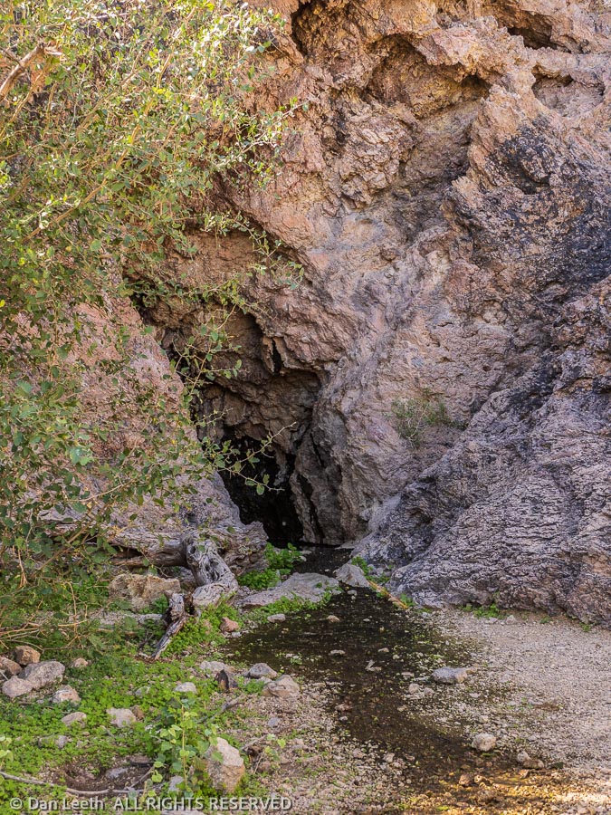
We stopped at the trailhead for Dripping Springs and walked the one-mile trail to the springs, which lie in a cave. The place was rife with bees, which according to a ranger at the visitor center are probably Africanized killer bees. We didn’t stay long.
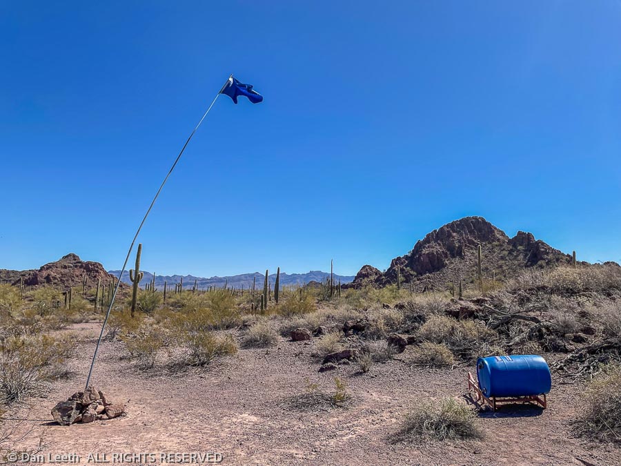
At a few spots along the road, we saw blue flags flying atop tall staffs. They marked caches of water held in blue barrels, which were placed in the area by a group called Humane Borders. Obviously, the Park Service is content with their existence.
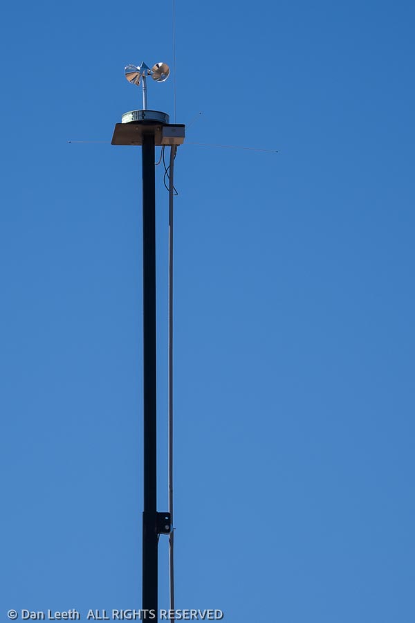
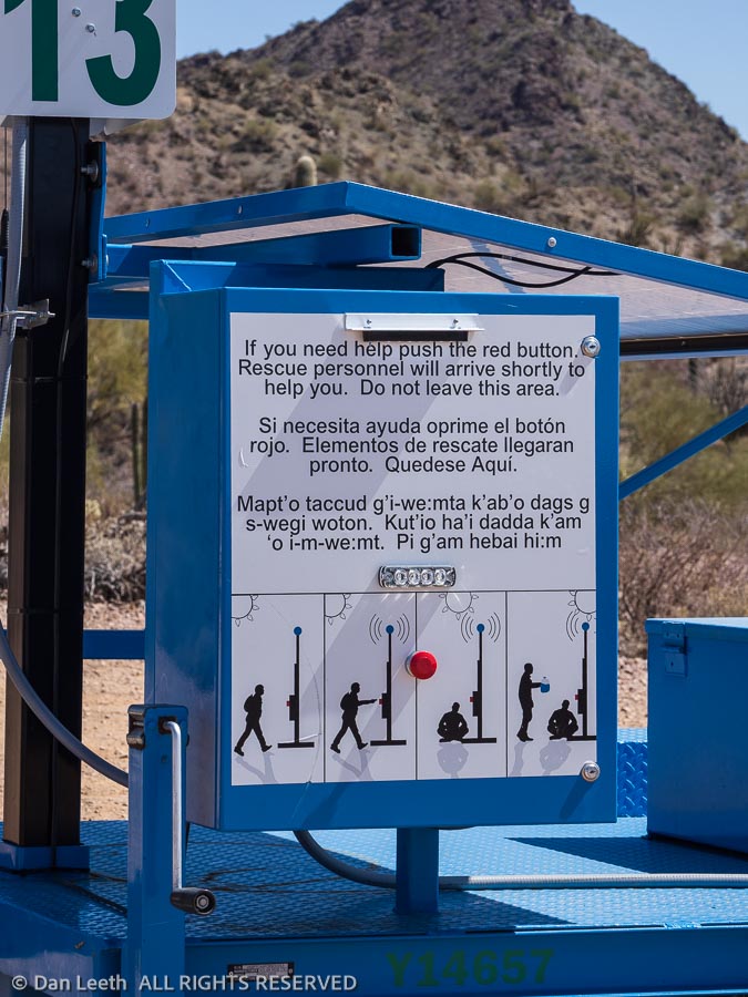
Elsewhere along the road we saw light reflecting off rotating mirrors. They marked emergency call boxes.
Instructions for their use have been posted in English, Spanish, native and sign languages. With no cell coverage along much of the road, these boxes could be lifesavers for us gringos as well as undocumented immigrants.
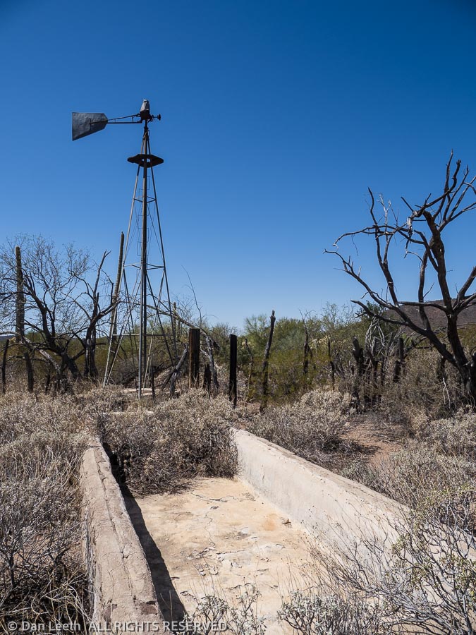
We stopped at Bonita Well, which offered pit toilets and a picnic table. The well has long since run dry, perhaps because someone stole the rotor blades off the windmill. It’s hard to imagine someone choosing to live out here in the middle of nowhere, but I suppose one could have said the same thing about the first inhabitants of Phoenix or Tucson. Maybe the current inhabitants, too.
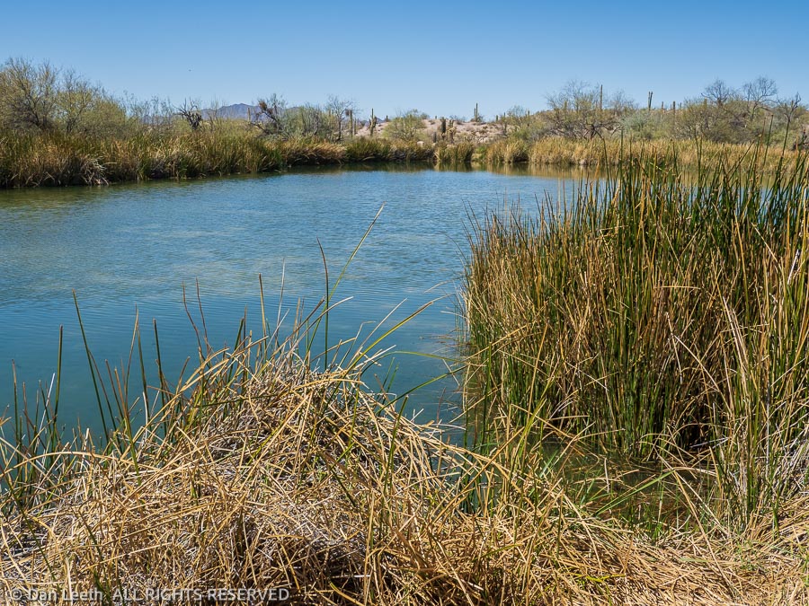
Just north of the border, we stopped at Quitobaquito Spring, a pond of water in the middle of the desert. Last time I was here (probably 1974) my step dog decided the ducks swimming in the water needed a little herding. She jumped in and swam after a flock of fowl, giving out an occasional bark. The ducks waited until the dog was just a few dog lengths behind, then they would flap wings and flutter out ahead, laughing all the way.
[Yes, dogs should be on a leash and never allowed to herd the local wildlife. But we were young and rebellious back then, protesting the war, segregation and leash laws.]
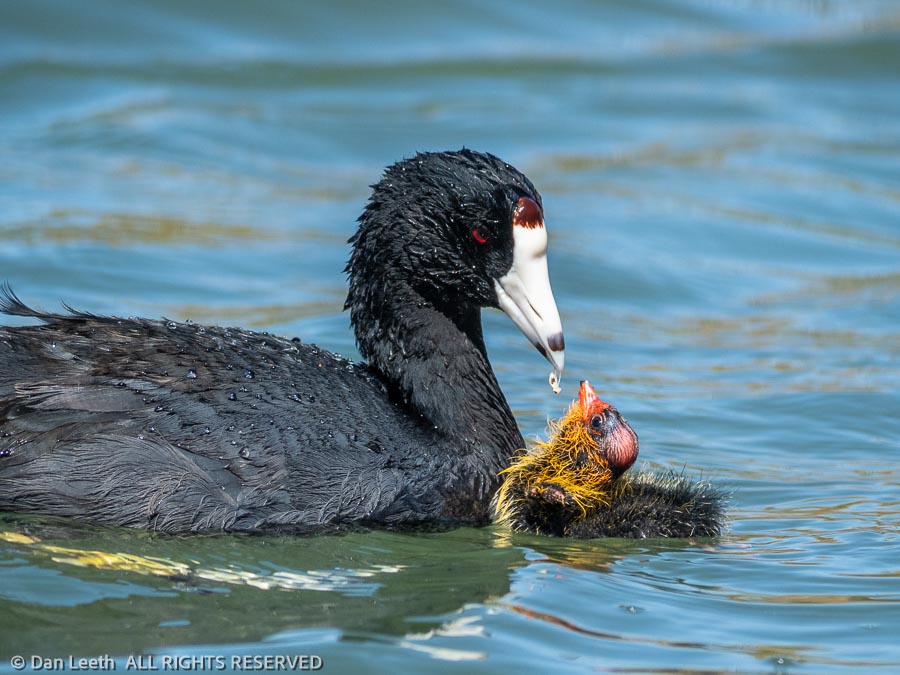
On this visit, we found a pair of black bodied American coots and their colorful offspring swimming in the pond. We watched the adults dive down, pull up a hunk of some tasty plant and feed it to the colorful little quackers who diligently followed their parents around.
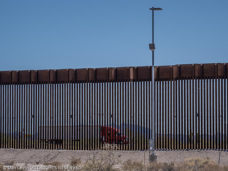
Now following the border, we drove for miles along The Donald’s wall. Regardless of one’s political stance, this might be a place where this tall picket fence might be needed.
Mexico Highway 2 runs a few dozen yards away on the southern side of the border. Without the fence, drug runners could simply stop along the highway, walk their product over to a tourist-looking accomplice on the American side and be gone. Now they’ll have to catapult it over the fence. Make ‘em work for it has always been my motto.
Driving back to camp, we took a detour up to Senita Basin so we could see what a senita cactus looks like. Although similar to an organ pipe, the senita has fewer vertical ribs and is covered with needles that look like an old geezer’s beard. I remember seeing and photographing these growing along the Mexican coast in San Carlos.
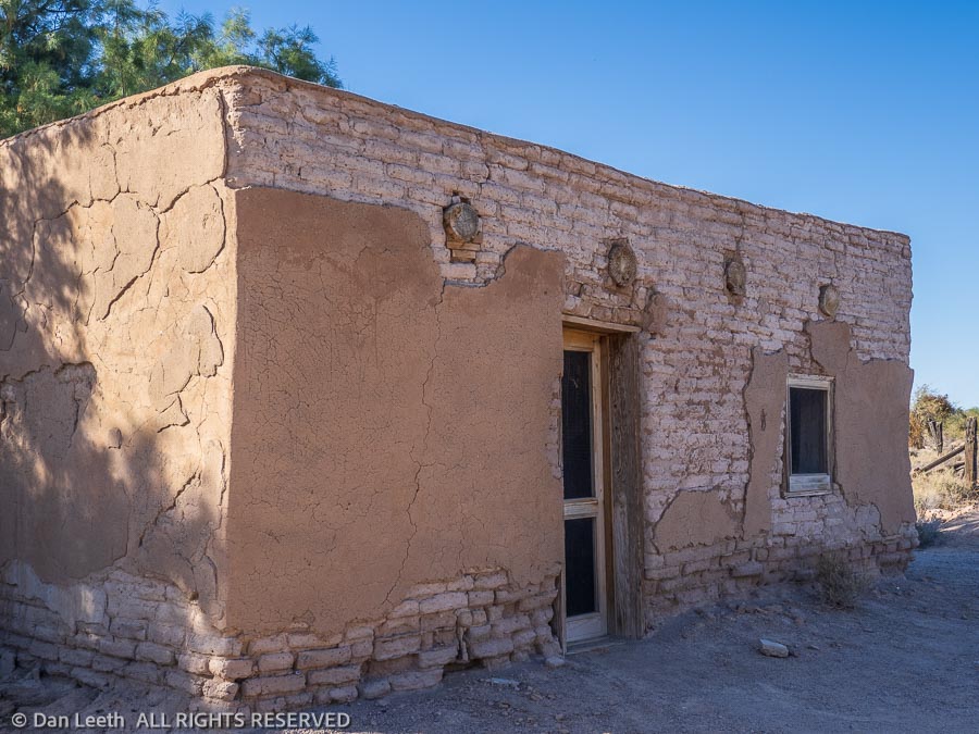
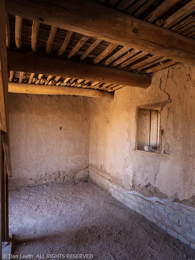
A final detour before heading back to camp was to Gachado Line Camp on the Camino de Dos Republicas.
Here stands an old adobe dwelling with its roof and much of its stucco still in place. On the way in, we passed a pair of Border Patrol trucks. The agents driving apparently knew we weren’t smuggling in dope or immigrants.
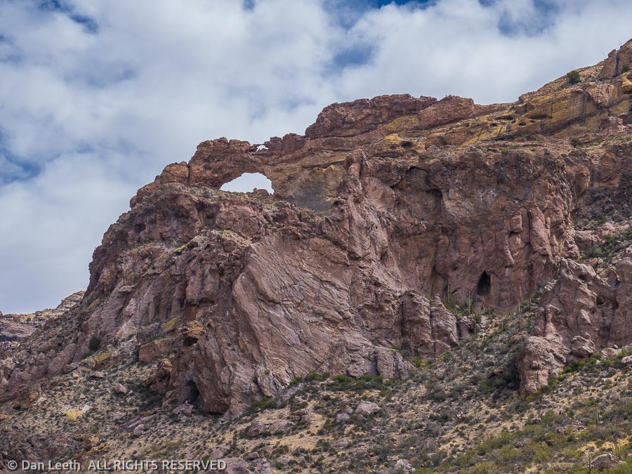
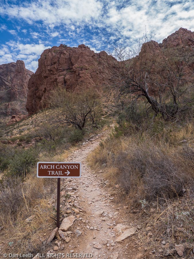
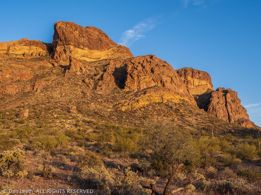
Yesterday, we drove the 21-mile Ajo Mountain Loop. The plan was to do a series of shorter hikes along the one-way section of the loop. Our first was Arch Canyon.
On the way, we listened to a point-by-point narrative describing the things we were seeing along the way. At Arch Canyon, the ranger in the app said it was a two-mile roundtrip hike up the canyon. For a hike that short, we didn’t even bother to take packs or water.
At the 0.6-mile point, a sign pointed us up a steep side canyon. We made the turn and started upward. The trail got steeper and rockier as we went up. Since we hadn’t yet reached the one-mile point, I figured this must still be the main tourist trail.
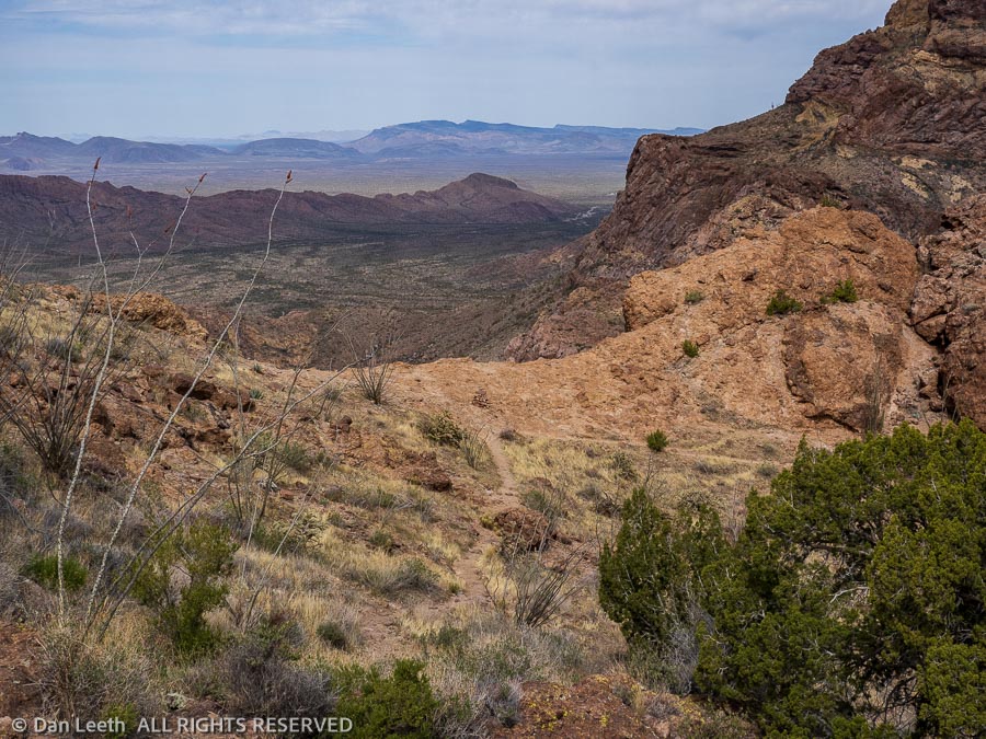
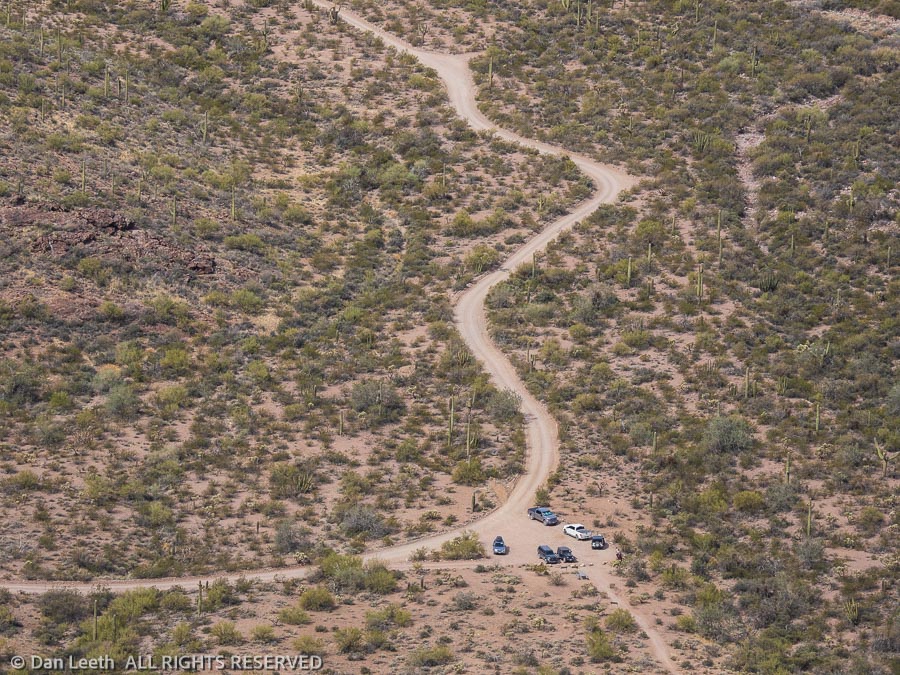
The one-mile point came farther up the trail, but since it looked like we were near the top, we continued onward. At a ridgetop saddle, I stopped and looked down on the parking lot where Tighty was parked. She now had nearly a half-dozen neighbors.
The trail looked as if it continued down to a steep drainage below. Maybe this was an alternative route down? I took a quick peek but decided not to pursue it. It turns out that trail continued around and into the arch.
We had another hike planned for another spot down the road, but Dianne said she’d had enough for the day.
“Let’s just go back to the trailer and down a few beers and maybe a box or two of Girl Scout cookies,” she suggested. At least that’s what it sounded like to me.
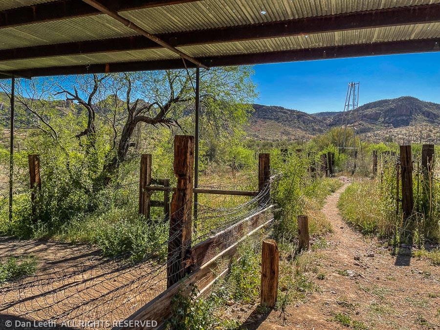
Not wanting to insult my body by ingesting a massive overdose of sugar and alcohol, I decided we needed to do another hike. This one would be up Alamo Canyon in the northeastern part of the park. A few miles drive down a graded gravel road led to the Alamo Canyon Campground, a four-site, tents or pickup camper only primitive campground at road’s end.
“It’s really quiet out here at night,” an elderly tent camper from Pennsylvania told us.
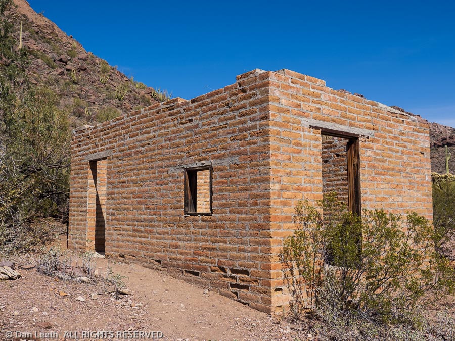
From the campground, a one-mile trail leads to an old ranch where a brick home/cabin still stands with an old corral a quarter mile beyond. It made a lovely final hike.
Back at camp, I made sure we had only one beer each with nary a single Girl Scout cookie to be seen.
Today, Sunday, is our rest day. Dianne watched a video of her church service while I slaved away in the kitchen washing dishes. When the rain stops, we’ll unleash Bob and the two Jerrys from the trailer so we can refill the trailer’s freshwater tanks and drain the gray and black.
Oops. After 47 seconds of torrential drips, the rain storm just stopped. Time to get to work.
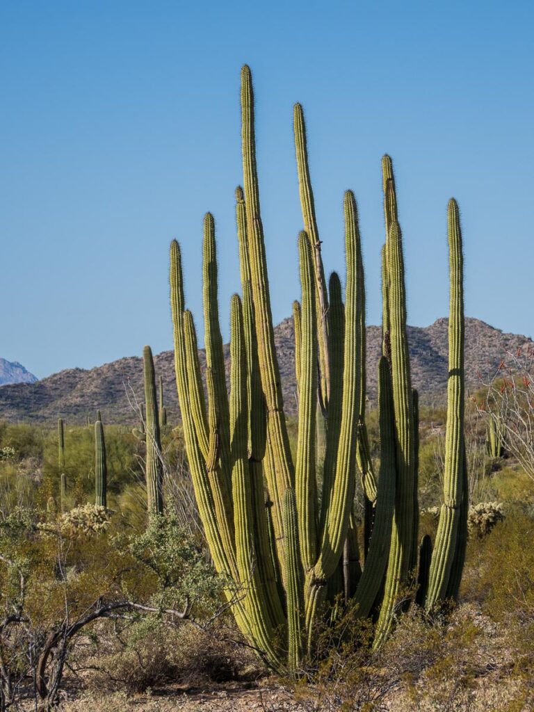
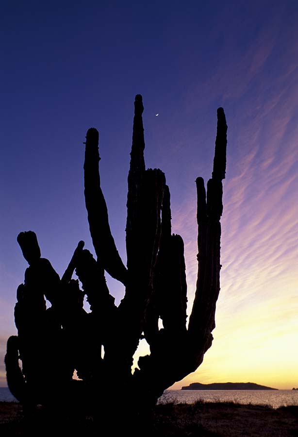
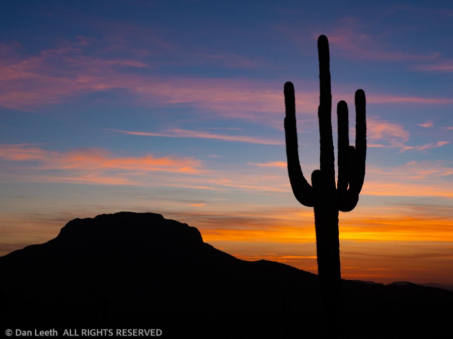
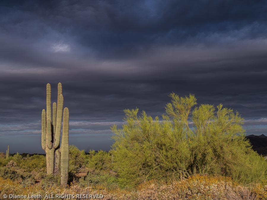
Arizona state law requires that every tourist visiting the desert must post at least one photo of a saguaro silhouetted in the sunset. Here’s mine.
I suspect for most people, Organ Pipe Cactus National Monument is a one-and-done sort of place – stop at the visitor center, drive the Ajo Mountain loop, admire the wall and scurry back to civilization. We have two full weeks down here and have not run out of things to do.
On Monday, we drove into the big city of Ajo. One of the park rangers here at the monument wore some earrings Dianne liked and was told they were available at a shop in the Ajo plaza. We also needed some groceries and were in need of a good burrito and margarita for lunch. Unfortunately, the earring shop and most everything else in town was closed on Monday, but we did get groceries, a burger and quite possibly the second worse margarita I’ve ever endured.
On Tuesday, we did an 11-mile hike that took us to the Red Tanks Tinaja, a natural depression in the rock that catches and holds rainwater. It was dry.
From there, we hiked on to the Baker Mine, which was little more than mine tailings. Next stop was the Milton mine.
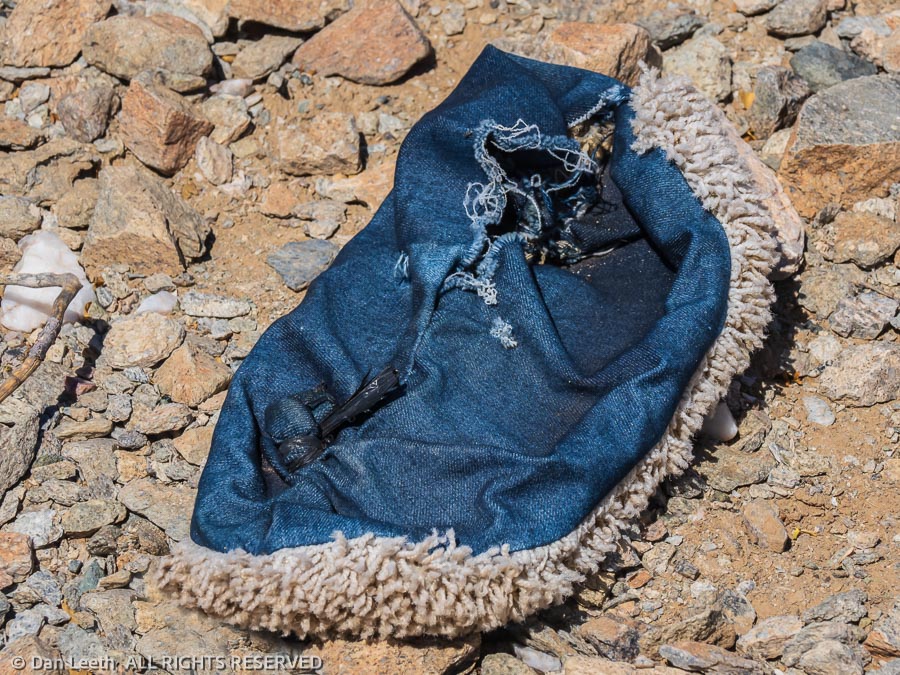
On our way to the Milton, we passed weathered piles of clothing left by folks who entered the country illegally, most likely drug smugglers. The residue included camouflage garb and shoe covers with carpet soles, which don’t leave tracks in the sand.
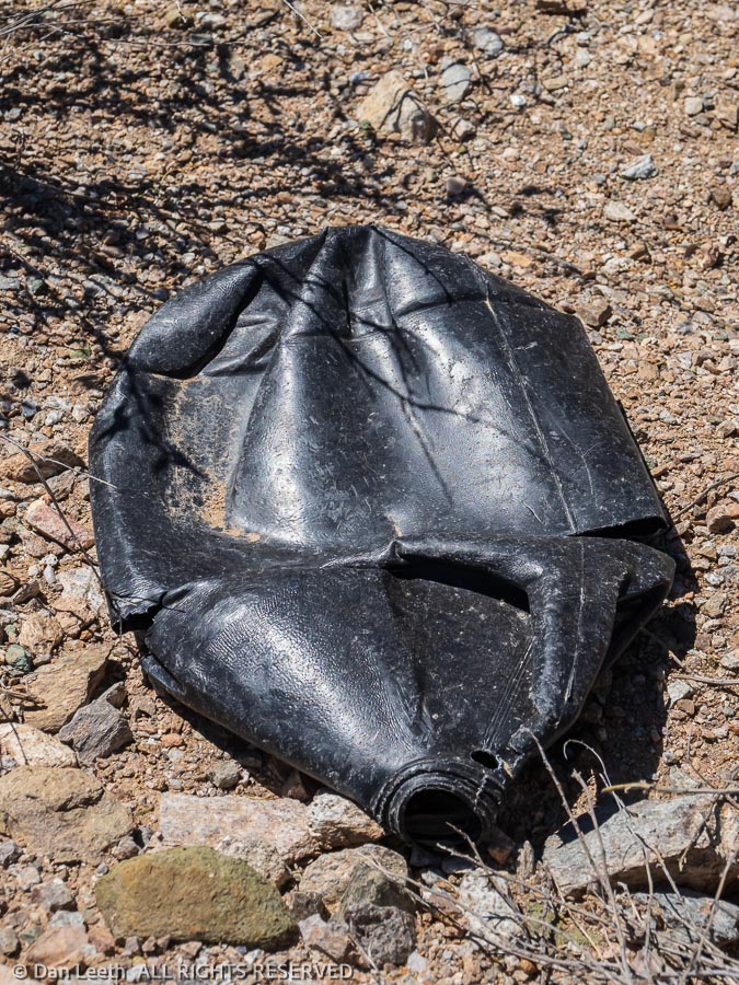
Nearby was one of the infamous black water bottles. They’re specifically made for folks crossing the border illegally, colored black so they won’t reflect light.
The Milton Mine was a more extensive operation with more to see and explore.
From there, we continued to Senita Basin, where we turned onto a trail that would take us back past the Red Tank Tinaja (still dry) and on to our truck., which waited beneath Pinkley Peak. On the entire loop, the only other person we encountered was a trail runner out doing his Coopers on the rough, rocky trail.
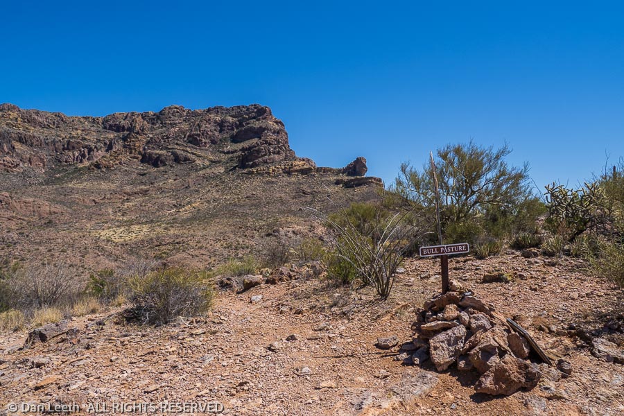
Wednesday was a flake-out day in camp. On Thursday, we did a little four-mile trail in the Ajo Mountains, which led up to a place called Bull Pasture, a thousand feet above the valley floor. Apparently some rancher used to bring his cattle up here to graze. I have no idea how he got them here, but it wasn’t by our route.
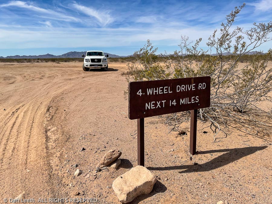
On Friday, we did a long drive up the Pozo Nuevo Road through the western side of the park. The first part of the route was marked as a 4×4 road. Instead of being a 4×4 road, it turned out to be a well graded route for its entire 14-mile distance. It was smoother than I-70 through Colorado.
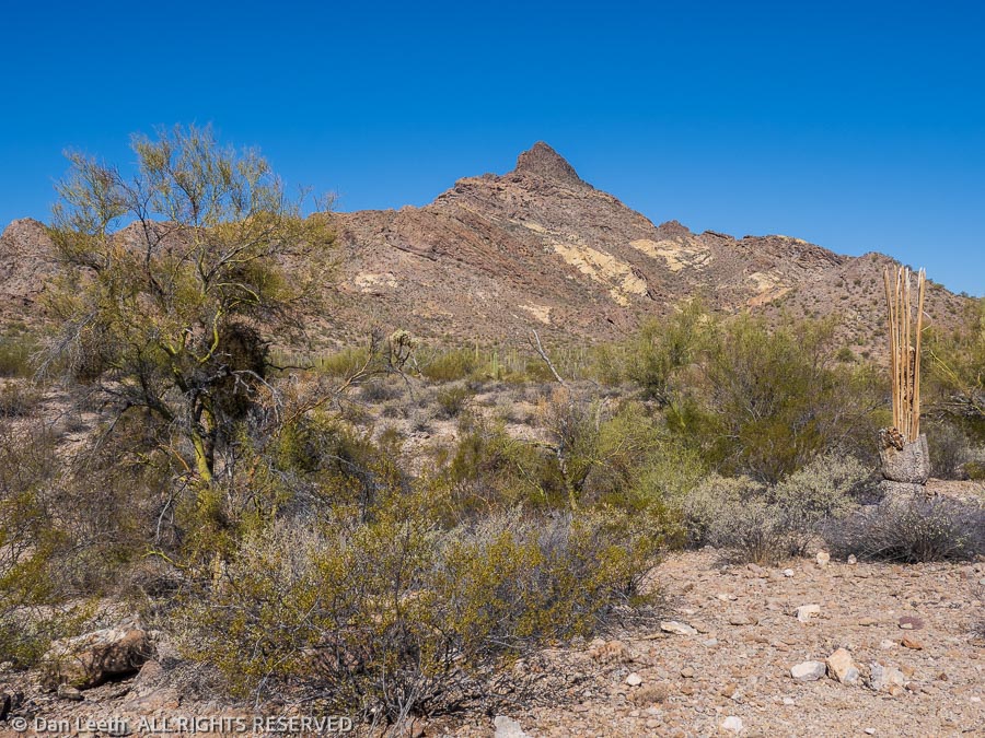
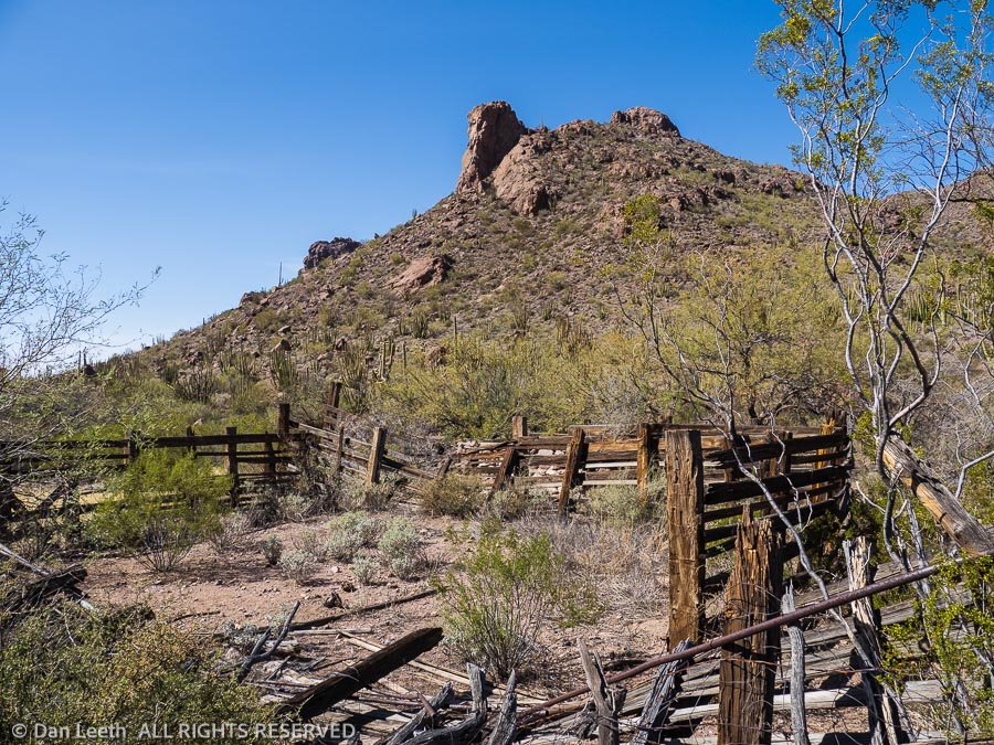
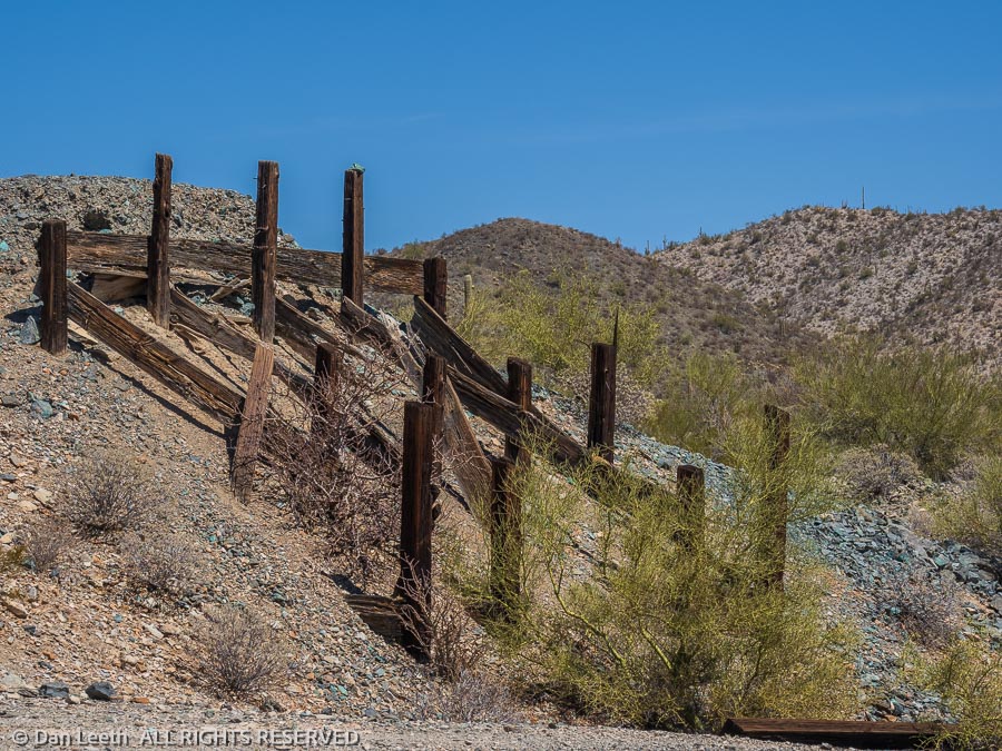
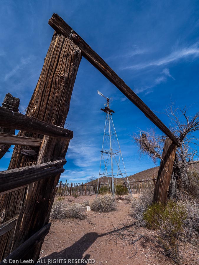
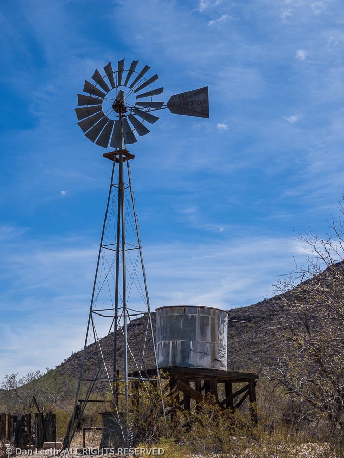
We stopped to explore the Pozo Nuevo line camp along the way. Here stood the remains of a windmill and corral with various pieces of rusting equipment and furnishings lying about.
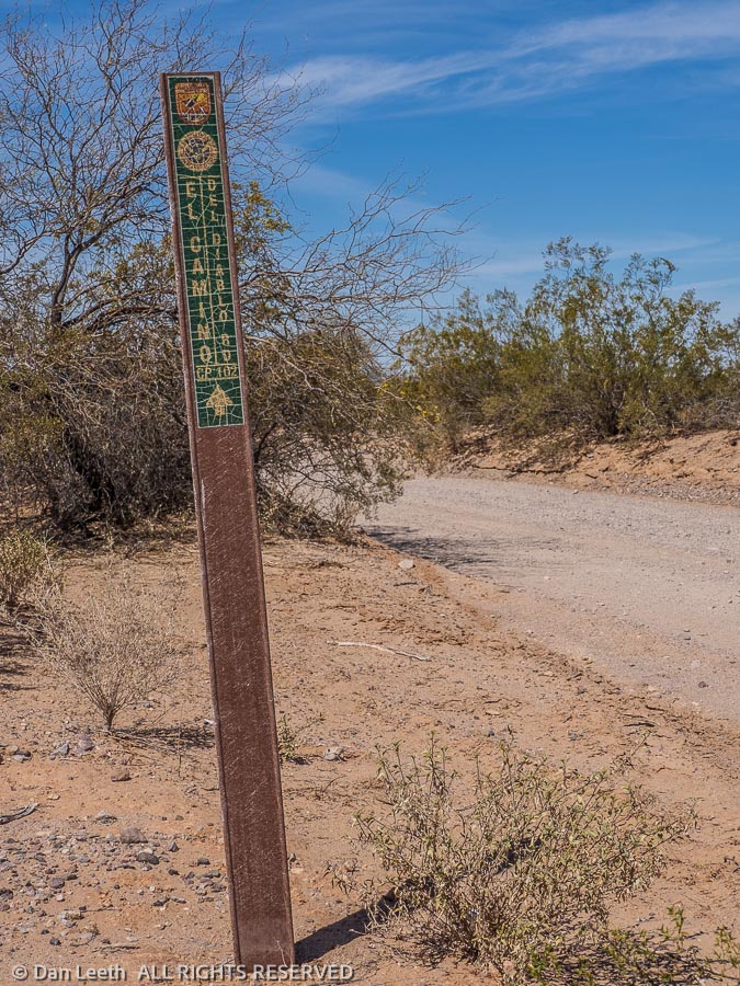
The Pozo Nuevo road T-bones into a road with two names – the Bates Well Road or El Camino del Diablo (the Road of the Devil). We turned and headed west, following this Highway to Hell up to the park boundary and the start of the Cabeza Prieta National Wildlife Refuge.
El Camino del Diablo continues as a true 4×4 route through the desert, crossing the wildlife refuge and proceeding on to Yuma. I’d love to drive the entire Camino del Diablo sometime after we get the Bronco.
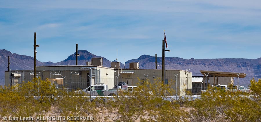
At the border of the monument and refuge sprawls a Border Patrol facility surrounded by razor wire and no trespassing signs.
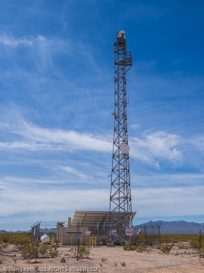
Across the street stands a huge surveillance and communications tower complete with cameras. No doubt, some agent got a great shot of me relieving myself on a creosote bush. Returning on the narrow road, we met an officer driving a Border Patrol van. While he did not appear happy to see us out there, he did not cite me for unlawfully watering the vegetation.
Heading east across the monument, we soon reached the Bates Well. The Gray family lived here at the time the monument was created in 1937 and they were allowed to stay and run their ranch.
When Henry Gray, the last surviving member of the family died in 1976, the ranch was closed. The home, buildings, windmills and tanks remain.
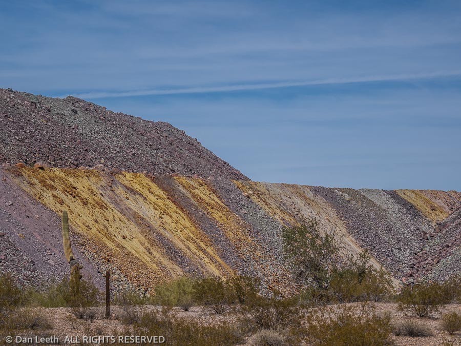
Continuing past the tailings from the Ajo Mine, Arizona’s first open-pit copper mine, we headed into town. After burritos and brews at Tacos El Tarasco, Dianne went looking for her earrings. Unfortunately, the lady selling them had closed for the season and evacuated to the Phoenix area. While Dianne left with a full wallet, I found a nice T-shirt to buy.
As we near the end of our Organ Pipe stay, we had just three park trails left to hike. The longest was the three-mile Senita Basin loop. A nice, graded road leads to the trailhead.
“We’ll drive out, hike the loop and motor back to the trailer for lunch,” I suggested to my lovely wife.
“No!” she insisted. “I want to hike from here.”
A series of trails connect the campground with the Senita Basin loop. The first two miles follows the trail to the Victoria Mine, a trail that goes down, across and up no fewer than 987 washes and arroyos. A 1½-mile connector trail goes from there to the three-mile-long Senita Basin loop. From the trailer, we’d be doing a nice 10-mile out-and-back hike.
No problem, except it was 10:00 a.m. in the morning and the high temperature for the area was predicted to exceed 95 degrees by midday. And my wife claims to hate heat.
So, after a lengthy discussion, we compromised and did it her way. We filled water bottles, hoisted packs and took off into the unforgiving desert smack dab in the heat of the day. Nary a breeze ruffled the leaves of the desert plants. Even the sun-loving lizards sat in the shade, looking at us in baffled wonderment. Turkey vultures circled ominously overhead.
Other than a handful of people we met on the Victoria Mine trail in the morning, we had the desert to ourselves. We walked along, admiring the beauty of hedgehog cactus and ocotillo in bloom. Stopping in the shade, we were serenaded by a handful of unseen songbirds. It was a beautiful time to be in the desert.
On the return, my heat-hating wife took the lead, sprinting up and down the washes and arroyos. Ahh, to be young again.
Back at the trailer, it was 108 inside. We stripped off our boots and retreated to the shady edge of our campsite. That first beer tasted so good, I had another. Showers followed.
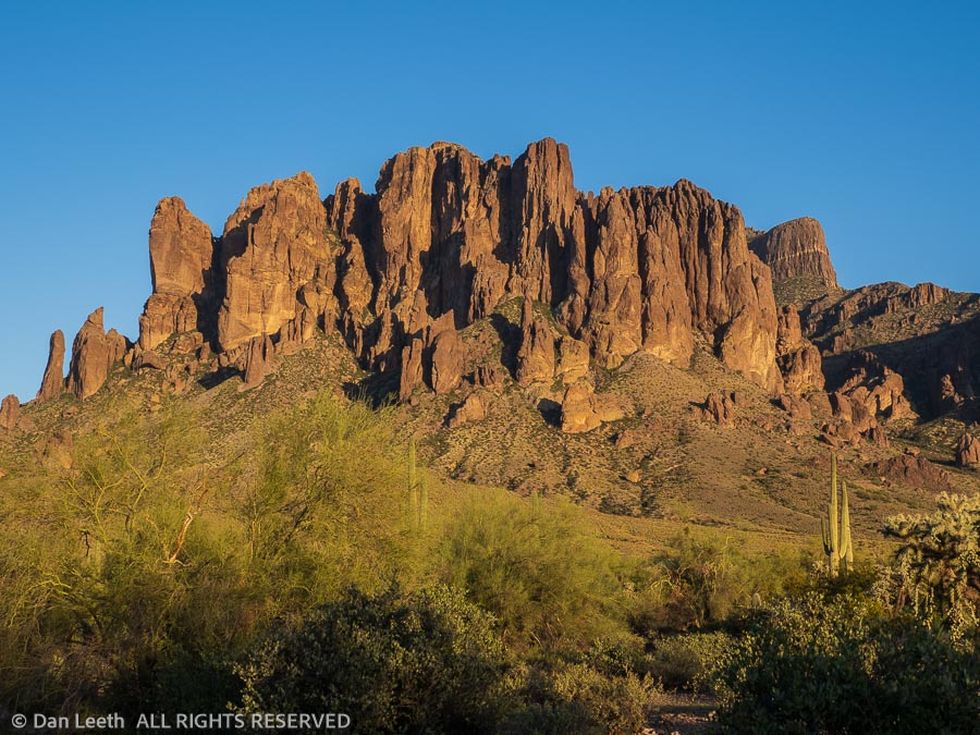
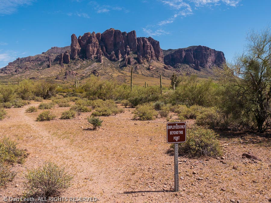
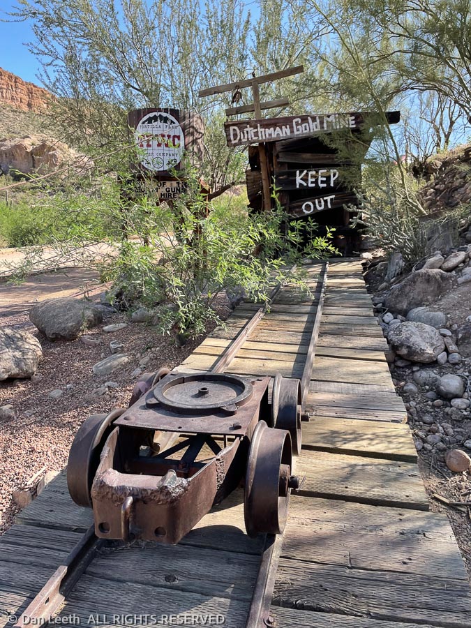
Our two-week stay at this border-hugging national monument has come to a close. We’ve driven the drivable roads and hiked nearly all of the formal trails. It’s time to move on to Apache Junction and the Superstition Mountains where we will meet friends and continue our search for the elusive Lost Dutchman Mine.
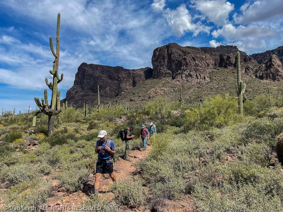
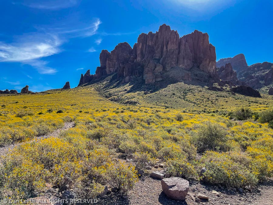
On our first full day at Lost Dutchman State Park, we and our camping buddies from Colorado began our search for the lost mine of Jacob Waltz, the Dutchman. We figured ol’ Jake would have dug his mine along a trail named for him, so we began our search with a hike down Jacob’s Crosscut Trail.
Beginning off the park’s Siphon Draw trail, the Crosscut Trail parallels the face of Superstition Mountain for about five miles. The trail is relatively level and the views are stupendous with a shag carpet of brittlebush in bloom.
Finding no veins of gold, our friends turned around at the 3½-mile point. Dianne and I continued another 1½ miles to where the trail ends at some homes on Broadway Lane.
These domiciles, I suspect, cost far more than the value of all of the gold the Dutchman dug from the ground.
Here we met the Lost Mine Trail, which no doubt goes directly to Jake’s lost diggings. It’s hard to believe the mine is still lost if there’s a trail going straight to it.
Unfortunately, we didn’t have time today to hike up and recover any of that lost gold, so we turned around and headed back to our campsite. Today’s golden treasure will come in cans.
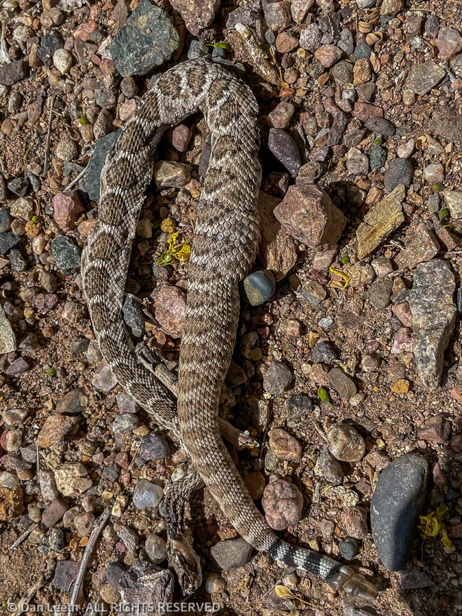
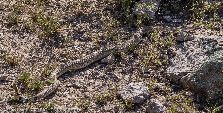
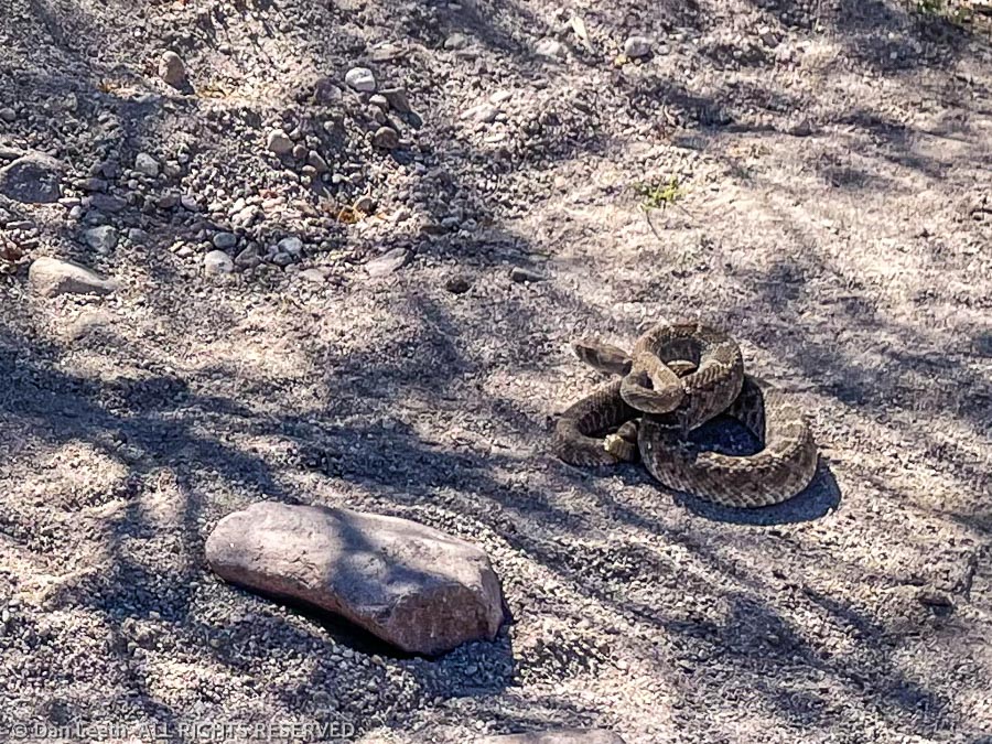
We’ve been here over a week now, and we still have not found the famous Lost Dutchman Mine. Instead of striking gold, we’ve found lots of striking reptiles.
On Saturday, we searched for the Dutchman’s lost treasure on the Treasure Loop Trail in Lost Dutchman State Park. Instead of gold, we met a fellow hiker who told us there was an obstinate buzz-worm on the trail ahead. The thing refused to move, even though they were throwing rocks at it. We wisely took another route.
On Sunday, one of the campground wallys scraped up the remains of a buzz-worm that had been run over on the pavement. The little buzzers like to warm themselves on the pavement at night, which as this one found out, can be detrimental to a snake’s health.
Monday, I took a short battery-charging drive in the Titan. When I got back to camp, I found a small buzz-worm squished on our campsite drive. I must have backed over it when I departed the campsite. I’ll look more carefully next time I walk up to the truck.
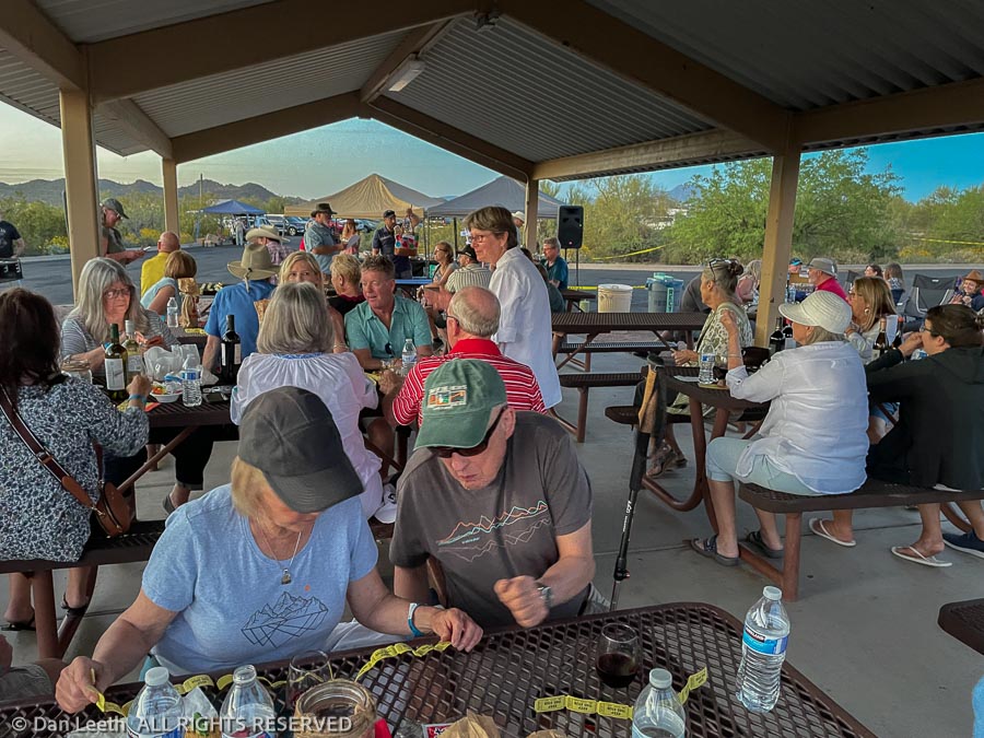
That night, we attended the Picture Perfect Wine Tasting in the park. It featured good food, ample quantities of wine that didn’t come straight from a three-liter box and raffles that we didn’t win. Walking back to our camp, we were sure to carry a flashlight and look for slithering reptiles warming themselves on the pavement.
On Tuesday, we did a pleasant 9½-mile search for the missing mine from the First Water Trailhead. The ranger there didn’t give us any clues as to the mine’s whereabouts, but he did warn us to be on the lookout for buzzers.
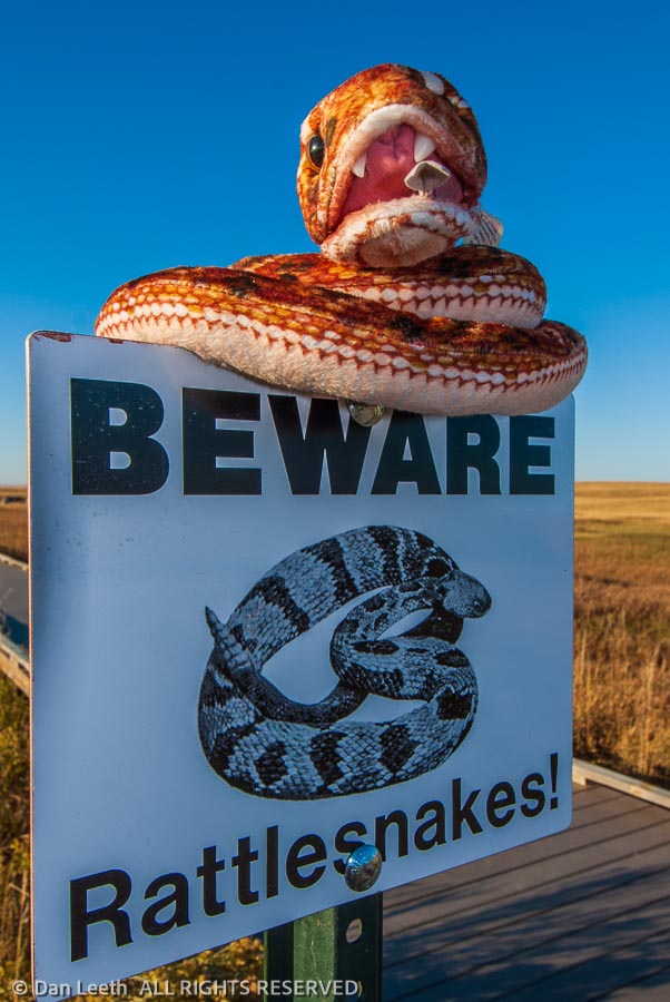
“They’re hungry, horny and aggressive,” he advised. “Don’t go walking through the grass.”
We only found one, maybe a 2½-footer, and it was slowly slithering off the trail looking for some shade. I don’t know if this guy was another d-back or one of the more toxic green mojaves. It may have been hungry or horny, but it sure wasn’t aggressive.
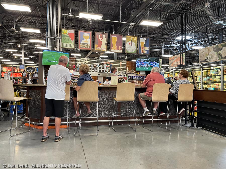
They say the Dutchman was a beer drinker, so on Wednesday, we headed into town for a few research brews (and pizza) at my favorite Apache Junction bar – Fry’s grocery store. I sure wish Kroger would build one of these super stores with an in-market bar somewhere in Grand Junction. It gives us guys something to do while our wives are maxing out the MasterCard on food purchases.
Today’s mine search was a short 5½-mile romp past an old windmill and corral.
From there, we continued up First Water Creek to Hackberry Springs. Most of the route followed the creek bed, which featured inviting pools of water along the way.
Around midway to the spring, we ran into a small diamondback right on the path. It was coiled with its head up, but it rudely didn’t offer a welcoming buzz.
Our return to the First Water Trailhead took us through Garden Valley – one of my wife’s favorite spots in the area. When we were last here, the place was truly a garden, and Dianne was eager to show it to our hiking buddies.
Unfortunately, a series of wildfires sparked by lightning and/or Jewish space lasers changed the looks of the place.
Our friends may not have been treated to a delightful garden, but at least they’ll get to say they met an Arizona buzz-worm.
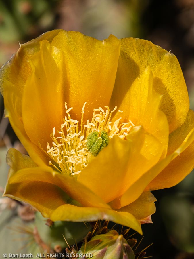
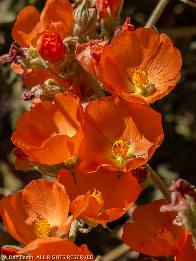
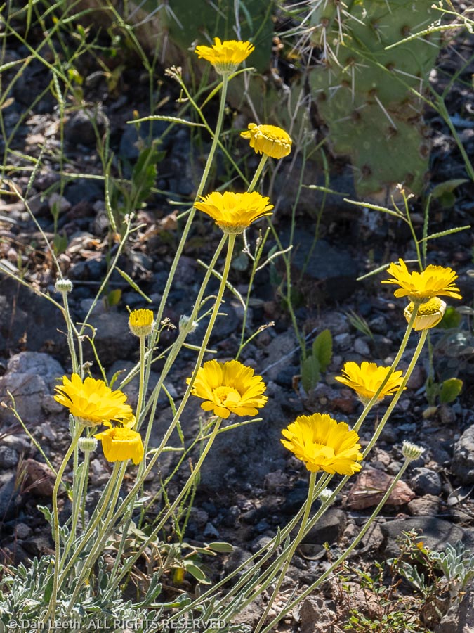
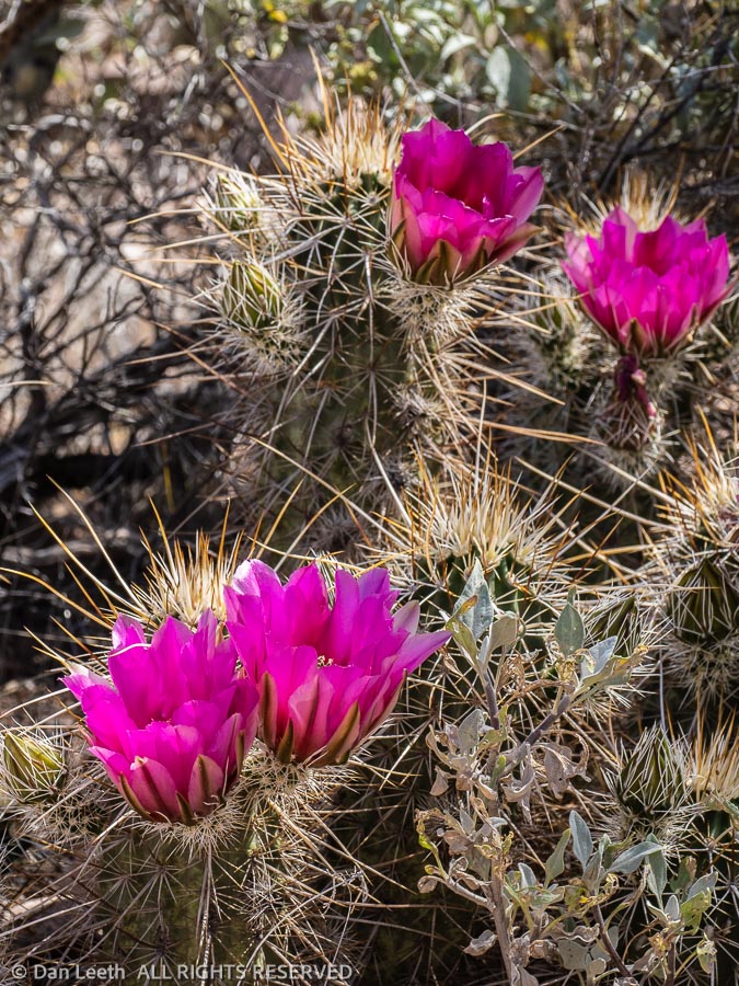
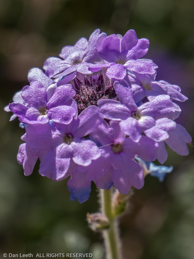
“Why don’t you post pictures of pretty desert flowers instead?” she asked my lovely wife.
Well, it hasn’t been a good flower year down here, but here are shots of a few pretty desert flowers we’ve passed by on our elusive search for the Dutchman’s lost gold mine.
Our search for the Dutchman’s lost mine continues.
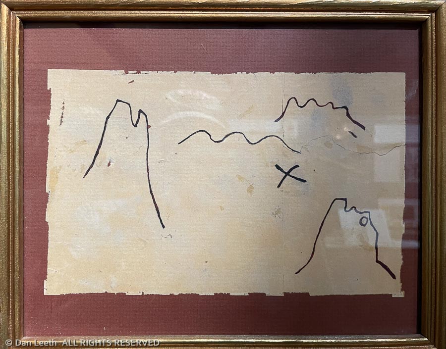
We figured our hunt for this lost ledge of gold might go better with a map, so we stopped down at the Superstition Mountain Museum on Friday to see what was available. This one, would probably work as well as any.
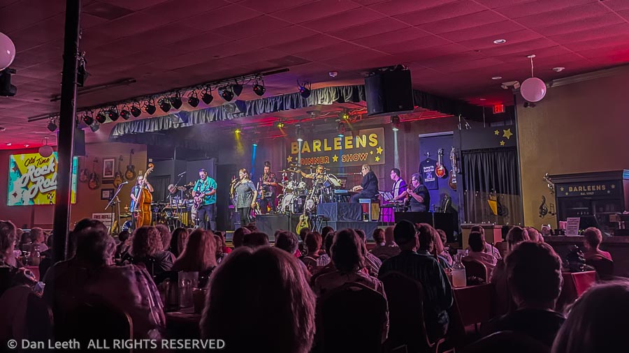
That night, all six members of our search party attended the Old Time Rock ‘N’ Roll show at Barleens Dinner Theater in Apache Junction. A fun evening of golden oldies might be as close as we’ll get to the precious metal on this trip.
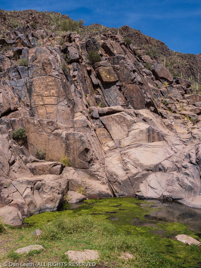
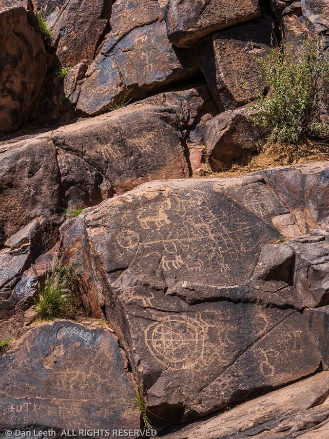
The next day, we all went our separate ways in search of the lost mine. Thinking that the Dutchman might have left a clue in the rocks, Dianne and I chose to explore the petroglyphs surrounding the springs off the Hieroglyphic Trail.
We were amazed that in a location this popular, the ancient petroglyphs were little marred by modern-day graffiti. As far as we could see, the Dutchman etched no clues to his mine’s location here.
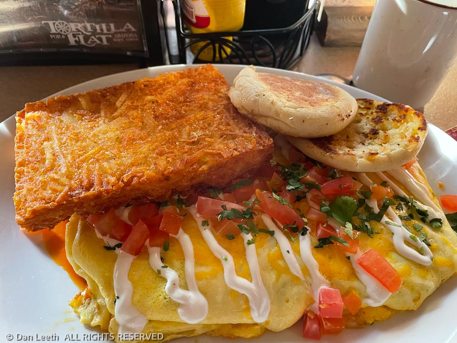
On Sunday morning, we headed up the Apache Trail to Tortilla Flat, which once served as a stagecoach stop back when the Roosevelt Dam was being built in the early 1900s. Fortunately, new restrooms have been built since then.
These days, it’s a popular tourist trap that serves great food. Not one member of our search party finished his or her breakfast.
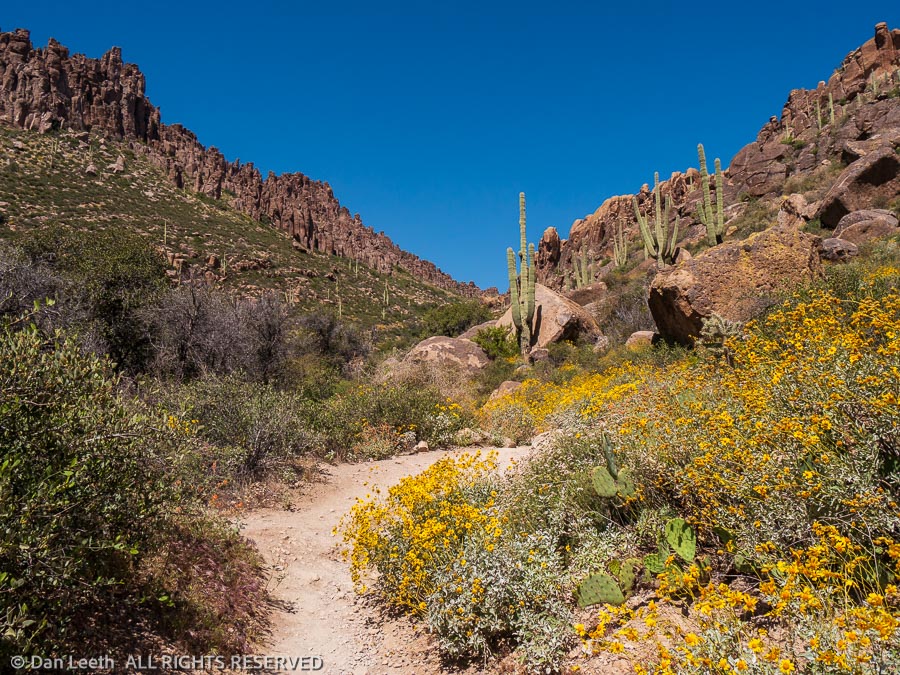
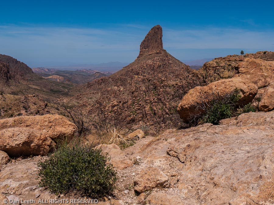
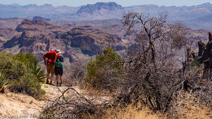
Monday morning, we hiked up Peralta Canyon, named for the Mexican family who supposedly once mined gold in this area.
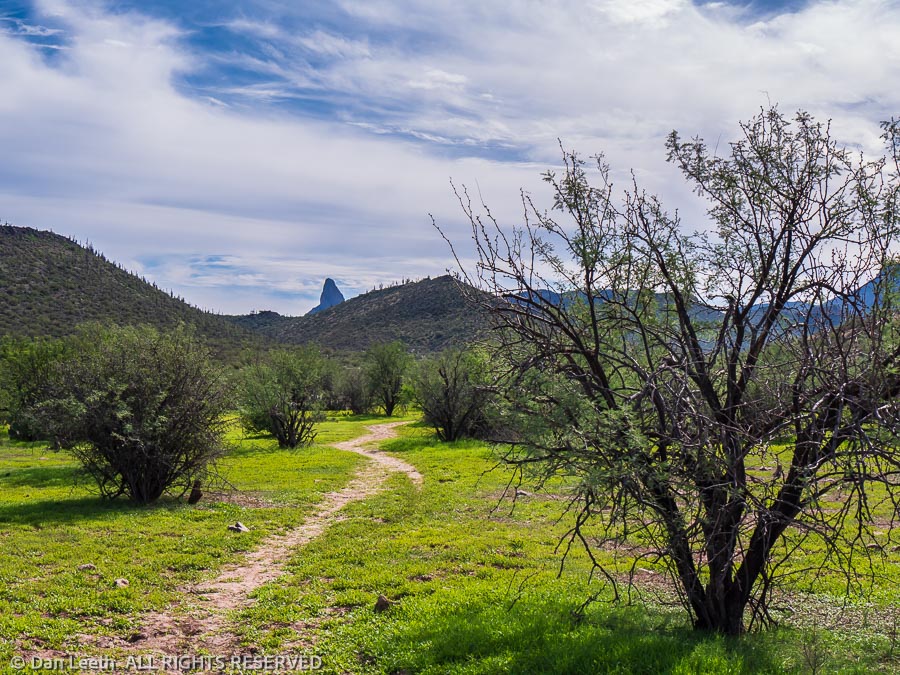
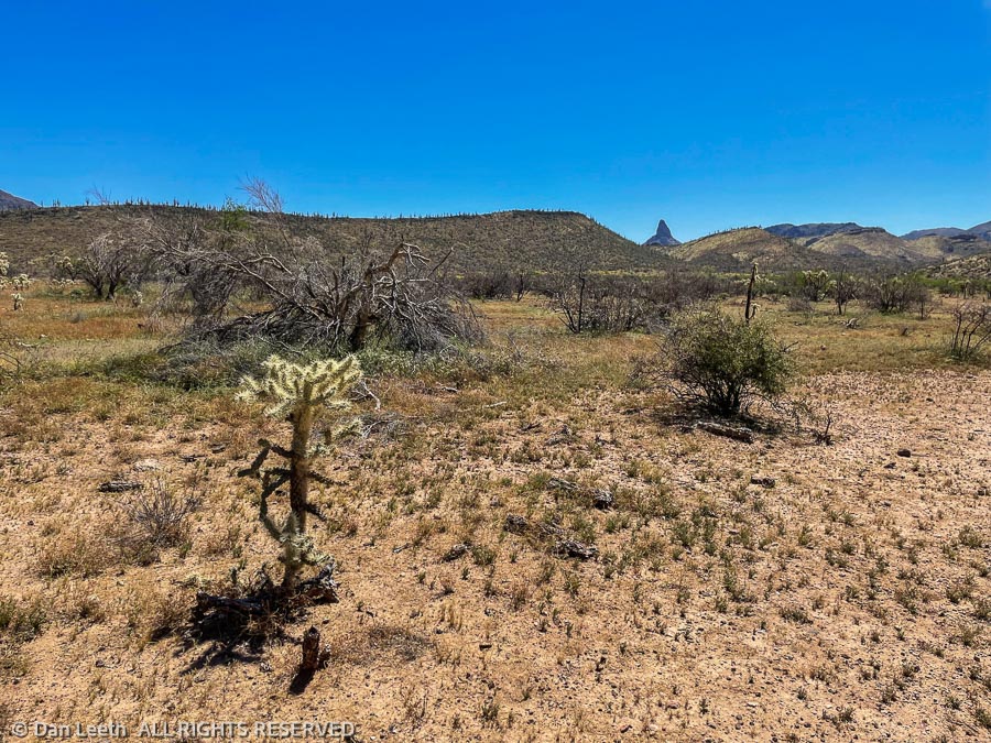
We stopped atop Fremont Saddle. Below us stood Weaver’s Needle, long a center of attention for Dutch hunters.
In East Boulder Creek Canyon below the Needle, well-armed, rival groups led by Celeste Jones and Ed Piper both searched for the Dutchman’s, Peralta’s or Jesuit’s lost gold. Fortunately, we did not have to fight any of our fellow hikers over the golden views.
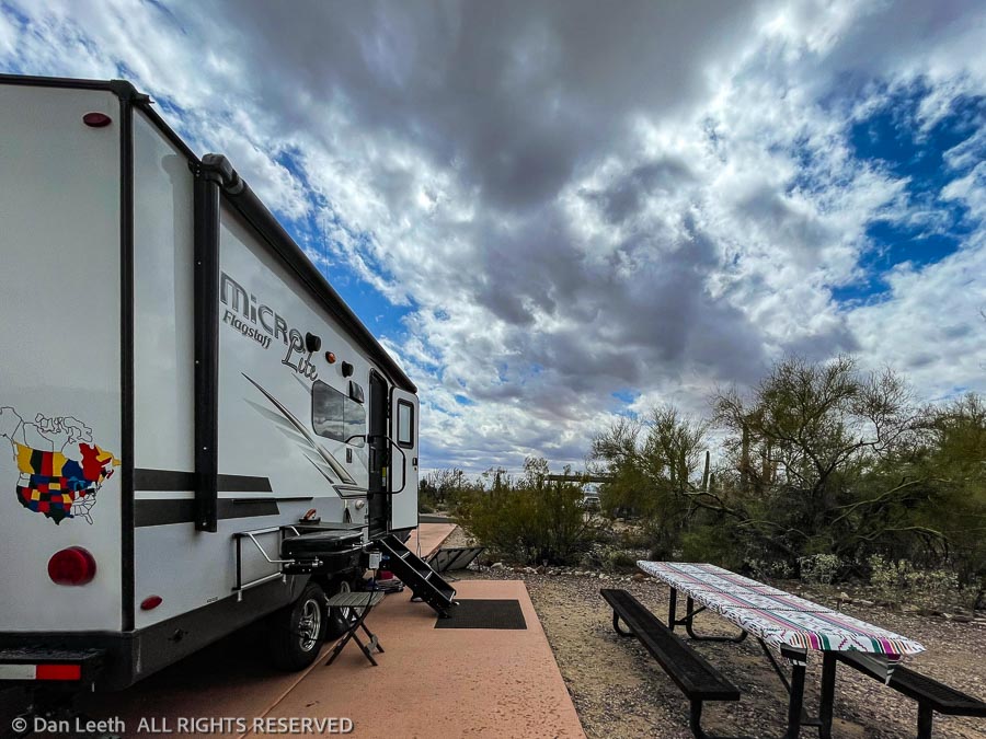
It’s Tuesday morning, and our two-week stay at Lost Dutchman State Park is rolling to a close. Today is pack-up and drain the tanks day. Tomorrow, we hitch up and tow our home back to Colorado where the weather reports say it’s currently snowing.
Our ongoing search for the Dutchman’s Lost Mine will continue with a return trip sometime in the future. After all, that mine has to be around here somewhere, and we intend to find it.