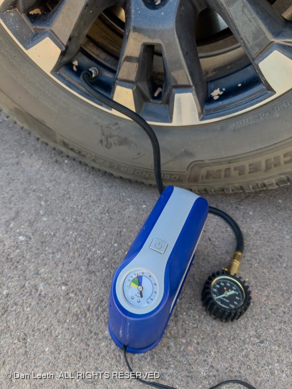
We were going to drive the Hell’s Backbone backcountry road today, but after yesterday’s fun on the washboards, we decided to Hell with it and just hung around camp. Dianne worked on her LifeVantage business while I topped up the truck tires (we lowered them yesterday to provide a softer ride on the washboards). I used the 12-volt air pump I bought at Canada Tire nine years ago. The pump I bought last year at Amazon doesn’t work now.
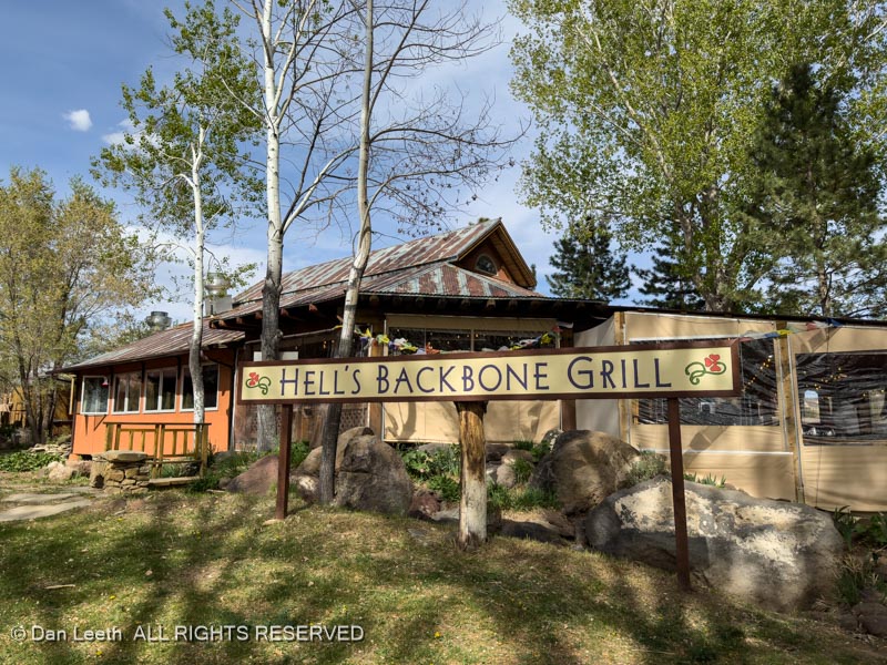
We then drove to dinner at another of our favorite Utah restaurants, this one located in Boulder, Utah.
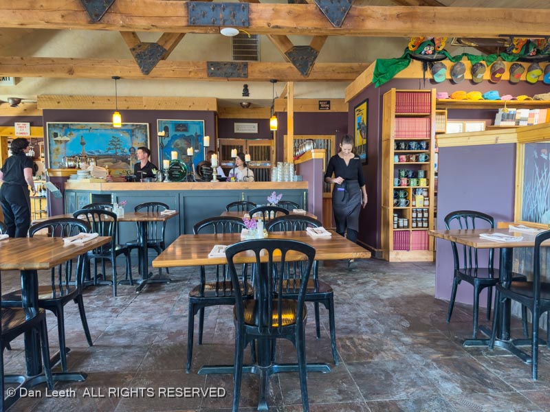
The latest reservation we could get was for 4:15 in the afternoon, and it definitely wasn’t crowded.
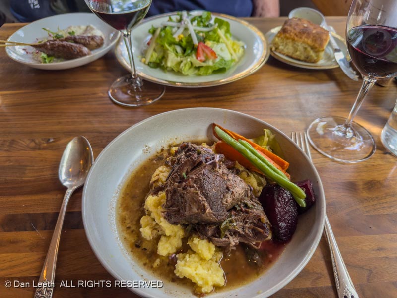
I had braised bison while Dianne had a salad and lamb skewers. We enjoyed all this with a bottle of red wine from the Douro Valley of Portugal. All was very tasty.
While the meal was all a bit pricey, we really don’t mind spending the kids’ (we don’t have any) inheritance on our own self indulgence.
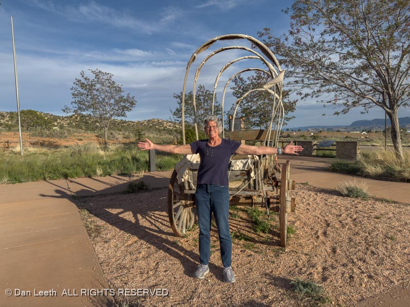
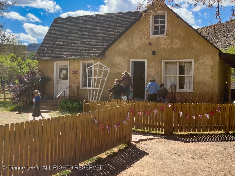
Heading back into Escalante, we made a brief stop at the Hole in the Rock Heritage Center. Here, Dianne demonstrated that the covered wagons like the Hole in the Rock party used were narrow enough to make it through the top portion of the route down the cliffs, which we explored yesterday.
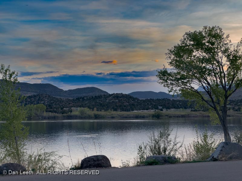
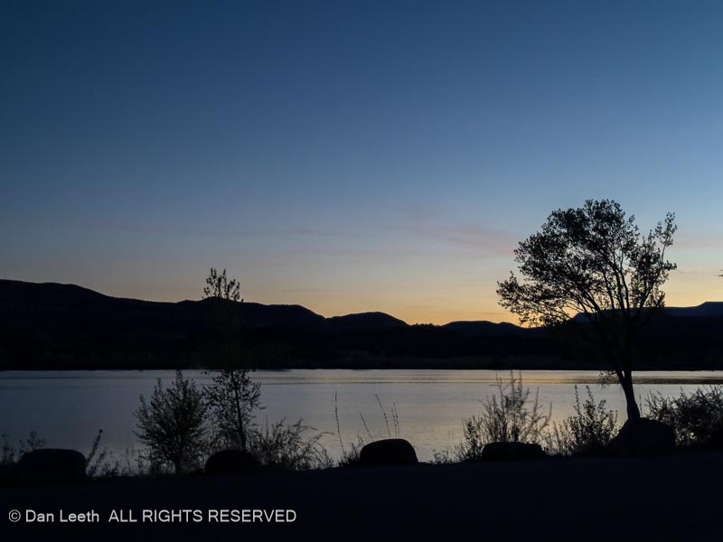
Back at camp, we finished our bottle of wine while watching ducks and geese swim in the reservoir.
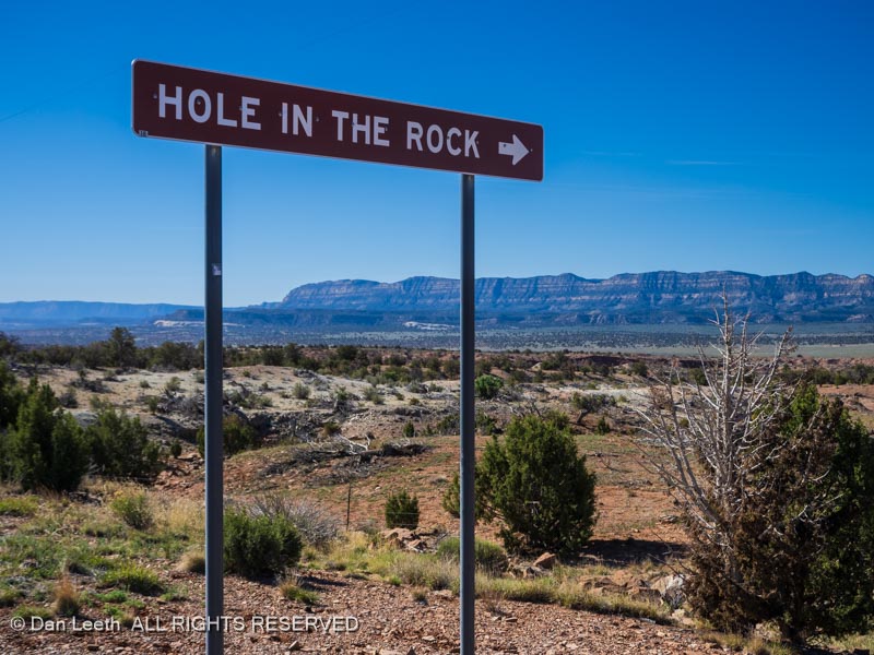
Today was the day we would drive the 55.3-mile route to the Hole in the Rock.
In the late 1870s, leaders of the Church of Jesus Christ of Later Day Saints (Mormons) decided they needed more of their members to colonize the area that is now southeast Utah. Volunteers were conscripted and an expedition of 200 people, 83 wagons and over 1,000 head of cattle began their trek toward what is now the Four Corners area.
They had two proven routes to get there. They could go south into what is now northern Arizona and cross the Colorado River at Lee’s Ferry. Unfortunately, the local Native Americans did not look kindly toward folks passing through their lands.
A second alternative was to head north and cross the Colorado River in Moab, but that was deemed to be too lengthy a route.
So, the group looked at a third alternative. They would head for the town of Escalante and go south from there on a totally unproven route. Dianne and I would spend the day retracing that route.
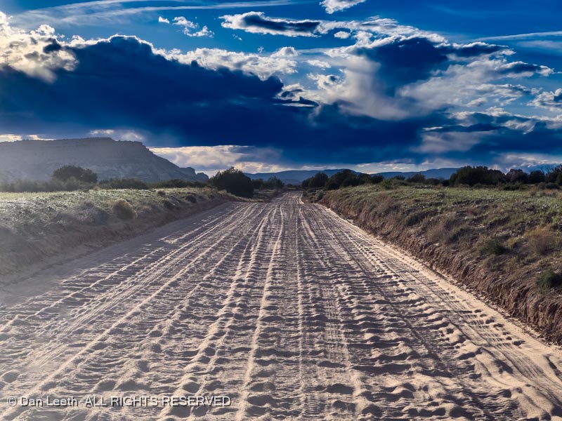
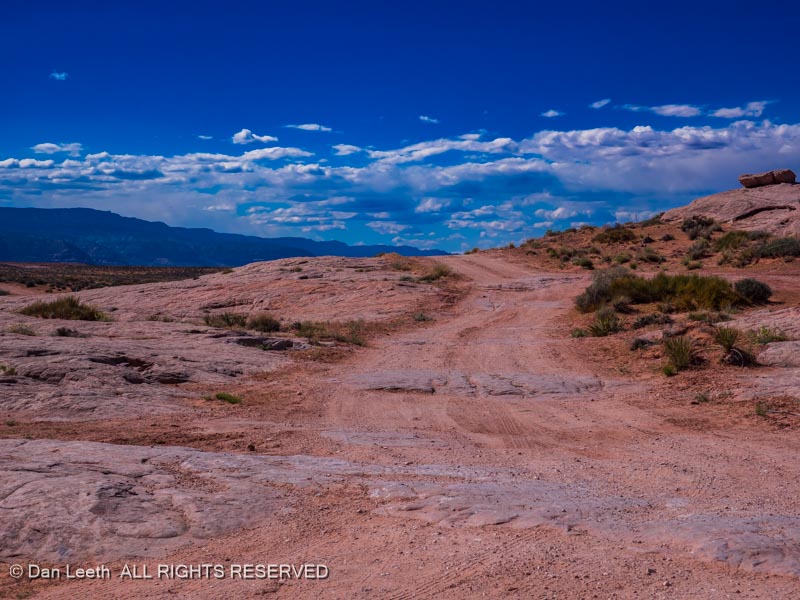
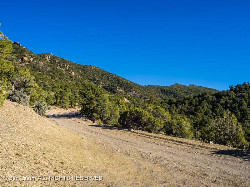
On the first part of their journey from Escalante, the Mormon pioneers followed an existing trail used by the locals. I’m not sure how smooth their route was, but our route required traversing what some experts claim is the worst washboard road in the state of Utah.
Go slow and the truck vibrated so badly, I feared my tooth fillings might fall out. Go fast and I more smoothly bounced over the humps. Unfortunately, I then had no steering control.
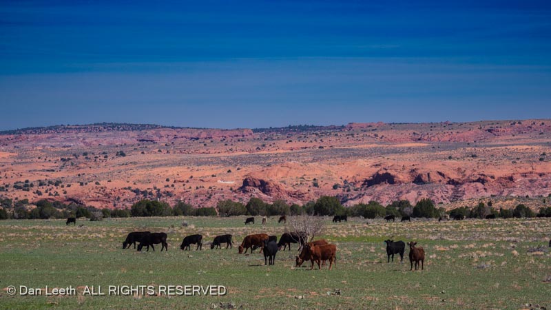
On the left side of the road, we saw herds of local wildlife (slow elk, as Ed Abbey called them) feeding beside the roadway.
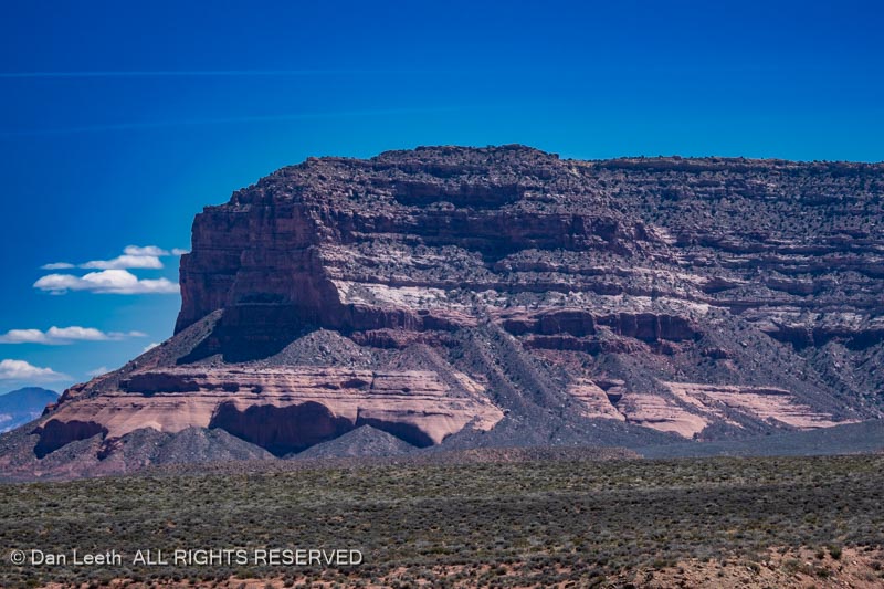
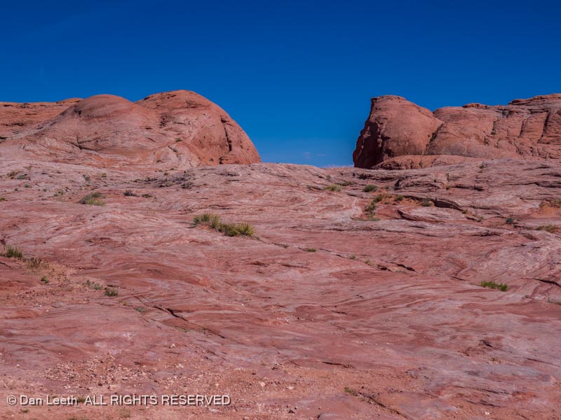
On the right side of the road stretched the cliffs of the Kaiparowits Plateau.
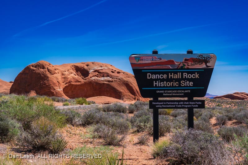
At around the halfway point on our drive, we reached Dance Hall Rock, a large sandstone alcove, where the LDS pioneers played music and held dances.
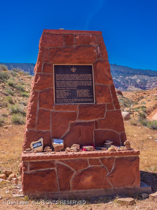
The roadway crosses a number of deep washes requiring one to traverse steep ups and downs. Out here in the 1960s, brake failure on a truck resulted in the death of 13 members on a Boy Scout outing. A roadside monument commemorates their passing.
While the first part of the graded road was easy enough for most any vehicle with high clearance, good tires and decent shock absorbers, the last seven miles become a bit rougher requiring high clearance 4×4.
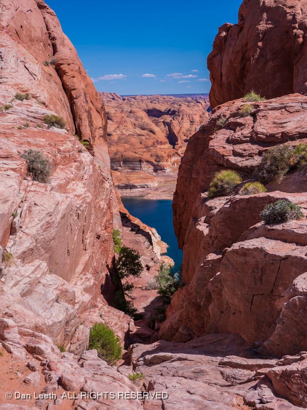
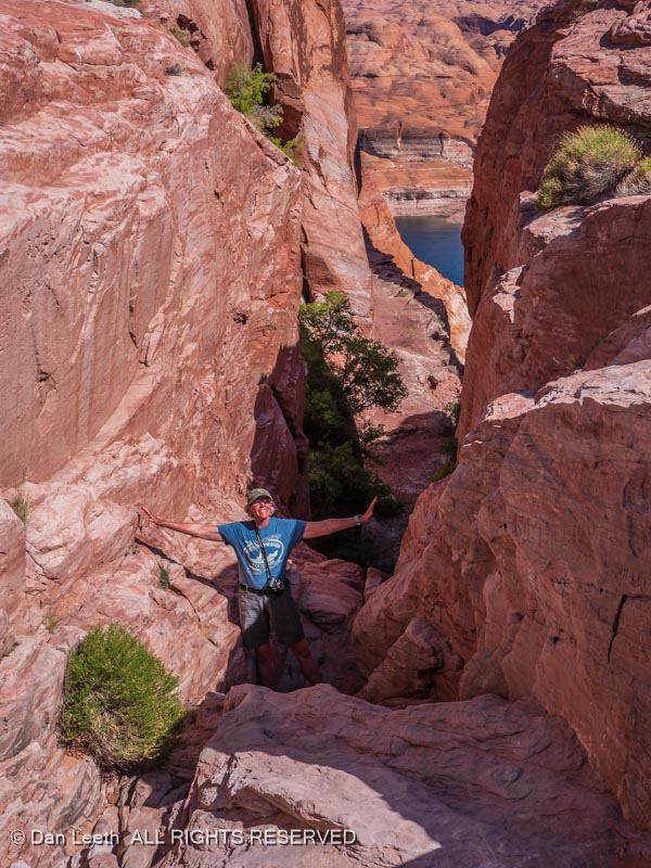
Finally, the road ends at this gap in the cliffs known as the Hole in the Rock.
The Colorado River flows 2,000 feet below the cliffs at road’s end. Here, the Mormon pioneers found a narrow gap in the rock face (the “hole”) that with a little modification could be used to lower the wagons down to the river.
It’s steep and about an arm’s width narrow at the top.
Given the choice of riding in the wagons as they were lowered down or just walking, I suspect the majority of the pioneers chose to descend on their own two feet.
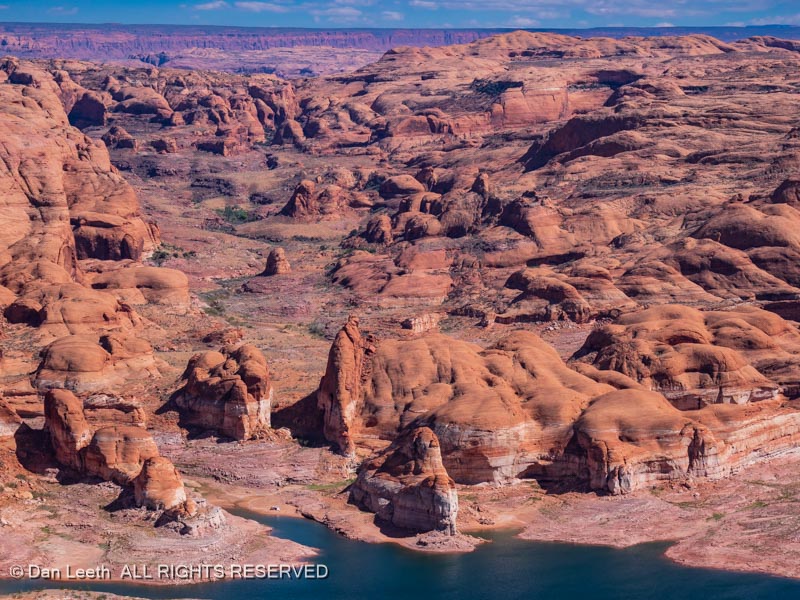
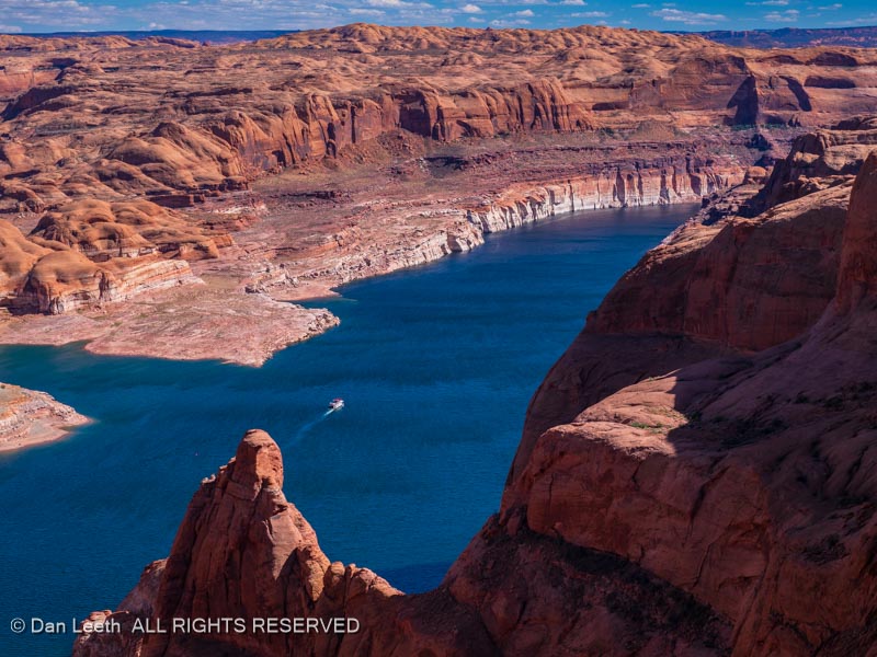
At the bottom, the pioneers built rafts and ferried the wagons across what then just a river. From there, they continued overland until they got to the site of Bluff where they said “that’s enough” and settled down. Today, the diminishing waters of Powell Reservoir fill the canyon bottom where the Colorado River once flowed.
I wonder if the folks on the houseboat passing by realized what they were looking at as they passed the Hole in the Rock.
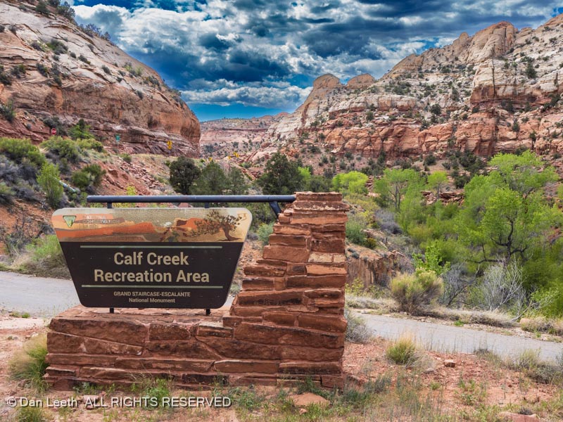
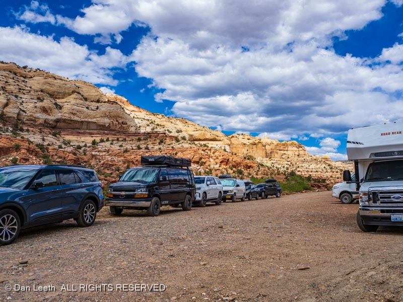
After a lazy morning in camp, we finally set off for today’s hike – a seven mile stroll to lower Calf Creek Falls. Our first obstacle was finding a place to park.
Something tells me we won’t be alone on the trail.
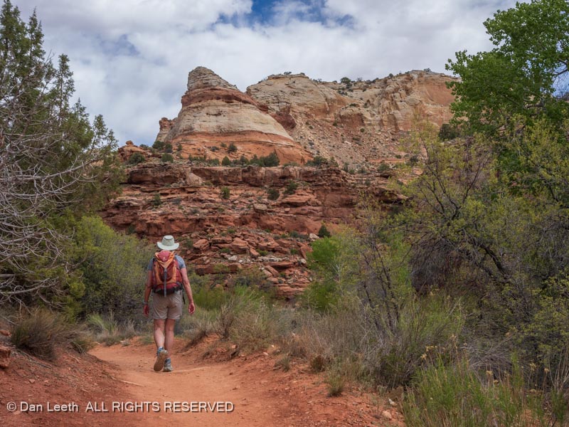
Other than being a bit sandy, the trail was well defined and easy to follow. Cliff faces towered on either side…
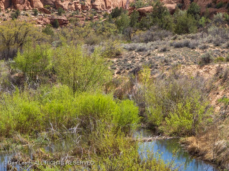
…with beaver dams in the stream below.
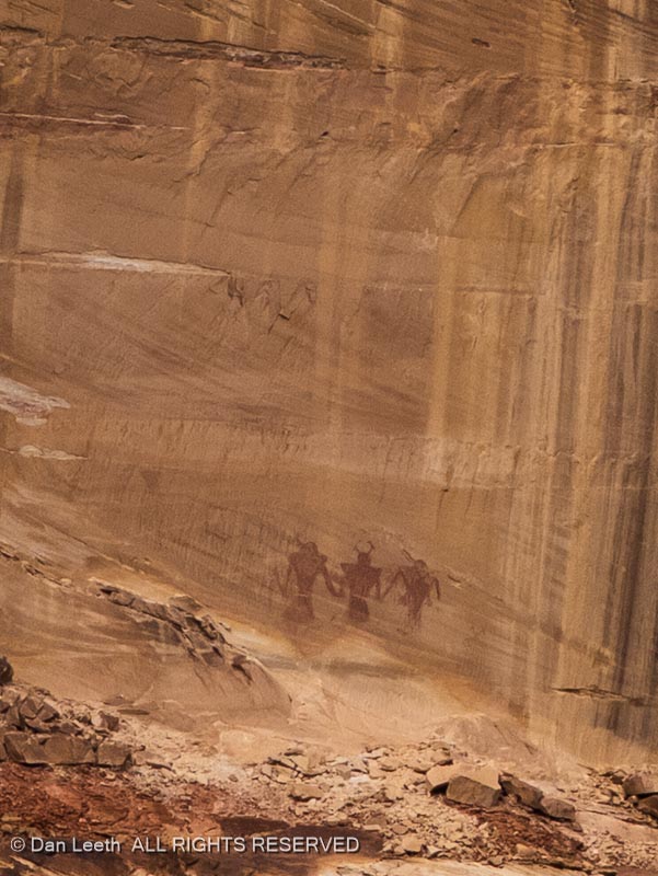
A guide we got from the Esalante-Grand Staircase visitor center helped us find some pictographs from the Fremont Culture on the cliffs across the valley.
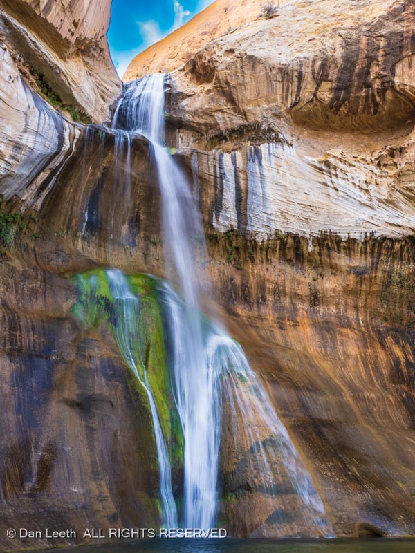
Finally, we arrived at Calf Creek Falls…
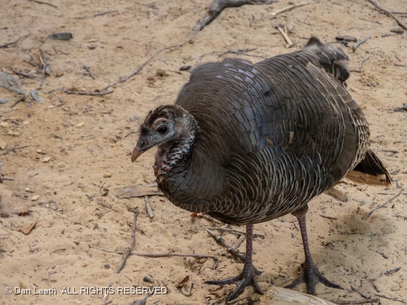
…a sight we shared with a wild turkey who was not shy around humans.
On the trip back, we were treated to the canyon’s naked cliffs blushing in the sunset light.
Finally, at the end of a 7+ mile hike, we found our truck patiently waiting for us in a now empty parking lot.
Back at camp, we dined on chips and salsa while looking across the still waters of the reservoir.
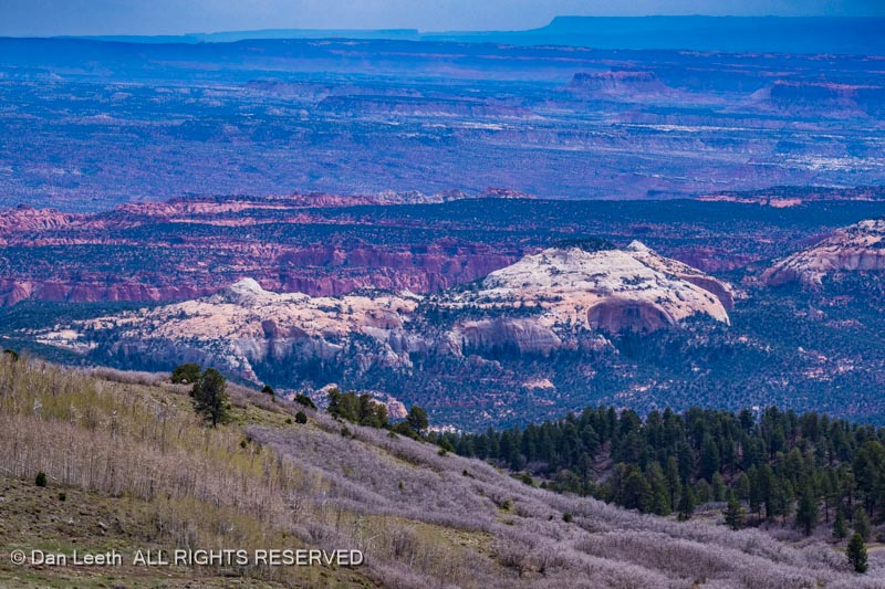
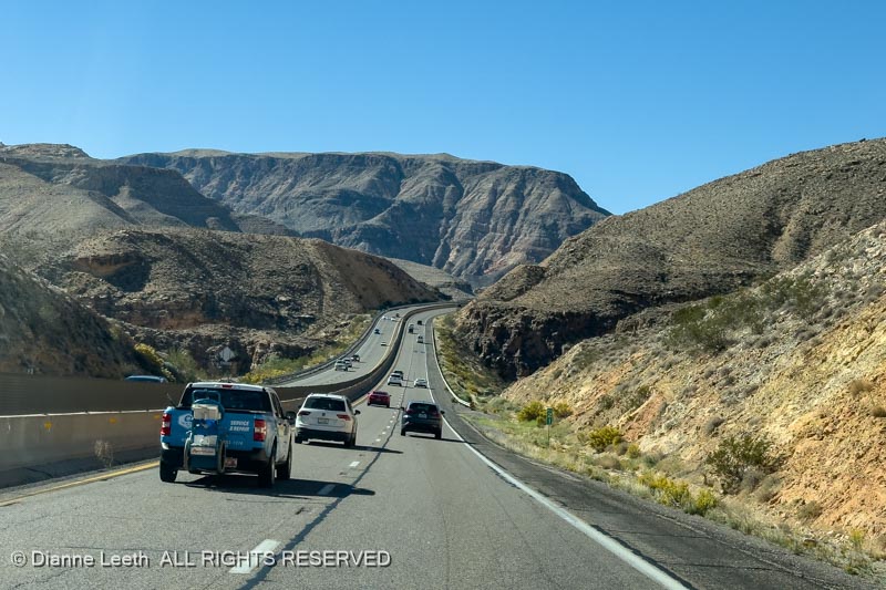
After a fantastic breakfast of spoon-size shredded wheat and formerly frozen blueberries, we packed the truck, hitched up the trailer and set off for Escalante. We stopped at one scenic overlook on the way and gazed down on the land of sandstone. This is a drive I’ve made many, many times before.
It took almost three hours to cover the 110-mile distance. I love pulling a trailer over the mountains (no I don’t).
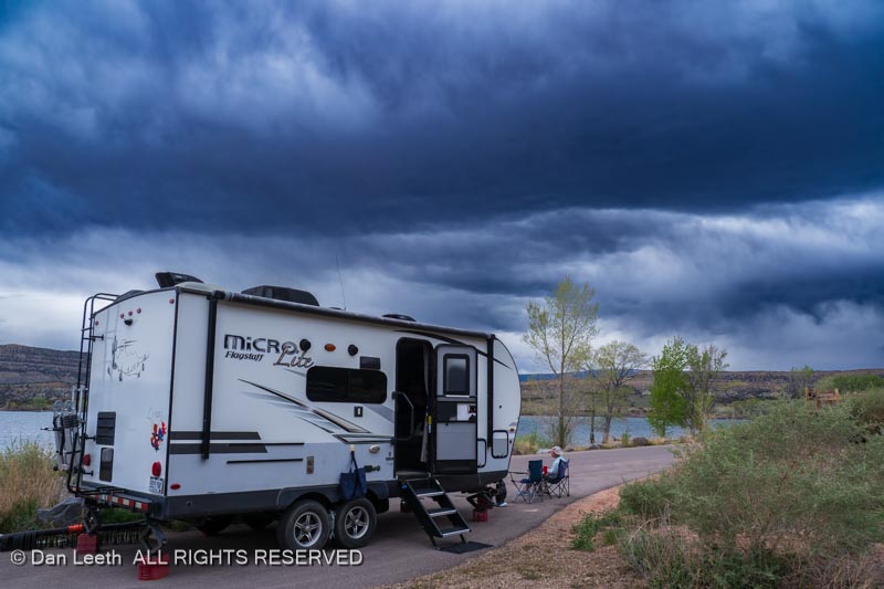
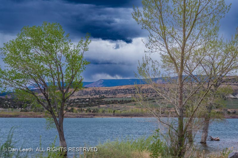
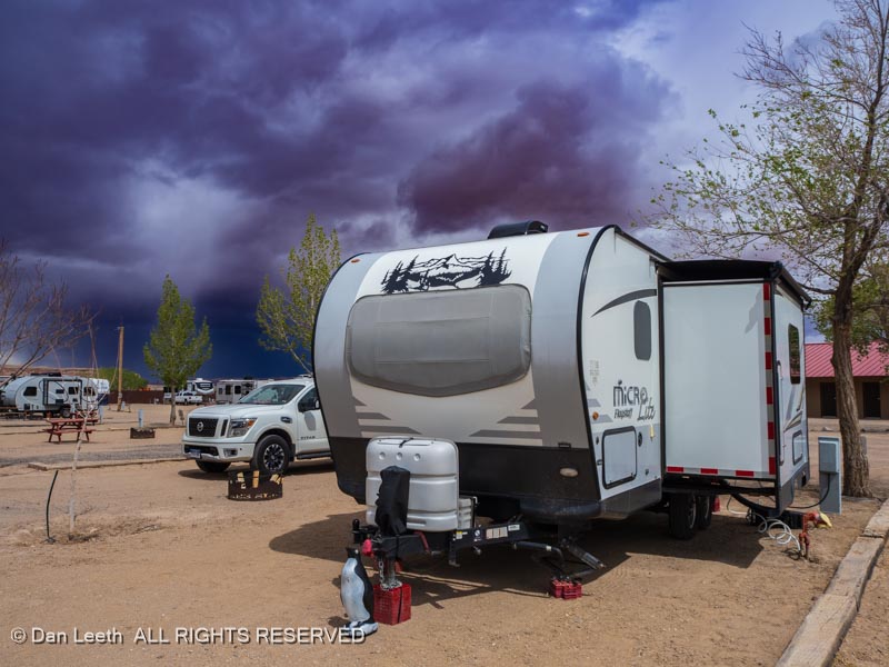
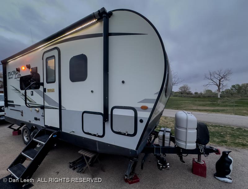
We checked into Escalante Petrified Forest State Park and after getting the trailer set up, downed beer and a bowl of popcorn while gazing at 130 acres of choppy water.
Our site looks down on Wide Hollow Reservoir, which is teaming with ducks and squawking geese. While the weather seems a bit iffy, only 1/100th of an inch of rain is predicted to fall tonight. It may not be fun pulling the trailer, but once again, we’re thankful to not be camping in a tent.
Tomorrow, it’s off to work (weather permitting). I’ve got several back-of-beyond roads around here that I want to cover for Utah Life Magazine, which would make this portion of our adventure a tax-deductable business trip.
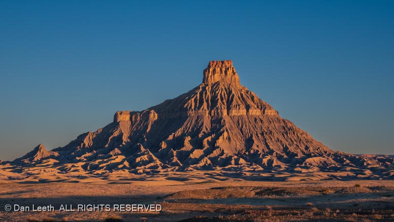
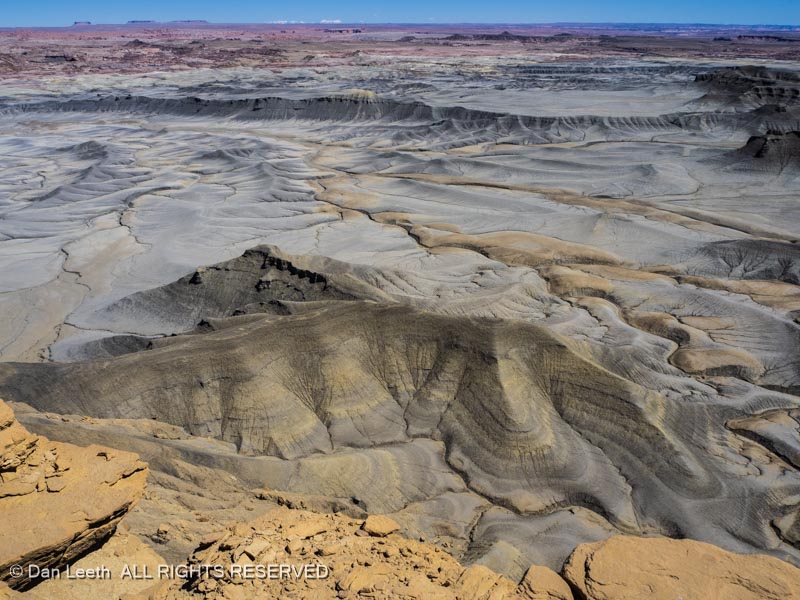
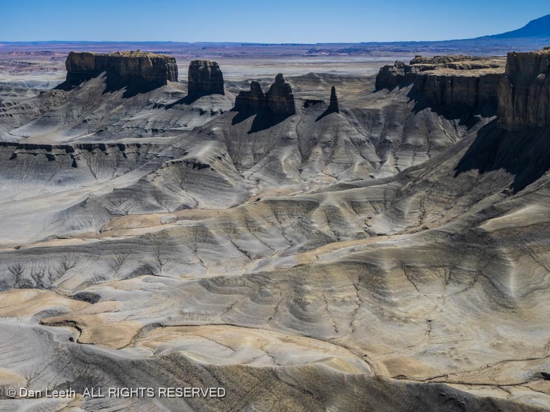
NASA astronauts are heading back to the moon and so are we. We got up well before the sun, brewed a pot of coffee, tossed cameras in the truck and blasted off for another landing at Moonscape Overlook. Our goal was to shoot the moonscape again, this time with early morning lighting.
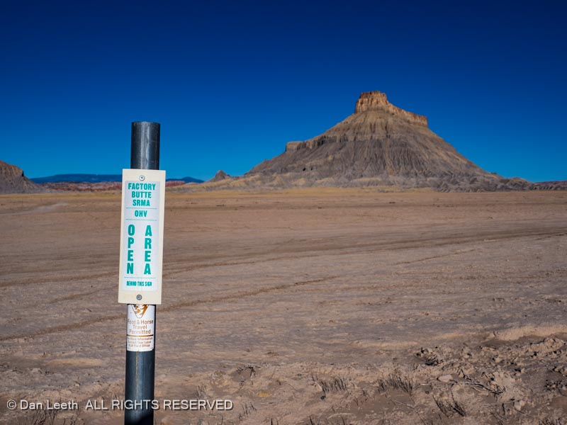
On the way there, we stopped for some shots of the sunrise light bathing Factory Butte in blushing orange.
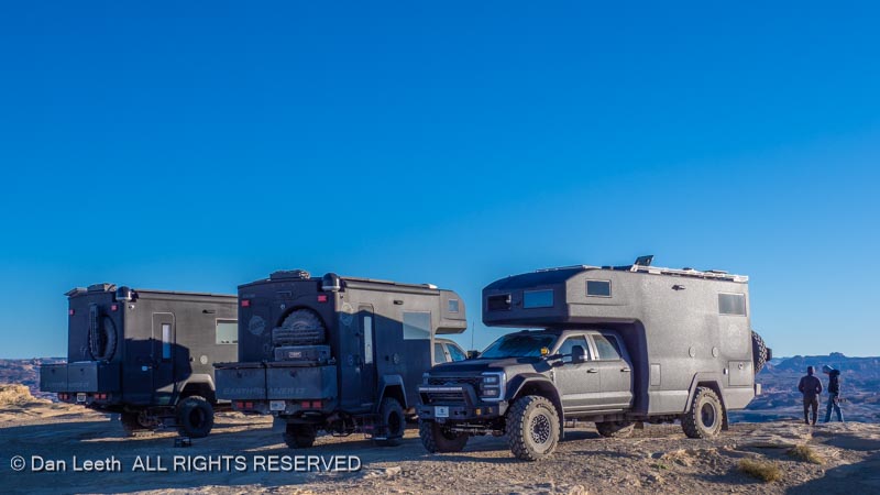
A few turns later, we reached Moonscape Overlook, which was now teaming with humans. Up on the hill sat a trio of Earth Roamers (very expensive off-road motor homes). Two had Colorado plates. The third was from Ontario, Canada.
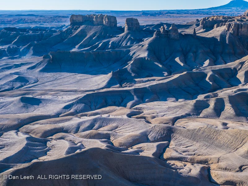
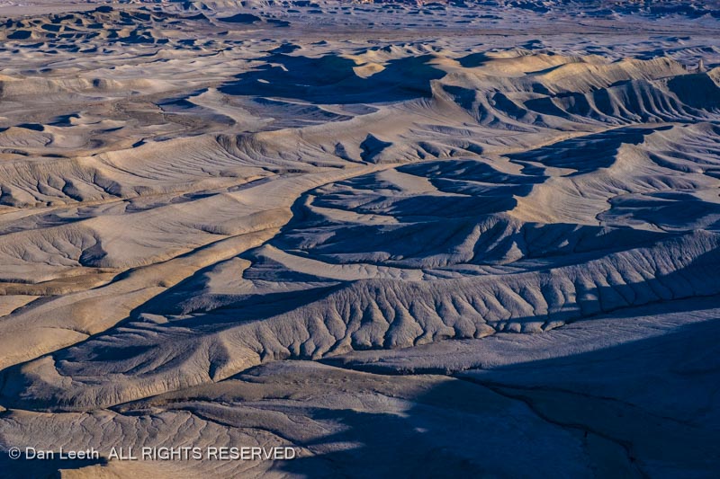
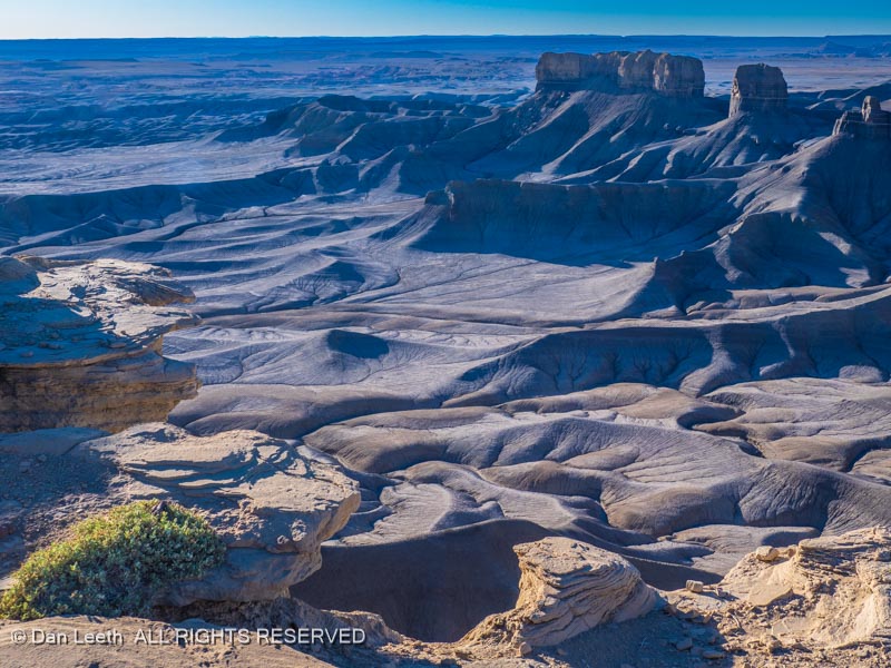
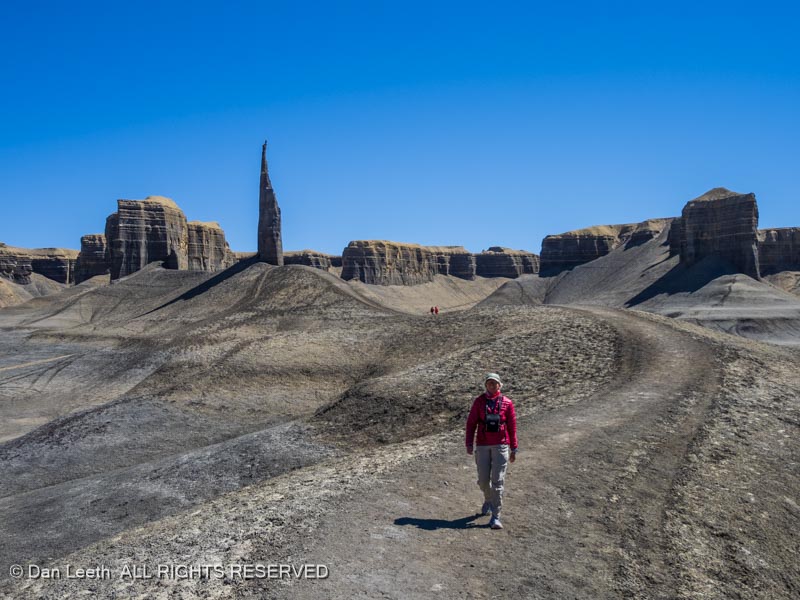
In the morning’s sub-40 temperatures, we wandered around the cliff-top rim, shooting photos of the the dark rolling terrain below, which appeared to be totally devoid of plant life.
Some people might call this an ugly wasteland…
…but I find it strangely beautiful.
After a few hundred shots, we finally escaped the cold by crawling back into the truck and beginning our retreat to civilization. Our route ran beside the Factory Butte Special Resource Management Area, which is essentially a big adult sandbox for ATV/OHV owners. I wish these folks would just play with their toys out here where it’s legal and not go tearing up the outlying terrain where it’s not. But then, the rules, as we know, don’t apply to everyone.
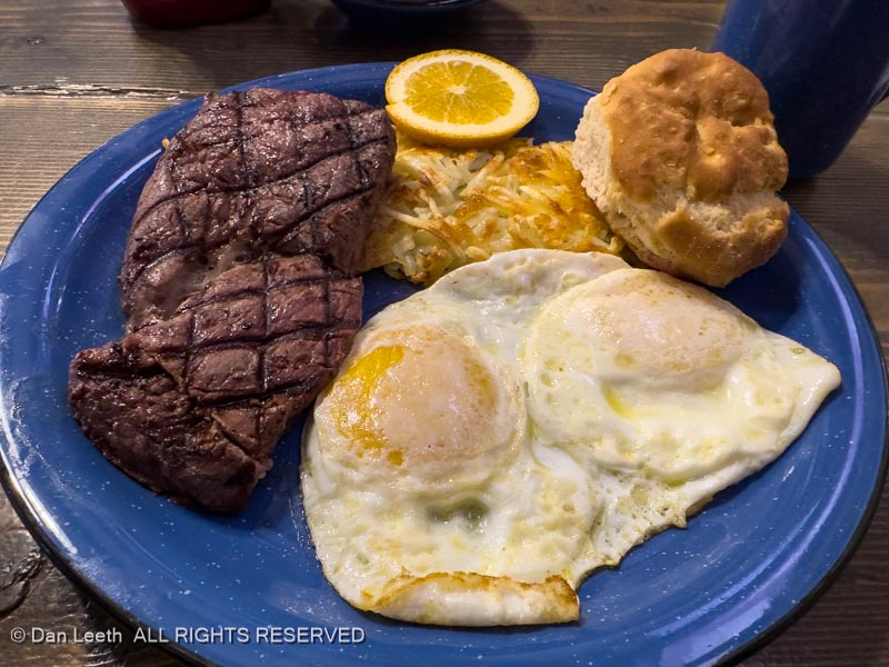
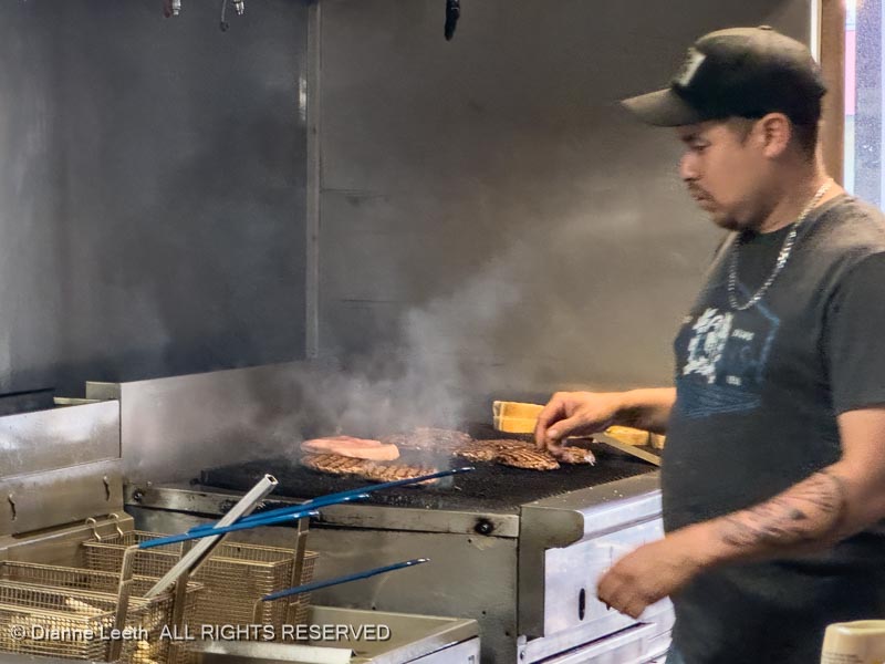
Back in Hanksville, we celebrated Easter Sunday with breakfast at Duke’s Slickhorn Grill. I opted for steak and Easter eggs (over easy) while Dianne opted for flapjacks and Easter eggs scrambled.
Could this be why we never lose weight on camping trips?
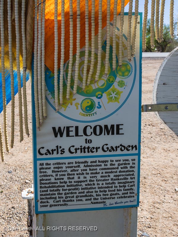
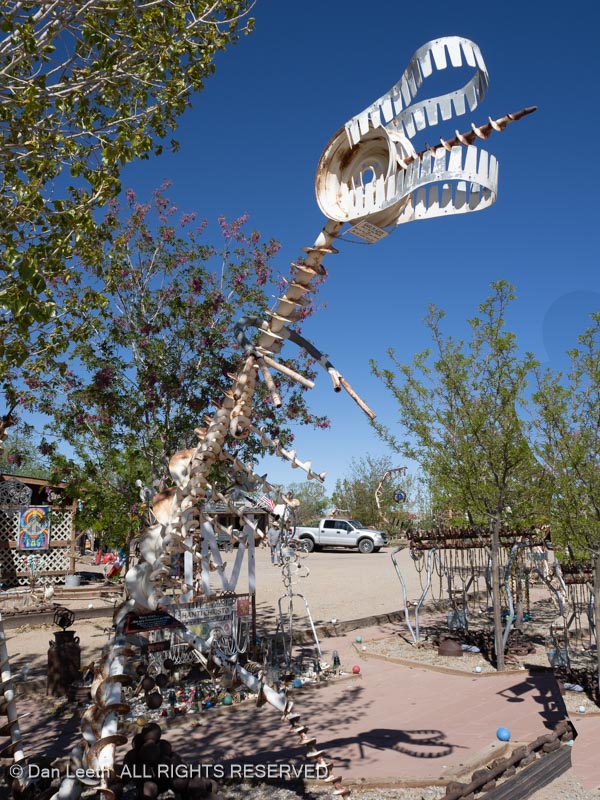
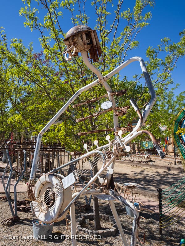
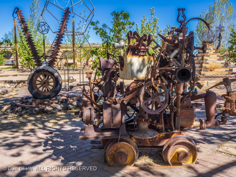
Saturday offered another lazy day. After spending the morning in the trailer, we finally got out for a short walk, heading over to check out Carl’s Critter Garden.
The roadside lot contains an artistic sculpture garden of objects made from refuse. Some depict local animals…
…others feature humans…
…and some are just artistic hodgepodges depicting who knows what.
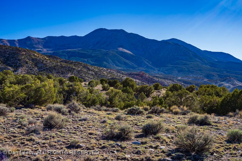
After our immersion into the Hanksville art scene, we decided to take a spin up into the nearby Henry Mountains.
The graded gravel road from town was wide and smooth at the beginning, but the higher we progressed, the larger and angrier the gravel got. With the road surface becoming wife-annoyingly rough, we turned around and headed back to town. Next time, we’ll take the Subaru instead of our 4×4 Nissan Pro 4X off-road pickup truck.
Returning to camp, we faced a serious question about our future. We could either dine tonight on Dianne-cooked spaghetti in the trailer with wine from a box, or we could drop into Duke’s Slickrock Grill, a hundred yards from our trailer, for a real meal with real bottled wine.
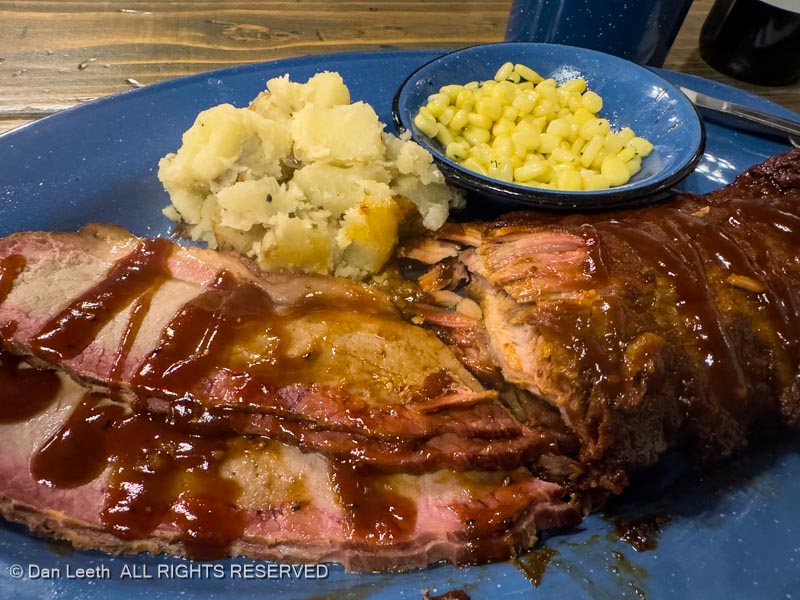
Although the vote was close, brisket and ribs at Duke’s beat out the spaghetti dinner option.
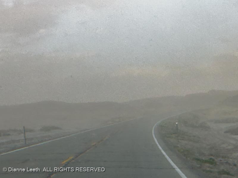
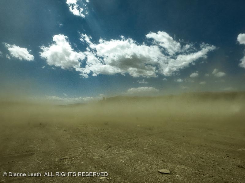
Awakening to a windy morning, we sat in the trailer debating whether to follow through with our original plan of driving out to a nearby significant geological feature. Finally, in the early afternoon, we decided to give it a try. We fired up the truck, set off down the highway, and a few miles from Hanksville, reached what we thought was our turnoff.
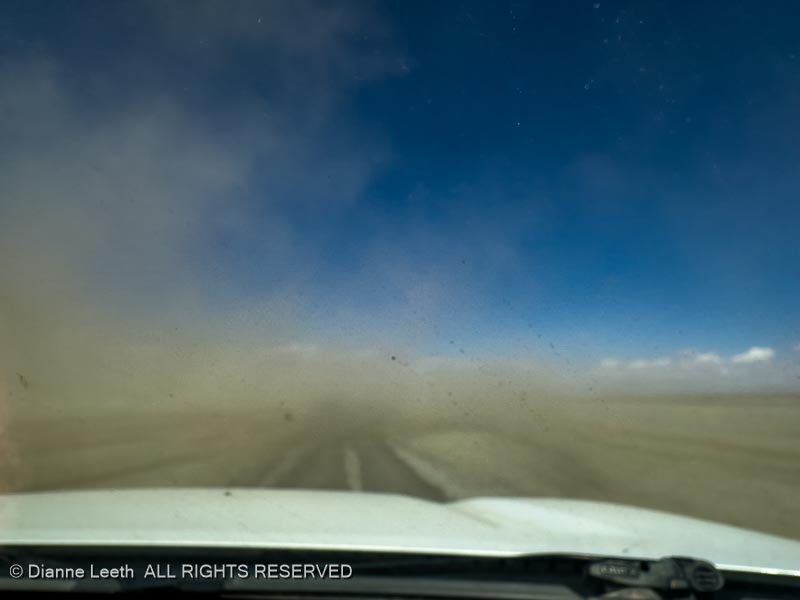
The wind blew the dirt making it difficult at times to even see the high-clearance motor trail to the site. Reaching our objective would require negotiating a half-dozen miles of this followed by a three-mile hike. We can’t take photos in this crap, so we made the logical decision to turn around and go elsewhere.
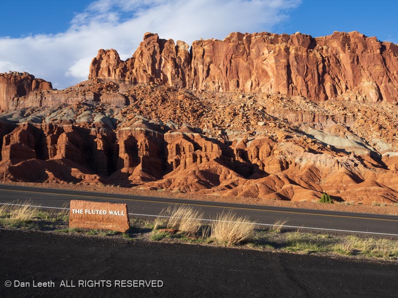
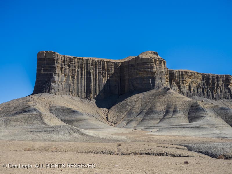
The elsewhere we chose was Capitol Reef National Park, which lay about 30 miles to the west.
Our first stop was the Gifford House store and museum where they still had a few mixed berry pies available for sale. They had two fewer available after we departed.
From there, we drove down the park’s Scenic Drive to pavement’s end and continued on a dirt road past the Golden Dome.
We continued to Pleasant Creek where the remains of an old ranch still grace the ground.
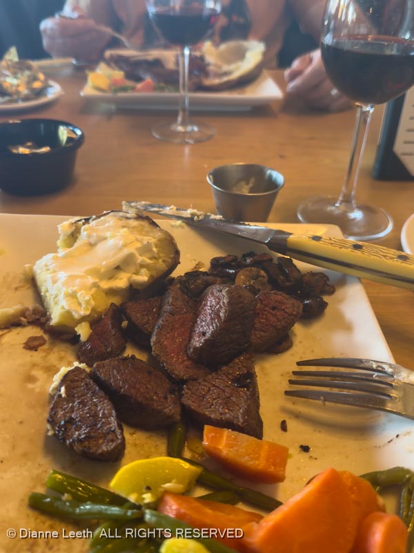
From there, we turned around, left the park and headed into Torrey where we enjoyed a great meal (with wine) at the Broken Spur Steakhouse. We met the former owners when researching a magazine feature a few years ago, and we’ve been back many times since.
Then came the exciting drive back to our camp in Hanksville. Even though we were on a paved highway, dirt blowing from the empty landscape drastically obscured visibility.
Fortunately, there was little traffic and we made it back to our trailer in one piece.
We now sit in our trailer, which is rocking in the gusting wind. If we’re not blown to Oz tonight, we’ll maybe try to reach our geological feature tomorrow.
It’s Friday morning and the wind has quieted to just a gentle breeze. Today, we will explore those geologic features we failed to reach yesterday.
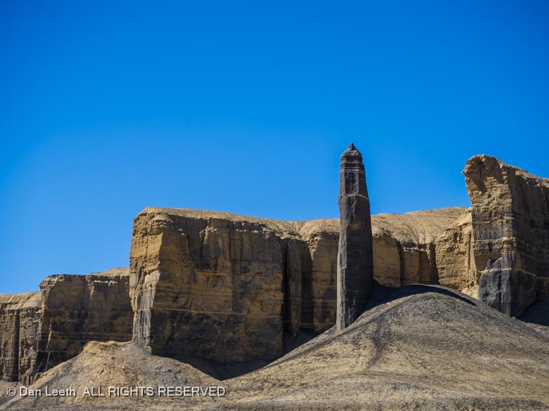
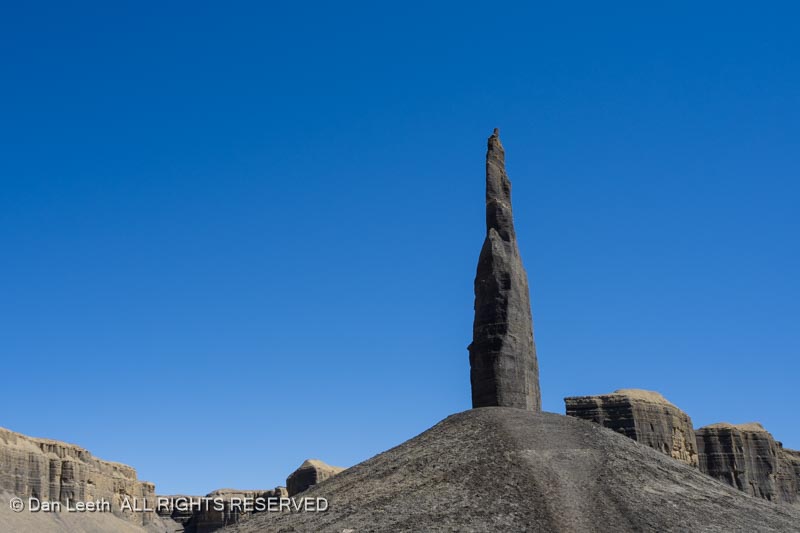
Our first stop was the local BLM office where we got maps showing our routes and advice covering how best to get there. Our first objective was a spire known as Long Dong Silver (so named by rock climbers a few decades ago). The BLM calls it Blue Valley Spire.
We followed the directions we were given and soon reached the trailhead for our one mile hike to the spire. The fence was to keep vehicles out, but as we know, the rules don’t apply to everyone. We saw one Jeep-driving touron drive through the restricted area and were told that another did the same earlier.
Hiking up the valley, we passed towering cliffs…
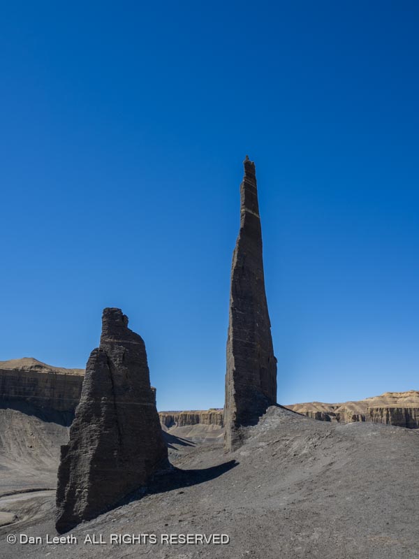
…and another free-standing spire.
Finally, around one corner we reached Long Dong Silver.
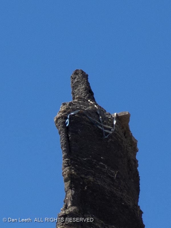
I can’t imagine what it must have been like to climb this needle in the sky, but climbers’ slings still wrap around the summit.
After snapping a few photos, we said goodbye to the Dong…
…and hiked back to the truck.
Our next objective was Moonscape Overlook…
…which lay a few miles away.
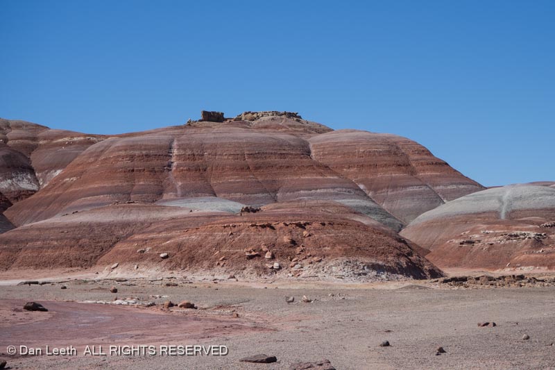
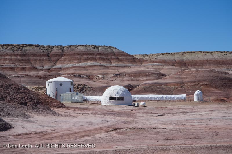
From there, we headed to the Bentonite Hills…
…home of the Mars Desert Research Station.
A short distance beyond, we encountered an ATV with four space-suited folks from the station onboard. We waved, but they ignored us. I guess they didn’t expect to encounter earthlings out here.
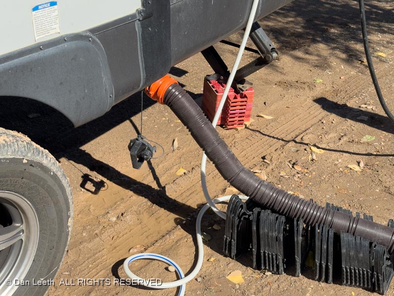
Back at the trailer, I consumed an adult beverage while Dianne showered. Then I showered. I love having full hookups with no limit on water and the ability to dump the holding tanks at will.
Given enough time, I think that I could get used to this camping lifestyle.
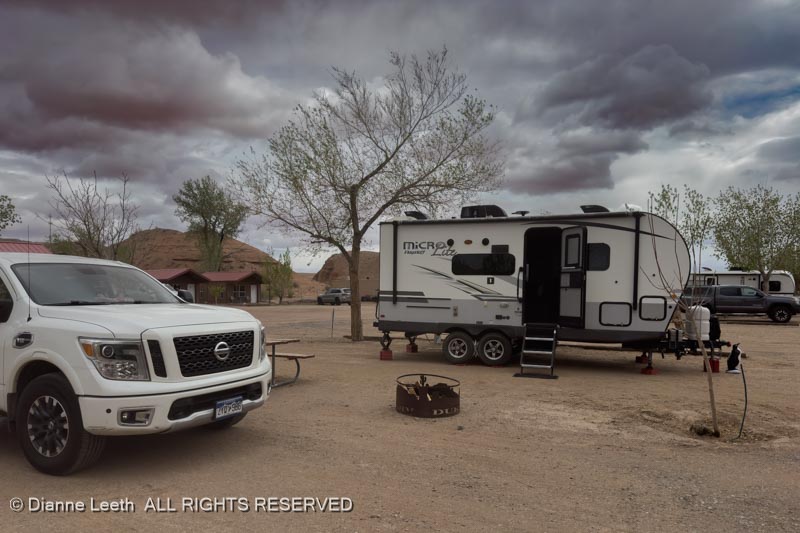
We awoke to rain in Green River. Between drops, we topped up with fuel, hooked up the trailer and headed to Hanksville, where we would spend five nights camped at Duke’s RV Park.
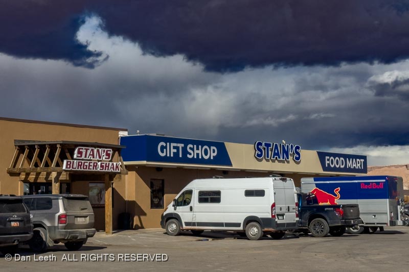
When we arrived, the RV office was locked. Rather than wait around for the Duke to return, we headed for Stan’s Burger Shack, one of Dianne’s favorite birthday dinner destinations (and it’s not even her birthday yet).
Back at Duke’s (two burgers later), Dianne texted the Duke, got our assigned campsite and we moved in. These are double-wide sites, giving us more room than a typical RV park site.
I’ve got a long list of back-of-beyond roads I want to explore near Hanksville, but around these parts, rain can turn otherwise navigable byways into quagmires of tire grabbing muck that can mire even a 4×4 truck. Last year, we came here with the same backroad intentions but rain made sure we accomplished nothing. In spite of what today’s angry skies are telling us, we hope that this visit will be more productive than last.
Dianne, needing something to fill her retirement days, has started peddling nutritional supplements from LifeVantage. She had a meeting to attend in Las Vegas, Nevada, so we decided to hook up the trailer and take a long, winding way there.
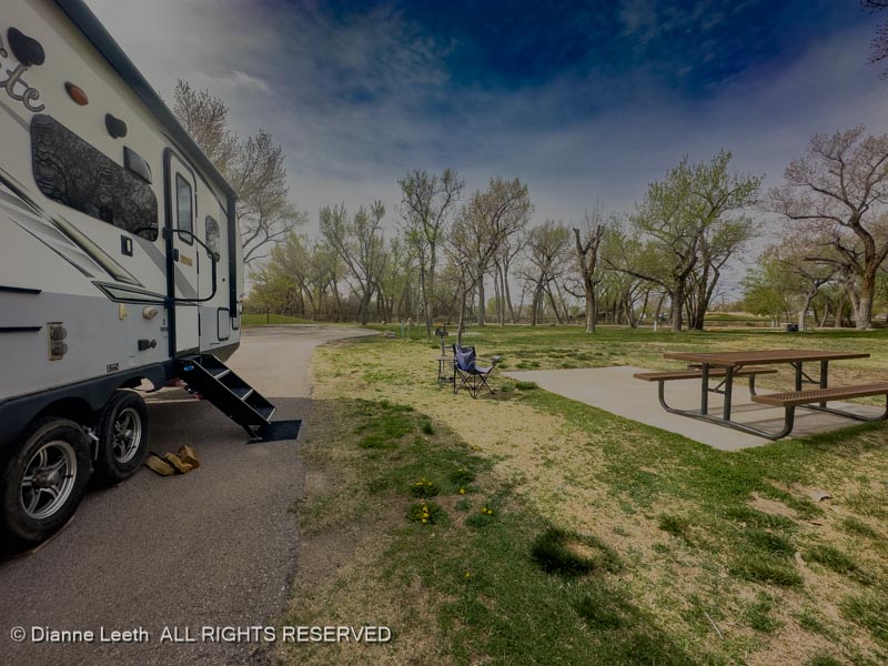
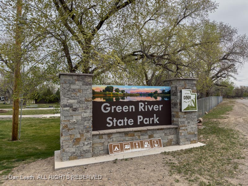
Day one of our Las Vegas adventure began with a 90-mile drive from our home in Fruita to Green River State Park in Utah.
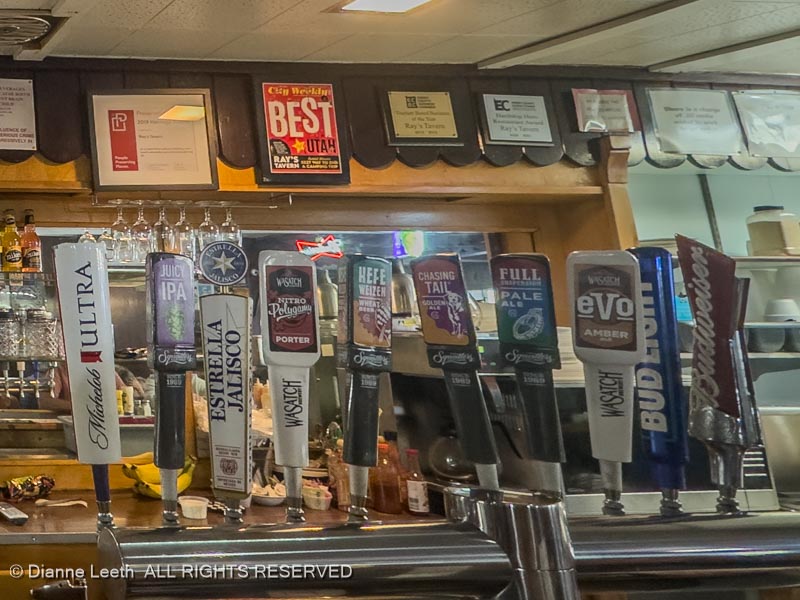
After setting up with electric and water hookups (no sewer hookup here), we dined at Ray’s Tavern, our favorite burger place in Utah. Ray, the original owner, is a distant cousin of Dianne’s but we still had to pay.
We downed our half-pound bacon cheese burgers with some Evolution Amber. Gone are the old 3.2 beer days in Utah. Beehive State brews can now have 5.0 ABF (alcohol by volume) content.
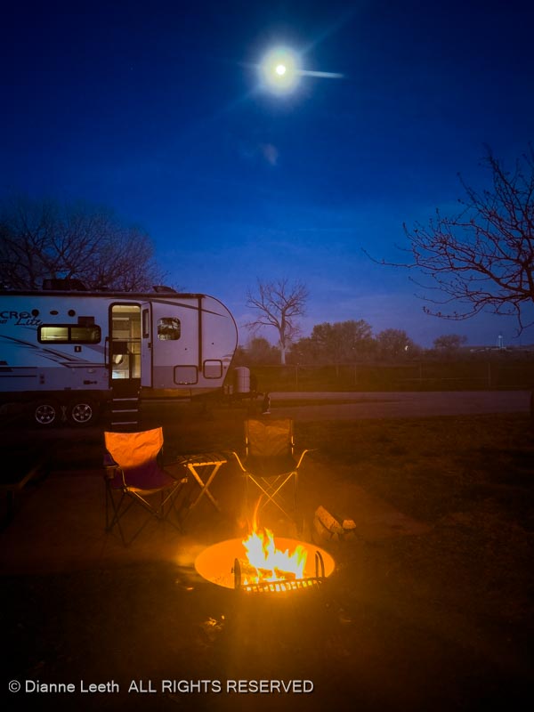
Back at the trailer, we built a campfire, downed small glasses of imported Spanish white wine and listened to trains occasionally whistle by. All were freighters – the 6:32 p.m. Amtrak hadn’t yet passed through by the time we headed to bed at 10:00 p.m.
We decided our layover day in Green River should be as unproductive as possible. That was a goal we easily achieved.
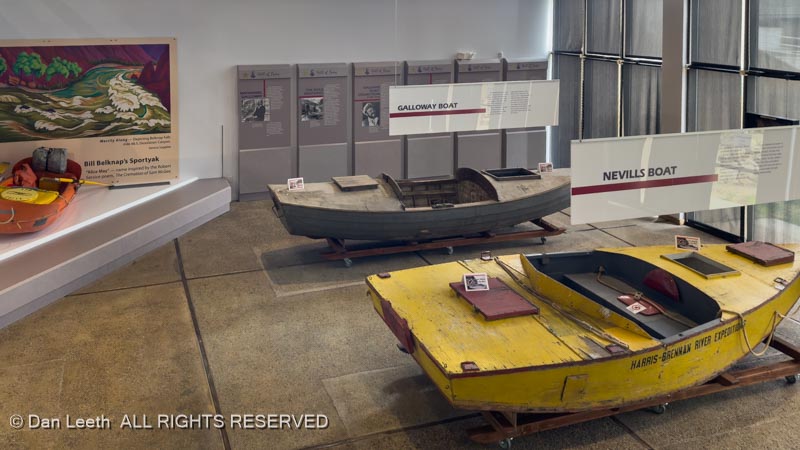
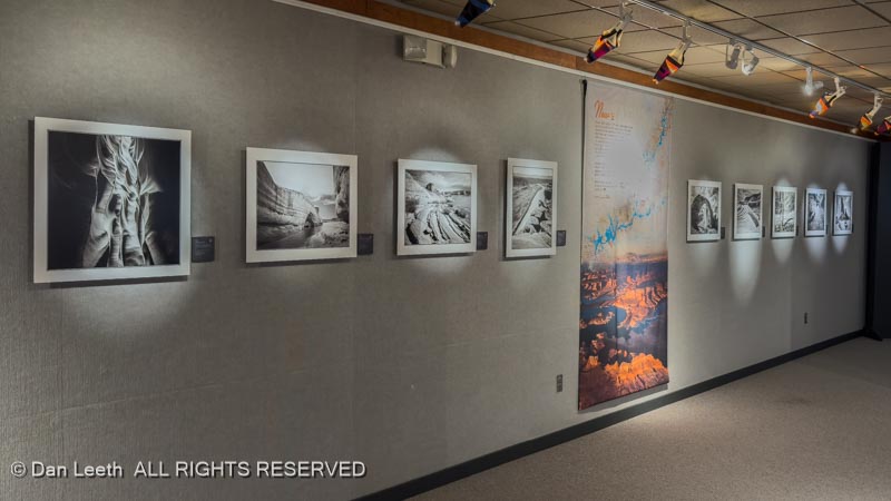
After a late breakfast (granola) in the trailer, we put on our TRs and hiked down to the John Wesley Powell Colorado River History Museum here in Green River.
They had on display a series of beautiful black-and-white photos of Glen Canyon shot before the damn dam was built and the exquisitely beautiful canyon flooded.
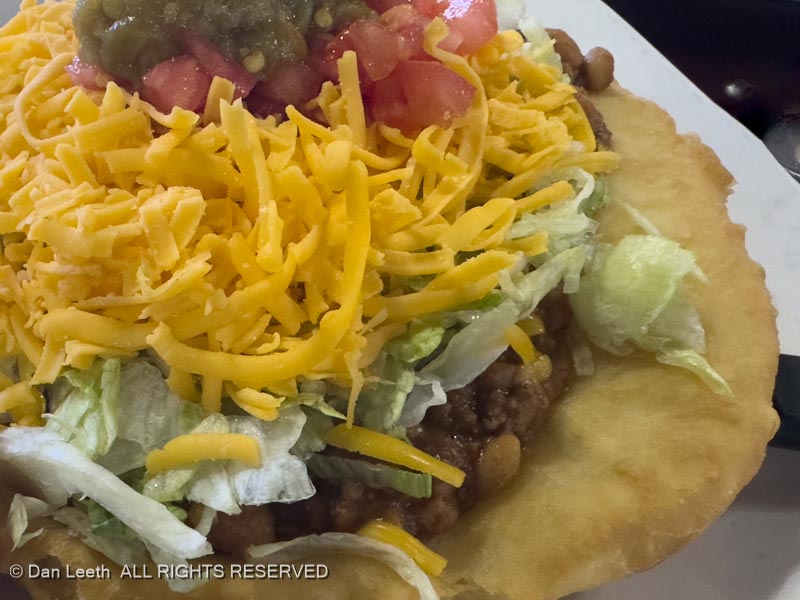
Before heading back to the campground, we stopped at the Invasive Weed (Tamarisk) Restaurant for a late lunch/early dinner. Dianne opted to go foreign (French dip sandwich) while I chose to have my favorite Indian food (Navajo taco).
No fire tonight – it’s too damn cold and windy out. We’ll just sit comfortably in the trailer with the heat on.