Head Hunting

            Our springtime trip to Utah’s canyon country began Saturday with a two-night stay at James M. Robb Colorado River State Park Fruita Section where we dewinterized the trailer and sanitized the freshwater tank.  These are jobs that I would have been done at home when we lived back in Gridlock City.  Can’t do that at our Village in Fruita.

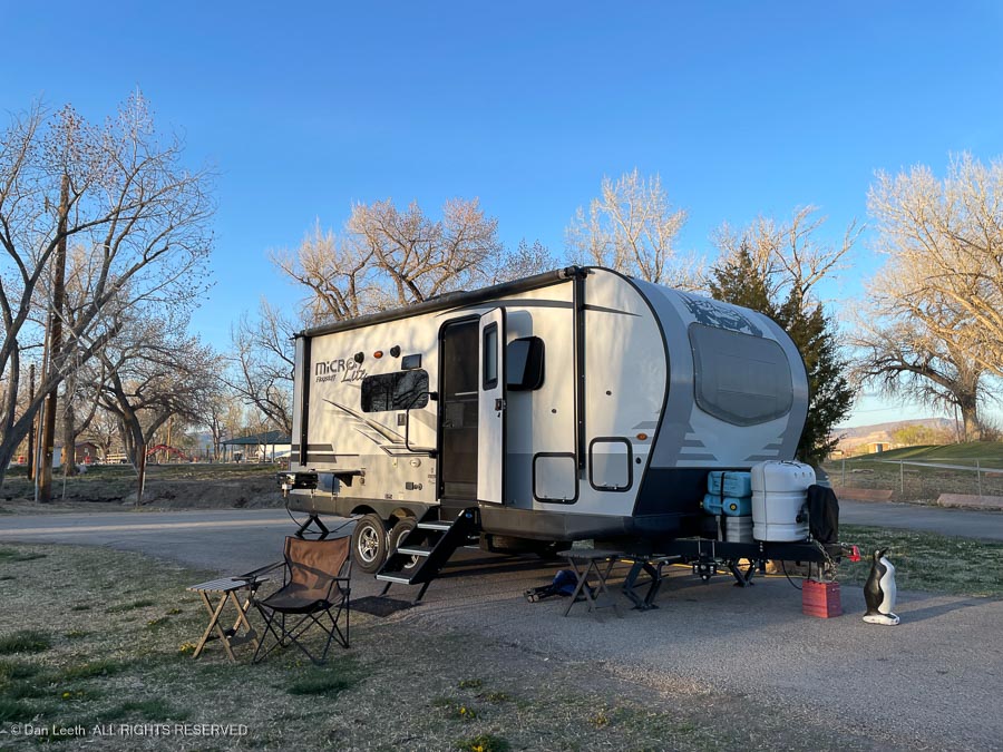
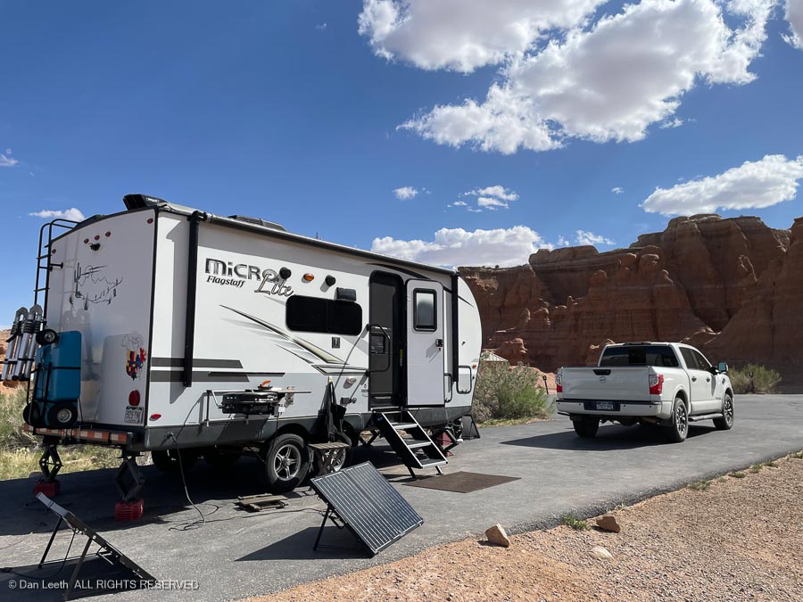
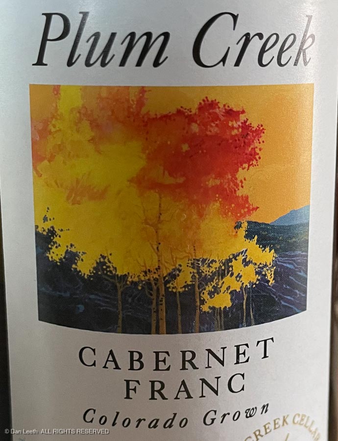
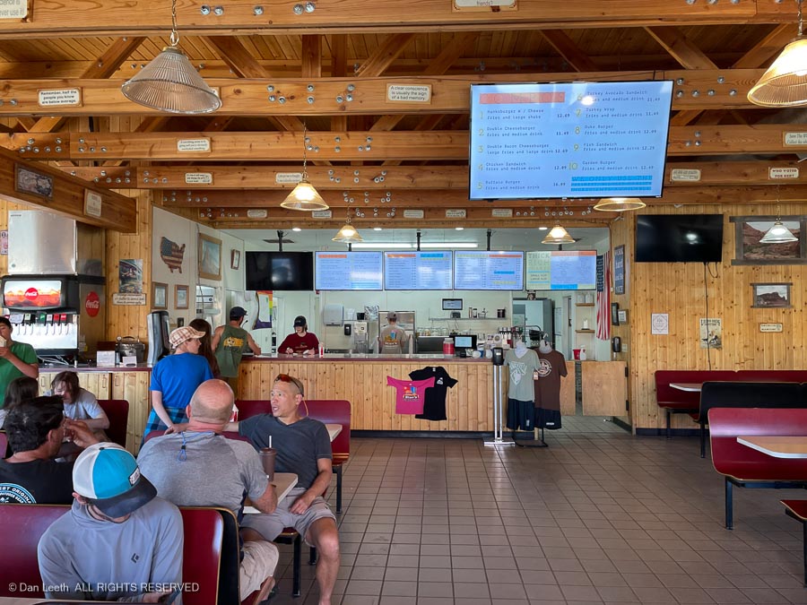
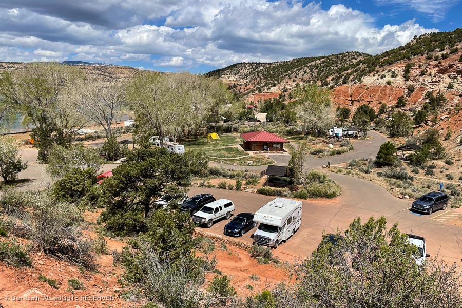
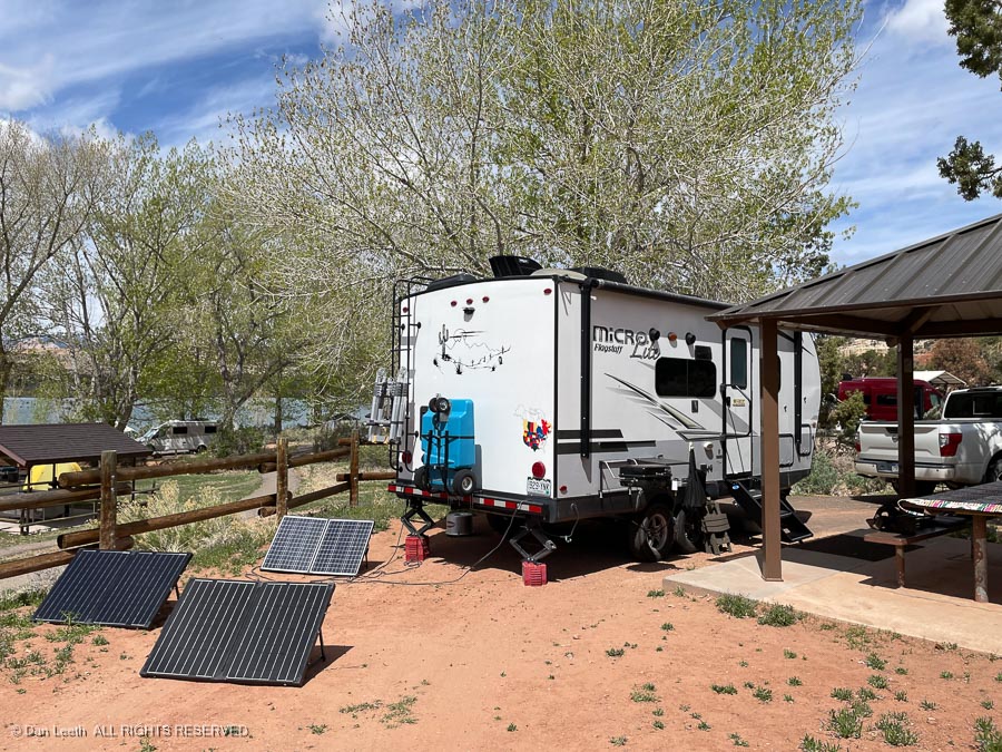
            After taking care of a few errands on Monday morning, we hooked up the trailer and drove across the street to the Strayhorn Grill for lunch.  Then it was off on our 90-mile journey to Green River State Park in Green River, Utah.  There we had an excellent site with an excellent view of water line construction workers digging holes with their excavators.

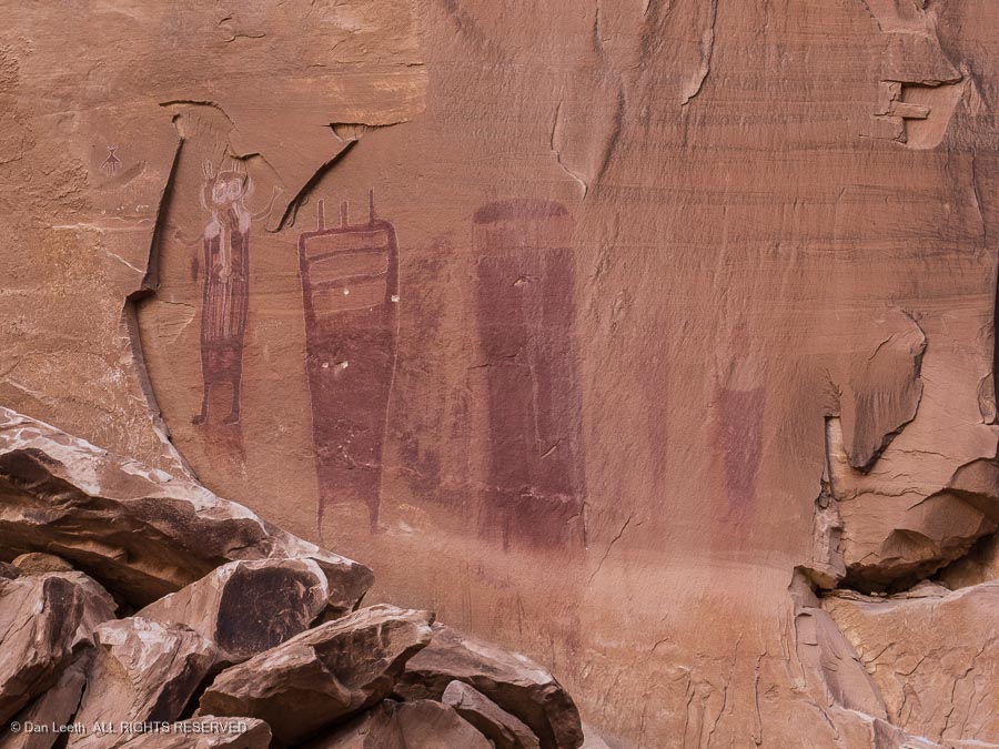
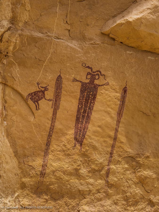
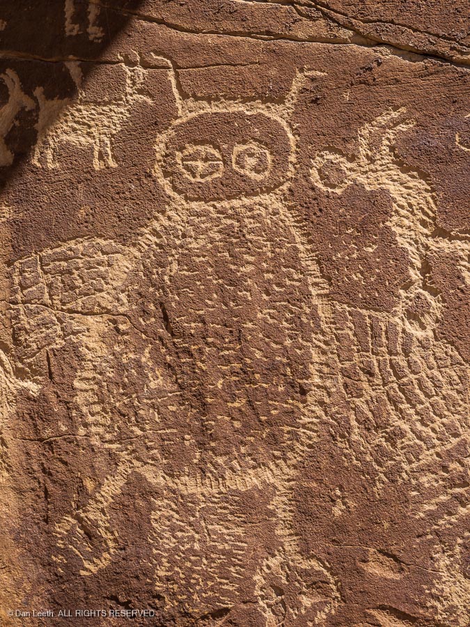
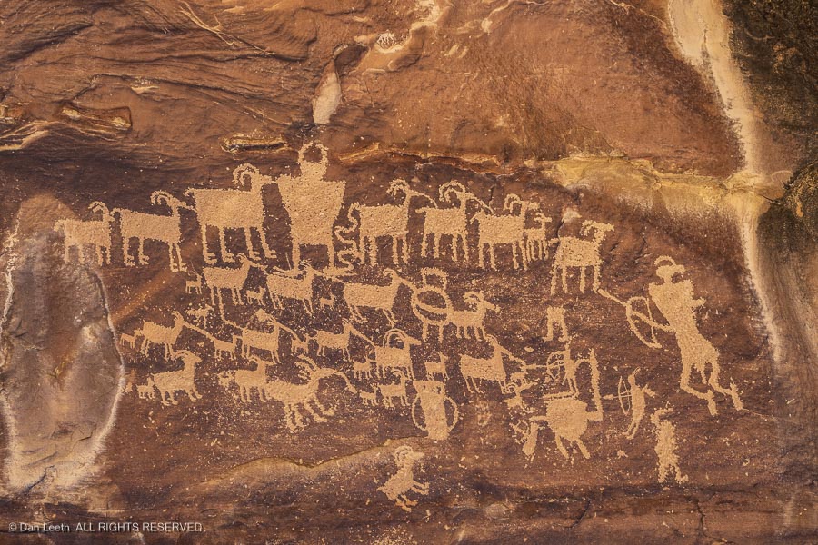
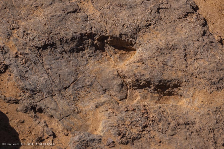
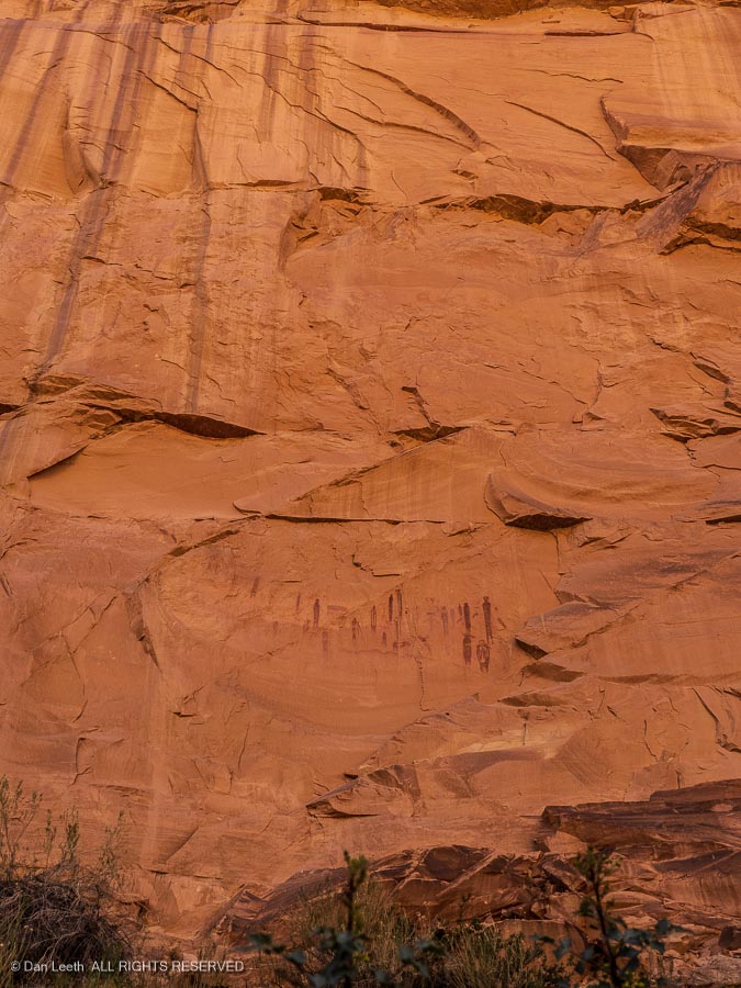
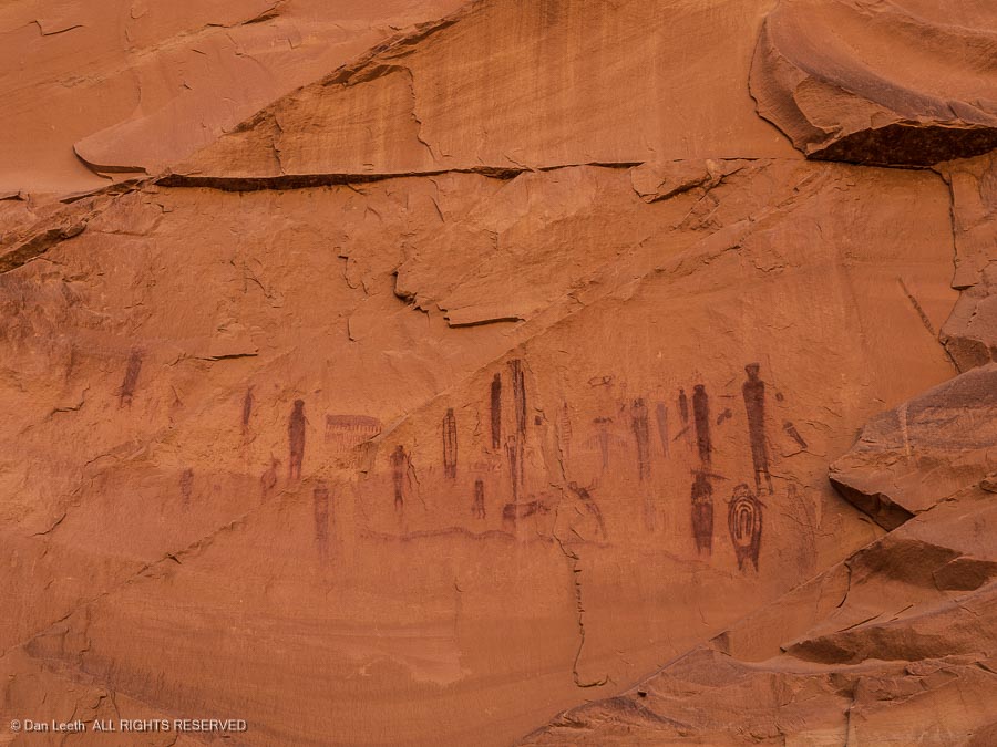
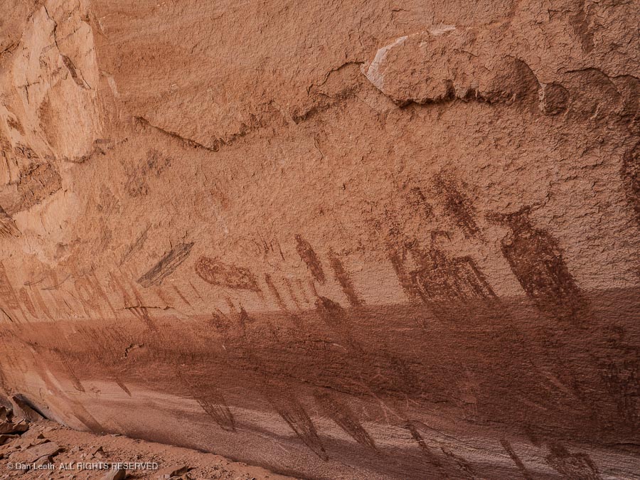
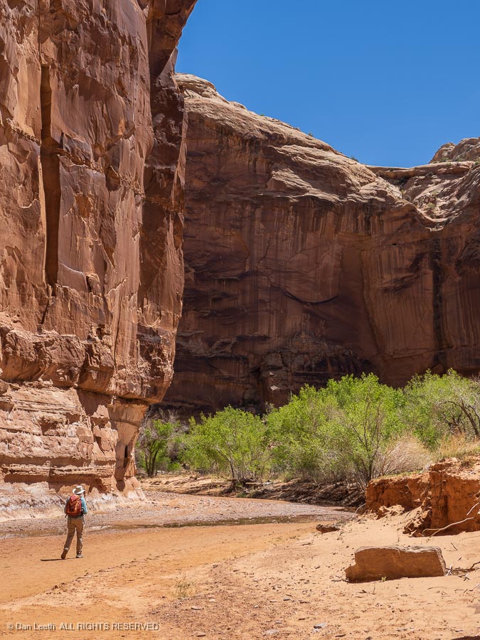
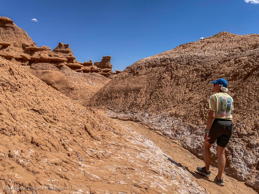
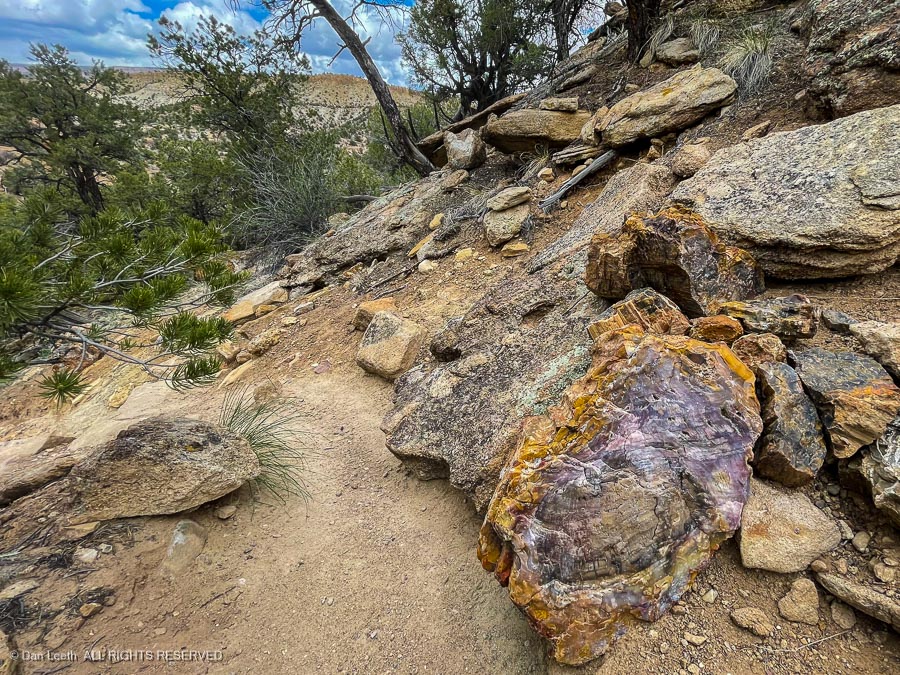
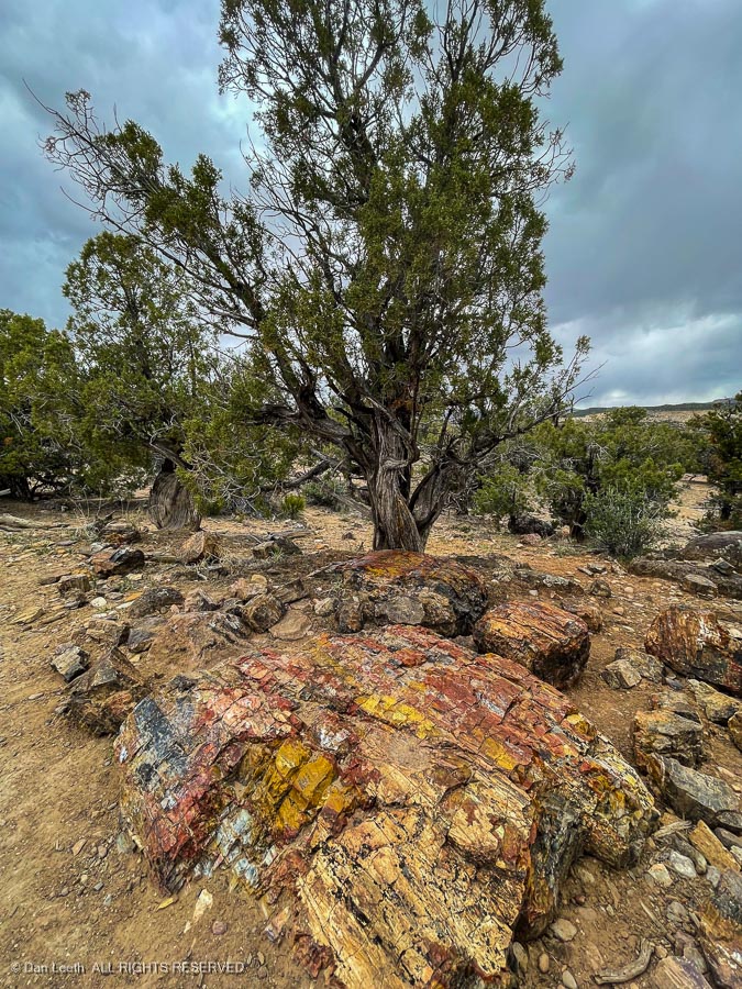
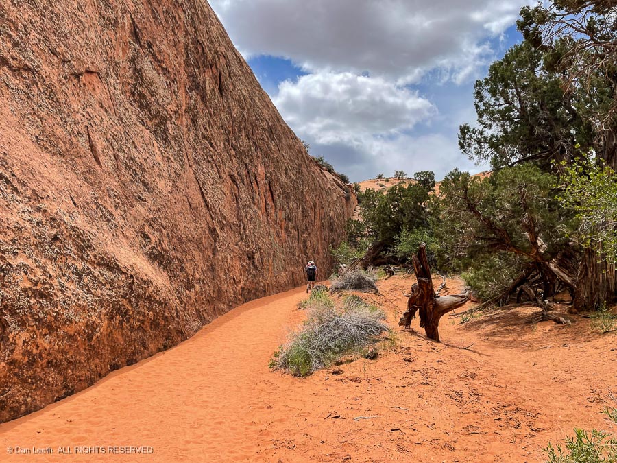
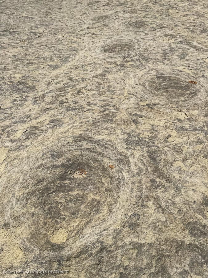
            Tuesday, we headed off for the San Rafael Swell.  Our first objective was the Black Dragon Pictographs – rock art panels painted centuries ago by the Fremont Indians. 

The guidebook said it required a hike of somewhere between one-half and seven miles to reach.  That might be true if we were driving the family Buick.  In Tighty, our 4×4 Nissan truck, we drove right up to them.

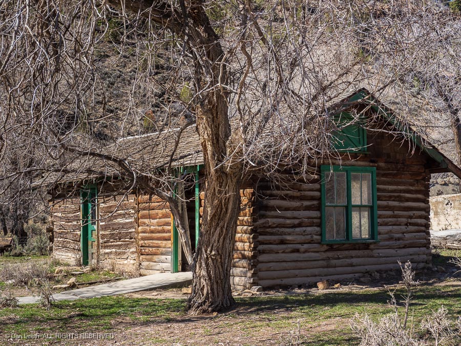
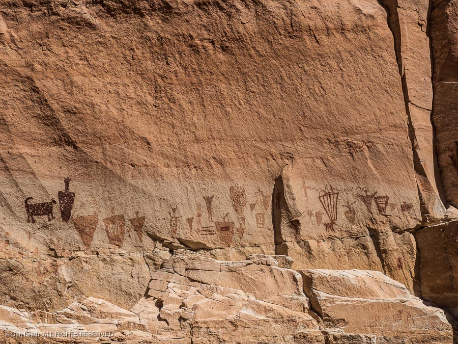
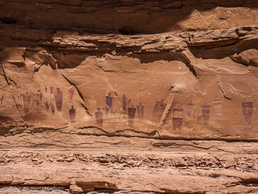
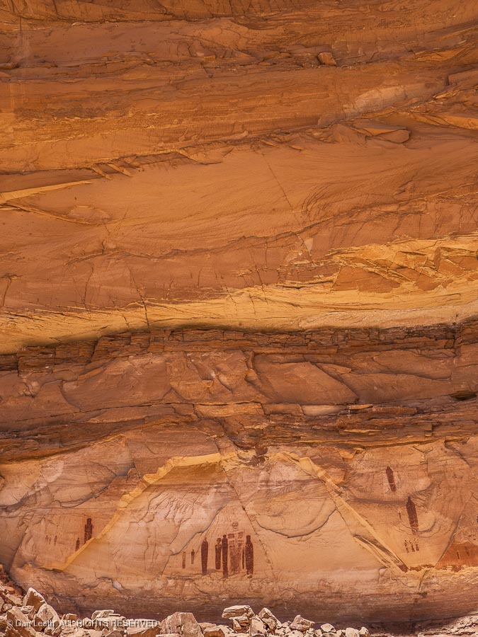
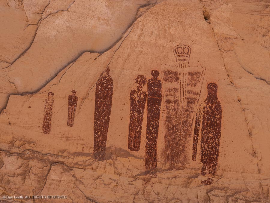
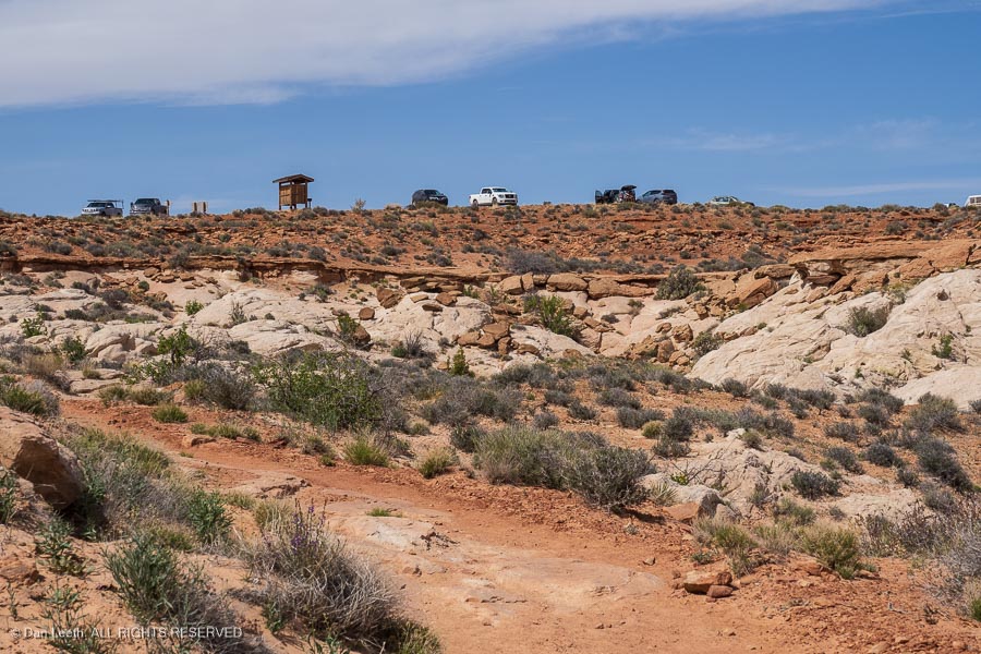
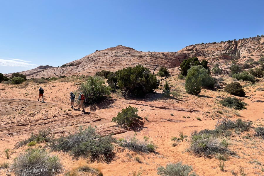
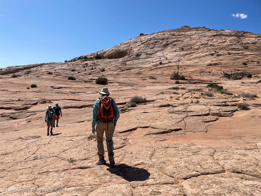
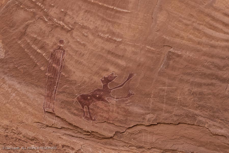
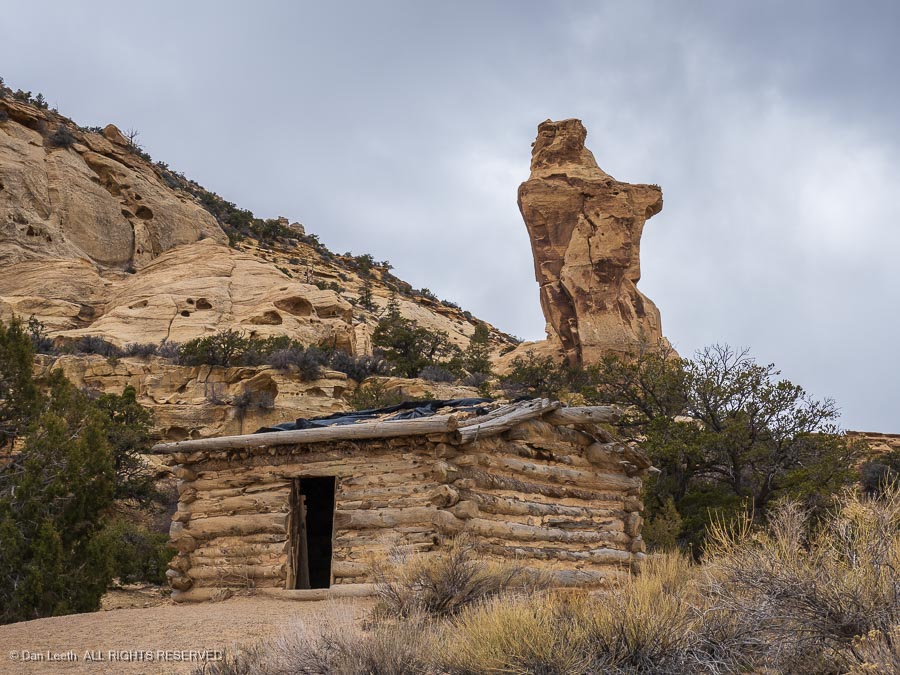
            Our next targets were the Head of Sinbad pictographs and an old log cabin built by the Swasey boys.  The route to the Head of Sinbad (which is named for a geologic formation, not the content of the artwork) took us up a sandy track across the flats.  No problem for the Titan, but that family Buick would never make it up here and still have a muffler attached.

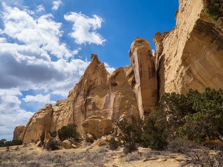
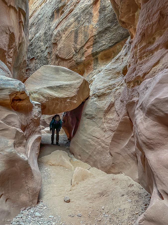
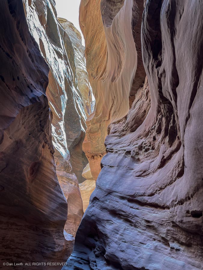
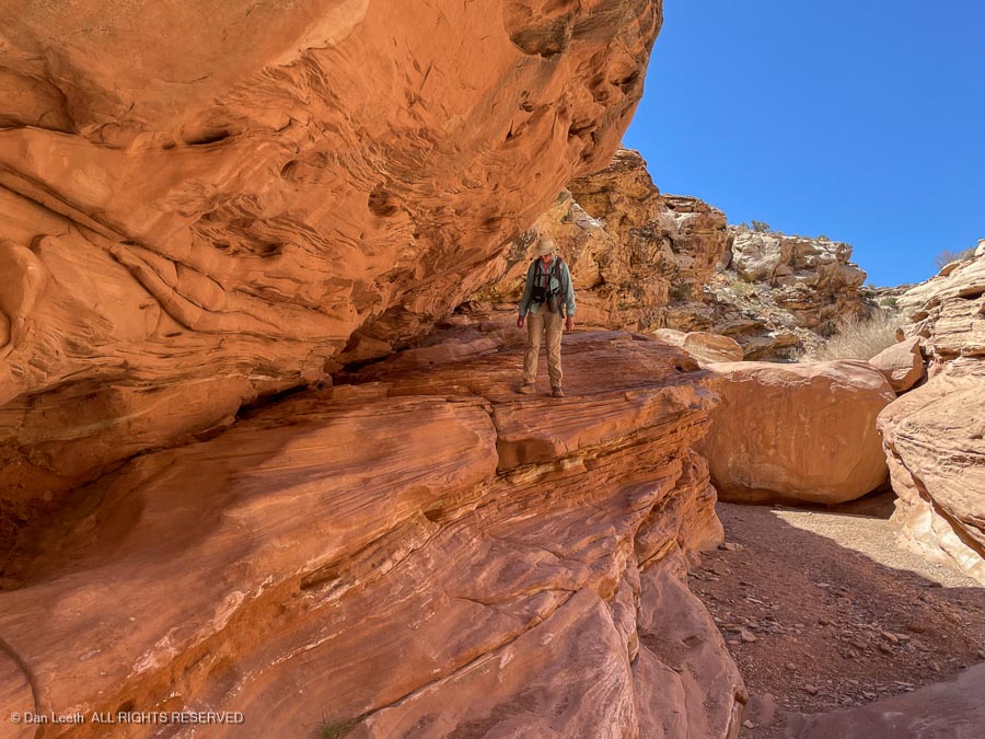
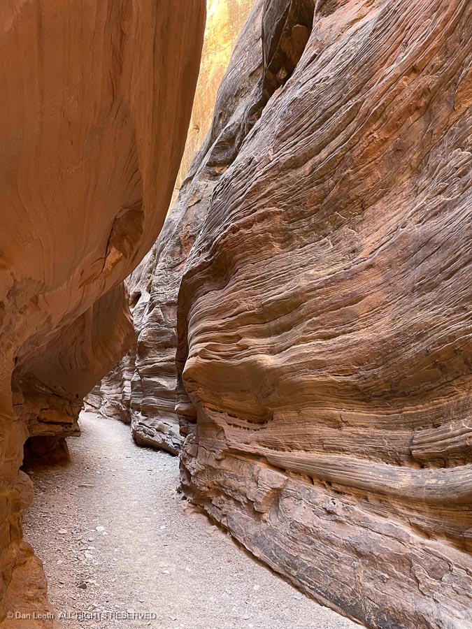
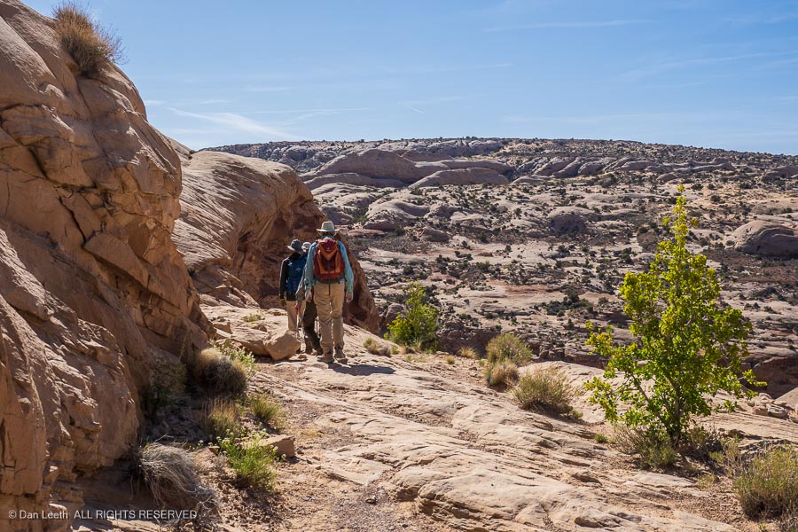
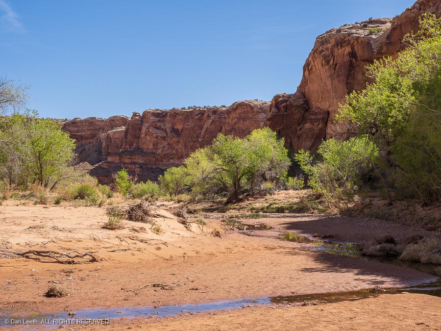
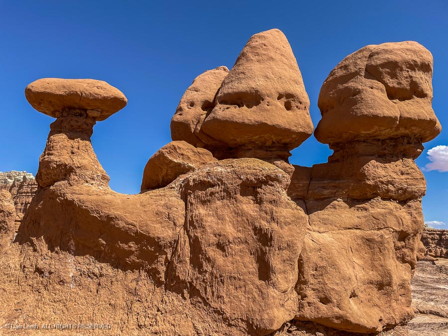
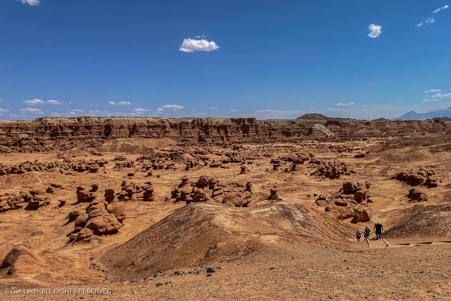
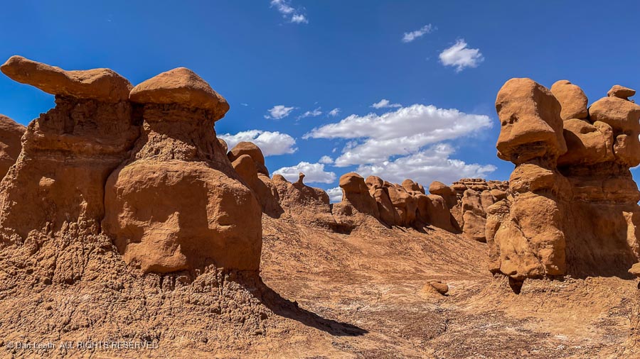
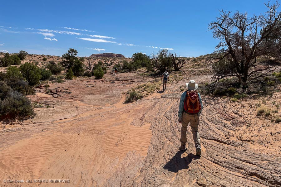
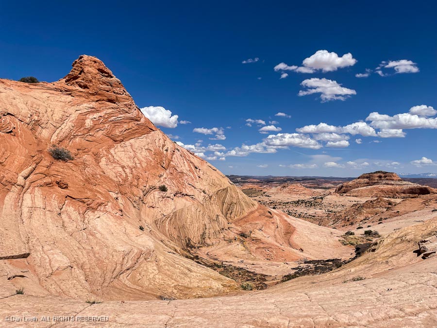
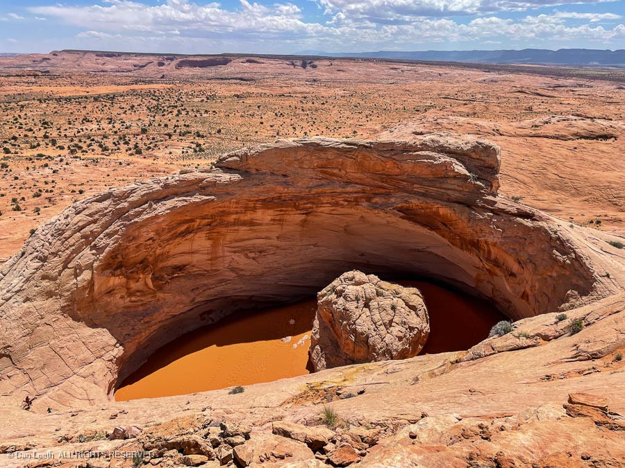
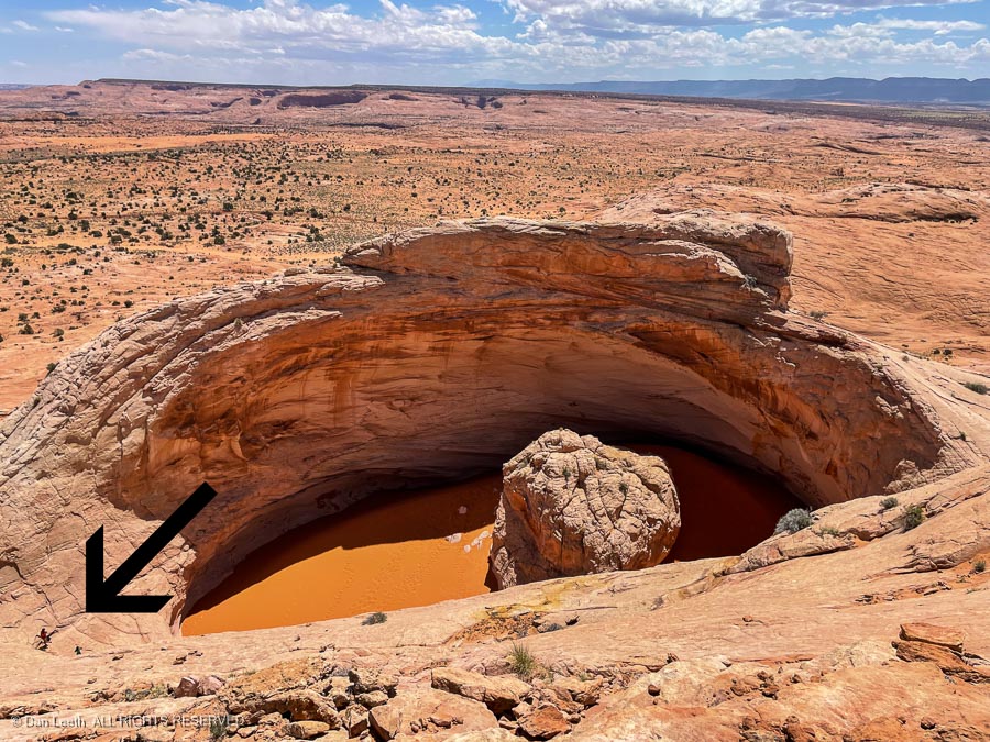
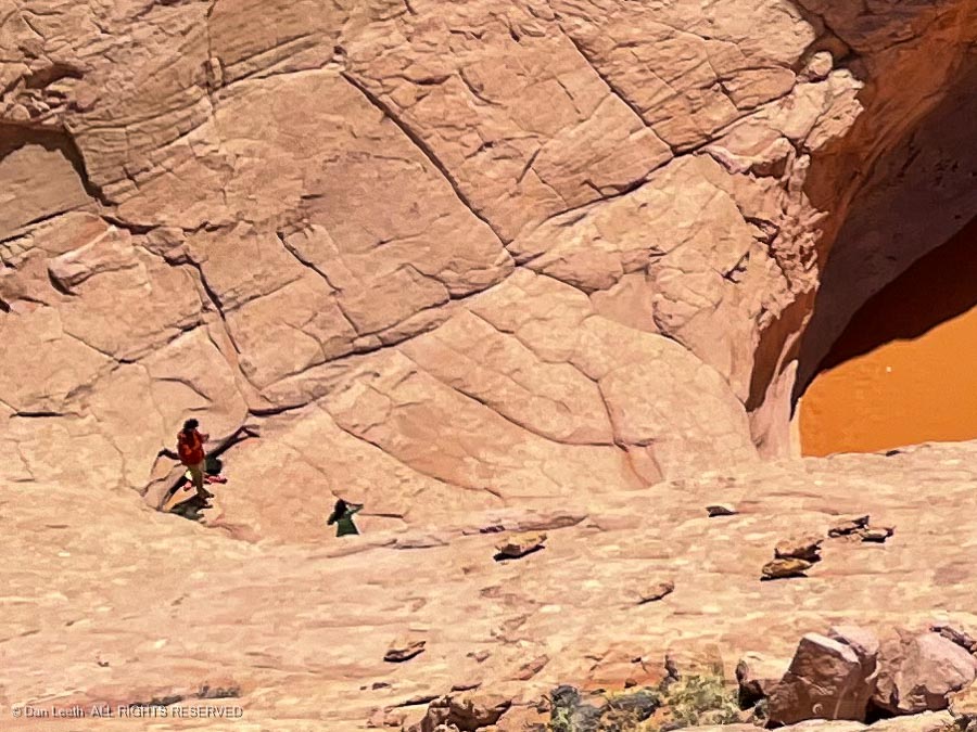
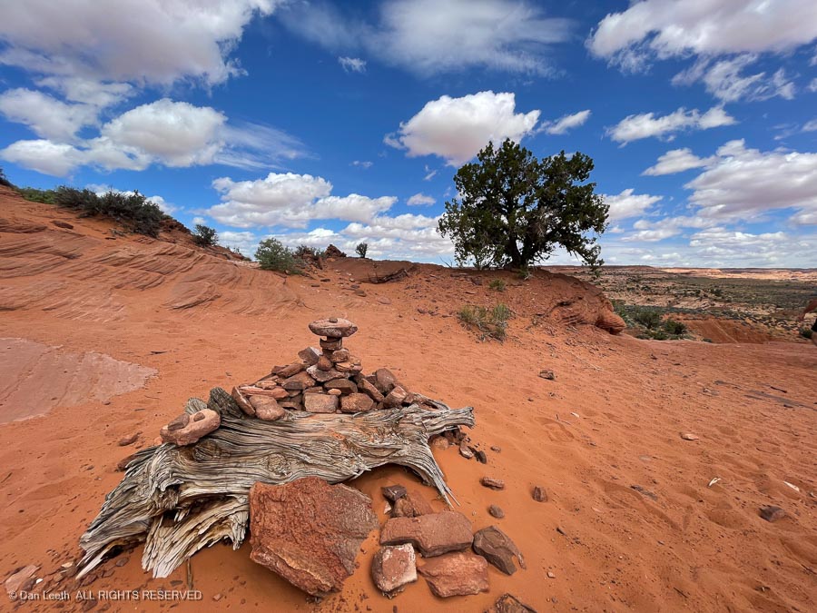
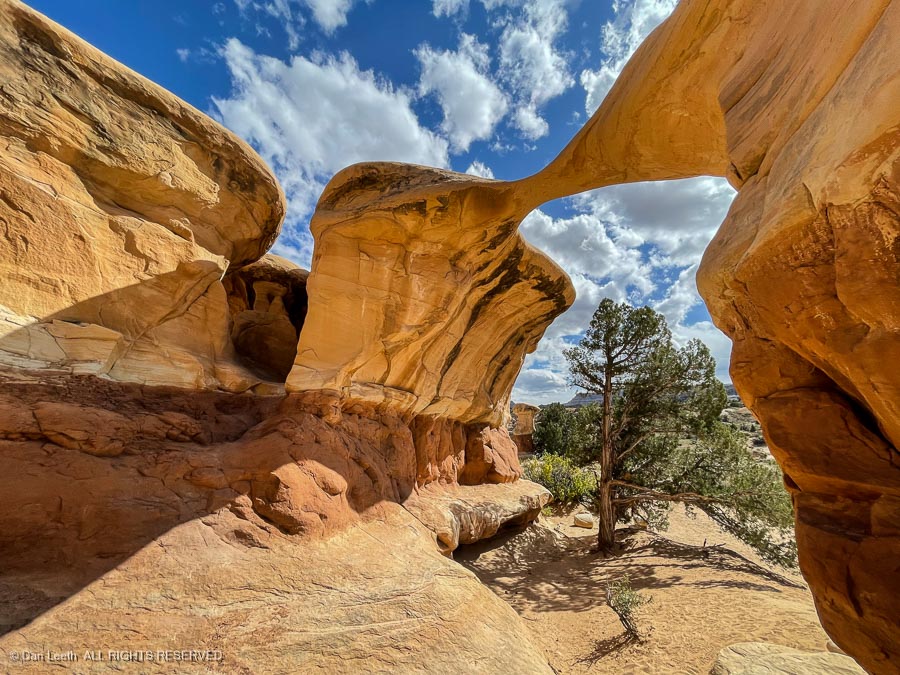
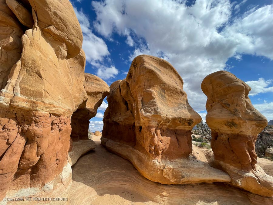
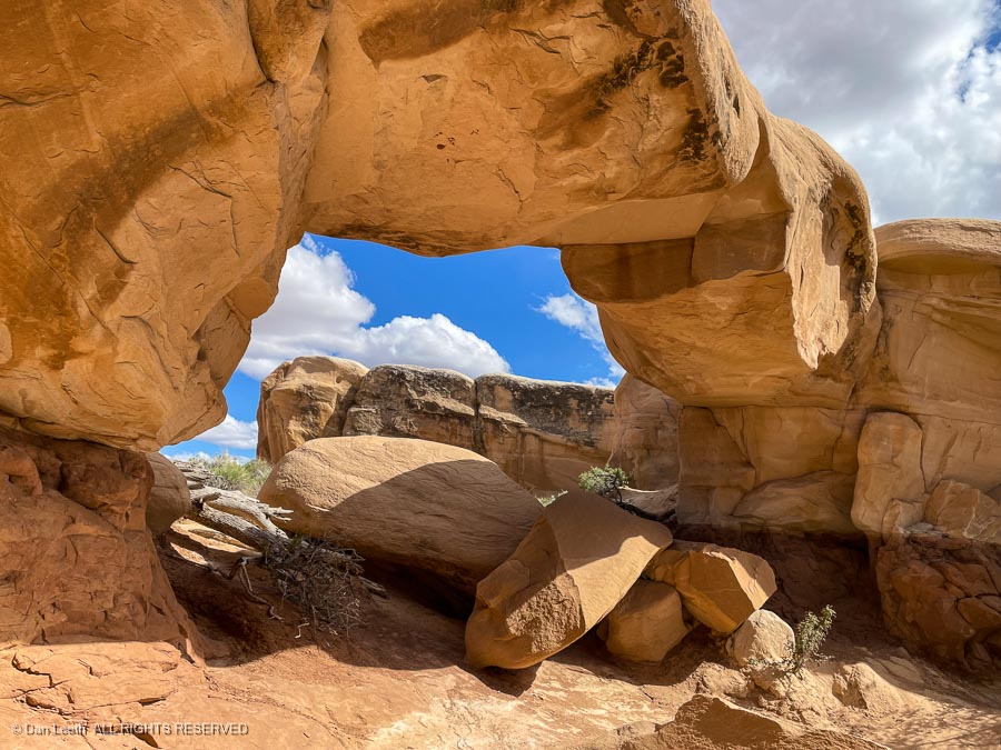
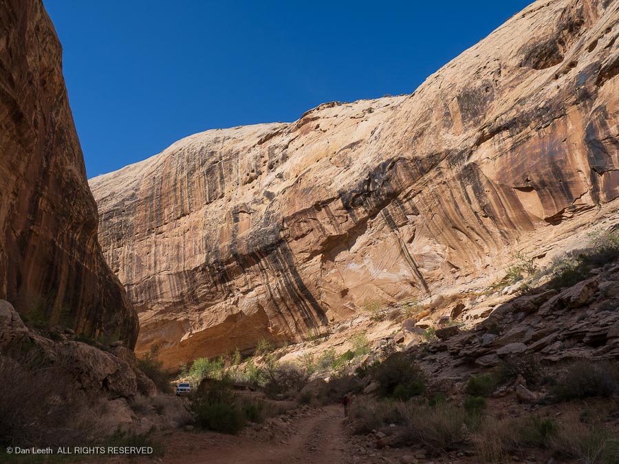
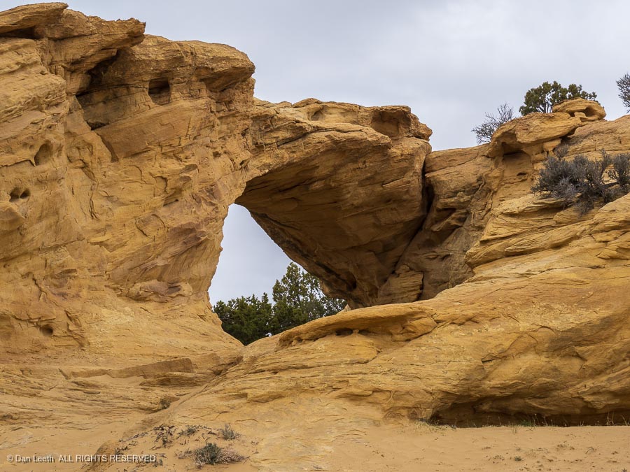
            Several side-tracks intersected our track and we didn’t know which to take.  We finally stopped and hiked up the road a half-mile or so in search of the artwork.  We found incredibly beautiful geology and Dutchman Arch, but no pictographs. 

Giving up, we turned back and headed up the well-signed route to Swasey’s Cabin.

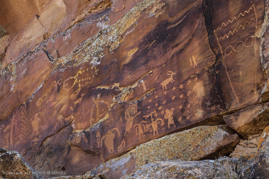
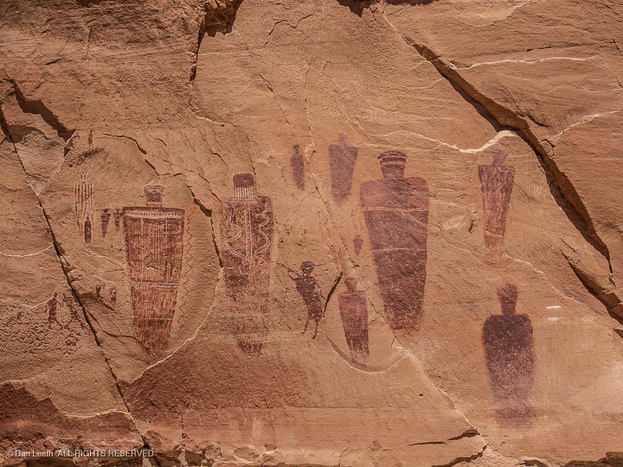
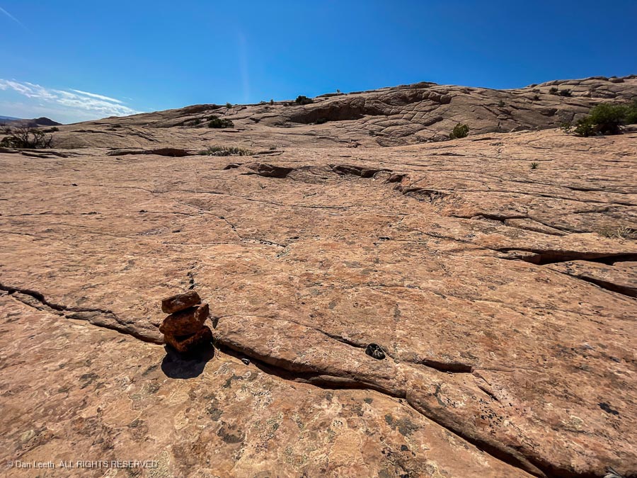
            It was there that I had a Eureka moment.  I pulled out my phone and surprisingly found here in the wilderness, I had one bar of precious Verizon coverage.  I checked my Gaia app, found the location for the Sinbad pictographs, plotted out a route and we were on our way. 

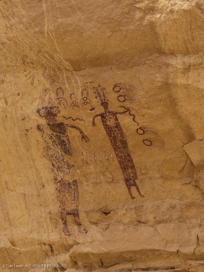
The effort proved worth it.

Exposing Ourselves to Art

Keeping with the rock art theme, Wednesday would be a driving day through Nine Mile Canyon, which offers numerous rock art sites, mostly petroglyphs, scattered along its length.  The route begins near Price, about an hour’s drive northwest of Green River.

We had a hand-out map of the canyon, which had a few rock art sites marked.  Nine Mile Ranch, site of the only campground in the canyon, displayed a sign saying they had canyon guidebooks and maps available.  We stopped to check it out. 

The elderly owner handed us one, admitting that at $30, it was “kinda expensive.”  The one inch-thick, spiral-bound book had descriptions, photos, GPS coordinates interspersed with pages of local history.  We bought it.

 We didn’t need the guide to get us to the first site, and had no trouble finding it since there was a roadside sign with an arrow pointing to “First Site.”  We walked around, shooting photos of the rock-pecked artwork. 

Using the guide we had purchased, we found numerous unsigned rock art locations along with the big ones that had roadside arrows.  Moving from site to site, we shot a few million megapixels of images of this ancient art, the meaning of which can only be guessed.

Of course, this image clearly was a Fremont Indian ad for a prehistoric Hooters.

 There were also old ranches and buildings to explore along the way.

Most of the Nine Mile Canyon art was petroglyphic.  One notable exception was a deer painted on the back wall of an alcove known as Rasmussen Cave.  The site is on private land and when the owner got fed up with people entering his property, he supposedly hired some Boy Scouts to paint a “No Trespassing” warning on the back wall of the alcove.  Their spelling was about as poor as the Scouts’ choice of location.

Fortunately, the Boy Scouts never got to the Great Hunt petroglyph panel farther up the canyon.  This was perhaps the highlight of the canyon gallery.

Through the Straight and Narrow

On Thursday, we made the long 52-mile journey to Goblin Valley State Park where we were treated to an afternoon breeze that rocked the trailer and slid our solar panels around.  It was a night for dining indoors.

Under calm conditions on Friday, we loaded our packs and set off to hike the eight-mile loop up Little Wild Horse Canyon and down Bell Canyon.  This is a popular slot canyon hike with souvenir t-shirts available for purchase at the Goblin State Park Visitor Center. 

I expected flat, easy hiking the whole way, which most of it was.  There were, however, a few obstacles to crawl over or under.  A couple required that we take off our packs.

We have hiking friends back in Fruita, transplants from the Midwest, who had never been to Utah before.  On their first trip into 3.2 country, we drove them down along the Colorado River towards Moab.  While they marveled at the beauty of the canyon walls, we assured them that while attractive, this was not the beautiful part of Utah.  For me, the hike up Little Wild Horse and down Bell exposed a far more attractive, intimate piece of Utah.

We went from sandy wash bottoms to deep slots so narrow one could touch both sides simultaneously in places, sometimes with just elbows extended. 

Canyon walls made faces at us with layers of swirling color and patterns. 

In the wider spots, we could look up at cliffs, dolloped with greenery and radiating nuggets of golden rock against a sapphire sky.

We met dozens of youngsters (anyone under age 50 is a “youngster”) along the way.  The only AARP-aged citizens we encountered were a pair of not yet retired, old coots who went part way up before turning back.  As far as we know, we became the only geezers doing the complete eight-mile loop that day.

Back at camp, we downed brews while sitting trailer-side in the late afternoon sun.  Yesterday’s wind was gone, replaced by just a gentle, cooling breeze.  We watched the setting sun paint the buttes out to the east.  For other folks, this place would be a vacation destination. 

For us, canyons like these lie just a 2½-hour drive from home.

Horseshoe Canyon

On Sunday, we finally made a hike I’ve long wanted to do.  We would hike up Barrier Creek in Horseshoe Canyon to the Great Gallery, which displays some of the finest rock art to be found.

Horseshoe Canyon occupies its own, detached section of Canyonlands National Park, and getting to the trailhead requires driving 30.6 miles on a graded road of moderate quality.  We got up before the sun, made coffee/tea, downed cereal and took off.  After an hour of bouncing down the dirt, we arrived at the trailhead, just minutes after Ranger Bryce of the National Park Service, who was there to give a free tour. 

Along with the young ranger and one other couple, we took off down the trail toward the canyon bottom.  Ranger Bryce explained that the road had been constructed in the ‘20s to access an oil well.  The well never produced, so the oil company departed, and a local rancher started maintaining the road into the ‘50s.  Today, the abandoned route makes a nice hiking path.

It’s a 1½ mile hike, mostly on slickrock, from the rim to canyon bottom.  Along the way, we passed a dinosaur footprint, learned a bit about the geology of the area and examined old photos of the road that Ranger Bryce brought along.

Shortly after reaching the canyon floor, we encountered our first panel of pictographs.  They were painted high on a sandstone wall, so the Park Service imaginatively named this the High Gallery.  Ranger Bryce said that experts believe the prehistoric painters must have used scaffolding to reach this lofty canvas.

Next stop a short distance away was the Horseshoe Shelter Gallery.

The figures with their trapezoid bodies are examples of the Barrier Canyon style, named for Horseshoe Canyon’s original name.  Range Bryce explains that nobody knows their meaning, and their age, whether measured in centuries or millennia, is open for debate. 

While beautiful, the 2½-mile hike along the canyon floor was mostly a slog through loose sand.  Fortunately, Barrier Creek flowed in places, and the damp ground beside the stream provided welcome sections of hard-packed ground.  Then it was back to the sand.

About half-way up the canyon, we came to the Alcove Site, which surprisingly featured pictographs painted in an alcove. 

After more slogging up the canyon, we finally reached the grand prize – the Great Gallery.  It featured a long wall of pictographs, some of which Ranger Bryce said were over eight feet high.  (Chains keep visitors away from the base of the pictographs, so we couldn’t measure the eight ourselves.)

We sat on rocks in the shade of a cottonwood along with a few other hikers who preceded us to the site, pondering what message those early inhabitants were trying to convey.  Ranger Bryce does not believe that it was a depiction of a visit by extraterrestrial aliens, but he’s never been to Roswell.

Ranger Bryce needed to depart early to attend to paperwork before he set out on a three-day patrol of Canyonland’s Maze District.  We stayed.  When another hiker with a big camera appeared, we departed for the hot, sandy slog back to Tighty. 

Finally approaching the trailhead, feeling sunbeaten and fatigued, my only regret was that I hadn’t had the foresight to stash a cooler of cold brews in the truck.

Going to the Goblins

“This country is geology by day and astronomy by night,” observed English writer, J.B. Priestley. 

While he may have been talking about the Arizona desert, it’s a perfect description of Goblin Valley and the rest of Utah’s canyon country.

Dianne and I have been to Goblin Valley several times in the past, so on this trip, we felt no rush to leave our campsite and go out to look at the hoodoos.

It wasn’t until Monday afternoon, the anniversary of my wife’s 29th birthday, that we hiked up the Entrada Trail from the campground to the valley of the goblins.

As we’ve done on previous occasions, we walked around the valley floor, examining the formations and using our imagination to suggest what they looked like. 

On previous trips out here, I’ve gotten up in the middle of the night, driven out to the tourist parking lot and wandered down on the valley floor to photograph the goblins silhouetted against the Milky Way.

But not on this trip.  Tonight, under a hazy, moonlit sky, we celebrated my wife’s birthday with grilled New York steaks and a stellar bottle of 2016 Plum Creek Cabernet Franc.

The Cosmic Ashtray

Tuesday, we hooked up the trailer and began the long, 144-mile trek from Goblin to Escalante Petrified Forest State Park, which is conveniently located in Escalante, Utah.  On the way there, we stopped at Stan’s Burger Shak and gas station in Hanksville so Dianne could have her (a day late) birthday burger and thick milkshake. 

We arrived in Escalante and pulled into our campsite just as our camping friends from Gridlock City arrived.  Over a glass or two of wine by our (propane) campfire, we decided that our first hike together out here would be a nine-mile, cross-country stroll to the Cosmic Ashtray.

Following a map copied off the internet, our wandering route took us across nice, firm rock…

…and deep, loose sand.

After about three miles of traversing the rocks and sand of the desert floor…

…it was time to start climbing up the sandstone knobs.

Finally, 4½ miles from the trailhead, we arrived at the immense Cosmic Ashtray.

To give you an appreciation of the size of this thing, the two specks you see at the bottom left…

…are people.

We waited, hoping one of those extraterrestrial, cosmic entities we saw depicted in Horseshoe Canyon would show up and flick some ashes into the pit. 

It didn’t happen.

Disappointed, we made the long trek back to the car and ultimately the campground where cold brews and hot showers awaited.

A Walk in the Woods

Our campground lies in Escalante Petrified Forest State Park.  As many times as I’ve been through this little town in southern Utah over the past 50 years, I never knew they had petrified wood out here.

On Thursday, our recovery day from visiting the Cosmic Ashtray, Dianne and I did the 2¾-mile Petrified Forest and Sleeping Rainbows Trails in the park. 

A person standing on a rock

Description automatically generated with medium confidence

From the campground, the trail begins with a crawl up a steep slope before wandering around on a bench top.  Up topside, we passed many samples of the totally stoned trees sacked out on the ground…

…some of which were quite colorful.

This petrified forest may not be as spectacular as the National Park in Arizona, but it’s still well worth the slight effort required to hike up the well-defined trail for a look at the rocky growth.

Playing the Slots

On Friday, we headed out with our friends, Brett and Paula, to do a loop hike through a pair of narrow, “slot” canyons. 

The route to the trailhead took us down the Hole in the Rock Road, which follows the 1879 route of a band of Mormon settlers sent to establish a settlement in what is now southeastern Utah.  While it was just a pleasant wagon track for the settlers, we were treated to a graded roadway with washboards as high as the average speed bump but far closer together. 

At the trailhead, cars displaying license plates from across the country filled the parking lot.  We would not be alone playing in the slots.

Our goal was to hike up Peek-a-Boo Gulch, cross overland to the head of Spooky Gulch and descend back through it.

A sign warned us about the narrowness of Spooky. 

We tested it out.  While Dianne’s body fit through, we were worried about her hat.

A person standing next to a sign

Description automatically generated with medium confidence

The two slot canyons feed into the Dry Fork of Coyote Gulch.  Our first obstacle involved sidestepping down the slickrock to get to it.

Fortunately, the route was well marked with cairns.

A picture containing ground, sky, outdoor, desert

Description automatically generated

Entering the mouth of Peek-a-Boo Gulch requires ascending a steep chute of slick slickrock.  A pile of rocks at the bottom helps one get a foot onto the lower Moki step someone had chiseled long ago into the rock.  We watched as another hiker struggled up.

When we found out that from there, we would need to wade through knee-deep, canyon-bottom potholes of icy water, we decided to skip Peek-a-Boo and go directly to Spooky, which we would hike from the bottom up.  Along the way, we passed a sandy bench covered with evening primrose blossoms.

We reached the mouth of Spooky and began heading up.

It wasn’t too bad at first…

…but that changed in a hurry.

It soon got worse…

A close-up of a bug

Description automatically generated with low confidence

…and worse.

The hike wouldn’t have been bad if all the traffic traveled in the same direction, but that wasn’t the case.  While we were hiking up, others were coming down, and passing each other in a slot canyon narrower than potholes in a Colorado highway was a pain.  One by one our group turned around, exited Spooky and hiked back to the car.

On the drive back to the campground, we detoured off the washboard road to track down some dinosaur trackways located up on a sandstone bench…

…followed by a stop at some photogenic rock formations in a place known as the Devil’s Garden.

“Why is it always named after the Devil?” Dianne pondered.

“Why not name it the Angel’s Garden?”

Back in town, we tried to celebrate Cinco de Mayo with a nice Mexican dinner.  Let’s just say that while Escalante may be named for an 18th century Spanish priest, it does not abound in indoor Mexican eateries.

A Day of Sun and Solitude

Saturday was a day of issues. Dianne is having knee issues, I’m having hip issues and the trailer is having battery depletion issues. A day of rest along with some little blue pills should help mitigate the knee and hip pains.

As for the trailer, a day spent moving our trio of 100-watt solar panels around as the sun slides through the sky should help alleviate the battery depletion issue. A touch of generator assistance may help, too.

Kodachrome in Color

On Monday, we made the 40-mile drive to Kodachrome State Park, which noted experts (us) have declared to be the most beautiful state park campground in Utah.  Our site was in a nicely private, large pull-through site near the cliffs…

…with an excellent view of the park’s signature rock formation.

It’s not what you think it is.  This is a sedimentary pipe, one of around 67 in the park, that formed when pockets of water-saturated sediments became cemented together.  When the softer surrounding rock eroded away, the tougher caprock remained, forming vertical columns.