
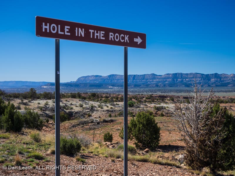
Today was the day we would drive the 55.3-mile route to the Hole in the Rock.
In the late 1870s, leaders of the Church of Jesus Christ of Later Day Saints (Mormons) decided they needed more of their members to colonize the area that is now southeast Utah. Volunteers were conscripted and an expedition of 200 people, 83 wagons and over 1,000 head of cattle began their trek toward what is now the Four Corners area.
They had two proven routes to get there. They could go south into what is now northern Arizona and cross the Colorado River at Lee’s Ferry. Unfortunately, the local Native Americans did not look kindly toward folks passing through their lands.
A second alternative was to head north and cross the Colorado River in Moab, but that was deemed to be too lengthy a route.
So, the group looked at a third alternative. They would head for the town of Escalante and go south from there on a totally unproven route. Dianne and I would spend the day retracing that route.
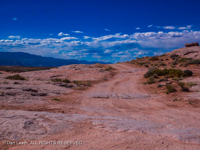
On the first part of their journey from Escalante, the Mormon pioneers followed an existing trail used by the locals. I’m not sure how smooth their route was, but our route required traversing what some experts claim is the worst washboard road in the state of Utah.
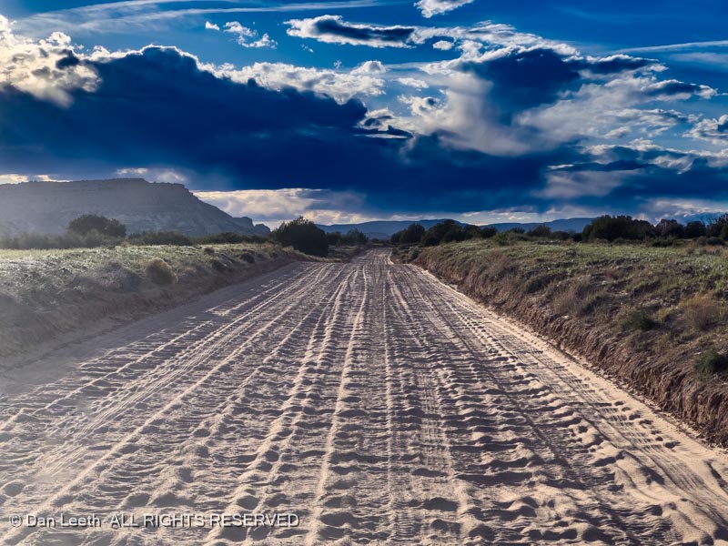
Go slow and the truck vibrated so badly, I feared my tooth fillings might fall out. Go fast and I more smoothly bounced over the humps. Unfortunately, I then had no steering control.
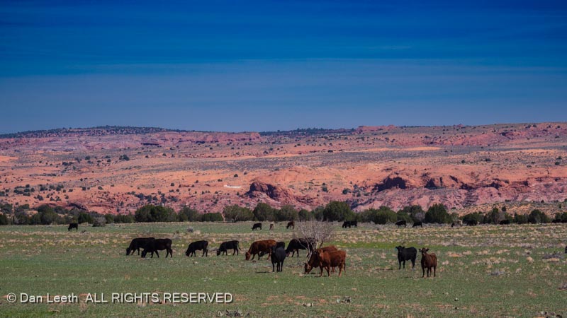
On the left side of the road, we saw herds of local wildlife (slow elk, as Ed Abbey called them) feeding beside the roadway.
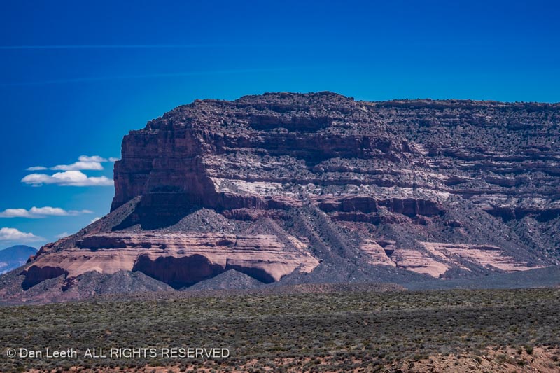
On the right side of the road stretched the cliffs of the Kaiparowits Plateau.
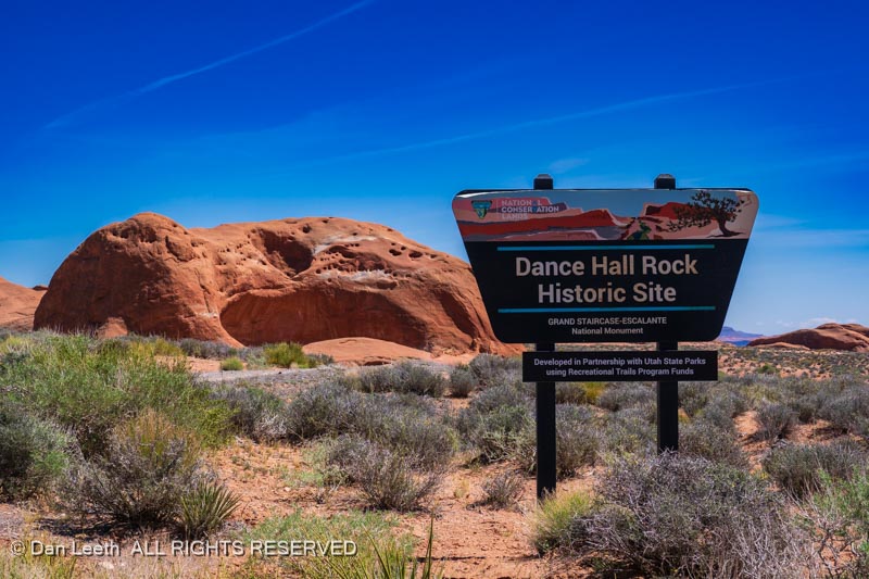
At around the halfway point on our drive, we reached Dance Hall Rock, a large sandstone alcove, where the LDS pioneers played music and held dances.
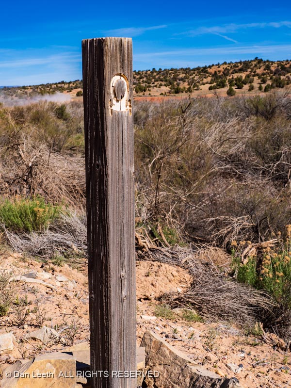
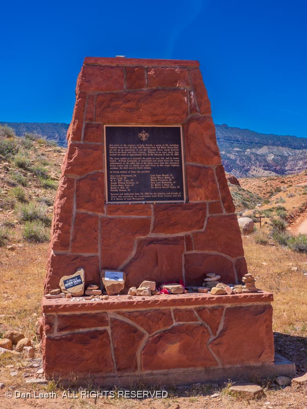
The roadway crosses a number of deep washes requiring one to traverse steep ups and downs. Out here in the 1960s, brake failure on a truck resulted in the death of 13 members on a Boy Scout outing. A roadside monument commemorates their passing.
While the first part of the graded road was easy enough for most any vehicle with high clearance, good tires and decent shock absorbers, the last seven miles become a bit rougher requiring high clearance 4×4.
Finally, the road ends at this gap in the cliffs known as the Hole in the Rock.
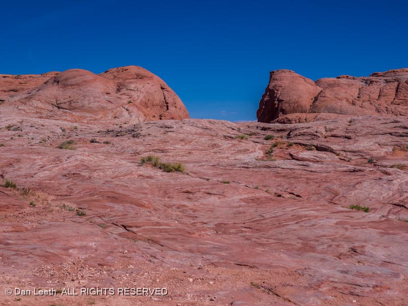
The Colorado River flows 2,000 feet below the cliffs at road’s end. Here, the Mormon pioneers found a narrow gap in the rock face (the “hole”) that with a little modification could be used to lower the wagons down to the river.
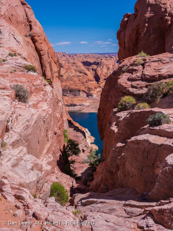
It’s steep and about an arm’s width narrow at the top.
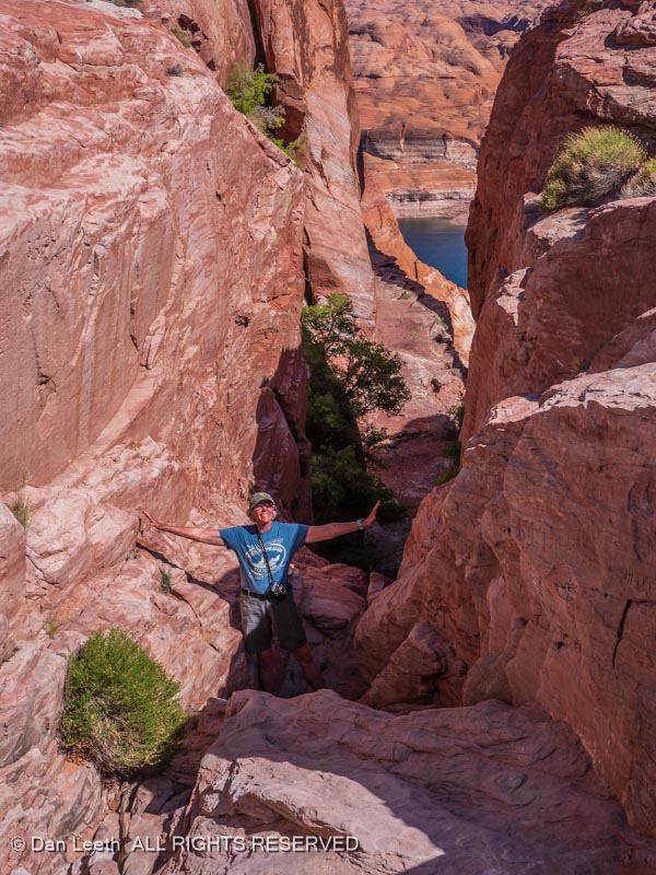
Given the choice of riding in the wagons as they were lowered down or just walking, I suspect the majority of the pioneers chose to descend on their own two feet.
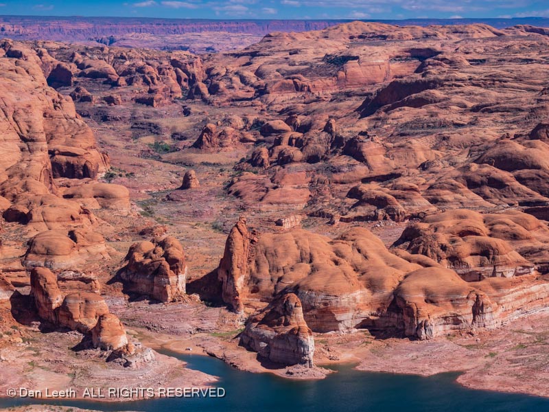
At the bottom, the pioneers built rafts and ferried the wagons across what then just a river. From there, they continued overland until they got to the site of Bluff where they said “that’s enough” and settled down. Today, the diminishing waters of Powell Reservoir fill the canyon bottom where the Colorado River once flowed.
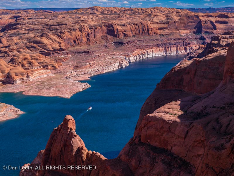
I wonder if the folks on the houseboat passing by realized what they were looking at as they passed the Hole in the Rock.